9 Breathtaking Coastal Bluff Trails In Oregon You Need To Experience
How many places have you visited without carrying that memory for the rest of your life? I doubt it has ever happened.
They say you are as rich as the places you have seen and traveled. I say you are lucky if you have the chance to travel at all, and truly rich if you can feel the journey deep in your bones.
People do not attach memories to images and scenery. They attach them to emotions.
Oregon has a way of reaching into the quietest parts of you and pulling something out you forgot was there. These coastal bluff trails do not just offer a view.
They offer a confrontation with something raw and real. The kind of feeling that stays with you long after the trip is over and the photos are uploaded.
1. Cape Sebastian Trail
Standing at Cape Sebastian feels like the earth decided to show off. The trail sits about 700 feet above the Pacific Ocean.
That is not a typo. You are genuinely high up.
The views stretch nearly 50 miles on a clear day. You can see all the way to California from the southern viewpoint.
That alone makes the drive to Gold Beach worth it.
The trail itself is about 1.5 miles one way. It winds through coastal spruce forest before opening to jaw-dropping bluff views.
The path is well-maintained but can get slippery after rain.
Spring wildflowers line the edges of the trail in April and May. Yellow and purple blooms pop against the green forest backdrop.
It is genuinely one of the prettiest seasonal displays on the Oregon coast.
Wildlife sightings here are common. Gray whales pass close to shore during migration season.
Bring binoculars, and you will not regret it.
The parking area has two lots, north and south. The south lot gives you the better starting point for ocean views.
Go early on weekends because this spot fills up fast.
Cape Sebastian is a quieter alternative to some of the more crowded coastal parks. You get the epic scenery without fighting for a parking spot every five minutes.
The address is Cape Sebastian State Scenic Corridor, Gold Beach, OR 97444.
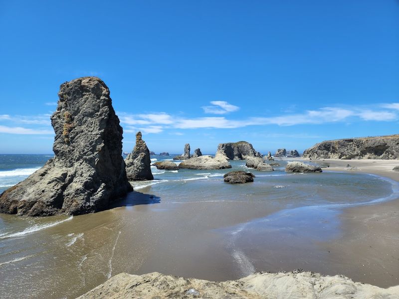
2. Natural Bridges
Natural Bridges is one of those places that genuinely looks fake. The ocean has carved massive rock arches right out of the bluff.
Waves thunder through the openings like nature built its own tunnels.
This spot sits within the Samuel H. Boardman State Scenic Corridor.
The short path to the viewpoint is less than a mile. Easy access means even casual walkers can experience this without breaking a sweat.
The arches were formed over thousands of years by relentless wave action. The rock is dark basalt, which contrasts beautifully with the white foam below.
Every single photo you take here looks professionally edited.
The viewpoint platform gives you a direct look down into the churning water. It is both thrilling and slightly terrifying.
Kids love it, and honestly, so do adults.
Brookings sits in the so-called Banana Belt of Oregon. The weather here is noticeably milder than the rest of the coast.
You might actually get sunshine when everywhere else is foggy.
The surrounding corridor has multiple other viewpoints worth visiting the same day. Arch Rock and Whaleshead Beach are both nearby.
Plan a half-day to explore the whole stretch properly.
Parking is free and right off Highway 101. The trail to the viewpoint is paved and accessible.
This spot is located in Brookings, OR 97415.
3. Indian Beach Trailhead
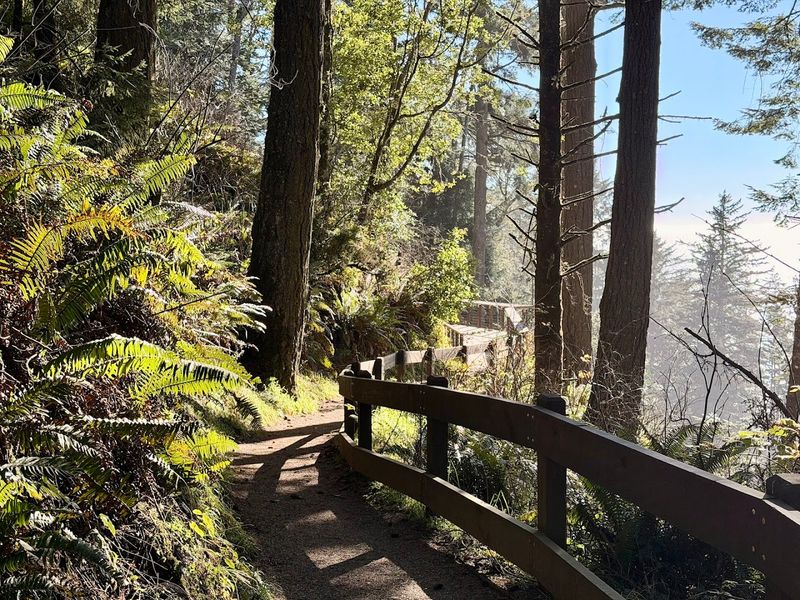
Indian Beach Trailhead is the starting point for one of the most scenic hikes in Ecola State Park. The forest here is thick with Sitka spruce and ferns dripping with coastal moisture.
It smells incredible, like earth and salt air combined.
The trail connects Indian Beach to Ecola Point, covering roughly 2 miles one way. Elevation gain is moderate, so your legs will feel it but not hate you for it.
The reward at the top is a sweeping view of the entire coastline.
Haystack Rock is visible from several points along the trail. That iconic basalt monolith sits just offshore near Cannon Beach.
Seeing it from elevation gives you a completely different appreciation for its size.
Tidepools at Indian Beach itself are worth exploring before you hike. Starfish, sea anemones, and hermit crabs are common finds at low tide.
Check tide charts before you go so you catch the best window.
Ecola State Park has a rich history tied to the Lewis and Clark Expedition. Captain Clark walked this headland in 1806 searching for a beached whale.
The trail literally follows a historic route used over 200 years ago.
Day-use fees apply at Ecola State Park. The park can get crowded in summer, especially on weekends.
Arrive before 9 AM, and you will have the trail mostly to yourself.
Find it at Ecola Park Rd, Cannon Beach, OR 97110.
4. Cape Meares State Scenic Viewpoint
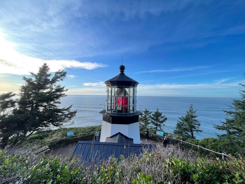
A spot like this has a surprising amount of cool in a very small area. You get a historic lighthouse, massive sea stacks, an octopus tree, and ocean views all within a short walk.
It is basically a coastal highlight reel.
The Cape Meares Lighthouse is the shortest lighthouse on the Oregon coast at just 38 feet tall. It was built in 1890 and is still standing strong.
You can peek inside during open seasons and see the original Fresnel lens up close.
The Octopus Tree is a Sitka spruce with multiple trunks growing outward instead of upward. Scientists believe it was shaped by coastal winds over centuries.
It looks like something out of a fantasy novel.
Sea stacks called the Three Arch Rocks sit just offshore. They are a protected wildlife refuge and home to thousands of seabirds.
Common murres, tufted puffins, and Steller sea lions all call this place home.
The viewpoint trail is short and paved in sections. Most of the walk is under a canopy of old-growth forest.
It is accessible for a wide range of fitness levels, which is a big plus.
Cape Meares is part of the Three Capes Scenic Route. The drive alone through Tillamook County is worth the trip.
Combine it with Cape Lookout and Cape Kiwanda for a full coastal day.
Point your navigation to 3500 Cape Meares Loop, Tillamook, OR 97141.
5. Sunset Bay to Cape Arago Trail
This trail is a full coastal experience packed into about 8 miles round trip. You start at the calm, sheltered Sunset Bay and work your way out to the rugged Cape Arago headland.
The contrast between the two ends is genuinely dramatic.
Sunset Bay itself is one of Oregon’s most protected swimming beaches. The bay is nearly enclosed by sandstone cliffs, which calms the surf significantly.
It looks like a secret cove that the ocean forgot to make dangerous.
As you move toward Cape Arago, the terrain gets wilder. The trail hugs sandstone bluffs with serious drop-offs below.
Keep to the marked path, and you will be totally fine.
Shore Acres State Park sits between the two endpoints. It features formal gardens that bloom brilliantly in summer and winter.
Yes, flowers are blooming in winter on the Oregon coast, which is honestly hilarious and wonderful.
Cape Arago overlooks Simpson Reef, one of the largest marine mammal haul-out sites on the Oregon coast. Hundreds of sea lions and harbor seals rest on the rocks below.
The noise and smell hit you before you even see them.
Binoculars are essential for this trail. The wildlife viewing opportunities are unmatched in the region.
Bring layers because the wind at Cape Arago is no joke.
You can visit it at 10793 Cape Arago Hwy, Coos Bay, OR 97420.
6. Cascade Head Lower Viewpoint
Cascade Head is the kind of hike that humbles you a little. The lower trail from the Knight Park trailhead is a solid 4 to 5 miles out and back.
It climbs through old-growth Sitka spruce before opening onto sweeping headland prairie.
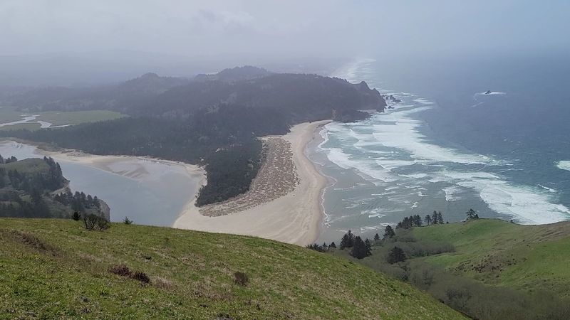
The views of the Salmon River Estuary from the upper section are stunning. The estuary spreads out below like a painting, with the Pacific Ocean beyond it.
On a clear day, the scene is almost too beautiful to process.
Cascade Head is part of Oregon’s only UNESCO Biosphere Reserve. That designation exists because of the rare species living here.
The Oregon silverspot butterfly and Cascade Head catchfly wildflower are both found almost nowhere else on earth.
The upper trail is closed from January 1 to July 15 every year. This protects the sensitive prairie habitat during critical growing seasons.
Plan your visit for late summer or fall for the full experience.
The lower trailhead at Knight County Park is free to use. No parking pass required, which is a pleasant surprise on the Oregon coast.
The trail can get muddy after rain, so waterproof boots are genuinely recommended.
Wildlife here includes Roosevelt elk, which sometimes graze the open meadows. Spotting a herd of elk against the ocean backdrop is surreal.
Bring patience and a camera with a decent zoom.
See this spot at 3201 Savage Rd, Otis, OR 97368.
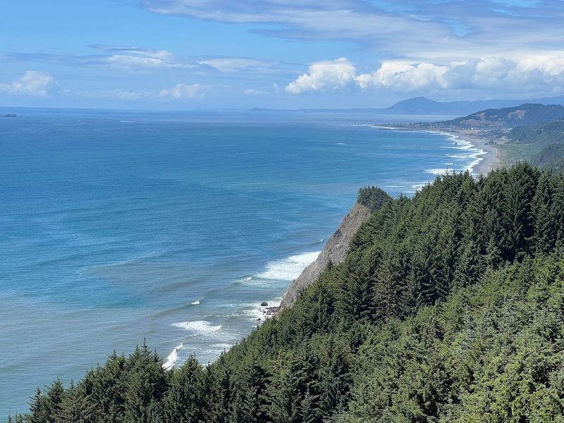
7. Cape Lookout Scenic Viewpoint
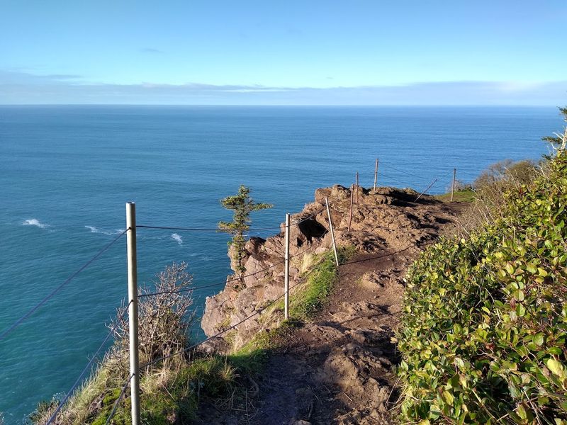
Cape Lookout is often called the most dramatic cape on the Oregon coast, and I am not going to argue with that. The trail follows a ridge that juts 1.5 miles directly into the Pacific Ocean.
You have ocean views on both sides of the path simultaneously.
The hike is about 5 miles out and back. The trail cuts through dense coastal forest before the ridge opens up to the full ocean panorama.
It is moderately difficult but absolutely manageable for most hikers.
Whale watching from Cape Lookout is legendary. During migration from late March through early June, gray whales pass remarkably close to shore.
Hikers have reported seeing whales breach from the trail itself, which is absolutely wild.
The cliffs drop hundreds of feet below the trail in places. The exposure is real, and the views are exhilarating because of it.
Stay on the path and resist the urge to peer too far over the edge.
A World War II memorial plaque near the tip marks where a B-17 bomber crashed into the cape in 1943. The story is haunting and adds real historical weight to the hike.
Reading it changes how you feel about the view.
The trail can be extremely muddy and wet, especially in spring. Good waterproof hiking boots are not optional here.
Trekking poles also help on the steeper sections near the trailhead.
This place is located in Beaver, OR 97112.
8. Face Rock State Scenic Viewpoint
Face Rock is Bandon’s most iconic landmark, and once you see it, you will completely understand why. The rock formation looks unmistakably like a face gazing upward from the ocean.
Local Coquille tribe legend says it is a princess turned to stone by an evil sea spirit.
The viewpoint sits atop a coastal bluff with a short, easy path down to the beach. The walk is accessible for nearly everyone, including families with young kids.
Getting down to the sand gives you a whole new perspective on the sea stacks.
Bandon Beach is surrounded by a cluster of named sea stacks. Cat and Kittens Rock, Elephant Rock, and Goat Island all rise from the surf nearby.
Each one has its own shape and personality, which makes the beach feel like an outdoor gallery.
Sunset photography at Face Rock is borderline unfair. The golden light hits the sea stacks from behind, creating silhouettes that look straight out of a movie poster.
Photographers show up here from all over the Pacific Northwest, specifically for these shots.
Tidepool exploration near the base of the rocks is excellent at low tide. Sea stars, purple urchins, and chitons are common finds.
Always check tide tables before heading down because the surf can move in fast.
Bandon is also famous for its cranberry bogs and world-class golf courses. You can make a full weekend out of this area easily.
It’s located Near Coos Bay, Bandon, OR 97411.
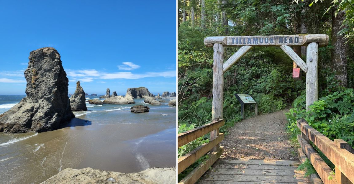
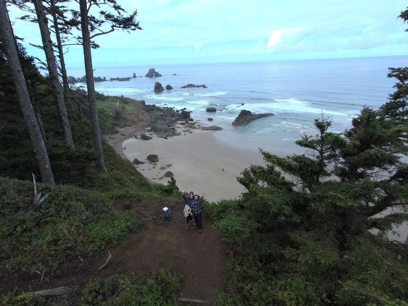
9. Tillamook Head North Trail
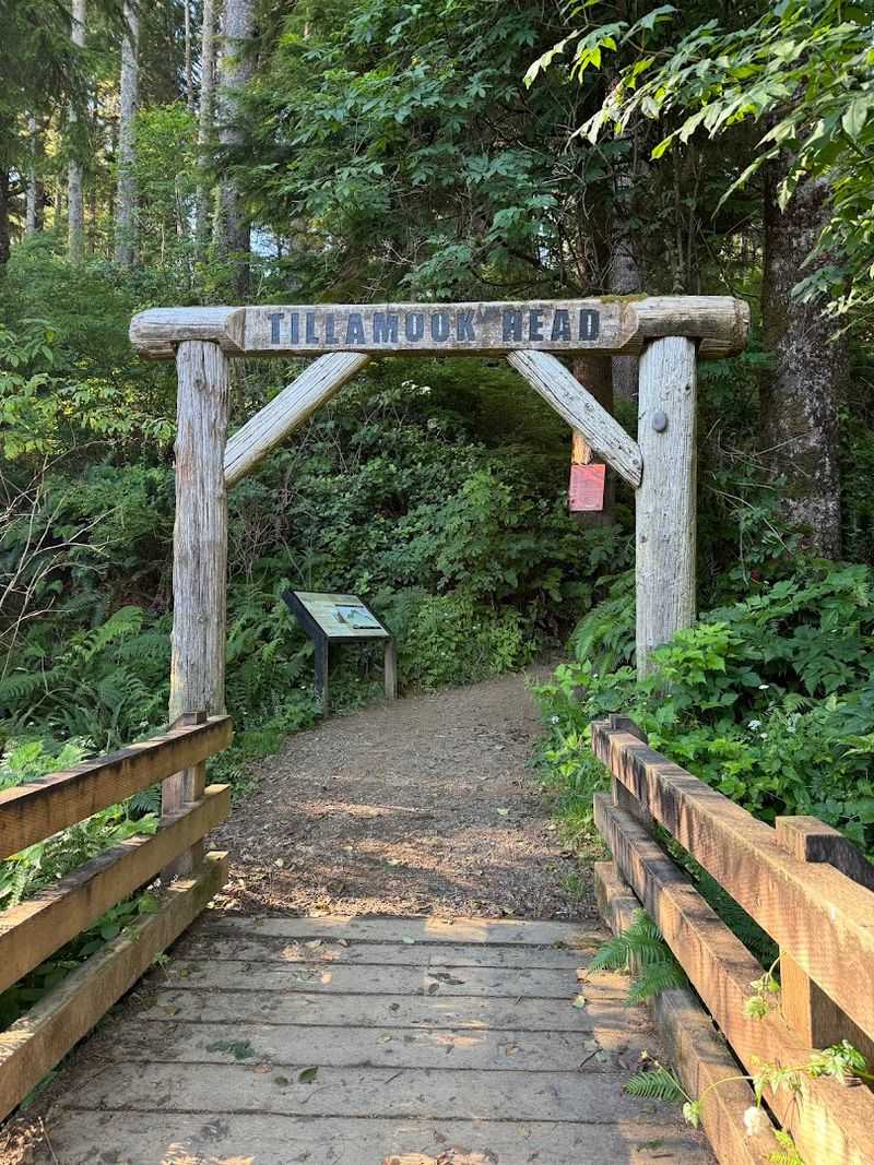
This trail follows one of the most historically significant routes on the entire Oregon coast. Captain William Clark of the Lewis and Clark Expedition walked this exact headland in January 1806.
He was chasing a beached whale, which is both ambitious and deeply relatable.
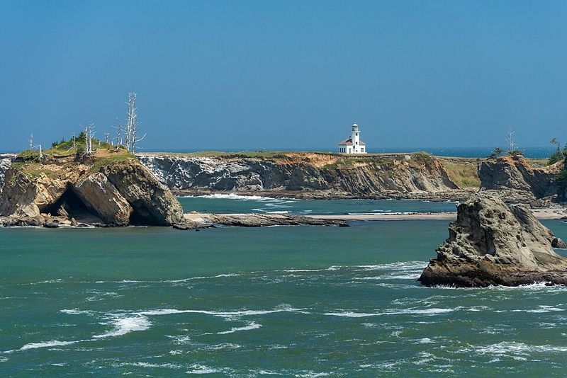
The trail runs through Ecola State Park and offers incredible views of the Tillamook Rock Lighthouse offshore. That lighthouse, nicknamed Terrible Tilly, sits on a basalt rock one mile out to sea.
It was decommissioned in 1957 and has had a wild life since, including a stint as a columbarium.
The forest on this trail is dense old-growth spruce and alder. Massive trees create a canopy so thick that even light rain barely reaches the trail below.
It feels ancient in the best possible way.
An abandoned World War II radar installation sits along the route. The concrete bunker is still standing and you can walk right up to it.
History nerds will absolutely love this unexpected discovery mid-hike.
The full trail is 6.3 miles one way between Seaside and Cannon Beach. Most hikers do a 4-mile out-and-back section from the Cannon Beach end.
Elevation gain reaches around 1,200 feet, so your lungs will definitely notice.
Trail conditions can be rugged with uneven rocky sections and fallen trees. Sturdy footwear is strongly recommended here.
Poles help on the steeper descents, especially after wet weather.
Visit it at Sunset Blvd, Cannon Beach, OR 97110.