This Tennessee Hike Will Test Your Legs And Your Nerves, And Treat You To Incredible Views
A hike does not need to be long to make your legs question your life choices.
In Tennessee, one steep Smoky Mountains trail packs a serious workout into a short distance. The climb comes fast.
Stone steps, rocky stretches, and sharp elevation gain keep your attention the whole way. It is beautiful, but it does not let you coast.
Then the nerves kick in.
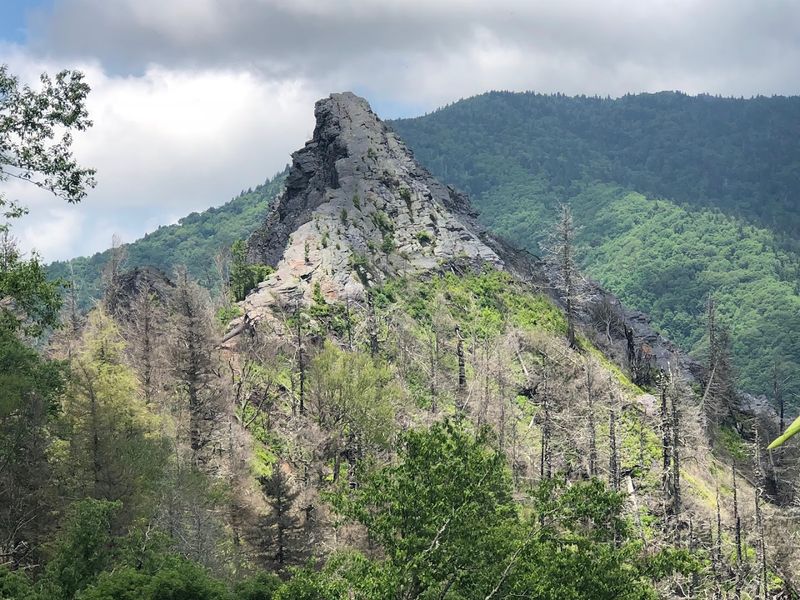
This trail is known for its rugged feel and dramatic mountain scenery, though hikers should know the original summit area is no longer open for safety reasons after wildfire damage.
The current route still leads to a rewarding overlook, giving you a powerful look at the peaks that made this hike famous.
Bring water. Wear proper shoes.
Take your time. This Tennessee trail may challenge you, but the views make every hard-earned step feel worth it.
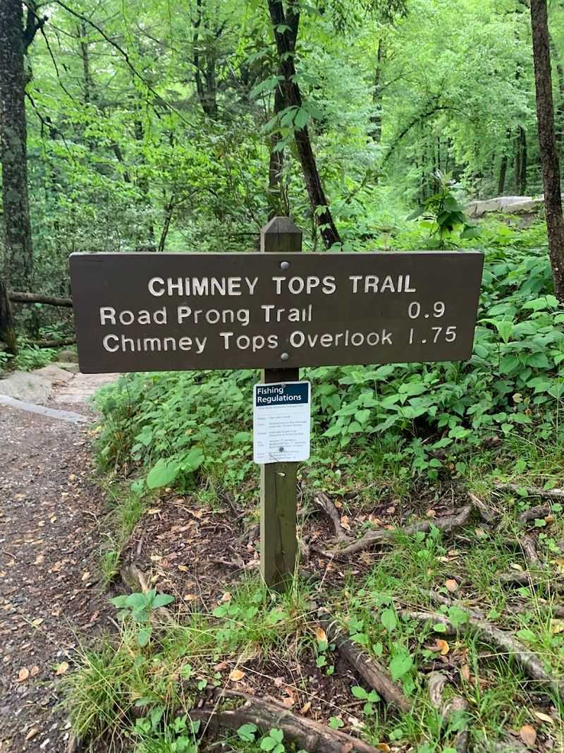
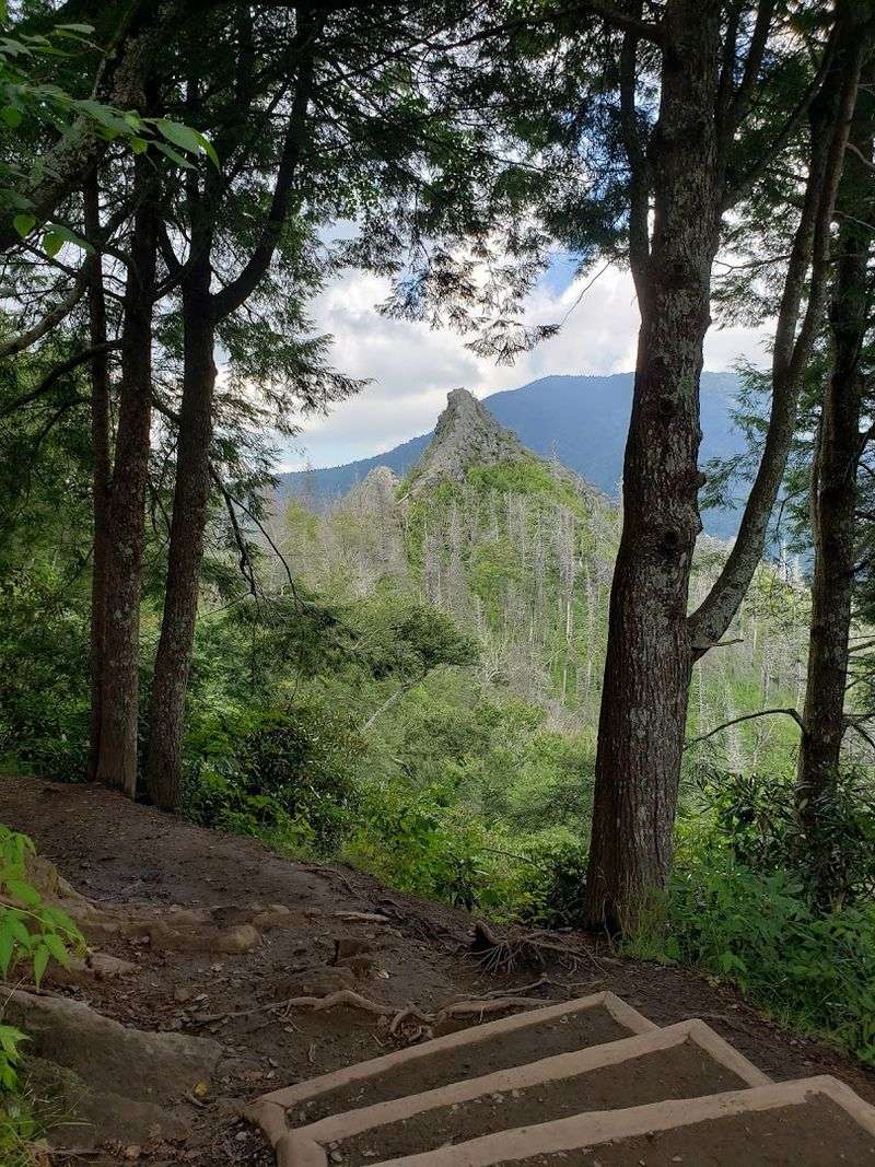
The Trail That Starts Easy And Gets Serious Fast
The first stretch of this trail has a way of lulling you into false confidence. The path begins as a pleasant forest walk along Road Prong Creek.
The sound of moving water keeps you company and the canopy overhead stays thick and cool.
It is easy terrain, and many hikers pick up a comfortable pace here without thinking much about what comes next.
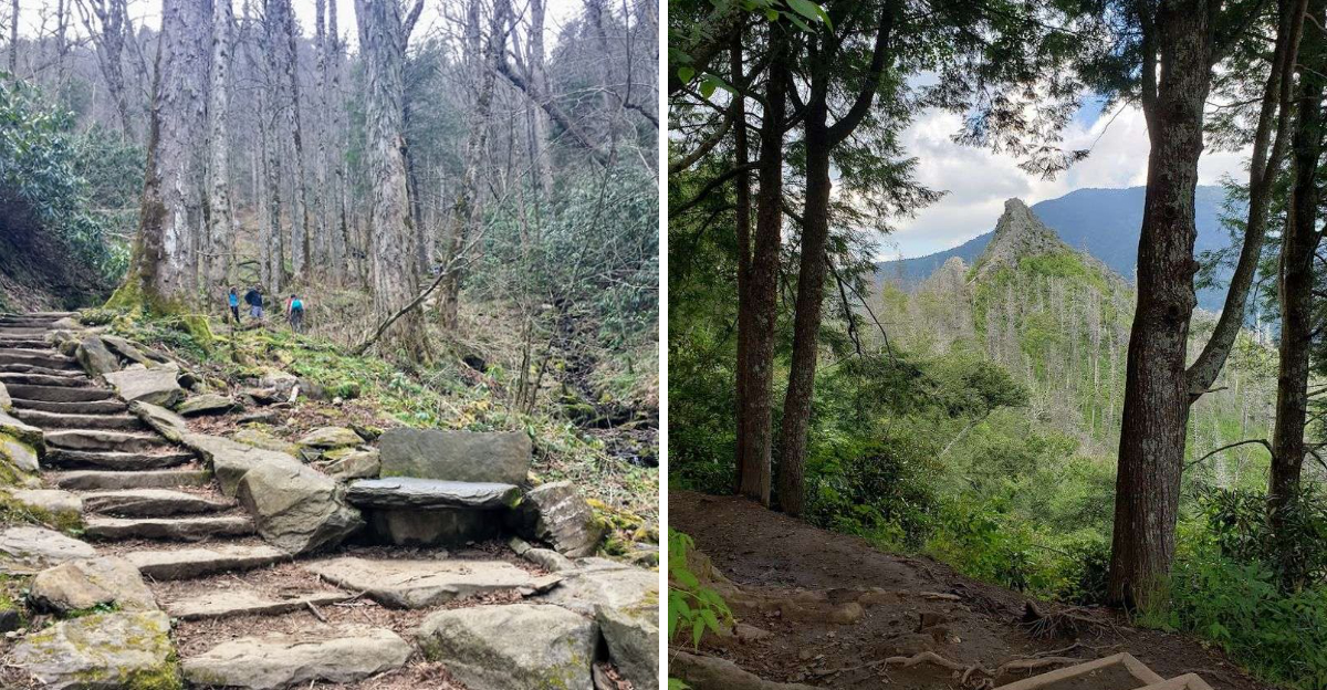
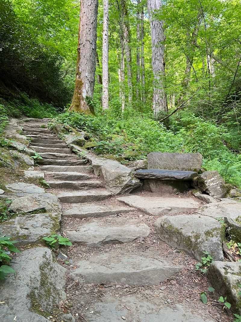
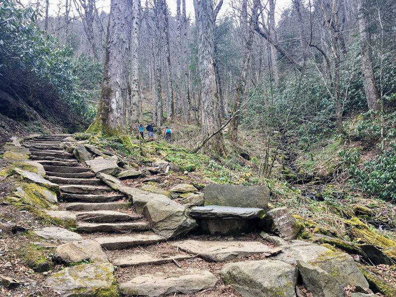
Then the trail shifts. Around the halfway mark, the incline sharpens considerably, and the stone stairs begin.
Over 360 of them have been carved and placed into the mountainside to help hikers manage the steep ascent. They are sturdy and well-maintained, but they do not make the climb easy.
The final mile gains more than 900 feet in elevation, a rate that rivals some of the steepest trails in Colorado.
The trailhead sits off Newfound Gap Road, about 6.7 miles south of the Sugarlands Visitor Center. Arriving early is strongly recommended.
Parking fills up quickly on most mornings, and the lot is small. Sturdy footwear matters here.
The terrain transitions from packed earth to rocky, uneven ground as you climb higher, and good traction makes a real difference on the upper sections.
Road Prong Creek And The Beauty Of The Lower Trail
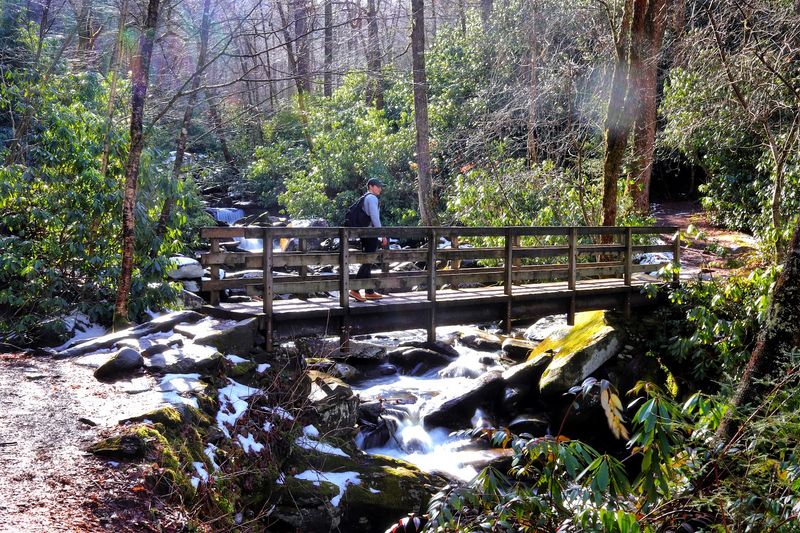
Before the hard climbing begins, the lower section of the Chimney Tops Trail offers some genuinely lovely scenery that deserves its own attention. Road Prong Creek runs alongside the path for much of the early portion of the hike, and it is full of character.
The water moves quickly over rounded stones, dropping into small pools and rushing through narrow channels cut into the bedrock over centuries.
Several footbridges cross the creek along the way, and these are natural stopping points for photographs and a moment to catch your breath before the real work begins. In spring and early summer, the trailside vegetation is remarkable.
Rhododendron and mountain laurel grow in dense thickets, and wildflowers appear in surprising variety along the creek banks. The forest here feels genuinely old and undisturbed.
One reviewer noted that the snow-covered rocks in the stream near the first bridge made for some of the best photographs of the entire trip. That observation holds true in other seasons as well.
The lower trail rewards those who slow down and pay attention.
Rushing through this section is understandable, but the creek scenery is part of what makes this hike memorable from the very first steps.
Stone Stairs, Steep Grades, And The Physical Reality Of This Climb
Nobody finishes the Chimney Tops Trail without having an honest conversation with their legs. The upper half of this hike is genuinely demanding.
The stone stairs that line the steepest sections are both a help and a humbling reminder of how much elevation remains. More than 360 stairs have been built into the trail.
By the time you reach the upper third, your thighs will have formed a strong opinion about the whole endeavor.
The elevation gain of approximately 1,487 feet over roughly two miles places this trail in a category that surprises many visitors. The short total distance makes it seem approachable on paper, but the gradient in the final mile is relentless.
Some hikers have compared the physical demand to climbing a 14,000-foot peak in Colorado, at least in terms of how steeply the elevation accumulates.
One experienced hiker admitted that it caught them completely off guard despite years of hiking experience. That kind of candid reaction is useful information.
Trekking poles are worth bringing. They reduce strain on the knees during the descent, which can be just as taxing as the climb.
Plan for three to four hours if you want to move at a comfortable, enjoyable pace and take in the surroundings properly.
What The 2016 Wildfire Changed About The Summit Experience
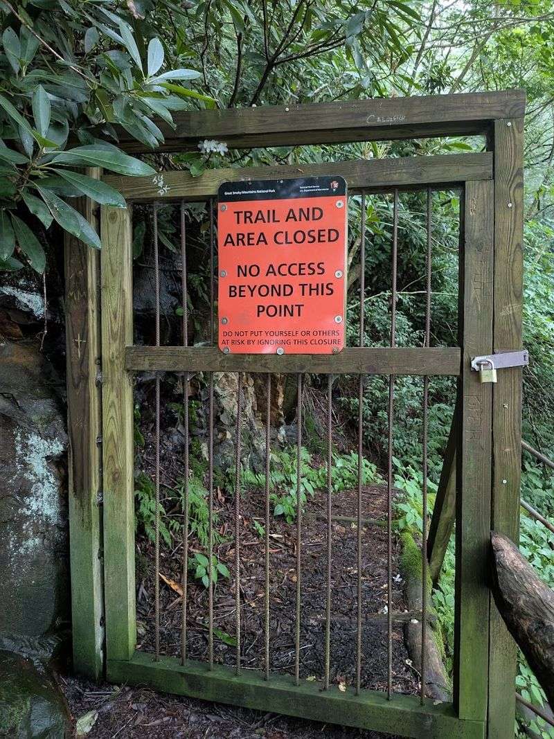
The story of the Chimney Tops summit is inseparable from the Chimney Fire of November 2016, one of the most destructive wildfires in modern Smoky Mountains history.
The blaze caused significant damage to the rocky pinnacles at the top of the trail, leaving the final quarter-mile structurally compromised and permanently closed to hikers.
The closure signs are serious and should be respected, even when the temptation to push forward feels strong.
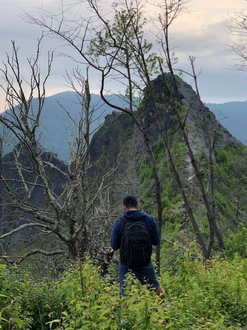
In response to the closure, the National Park Service constructed a new observation point roughly a quarter-mile below the former summit.
This platform delivers a clear and impressive view of the Chimney Tops pinnacles themselves, as well as sweeping sightlines toward Mount LeConte and the surrounding ridgelines.
The perspective from this point is actually quite good, and for most visitors, it provides everything the hike promises in terms of panoramic reward.
A handful of reviewers have mentioned ignoring the closure signs and continuing to the top anyway. That choice carries real risk.
The terrain above the gate is unstable, and the consequences of a fall at that elevation are severe. The observation point below offers a genuinely satisfying view without the danger.
The mountain is worth respecting, and the new viewpoint makes a compelling case for following the rules without feeling shortchanged.
Panoramic Views That Make Every Step Worth The Effort
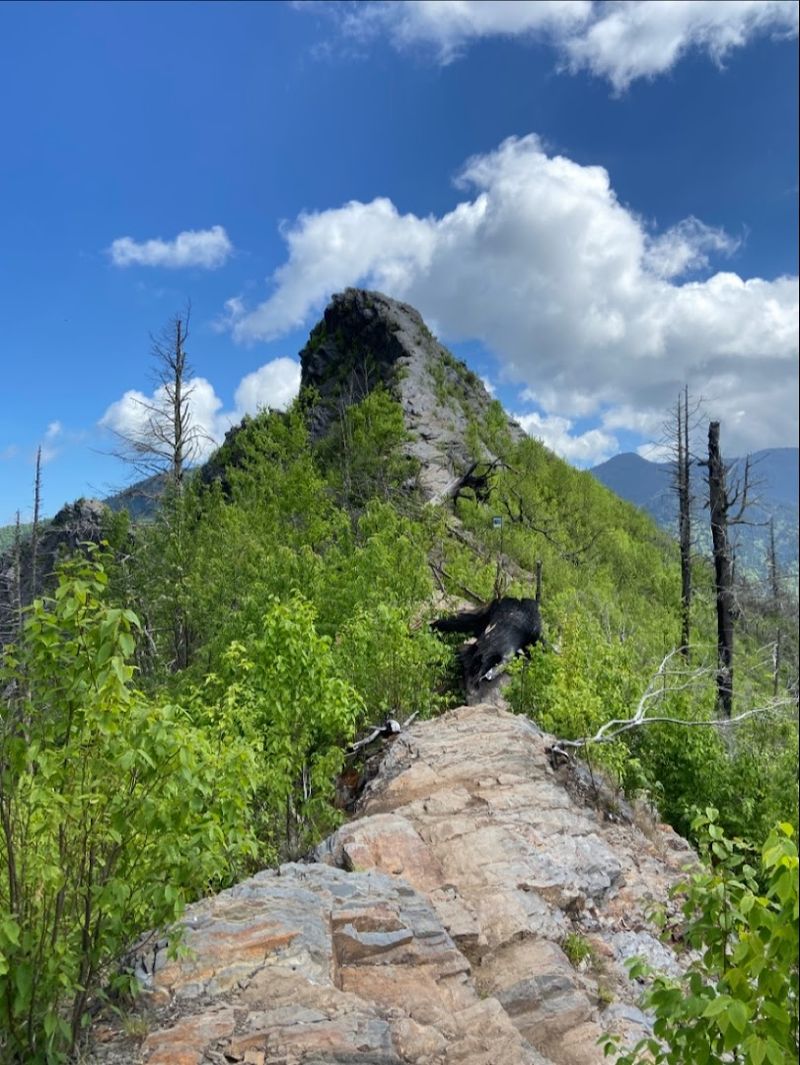
At the observation point near the top of the Chimney Tops Trail, the landscape opens up in a way that feels almost disproportionate to the modest trail length below. Mount LeConte rises prominently to the northeast.
The rocky twin pinnacles of the Chimney Tops themselves stand clearly visible against the sky above the observation platform. On clear days, the view extends across multiple ridgelines deep into the park.
The rating of 4.7 stars across over 100 reviews tells a consistent story. Hikers with varying fitness levels and trail experience return the same verdict: the views justify the climb.
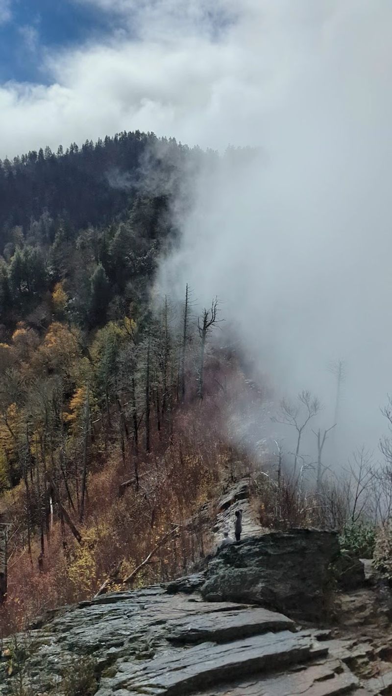
One reviewer described burning 800 calories on the ascent alone, then standing at the top calling it stunning. Another mentioned that the fog rolling through the peaks during a November afternoon created a view unlike anything they had anticipated.
Morning visits tend to offer the clearest sightlines before afternoon clouds and haze build over the mountains. Fall foliage season adds considerable color to the panorama, though trail traffic increases significantly during peak leaf season.
Spring brings wildflowers and fuller creek flow on the lower trail. Any season except icy winter conditions offers a legitimate and rewarding experience at the top.
Gear And Preparation That Will Actually Make A Difference
Preparation for the Chimney Tops Trail is not about being dramatic. It is about being practical.
The trail is short enough that many people show up underprepared, treating it like a casual walk rather than a legitimate mountain hike. That approach tends to end with sore knees, cramping calves, and a very long-feeling descent back to the parking area.
Sturdy footwear is the single most important piece of equipment you can bring. The upper trail involves rocky, uneven surfaces, and the stone stairs can become slick when wet or icy.
Trail runners work for experienced hikers, but proper hiking boots with ankle support are a smarter choice for most people. Trekking poles are worth the minor inconvenience of carrying them, especially on the way down when tired legs make balance more difficult.
Water is non-negotiable. The climb generates real heat and effort, and dehydration sets in faster at elevation than most people expect.
Bring more than you think you need. Snacks with some protein and carbohydrates help sustain energy through the upper section. Pets are not allowed on this trail, so leave them at the accommodation.
Layers are useful in cooler months, since the temperature at the observation point can drop noticeably compared to the trailhead.
Parking, Permits, And Practical Logistics For Your Visit
Getting to the Chimney Tops trailhead requires a bit of planning that goes beyond simply plugging the address into a navigation app. The parking area along Newfound Gap Road is small, and on busy weekends it fills by mid-morning or earlier.
Arriving before 8 a.m. gives you a reasonable chance of securing a spot. A small overflow area sits about 150 feet further down the road, but it holds only a handful of vehicles.
The trailhead is located approximately 6.7 miles south of the Sugarlands Visitor Center, making that visitor center a logical first stop. Cell service is unreliable or completely absent at the trailhead and along much of the trail.
One reviewer specifically flagged this issue after arriving without cell service and being unable to sort out the pass requirement on the spot.
The trail is open year-round in theory, but winter conditions introduce ice on the stone stairs and upper trail sections that make the ascent genuinely hazardous without microspikes or crampons. Spring through fall represents the optimal window.
Seasonal Conditions And The Best Time To Make The Climb
Each season brings a different version of the Chimney Tops experience. The differences are significant enough to influence which time of year suits your goals for the hike.
Spring is arguably the most visually rich season on the lower trail.
Road Prong Creek runs high and fast from snowmelt and spring rain, the rhododendron blooms in earnest, and the forest floor shows considerable wildflower activity.
Temperatures are manageable, and the trail is not yet at peak summer crowding.
Summer brings warm temperatures and full green canopy, which provides shade on the lower trail but can make the exposed upper sections feel quite warm. Starting early is especially important in summer to avoid both heat and afternoon crowds.
Fall is the most popular season overall, and for good reason. The hardwood trees along the trail turn in late October, and the views from the observation point gain an extra layer of color.
Winter is the outlier. The trail remains technically accessible, but ice accumulates on the stone stairs and rocky upper sections. A Valentine’s Day visitor described nearly empty trails, which has its own appeal.
Cold temperatures and fog in fall evenings can also produce atmospheric views that are genuinely unlike any other season on the mountain.
Safety Considerations That Every Hiker Should Know Before Going
The Chimney Tops Trail has a reputation for being more demanding than its short distance suggests, and that reputation is well-earned.
The rapid elevation gain, the rocky upper terrain, and the exposed observation area all require a degree of physical fitness and trail awareness that casual walkers may underestimate.
The closure of the final quarter-mile is a safety measure, not a bureaucratic inconvenience.
The terrain above the gate was damaged in the 2016 wildfire, and the rock structure is no longer stable.
Falls in that zone carry serious consequences. The observation platform constructed below the former summit provides a safe and genuinely rewarding alternative.
Children can complete this trail, but younger or smaller kids will find the stone stairs and steep gradient physically demanding. The upper section near the observation point involves open, unguarded terrain where footing matters.
Trekking poles, plenty of water, and a realistic assessment of your fitness level before you start will make the entire experience considerably more enjoyable and far safer.
Why Chimney Tops Remains One Of The Smokies Most Talked-About Trails
Few trails in the eastern United States generate the kind of consistent word-of-mouth that the Chimney Tops Trail does. With a 4.7-star rating built from over a hundred honest reviews, the trail occupies a particular place in the hiking culture of the Smokies.
People come back to it. They recommend it specifically.
They describe it as difficult and then immediately say it was worth every step. Part of that reputation comes from the efficiency of the experience.
You gain substantial elevation, move through beautiful forest, follow a mountain creek with small waterfalls, and arrive at a viewpoint that frames the distinctive rocky pinnacles against the sky.
All of that happens within roughly two miles of walking.
For a region packed with longer and more logistically complex hikes, the Chimney Tops Trail offers a concentrated version of what makes the Smokies worth visiting.
The trail is located in Great Smoky Mountains National Park at Tennessee 37738, accessible from Newfound Gap Road. It continues to draw hikers from across the country who have heard the story and want to verify it personally.
The sense of accomplishment at the top is exactly the kind that stays with you well beyond the drive home.