Nevada Has A National Forest Bigger Than Some States And It Is Hiding In Plain Sight
Ask someone to describe Nevada and you’ll probably hear about casinos, sagebrush, and endless desert highways. What rarely comes up is a landscape filled with mountain peaks, alpine lakes, dense forests, and enough wilderness to keep exploring for years.
Stretching across a huge portion of the state, this massive outdoor playground is so woven into the scenery that many travellers drive right past it without realizing its scale. One moment you’re crossing open desert, the next you’re surrounded by towering pines and cooler mountain air.
The contrast is part of the surprise. For anyone who thinks Nevada is all sand and slot machines, this enormous natural wonder offers a completely different side of the Silver State.
It Is The Largest National Forest In The Lower 48

Humboldt-Toiyabe National Forest holds the record as the biggest national forest in the contiguous United States. Few visitors realize they are standing in a place larger than entire national parks combined.
The forest dwarfs famous protected lands like Yellowstone or Yosemite in total acreage. Its boundaries encompass mountain ranges, valleys, and high desert terrain that shift dramatically with elevation.
Size alone does not tell the full story, but it hints at the diversity waiting inside. Travelers can spend weeks exploring different corners and still find new landscapes.
The forest’s administrative offices in Sparks, NV 89431 coordinate management across this immense territory, ensuring trails stay maintained and ecosystems remain protected for future generations to discover and enjoy.
The Forest Covers About 6.3 Million Acres
Numbers become hard to grasp at this scale, but 6.3 million acres translates to roughly 9,800 square miles of public land. That measurement puts the forest in a category few Americans can fully imagine without a map.
To put it in perspective, the entire state of Massachusetts covers about 7,800 square miles. Humboldt-Toiyabe comes close to matching that with forest alone.
Visitors driving through Nevada might cross the forest multiple times without noticing boundaries because the landscape flows naturally from one section to another.
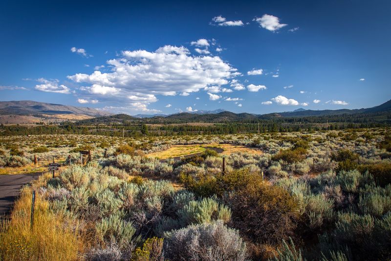
This acreage includes everything from sagebrush flats to alpine lakes tucked above timberline. Each acre serves a purpose in the larger ecosystem, supporting wildlife corridors and watershed protection.
The sheer size allows for solitude even during busy seasons, making it possible to hike for hours without encountering another soul on the trail.
It Spreads Across Nevada And A Slice Of Eastern California
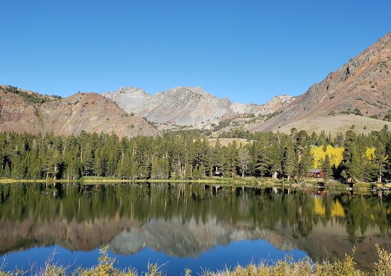
Geography splits this forest into two states, with the majority residing in Nevada and a smaller portion reaching into California. The California sections include areas near Bridgeport and the Eastern Sierra, adding alpine character to the mix.
Nevada claims the bulk of the acreage, but the California sections bring their own distinct flavor. High peaks along the Sierra crest create dramatic backdrops, while Nevada’s portions offer wide basins and isolated mountain ranges.
Both states benefit from the recreational opportunities and water resources the forest provides.
This cross-border arrangement means visitors can experience two different landscapes within one national forest. The transition zones reveal how terrain shifts with longitude and climate.
Driving from Nevada into California through forest land offers a lesson in biogeography without needing a textbook, just observant eyes and a sense of curiosity about the land.
Its Sections Are Scattered Rather Than One Continuous Block
Most national forests form one unbroken expanse, but Humboldt-Toiyabe breaks that pattern completely. Its sections scatter across Nevada like islands, separated by private land, towns, and valleys that never became part of the federal system.
This fragmented layout confuses first-time visitors who expect to enter once and stay inside forest boundaries. Instead, travelers might drive through the forest, exit into rangeland, then re-enter another section miles down the road.
Each fragment contains its own character, shaped by local geology and climate patterns unique to that mountain range.
The scattered nature actually increases access for Nevada residents, placing forest land within reach of more communities. It also creates management challenges, requiring coordination across vast distances.
Understanding this layout helps visitors plan trips more effectively, knowing they might need to drive between sections to experience different recreational opportunities and natural features throughout the region.
The Forest Reaches From Northern Nevada To The Spring Mountains
Length matters as much as total area when considering this forest’s reach. Humboldt-Toiyabe stretches from the Oregon border in the north down to the Spring Mountains just outside Las Vegas, covering nearly the entire length of Nevada.
This north-south span creates incredible ecological diversity. Northern sections experience harsher winters and support different plant communities than the southern ranges near Las Vegas.
The Spring Mountains provide a cool refuge above the desert heat, while northern areas stay snow-covered well into summer.
Travelers driving Interstate 80 or Highway 95 pass through or near the forest repeatedly without always recognizing it. The forest’s reach means almost every Nevada resident lives within a few hours of at least one section.
This accessibility makes it a resource for weekend trips, day hikes, and quick escapes from urban centers throughout the state, serving millions of visitors annually.
Seven Ranger Districts Manage Its Vast Landscape
Managing 6.3 million scattered acres requires serious organizational structure. Seven ranger districts divide responsibility across the forest, each focusing on specific regions with their own challenges and visitor needs.
Districts include the Spring Mountains near Las Vegas, the Ruby Mountains in the northeast, and Carson District near Lake Tahoe, among others. Each district maintains its own staff, visitor centers, and local knowledge about trails, wildlife, and seasonal conditions.
This decentralized approach allows rangers to develop expertise in their specific areas rather than trying to know everything about millions of acres.
Visitors benefit from this system by getting accurate, location-specific information when planning trips. Calling the district office closest to your destination yields better trail conditions and camping availability than generic forest-wide information.
The district structure also speeds up response times for emergencies and allows for management decisions tailored to local ecosystems and community needs.
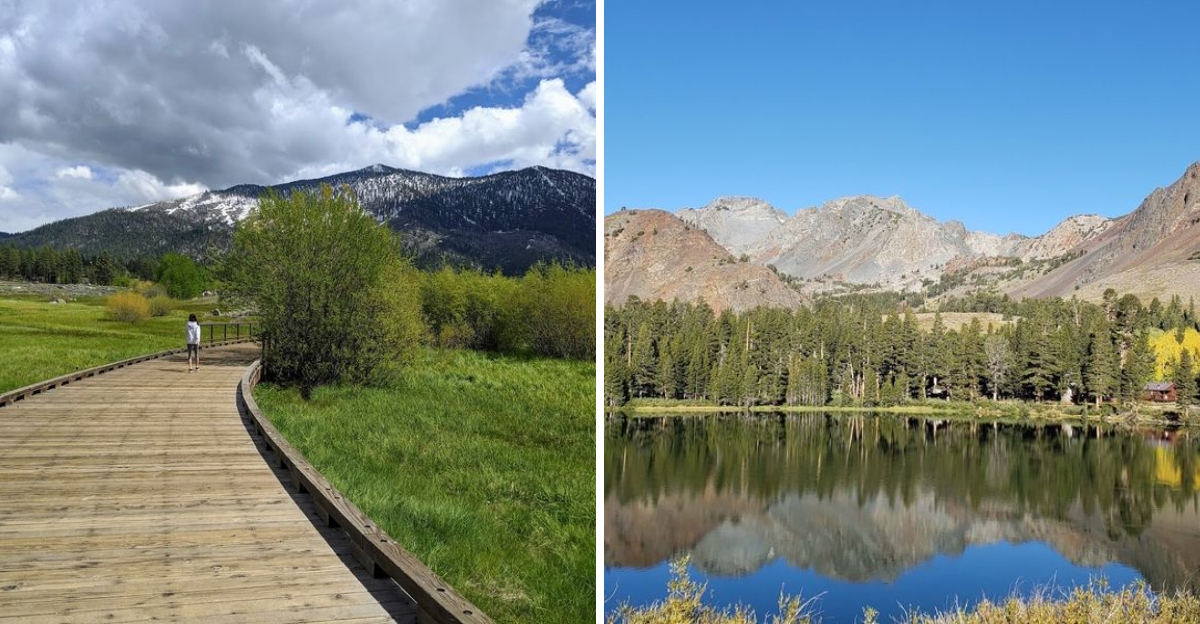
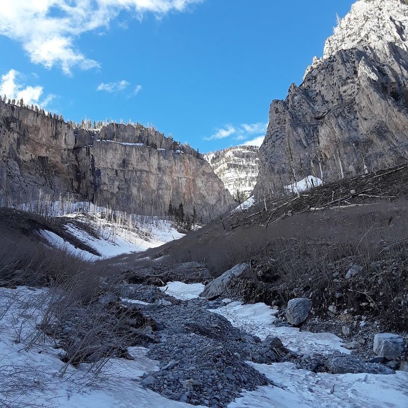
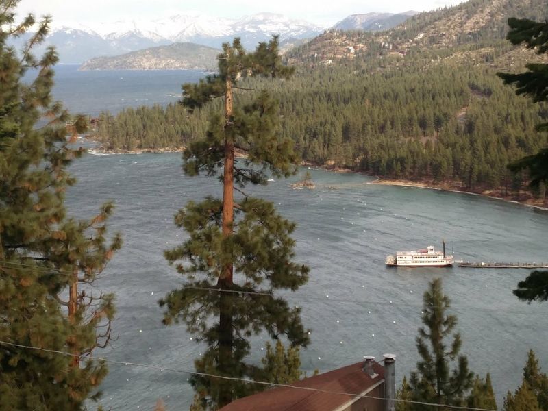
The Ruby Mountains Are One Of Its Most Scenic Areas
Locals call them the Nevada Alps, and the Ruby Mountains earn that nickname through sheer vertical drama. These peaks rise abruptly from the high desert floor, creating a skyline that surprises anyone expecting flat sagebrush country.
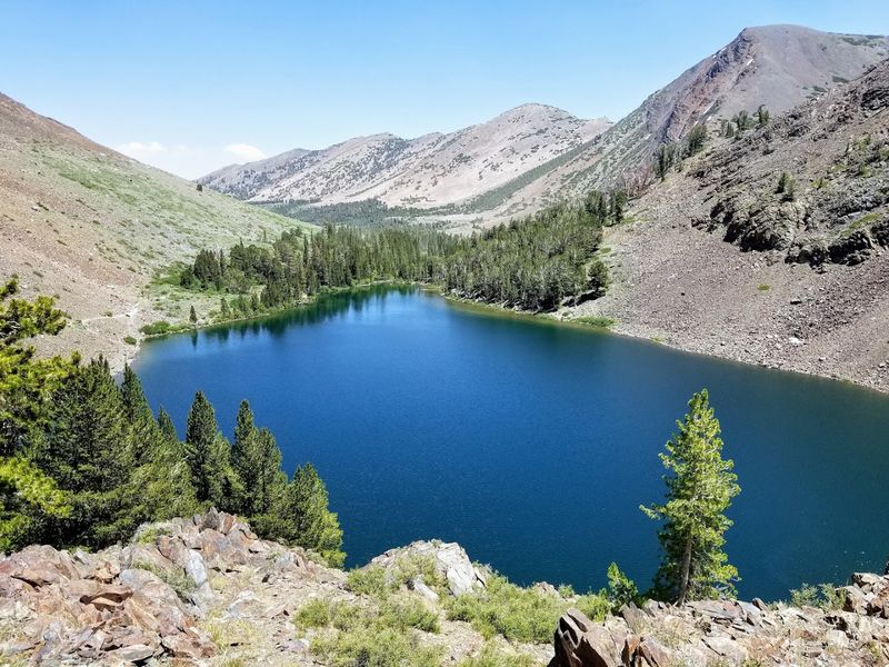
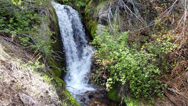
Lamoille Canyon cuts into the range like a natural sculpture, with a paved road providing access deep into the mountains. Glacial cirques hold turquoise lakes above 10,000 feet, while wildflower meadows explode with color during brief summer growing seasons.
The Rubies support hiking, backpacking, and some of Nevada’s best wilderness experiences.
Wildlife thrives here too, with mountain goats clinging to cliffsides and mule deer browsing in the valleys. Winter transforms the range into backcountry skiing terrain for those willing to earn their turns.
The Ruby Mountains demonstrate that Nevada contains genuine alpine environments, not just desert, and they remain less crowded than similar terrain in neighboring states.
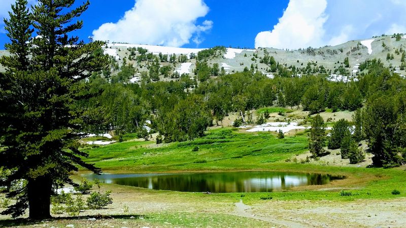
Visitors Can Hike, Camp, Fish, Bike, And Stargaze
Recreation opportunities span every season and skill level throughout the forest. Hundreds of miles of trails accommodate everyone from casual walkers to serious backpackers tackling multi-day routes through wilderness areas.
Camping options range from developed campgrounds with amenities to dispersed sites where solitude comes standard. Fishing in high mountain lakes and streams produces trout in cold, clear water that tastes like the snowmelt feeding it.
Mountain biking trails thread through forests and meadows, offering technical challenges and scenic cruising depending on route selection.
Night skies here rival any in the country, with minimal light pollution across most sections. Stargazing reveals the Milky Way in detail lost to most Americans living near cities.
Winter adds skiing, snowshoeing, and snowmobiling to the menu. The variety means families can find activities everyone enjoys, and solo adventurers can choose their own level of challenge and isolation within the same forest system.
It Includes Multiple Designated Wilderness Areas
Wilderness designation carries legal weight, protecting certain areas from roads, vehicles, and permanent structures. Humboldt-Toiyabe contains numerous wilderness areas where nature operates on its own terms without human interference beyond foot traffic.
These protected zones include the Jarbidge Wilderness in the north, the Arc Dome Wilderness in central Nevada, and the Mount Charleston Wilderness near Las Vegas. Each maintains strict regulations about group size, camping practices, and leave-no-trace principles.
The rules ensure these places remain wild for future generations.
Entering wilderness areas requires more preparation and self-reliance than developed recreation sites. No cell service, no rescue helicopters on standby, no marked campsites with fire rings.
These places reward visitors with authentic wilderness experiences increasingly rare in modern America. The silence, the dark nights, and the sense of being truly away from civilization make the extra planning worthwhile for those seeking genuine connection with unmodified landscapes.
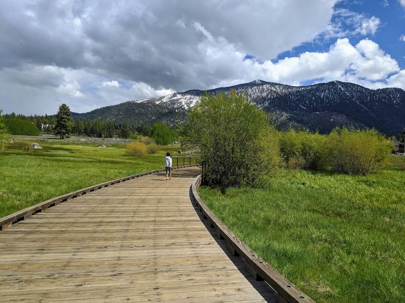
The Forest Offers Cooler Mountain Escapes Near Desert Towns
Temperature differences between valley floors and mountain peaks create natural air conditioning throughout Nevada. Towns baking at 100 degrees in summer sit just 30 minutes from forest elevations where temperatures hover in the comfortable 70s.
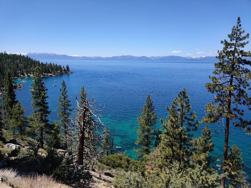
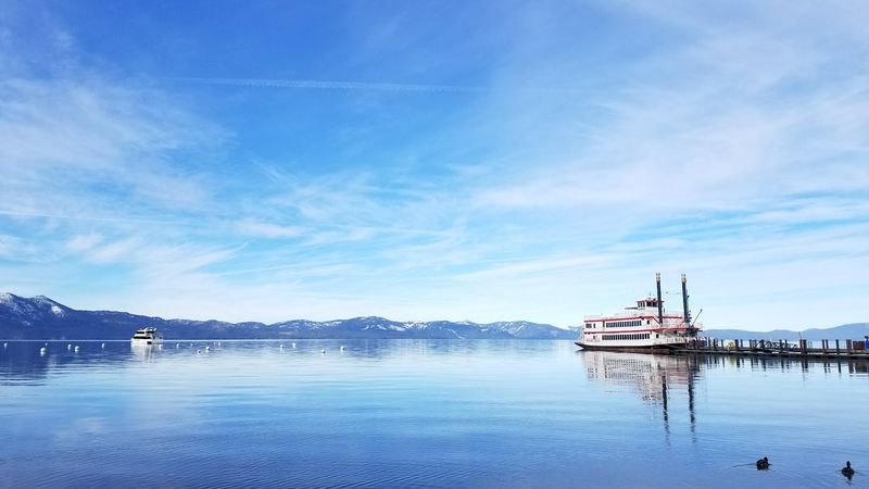
Las Vegas residents drive to Mount Charleston for relief when the Strip becomes unbearable. Reno locals head to the Carson Range for similar escapes.
These mountain zones provide not just cooler air but different ecosystems entirely, with pine forests replacing creosote and sagebrush.
The temperature gradient makes the forest a crucial resource during increasingly hot summers. Day trips bring relief without requiring overnight travel, and weekend camping trips offer extended breaks from heat.
This accessibility turns the forest into a safety valve for desert communities, providing recreation and respite when lower elevations become uncomfortable. The elevation difference also extends outdoor recreation seasons, allowing activities in the mountains while valleys sit under oppressive heat or bitter cold.
Its Size Makes It Larger Than Several U.S. States
Rhode Island covers about 1,200 square miles, making it smaller than Humboldt-Toiyabe by a factor of eight. Delaware spans roughly 2,000 square miles, still dwarfed by the forest’s 9,800 square miles of terrain.
These comparisons help visualize what 6.3 million acres actually means in practical terms. The forest could swallow Connecticut with room to spare.
It exceeds the combined area of Rhode Island and Delaware together. Such measurements place it firmly in the category of geographic features that shape entire regions.
Size creates both opportunities and challenges. Visitors gain access to enormous variety within one administrative unit, but they also face navigation complexity and long distances between services.
The scale means someone could spend years exploring and still find new corners. It also means the forest plays a major role in Nevada’s identity and ecology, influencing weather patterns, water supplies, and wildlife populations across a significant portion of the state’s total area.
Many Nevada Visitors Pass Near It Without Realising It’s There
Casinos and desert landscapes dominate Nevada’s popular image, leaving forests out of the mental picture most tourists carry. Travelers driving between Reno and Las Vegas often pass through or alongside forest sections without recognizing the public land surrounding them.
The scattered nature of the forest contributes to this invisibility. Without a single grand entrance or iconic gateway, the forest blends into Nevada’s basin-and-range geography.
Signs marking forest boundaries appear and disappear along highways, noticed mainly by locals or dedicated outdoor enthusiasts paying close attention.
This low profile means the forest remains less crowded than famous parks in neighboring states. Those who do discover it often feel like they have stumbled onto a secret.
The lack of fame preserves the quiet character many visitors seek. It also means Nevada holds recreational resources most Americans never consider, hidden in plain sight along highways that millions of people travel annually without ever stopping to explore the mountains rising just miles from the pavement.