
9 Epic Tennessee Day Hikes That Will Make You Forget Your Phone Exists
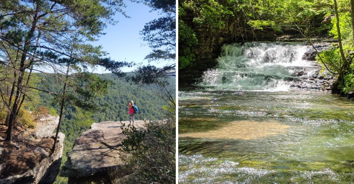
Does your phone really need to come along for every view? Tennessee has trails that make that question feel almost silly.
One minute you are checking the time, and the next you are following a creek, climbing toward a ridge, or standing beside a waterfall loud enough to erase every notification in your head.
These hikes are not just pretty walks with good photo spots. They ask for your attention. Rocky paths, forest shade, mountain air, and big overlooks all have a way of pulling you back into the moment.
Some routes feel wild and quiet. Others bring a challenge that makes the payoff even better.
That is what makes a great day hike so satisfying. You leave with muddy shoes, tired legs, and the rare feeling that you did not miss a thing online.
1. Fiery Gizzard Trail, Tracy City To Foster Falls
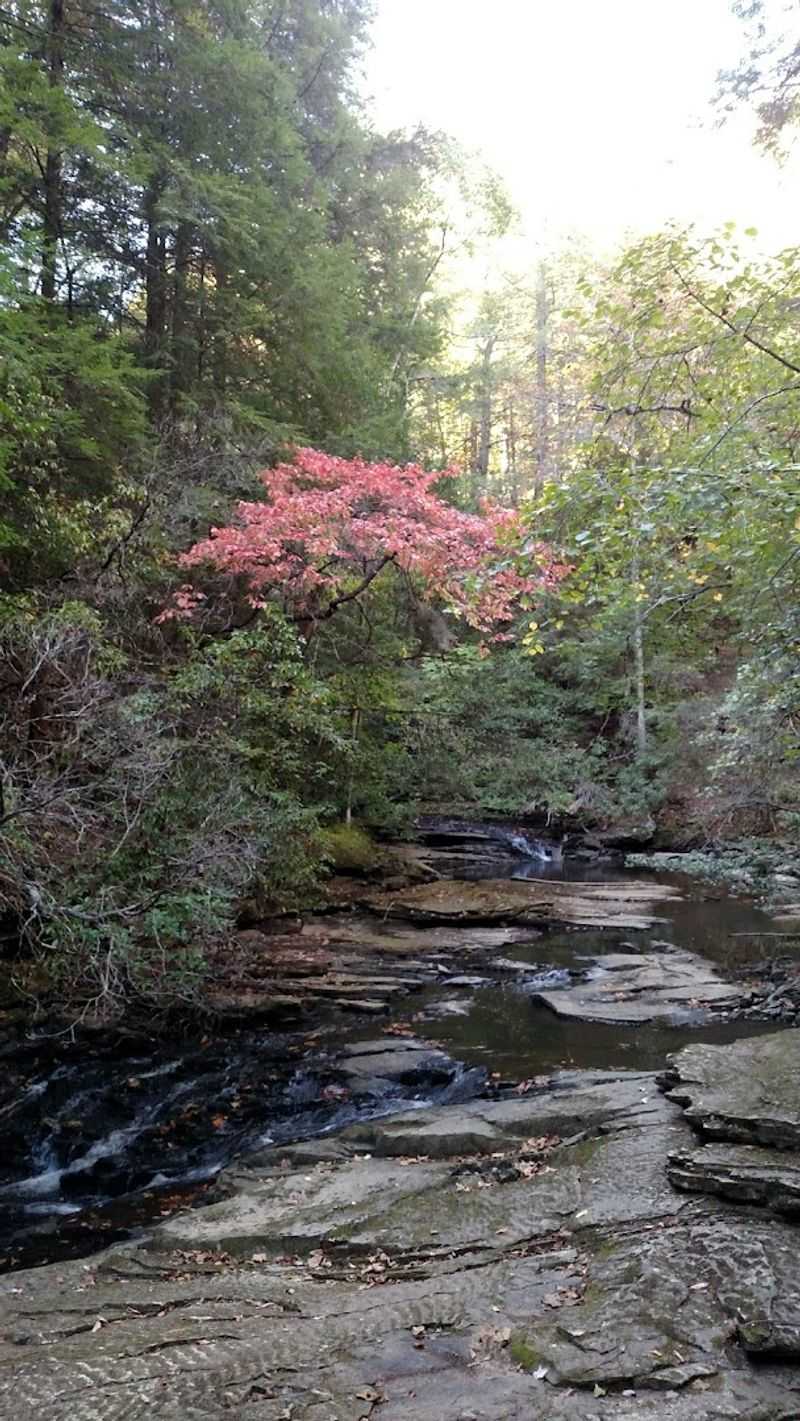
Few trail names in the entire country carry as much personality as this one, and the Fiery Gizzard Trail in Marion County absolutely earns every letter of it.
Running roughly 12.5 miles one way through South Cumberland State Park, it connects Tracy City to the thundering Foster Falls, a single-drop waterfall that crashes 60 feet into a pool below.
The terrain here is no joke. Deep canyons carved by Fiery Gizzard Creek, old-growth forests with hemlocks pushing past 200 years old, and rocky creek crossings all demand your full attention from start to finish.
Hikers who want a shorter taste can enter near Grundy Forest and sample a section without committing to the full distance. Those who push further will find Raven Point, a dramatic overlook that rewards the effort with sweeping wilderness views.
Backpacker magazine once named this trail one of the top 25 hikes in the United States, and standing at Foster Falls, it is easy to understand why.
Pack enough water, wear sturdy shoes, and give yourself a full day to absorb everything this rugged Tennessee classic has to offer.
2. Virgin Falls Trail, Sparta
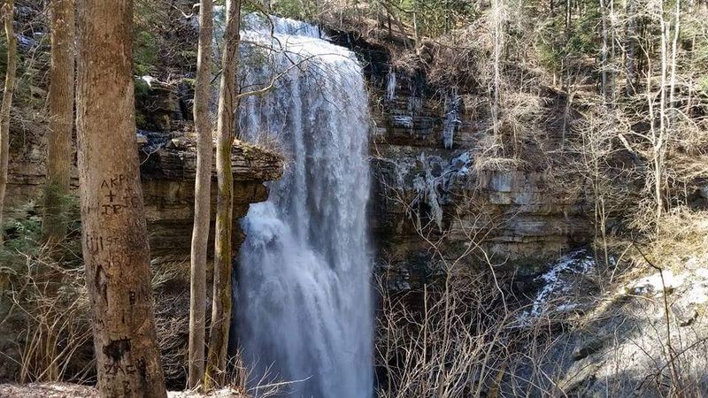
Imagine a waterfall that appears out of nowhere, drops 110 feet in a dramatic rush, and then vanishes completely into the earth.
That is exactly what greets hikers who make the journey to Virgin Falls in the Virgin Falls State Natural Area near Sparta and it is the kind of natural trick that genuinely stops people in their tracks.
The round trip covers roughly 9 miles, with about 1,300 feet of elevation change and rocky footing that keeps you locked in and focused throughout.
Along the way, the trail passes Big Branch Falls, Big Laurel Falls, and the fascinating Sheep Cave, making the journey feel like a series of rewards rather than a single payoff.
One important detail worth knowing: the caves along the trail are closed from August through May to protect the resident bat populations, so summer visits offer the fullest access to the area.
After a good rainfall, the water volume at the falls is at its most spectacular, so timing your trip after recent precipitation pays off.
The access road to the trailhead is unpaved and rough, so a vehicle with decent ground clearance is a smart choice. This trail earns its reputation as one of Tennessee’s great “earn the view” experiences.
3. Honey Creek Loop, Big South Fork National River And Recreation Area
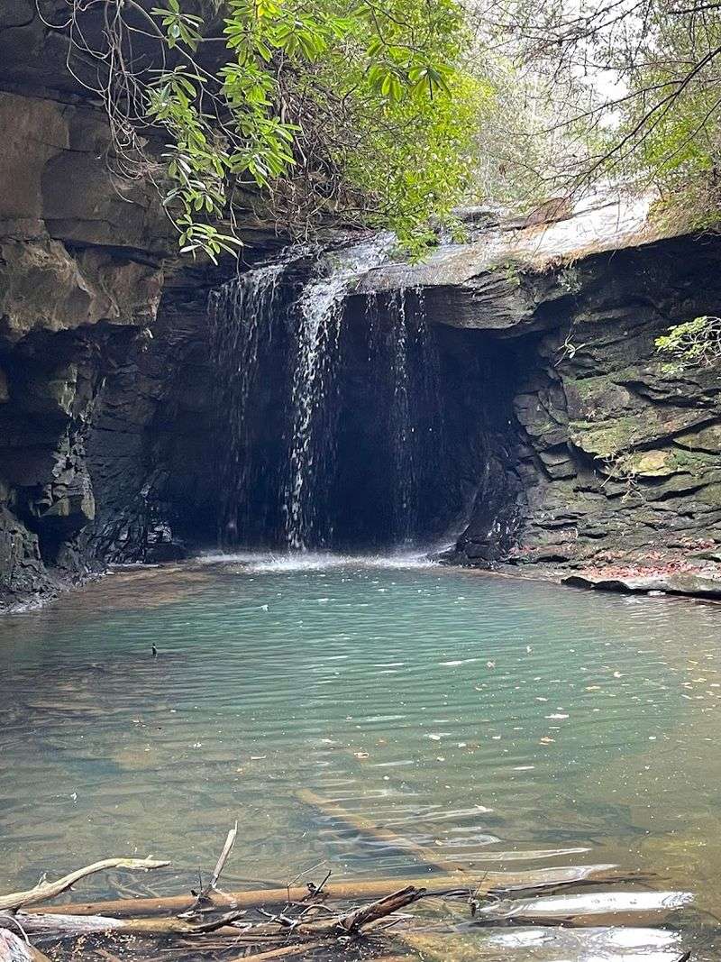
Experienced hikers often talk about trails that humble them, and the Honey Creek Loop in Big South Fork National River and Recreation Area, Pickett County,has a well-earned reputation for doing exactly that.
At just 5.5 miles, the distance sounds approachable, but the trail is widely considered the most strenuous in the entire park, with rangers and locals alike advising a minimum of five to eight hours to complete it safely.
Creek crossings, slick rock faces, tight boulder squeezes, and scramble sections where hands and knees come into play are all part of the experience.
The payoff is a landscape that feels genuinely wild, with sheer sandstone bluffs, cascading waterfalls during wetter months, and ancient rock shelters once used by Native Americans tucked into the canyon walls.
A spur trail leads to the Honey Creek Overlook, perched 250 feet above the South Fork of the Cumberland River, offering a perspective on the gorge that makes the extra steps entirely worth it.
Avoid this loop immediately after heavy rain or during freezing temperatures, as the already-technical terrain becomes significantly more dangerous under those conditions.
Arrive ready to be fully absorbed by one of the most raw and rewarding short hikes Tennessee has to offer.
4. Alum Cave Trail, Great Smoky Mountains National Park
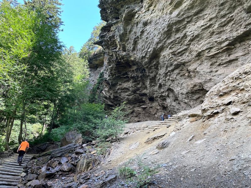
There is a moment on the Alum Cave Trail, when the forest opens up and the towering Alum Cave Bluffs appear overhead, stretching 80 feet high and offering a dry, cathedral-like shelter beneath their overhang.
That moment alone makes the 4.6-mile round trip worth every step.
The hike begins with a gentle climb alongside Walker Camp Prong and Alum Cave Creek, crossing log bridges before reaching Arch Rock, a natural stone archway that hikers pass directly through.
It is one of those small trail details that feels surprisingly thrilling when you are actually standing inside it.
Higher up, a heath bald covered in mountain laurel and rhododendron frames the approach to Inspiration Point, where views of Little Duck Hawk Ridge open up across the valley.
The bluffs themselves carry a fascinating history, having been mined for Epsom salts in the 1830s and later tapped for saltpeter during the Civil War.
Because this trail ranks among the most popular in the entire national park, arriving early on weekends is not just a suggestion but a near necessity.
A parking tag is required at the Newfound Gap Road trailhead, so plan ahead and claim your spot before the crowds do.
5. Charlies Bunion Via The Appalachian Trail, Great Smoky Mountains National Park
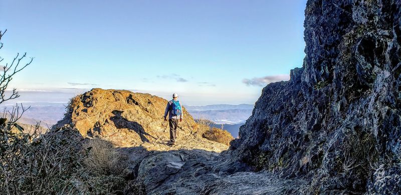
Walking the spine of the Appalachian Mountains has a way of making everything else feel small.
The eight-mile round trip to Charlies Bunion from Newfound Gap in Great Smoky Mountains National Park delivers that feeling in full.
The trailhead sits right on the Tennessee-North Carolina state line, and the route follows the Appalachian Trail through a high-elevation spruce-fir forest where the air is noticeably cooler and sharper than in the valleys below.
The elevation gain tops 1,600 feet, but the climb is gradual enough that most fit hikers find a comfortable rhythm without stopping constantly.
At the summit, Charlies Bunion reveals itself as a jagged pyramid of ancient Precambrian slate jutting boldly into open air, with unobstructed views rolling across the mountains in every direction.
The name itself comes from a lighthearted trail-side moment in 1929, when hiker Horace Kephart compared the rocky knob to a hiking companion’s sore foot.
The exposed ridge that shaped the rock was itself formed by a 1925 fire followed by a devastating 1929 flood that stripped away the soil.
The Icewater Spring Shelter sits along the route and makes for a good rest stop. Secure a parking tag at Newfound Gap before you set out, because this trailhead fills up fast on clear-sky days.
6. Roan Highlands To Grassy Ridge Bald, Roan Mountain
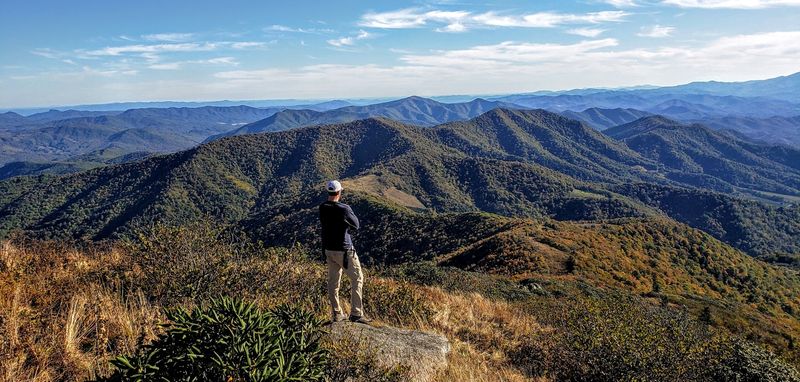
Standing on Grassy Ridge Bald feels less like being on a mountain and more like being on top of the world with nothing between you and the horizon in any direction.
This section of the Appalachian Trail near Roan Mountain starts at Carvers Gap on the Tennessee-North Carolina border and rolls across the longest continuous stretch of grassy balds in the entire Appalachian range.
The approximately five-mile round trip passes over Round Bald and Jane Bald before reaching Grassy Ridge, where 360-degree views reward the effort with a sense of space that feels rare anywhere in the eastern United States.
In summer, the balds burst with wildflowers, including spreading avens and Gray’s lily, two rare species that draw botanists and nature lovers from across the region.
The Roan Highlands are also home to one of the world’s largest natural rhododendron gardens, located nearby at Roan Mountain State Park, making a late June visit particularly spectacular when the blooms peak.
Sunrise and sunset visits on clear days produce the kind of light that photographers plan trips around.
Parking at Carvers Gap fills quickly on weekends, so an early arrival is strongly recommended.
Bring layers even in summer, since the elevation and open exposure can make conditions windier and cooler than expected at the trailhead below.
7. Stone Door To Big Creek Gulf And Ranger Falls, Savage Gulf State Park
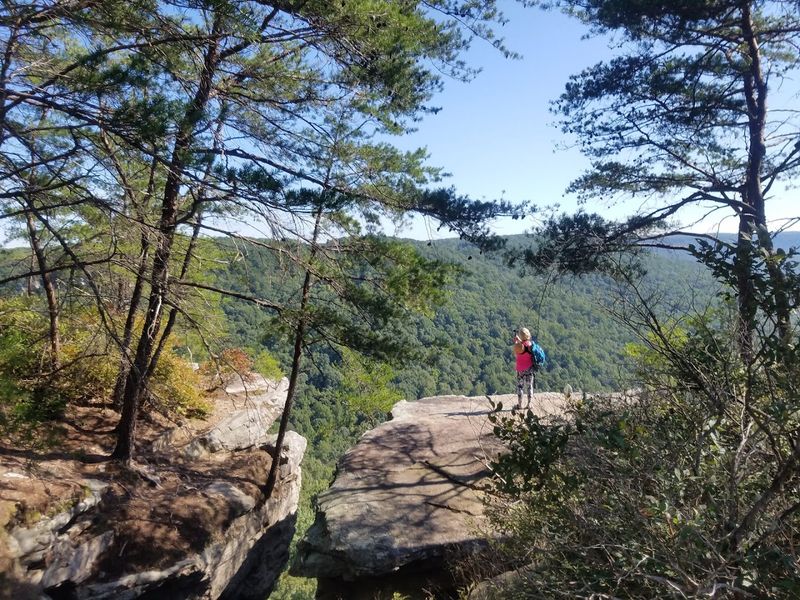
The Stone Door is one of those geological features that makes you stop and stare simply because it looks like something out of a fantasy novel.
A massive vertical slice through the limestone caprock of the Cumberland Plateau in Savage Gulf State Park, it serves as both an iconic photo stop and the starting point for one of the best full-day hikes on the plateau.
An easy 0.9-mile walk from the Stone Door Ranger Station delivers you to this natural overlook, where the canyon drops away below in a dramatic sweep.
Most visitors stop here and turn back, but continuing onward transforms the outing into a challenging seven-mile day hike through Big Creek Gulf and toward Ranger Falls.
Big Creek Gulf is a sheer-walled canyon plunging roughly 750 feet, carved by centuries of mountain stream activity into dramatic formations that reward slow, observant hiking.
The side trail to Ranger Falls adds a waterfall payoff that feels especially satisfying after the longer canyon section.
Hikers are required to register at the kiosk near the trailhead before heading out, a simple step that keeps the park’s backcountry safe and well-monitored.
Pack a full lunch and plenty of water, because once you drop into that canyon, the outside world fades away completely.
8. Cummins Falls Gorge Trail, Cookeville
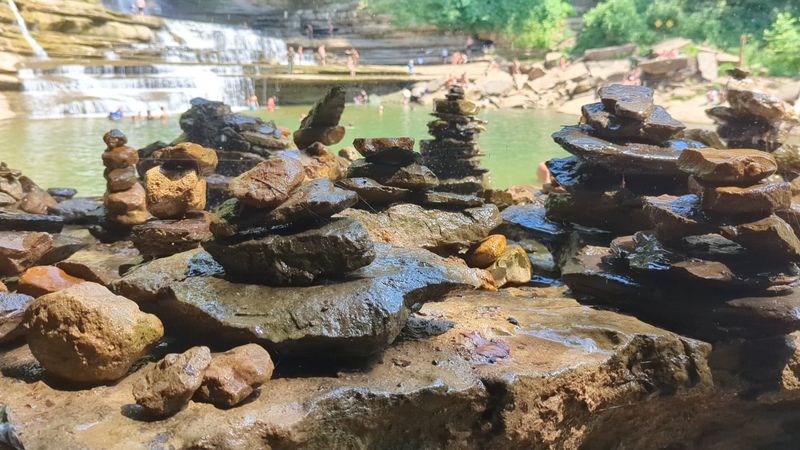
Most hikes end at a waterfall. The Cummins Falls Gorge Trail near Cookeville essentially makes the waterfall the entire point of the journey.
Getting there involves enough boulder hopping, water crossings, and gorge scrambling to feel like a genuine river expedition rather than a casual walk.
Cummins Falls itself drops 75 feet and ranks as the eighth largest waterfall in Tennessee by water volume, crashing into a wide natural pool that draws visitors from across the state.
The approach through the gorge is what sets this hike apart, with uneven terrain, slick rock surfaces, and creek crossings that require full attention every step of the way.
A Gorge Access Permit is required to reach the base of the falls, and the number of permits issued each day is limited, especially during peak summer months.
Booking online in advance is strongly recommended to avoid arriving and finding access sold out for the day.
Park rangers check permits at the entry point, and access to the gorge can be closed without advance notice if weather conditions create flash flood risk. Water-friendly footwear is essential, and light packing makes the scramble significantly easier.
When conditions align and the falls are running strong, this trail offers one of the most memorable waterfall experiences in the entire state.
9. Machine Falls Loop, Short Springs State Natural Area
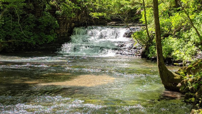
Not every great waterfall hike requires an all-day commitment, and Machine Falls at Short Springs State Natural Area in Coffee County makes a strong case for the short-but-spectacular category.
Positioned conveniently between Tullahoma and Manchester, this trail packs steep ravines, cascading side streams, and one genuinely impressive main attraction into a loop that most hikers complete in two to three hours.
Machine Falls drops more than 60 feet and spreads nearly 60 feet wide as it pours out of a cave opening in the bluff face, creating a curtain of water that feels much larger and wilder than the trail distance would suggest.
Reaching the base sometimes means walking through ankle-deep water in the creek bed, which adds a playful, slightly splashy element that most visitors seem to enjoy.
The natural area also offers longer loop options that pass Busby Falls and Adams Falls, both worth visiting during the high-water months of late winter and early spring when flow rates are at their peak.
Spring visits carry an added bonus, as the forest floor comes alive with wildflowers, including some rare species that bloom briefly and beautifully along the ravine walls.
This is the kind of trail that leaves you quietly satisfied, the sort of hike where the reward-to-effort ratio is so good you will find yourself planning a return visit before you even reach the parking lot.