
This 12.7-Mile Scenic Massachusetts Rail Trail Follows An Old Railroad Route Past Woodlands Rivers And Mountain Views
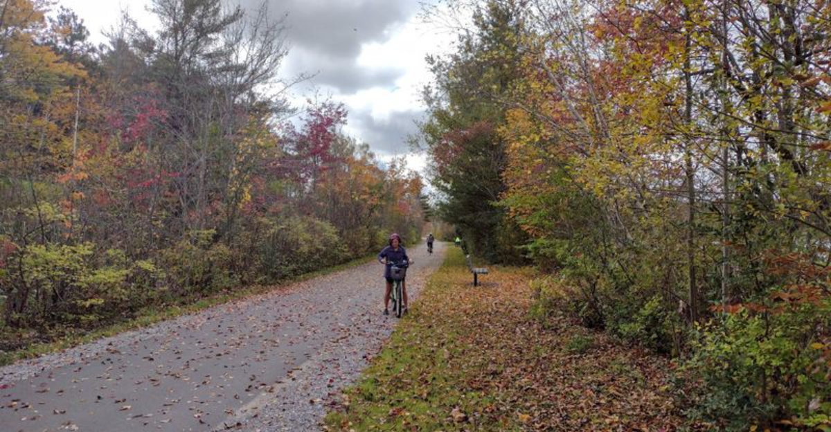
Massachusetts hides an old transportation corridor that has completely changed jobs.
Steel rails once ran through here hauling freight between mill towns, and now the same stretch carries bikers, walkers, and runners instead.
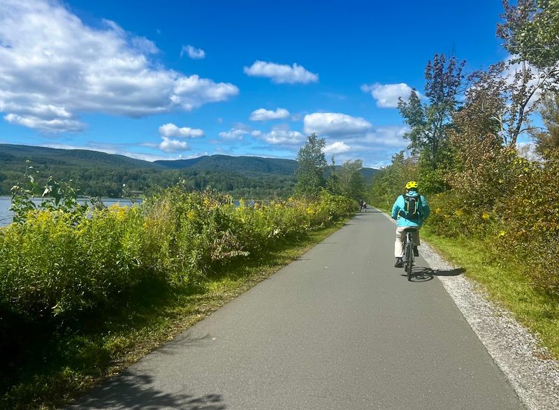
Water follows the route for most of the way, shifting between a calm reservoir and a winding river that cuts through the valley. Mountains rise up on either side, framing the whole path in green during summer and gold during fall.
Wetlands show up along certain stretches, home to herons, turtles, and the occasional bald eagle if you look closely. The path stays flat and paved almost the entire way, so it works well for beginners and casual riders alike.
Small towns pop up here and there, giving people a reason to stop, grab food, or rest before continuing on. Massachusetts built this into something special, a route where history and scenery move together at exactly the same pace.
This Old Rail Line Became A Trail Everyone Can Enjoy
Long before cyclists and joggers claimed this corridor, steam engines rumbled through the Berkshire hills on a mission to link Pittsfield with Rutland, Vermont.
The Pittsfield and North Adams Railroad laid those tracks in the 1840s.
Over the following decades, the line changed hands several times, passing through the rosters of the Boston and Albany Railroad, the New York Central, and eventually the Boston and Maine Railroad.
Rail service finally ended in 1990, leaving behind a quiet corridor that nature began reclaiming almost immediately. Rather than let the land sit idle, planners recognized its extraordinary potential as a recreational pathway.
Conversion work began, and the trail opened in phases starting in 2001, with further sections added through 2017, and additional extensions completed in 2022 and 2024.
Today the Ashuwillticook Rail Trail stretches approximately 14 miles through Berkshire County, Massachusetts, running north to south through Cheshire, Lanesborough, Adams, and into Pittsfield.
The name itself carries history, derived from a Native American term for the south branch of the Hoosic River, meaning the pleasant river in between the hills.
That description still holds remarkably well.
Tracing The Hoosic River Valley
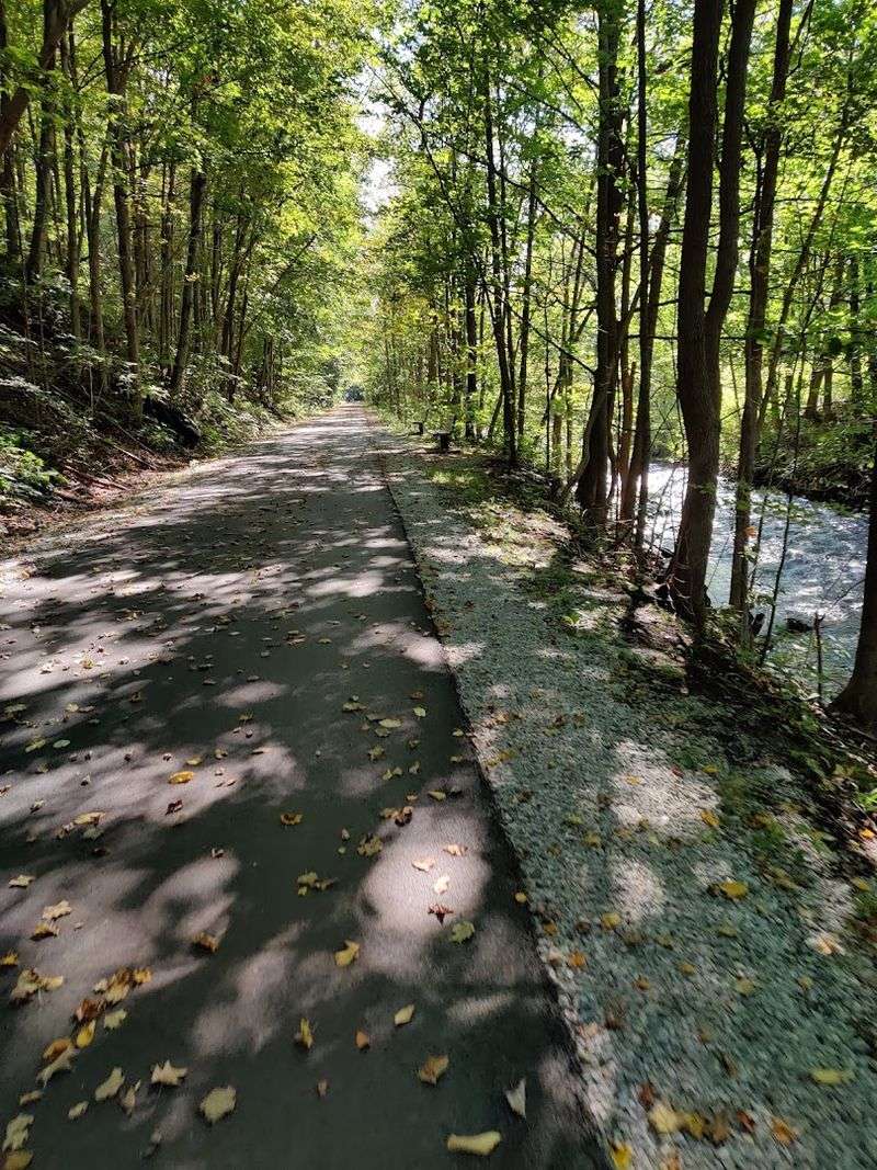
The Hoosic River is a constant companion along much of this trail, flowing quietly beside the path as it moves through the valley it carved over centuries.
You catch glimpses of it through gaps in the trees, hear it before you see it on quieter mornings, and feel the cooler air that rises from its surface on warmer afternoons.
It is a relationship between path and water that never grows tiresome.
The trail follows Massachusetts Route 8 through the valley, keeping the river close for long stretches between Adams and Cheshire.
In Adams, the northern section of the trail passes old mill buildings standing on the far shore of the Hoosic, their brick facades weathered but still commanding.
The town’s restored main street runs nearby, and it is worth a short detour to read the historical markers and observe the architecture that survives from the industrial era.
The valley itself frames the journey with a kind of quiet grandeur.
Hills rise on both sides, the river murmurs below, and the trail rolls forward with a gentle, almost imperceptible grade that keeps the experience accessible for walkers, cyclists, and anyone traveling at a comfortable pace through this understated New England landscape.
Lakes And Reservoirs Line This Trail At Every Turn
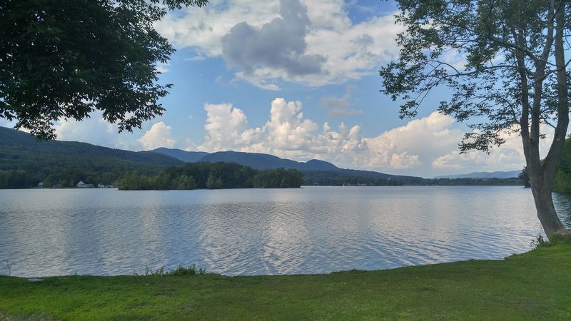
Few things slow a cyclist’s pace as reliably as the sight of still water stretching out beside the path.
Along the Ashuwillticook Rail Trail, that moment arrives at Cheshire Reservoir, a 418-acre body of water that accompanies the trail for a remarkable 2.4-mile stretch of shoreline.
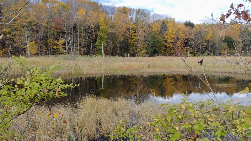
On calm mornings, the surface mirrors the surrounding hills so cleanly that the reflection looks painted rather than natural.
Berkshire Pond adds another dimension to the water scenery, offering its own quiet views and serving as a location for fishing.
Anglers along this section cast for bass, northern pike, and yellow perch, particularly near Farnum’s Causeway, which crosses Cheshire Lake and provides one of the more memorable vantage points on the entire trail.
Standing there with open water on both sides is an experience that feels genuinely removed from ordinary routine.
The wetlands that flank various sections of the trail contribute their own subtle beauty. Cattails, marsh grasses, and the occasional floating lily pad create a layered foreground against the hills beyond.
These areas also attract a concentration of bird life, making them worth slowing down for, camera ready, especially in the early morning hours when activity peaks and the light is most favorable.
Grand Panoramas Of Berkshire Peaks
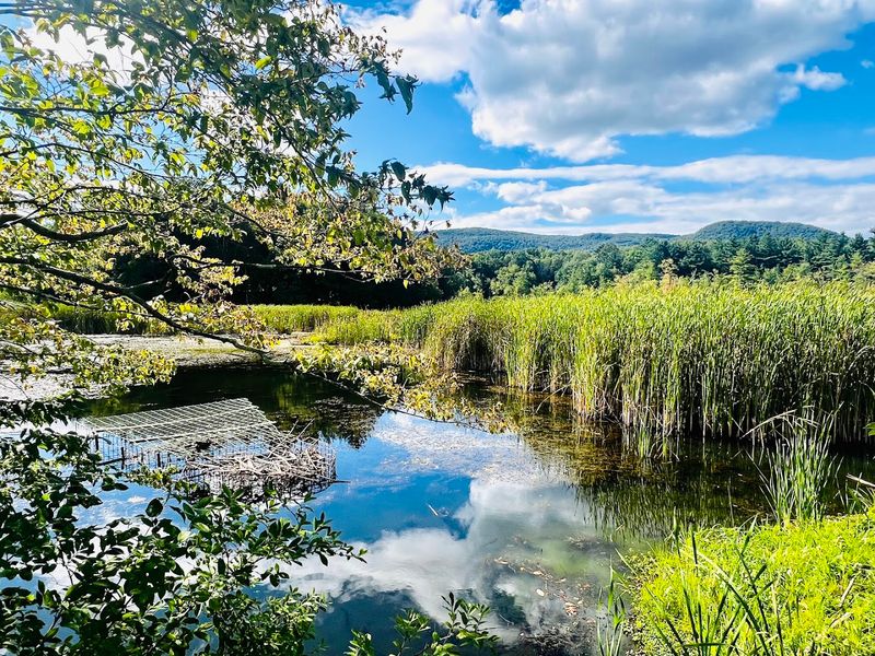
Mount Greylock stands at 3,491 feet, making it the highest point in Massachusetts, and on clear days along the Ashuwillticook Rail Trail, its silhouette appears on the horizon with a quiet authority.
You do not need to climb it to appreciate its presence.
The trail offers distant views that frame the peak against open sky, providing a sense of scale that reminds you exactly where you are in the larger geography of New England.
The Berkshire Mountains form the broader backdrop for the entire trail experience. Their ridgelines define the edges of the valley, and as you move between Cheshire, Lanesborough, and Adams, the angles shift and new compositions emerge.
Morning light on the eastern slopes differs entirely from the warm tones that settle over the western faces in the late afternoon, giving the same mountains a different character depending on when you travel.
These panoramic moments arrive without warning, opening up between tree lines or across the reservoir surface with a generosity that feels almost deliberate.
The trail’s flat grade means you can look up and around without worrying about your footing.
A Haven For Diverse Wildlife
An osprey dropping toward the water with folded wings is the kind of sight that stops you mid-stride and makes you grateful you chose this trail today. Wildlife observation along the Ashuwillticook is not incidental to the experience.
It is central to it. The combination of open water, wetlands, woodland edges, and river habitat creates conditions that support an impressive range of species across every season.
Herons wade in the shallows with their characteristic patience, while kingfishers streak low over the water in flashes of electric blue. Turtles arrange themselves on logs in the sun with the satisfied air of creatures that have perfected the art of doing nothing.
Ducks, geese, and the occasional eagle pass overhead, and frogs announce themselves loudly from the marsh edges on warm evenings. Muskrats and beavers leave evidence of their industry in the reeds and along the banks.
Songbirds fill the wooded sections with layered sound, and squirrels conduct their perpetual business in the canopy above. Hawks circle on thermal currents over the open sections near the reservoir.
This trail delivers consistent opportunities without requiring any specialized equipment beyond patience and a reasonable willingness to move quietly.
Leisurely Pursuits On A Paved Path
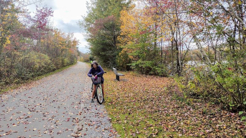
The trail surface is ten feet wide, smooth, and swept regularly, which means the range of activities it supports is broader than most rail trails of comparable length.
Cycling is the most popular pursuit, and the gentle grade makes it manageable for riders of all ages without requiring any particular fitness level.
A casual pedal from one end to the other gives you roughly a half-day excursion with time for stops.
Walkers and runners share the path comfortably, and rollerbladers find the smooth pavement particularly satisfying.
In winter, when snow settles over the valley, the trail transitions into a corridor for cross-country skiing and snowshoeing, extending its usefulness well past the warmer months.
The seasonal shift also changes the character of the landscape entirely, giving regular visitors a reason to return when the trees are bare and the reservoir surface takes on a steely winter tone.
Several trailheads offer free parking, including access points in Adams at Lime Street, Russell Field on Harmony Street, and the visitor center at 3 Hoosac Street. Cheshire access points sit on Railroad Street and Farnams Road.
Some locations provide seasonal restrooms, picnic areas, and bike repair stations, making the logistics of a full-day visit straightforward and well-supported for most users.
Towns Along The Traversed Route
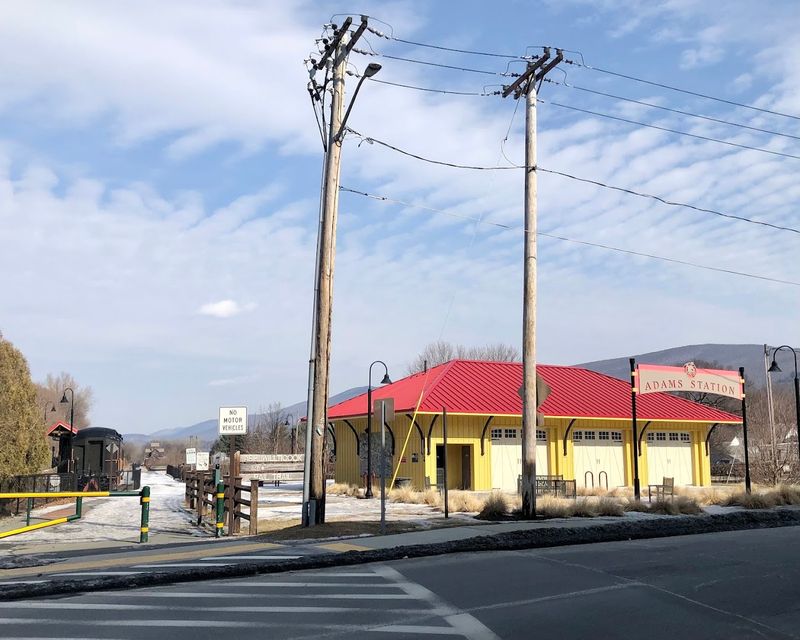
The trail does not pass through wilderness alone. It connects three towns and one city in a way that gives each stop its own distinct character.
Adams anchors the northern experience with its brick mill buildings, restored main street, and a visitor center at 3 Hoosac Street that offers a useful orientation for first-time trail users.
The town’s industrial heritage is visible from the trail, and walking its main street adds a layer of historical context to the journey.
Cheshire contributes one of the trail’s more charming details: a trailside business operating out of an old Boston and Albany Railroad station building, where visitors can pick up snacks and refreshments.
It is a practical stop that also doubles as a small moment of architectural nostalgia.
The trail in Cheshire also crosses the Appalachian Trail, making for an interesting intersection of two very different long-distance routes.
Lanesborough connects the trail to the Route 7 and Route 8 corridor, offering another access point for visitors approaching from the south.
Pittsfield, the largest city along the route, provides southern trailhead access at Merrill Road and Crane Avenue.
Together, these communities give the trail a lived-in quality that feels grounded in real New England life rather than simply preserved for recreational use.
Accessible Pathways For All Explorers
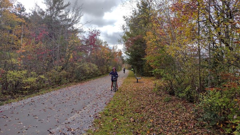
Accessibility on recreational trails is often promised and inconsistently delivered. The Ashuwillticook Rail Trail takes the commitment seriously.
The path is paved, flat, and maintains a gentle grade throughout its length.
This makes it genuinely usable for people in wheelchairs, those pushing strollers, older adults managing mobility challenges, and young children on their first bike without training wheels.
The ten-foot width allows users moving at different speeds to share the space without tension. A cyclist can pass a walker without either person needing to step aside dramatically.
This practical design detail makes the trail feel inclusive rather than merely tolerant of slower users. Multiple trailheads with free parking and accessible facilities reinforce that the infrastructure was planned with a broad audience in mind.
The Lanesborough trailhead at the Route 7 and Route 8 connector serves as a convenient mid-point entry for those who prefer shorter sections rather than the full length.
Pittsfield’s access points at Merrill Road and Crane Avenue provide southern entry options with parking.
The trail’s current length of approximately 14 miles means that even a partial visit covering just a few miles delivers a satisfying experience.
Future plans include extensions toward North Adams and eventually Williamstown, which would push the total projected length to 25 miles.
Seasons And The Sustained Beauty
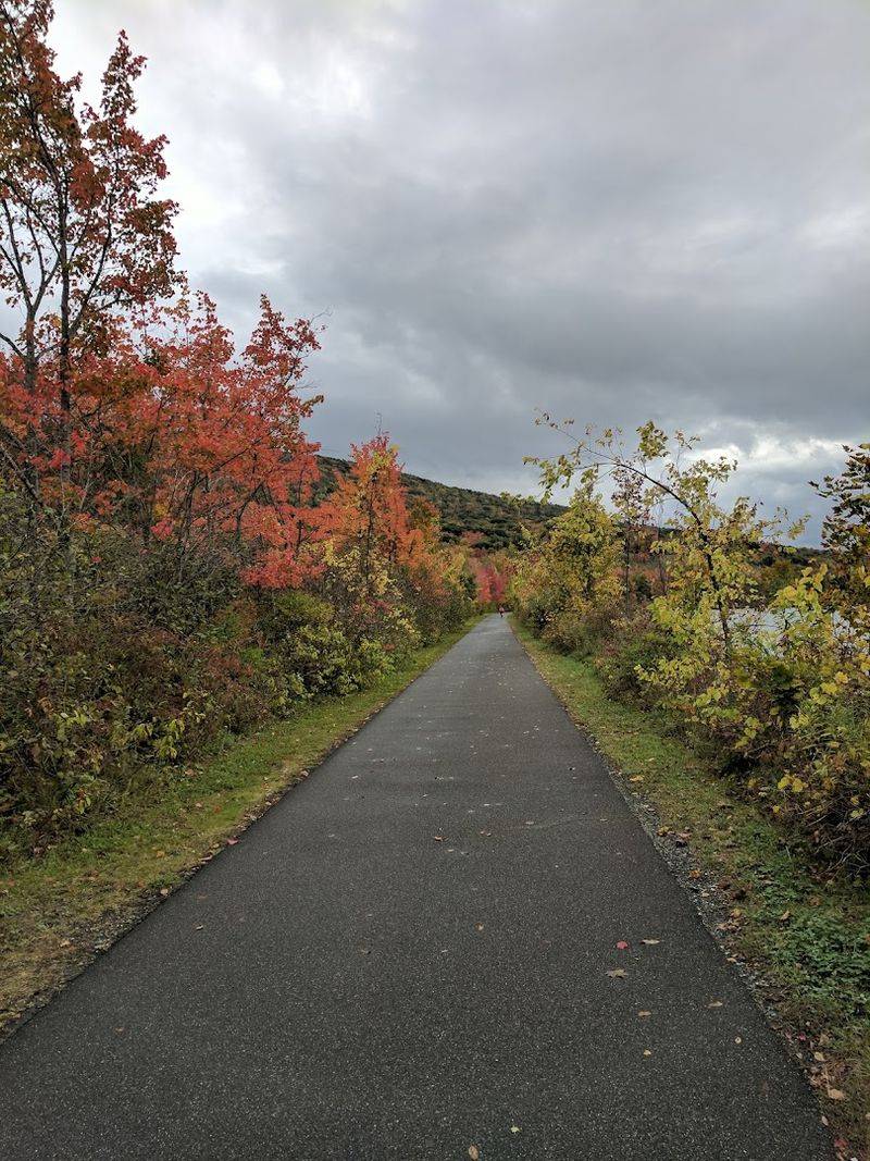
Autumn arrives on this trail with a confidence that few landscapes can match.
The deciduous trees that line the path and surround the reservoir turn in sequence, moving from green through yellow and orange to deep red over the course of several weeks.
The reflection of that color in the still water of Cheshire Reservoir produces a view that people plan return trips around, sometimes arriving specifically for that two-week window when the display peaks.
Spring brings a different energy: the sound of returning birds, the gradual greening of the hillsides, and the Hoosic River running fuller and faster after snowmelt.
Summer settles the trail into its most sociable season, with families, cyclists, and casual walkers sharing the path in comfortable numbers.
The tree canopy provides shade over long sections, keeping temperatures manageable even on warmer days when the open sections near the reservoir feel distinctly sunnier.
Winter strips the landscape back to its structural elements, and the trail takes on a spare, contemplative quality.
Cross-country skiers and snowshoers who venture out on clear winter mornings find a version of the trail that feels entirely different from its summer self.
Each season makes a genuine argument for its own particular appeal, which is why the Ashuwillticook Rail Trail draws visitors throughout the year rather than only during the obvious peak months.