
A Remote 2.5 Mile Trail In Alaska Leads To An Enchanting Forest And A Secret Beach
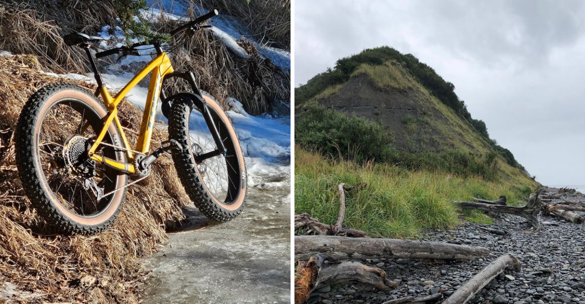
Alaska just handed you a dare disguised as a hiking trail. Thick spruce and alder swallow the path within steps, filtering light into shifting patterns below.
The air turns sharp with moss and rain, and roots grip every inch of ground. Push through and the trees thin fast.
A canyon opens below, carved by a creek that has spent thousands of years cutting through solid stone. The bluff edge drops sharply, and the view earns every bit of mud clinging to your boots.
Keep going and a shoreline waits, one most visitors never bother finding. Tide pools ripple with quiet life, driftwood litters the shore, and eagles circle overhead like they own the sky.
Alaska stacks the drama here in layers.
Where The Trail Begins And What To Expect
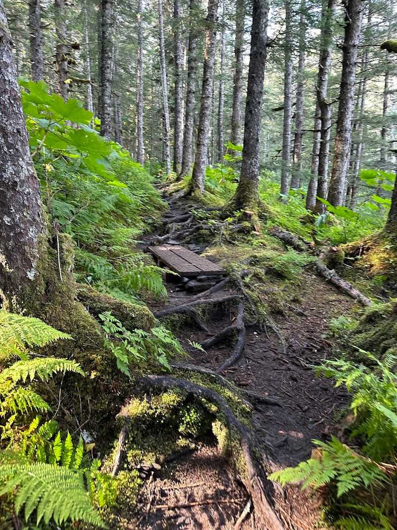
Right off the Sterling Highway, about four miles north of Homer, Alaska, a gravel turnoff marks the start of something special. The Diamond Creek Trailhead at 41298 AK-1, Homer, AK 99603, sits quietly off the road without much fanfare.
Blink and you might miss it.
From the lower parking area, the trail descends toward the beach through a mix of open meadow and thick forest. The upper bench offers a separate network of singletrack trails, popular with mountain bikers and dog walkers.
These upper paths are well-maintained and relatively easy to navigate.
The lower trail toward the beach is a different story. It gets steep, narrow, and often muddy.
Expect some sections of blue clay that turn slick after rain. Signage is minimal, so paying attention to the path ahead matters.
Sturdy, waterproof boots are not optional here. A walking stick will also earn its keep on the steeper descents.
Come prepared and the trail rewards generously.
The Forest That Pulls You In Deep
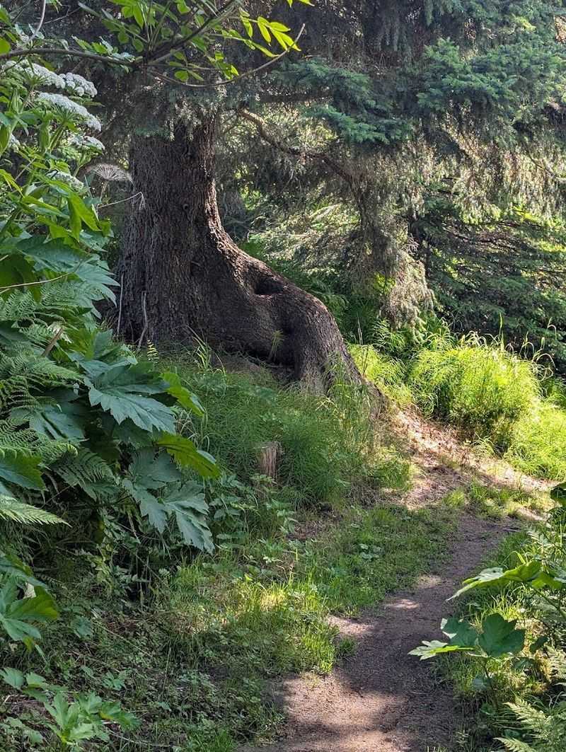
Step past the trailhead and the trees close in fast. Spruce, alder, and pine crowd the path on both sides, creating a canopy that filters sunlight into soft, shifting patterns on the ground below.
The air smells like moss and earth.
This forest section is one of the most atmospheric parts of the hike. Native plants fill the understory with texture and color.
Bird calls echo through the branches, and the forest feels genuinely alive in a way that is hard to describe until you are standing inside it.
The broader Diamond Creek watershed connects to the Homer Demonstration Forest, a preserve that includes an arboretum and self-guided nature trails. That context adds depth to what might otherwise seem like a simple walk through the woods.
Thrushes, warblers, chickadees, and various raptors are frequently spotted in spring and summer. The forest section does not last forever, but it sets a mood that carries through the entire hike.
Slow down and take it in.
The Canyon Edge And The Views That Stop You Cold
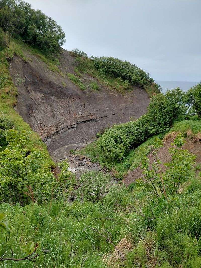
At some point along the descent, the trees thin out just enough to reveal the canyon. Diamond Creek cuts through the landscape below, and the trail runs right along the rim of the bluff above it.
The drop is significant. The view is better.
Layers of ancient stone are visible in the canyon walls, each one telling a piece of Alaska’s geological story. The Naptowne glaciation shaped much of this landscape, and evidence of ice-marginal drainage is written into the rock itself.
It is geology you can actually see without a textbook.
Some sections of the bluff edge are unstable. Erosion has created spots where the cliff face can drop away without warning.
Orange fencing marks the worst areas, but cautious footing is still essential. The path narrows in places, and concentration matters more than speed here.
Pause at the safer overlooks and take a long look at the creek winding below. That view alone justifies the muddy boots.
The Secret Beach That Makes It All Worth It
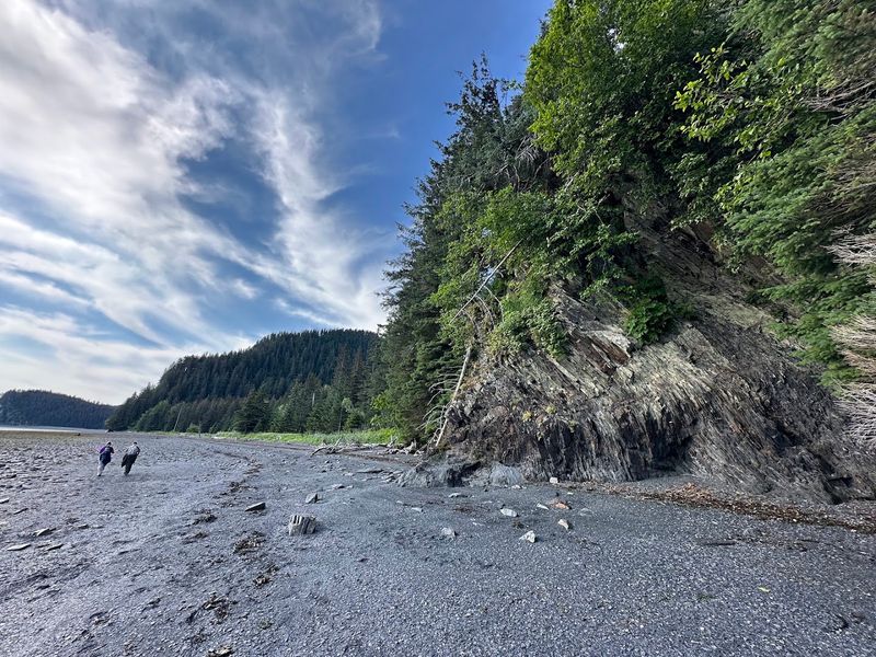
After all the mud and the steep, narrow final stretch, the trail opens onto the beach. The bluffs frame the scene on either side.
Driftwood is scattered across the pebble shore like furniture left by the tide.
This beach earns the word “secret” honestly. It sits far enough from the road and requires enough effort to reach that crowds are rarely a concern.
On most days, the only company here is the wind, the waves, and whatever wildlife happens to be passing through.
The beach itself is shallow and expands dramatically during low tide, revealing a broad expanse of shore that practically begs to be explored. Some visitors bring a snack and sit on the smooth rocks for a while before heading back up.
Others do a full beach run along the waterline. Either approach feels right.
The beach does not rush anyone. It just sits there being spectacular, completely unbothered by the outside world.
Tide Pools Teeming With Alaskan Marine Life
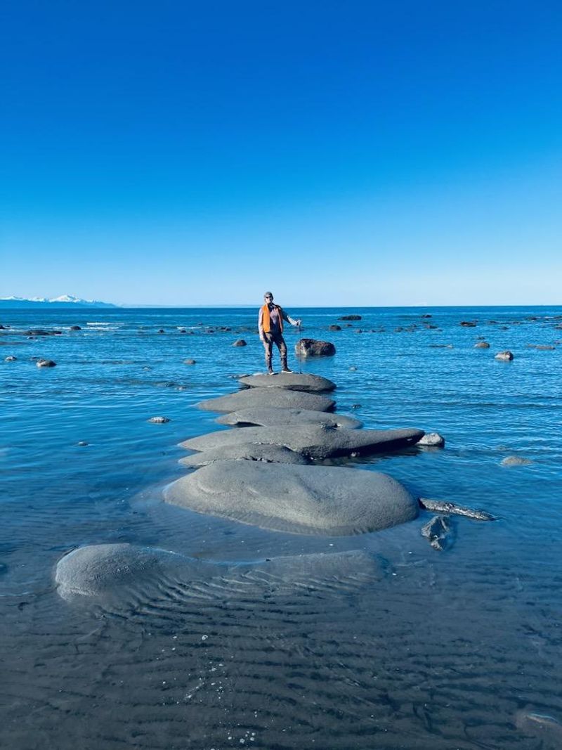
Negative low tides transform this beach into something extraordinary. When the water pulls back far enough, tide pools emerge across the exposed rock shelves, each one its own miniature ocean.
Sea stars, anemones, crabs, and occasionally even octopuses become visible in the shallow water.
Checking tide charts before visiting is not just helpful, it is essential. A positive low tide means the pools stay mostly submerged and the experience is limited.
A negative low tide means the full show. Timing the visit correctly makes an enormous difference in what the beach has to offer.
Beyond the pools, the shallow nearshore water brings its own surprises. Sea otters sometimes float just offshore, and harbor seals occasionally pop their heads up to investigate visitors with calm, curious eyes.
The beach at low tide is not just a pretty place to stand. It is an active, living ecosystem that operates on its own schedule.
Respecting the marine life means watching without touching and leaving the pools exactly as found.
Bald Eagles, Moose, And The Wildlife That Calls This Place Home
Bald eagles are practically a given here. They circle the beach and the canyon with the casual confidence of creatures that know they own the sky.
Watching one drop toward the water and then pull back up is the kind of moment that makes people stop mid-sentence.
Cormorants, sea ducks, and other coastal birds work the shoreline throughout the day. The forest section of the trail is equally active, especially in spring and summer when songbirds fill every branch with sound.
The diversity of bird species along this trail makes it a legitimate destination for birding enthusiasts.
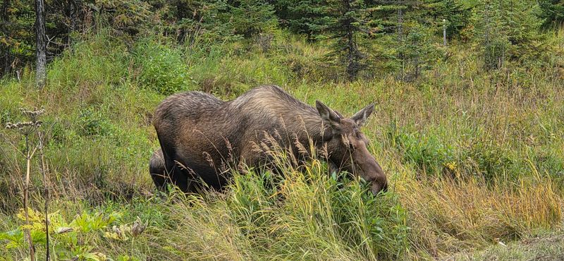
Moose are also part of the picture. They tend to appear without warning in the vegetation along the trail, large and unhurried and completely indifferent to hikers nearby.
Keeping a respectful distance is always the right call. Early mornings and late afternoons tend to produce the most wildlife activity, so timing the hike around those windows increases the chances of memorable encounters.
Alaska delivers on wildlife, and this trail is no exception.
The Upper Bench Trails For Bikers And Easy Walkers
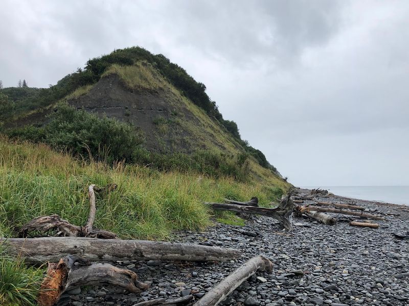
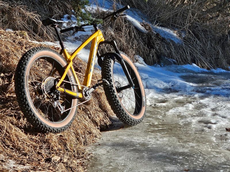
Not every visitor is chasing the beach. The upper bench trail network offers more than four miles of singletrack through the forest, and it is a completely different experience from the descent to the coast.
The terrain is gentler, the paths are better maintained, and the vibe is more leisurely.
A local cycling club has put significant effort into maintaining these upper trails, and it shows. The routes wind through native forest with enough variety to stay interesting across multiple laps.
Dog walkers, casual hikers, and mountain bikers all share the space without much friction.
For families or anyone who prefers a lower-stakes outing, the upper trails offer a satisfying loop without the mud and steep drops of the lower path. The forest is just as beautiful up here, and the bird activity is equally impressive.
It is a good option for a quick morning walk or an afternoon ride when the tide is not cooperating for beach exploration. The trail system as a whole has something for almost every level of outdoor interest.
Geology Written In Stone Along The Descent
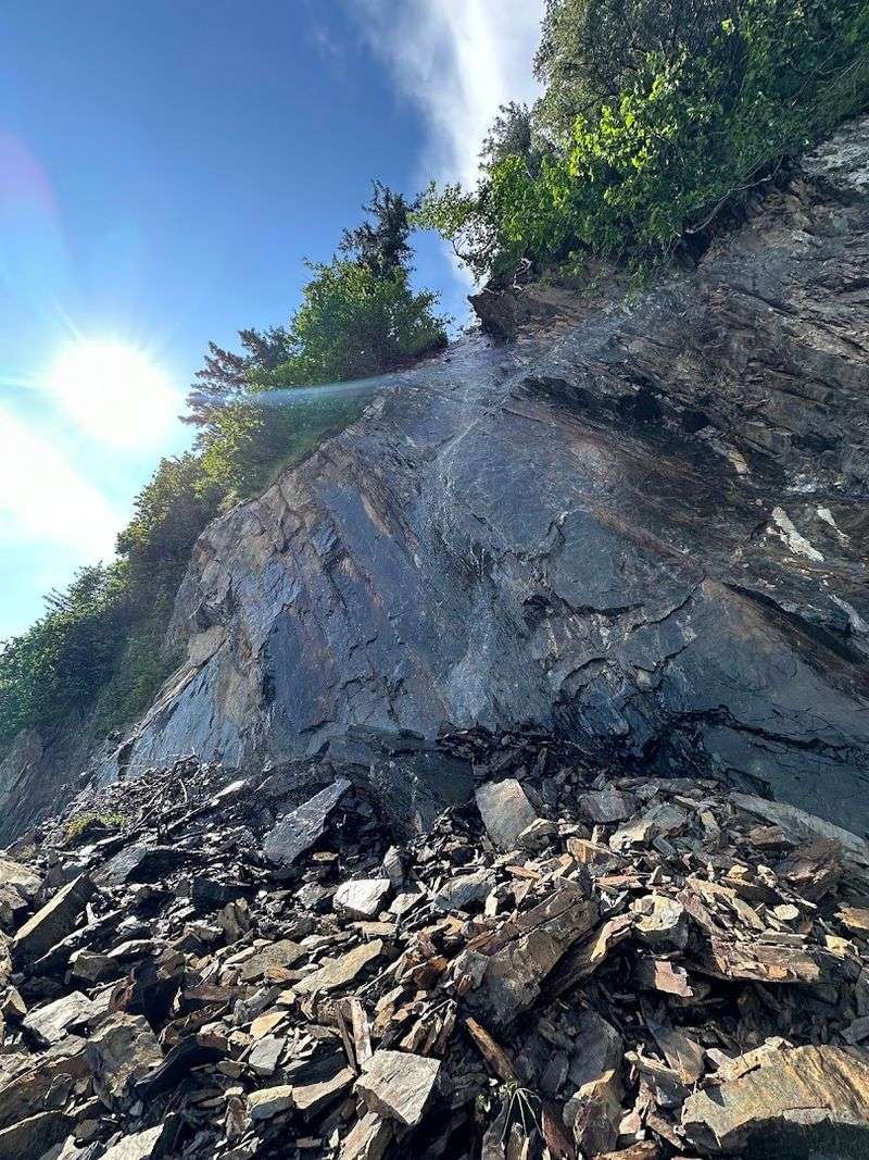
The canyon walls along the descent are basically an open geology textbook. Distinct layers of stone are visible from the trail, each band representing a different period in the earth’s long history.
The formations here are connected to the Naptowne glaciation, an ancient event that carved much of the surrounding landscape.
Evidence suggests Diamond Creek once functioned as an ice-marginal drainage channel during glacial periods. That history is baked into the rock faces that line the path down to the beach.
The weathered cliffs along the shore show further evidence of tidal and glacial shaping over thousands of years.
Indigenous communities also utilized this area historically, adding cultural layers to the geological ones. The land holds more stories than most visitors realize on a first pass.
Looking at the rock formations with that context in mind changes how the landscape reads. What looks like an ordinary cliff face becomes a record of enormous forces acting over enormous stretches of time.
Alaska tends to do that, make everything feel older and bigger than expected.
Practical Tips For A Safe And Rewarding Visit
Tide timing is the single most important factor for planning this hike. Rising tides can move fast and cut off access to the beach, potentially trapping hikers against the bluffs.
Checking local tide charts before leaving the car is a non-negotiable step, not an optional one.
Waterproof boots with solid ankle support are strongly recommended. The blue clay sections of the trail become dangerously slick when wet, and regular sneakers will not cut it.
A walking stick or trekking pole adds stability on the steeper sections and on the rope-assisted scramble near the bottom.
There are no restrooms, no garbage cans, and no road maintenance at the trailhead. Pack in everything needed and pack out everything brought.
Summer months offer the most reliable weather for the hike, though the trail runs year-round for those prepared for cooler conditions. A yurt at the end of the trail is available for rent, making an overnight stay possible.
Firewood is not available on-site, so anyone planning to camp should bring their own supply.
Views Of Cook Inlet And The Mountains Beyond
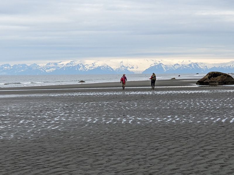
From the beach, the views across Cook Inlet are the kind that make people go quiet. Snow-capped peaks line the far shore, and on clear days, prominent volcanic summits including Mount Augustine, Iliamna, and Redoubt are visible across the water.
The scale of the scene is hard to process at first.
The trail also offers partial views during the descent, particularly along the canyon rim where the trees open up toward the inlet. Those glimpses build anticipation for the full panorama waiting at the bottom.
The payoff is real.
Sunsets over Cook Inlet from this beach are a separate category of experience. The light shifts across the water and the mountains in ways that change by the minute.
Alaska’s long summer evenings mean the colors linger far longer than expected. Kachemak Bay adds further drama to the eastern view, framed by the same bluffs that line the trail.
Bringing a camera is obvious advice, but even the best photos struggle to capture what the eyes actually see standing on that shore.