
This Montana State Park Is So Quiet You May Have It Almost Entirely To Yourself
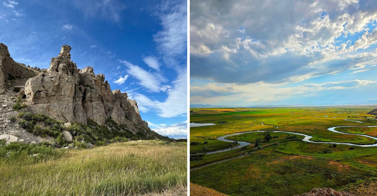
What would you do with a Montana state park that felt almost completely yours? At this quiet roadside landmark, there may be no crowd, no busy visitor center, and no long line of cars competing for the same view.
Instead, a massive rock formation rises above the Beaverhead River, carrying a story tied to Sacagawea and the Lewis and Clark Expedition. The landscape feels wide, still, and surprisingly personal.
You can stand there for several minutes without hearing much beyond the wind. Montana has larger parks with longer trails and more facilities, but that is not the appeal here.
This state park keeps things simple. A small parking area, open scenery, and a landmark shaped by both geology and history are nearly the entire experience.
Bring water, take your time, and enjoy the silence. You may leave wondering how a place this important remains so easy to have almost entirely to yourself.
Sacagawea Recognized Home In The Shape Of A Swimming Beaver
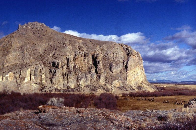
The rock formation earned its name from Sacagawea’s sharp eye and homesick heart. When the Lewis and Clark Expedition passed through in August 1805, she immediately recognized the distinctive shape.
The young Shoshone woman hadn’t seen her homeland in years after being captured as a child.
To her, the towering rock looked exactly like a beaver’s head breaking the water’s surface. That recognition meant everything because it told her the expedition was finally entering Shoshone territory.
Her people lived somewhere nearby, and the expedition desperately needed to trade for horses.
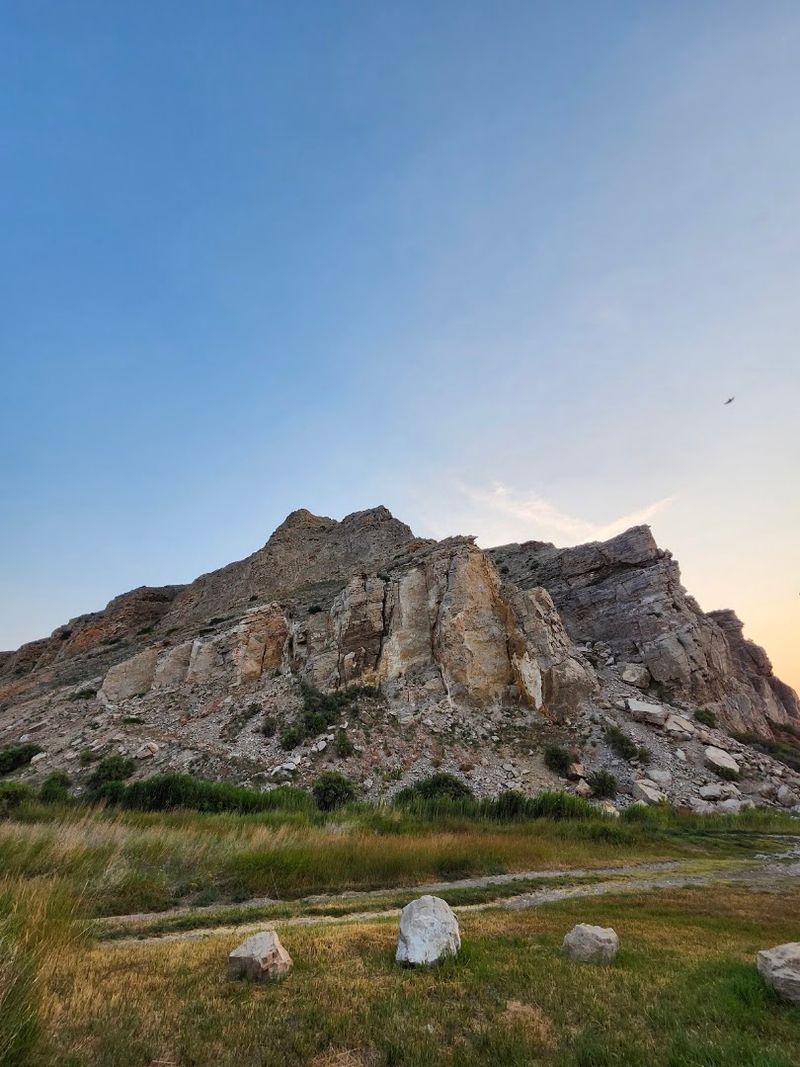
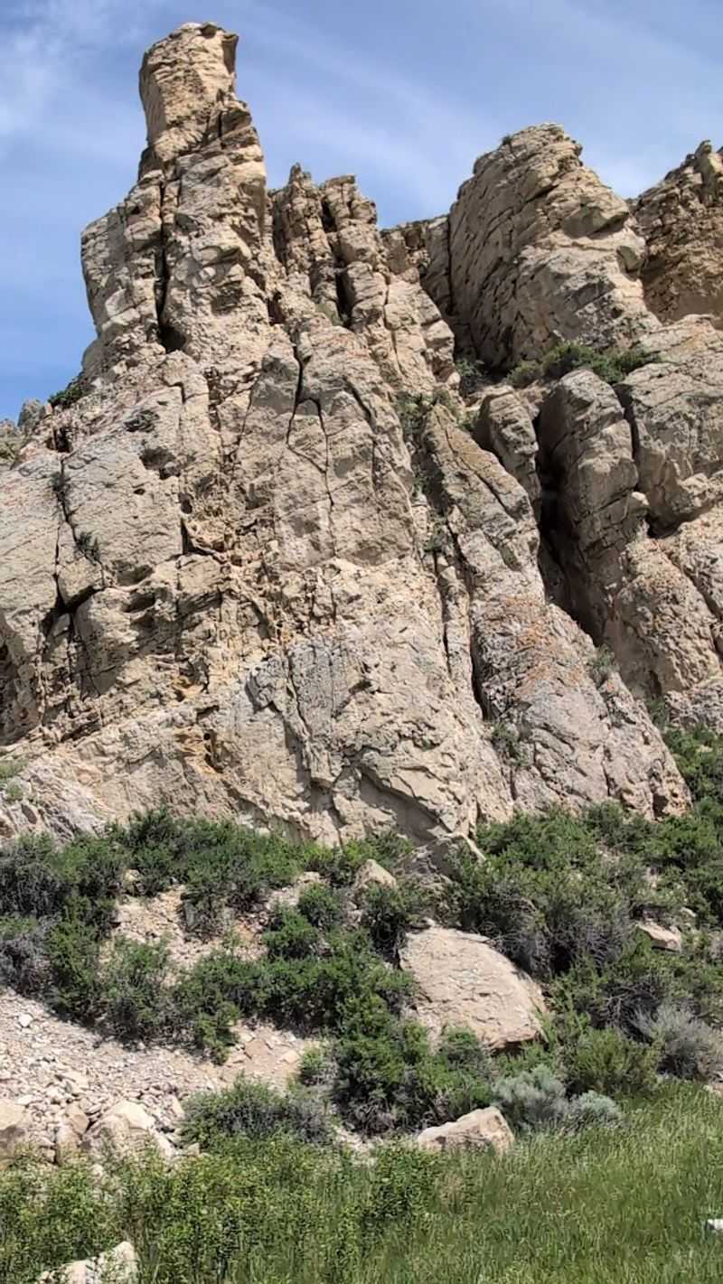
The rock still dominates the landscape today, rising about 150 feet above the surrounding plains. From certain angles, you can absolutely see the beaver profile that gave Sacagawea such hope.
The formation consists of limestone that has resisted erosion better than the softer rock around it.
Standing at its base, you’ll understand why this landmark mattered so much to someone searching for familiar ground in unfamiliar circumstances.
The Search For Shoshone Horses Made This Landmark Crucial
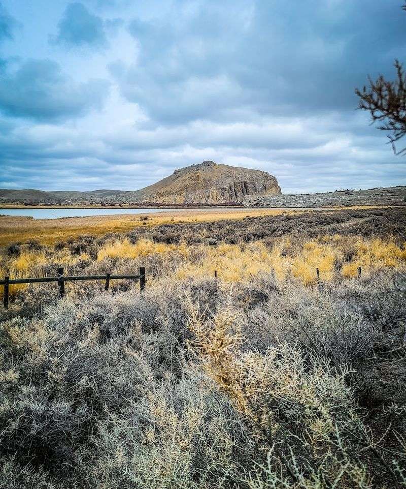
The expedition wasn’t just sightseeing when they reached Beaverhead Rock. They faced a logistical crisis that threatened the entire mission.
Their canoes couldn’t navigate the shallow, rocky streams ahead, and carrying all their supplies on foot through mountain passes was impossible.
Shoshone horses represented their only realistic option for continuing westward. The tribe was known for their excellent horses and knowledge of mountain routes.
Sacagawea’s recognition of the rock gave Captain Lewis the confidence to push forward with a small advance party.
He took three men and hiked ahead while Clark brought the main group and boats more slowly. This decision to split the party was risky but necessary.
The gamble paid off when Lewis found the Shoshone camp and began negotiations. The horses they eventually obtained made the difference between success and failure.
Today’s visitors can hike the same terrain and appreciate just how challenging that landscape would have been without pack animals to share the burden.
Sixteen Miles Past Dillon The Crowds Practically Disappear
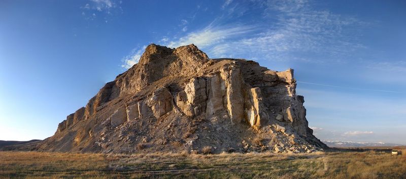
Beaverhead Rock State Park sits about 16 miles north of Dillon on Highway 41. That’s close enough for an easy day trip but far enough that casual tourists rarely make the effort.
Dillon itself is a small Montana town, not a major tourist hub, which keeps the starting visitor numbers low.
The park doesn’t appear on most must-see Montana lists, and it lacks the name recognition of places like Glacier or Yellowstone. That anonymity works beautifully if you’re seeking solitude.
Multiple reviews mention having the entire rock to themselves during their visit.
Even during July and August, when Montana tourism peaks, you might encounter only one or two other vehicles. The primitive nature of the park naturally filters out visitors who prefer developed amenities.
Families with young children, RV travelers, and anyone seeking accessible facilities typically skip this destination. What remains is a self-selected group of history buffs, serious hikers, and people who genuinely value quiet over convenience.
The location in southwestern Montana also means it’s off the main tourist corridor that runs through the state’s more famous attractions.
A Tiny Parking Area Marks The Beginning Of The Entire Visit
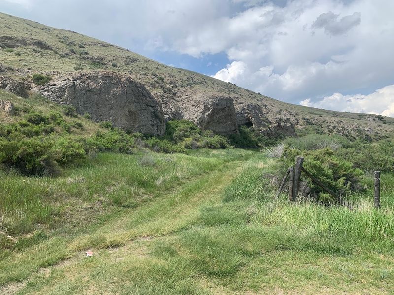
Finding the parking area requires paying attention because it’s easy to miss. Highway 41 runs past the rock formation, and a dirt road branches off heading toward the base.
The road is narrow, rutted in places, and definitely not designed for RVs or large vehicles.
After about a half-mile, you’ll reach a small clearing with an old information board. This is your parking spot, and it holds maybe four or five vehicles comfortably.
The board itself often lacks brochures, so don’t count on picking up printed information here.
Several reviews mention the rough condition of Beaverhead Rock Road, especially after rain. Sedans can make it in dry conditions if you drive carefully and avoid the deeper ruts.
The single-lane width means you might need to back up if you meet another vehicle coming the opposite direction. But honestly, that rarely happens because so few people visit.
The parking area’s primitive nature actually adds to the park’s charm if you’re prepared for a genuine backcountry experience rather than a polished tourist attraction.
No Campground Or Restrooms Means The Silence Stays Intact
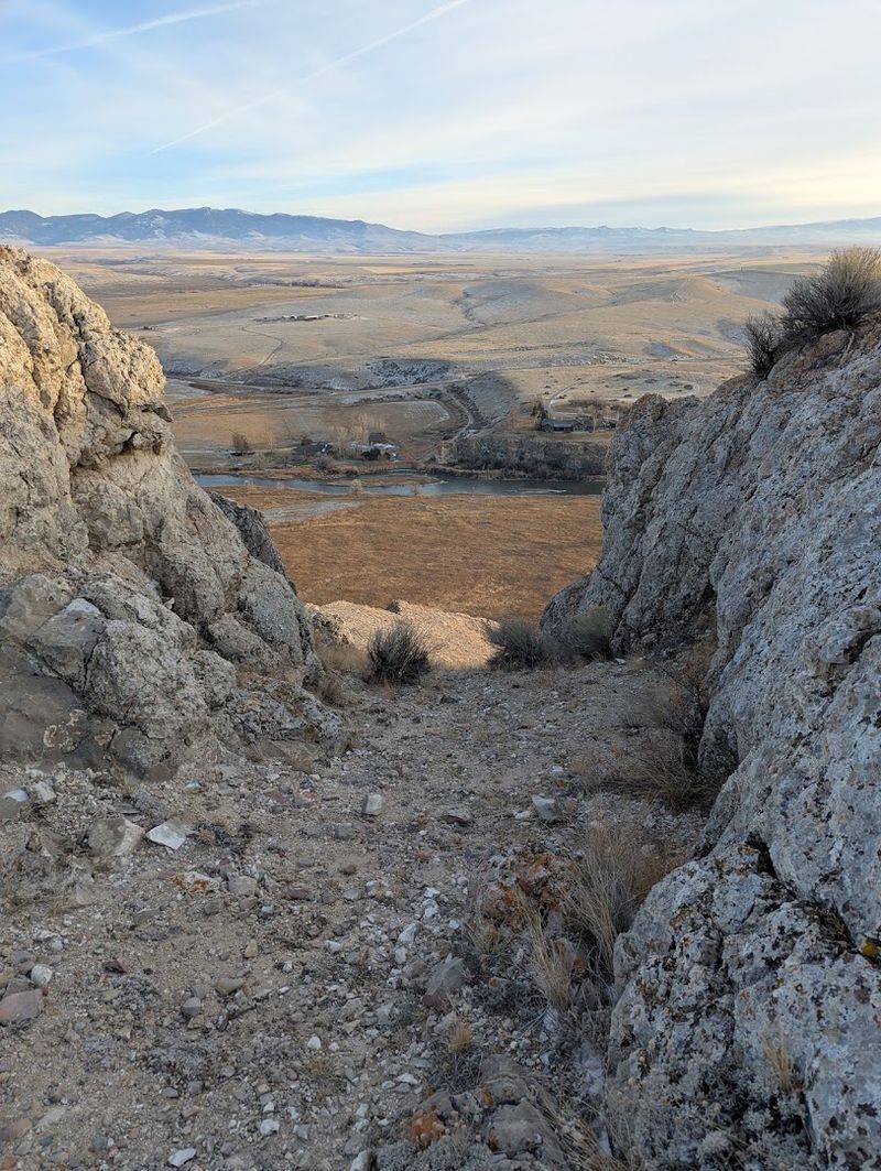
Beaverhead Rock State Park operates under a strict definition of primitive. There are no restrooms, no water fountains, no picnic tables, and definitely no campground.
The state maintains the land but provides virtually zero amenities beyond trail access.
This bare-bones approach keeps visitor numbers low and preserves the historical character of the landscape. You won’t hear generators humming or see RVs circling for hookups.
The lack of facilities also means you need to plan accordingly before arriving.
Use restrooms in Dillon or Twin Bridges before driving out. Bring all the water you’ll need for your hike, plus extra for safety.
Pack out everything you pack in because there are no trash cans either. Some visitors see the absence of amenities as a drawback, but it’s actually the park’s greatest strength.
Montana has plenty of developed parks with full services.
This one offers something increasingly rare: a chance to experience a landscape without modern conveniences intruding on the view or the quiet.
The Climb Looks Short Until The Slope Starts Fighting Back

From the parking area, Beaverhead Rock doesn’t look particularly challenging. The elevation gain is only about 150 feet, and the distance seems manageable.
Then you start climbing and realize this rock has some bite to it.
The terrain is loose and rocky, especially on the way down when gravity works against your footing. Cacti grow everywhere, so watching your step becomes essential.
There’s no official marked trail, though you’ll find a worn path that winds around the back for a more gradual ascent.
Some hikers prefer the steeper, more direct route from near the highway, which gets you to the top faster but requires more scrambling. Either way, wear proper hiking boots with good ankle support and traction.
Several reviews mention the loose rock making descent tricky, particularly for younger children. One family reported their three-year-old needed to ride in a backpack for most of the uphill portion.
The round-trip takes anywhere from 45 minutes to nearly two hours depending on your pace and how long you spend at the summit enjoying the views.
The Summit Opens Over The Beaverhead River And Distant Peaks
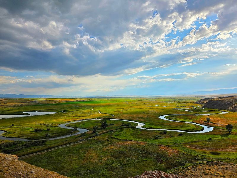
Reaching the top of Beaverhead Rock delivers exactly what you climbed for: sweeping views in every direction. The Beaverhead River curves through the valley below, its waters reflecting the sky.
Beyond the river, Montana’s plains stretch toward mountain ranges on the horizon.
The summit itself is fairly small, with room for maybe a dozen people to spread out comfortably. Most visitors find themselves alone or sharing the space with just one other group.
Early morning hikers report stunning sunrises that paint the eastern mountains in shades of pink and gold.
You can see for miles from up here, which explains why this rock served as such an important landmark for centuries. Native peoples used it for navigation long before Lewis and Clark arrived.
Bring binoculars if you want to spot wildlife in the valley below. Eagles and hawks often ride the thermals around the rock.
The wind picks up at the summit, so a light jacket feels good even on warm days.
Most people spend 15 to 30 minutes at the top before heading back down.
Winter Turns The Quiet Landscape Into A Much Tougher Adventure
Summer visitors enjoy the easiest access to Beaverhead Rock, but the park technically stays open year-round. Winter transforms the experience into something much more demanding.
The dirt access road becomes impassable when snow and ice accumulate, forcing you to hike in from the highway.
That adds significant distance and difficulty to your journey. The rock itself gets coated in ice and snow, making the climb genuinely dangerous without proper equipment.
Wind chill in the valley can drop temperatures well below zero, creating conditions that demand serious cold-weather gear.
Very few people visit during winter months, which means you’re truly on your own if something goes wrong. Cell phone coverage is spotty at best in this area.
If you’re determined to experience the park in winter, treat it as a backcountry adventure requiring appropriate preparation. Microspikes or crampons become essential for the icy rock face.
Layered clothing, emergency supplies, and experience with winter hiking are non-negotiable.
Montana winters don’t forgive casual mistakes, especially in remote locations without services or nearby help.
This Primitive Park Asks Visitors To Bring Everything They Need
Successful visits to Beaverhead Rock require more planning than trips to developed parks. Water tops the essential items list because there’s none available on-site.
Bring at least one liter per person for the hike, and more if temperatures are high.
Sunscreen and a hat matter because shade is limited on the rock and surrounding terrain. A basic first-aid kit makes sense given the rocky, uneven terrain and abundant cacti.
Snacks or a light lunch let you enjoy the summit views without rushing back down.
Your phone works as a camera but don’t count on it for emergencies since coverage is unreliable. Some hikers bring a paper map of the area just in case.
Sturdy hiking boots protect your ankles and provide traction on loose rock. Long pants help avoid cactus encounters and provide sun protection.
Bug spray becomes crucial during June when mosquitoes are active near the river. A small trash bag lets you pack out your waste since there are no receptacles.
Montana requires visitors to be self-sufficient in primitive areas, and this park exemplifies that expectation perfectly.