
This Forgotten Arkansas Scenic Highway Winds Through Ancient Delta Countryside
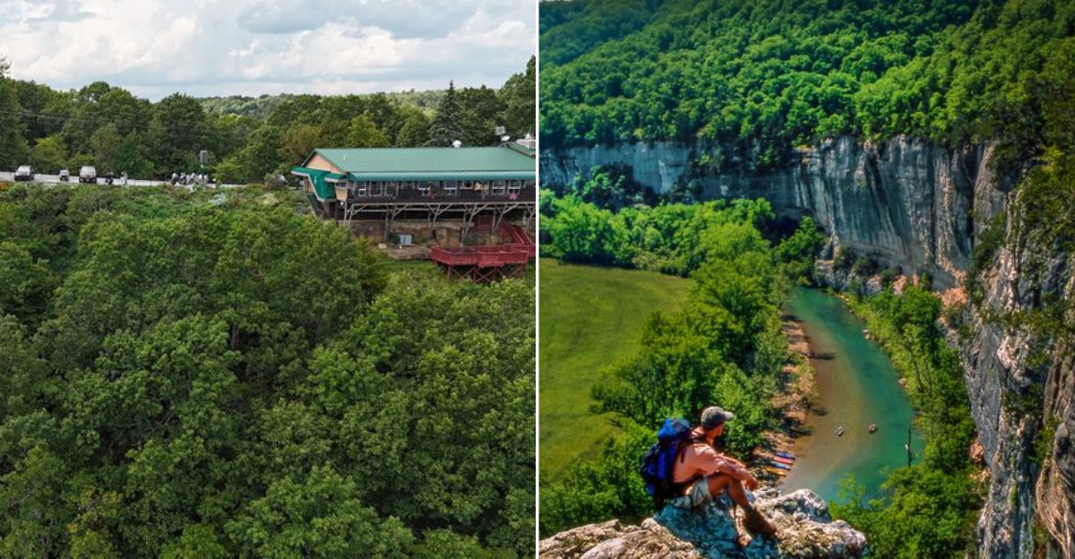
One long road can reveal nearly an entire state without making the scenery feel repetitive. Arkansas stretches this drive through pine country, mountain ridges, river valleys, and small towns that give every section its own personality.
How many landscapes can one highway fit into a single road trip? Southern forests rise into unusual east-to-west mountains, then fall toward broad valleys before climbing into the Ozarks.
A historic bathhouse district adds an easy break, with thermal springs and old buildings changing the mood completely. Farther north, waterfalls, rocky canyons, and cooler mountain air bring another round of surprises.
Small towns appear just when drivers need food, fuel, or time to stretch their legs. Pack snacks, leave room for unplanned stops, and treat yourself to a road trip that makes almost three hundred miles feel like several adventures rolled into one.
Pine Woods Drive South
Southern Arkansas sets the mood fast. The highway rolls through thick pine woodlands where the air smells like earth and evergreen.
It is quiet, unhurried, and completely beautiful in its own understated way.
Near El Dorado and Camden, the landscape softens into gentle hills and winding stream valleys. This is not a dramatic mountain scene.
It is something more personal, more peaceful, like the land is letting you breathe.
El Dorado carries a fascinating oil boom history from the 1920s. The South Arkansas Arboretum offers thirteen acres of walking trails surrounded by native plants.
Have you ever walked through a forest that felt like it had a story to tell?
Camden sits above the Ouachita River on scenic bluffs that are worth every minute of the detour. The town holds a quirky claim to fame as the birthplace of a beloved American soda.
The river views from those bluffs are the kind you want to photograph and never delete.
Starting your AR 7 journey here means easing into the adventure slowly. The southern pines prepare you for everything wilder that comes next.
Pack a snack, roll the windows down, and let Arkansas do the rest.
Ouachita Mountain Climb
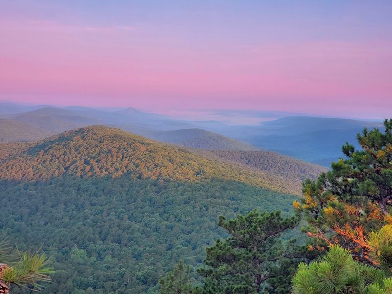
The Ouachita Mountains do not look like most mountain ranges. They run east to west, which is unusual, and that quirk gives the landscape a raw, ancient feeling.
Driving AR 7 through these ridges feels like the road was carved just for you.
The scenery here shifts from rolling pines to dramatic elevation changes. Every curve reveals something unexpected, a rocky ridge, a valley dropping away below, a hawk circling overhead.
Ready to feel small in the best possible way?
DeGray Lake Resort State Park is a standout stop along this stretch. It is Arkansas’s only resort state park, and the lake itself is stunning.
You can get out on the water, hike the trails, or simply sit and watch the light change across the surface.
The Ouachita National Forest surrounds you for miles through this section. Near Iron Springs, there is a campground and access to Hunt’s Trail, which leads up to Short Mountain for sweeping views.
The Jessieville CCC interpretive site nearby adds a layer of history to the natural beauty.
This mountain section of AR 7 rewards drivers who take their time. Pull over when something catches your eye.
The Ouachitas are not in a hurry, and neither should you be. This stretch alone is worth planning the whole trip around.
Hot Springs Historic Row
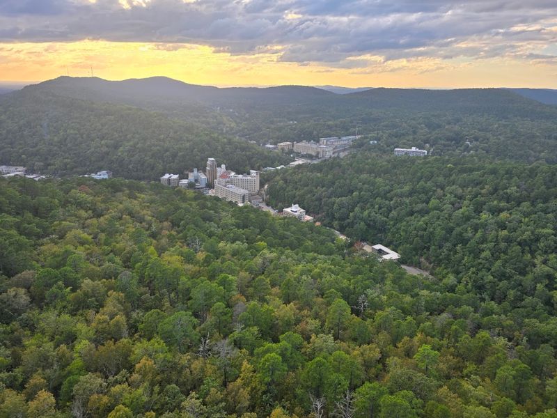
Hot Springs National Park is one of those places that surprises people every single time. AR 7 runs right through the heart of the historic downtown, putting Bathhouse Row directly in your path.
You cannot miss it, and honestly, you would not want to.
The bathhouses are stunning examples of early twentieth century architecture. They stretch along Central Avenue like a grand parade of history.
Some are still active, some are museums, and all of them are worth slowing down for.
The thermal waters here have been drawing visitors for over a century. People came from across the country to soak in the naturally heated springs and experience what was considered a healing retreat.
Does a place with that kind of history not make you curious?
Beyond Bathhouse Row, Hot Springs offers excellent fishing and boating on five surrounding lakes. The surrounding Ouachita Mountains provide a dramatic backdrop to every view.
Drive up to Hot Springs Mountain Tower for a panoramic perspective that puts the whole landscape into focus.
Hot Springs is also a lively town with great food, art galleries, and a historic horse racing track. It manages to feel both nostalgic and alive at the same time.
Plan to spend at least a few hours here because one pass through will not be enough.
Arkansas River Valley Views
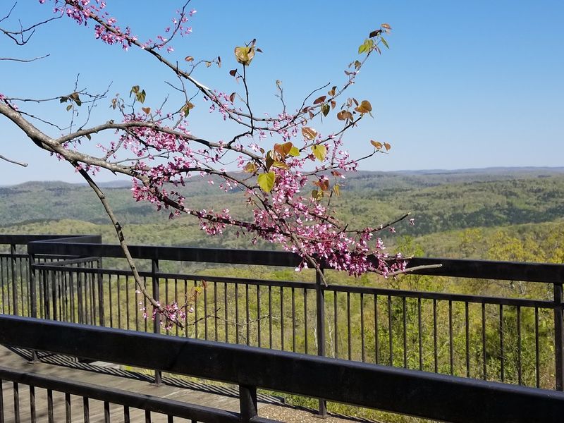
After the Ouachita Mountains, AR 7 drops into the Arkansas River Valley and the landscape opens up dramatically. Wide fields stretch out in every direction, framed by distant ridgelines.
It feels like the highway exhales after all those mountain curves.
Russellville is the main hub in this section and a great place to recharge. Lake Dardanelle State Park sits nearby and offers excellent fishing, boating, and lakeside picnic spots.
The lake itself is massive and gorgeous, especially in the early morning when the mist is still sitting on the water.
Petit Jean State Park is a short detour from this stretch and completely worth it. The park is famous for its hiking, cycling, and birding opportunities.
Have you ever stood at the edge of a canyon and felt the wind push back against you?
Mount Magazine State Park is another nearby highlight. At 2,753 feet, it is Arkansas’s highest point and offers activities like hang gliding, rappelling, and rock climbing.
The butterfly population up there is remarkable and makes even a short walk feel magical.
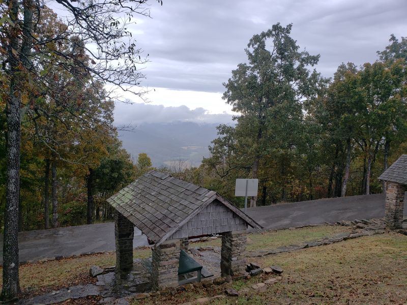
The Rotary Ann Roadside Park sits along this stretch and holds the title of Arkansas’s very first roadside rest area. It offers expansive Ozark Mountain views.
Stop, stretch your legs, and remind yourself that sometimes the best moments on a road trip happen at the unexpected stops.
Ozark Foliage Explosion
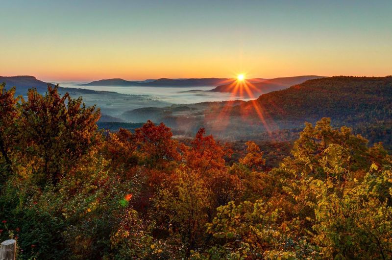
Fall on AR 7 through the Ozarks is the kind of thing people drive hundreds of miles just to see. The trees turn every shade of red, orange, and gold, and the highway becomes a tunnel of color.
If you have never done a fall foliage road trip, this is where to start.
The Ozark Mountains in this section are dramatic and layered. The highway climbs and winds through terrain that feels untouched and wild.
Every overlook presents a view that looks like it was painted rather than real.
Even outside of fall, this stretch delivers. Spring brings wildflowers bursting along the roadside.
Summer keeps everything deep green and lush. Winter strips the trees back and reveals the full shape of the ridges in a way that is surprisingly beautiful.
AR 7 through the Ozarks is genuinely challenging to drive, with tight curves and steep grades that demand your attention. That is part of what makes it so rewarding.
Does a road that makes you work a little not feel more satisfying to finish?
Wildlife sightings are common through this stretch. Deer, wild turkey, and hawks are regular companions on the drive.
Keep your camera ready and your speed reasonable. The Ozarks reward the patient traveler with moments that are hard to put into words.
Jasper Grand Canyon Overlook
Jasper is the kind of small town that punches way above its weight when it comes to scenery. Sitting in the heart of the Arkansas Ozarks, it is the gateway to what locals proudly call the Grand Canyon of the Ozarks.
That nickname is not an exaggeration.
The views of the Little Buffalo River Valley from the overlooks near Jasper are genuinely jaw-dropping. The canyon drops away sharply below the highway, revealing layers of forested ridges that stretch to the horizon.
Have you ever seen a view that made you forget to breathe for a second?
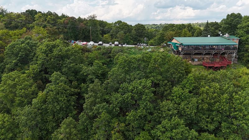
The Cliff House Inn and Restaurant sits right on the edge of this canyon and offers meals with views that most restaurants could only dream about. It is the kind of place where you order something simple and end up staring out the window for twenty minutes.
Treat yourself.
Jasper is also surrounded by access points to the Buffalo National River, the country’s first designated national river. Hiking and floating are the big draws here.
The Alum Cove Natural Bridge, a massive quartz sandstone arch, is a short hike away and genuinely impressive up close.
Spend a night in Jasper if you can. The town has a relaxed, welcoming energy.
Morning fog settling into the canyon below town is something that stays with you long after the trip is over.
Buffalo River Trail Access
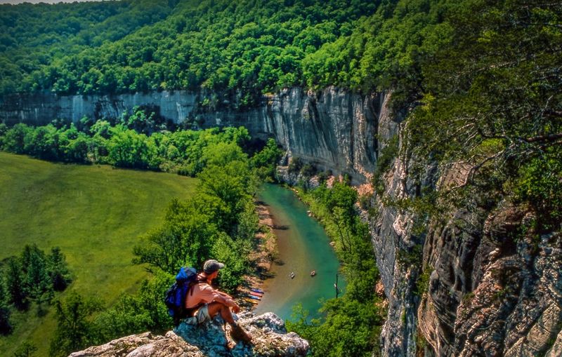
Buffalo National River is one of Arkansas’s crown achievements, and AR 7 puts it right at your fingertips. This was the first river in the United States to receive national river designation, which tells you everything you need to know about how special it is.
The river runs crystal clear over smooth gravel bars and beneath towering limestone bluffs. Floating the Buffalo is a bucket-list experience for outdoor lovers.
Even if you do not get on the water, just standing on a gravel bar and looking up at those bluffs is worth the stop.
Hiking trails in this area range from easy walks to serious full-day challenges. The Pedestal Rocks and King’s Bluff trails near Pelsor are standouts.
These paths lead to panoramic views from the top of the Ozark Plateau and past fascinating rock formations that look like something from another planet.
Wildlife thrives along the Buffalo River corridor. Black bears, elk, and river otters all call this area home.
Are you the kind of traveler who gets excited spotting wildlife in the wild? This is your place.
The area around the Buffalo National River feels genuinely remote in the best possible way. Cell service fades and the natural sounds take over.
That disconnection is exactly what most people are looking for when they plan a road trip through a place like AR 7.
Harrison And Bull Shoals End
Harrison makes for a satisfying final chapter on the AR 7 story. This charming northern Arkansas town has a historic square lined with brick storefronts, antique shops, and local eateries that feel genuinely lived-in.
The Ozark Cafe has been serving locals and travelers since 1909, which is a pretty good track record.
The Boone County Heritage Museum is worth a stop for anyone who wants to understand the history of this corner of Arkansas. The exhibits are engaging and give real context to the landscape you have been driving through.
History hits differently when you are standing in the middle of it.
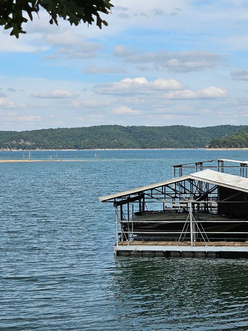
Bull Shoals Lake is just north of Harrison and is one of the largest lakes in the United States. Fishing, boating, and camping are the main draws.
The lake sits in a landscape of rolling Ozark hills that makes every angle look like a postcard.
Diamond City, Arkansas, sits near Bull Shoals Lake and marks the northern reaches of the AR 7 journey. The full route of AR 7 runs through Arkansas, with this northern stretch near Diamond City, Arkansas, being the final destination before the highway concludes near Bull Shoals Lake.
Can you think of a better way to end a road trip than at a massive lake surrounded by Ozark hills?
AR 7 is not just a highway. It is proof that Arkansas deserves far more attention than it gets.
Drive it once and you will start planning your return trip before you even get home.