
Powerful Rapids Turn This Massachusetts Waterfall Into A Standout Natural Attraction
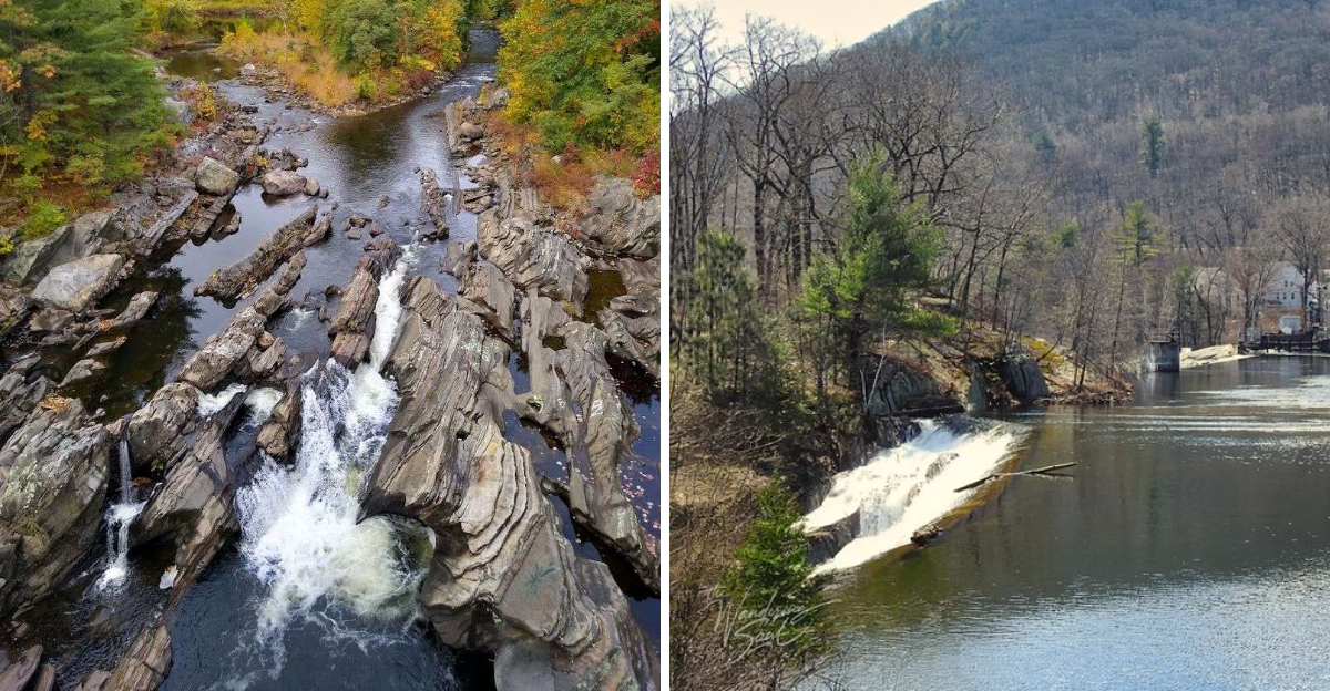
Some waterfalls impress with height. This one grabs your attention with pure force.
Powerful rapids rush over dark rock and send white water crashing through the channel below. The sound grows louder as you get closer, making the entire scene feel alive.
It is rugged, dramatic, and surprisingly easy to admire without planning a major outdoor adventure.
This Massachusetts waterfall stands out because the surrounding rocks shape every twist of the current. Water surges through narrow gaps, spills over uneven ledges, and creates a constant show after periods of rain.
Even a quick visit can feel exciting.
Bring a camera, but take a moment to simply watch. The rushing water changes by the second, and no two views feel exactly the same.
For anyone who enjoys bold scenery and natural places with real energy, this powerful waterfall deserves a place on the seasonal travel list.
The Unyielding Power Of The Westfield
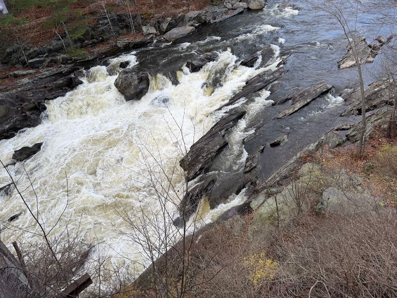
Few rivers in New England carry themselves with the authority of the Westfield River.
Running through the hills of Hampden County, it moves with a confidence that comes from centuries of carving its own path through resistant bedrock.
The sound reaches you before the water comes into view.
At Woronoco, the river narrows and accelerates, pushing through channels that amplify its force considerably. The result is a sustained roar that fills the surrounding valley with a kind of natural white noise that feels both calming and slightly humbling.
Standing near the main cascade, you feel the mist before you consciously register it.
The Westfield River stretches over 50 miles and feeds into the Connecticut River, making it one of the most significant waterways in western Massachusetts.
Its Class III and IV whitewater sections are regionally rare, offering conditions that most rivers in the state simply cannot match.
This is not a gentle stream dressed up in seasonal foliage.
The Westfield earns its reputation through sheer volume, speed, and the kind of geological stubbornness that shapes landscapes over thousands of years rather than decades.
Ancient Cascades And Salmon Legends
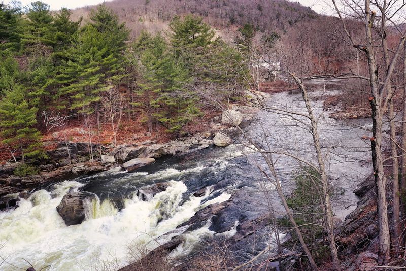
Long before the area had a modern name on any map, this stretch of the Westfield River was known for something remarkable: Atlantic salmon.
The falls were historically called Salmon Falls, a name earned honestly through generations of observation and active fishing at this precise location.
Native people recognized the site as a place of abundance. For millennia, the Woronoco area supported a substantial village of over a thousand people who fished, hunted, and cultivated crops along these very riverbanks.
Salmon Falls held considerable cultural and practical importance in their daily lives, functioning as both a food source and a gathering point through the seasons.
Atlantic salmon no longer run these waters in the numbers they once did, but the name and the memory persist in local history.
The river itself has made a meaningful ecological recovery from past pollution, and native trout now populate its cleaner stretches with encouraging regularity.
That recovery is itself a kind of quiet triumph.
The falls at Woronoco carry layered meaning, part geological spectacle, part ecological story, and part living record of a human relationship with moving water that stretches back further than written records can reliably confirm.
Where Stone And Current Converge
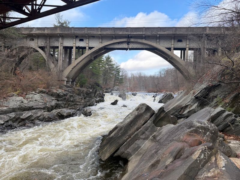
Geology rarely announces itself loudly, but at Woronoco Falls it makes an unmistakable statement.
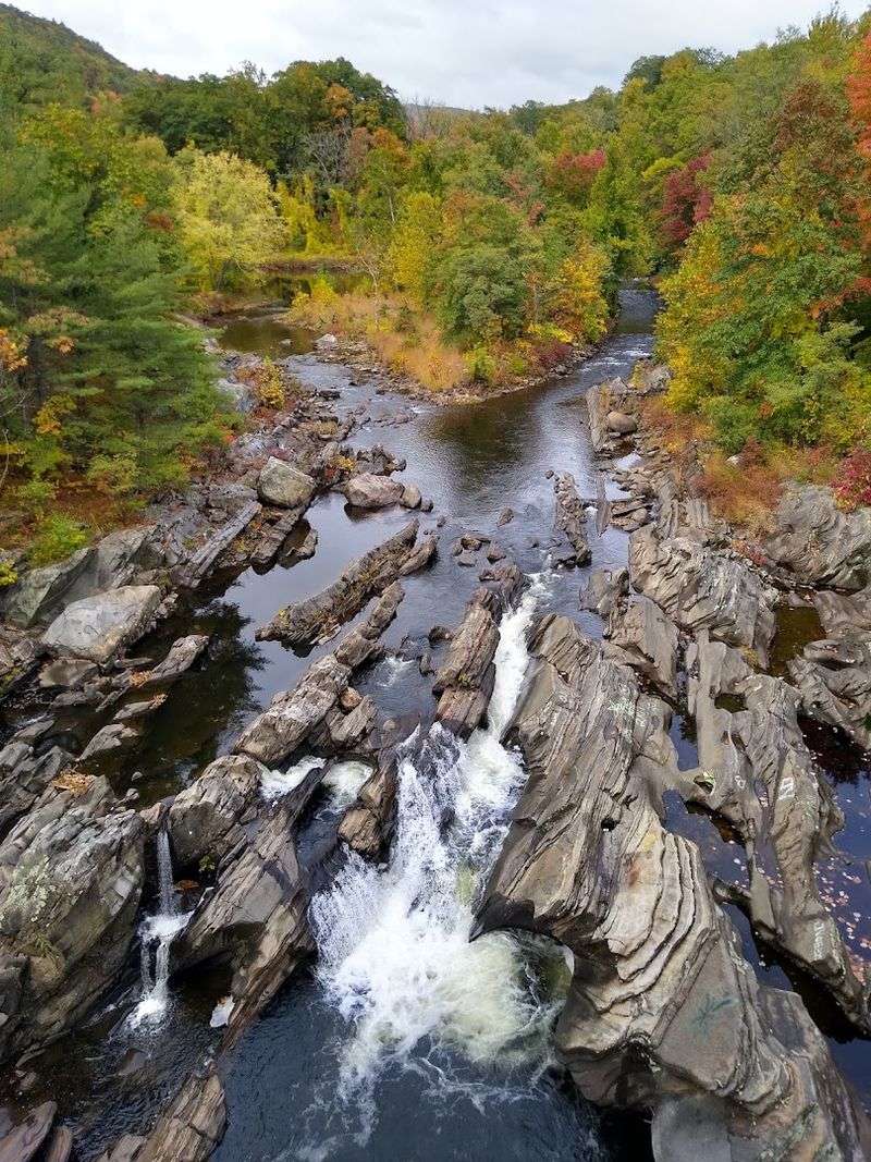
The riverbed and surrounding rock formations display an unusual combination of vertical and horizontal potholes, carved over centuries by the persistent circular motion of water and sediment grinding against stone.
These potholes are not incidental features. They represent an ongoing process that has been shaping this landscape since long before European settlement.
Each depression in the rock is essentially a record of time, a physical archive of how water and stone negotiate with each other across geological timescales.
Running your hand along the smooth interior of one of these formations makes the concept of deep time feel suddenly tangible.
The falls themselves descend in a series of natural steps rather than a single dramatic plunge, which gives the water multiple opportunities to accelerate, pool, and accelerate again.
This staggered descent creates the visual layering that makes Woronoco Falls particularly photogenic across different seasons.
The rock faces flanking the river show striations and mineral variations that reward close attention.
For anyone with even a passing interest in earth sciences, this location near Russell, MA 01071 offers a genuinely instructive afternoon in an outdoor classroom with no admission fee required.
A River’s Industrial Chronicles
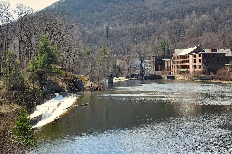
The industrial story of Woronoco Falls begins in the 1870s, when the Woronoco Paper Company recognized that falling water meant available power.
They were the first to dam this section of the Westfield River, setting in motion a sequence of industrial development that would define the character of the surrounding community for well over a century.
The Strathmore Paper Company eventually took over operations and built a reputation for producing high-quality bond papers at this site.
The mill became the economic foundation of the area, and with it came Horace A. Moses, an industrialist with an unusual vision.
Moses developed Woronoco into what historians describe as a model company town, a planned community designed around the needs and wellbeing of its workforce in ways that were genuinely progressive for the era.
Today, two dams remain at Woronoco, and a modern hydroelectric plant operated by Eagle Creek Renewable Energy continues to generate power from the same river that first attracted industrial attention over 150 years ago.
The Strathmore Mill complex and the powerhouse are both considered eligible for the National Register of Historic Places, a recognition that honors the site’s layered significance beyond its natural features alone.
Navigating The Turbulent Flow
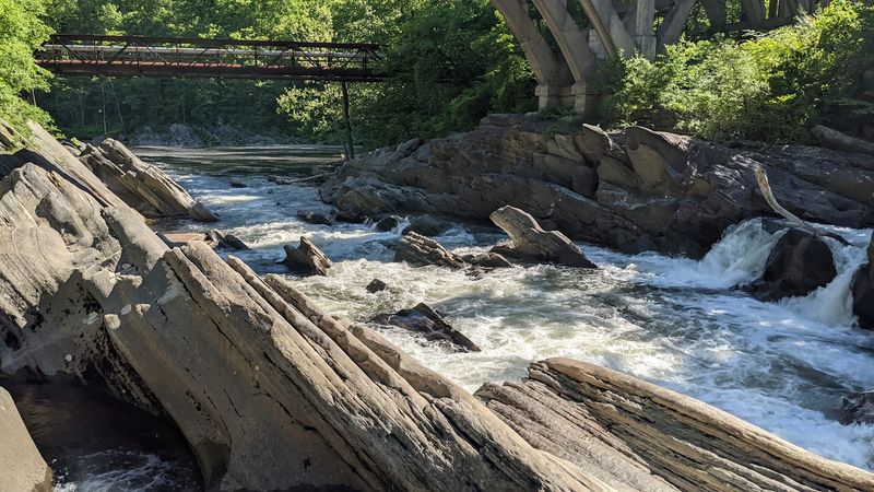
The Westfield River does not apologize for its difficulty. Its Class III and IV whitewater sections demand real skill, genuine preparation, and a healthy respect for moving water at volume.
These classifications are not common in Massachusetts, which makes the Westfield a destination rather than an afterthought for serious paddlers throughout the region.
The stretch near Woronoco includes a section known as the Hill and Dale Rapids, rated Class III, which delivers the kind of sustained technical challenge that keeps experienced kayakers and canoeists returning season after season.
The rapids require active navigation rather than passive floating, with currents that shift and accelerate in ways that reward careful reading of the water ahead.
Eagle Creek Renewable Energy, the current operator of the Woronoco hydro station, has made meaningful investments in river access for non-motorized watercraft.
Canoe portage facilities are available, along with designated parking areas and clearly marked put-in and take-out points for hand-carry boats.
The portage path includes rest stops and directional signage, and public access to these amenities carries no charge.
Downstream, Strathmore Park provides additional river access for fishing and boating, extending the usable stretch of this remarkable waterway considerably.
Paddler’s Passage Through Scenic Grandeur
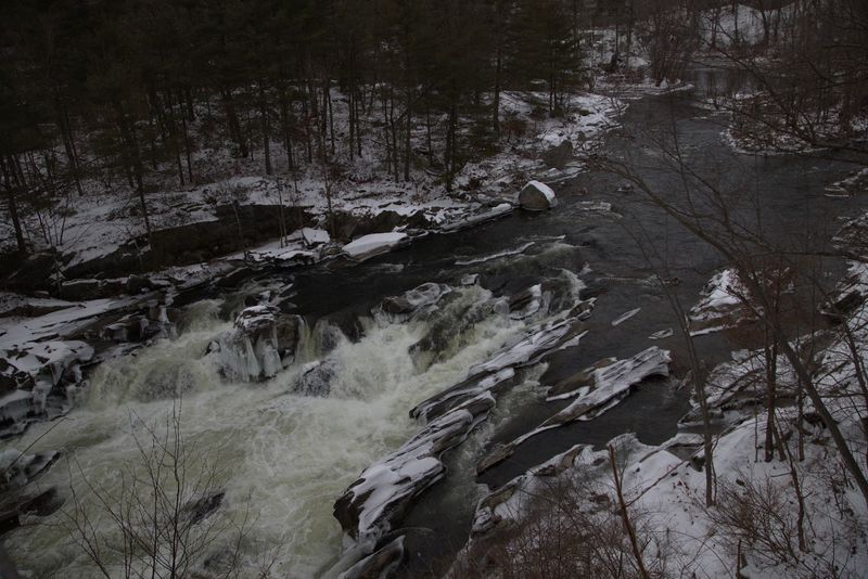
Beyond the technical challenge of its rapids, the Westfield River corridor offers something that pure difficulty cannot provide on its own: sustained visual beauty across a landscape that has retained much of its natural character.
The river runs through one of the largest roadless wilderness areas remaining in Massachusetts, a fact that shapes the experience of being on the water in a fundamental way.
Paddling through this stretch means spending extended time away from roads, development, and the general noise of contemporary life.
The forest closes in on both banks with a density that feels genuinely remote even when civilization is not far off by map distance.
Herons, osprey, and native trout are regular companions along this corridor, particularly in the cleaner water sections that have benefited from decades of ecological recovery efforts.
The Westfield River spans over 50 miles of paddling opportunity, offering routes that range from manageable day trips to multi-day journeys for those with the equipment and inclination.
The scenery shifts gradually as the river descends, moving through different rock types and vegetation zones that give each section a distinct personality.
For paddlers who want more than adrenaline from their time on the water, this river delivers depth alongside its considerable speed.
The Echoes Of Woronoco’s Heritage
Place names carry history whether people pay attention to them or not.
Woronoco is a name that originates with the Native people who lived here, a community of over a thousand individuals who built their lives around this section of the Westfield River over thousands of years.
Their presence shaped the land in ways that persisted long after European settlement fundamentally altered the region.
The site at Salmon Falls held particular significance in Native American history, functioning as a reliable and productive fishing location across generations.
When European settlers arrived and began mapping and naming the landscape, they often retained Indigenous place names in modified form, and Woronoco is a clear example of that pattern of partial preservation.
The industrial era added another layer to this already complex heritage.
Horace Moses transformed the village into a model company town during the early twentieth century, creating housing, amenities, and community infrastructure for mill workers.
The physical remnants of that era, including stand alongside the river as quiet evidence of how many different human stories this single location has absorbed and held across the centuries.
Massachusetts’ Wildwater Sanctuary
Massachusetts is not typically the first state that comes to mind when serious whitewater paddlers plan their season. The Westfield River corridor near Woronoco is working to change that perception, one rapid at a time.
The combination of Class III and IV water, genuine wilderness character, and a long paddling season makes this river system genuinely distinctive in a regional context.
The watershed encompasses one of the largest roadless wilderness areas in the state, a designation that carries real meaning for the quality of the experience on and around the water.
Clean air, intact forest cover, and a river system now clean enough for swimming represent the outcome of sustained conservation and management efforts over several decades.
Native trout populations have returned to stretches that were once too polluted to support them.
Strathmore Park downstream provides public access for swimming, fishing, and boating, extending the recreational reach of this corridor beyond the falls themselves.
The entire Woronoco area functions as a layered destination where geology, ecology, history, and recreation occupy the same physical space without competing for dominance.
That balance is rarer than it sounds, and it is precisely what makes this corner of western Massachusetts worth the drive from almost anywhere in the region.