
Illinois’s Most Stunning State Park Is One Few Dare Visit After Dark
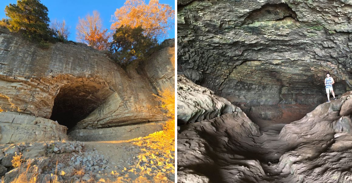
What if the most stunning spot in Illinois turned unsettling the moment the sun dropped? Locals will tell you exactly why almost nobody dares stick around here once the light fades.
A limestone opening carved by ancient floodwater stretches wide along a riverbank, catching a single beam of light through a crack in the ceiling at midday.
Stairs wind down past mossy bluffs while barges drift past on the water below. Trails wander through hickory-covered ridges nearby, rewarding anyone willing to climb a little higher.
Centuries of legend cling to this stretch of Illinois, stories about outlaws hiding along the riverbank long before anyone thought to build a trail. Cross a free ferry, wander a bluff-top trail, or simply watch the shadows swallow the opening whole.
The Cave That Started Everything
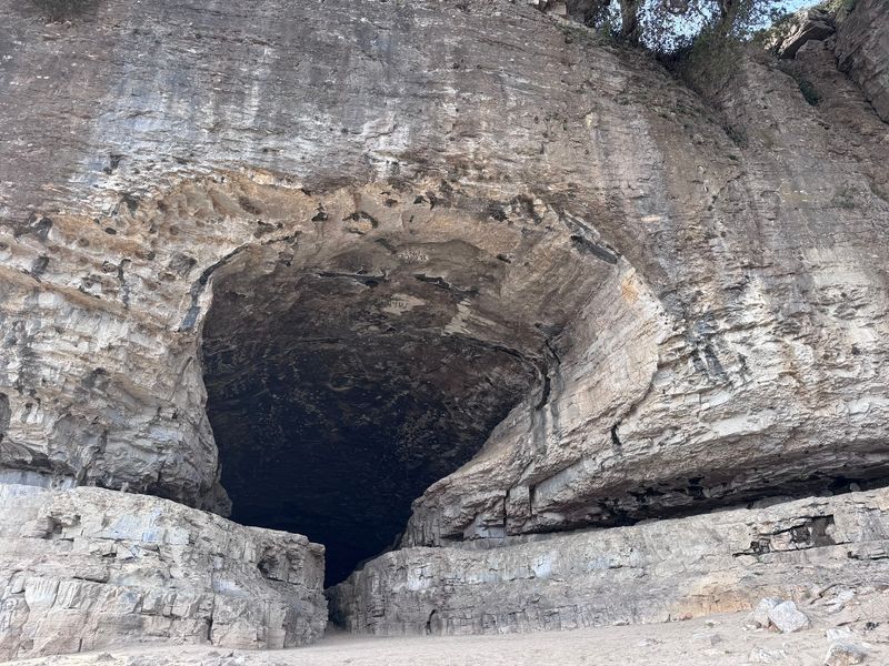
Fifty-five feet of open rock. That is the first thing visitors notice at the shoreline.
The cavern was cut into the limestone bluff face by water, weather, and glacial meltwater over an enormous stretch of time. It behaves less like a typical dripstone cave and more like a tunnel bored straight into the cliff.
Depth is modest. Reports and visitor accounts put the usable interior at roughly a hundred feet or so, wide and open rather than twisting and tight.
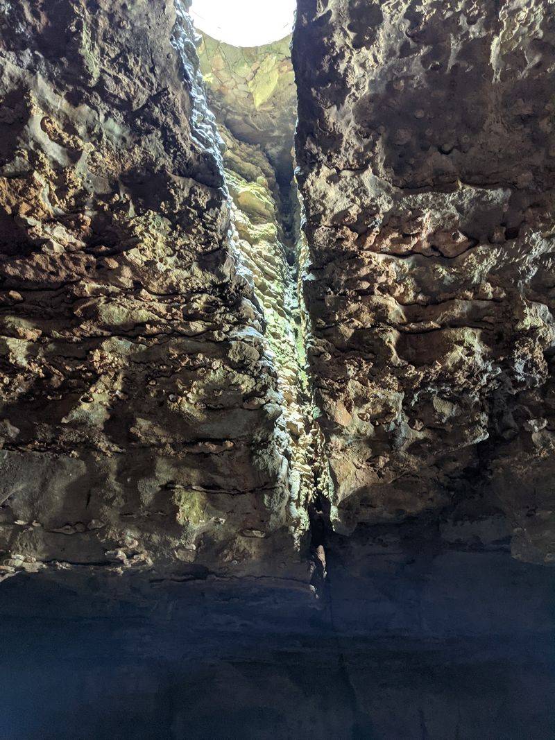
A fissure splits the ceiling near the back. Around midday, light pours through that gap and washes the rear wall in a soft glow.
The floor turns muddy after rain, so sturdy shoes earn their keep. Older graffiti marks the ceiling, some of it decades deep, which puzzles nearly everyone who cranes their neck at it.
The park sits at 1 New State Park Rd, Cave-In-Rock, Illinois, in Hardin County. Most people spend an hour or two here and leave wanting more.
River Pirates And A Reputation That Stuck
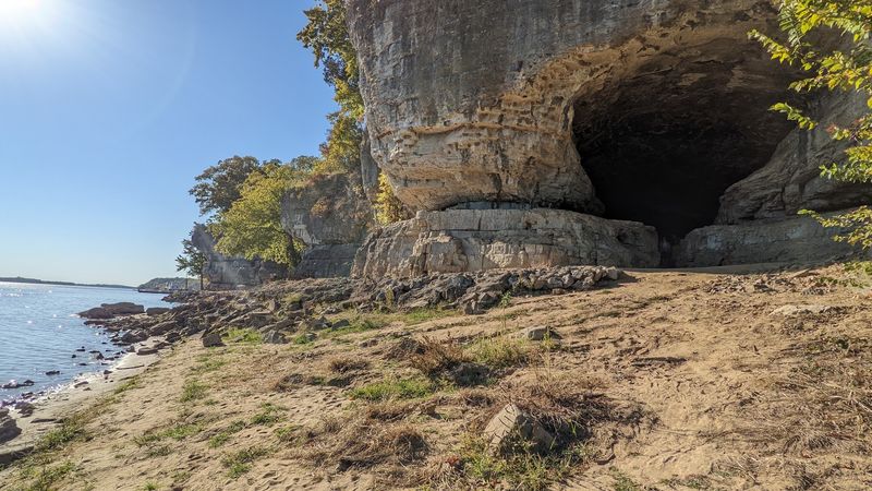
Bandits loved a landmark. This one was impossible to miss from the water.
Between the late 1700s and the early 1800s, the cave gained a rough reputation as a base for river pirates, counterfeiters, and highway robbers. Flatboats loaded with goods floated downriver toward New Orleans, and crews had few places to hide.
Local lore ties several notorious frontier gangs to the cavern. Documentation for some of those claims is thin, so the safest description is legend layered over fact.
Vigilantes reportedly moved against the outlaws near the end of the 1700s, breaking up the stronghold. Trade along the river eventually grew too busy and too watched for hideouts to survive.
What lingers is atmosphere. Standing inside the opening, with the river slapping the rocks below, the stories feel closer than they should.
Reviewers still mention the pirate connection more than the scenery. That says plenty about how long a good story survives.
Why Almost Nobody Sticks Around After Sunset
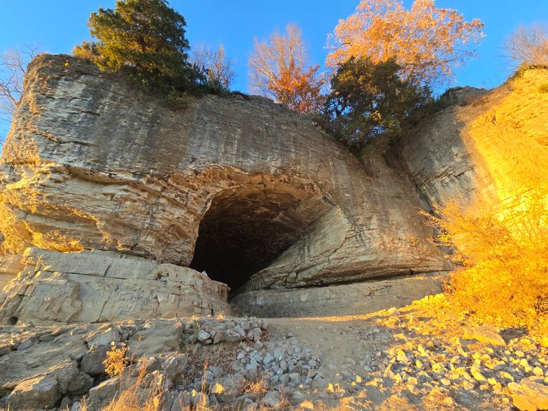
The light goes, and the cave stops being friendly.
Without the midday sunbeam through the ceiling crack, the interior turns pitch black. The natural chimney that lights the back wall at noon does nothing at all after dark.
Footing is the practical problem. Wet limestone, uneven mud, and steep stairways down to the shore make evening exploring a poor idea.
Then there is the reputation. Tales of ambushed travelers and lawless frontier gangs have been retold for two centuries, and they hang around the entrance like fog.
The town itself winds down early. Visitors often note that very little stays open past the dinner hour, which leaves the bluffs quiet in a way that feels almost staged.
Park gates close at night, so exploring is not an option anyway. Daylight visits give the same drama with far better footing.
Sunset from the bluff top is the smart compromise. Watch the river darken, then head up the hill.
Stairs, Shortcuts, And Where To Actually Park
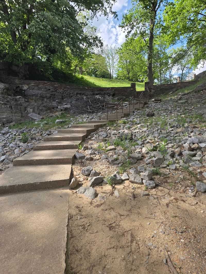
Park in the wrong lot and the walk triples.
Many navigation apps send drivers up the hill toward the restaurant and lodge area. From there, the cave is a long downhill trek.
Regulars recommend the first parking area after entering, the one with a small hill and a set of stairs. From that lot, the cave is a short stroll of just a few minutes.
Stairs are part of the deal either way. Steps lead up over the rise, then down toward the pebbly shoreline where the cave opens.
A trailer parking area sits near that first entrance, which helps anyone towing a camper. A playground shares the same general zone.
Restroom facilities in the lower area are basic, so plan accordingly before heading down. Bring water in warm months.
Turn left at the shore, and the arch appears. Simple directions, big payoff.
Trails That Ride The Bluff Line
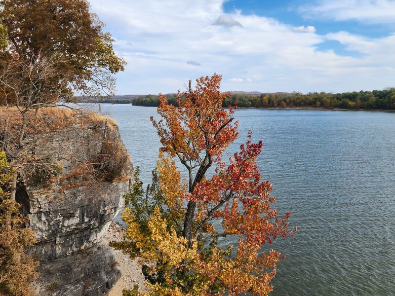
The cave gets the attention. The trails quietly deliver the views.
Several short routes thread through the park’s wooded hills, rated moderate rather than punishing. One path leads straight to the cave itself.
A riverside route hugs the water and opens onto long looks at the Ohio. Other trails climb into hickory-covered ridges and along bluff edges where the drop-off keeps hikers honest.
Elevation here is gentle by mountain standards, with wooded hills rising roughly sixty feet above the river in places. Roots and loose rock still ask for decent footwear.
Autumn turns the canopy gold and rust, which makes the bluff overlooks feel twice as generous. Spring brings green tunnels and birdsong instead.
Visitors with dogs often mention how well the short loops work for a quick outing. Leashes are standard practice.
Photographers get the best light early or late. Hikers get the best air in October.
A Free Ferry Ride Across The Ohio
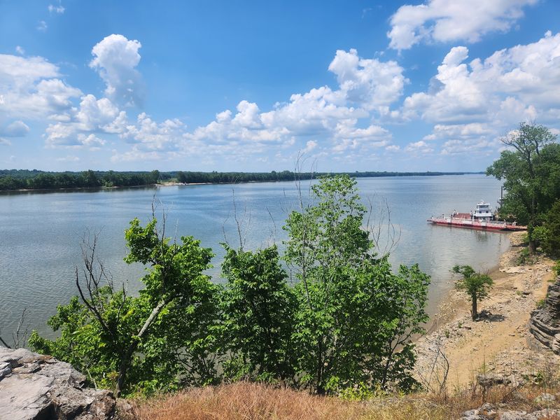
Free river crossings barely exist anymore. One still runs right next to this park.
The Cave-In-Rock Ferry carries vehicles across the Ohio River, linking Illinois Route 1 with Kentucky Route 91. There is no charge to ride.
Cars, pickups, and clusters of motorcycles roll onto the deck. The trip is short, breezy, and oddly thrilling for something so ordinary.
On the Kentucky side, roads wander into Amish country, where horse-drawn traffic and small country stores appear along the shoulder. Many visitors treat the ferry as half the reason they came.
Schedules and operation can change with river conditions, so checking before counting on it is wise. High water sometimes pauses service.
Barges and towboats push past while waiting, which gives the whole scene a working-river feel rather than a tourist one. Cameras come out fast.
Ferry mentions show up constantly in visitor comments. That is not an accident.
Picnic Shelters, Playgrounds, And Slow Afternoons
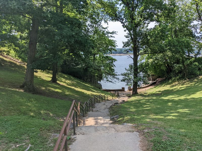
Some families never make it past the picnic tables.
Shaded areas throughout the wooded park hold tables and grills, spaced far enough apart to feel private. Large shelters handle bigger group gatherings.
Three developed playground areas keep younger visitors busy while adults set out lunch. Gazebos add cover when clouds roll in.
The layout works well for a full day rather than a quick stop. Explore the cave in the morning, eat under the trees, then wander a trail in the afternoon.
Trash cans and restrooms are limited in spots, so packing out what comes in is the neighborly move. A cooler and a roll of paper towels solve most problems.
Weekends draw school groups and local families, especially in late spring. Weekday mornings feel almost private.
Cost is the sweetener. Entry to the park costs nothing, and parking is free too.
Fishing And Boating Along The Big Water
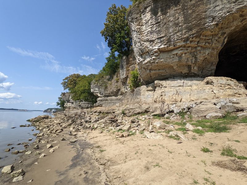
Catfish country. The Ohio delivers.
Anglers work the river for catfish, bass, and bluegill, and a pond inside the park offers a calmer option for shorter attention spans. Two boat ramps give direct access to the main channel.
Boat traffic ranges from small fishing rigs to commercial barges pushing upstream. Watching a loaded tow slide by from the shoreline never quite gets old.
Currents on a river this size deserve respect, especially near the bluffs. Life jackets are not optional gear.
Shorter runs downstream open access toward the Saline River area for more fishing options. Local conditions vary, so checking current regulations before casting saves headaches.
Shoreline walkers sometimes encounter dried carp along the pebbles after high water recedes. It is part of river life, not a flaw in the park.
Early mornings bring mist off the water. Bring coffee and patience.
Sleeping On The Bluff Or Under Canvas
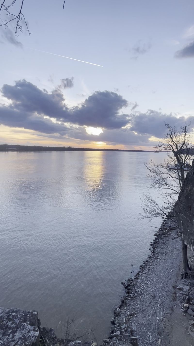
Waking up above the Ohio changes the whole trip.
Duplex guest suites sit on the bluff top, each built to hold a small group. Private patio decks look out over the moving water below.
A restaurant near the lodge area serves southern-style cooking, and visitors frequently call it reasonably priced. Hours can shift by season, so timing meals matters in a town this quiet.
Campers get their own setup. Class A sites with electricity handle RVs, while tent sites suit lighter travelers.
Shower buildings, restrooms, and a dump station support longer stays. Reserving ahead is smart during peak fall weekends.
Staying overnight also means catching the river at dawn, when fog sits low and the bluffs go quiet. That view alone justifies the drive.
Cabins earn steady mentions from returning visitors. Booking early is the trick.
From Frontier Shelter To Protected Parkland
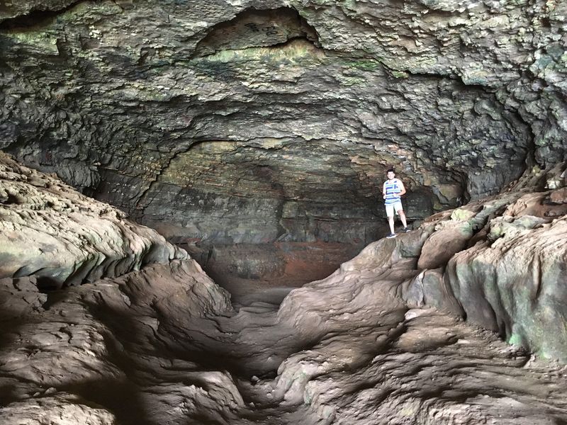
Long before outlaws, the cave was simply useful.
Native peoples used the shelter for thousands of years, taking advantage of the dry overhang and the wide view of the river. Later, pioneers heading west stopped here for rest and cover.
A French explorer mapped and named the site in 1729, calling it the cave in the rock. The name stuck through centuries of changing hands.
The State of Illinois purchased land around the cavern in 1929, setting aside roughly sixty-five acres for public use. The park grew over the years to just over 200 acres.
Today the Illinois Department of Natural Resources manages the grounds, balancing access with preservation. That oversight keeps the cave open and walkable.
Seeing the same arch that guided flatboat crews puts the timeline into focus. Two centuries collapse into one glance.
History here is not behind glass. It is under your boots.
A Springboard For Southern Illinois Adventures
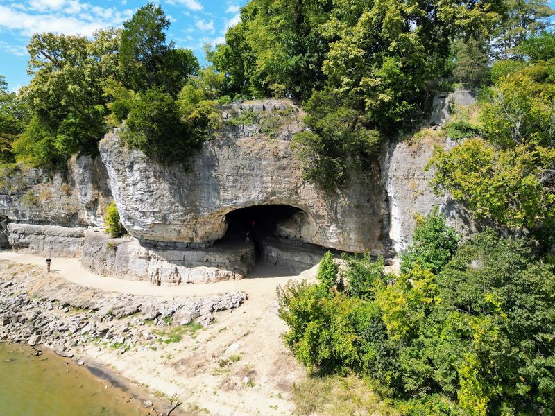
One cave rarely satisfies anyone who drives this far.
The park sits near the eastern reaches of the Shawnee National Forest, which opens the door to a full weekend of stops. Garden of the Gods, with its wind-sculpted sandstone, lies within a short drive.
Rim Rock, Pounds Hollow, and Tower Rock add trails, swimming, and camping options nearby. Each offers a different flavor of southern Illinois terrain.
A nine-hole golf course sits just north of the park for anyone traveling with clubs. The ferry adds Kentucky’s Amish farmland to the itinerary.
Roads out here narrow and twist, which slows travel times more than maps suggest. Fuel stops are spread thin, so topping off early pays.
Plenty of travelers discover the cave as a bonus stop on the way back from bigger destinations. Most say they wish they had budgeted more hours.
Build the route with room to linger. The region rewards it.
Timing The Visit For The Best Light
Midday is the secret weapon here.
When the sun climbs high, light drops through the ceiling fissure and brightens the back of the cavern. Photos taken then look nothing like the shadowy shots from morning visits.
Spring and fall bring the friendliest weather. Autumn color across the bluffs makes the river overlooks especially rewarding.
Summer works fine, though humidity along the water gets heavy. The cave interior stays cool and damp, which feels welcome in July.
Winter clears out the crowds completely. Bare trees open up sightlines that leaves normally block.
Rain complicates the cave floor, turning packed dirt into slick mud. Waterproof shoes and a small flashlight cover both problems.
Weekday visits mean fewer school buses and quieter trails. An hour or two is enough for the cave, though a half day suits anyone who wants the trails too.
Pick your season, then chase the noon sunbeam. Illinois saves its strangest light for this bluff.