
This Hidden New York Canyon Has 400-Foot Cliffs And Most People Have No Idea It Exists
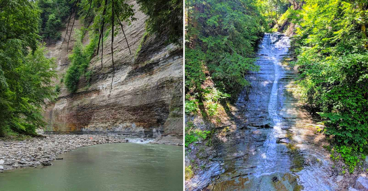
Four hundred feet is a long way up when you are standing at the bottom of a gorge. That is what makes one wild corner of western New York feel so different from the usual weekend hike.
Rock walls rise hard above the creek, and old trees crowd the rim like they have seen everything already.
New York gets wonderfully dramatic here. The water below can look green and clear, with narrow falls slipping down the stone after rain.
What really gets me is how little fuss surrounds the place. No giant entrance sign announces what is waiting ahead. You follow the creek, watch the walls grow taller, and suddenly the scale starts to sink in.
Parts of the forest have been standing for centuries, which gives the whole canyon a deeper sense of age. It feels rough, quiet, and far removed from crowded overlooks. That makes finding it feel even better.
A Gorge That Rivals The Postcards
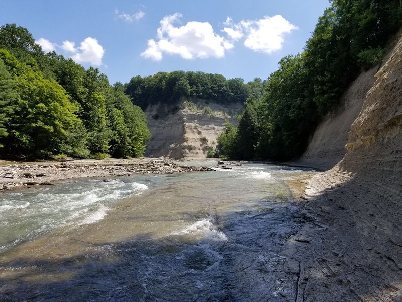
Few people expect a canyon in this corner of the state. Yet the walls here climb between 100 and 500 feet, with several rock faces standing almost straight up at roughly 400 feet.
Cattaraugus Creek did the carving, patiently, over thousands of years. The Main Branch canyon drops as deep as 480 feet. The South Branch measures around 380 feet, which is still taller than most buildings you have ever stood beside.
Layers in the rock tell an old story. Devonian siltstones and shale of the Canadaway Formation stack up like pages, and the gorge even exposes ancient bands of the Onondaga Escarpment.
Standing at the rim, the scale sneaks up on you. Trees along the creek bed look like sprigs of parsley. Sound behaves strangely too, with water noise rising up the walls in a low, steady hum.
Small waterfalls thread down the sides, and a few of them fall more than 100 feet. Nothing about the place feels manicured or arranged for visitors.
That raw quality is exactly the appeal. The canyon simply exists, wild and quietly enormous, waiting for anyone curious enough to look.
Forty Road Holds The Key
The name of this place is Zoar Valley Multiple Use Area, and one small gravel lot serves as its front door. Set your navigation for Forty Road, Persia, NY 14179, and you will find the entry point that regulars swear by.
Getting there is half the charm. Country roads roll past farms and hedgerows between the villages of Gowanda and Springville, with no billboards announcing what waits ahead.
From the lot, a short accessible path of about 200 feet leads to a scenic overlook of the gorge. That is a remarkably small effort for a remarkably big view.
The same entrance gives clean access to the South Branch of Cattaraugus Creek. Hikers who want water beneath their boots start right here.
New York State manages the land through the Department of Environmental Conservation, and the protected core sits within the towns of Collins, Otto, and Persia.
Cell service fades out in much of the valley. Download your maps at home, tell someone your plan, and enjoy the rare gift of a phone that stays quiet in your pocket.
Trees That Predate The Nation
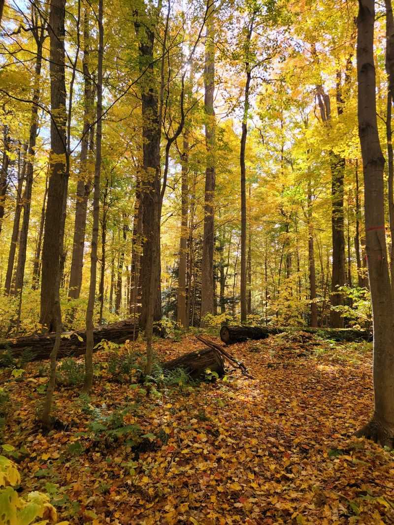
Old-growth forest is rare east of the Mississippi, and Zoar Valley protects more than 600 acres of it. That makes these woods some of the last of their kind in Western New York.
Certain Eastern Hemlocks here have been dated at over 410 years old, measured at breast height. Those trees were already sturdy when European ships were still charting the coastline.
Size is the giveaway. Trunks grow thicker than expected, and the canopy climbs unusually high because steep slopes kept loggers away for generations.
Beech and maple mix in with the hemlocks, which turns autumn into a slow burn of gold, copper, and deep red. Spring brings a different show, with wildflowers taking advantage of light before the leaves fill in.
Walk slowly through these stands and the temperature drops a few degrees. Hemlock shade does that.
Roots grip the slope like old fingers, so stepping on them repeatedly does real harm. Stay on the trail tread and let the giants keep growing.
Few forests in the state offer this kind of quiet company. It feels less like sightseeing and more like being introduced.
Waterfalls Without The Crowd Control
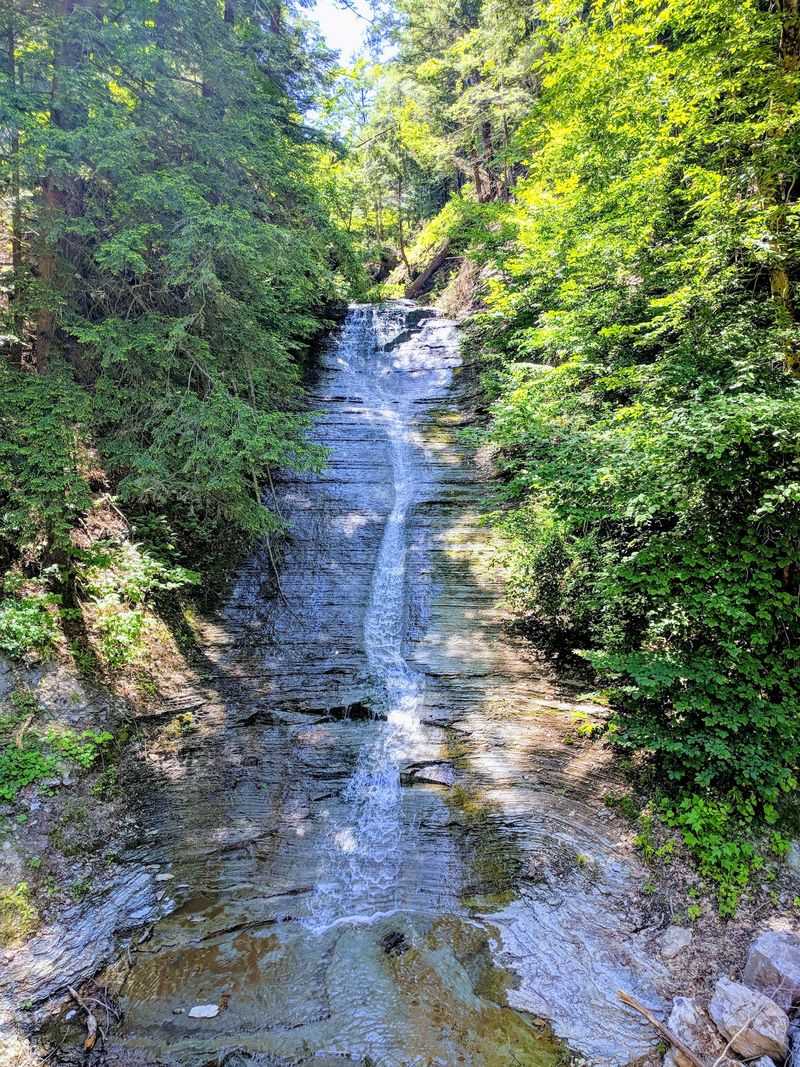
Ribbons of water slip over the canyon walls in more places than you can count. Some of these drops fall more than 100 feet before joining the creek below.
Volume changes with the calendar. Spring melt and heavy rain turn modest trickles into loud, misty curtains, while late summer often reduces them to slender threads over dark shale.
None of them come with viewing platforms or handrails. You find them by walking, watching, and listening for the sound bouncing off rock.
The creek bed itself does a lot of the work. Flat shale shelves spread out like stone patios, and shallow riffles run clear enough to count pebbles.
Access to the water from the Forty Road side is straightforward, which makes the South Branch a favorite for anyone chasing cascades on foot.
Footing gets slick fast on wet rock, so water shoes with real grip beat sandals every time. Trekking poles help more than pride allows most people to admit.
Photographers should aim for overcast days. Soft light keeps the white water from blowing out and lets the mossy greens show their true color.
Swimming Holes And River Beaches
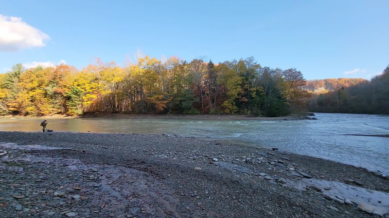
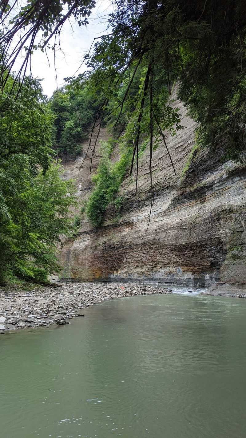
Summer changes the mood down in the gorge. Deep pools form where the current slows, and small river beaches of gravel and sand appear along the bends.
Water clarity is the first thing that surprises visitors. On calm days the green pools look almost tinted, with sunlight flickering across the stones underneath.
Cattaraugus Creek runs colder than expected even in August, which is the whole point on a humid afternoon. Wading in slowly saves you from the gasp.
Current speed deserves respect. Flow shifts quickly after upstream storms, and a mellow pool one week can push hard the next.
Check the forecast before you commit, and skip the water entirely when levels look high or the color turns muddy brown.
Bring water shoes for everyone in your group. The rocks range from smooth shelf to sharp cobble, and bare feet lose that argument every time.
Younger kids need hands-on supervision near the edges and in the current. Set a clear boundary, pick a shallow pool, and the afternoon runs smooth.
Pack out every scrap you carry in. The place stays beautiful because visitors keep it that way.
Boots On, Elevation Ahead
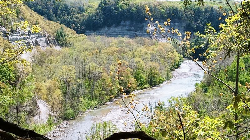
Hiking here comes in two flavors. Rim walks stay gentle and reward you with overlooks, while descent routes drop hard toward the creek in under a mile.
Expect roughly a 25 minute walk down to the water on the popular routes. The return trip takes longer and works your lungs.
Mud is a fact of life on these slopes. Spring and post-rain conditions turn the tread greasy, so waterproof boots with aggressive lugs earn their keep.
Many creek-level routes involve walking in the water or fording shallow sections. Plan for wet feet rather than fighting it.
Trail markers are sparse compared to state parks, so a downloaded offline map keeps you oriented. Cell coverage disappears in much of the valley.
Poison ivy grows along wooded edges in summer. Long socks and a quick glance before you sit down solve most of that problem.
Ticks show up in warm months too, so a body check afterward is smart practice.
Go early on weekends. Cooler air, better light, and fewer people make the whole outing feel like the valley belongs to you.
Anglers, Paddlers, And Bird Nerds
Steelhead and rainbow trout draw a devoted crowd to Cattaraugus Creek. Anglers work the runs and deeper seams, and the setting alone makes a slow day feel worthwhile.
Paddlers get their turn when flows come up. White-water rafting has a long history on this creek, and canoes and kayaks share the water during the right conditions.
Launch choices matter. Creek access from certain spots, including Valentine Flats, is not recommended for boats, so plan your put-in carefully.
Birders bring binoculars for good reason. Bald eagles cruise the gorge corridor, and the mixed forest supports songbirds through spring migration.
Wildlife sightings stack up on quiet mornings. Deer slip between hemlocks, beavers work the slower water, and porcupines occasionally lumber across the trail.
Winter opens another door. Cross-country skiing and snowshoeing turn the rim routes into a hushed white corridor with frozen seeps glazing the cliffs.
Hunting and trapping are permitted in designated areas under state rules. Wearing blaze orange during fall seasons is a simple, sensible habit.
Nature study and plain old scenic viewing count as legitimate activities here. Sitting still on a shale shelf is time well spent.
Rules That Keep The Wild Wild
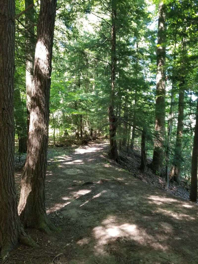
Conservation area, not a manicured park. That distinction shapes everything about a visit, starting with the near total absence of safety barriers along the cliffs.
Regulations adopted in 2021 restrict access upstream from the Forty Road lot. A 15 foot setback from cliff edges applies, and cliff climbing is flatly prohibited.
Safe gorge and creek access exists in two places only, that lot and the Valentine Flats Trail. Freelancing your own route is neither clever nor allowed.
Private land borders several public access points. Staying on marked trails and reading posted signage keeps you out of someone’s backyard.
Hours run from 6 AM to 8 PM, with the area closed between sunset and sunrise. Camping is not permitted anywhere on the property.
Dogs belong on a leash. Trash belongs in your pack, and the valley stays clean because visitors take that seriously.
Questions can go to the managing office at (716) 379-6364 before you drive out.
Follow the rules and the reward is enormous. Four hundred feet of ancient rock, old trees, clear water, and a slice of New York most people never see.