
10 Under-The-Radar Nevada Hikes For Your 2026 Bucket List
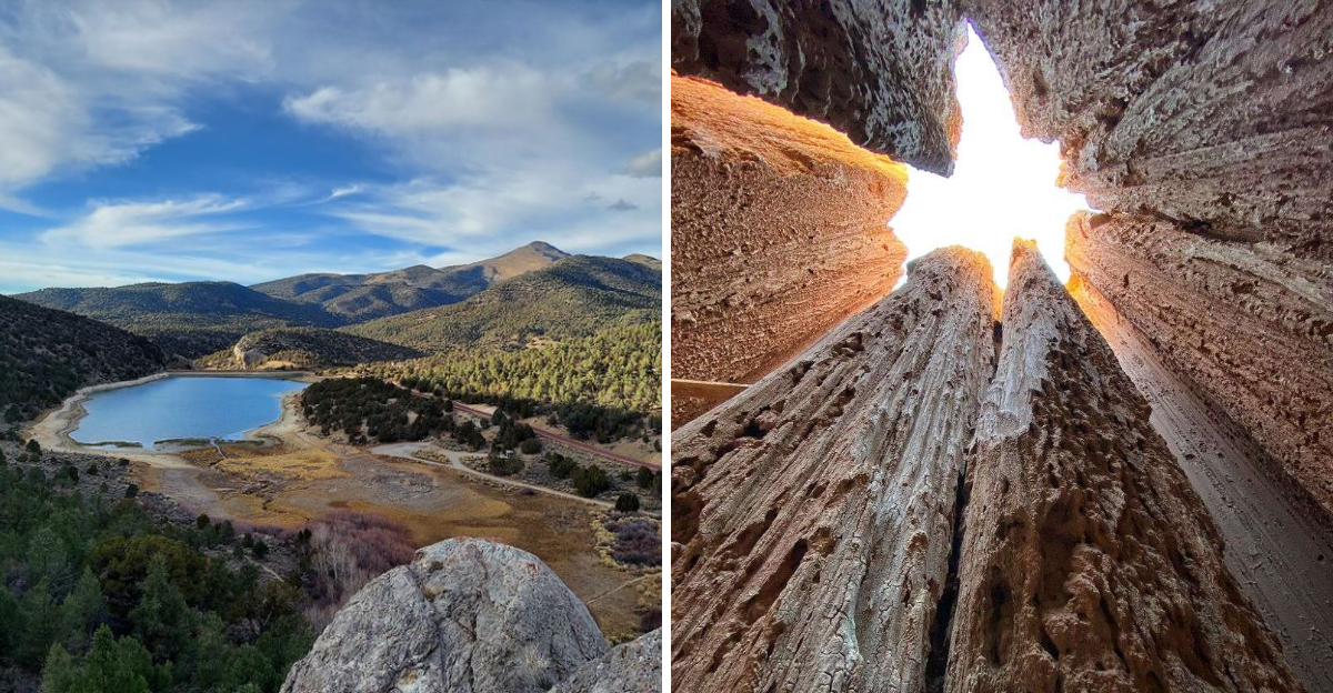
Waterfalls tumble behind sagebrush hills just minutes from downtown streets. Ancient carvings cover canyon walls older than memory itself.
Steam rises from pools sitting deep below towering red cliffs.
Nevada hides these trails guarding secrets most road trippers drive right past. Bighorn sheep watch quietly from limestone ledges above a rushing river.
Wild chickadees land softly on bare palms during snowy winter mornings.
A ghost town sits beside fossils from a warm ocean gone for millions of years. Fixed ropes drop hikers into steaming springs near a massive dam.
Clay spires glow gold when sunset hits the canyon floor just right.
Nevada rewards anyone curious enough to leave the highway behind for good. Pack extra water, grab a trail map, and start marking dates on next year’s calendar.
1. Kings Canyon Waterfalls Trail
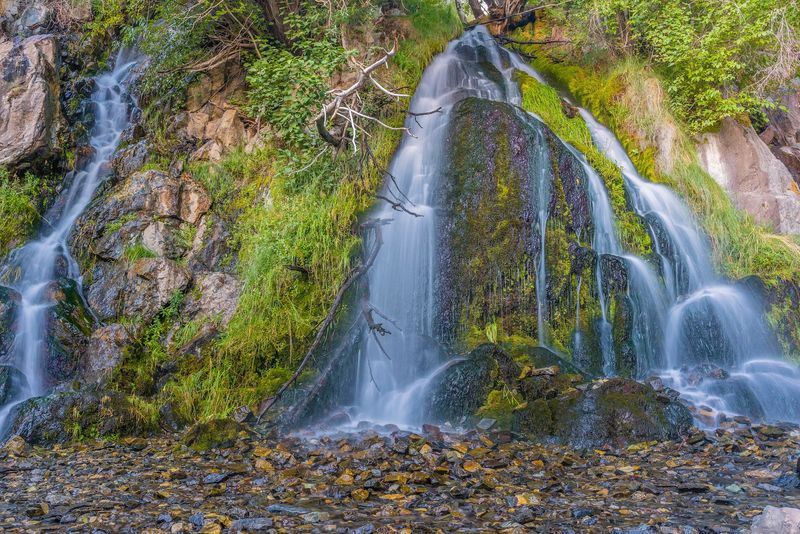
Ten minutes from a state capital, and suddenly you hear falling water. Kings Canyon pulls off that trick beautifully.
The trail starts on sagebrush slopes just outside downtown Carson City. Pines and firs take over as you climb.
Look back and you will spot the Virginia Range, Washoe Lake, and rooftops below. The views come free with very little effort.
The star is a cascading waterfall roughly 25 to 30 feet tall. Spring is the smart season, when snowmelt gives the falls real power.
Kings Canyon carried travel and freight traffic back in the late 1800s. The old route still feels well worn underfoot.
Reaching the lower falls takes about a quarter mile of easy walking. Kids and casual hikers handle it without complaint.
Want more? Push past the lower falls onto the upper loop.
That extension runs roughly four miles with steeper pitches and thicker tree cover. You may find quieter cascades along the way.
Shade stays scarce until you reach the water, so sunscreen matters here. Carry more water than you think you need in summer.
Go early, and the canyon feels like your own private backyard.
Kings Canyon Rd, Carson City, NV 89703
2. Prison Hill Recreation Area North Loop Trail
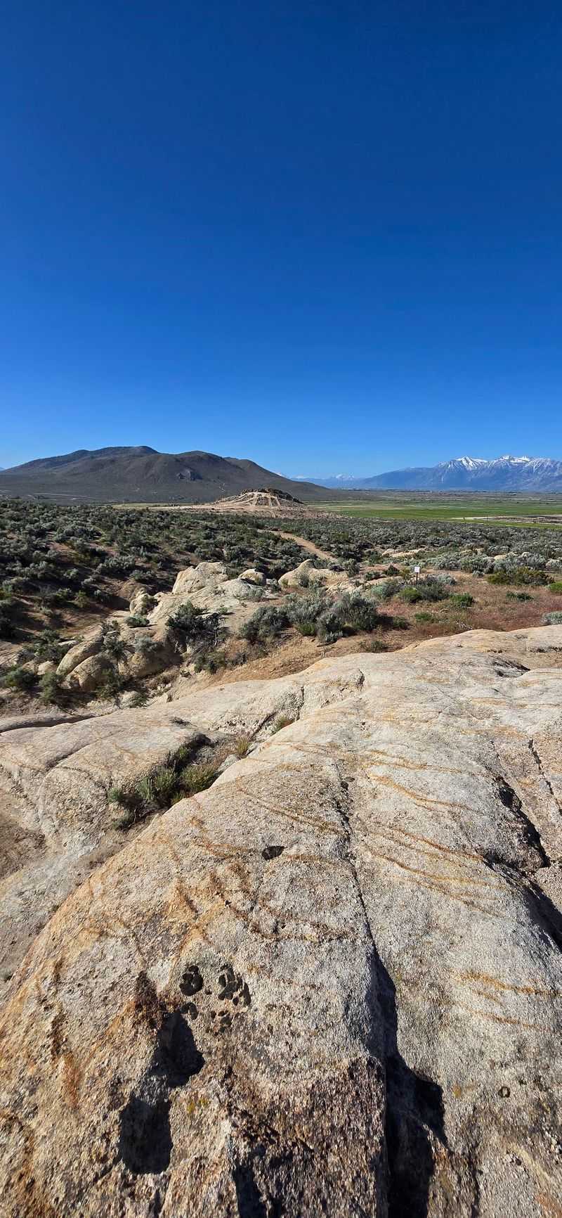
Big views, short drive, zero crowds. Prison Hill delivers all three on a good morning.
The recreation area covers roughly 2,500 acres right beside Carson City. Locals treat it like a giant outdoor gym.
North Loop Trail runs about 2.1 to 2.2 miles of singletrack. Rate it moderate, with a few rocky, technical patches that keep you alert.
Climb a little and the panorama opens up fast. Downtown Carson City, the Carson Range, Eagle Valley, the Carson River, and the Pine Nut Mountains all show up.
Rock formations break up the sagebrush and give the route character. Photographers love the low light here.
Wildlife sightings happen often. Coyotes, rabbits, hawks, and deer move through regularly, and golden eagles have nested in the higher outcrops.
Motors stay out. Hikers, mountain bikers, and horseback riders share the trails instead.
Volunteer groups have improved several routes in recent years. Signage keeps getting better.
A brush fire in 2021 scarred parts of the northern section. Vegetation is still recovering, so stick to marked paths.
Bring sun protection. Shade barely exists out here.
Finish the loop, look back at the ridge, and you will already be planning a return lap.
Carson City, NV 89701
3. Chickadee Ridge Trail At Tahoe Meadows
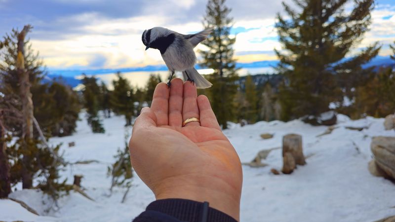
A wild bird landing on your palm sounds like a fairy tale. Chickadee Ridge makes it happen in real life.
The trail leaves from Tahoe Meadows along the Mount Rose corridor near New Washoe City. Lake Tahoe glitters in the distance once you gain the ridge.
Mountain chickadees here have grown famously bold. Hold out sunflower seeds, stay still, and one may hop right onto your hand.
Difficulty sits between easy and moderate. Families manage it, though snow changes the math.
Winter is the headline season. Snowshoes help enormously, and the bird encounters feel most magical against fresh powder.
Spring and summer flip the scenery completely. Meadows turn green, wildflowers pop, and snowmelt streams thread through the grass.
The route connects into the larger Tahoe Rim Trail system. You can extend your day easily if energy allows.
Leash your dog. Loose pets scatter the birds and ruin the moment for everyone.
Parking fills quickly on clear weekends. Arrive early and dress in layers, because ridge wind bites.
Bring a small bag of seed, patience, and a camera you can operate with gloves on.
Few Nevada hikes end with feathers brushing your fingertips.
Mt Rose Hwy, New Washoe City, NV 89704
4. South Fork Canyon Trail, South Fork State Recreation Area
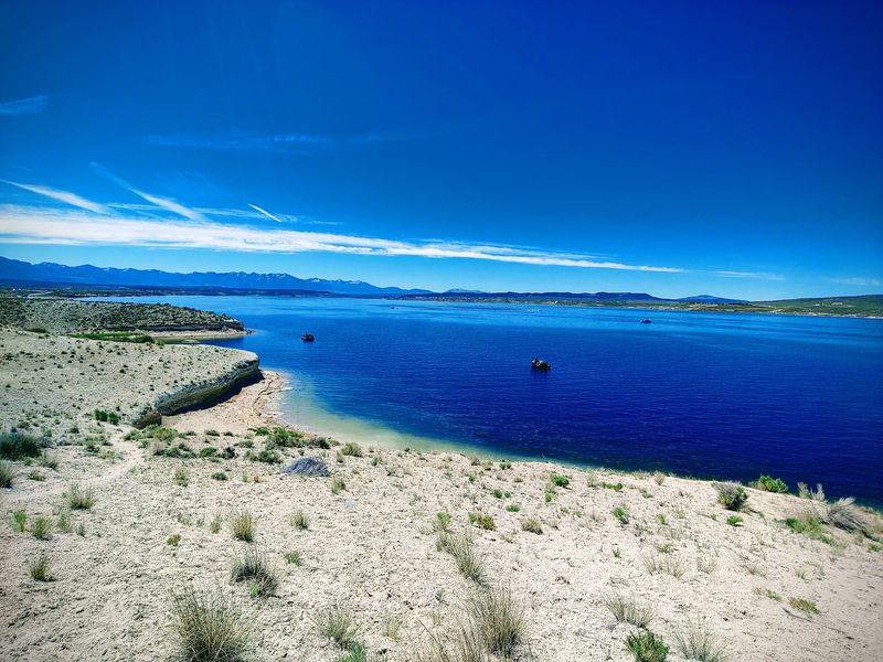
Elko County hides a river canyon most road trippers never notice. South Fork Canyon sits below the main reservoir dam near Spring Creek.
The Bureau of Land Management oversees this stretch. Access to the South Fork River comes easy from here.
Limestone cliffs tower over the water. Desert wilderness spreads out in every direction, raw and quiet.
Floating draws plenty of visitors. Tubes, kayaks, and canoes all work when flows cooperate.
Spring runoff usually brings the best water levels. Later in the season the river drops considerably.
Walking the canyon rewards patient eyes. Wildlife moves along the riparian corridor, especially near dawn.
History runs through here too. The Hastings Cutoff, part of the California National Historic Trail, crossed this ground with westbound settlers.
Standing in that canyon, you can picture wagons picking their way along the water.
Roads beside the river stay primitive. Skip them during wet weather unless you enjoy mud rescues.
Cell service is unreliable, so tell someone your plan. Carry extra water and a paper map.
Camping and fishing opportunities exist nearby at the recreation area.
Come for the float, stay for the cliffs, and leave with sand in your shoes and stories worth telling.
353 Lower South Fork Rd, Spring Creek, NV 89815
5. Cave Lake State Park
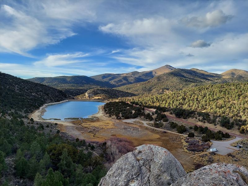
Pine trees and blue water at 7,300 feet. Eastern Nevada surprises people who expect nothing but sagebrush.
Cave Lake State Park sits in the Schell Creek Range outside Ely. The centerpiece is a reservoir of roughly 32 acres.
Limestone cliffs and thick pine forest ring the shoreline. Reflections on calm mornings look almost painted.
Trails suit every ability level. Easy lakeside strolls work for beginners, while steeper climbs reward stronger legs.
The Cave Lake Loop runs close to 3.9 miles. Sagebrush, pines, and rocky outcrops trade places along the way.
Summer brings fishing, boating, and camping. Trout anglers show up regularly.
Winter transforms the whole park. Ice fishing, snowshoeing, and cross-country skiing take over once temperatures drop.
Elevation matters here. Pace yourself if you arrived from sea level yesterday.
Nights get cold even in summer, so pack an extra layer for camping. Afternoon storms can roll through quickly in late summer.
Crowds stay light compared with parks closer to Las Vegas. That solitude is the real draw.
Pair a visit with a stop in Ely and its railroad history.
Sit by the water at dusk, and you will understand why locals guard this place.
US Highway 93 (Success Summit), Ely, NV 89301
6. Berlin-Ichthyosaur State Park
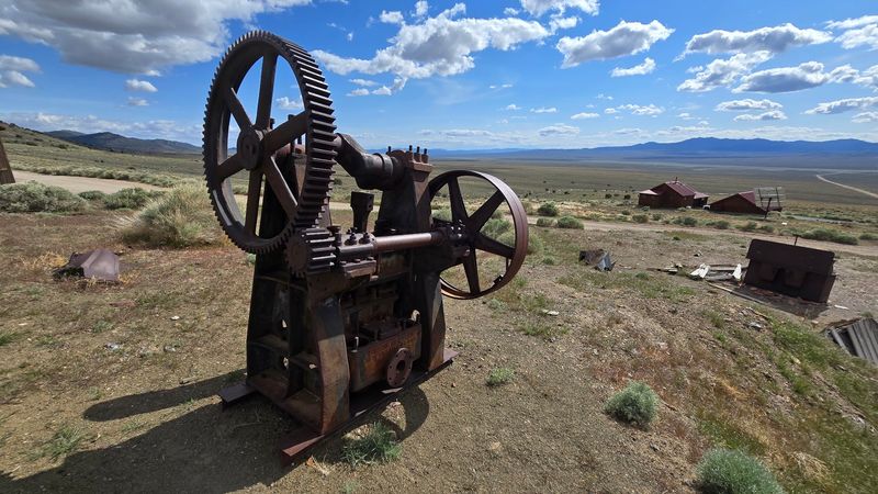
Fossils of giant sea reptiles in the middle of the desert. Nevada does not do subtle.
Berlin-Ichthyosaur State Park sits in far northwestern Nye County, reached by NV-844 out of the Austin area. The drive alone feels like an adventure.
Two attractions share one park. First comes Berlin, a preserved mining town from the 1890s.
Original buildings still stand, weathered and honest. Self-guided walks let you wander the townsite at your own speed.
Then there are the ichthyosaurs. These enormous marine reptiles swam in a warm ocean that covered Nevada around 225 million years ago.
Some of the largest specimens found in North America rest here. A Fossil House protects them where they were uncovered.
Viewing windows let you see the bones in the rock. Guided tours of the shelter are sometimes offered, though availability varies by season.
Bring supplies. Services are extremely limited out this way, and roads can be rough after storms.
Check road conditions before winter trips. Snow closes access at times.
Photographers love the late light on the old mill structures.
Mining history and prehistoric ocean creatures in one stop is a combination no other Nevada park can match.
NV-844, Austin, NV 89310
7. Sloan Canyon National Conservation Area Petroglyph Trail
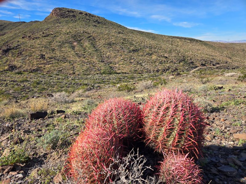
Over 300 rock art panels sit a short drive from the Las Vegas Strip. Most visitors never learn that.
Sloan Canyon National Conservation Area protects one of Southern Nevada’s most important cultural sites near Henderson. Nearly 1,700 individual petroglyphs cover the canyon walls.
Native cultures created them across a huge span of time, from Archaic through historic periods. Meanings remain debated by researchers.
Look for bighorn sheep, human figures, and abstract shapes. Once your eyes adjust, you start spotting them everywhere.
The Petroglyph Trail, also called Trail 100, runs about 4.4 miles round trip. Rate it easy to moderate.
A few dry falls require light scrambling. Sturdy shoes make the difference.
Heat is the main hazard. Outside the cooler months, temperatures climb fast and shade is basically nonexistent.
Carry far more water than feels reasonable. Start at first light in warm seasons.
Stop at the Visitor Contact Station before you head out. Staff share current conditions and trail updates.
Pets are not allowed on this particular trail, so plan accordingly.
Never touch or trace the carvings. Skin oils damage them permanently.
Walk out slowly, and the desert quiet stays with you long after the parking lot.
Nawghaw Poa Rd, Henderson, NV 89052
8. Goldstrike Canyon Hot Springs Trail
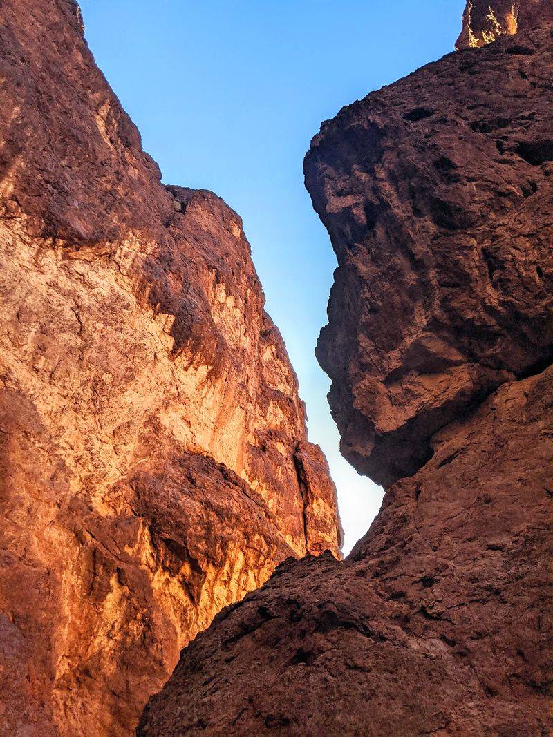
Ropes, boulders, and steaming pools. Goldstrike Canyon is not a casual afternoon walk.
Experienced hikers only, and I mean that. The route drops steeply into a dramatic red rock canyon outside Boulder City.
You will climb over huge boulders and use fixed ropes to descend sections around twenty feet. Class 3 scrambling shows up more than once.
Round trip runs roughly 5 to 5.5 miles with serious elevation change. Going down is easy, coming back up is the real work.
The payoff arrives as a chain of hot spring fed pools. Water temperatures generally sit between about 100 and 109 degrees Fahrenheit.
Small waterfalls and grottos hide throughout the narrows. Steam drifts through the rock in winter.
Keep going and the canyon opens to the Colorado River. That view alone justifies the sweat.
Watch the canyon walls for desert bighorn sheep. They move with alarming confidence up there.
Timing is critical. The trail closes from mid-May through September because of extreme heat.
Winter is the right season. Bring gloves for the ropes and grippy footwear.
Avoid putting your head under the water in natural hot springs.
Earn this one, and the soak feels unforgettable.
Goldstrike Pass Rd, Boulder City, NV 89005
9. Grapevine Canyon Petroglyphs Trail
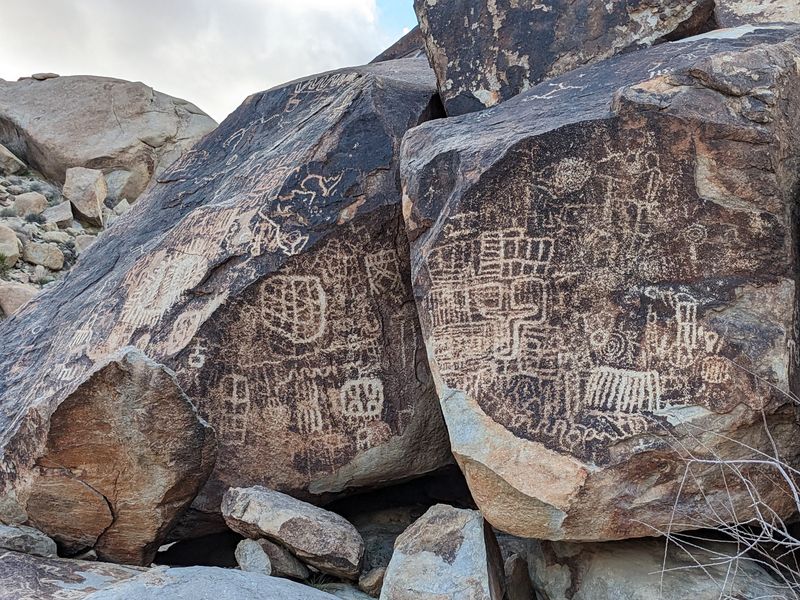
Ancient carvings, a desert spring, and shade in southern Nevada. Grapevine Canyon holds all of it.
The site sits within the Spirit Mountain area near Laughlin and Davis Dam. Indigenous peoples, including the Mojave, consider this ground sacred.
Treat it that way. Respect comes before photographs here.
The walk is short and easy, following a sandy wash. Loose sand is the only real challenge.
Petroglyphs appear on boulders as the canyon narrows. Estimates place many of them at over 800 years old.
Symbols include bighorn sheep, lizards, and abstract designs. Researchers still debate what most of them mean.
Keep walking and the scenery shifts dramatically. A freshwater spring supports cottonwoods and wild grapevines, which is exactly how the canyon earned its name.
Birds gather around that greenery. Sit quietly and you will hear plenty of activity.
Cooler months make the best visits. Summer heat out here is unforgiving.
Never touch the rock art or add chalk of any kind. Oils and marks cause lasting harm.
Christmas Tree Pass Road can be rough, so check conditions before driving it.
Leave the carvings exactly as you found them, and the next generation gets the same goosebumps you did.
Christmas Tree Pass Rd, near Laughlin/Davis Dam, NV 89046
10. Cathedral Gorge State Park, Miller Point And Eagle Point Trail
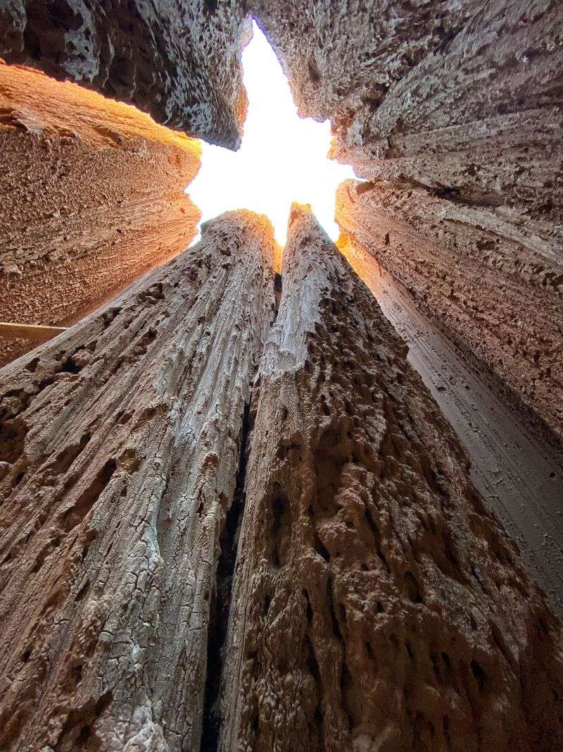
Clay spires, narrow slots, and a landscape that looks borrowed from another planet. Cathedral Gorge State Park sits near Panaca in southeastern Nevada.
Erosion carved soft bentonite clay into cathedral-like formations, hoodoos, and towering fins. Every rainstorm reshapes the details a little.
The slot canyons steal the show. Squeeze into the narrow passages and the walls close in above you.
Some visitors call them caves. Bring a headlamp and expect clay dust on your clothes.
Miller Point Overlook delivers the widest view of the gorge below. A stone gazebo built by the Civilian Conservation Corps in the 1930s marks the spot.
Eagle Point offers another strong vantage. Sunset light turns the formations warm gold.
The park holds roughly 6 to 9 miles of trails. Hiking, picnicking, camping, and photography all thrive here.
Geology fans get a bonus story. The area was once a Pliocene freshwater lakebed, later sculpted by volcanic activity and millions of years of erosion.
Avoid the slots during rain, since clay turns slick and flash flooding is possible.
Nights are dark and star-filled, which makes camping worthwhile.
Come with a wide lens and low expectations of leaving quickly.
111 Cathedral Gorge State Park Road, Panaca, NV 89042