
When The Aspens Turn Gold, This Nevada Mountain Trail Becomes Simply Stunning
Leaves flip almost overnight on one Nevada mountain trail, and the whole canyon seems to glow for about a week.
Dark evergreens crowd every ridge, so each aspen grove burns brighter by comparison. Wind shakes the leaves loose in a papery rattle that carries for yards.
A boardwalk keeps boots dry at the start, but the ground turns sandy and steep once the canyon narrows, and creek crossings with no bridge test balance more than once.
Further down, a quiet lake waits behind an old landslide, wide valley views open without warning, and chickadees practically beg for a seat on your palm.
Nevada saves its best color for those willing to earn it, and this trail hands out more surprises the longer the hike runs.
Where The Boardwalk Begins
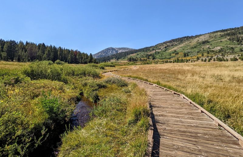
Boots stay dry for the first stretch. A wooden boardwalk carries hikers across the wet meadow at the Tahoe Meadows Trailhead, which sits along Mt Rose Hwy, New Washoe City, NV 89704.
The structure exists for a reason. Meadow soil here is fragile and holds water most of the year, so the planks protect plants that recover slowly from footsteps.
Small ponds and trickles of water sit scattered across the open ground. Twisted, wind-shaped trees line the edges, looking older than they probably are.
Signs mark sections closed for preservation, and stepping around them defeats the whole point. Staying on the designated route keeps this part of the Ophir Creek Trail intact for the next visitors.
The flat surface makes the opening portion friendly for mixed groups and shorter legs. Families often stop here without going any deeper into the canyon.
Parking happens along the wide highway shoulder on a space-available basis, so careful positioning matters with traffic passing.
A short loop through the meadow takes well under an hour and still delivers wide forest views.
A Descent That Tests The Knees
Downhill is not automatically easy. The full Ophir Creek Trail runs roughly six to seven miles one way, dropping something in the range of 2,000 to 2,500 feet toward Davis Creek Regional Park.
Starting from the higher Tahoe Meadows end means a long descent. That sounds pleasant until loose sand and rock start sliding underfoot.
Trekking poles help more than most people expect. Several reviewers mention slipping on sandy sections during the downhill stretch.
Footwear with real tread matters just as much. Rocky, uneven ground shows up in patches rather than all at once, which catches people off guard.
A one-way hike also needs a plan for getting back. Without a shuttle vehicle waiting at the lower end, the return climb becomes the real workout.
Plenty of visitors skip the full route entirely. Walking partway in and turning around still delivers the aspen groves and wide valley views.
Rest breaks come easy along here, since almost every bend offers a decent excuse to stop and look around.
Know the limits before committing to the whole thing.
Creek Crossings And Cold Feet
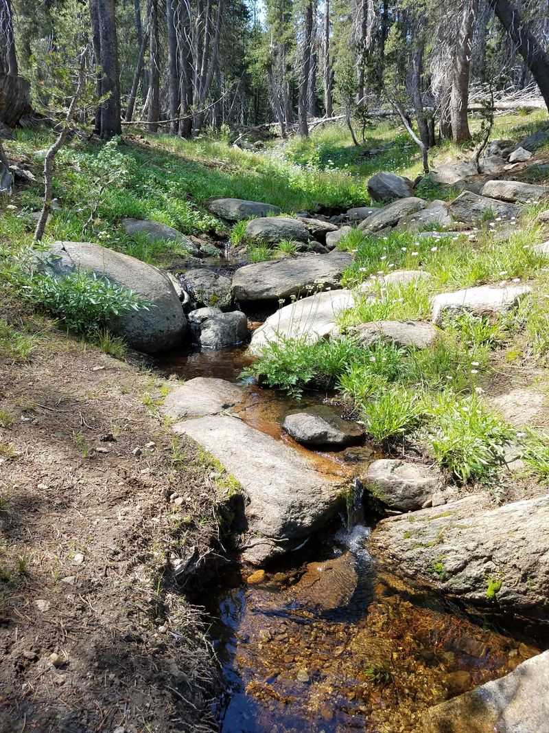
Wet socks are part of the deal. Ophir Creek runs alongside much of the trail, and several crossings have no bridge at all.
Water levels change with the season. Spring melt makes the crossings pushier, while autumn usually brings lower, friendlier flows.
Some hikers carry a spare pair of socks specifically for this. Others just accept the situation and keep walking.
The creek does more than complicate the route. Constant moving water fills the canyon with sound, which softens the effort of the climb.
Fish have been spotted in the flowing sections, and the streamside vegetation grows thicker and greener than the surrounding forest. That corridor of moisture supports a different set of plants entirely.
Rocks near the water stay slick, so slow steps beat confident ones. A wobbly ankle six miles from the car ruins an otherwise excellent day.
Following the creek also makes navigation simpler on the Ophir Creek Trail, since the water offers a rough sense of direction through wooded stretches.
Cold toes fade fast. The memory of the canyon sticks around much longer.
Golden Aspens Steal The Whole Show
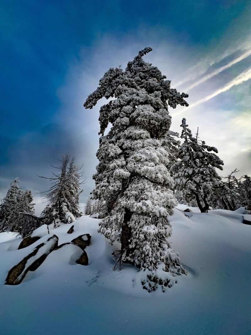
Gold does not last long up here. Quaking aspens along the Ophir Creek Trail flip from green to bright yellow over a matter of days, sometimes faster after a cold snap.
The effect works because of contrast. Dark evergreens crowd in on every side, so each aspen grove glows like a lamp switched on in a dim room.
Wind adds the soundtrack. Aspen leaves are attached by flat stalks, which makes them tremble at the slightest breeze, hence the name quaking aspen.
Photographers usually get the best results early or late in the day, when low light passes sideways through the leaves. Midday sun tends to flatten everything out.
Peak color generally arrives around early to mid October, though weather decides the exact timing every year. An early storm can strip branches bare in one afternoon.
Groves appear in patches rather than in one solid band, so a slow pace pays off. Rushing past means missing the smaller pockets tucked into folds of the hillside.
Anyone hoping for that classic Nevada autumn photo should plan a flexible window rather than a fixed date.
Washoe Valley Spread Out Below
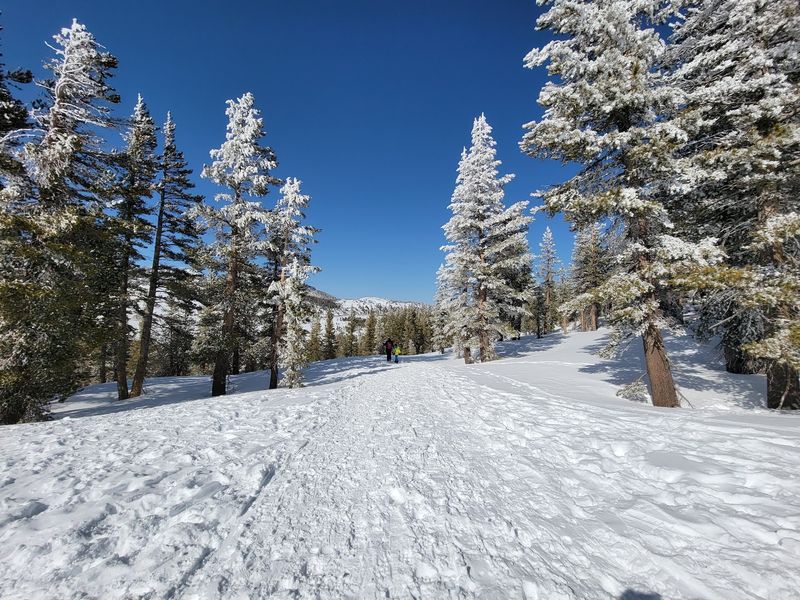
The view arrives without warning. Trees part along the eastern flank of the Carson Range, and suddenly Washoe Valley opens up far below.
Washoe Lake sits at the center of it. On calm days the surface throws light back toward the ridge in a wide, bright sheet.
Distant Sierra Nevada peaks fill the background, giving the whole scene a sense of depth that photos rarely capture properly. Height does most of the work here.
These openings appear at intervals rather than continuously. Sections of the Ophir Creek Trail run under thick tree cover, then break loose again at a rocky bend.
Some of the higher lookout points reportedly reveal Lake Tahoe off in the distance. Clear air helps, and autumn often provides it.
Exposed viewpoints also mean exposed hikers. Wind picks up on open slopes, and the lower end of the trail catches the most of it.
A hat and a windbreaker handle both sun and gusts. That small bit of preparation turns a chilly overlook into a comfortable lunch spot worth lingering at.
Upper Price Lake Hides In Plain Sight
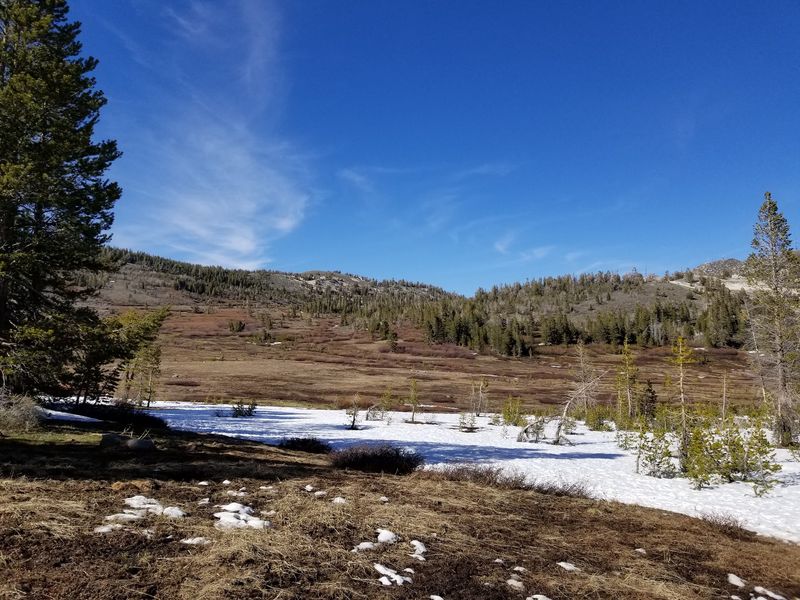
Deeper in, the reward changes shape. Hikers who continue along the Ophir Creek Trail eventually reach Upper Price Lake, a quiet pocket of water in otherwise rugged terrain.
Its setting tells a story. The lake sits beneath a massive landslide, and the debris field around it makes the origin obvious even to non-geologists.
Still water reflects whatever surrounds it. During peak color, that means gold and rust tones doubled across the surface.
Traffic thins out considerably by this point. Reaching the lake takes real effort, which naturally filters the crowd.
The spot works well for a long break. Rocks provide seating, and the silence out here feels heavier than it does near the trailhead.
Anyone planning to reach the lake should carry more water than seems necessary. There is no treated water anywhere along the route, and mountain streams need filtering.
Turning back from here makes a solid out-and-back day rather than a full one-way traverse.
Quiet places like this one tend to rearrange a person’s mood before the walk back even starts.
Chickadees That Land On Your Hand
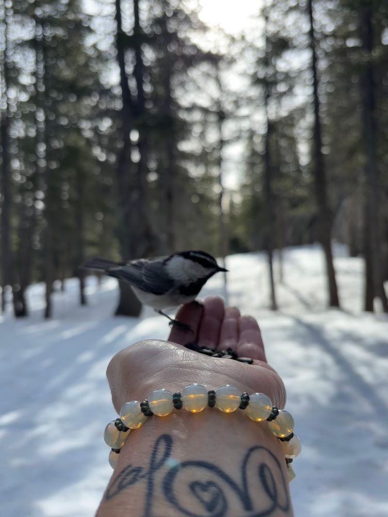
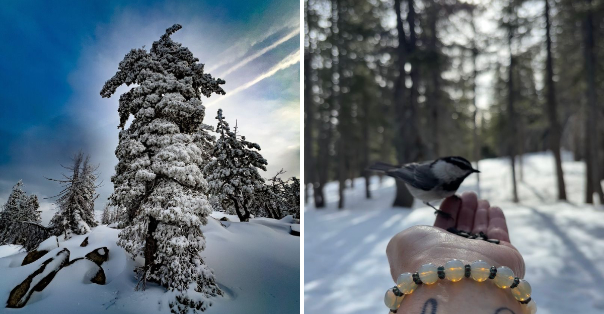
Birds here have figured out humans. Near Tahoe Meadows, mountain chickadees are famous for landing on outstretched palms holding seed, especially in winter.
The behavior draws visitors up the ridge in cold months. Standing still with an open hand is apparently the whole technique.
Autumn brings its own cast of characters. Pine Grosbeaks, Red Crossbills, and Evening Grosbeaks work the conifers, while warblers and the odd American Dipper favor the creek corridor.
Dippers are the strange ones. They actually walk underwater along stream bottoms hunting insects, which is a genuinely odd party trick for a songbird.
Larger animals share the Ophir Creek Trail too. Deer move quietly through the underbrush, and squirrels and chipmunks handle all the noise.
Juncos, white-crowned sparrows, and Mountain Bluebirds turn up at higher elevations. Binoculars earn their weight on this trail.
Feeding wildlife beyond the chickadee tradition is not a great idea, and dogs should stay under control near the meadow.
Patience beats persistence out here. Sitting quietly for ten minutes usually produces more sightings than an hour of walking fast.
Granite, Landslides And Ancient Chaos
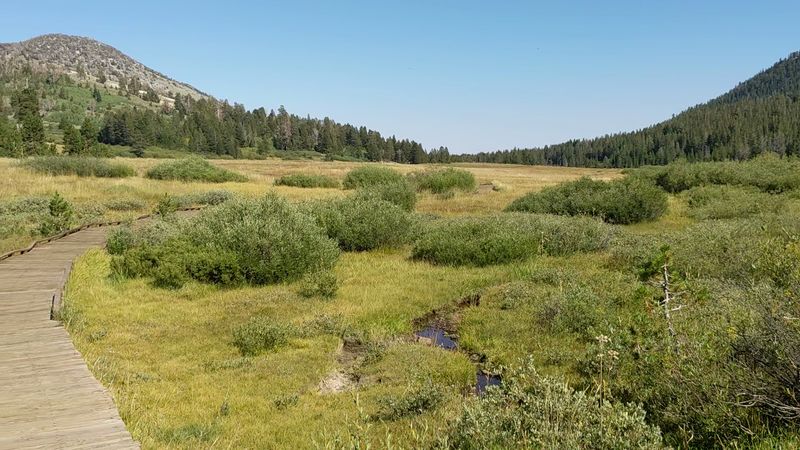
The rocks did not get here politely. Granite dominates the terrain around the Ophir Creek Trail, broken up by clear evidence of past landslides off Slide Mountain.
Names sometimes say everything. Slide Mountain has shed material downslope more than once, and the canyon still wears the scars.
Upper Price Lake owes its existence to one of those events. A slide blocked the drainage, and water pooled behind the debris.
Walking through the affected zones feels different from walking through mature forest. Rock piles, scoured channels, and younger trees mark where the mountain rearranged itself.
Geology also explains the trail’s sandy, gritty sections. Weathered granite breaks down into coarse decomposed grit that slides underfoot.
Autumn light hits the pale rock hard, which makes the golden aspens growing among boulders look even more vivid. Contrast does all the heavy lifting.
None of this requires a science background to appreciate. The landscape essentially shows its own work.
Curious hikers who look up at the slopes instead of just down at the path notice patterns that explain the entire canyon.
Timing The Peak Color Window
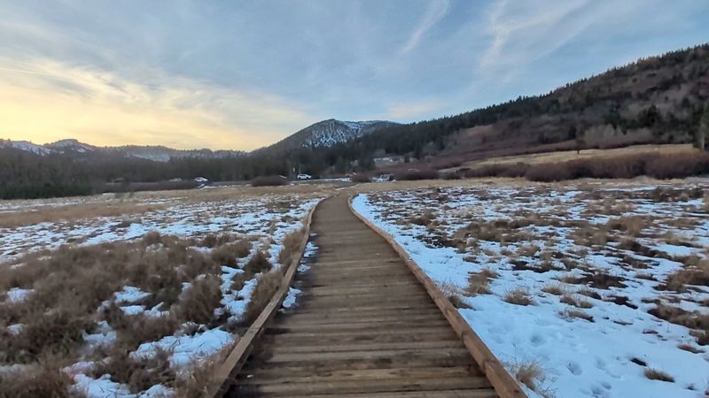
Guessing wrong costs the whole trip. Aspens along the Ophir Creek Trail generally reach their brightest around early to mid October, though seasonal weather shifts that window.
Warm, dry autumns can delay the change. Cold nights tend to speed it up dramatically.
Higher elevations usually turn before lower ones. That means a mid-elevation hike sometimes catches two stages of color in a single outing.
Snow is a real possibility even in October up near Tahoe Meadows. Small patches have been noted on the trail at the start of the month.
Layers solve most of it. Mornings run cold at this elevation while afternoons can feel almost warm in direct sun.
Weekdays offer thinner crowds than weekends, and early starts beat the midday parking scramble along the highway shoulder.
Checking recent trail conditions before driving up saves frustration, particularly with construction projects reported near the trailhead affecting access.
Flexible plans work best for chasing color anywhere in Nevada. Locking in a single date months ahead is mostly a coin flip.
Fortune favors the hiker who watches the forecast.
Practical Notes Before The Boots Go On
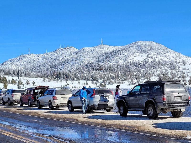
Preparation beats improvisation. The Tahoe Meadows Trailhead offers parking and vault restrooms, but no drinking water, so hikers need to carry everything they plan to drink.
Roadside parking fills up. Weekend mornings in fall get busy, and arriving early avoids circling for a shoulder spot.
Valuables belong out of sight. Vehicle break-ins have been reported in the general area, which makes an empty-looking car the smarter choice.
The Ophir Creek Trail shares space with mountain bikers and horseback riders on some sections. Yielding politely keeps everyone moving.
Cell coverage in mountain canyons is never guaranteed. Telling someone the planned route is basic sense.
Sun exposure surprises people at elevation. Parts of the trail run open, so sunscreen and a hat belong in the pack even in autumn.
Dog owners will find waste stations near the meadow, and using them keeps the boardwalk area pleasant.
Construction near the trailhead has closed portions in the past, so checking current conditions before driving up is worth the two minutes.
Small details like these turn a good hike into an easy one.
Bikes, Hooves And Snowshoes Share The Route
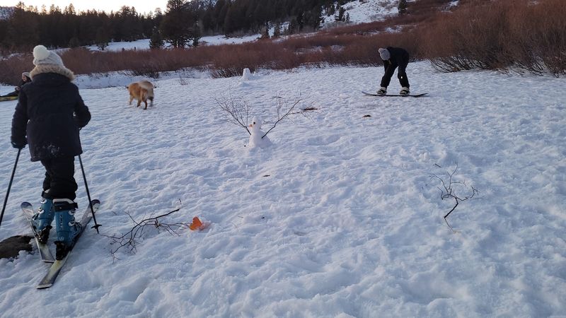
Hiking is only one option. Mountain bikers ride portions of the Ophir Creek Trail, and the steeper, rockier stretches keep things interesting for them.
Equestrians use sections as well. Wide meadow approaches and forest singletrack suit horses better than the technical descents.
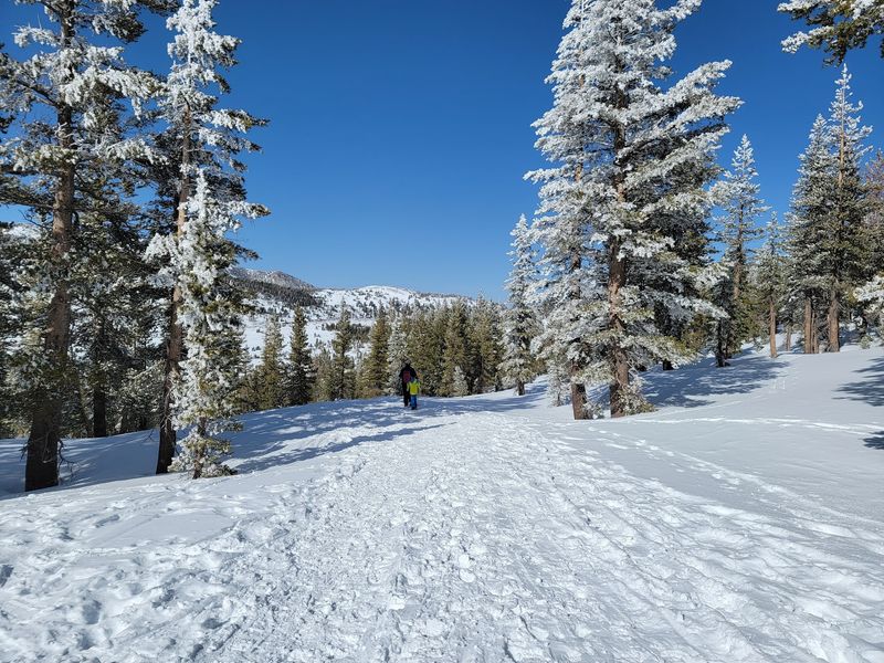
Winter transforms the place completely. Snowshoeing, cross country skiing, and sledding all happen around Tahoe Meadows once the snow stacks up.
The open flats near the road double as a sledding zone, with a short steep drop from the shoulder feeding into a long runout. Families gravitate there.
Following other people’s tracks becomes the navigation method in deep snow. Trails vanish under white, and inclines feel steeper than they look.
Fresh powder can swallow legs to thigh depth, which makes snowshoes a good call rather than an accessory.
The trailhead also connects to the Tahoe Rim Trail, opening up longer routes through the Humboldt-Toiyabe National Forest.
Year-round access means the same parking pullout serves autumn leaf-watchers and winter sledders alike. Few spots in Nevada pull double duty this well.
The Highway That Sets The Mood
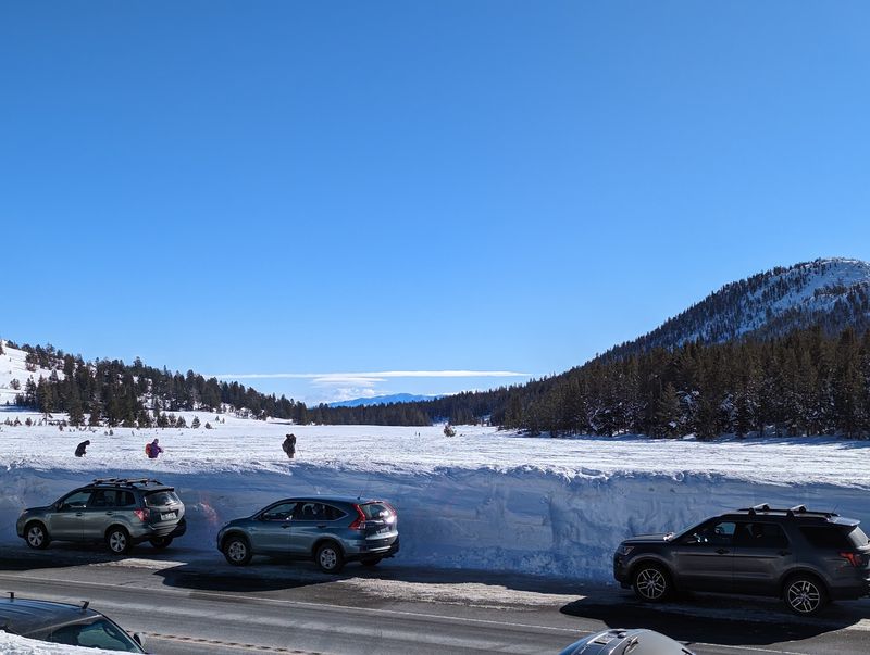
The drive earns its own applause. Mount Rose Highway, officially Nevada State Route 431, climbs roughly 25 miles between Reno and Lake Tahoe.
Scenery changes as the road gains elevation. High desert sagebrush gives way to dense alpine forest in a surprisingly short distance.
Pullouts along the way invite stops. Views reach out over Washoe Valley on one side and toward the Lake Tahoe Basin on the other.
Trailhead access sits right off this highway, which makes the Ophir Creek Trail an easy add-on for anyone traveling between Reno and the lake.
Some visitors stop for just 45 minutes to walk the meadow loop, then continue driving. That works fine.
Mountain weather affects the road. Snow and ice arrive early at these elevations, and conditions can shift quickly in late autumn.
Approaching by car in the golden season means the color show starts before the parking brake goes on. Aspen pockets appear along the roadside too.
Nevada packs a lot into this one stretch of pavement, and the trail at the top is the payoff.