
9 Forgotten Tennessee Ruins With Dark Histories Worth Exploring
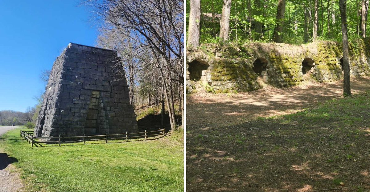
Ruins have a strange pull. You know the story may be grim, yet you still want to see what was left behind.
Tennessee is full of places where stone walls, old furnaces, abandoned foundations, and forgotten roads still carry pieces of the past. A few look almost peaceful now, which only makes their history feel more unsettling.
These places are not interesting because they are spooky for the sake of it. Their stories involve mining disasters, convict labor, war, vanished communities, and industries that disappeared almost as quickly as they grew.
Time has softened the edges, but it has not erased what happened there. Today, trails and parks lead visitors past structures that once shaped entire towns and livelihoods.
If you like history with a little atmosphere and a reason to look twice at every crumbling wall, these Tennessee ruins are worth seeing for yourself.
1. Elkmont And The Wonderland Hotel Ruins, Great Smoky Mountains National Park
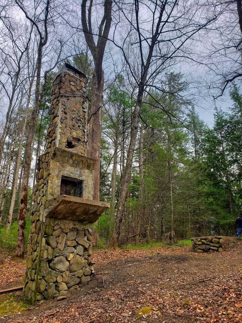
Roughly eight miles from Gatlinburg, a mountain neighborhood sits half-swallowed by forest. Elkmont started as a logging town in the 1840s under the name Little River.
A railroad later turned it into a fashionable summer escape.
The Wonderland Hotel opened in 1912, built by the Wonderland Club Company. Guests came for mountain air, big meals, and long porch afternoons.
Around 1910 the Appalachian Clubhouse appeared, and rustic cottages filled a section called Daisy Town.
When Great Smoky Mountains National Park was created in 1934, families chose between selling their land or holding lifetime leases. Most leases ended in 1992, and the empty buildings slowly gave in to weather.
The hotel itself eventually came down after years of decay.
What remains feels oddly peaceful. Stone walls, chimneys, and foundations line the trails, with moss doing most of the decorating.
Near the old hotel site, a fountain and overgrown entrance steps still hint at grander days.
The National Park Service has restored 19 significant structures here, so visitors can actually walk through preserved cabins. Little River and Jakes Creek run nearby, perfect for fishing or cooling your feet.
Come early if you want parking, especially in summer. Bears, deer, and elk roam this corner of Tennessee, so keep your distance and your snacks packed away.
2. Lone Rock Stockade And Grundy Lakes Coke Ovens, Tracy City
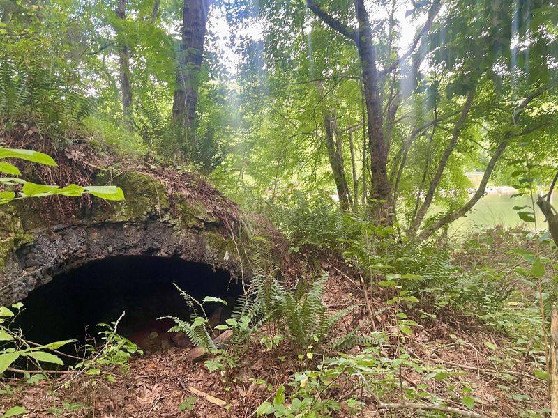
Few picnic spots carry a heavier backstory than this one. On the edge of Tracy City, the Grundy Lakes Historic District holds the remains of an industrial chapter tied to Tennessee’s convict leasing system, used from 1871 to 1896.
The Tennessee Coal, Iron, and Railroad Company ran mines and ovens here, leasing prisoners from the state to work them. Lone Rock Stockade housed those workers.
Around 1883, the company built roughly 130 beehive coke ovens to turn local coal into fuel for the steel industry.
Free miners in the area objected strongly, since the system undercut their own jobs. On August 13, 1892, they marched on the stockade, removed company property, took charge of the imprisoned men, and burned the building.
That clash belonged to the wider Coal Creek Wars, which pushed the state to end convict leasing in 1896.
After mining wrapped up, the land was donated to Tennessee. In the 1930s the Civilian Conservation Corps built four lakes, planted trees, and shaped the park you see today.
Paved paths make the ovens easy to reach, and many still show original firebrick. Trunnel heads used for loading coal sit nearby.
Bring a swimsuit, a fishing rod, and binoculars. History and recreation share the same shoreline here.
3. Laurel Snow Mining Ruins, Dayton
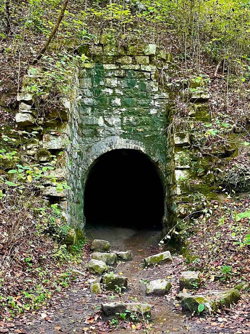
Waterfalls get the attention here, but the stonework tells the better story. Inside the Laurel-Snow State Natural Area near Dayton, in Rhea County, old industry hides along more than ten miles of trail.
The Dayton Coal and Iron Company began operations in 1882. An English businessman, Sir Titus Salt, had bought a huge tract of land in the region back in 1877, including the ground this operation later filled.
At its height, the company ran seven coal mines, 375 coke ovens, two blast furnaces, seventeen miles of railway, and about 200 worker houses. Coal from mines along Richland Creek became coke, which fed the furnaces.
The late 1880s and 1890s were the busiest years.
By the 1920s the work stopped and the forest moved in. The company had filed for bankruptcy in 1913.
Bowater later gifted the land to the state for recreation and preservation.
Hikers pass an arched ventilation shaft near the path, plus a larger stone arch that once opened into the Dixon Slope Mine. Railroad trestle remains, concrete footings, and old pipes appear along the way.
Laurel Falls drops 80 feet and Snow Falls about 35. Overlooks at Buzzard Point and Bryan Overlook reward the climb with valley views.
4. Dunlap Coke Ovens, Dunlap
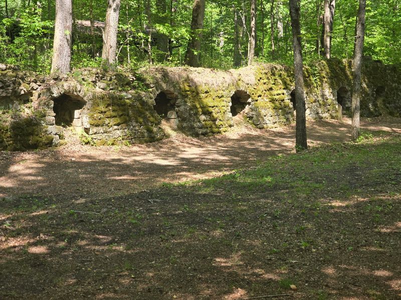
Two hundred sixty-eight brick-lined ovens sit under the trees here, and that number alone is worth the detour.
The Historic Dunlap Coke Ovens Park spreads across 88 shaded acres in the Sequatchie Valley, right below the Cumberland Plateau.
Coal first came off Fredonia Mountain in 1899. By 1902, the Douglas Coal and Coke Company had built the first fifty ovens plus an incline railway to bring coal down the slope.
A company town with a commissary and clubhouse grew alongside it.
Chattanooga Iron and Coal took over in 1905, adding more ovens and a steam-powered coal washer. The coke shipped straight to Chattanooga’s foundries.
A new rail line along Little Brush Creek arrived in 1916, prompting another hundred ovens.
Falling coal prices and the Great Depression ended production in 1922, and the site was abandoned by 1928. Volunteers with the Sequatchie Valley Historical Association cleared and preserved it in the 1980s, opening the park in 1987.
The museum sits inside a replica of the 1902 commissary, filled with photographs and artifacts. Outside, sandstone shells and firebrick interiors line the paths, along with ruins of the coal washer.
Ambitious visitors can hike the 3,900-foot incline for wide valley views. Picnic tables wait at the bottom, which feels fair.
5. Cedar Grove Iron Furnace, Linden
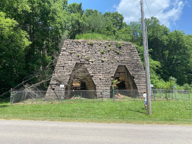
Thirty feet of hand-carved limestone still stands beside Cedar Creek, and it is the last of its kind in the state. Built between 1832 and 1834 near Linden in Perry County, Cedar Grove is Tennessee’s only surviving double-stack charcoal furnace.
Its base measures 31 by 52 feet. Builders used advanced hot blast Scottish smelting methods, which was cutting-edge technology at the time.
Iron drove much of Middle Tennessee’s economy in the 1800s, and that industry depended heavily on enslaved labor. Enslaved workers mined ore, burned charcoal, and tended the furnace itself.
At peak output the operation turned out 1,400 to 1,800 tons of pig iron each year.
Ore came from nearby Marsh Creek by mule cart. Finished iron left by riverboat from a landing on the Tennessee River, bound for markets across the South.
During the Civil War, iron meant munitions and armored vessels. In February 1862, after Forts Henry and Donelson fell, Union gunboats including the Conestoga, Tyler, and Lexington shelled the ironworks.
Operations stopped, and ironmaster William Bradley was gone from the complex. By 1883 the enterprise had faded entirely.
The site joined the National Register in 1973 and can be viewed from the road. Mousetail Landing State Park and the Buffalo River sit close by.
6. Laurel Furnace Ruins, Montgomery Bell State Park, Burns
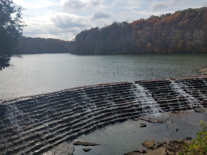
About thirty miles west of Nashville, a forest park hides the bones of an early iron empire. Montgomery Bell State Park in Burns, Dickson County, holds Laurel Furnace, established in 1815 by Robert Napier.
The land originally came to Colonel Richard Napier as a grant for Revolutionary War service. The furnace produced pig iron and hollow ware, and records from 1820 show an output of 660 tons.
Enslaved workers carried the operation, digging ore, burning charcoal, and keeping the furnace running. Water power ran the works at first, replaced by steam in the 1850s.
Production continued until the late 1850s.
The park takes its name from Montgomery Bell, often called Tennessee’s first iron master, who made cannonballs during the War of 1812. Before his death in 1855 he took steps to free many of the people he had enslaved.
Federal programs built the modern park during the Great Depression. An African American CCC unit, Company 4495, helped construct lakes and infrastructure. The park opened in 1943.
Laurel Furnace joined the National Register in 1988. Around it stretch 3,700 acres of hardwood forest and three lakes, including Lake Acorn with its sandy beach.
A replica log house and sandstone chapel mark the 1810 founding of the Cumberland Presbyterian Church here.
7. No Business Community Ruins, Big South Fork
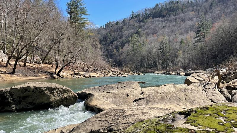
Naming a valley No Business takes a certain sense of humor.
Deep inside the Big South Fork National River and Recreation Area in Scott County, this remote settlement began in 1796 with Richard Slaven, a Revolutionary War veteran with a land grant.
His first cabin had rifle slits instead of windows.
Explanations for the name vary. Some say the isolation made settlers feel they had no business living there.
Others say outsiders had no business showing up.
The community grew past 300 residents by the late 1800s, with Crabtree, Blevins, and Boyatt families among them. People raised their own food, made their own shoes, and handled nearly everything themselves.
During Prohibition, the valley’s seclusion made it a moonshine center.
A 1933 dispute known as the Boyatt case brought serious trouble to the community, and Jerome Boyatt was later taken into custody. Isolation meant residents usually settled matters on their own.
After World War II, young men left for service and did not come back. The last resident departed in September 1960.
Today hikers find stone foundations, old washtubs, and fence remnants. The Ranse Boyatt farmstead chimney still stands, with a small burial plot nearby.
The surrounding 125,000 acres offer gorges, sandstone bluffs, and famously dark skies for stargazing.
8. Parch Corn Creek Farmstead Ruins, Big South Fork
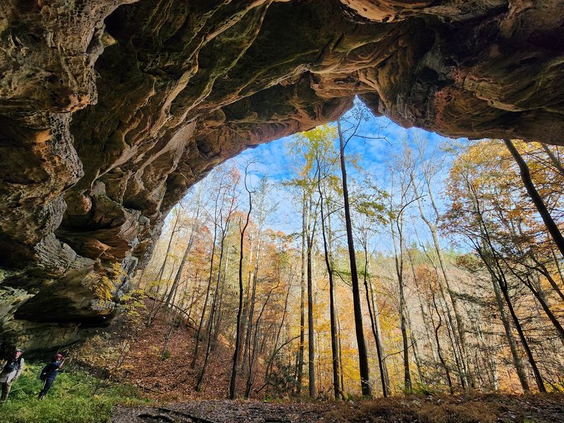
A creek with a name like Parch Corn practically demands investigation. Along its banks in Scott County, inside Big South Fork National River and Recreation Area, sit the remains of a pioneer homestead.
The Blevins family settled here around 1820, becoming one of the region’s best-known lines. In 1881, Armstead Blevins hired a young master cabin-builder named John Litton to raise the family home.
The result was a story-and-a-half single-pen log house, sixteen feet square, resting on sandstone piers. An exterior chimney of cut sandstone matched the building style common across the Cumberland Plateau.
Armstead lived there with his wife Helen and their five children.
Helen was laid to rest at Parch Corn Creek in 1913. Sons Houston and Jacob stayed on for decades, with Jacob reportedly remaining into the 1960s.
That stretched the family’s time here to roughly eighty years.
Fire destroyed the cabin in March 1998. Its tall rock chimney survived for years afterward before collapsing sometime before 2020.
Visitors today find remnant fields, chimney bases, foundations, dry stone walls, an old road, a rock ledge, and a spring. Helen’s lone grave still marks the spot.
The farmstead belongs to the proposed Big South Fork Rural Historic District. Trails through the gorge make the trip scenic as well as historic.
9. Great Western Iron Furnace, Bumpus Mills
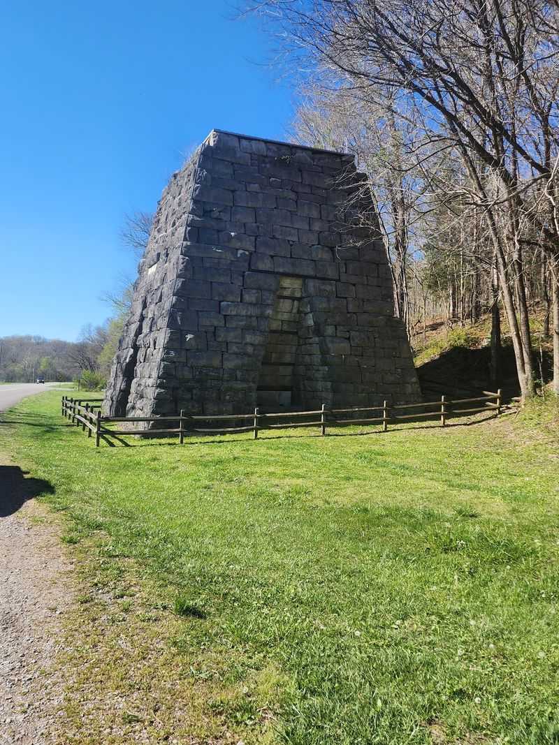
Short careers sometimes age the best. The Great Western Iron Furnace near Bumpus Mills in Stewart County ran for barely two years, which is exactly why it survives in such good shape today.
Brien, Newell, and Company built the steam cold-blast charcoal furnace around 1854 using local limestone. Inside, the stack rose about forty feet.
Workers hauled in charcoal from area timber, hematite ore from shallow local deposits, and limestone for flux.
Between 1855 and 1856, the furnace turned out 1,350 tons of high-quality iron in just 34 weeks. Then it stopped.
Financial strain, management trouble, thin ore supplies, and a national economic slump all played a part, and the works went up for sale in 1856.
Tennessee’s iron industry leaned heavily on enslaved labor, and the sale advertisement listed eighty experienced enslaved furnace hands. A historical marker notes that unrest among workers also contributed to the closure.
The furnace sat idle through 1861. After Forts Henry and Donelson fell in February 1862, Federal forces held the area for the rest of the war, and nearby roads saw plenty of military traffic.
You can find it along the Woodlands Trace National Scenic Byway in Land Between the Lakes. Interpretive signs explain smelting, and a spring just north once served the community.