
A Massive Volcano In Oregon Now Holds One Of The Most Beautiful Lakes In America
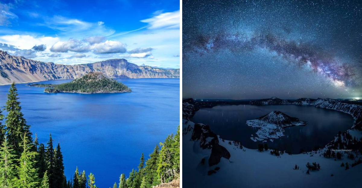
The view almost does not look real at first. Oregon has a brilliant blue lake resting inside the remains of a massive volcano. One look at the water is enough to make you stop and stare.
The scale is enormous, yet the view feels almost unreal. Few places in the state can match the drama of standing high above water surrounded by steep volcanic walls.
Oregon visitors can circle the rim, stop at overlooks, and watch the color of the lake shift as the light changes. Even photos struggle to capture how intense that blue really is.
The state has plenty of scenery worth pulling over for, but this place feels different. Knowing that a giant volcano once stood here makes the peaceful landscape even more fascinating, and the story behind that transformation is every bit as impressive as the view itself.
The Volcano That Made The Lake
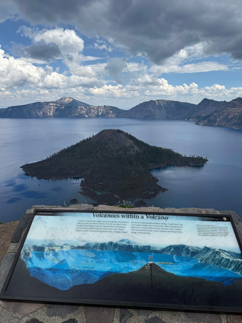
About 7,700 years ago, a mountain named Mount Mazama put on quite a show. A massive eruption emptied its insides, and the summit collapsed into the hollow space below.
What remained was a bowl-shaped basin called a caldera, roughly five miles across. Snow and rain slowly filled it over centuries, and no river has ever drained it since.
That closed system is the secret behind the water quality here. Nothing muddy washes in from streams, so the lake stays remarkably clean and clear.
Geologists consider the caldera one of the best studied volcanic features in North America. Standing on the rim, you can still read the story in the layered rock walls.
The volcano is not finished, technically speaking. Scientists classify it as dormant rather than extinct, and small features on the lake floor show past activity.
Knowing the backstory changes how the view feels. You are not just looking at a pretty lake, you are standing inside a mountain that rearranged itself.
Why The Water Looks Impossibly Blue
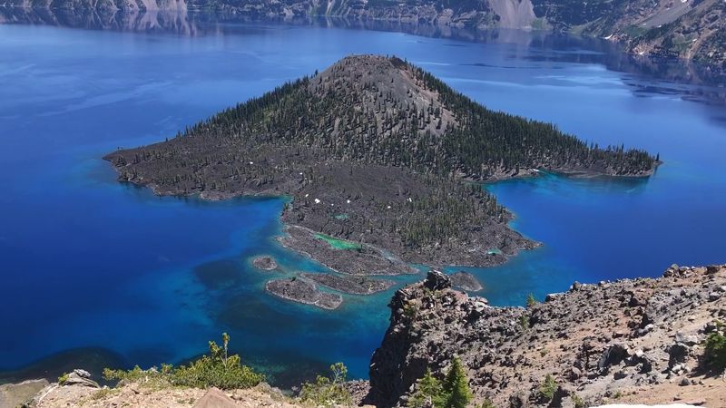
First-time arrivals often assume a filter is involved. The color really is that saturated, and physics deserves the credit.
Sunlight contains every color, and deep water absorbs the reds and yellows quickly. Blue wavelengths scatter back to your eyes, and extreme depth intensifies the effect.
Clarity matters just as much as depth. Because almost no sediment or algae clouds the water, light travels far down before bouncing back.
Researchers have measured clarity readings among the highest ever recorded for a large lake. Light has been detected more than 300 feet beneath the surface.
The shade shifts through the day, too. Morning light leans toward navy, midday brings an electric cobalt, and late afternoon softens everything to indigo.
Photographers should expect a challenge. Cameras frequently struggle to capture the intensity, which is why so many pictures look slightly underwhelming compared to the real thing.
Bring polarized sunglasses if you have them. Cutting the glare reveals color layers that ordinary lenses simply wash out.
America’s Deepest Lake, By A Wide Margin
Numbers rarely impress people standing in front of scenery, but this one lands. The maximum depth measures 1,943 feet, making it the deepest lake in the United States.
Only a handful of lakes worldwide sit deeper. On the global list, it ranks among the top ten by depth.
To picture it, imagine stacking the Empire State Building underwater with room left over. The caldera walls continue plunging well below the waterline.
The depth also keeps the lake from freezing over. Even with heavy snow above, the surface has fully frozen only a couple of times in recorded history.
Water temperature near the surface can reach the upper 50s Fahrenheit in late summer. Below about 300 feet, it holds steady around 38 degrees year-round.
Scientists have explored the bottom using submersibles and found colonies of moss growing at surprising depths. Sunlight reaching that far down makes such growth possible.
Depth turns a scenic overlook into something closer to a natural laboratory.
Rim Drive, The Road Built For Gawking
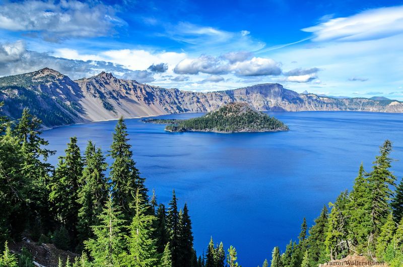
Some roads get you somewhere. Rim Drive exists purely so you can keep stopping to stare.
The loop runs 33 miles around the entire caldera, with more than 30 pullouts and overlooks along the way. Each one frames the water differently.
Plan on two to three hours minimum, though many people stretch it to a full day. Elevations along the route climb above 7,000 feet, so views stack up fast.
The west side generally sees lighter crowds and offers wide angles toward Wizard Island. East-side stops deliver dramatic cliff perspectives and more solitude.
Heavy snowfall keeps much of the loop closed for a large part of the year. Full access typically opens in early to mid-summer and lasts into October.
Check current road status before you commit to the drive. Conditions shift quickly at this elevation, even in June.
Trolley tours also circle the rim during warmer months. Letting someone else handle the driving frees you to actually look out the window.
Wizard Island Rises From The Middle
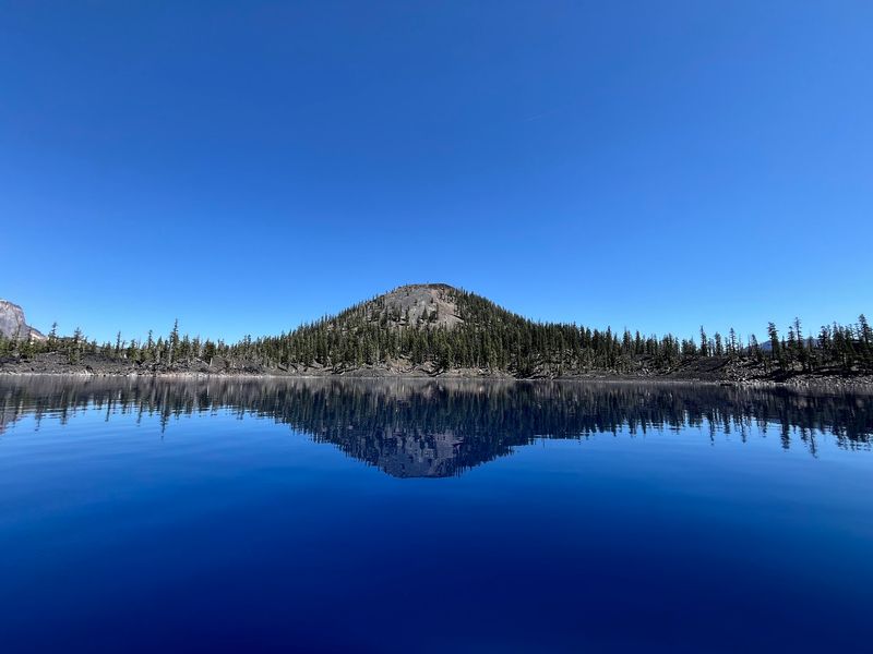
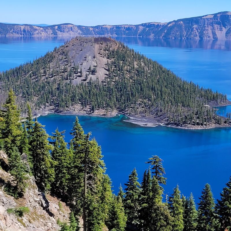
A volcano inside a volcano sounds like a tall tale. Wizard Island is exactly that, and it sits right in the western portion of the lake.
The cone formed after the caldera collapsed, built up by later eruptions. Its summit rises roughly 755 feet above the water line.
At the top sits a small crater about 300 feet wide, nicknamed the Witches Cauldron. A trail leads up through twisted whitebark pines to reach it.
Getting there requires a boat, and boats depart from a dock reachable only by trail. Space is limited, so plan ahead during busy months.
The island earned its name in the 1880s from an explorer who thought it resembled a wizard’s pointed hat. The comparison holds up surprisingly well.
From most overlooks, the cone provides essential scale. Without it, the lake would read as a flat blue plate rather than a sunken mountain.
Sunrise light hits the island first, turning its dark cinder slopes warm and gold.
Cleetwood Cove, The Only Way Down
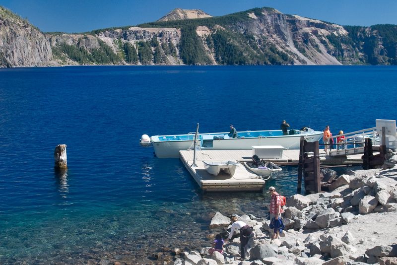
Only one legal route reaches the shoreline, and it earns every bit of its reputation. Cleetwood Cove Trail drops about 700 feet in just over a mile.
Going down feels easy and cheerful. Coming back up is the equivalent of climbing 65 flights of stairs at high elevation.
At the bottom, a rocky shoreline lets you touch the water directly. Swimmers do take the plunge, though the cold arrives instantly.
Boat tours also launch from this dock when operating. Guides explain the geology while cruising below the caldera walls, and some trips include a stop on Wizard Island.
Major rehabilitation work has affected trail and boat access in recent seasons. Always confirm current status before building your day around it.
Bring more water than seems necessary, plus a hat. Shade is scarce on the exposed switchbacks.
Even when the descent is closed, dozens of other trails remain open. Waterfalls, wildflower meadows, and rim viewpoints keep hikers busy for days.
Snow Is The Real Local Celebrity
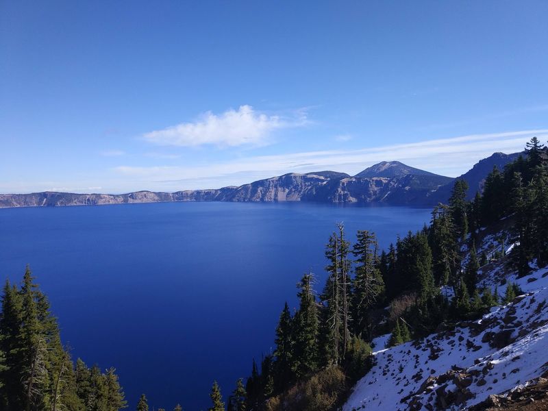
Ask anyone who has been here in May, and snow comes up before the color of the water. This is one of the snowiest inhabited places in the country.
Average annual snowfall reaches roughly 42 feet at park headquarters. Drifts along the rim can bury signs entirely.
All that snow feeds the lake. Since no rivers contribute, snowmelt and rainfall are the only water sources, balanced by evaporation and seepage.
Practical upshot for travelers, the season runs short. Many trails and roads stay buried into late June, and fresh flurries can appear any month.
Winter brings a different experience entirely. Snowshoeing and cross-country skiing replace hiking, and the south entrance road stays plowed for access.
Wildflowers explode once the snow finally retreats. Lupine, paintbrush, and monkeyflower blanket the meadows in a compressed, brilliant display.
Pack layers regardless of the calendar. Mornings can start near freezing and afternoons climb into the 70s during high summer.
Trails For Every Energy Level
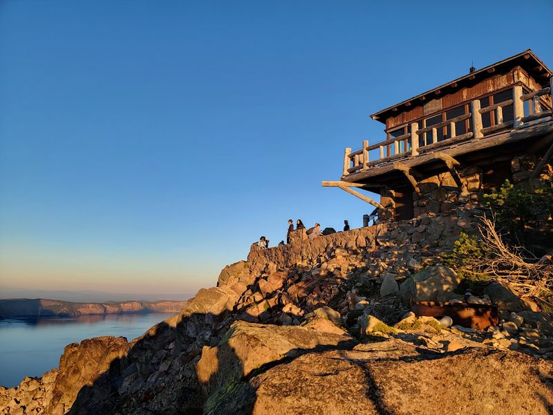
Hiking here ranges from stroll to sweat, and the payoff scales accordingly. More than 90 miles of trail thread through the park.
Garfield Peak Trail climbs from the lodge area for sweeping caldera panoramas. Roughly 3.4 miles round trip, with steady elevation gain.
Watchman Peak is shorter and steeper, ending at a historic fire lookout. Sunset from that perch faces Wizard Island directly.
Mount Scott offers the highest point in the park at 8,929 feet. On clear days, distant Cascade peaks line up across the horizon.
Not every trail involves climbing. Plaikni Falls follows a gentle path through old-growth forest to a waterfall fed by snowmelt.
Godfrey Glen provides an easy loop with canyon views and pumice spires. It suits families and anyone adjusting to the altitude.
Elevation deserves respect. Thin air makes moderate trails feel harder, so pace yourself and drink steadily.
Trail closures happen often due to snow or maintenance. Grab a current map at the visitor center before setting out.
Finding The Park And Getting Inside
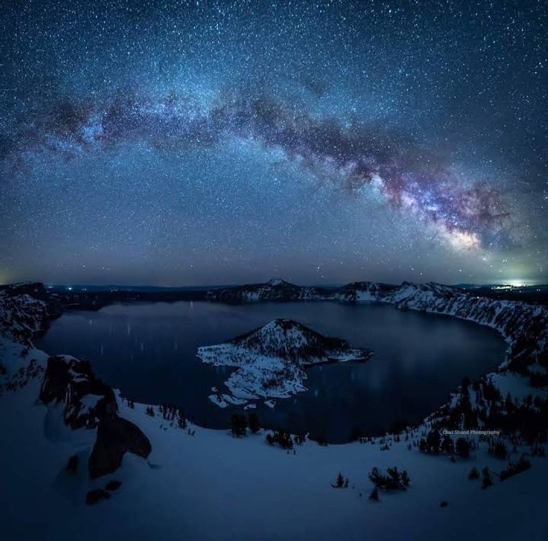
In practical terms, the caldera sits in the southern Cascades, reachable via Highway 62.
Medford lies roughly 80 miles southwest, and Klamath Falls about 60 miles south. Bend sits around 100 miles to the north.
Entrance fees run 30 dollars per vehicle in summer, valid for seven consecutive days. Individual walk-in and bicycle rates cost less.
The south entrance stays open year-round, which matters enormously in winter. The north entrance closes with the first heavy snowfall.
Steel Visitor Center near headquarters operates through most of the year. Rim Village facilities, including a gift shop and dining, run seasonally.
Cell service is unreliable throughout the park. Download maps before arriving and expect to navigate the old-fashioned way.
Fuel up before entering. Services inside are limited, and the nearest towns sit a fair distance from the rim.
Timing Your Trip Like A Pro
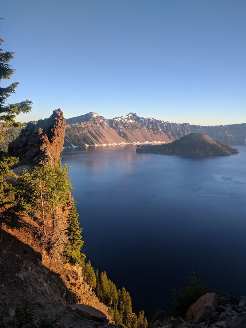
Late July through September delivers the most open roads and trails. Warm days, dry paths, and full access to Rim Drive make planning easier.
Crowds peak in those same weeks, especially midday at Rim Village. Arriving before 9 a.m. transforms the parking situation.
Early fall may be the sweet spot. Thinner crowds, crisp air, and occasional dustings of snow create postcard conditions.
Sunrise faces east across the water, and sunset lights the eastern walls. Photographers should scout their overlook the evening before.
Reserve lodging early if you want to stay inside the park. The historic lodge and nearby cabins fill months ahead.
Camping options exist near the south side during summer. Nights get cold at this elevation, so pack a warm sleeping bag.
Give yourself two days if possible. One day covers the loop drive, while the second opens time for a real hike.
However long you stay, Crater Lake tends to reset expectations about what a lake can look like.