
A short boardwalk in Northfield, Ohio, ends at 65-foot Brandywine Falls
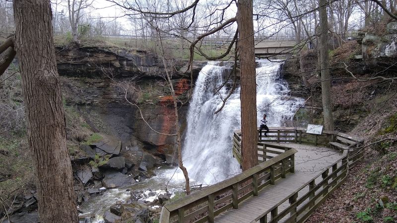
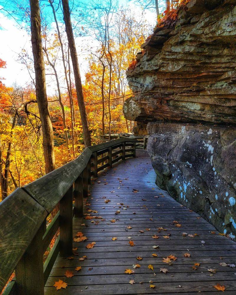
Some of the best things in Ohio don’t announce themselves. You park in an ordinary lot, follow a wooden walkway for about five minutes, and then the trees open up on a 65-foot curtain of water pouring over layered rock.
Most people who stumble onto it say the same thing: they had no idea something this dramatic was tucked into a quiet corner of Northeast Ohio. Here’s what makes the short stroll to this waterfall worth building a morning around.
Where the Boardwalk Begins
Address first, because it trips people up: 8176 Brandywine Rd, Northfield, OH 44067. The falls sit inside Cuyahoga Valley National Park, roughly between Cleveland and Akron, in an area officially known as Sagamore Hills Township.
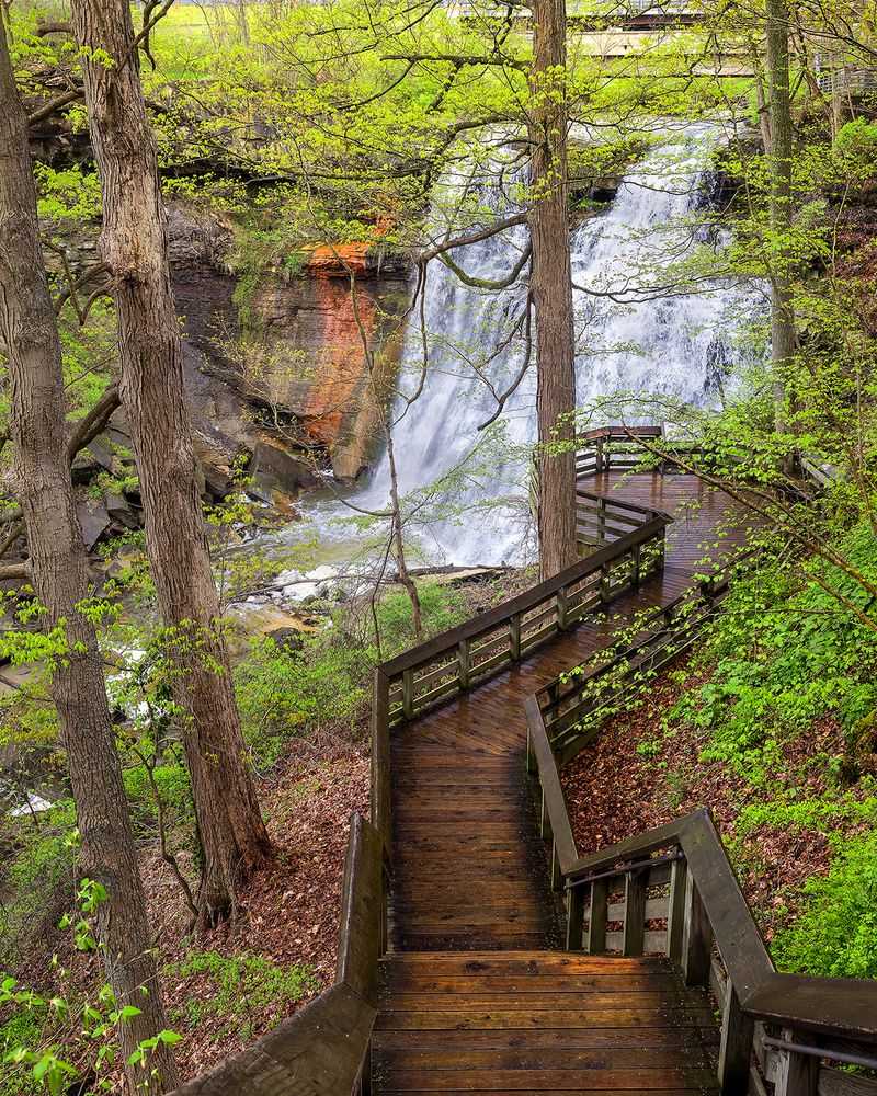
What you find at the end of the driveway is a park entrance without much fanfare. A parking lot, clean restrooms, a few interpretive signs, and a wooden walkway that visitors say is easy to spot the moment you step out of the car.
Five minutes of walking is genuinely all it takes to reach the upper overlook. That short distance is the whole appeal, and it explains why the lot fills so quickly on nice afternoons.
The falls themselves drop 65 feet into a wooded gorge cut by Brandywine Creek. Google lists the site simply as a park, which undersells things considerably given that the waterfall carries a 4.8-star average across nearly 6,000 reviews.
Consider it a destination that works two ways. You can treat it as a quick roadside stop, or you can use it as a trailhead for longer wandering through the ravine.
Sixty-Five Feet of Falling Water
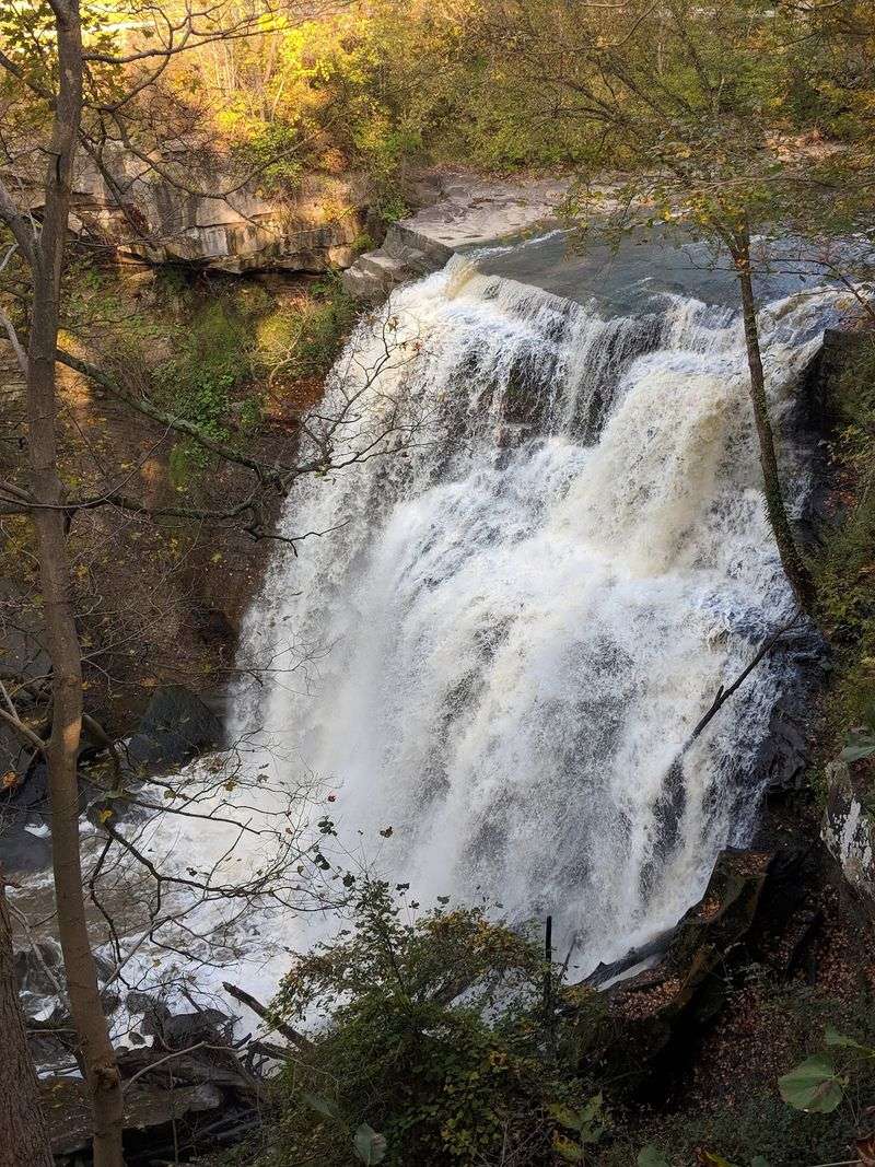
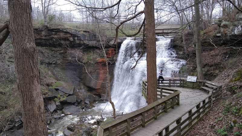
Sixty-five feet is taller than it sounds on paper. Standing at the rail, the drop reads as a tall, narrow ribbon rather than a wide sheet, and the water fans out as it falls, which is where the nickname bridal veil comes from.
Volume changes everything here. After steady rain, the creek surges and the falls thunder with real force; in drier stretches, the flow thins out and the rock layers behind it become the main event.
People arriving from out of state often react with disbelief that a waterfall this size exists near Cleveland. One family described squeezing it in at the end of a long day and being relieved they hadn’t skipped it.
Sound plays a bigger part than photos suggest. Even on a busy weekend, the rush of water fills the gorge and softens the chatter of everyone else at the overlook.
A few visitors mention that the bridges above the falls sneak into the frame. It’s a fair observation, though most photographers simply shift angle and shoot from lower down.
Rock Layers Older Than Almost Anything You’ll See Today
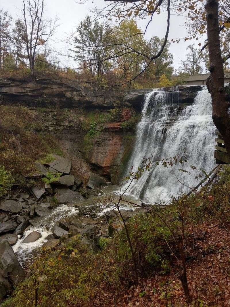
Look past the water and the cliff face tells a longer story. A hard cap of Berea Sandstone sits on top, and beneath it lie softer Bedford and Cleveland shales that erode faster, which is exactly why the ledge juts out the way it does.
Those shales began as mud on the floor of an ancient sea somewhere between 350 and 400 million years ago. Water wearing away the weaker layers underneath the sandstone is the engine behind the whole formation.
The falls themselves are young by comparison. Brandywine Creek only started carving this gorge about 10,000 years ago, after the last glaciers pulled back from northern Ohio.
Stepwise erosion also explains the terraced look. Water doesn’t slide down one smooth face; it breaks across a series of ledges, which is what gives the cascade its lacy texture.
Interpretive signage along the walkway covers much of this, and several visitors have noted that the overhanging rock adds a genuine sense of depth to the view. Geology nerds get more than they bargained for on a five-minute walk.
Traces of a Vanished Mill Village
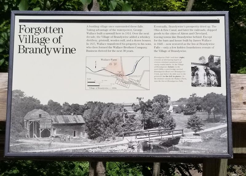
Water this powerful was too useful to leave alone. In 1814, George Wallace built here and set in motion one of the earliest settlements in the Cuyahoga Valley, a working community that came to be called the Village of Brandywine.
At its peak the village ran a sawmill, a grist mill, and a woolen mill, with a distillery in the mix as well. The falls supplied the power, and the settlement grew around that single natural advantage.
Industry hung on longer than you’d expect. By 1920 the Champion Electric Company was operating near the ruins of the old grist mill, generating power until lightning took out the operation in 1937.
What remains today is quieter. Stone foundations and scattered remnants sit among the trees, easy to walk past if you aren’t watching for them.
Knowing the backstory reframes the whole visit. The gorge that now feels like a peaceful pocket of forest was once loud with saw blades and mill wheels, and one visitor put it plainly, saying the history of the area surprised them as much as the waterfall did.
The Upper Deck and Its Accessible Approach
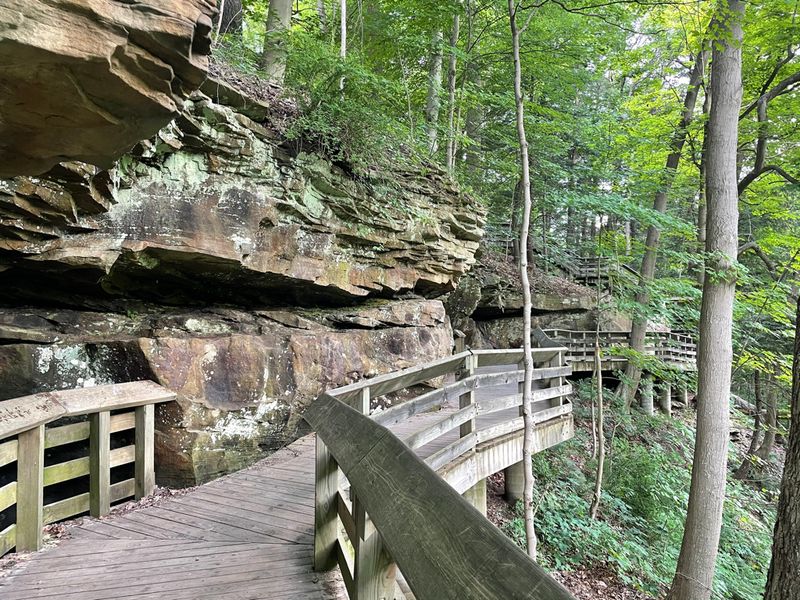
Not everyone can manage stairs, and the park planned for that. A paved, essentially flat path runs from the parking area to the upper viewing platform, which is described as accessible.
From up there you get the top of the falls, the lip where the creek tips over the sandstone, and a strong sense of the gorge dropping away below. Visitors who skip the descent report the upper view alone justifies the drive.
Distance is minimal. Reviewers repeatedly clock it at around five minutes from the car, calling it a flat walk with a real payoff at the end.
Benches and wide railings make it a comfortable place to linger rather than a spot you photograph and abandon. Families often park a stroller here and take turns going down.
One thing worth knowing: the upper deck looks down on the falls rather than across at them, so the full 65-foot profile reads better from below. If you only have ten minutes or mobility is a factor, the upper platform still delivers the moment, just from a different angle.
Roughly a Hundred Steps to the Base
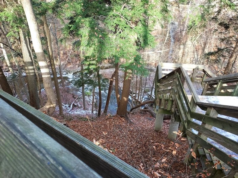
Ask anyone who’s been and the stairs come up fast. Reaching the lower viewing deck means descending somewhere in the range of 80 to 100 steps, and then climbing every one of them on the way back.
Good news for the hesitant: the flights are broken up by landings. Visitors mention resting spots between sections, which turns one intimidating staircase into several manageable ones.
Fitness matters less than you’d think. An 80-year-old visitor described the descent as easy, while others in hot weather chose to skip it and return on a cooler day.
The reward is a straight-on look at the full drop, close enough to feel spray on a high-water day. Photographers overwhelmingly prefer this angle.
Footing deserves attention. Wooden ramps and steps can turn slick after rain or in cold weather, and the boardwalk gets closed outright during icy conditions.
Sensible shoes are the single best piece of preparation. Several people specifically recommend comfortable footwear, and anyone planning to add the gorge loop afterward will want proper traction rather than sandals.
Brandywine Gorge Loop for Anyone Wanting More
Five minutes of boardwalk leaves some hikers wanting. Turn left instead of right from the lot and you pick up the Brandywine Gorge Loop, a mostly unpaved trail running about 1.4 to 1.5 miles through the ravine.
Hiking it in reverse is a trick worth borrowing. One parent walked the loop with three kids starting from the far side, saving the waterfall for the finale, and stopped midway for lunch beside the creek.
The trail dips close to the water in places, and along those stretches children can wade at the edges. Chipmunks, birdsong, and dense summer green fill in the rest.
Terrain is uneven rather than difficult. Roots, dirt, and gradual climbs make it a real hike, but families with elementary-age kids handle it regularly.
For a longer outing, the 1.5-mile Stanford Trail drops into the valley and links up with the Towpath Trail, opening the door to a much bigger day on foot.
A handful of visitors wish the on-site maps were clearer. Grabbing a park map from the national park website before arriving solves most of that confusion.
Four Seasons, Four Completely Different Waterfalls
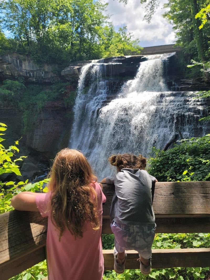
Autumn is when the parking lot really earns its size. Maples and beeches on both walls of the gorge turn gold and rust, and hikers who visit in October describe the fall color as the main reason to come back.
Spring brings the loudest water. Snowmelt plus rain pushes the creek hard, and the falls run full and thunderous through April and May.
Summer trades volume for shade. The canopy closes overhead, the trail stays cool even on hot days, and visitors say the falls look their best a day or two after a good rain.
Winter turns the whole gorge into something stranger. Ice builds along the rock face and the flow narrows, though the boardwalk closes when conditions get icy, so checking ahead matters.
Photographers rotate through all four. One frequent visitor called it beautiful in every season, and the changing water levels mean no two trips look quite alike.
Pick your season by preference: raw power in spring, color in fall, quiet cool in summer, and stark ice sculpture in the coldest weeks of the year.
What the Atmosphere Actually Feels Like
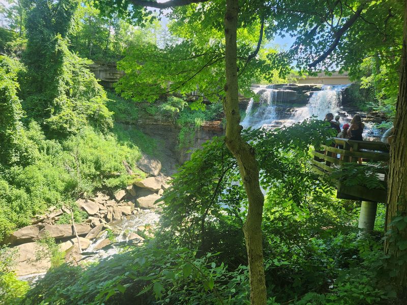
Crowded and peaceful sound like opposites, but both apply here. The overlooks fill up on weekends, yet the roar of the water and the depth of the gorge absorb the noise in a way that keeps things calm.
People take turns without being asked. Visitors have remarked on how respectful the crowd tends to be, everyone stepping aside so the next group gets a clear photo.
Early mornings are a different experience entirely. Someone who arrived at 7 a.m. found the lot mostly empty, which is the closest you’ll get to having the falls to yourself.
The soundtrack away from the deck is mostly birds and rustling leaves. On the gorge loop, hikers report chipmunks darting across the trail and long stretches with nobody in sight.
Mood-wise it lands somewhere between scenic pullout and genuine nature outing, depending entirely on how far you walk. Ten minutes gets you a photo; ninety minutes gets you a proper reset.
Either way, the place rewards standing still for a few minutes longer than you planned.
A Solid Pick for Families with Kids
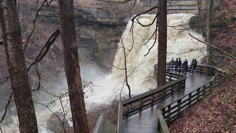
Short walk, big payoff, minimal complaining. That formula makes this one of the more family-friendly stops in the national park, and parents consistently describe it as a hike kids actually enjoy.
Wading spots along the gorge trail help enormously. Several sections put the creek within reach, and children who’ve been promised water access stay motivated through the uphill parts.
At the falls themselves, viewing happens from raised decks only, so there’s a clear boundary and no scrambling near the edge. Parents appreciate that structure.
Restrooms at the trailhead are mentioned again and again, described as clean and newer, which anyone traveling with small children will recognize as a legitimate selling point.
The stair count is the main variable. Younger kids handle the roughly 100 steps fine in cool weather; on a scorching afternoon, sticking to the paved upper path is the smarter call.
Bring water, snacks, and shoes with grip. One family turned the gorge loop into a picnic outing beside the creek and called it the highlight of their day, which is a pretty good template to copy.
Parking, Restrooms, and Timing Your Arrival
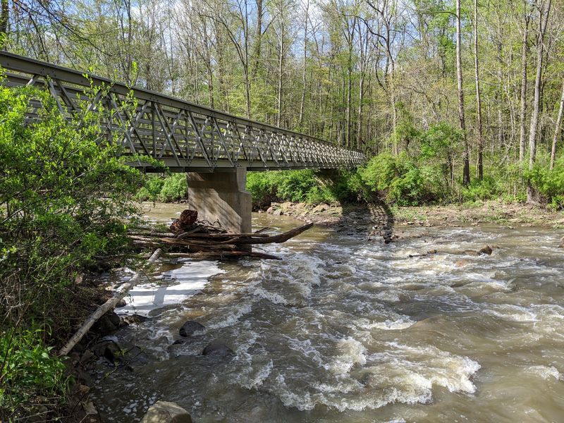
Parking is free and the lot is large, but it is also the single biggest logistical wrinkle. Expect it to be busy between roughly 10 a.m. and 4 p.m. on pleasant days and throughout the summer.
Regulars have a workaround. Show up early or late in the day and the crowd thins dramatically; a 7 a.m. arrival reportedly means an almost empty lot.
Even at peak times, visitors who come often say they usually manage to find a spot, though patience helps. Circling once or twice is normal on a Saturday afternoon.
Restrooms sit right at the trailhead and get frequent praise for being clean and well kept. There’s no admission charge, since Cuyahoga Valley National Park doesn’t collect an entrance fee.
Signage along the walkway is thorough, with informative panels and clear trail markings. A couple of visitors still wished for better maps of the wider park, so downloading one in advance is smart.
For questions before you go, the site lists a phone number, 440-717-3890, and the national park website covers current conditions and closures.
Getting There from Cleveland or Akron
Sandwiched between two cities, the falls are an easy drive from either direction. Cleveland sits to the north and Akron to the south, with Brandywine Road running through Northfield to the parking area.
Plugging the full address into your navigation app saves grief. One visitor searched for Cuyahoga Valley National Park generally and bounced between multiple locations before landing here, since the park spans a large stretch of the valley.
Road trippers use it as a natural break. Multiple people describe stopping mid-journey for twenty or thirty minutes and considering it time well spent.
If you’re already touring the park, this pairs neatly with other stops in the valley, and the Stanford Trail connects the area to the Towpath Trail for those going deeper.
Cell service and app-based directions generally work fine, but the surrounding roads are rural and winding, so give yourself a little buffer.
Coordinates for the truly precise: roughly 41.2769 north, 81.5386 west. Follow the signs once you’re close and the entrance is hard to miss.
Photography Notes and Small Frustrations
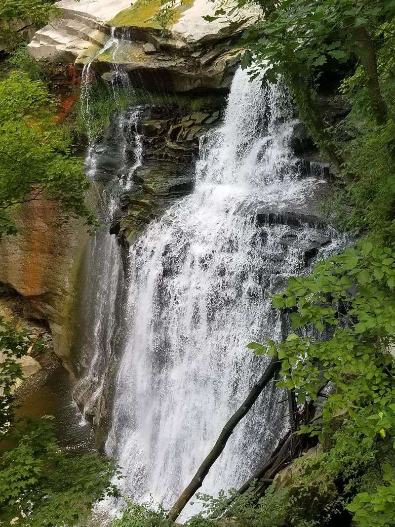
Every waterfall has its quirks, and this one has a couple. Bridges sit above the falls, and depending on where you stand they slip into the top of the frame, which a few photographers find distracting.
The fix is elevation. Shooting from the lower deck crops the built structures out and puts the full 65-foot drop front and center.
Light works best on overcast days or early morning. Bright midday sun creates harsh contrast between the shaded gorge and the white water, while soft cloud cover evens everything out.
Timing around rain pays off. Visitors repeatedly note the falls look most impressive a day after a good soaking, when the flow widens across the rock face.
Space on the lower deck is limited, so tripods require courtesy. The crowd generally rotates politely, but peak hours mean waiting your turn.
One more consideration: spray reaches the deck when the creek runs high, so a lens cloth is a genuinely useful thing to have in your pocket. Wooden surfaces can be slick then too, so plant your feet before framing the shot.
Final Thoughts on a Five-Minute Walk Worth Making
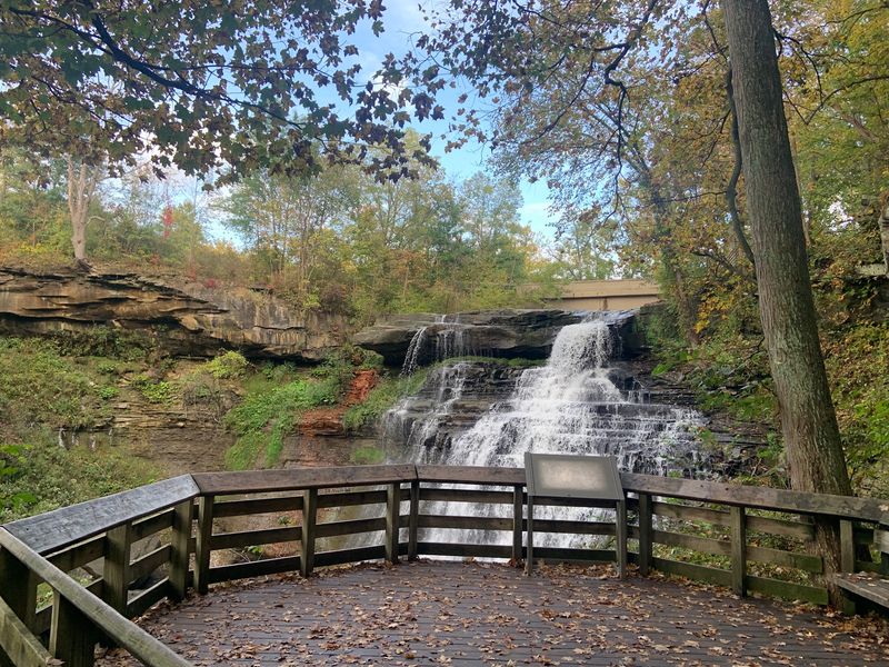
Effort-to-reward ratio is what keeps people coming back. A short stroll on a wooden walkway ending at a 65-foot cascade is a rare bargain, and the 4.8-star average across nearly 6,000 reviews reflects that.
Manage expectations on two fronts. The stairs are real, and the parking lot fills up, so plan around both rather than being surprised by them.
Who it suits: families wanting a low-commitment outing, road trippers needing a twenty-minute stretch, photographers chasing water and rock, and anyone curious about the mill village that once ran on this creek.
Who might want more: hikers looking for serious mileage, though the gorge loop and Stanford Trail connection help considerably on that front.
Best plan overall is the combination approach. Walk the loop first, finish at the falls, take the stairs down if the weather cooperates, and read a couple of the signs about the sandstone and the old mills.
Visitors describe leaving genuinely surprised that something this striking sits between Cleveland and Akron. Give it a morning and you’ll probably understand why.