
A Remote South Carolina Mountain Town That Remains One Of The State’s Best-Kept Secrets
South Carolina holds a mountain town that few outsiders ever manage to find on their own. Roads leading in wind through terrain that discourages casual visitors from ever stumbling upon it by accident.
Locals prefer it that way, rarely advertising what makes the town worth visiting in the first place. Nothing about this place feels curated for outside attention or built around drawing bigger crowds.
History and small town charm exist here without needing to compete for anyone’s attention. Visitors who do stumble upon this town often wonder why it isn’t more widely known.
That lack of recognition seems to be exactly what keeps it this peaceful. This town proved that sometimes staying quiet is precisely what makes a place worth finding.
The Heart of Downtown
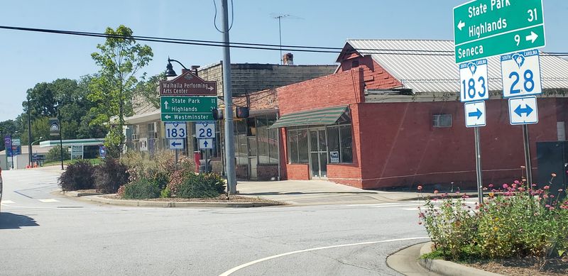
Some small-town main streets feel staged. Walhalla’s does not, and that is exactly why it works.
The downtown stretch runs wide and straight, shaded by mature trees, with brick commercial buildings from another century still doing honest work as shops and cafes.
Grid planning from the 1850s German founders explains the unusual width, and the name Walhalla itself translates to Garden of the Gods from Norse mythology.
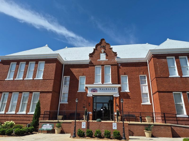
The Walhalla Civic Auditorium anchors the whole thing. Built originally as a graded school in 1901 and later expanded to include an auditorium, it now hosts concerts, plays, and community events.
The restoration effort says a lot about how seriously locals treat their history.
Walking the district takes maybe twenty minutes if you rush, or an entire afternoon if you actually stop and look. Storefront windows, old cornices, and faded signage reward anyone paying attention.
Because the town sits at the base of the mountains, downtown doubles as a staging area. Hikers grab coffee here before heading up to the tunnels and falls, then wander back through in the afternoon looking pleasantly wrecked.
Parking is simple and free of drama, which alone puts it ahead of most tourist towns. Weekday mornings are the calmest window if you prefer quiet sidewalks.
The county seat since 1868, Walhalla still handles courthouse business alongside its coffee and antiques, giving the place a working-town feel rather than a gift-shop one.
Echoes of Germany
Picture a group of German immigrants landing in Charleston in 1850, taking one look at the coastal heat, and deciding to keep walking north. That is roughly how this town got started.
General John A. Wagener led the group inland in search of land that felt more like home.
They settled on a stretch of upstate country and named it after Valhalla, the hall of the gods from Norse legend.
The founders laid the town out in a rigid grid and reportedly oriented the streets to reduce direct summer sun. Practical people, clearly.
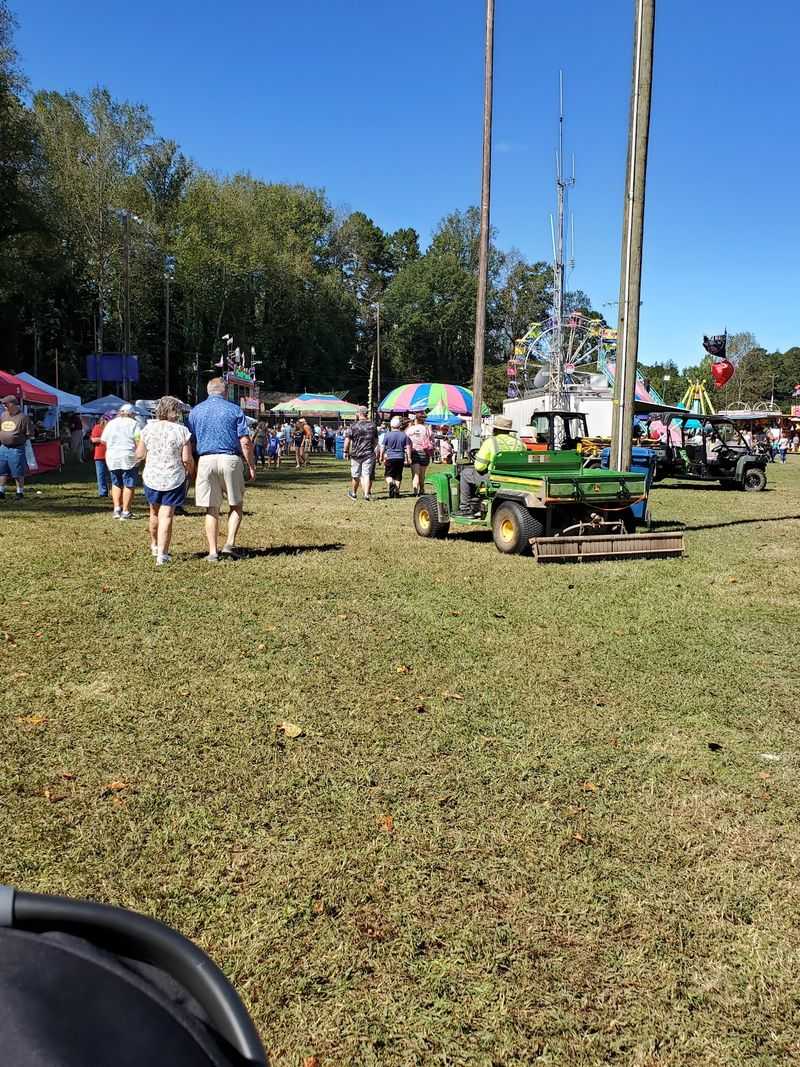
That heritage never faded into a footnote. Every October, Walhalla throws an Oktoberfest that takes over Main Street and Sertoma Field, with vendors, live music, and carnival rides drawing crowds from across Oconee County and beyond.
The festival is genuinely family-oriented, more community block party than tourist spectacle. Kids ride rides, bands play, and the streets fill with people who mostly know each other.
German place names and surnames still turn up around town, quiet reminders of who cleared this land. Street signs and cemetery markers tell that story better than any plaque.
If you can time a visit for autumn, you get two gifts at once. Blue Ridge fall color overhead and a heritage festival at street level, which is a hard combination to beat anywhere in the South.
The Unfinished Masterpiece
Here is a fun bit of failed ambition. In the 1850s, engineers set out to blast a railroad tunnel through a mountain so Charleston could reach the Midwest by rail.
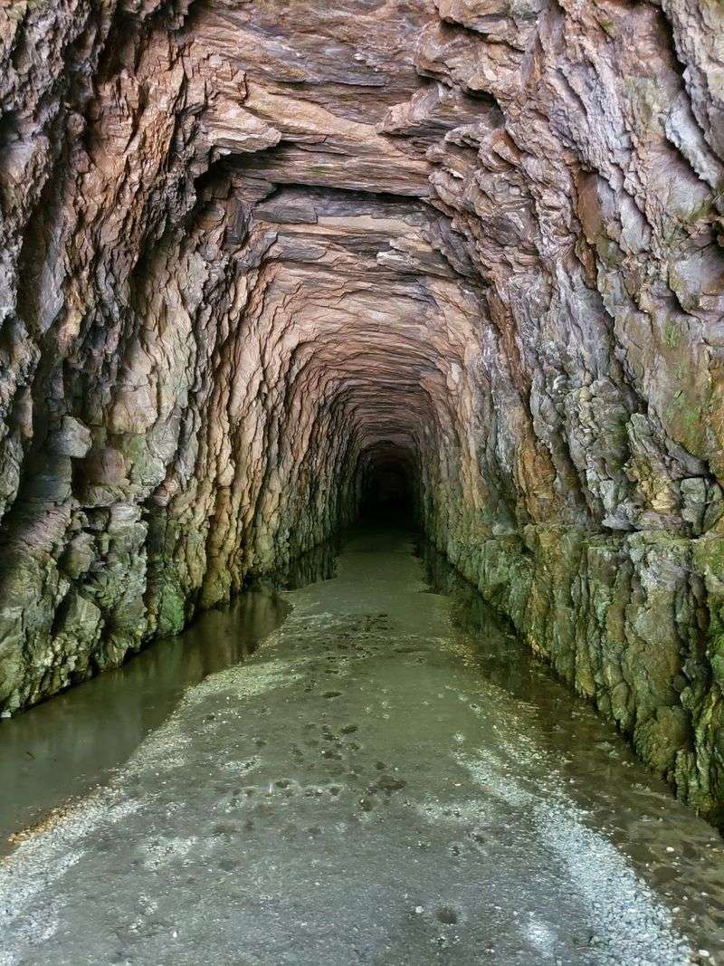
They never finished. The Civil War drained the money and the manpower, and work stopped for good, leaving a 1,617-foot blind tunnel drilled straight into the rock.
Stumphouse Tunnel sits inside a 440-acre park just outside town, and visitors can walk right into it. The walls still show the marks of hand tools and black powder blasting.
The temperature inside drops fast and stays put, hovering cool and damp year-round. That stable climate turned out to be useful, and Clemson University once used the tunnel to ripen blue cheese in it.
Bring a flashlight and shoes you do not mind soaking. Water drips constantly, and the floor stays wet, so flip-flops are a rookie mistake.
Sound behaves strangely in there. Voices bounce, footsteps echo, and the darkness swallows light quickly past the entrance.
The surrounding park has added trails and mountain biking routes over the years, so the tunnel is no longer the only reason to stop. Still, standing inside a 170-year-old hole in a mountain that never led anywhere is the main event.
Cool air in July feels like a reward for the drive.
Legendary Cascades
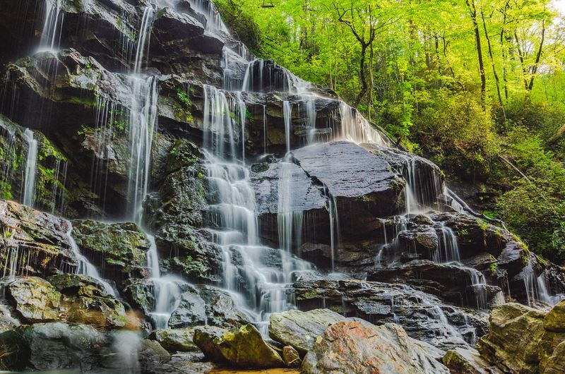
Legends stick to waterfalls, and this one has a good one. Issaqueena Falls drops about 100 feet over stacked rock ledges inside the same park as the tunnel.
Local lore tells of a Cherokee girl named Issaqueena who rode to warn settlers of a coming attack, then hid on a ledge behind the falling water to escape pursuit. Historians debate the details, but the story has outlived every version of the retelling.
Reaching the overlook takes almost no effort. A short walk from the parking area leads to a viewing platform where the whole cascade is visible at once.
Hikers wanting a closer look can follow a steeper trail down toward the base, though footing gets rough and slick in spots. Rock near moving water is never as grippy as it looks.
Spring runoff makes the falls loudest and fullest. Late summer thins the flow but reveals more of the rock structure underneath, which has its own appeal.
Pairing the falls with the tunnel is the smart move since they share a parking lot. Two of the region’s best-known landmarks, one stop.
Photographers tend to show up early, when mist hangs in the gorge, and the light is soft. Midday sun washes out the water and creates harsh shadows across the ledges.
Hidden Waterfalls
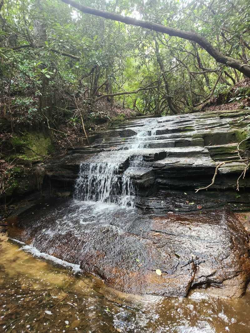
Not every cascade around here comes with a paved overlook. Yellow Branch Falls makes you earn it, and the payoff is worth every muddy step.
The falls sit in the Andrew Pickens Ranger District of Sumter National Forest, spilling roughly 50 feet down while spreading about 75 feet wide across a tiered rock face. Wide rather than tall, which makes for unusual photos.
Getting there means a 1.5-mile hike rated moderately difficult, winding through hardwood forest with several creek crossings along the way. No bridges on some of them, just rocks and good balance.
Roots, narrow footing, and a few steep sections keep the trail interesting. Waterproof boots turn the crossings from an obstacle into a non-issue.
The forest cove holding the falls stays cool and green, thick with rhododendron and moss-covered stone. Spring wildflowers show up along the trail before the canopy fills in.
Because the hike filters out casual traffic, the falls often feel private even on decent weather days. Weekday visits raise those odds considerably.
Water levels swing hard with rainfall, so a dry spell can turn the sheet of water into scattered trickles. After a good rain, it roars across the entire rock face.
Cell service gets spotty out there. Download your map before leaving town.
Trails Through Time
Failed engineering projects make surprisingly good hiking. The Blue Ridge Railroad Historic Trail follows the route of that unfinished 19th-century rail line, and the leftovers are still out there in the woods.
Three excavated tunnels sit along the corridor, each one a piece of the abandoned dream to link Charleston with the Ohio Valley. Crews cut them by hand before the whole plan collapsed.
The trail starts just above Issaqueena Falls, which makes it easy to add onto a visit you were already planning. Trailhead access is straightforward.
Walking an old rail grade means gentler climbs than most mountain trails, since trains could never handle steep pitches. Your knees will notice the difference.
Interpretive markers explain what crews were attempting and why it never came together. Reading them while standing in a hand-carved cut hits differently than reading them at home.
Middle Tunnel and Saddle Tunnel show varying degrees of collapse and overgrowth, with vegetation slowly reclaiming what dynamite opened up. Nature is patient.
History buffs get the most out of this one, but the forest alone justifies the walk. Hardwoods, creek sounds, and very little foot traffic.
Sturdy shoes matter since sections stay wet and rocky. A headlamp helps if you plan to peek into the darker openings along the route.
A Tapestry of Art
Driving the back roads around town, you start noticing giant colorful squares bolted to barns. That is not a coincidence, and it is not random decoration.
The Upstate Heritage Quilt Trail spreads more than 250 painted quilt squares across Oconee County and neighboring areas. They appear on barns, historic buildings, schools, businesses, and private homes.
Each design honors the region’s long quilting tradition, and many patterns connect to specific families or local stories. Traditional blocks like the star and log cabin show up in bold, oversized form.
Hunting them down turns an ordinary drive into a scavenger hunt. Trail maps help, though half the fun is spotting one you were not looking for.
Weathered barn wood behind bright geometric paint makes for a striking contrast. Photographers love the combination, especially in late-day light.
The project launched as a community effort to celebrate heritage and bring visitors onto rural roads they would otherwise skip. It worked, and the roads themselves are scenic.
Since many squares sit on private property, viewing happens from the roadside. Pull over safely and keep off driveways.
Kids tend to get weirdly competitive about who spots the next one. Rolling farmland, mountain views, and folk art in the same afternoon is a solid trade for a tank of gas.
Whispers of Ancient History
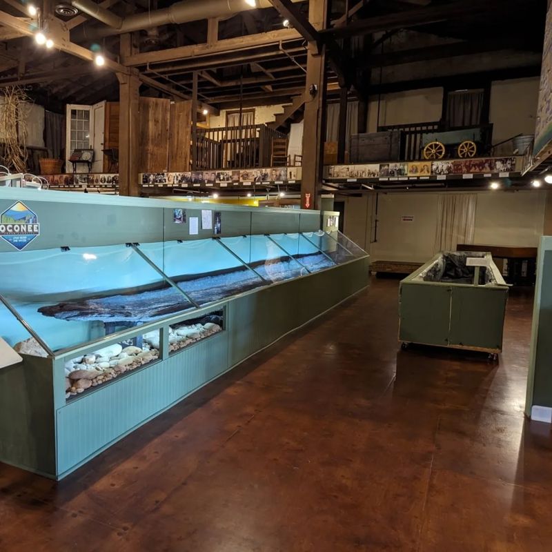
Long before German settlers drew their grid, the Cherokee lived across these mountains and river valleys. Oconee County itself carries a Cherokee name.
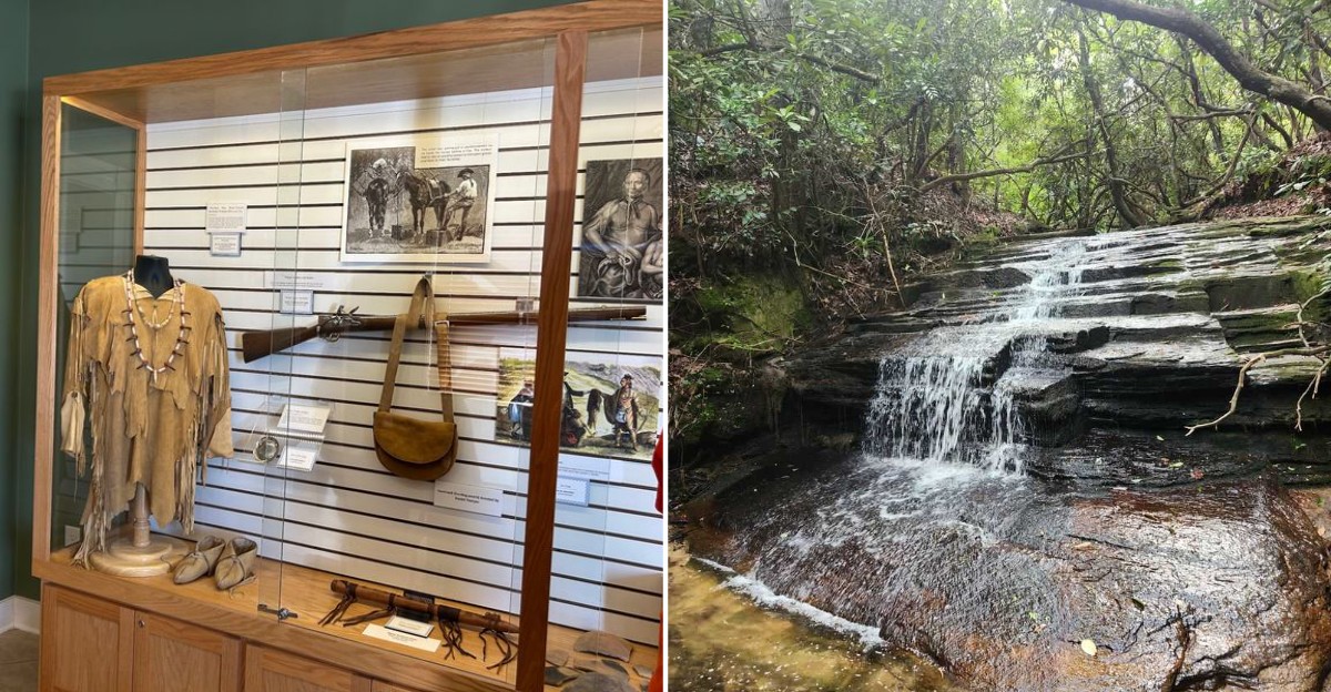
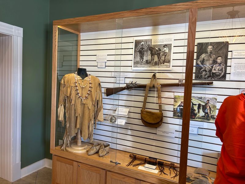
The Museum of the Cherokee in South Carolina sits downtown and preserves that history with a substantial artifact collection. Many pieces were found right here, turned up in local fields and along riverbanks.
Arrowheads, pottery, tools, and stone implements fill the displays, each one evidence of daily life stretching back centuries. Seeing objects pulled from nearby ground makes the timeline feel immediate.
Exhibits walk through Cherokee culture, community structure, and the disruption brought by European settlement. The presentation stays clear enough for kids while still giving adults real substance.
The museum operates on limited hours, so checking ahead saves a wasted trip. It is small, which means staff has time to actually talk with visitors.
Plan on an hour or so inside. Longer if you get pulled into the details, which is easy to do.
Understanding this layer of history changes how the rest of the area reads. Trails, waterfalls, and river bends stop being just scenery and start being places with a much older story.
Ancestral Cherokee land surrounds the town on every side. The museum is the best place to understand what you are standing on.