
This Quiet Tennessee Byway Delivers Overlook After Mountain Overlook And Costs Nothing To Drive
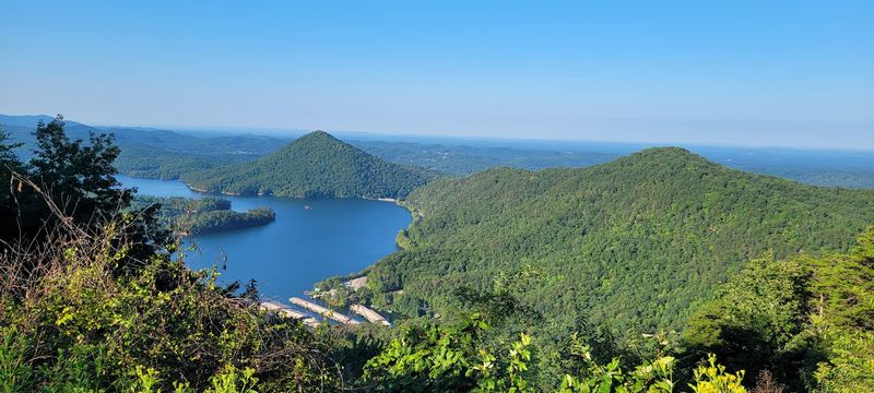
Some of the best Tennessee afternoons start by accident. You take a highway east because it looks shorter on the map, and forty minutes later the road is bending along a river gorge with pullouts every few miles and mountains stacking up in the windshield.
There is no ticket to buy, no gate, no line to stand in, just pavement, water, and one overlook after another. If you have a tank of gas and a cooler of sandwiches, you already have everything the day requires.
Where US-64 Trades Farmland for a River Gorge
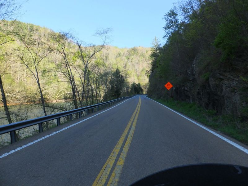
Past the last of the farm fields, US-64 quits acting like an ordinary highway. Pavement swings toward a river gorge, the shoulders pinch in, and rock walls climb on one side while moving water runs along the other.
Maps list the address plainly as US-64, Benton, Tennessee. That puts the western end roughly an hour east of downtown Chattanooga and somewhere near two hours south of Knoxville, close enough that a family can finish breakfast at home and still be standing at an overlook before noon.
The corridor runs through the Cherokee National Forest, tracing the Ocoee River and the string of lakes along it. No gate, no ticket booth, no parking sticker anywhere on the route.
You point the car east and the scenery handles the rest.
Travelers often describe it as a quiet road with outsized views, a drive where the road itself is the attraction rather than a way to reach one. Some push straight through in about an hour with the windows down.
Others stretch those same miles across a whole afternoon, stopping at pullouts, trailheads, and shaded tables set beside the water.
Dams, Powerhouses, and the Lakes They Made
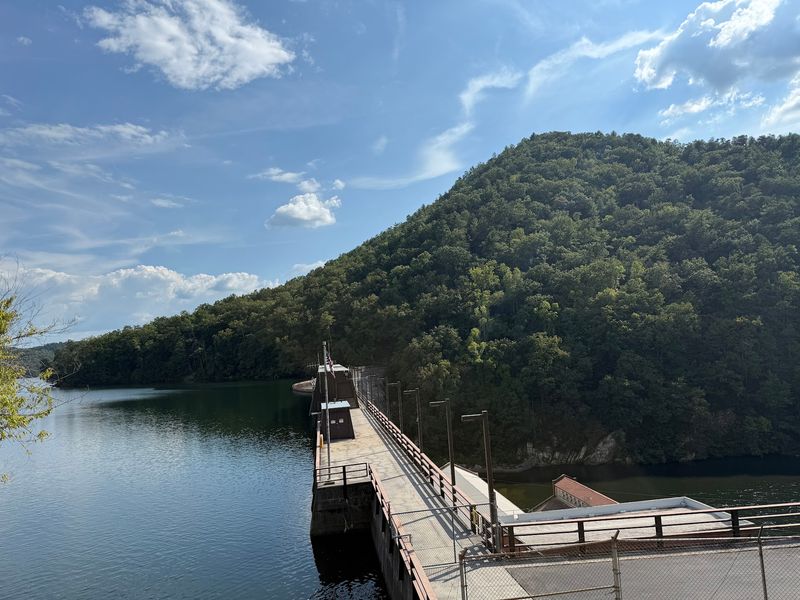
Curious why the water below the guardrail looks like a chain of lakes rather than one steady river? Credit the hydroelectric dams that have stepped the Ocoee down in sections for generations.
Drivers passing through frequently remark on those quiet dammed pools tucked back in the canyons.
Power operations still shape what you see from the car. Flat, glassy water sits behind each dam, while the stretches below run shallow or lively depending on what is being released that day.
The river drew national attention when its whitewater hosted international competition in the 1990s, and guides have worked the corridor ever since. Rafts and kayaks slip past on busy weekends, adding movement to an otherwise still landscape.
One traveler mentioned that hearing stories from a river captain made the whole corridor far more interesting, and that rings true. Knowing the pools, canals, and powerhouses are working equipment rather than decoration gives the drive a second layer.
History and scenery share the same guardrail here, which is a rare combination for a road that asks nothing at the door. Even children tend to perk up when someone explains that the lake below is holding back power for the valley.
Overlook After Overlook, All of Them Free
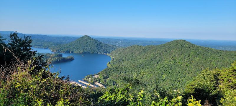
Fifteen minutes in, the rhythm becomes obvious. Gravel pullouts appear along the shoulder, each framing a different slice of gorge, ridge, or water.
Pull in, step out, look, repeat.
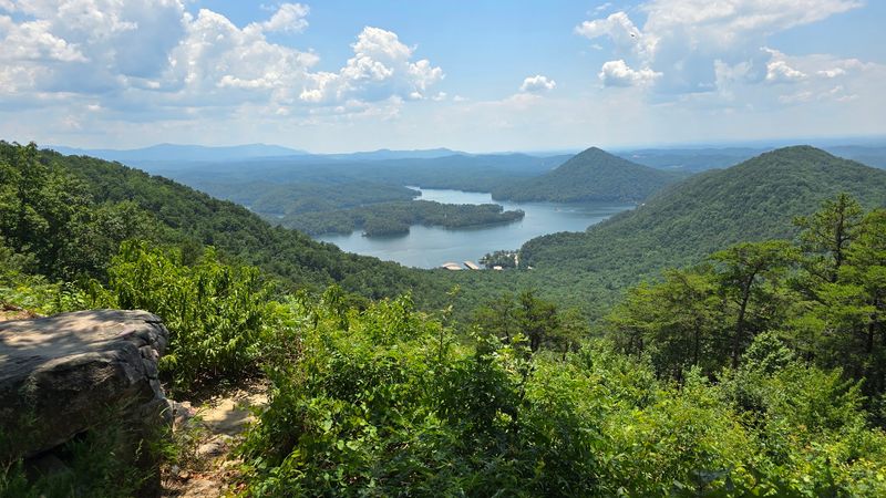
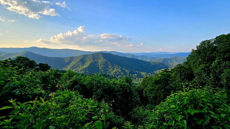
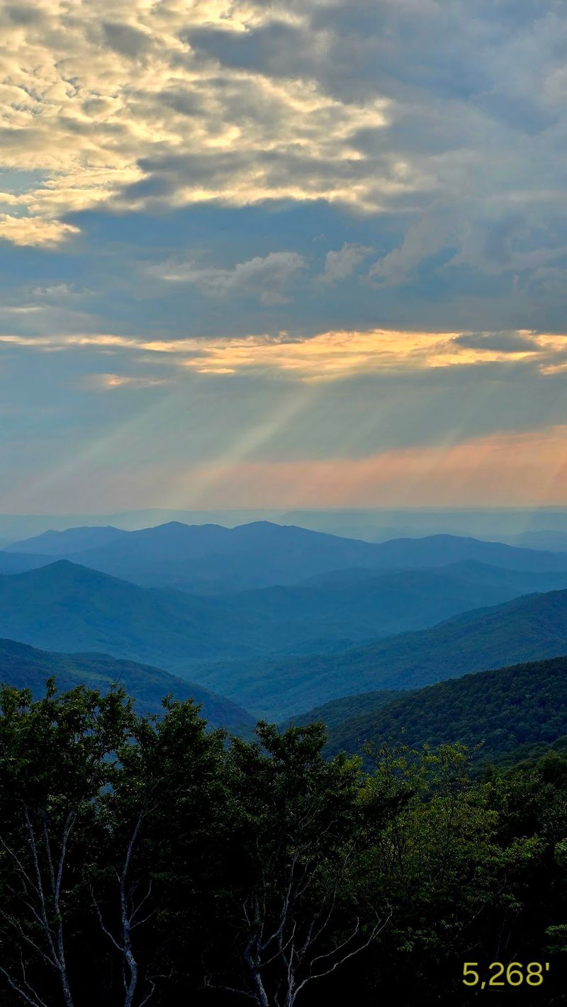
Certain overlooks sit low enough that you can hear the river working over rock. Others climb high enough to show layered ridgelines rolling toward the North Carolina line, the kind of view that flattens out completely in a phone photo and has to be seen in person.
Visitors regularly single out the lake vistas as the ones worth an extra ten minutes. Photographers get real mileage from the still surfaces early in the day, when the water holds a clean mirror image of the hills above it.
Late afternoon does its own trick, dropping long shadows across the gorge and turning the far ridges a soft blue. Neither version costs a thing.
There are no meters at the pullouts and no admission anywhere along the byway, which makes overlook-hopping painless on a family budget. Kids who start squirming after twenty minutes in a car seat also benefit from the steady supply of reasons to climb out and stretch.
Why Water Levels Change the Whole Trip
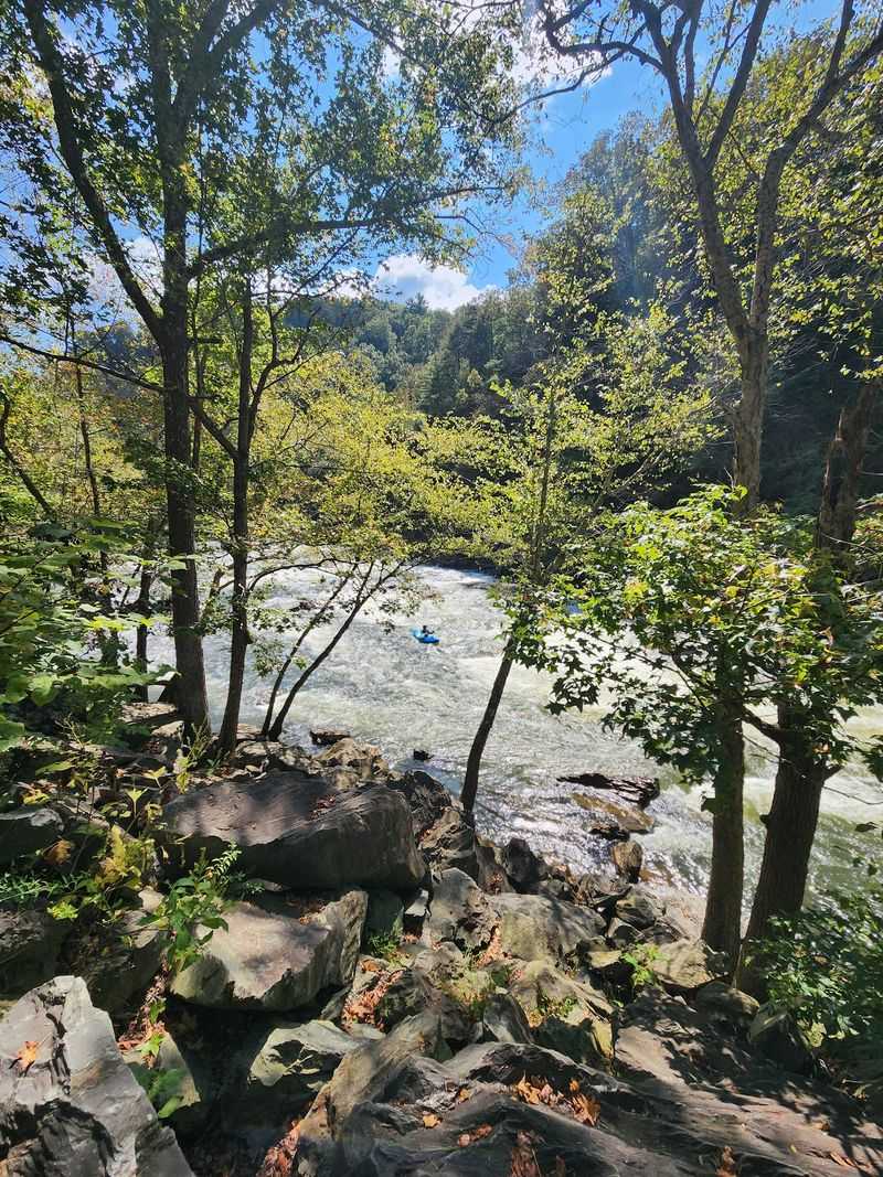
Ask anyone who drives this route often and their first question back is whether the water is up. Dam release schedules decide how much of that rocky riverbed is covered on any given day, and regulars say a low-water afternoon can feel muted compared with a full one.
When the flow is strong, rapids churn white between the boulders and the whole canyon gains a soundtrack. Rafts stack up at the bigger drops, and the pullouts fill with people leaning on the rail to watch them run through.
Releases generally follow seasonal patterns, leaning heavier toward warm-weather weekends, so checking conditions before you commit is simply good planning. Forest service information points and outfitter counters near the corridor can usually tell you what the river is doing.
Even on a quiet water day, the reservoirs stay full and the mountains are not going anywhere. One traveler summed it up well by saying the drive is at its absolute best when the water is up, but still lovely when it isn’t.
Think of it as two different trips sharing one road, then pick the version you want.
Trailheads Waiting Right Off the Shoulder
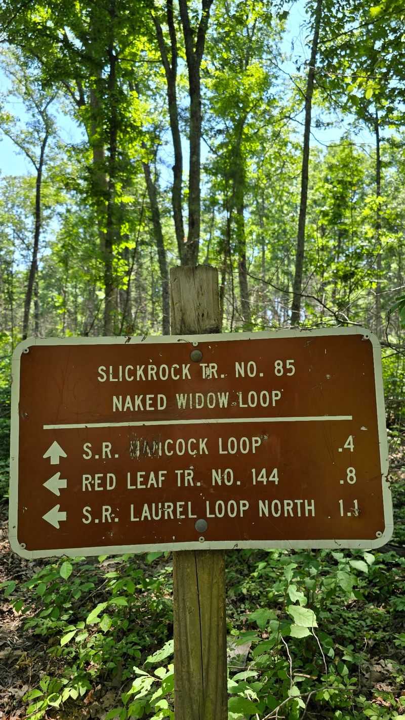
Boots in the trunk change this drive completely. Footpaths leave the corridor at several points, and hikers who know the area bring up the trails almost as often as the views.
Some are short leg-stretchers that drop toward the water in a few hundred yards. Others climb into the forest and keep going, rewarding anybody willing to trade an hour of shade and switchbacks for a quieter perspective on the gorge.
One frequent piece of advice from travelers is to take the side roads branching off the main route. Those spurs lead deeper into national forest land, where the traffic thins out and the woods close in around the car.
Wear real shoes if you plan to walk more than a few minutes, since the ground near the river stays slick and uneven. Trail conditions shift with the weather, and a rainy week can leave the lower paths muddier than they look from the parking area.
Autumn turns the whole hardwood canopy gold and rust, which is the busiest and arguably the finest stretch of the year. Spring brings wildflowers and fewer cars.
Picnic Tables, Paddles, and Unhurried Afternoons
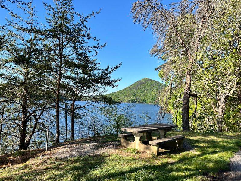
A cooler transforms this outing from a drive into a day. Several spots along the corridor invite you to park, unpack lunch, and sit beside the water while the traffic hums past somewhere behind you.
Paddlers make good use of the flatwater sections, and visitors have mentioned combining a picnic lunch with a few hours of kayaking on the calmer lakes. Bring your own boat, since there is no rental counter sitting at the pullouts.
Families tend to settle into one tableside spot rather than trying to sample all of them. Grandparents get a shaded seat, kids get shoreline rocks to sort through, and nobody has to buy anything to stay as long as they like.
Pack out whatever you pack in, because trash service along a forest corridor is limited and the pullouts stay clean only when people help. A trash bag in the back seat solves it.
Restroom facilities are thin along the route, so plan a stop in town first. That small bit of preparation saves a lot of improvising later in the afternoon.
Curves That Ask You to Slow Down
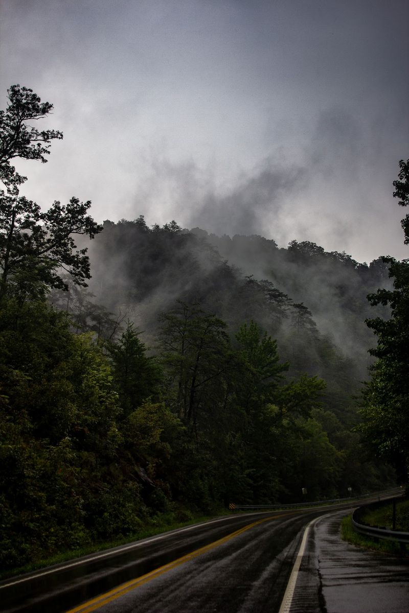
Motorcyclists have been onto this road for years. The corridor strings together long bends, tight canyon turns, and short straightaways where the river opens up beside you, and riders describe it as one of the better afternoons available in the region.
Sports car drivers say much the same, especially those who continue east toward the Nantahala area. Speed, though, is not really the point.
One visitor pointed out a familiar frustration: driving the posted limit through the curves can leave a line of impatient traffic behind you. The simple fix is the pullouts.
Use one, let the faster cars go, and get back to enjoying the view without a bumper in your mirror.
Wet leaves, morning fog, and the occasional rockfall all show up here, so the posted limits exist for good reason. Curves tighten quickly in the gorge section, and guardrails sit close to the pavement.
Take it as an invitation rather than a restriction. Slower travel is exactly how you notice the small waterfall on the left or the heron standing in the shallows.
Pack the Cooler, Because Food Is Thin Out Here
Hungry travelers get a quick education on this route. One driver put it bluntly, noting the drive was pleasant and the lake views enjoyable, but that there are very few places to eat along the way and a snack in the bag is a smart move.
Stock up before you leave pavement civilization behind. Benton and Cleveland sit on the western approach with groceries, sandwiches, and fuel, and small towns near the eastern end offer a few counter-service options along the main road.
Fill the gas tank early too. Service stations are scarce once the road enters the gorge, and cell reception in a deep canyon is never something to count on.
A cooler with sandwiches, fruit, chips, and cold drinks runs maybe twelve to fifteen dollars for a family and turns every overlook into a potential lunch spot. That beats hunting for a restaurant that isn’t there.
Coffee in a thermos is the other small luxury worth bothering with, particularly if you leave before sunrise to catch the morning light on the water.
Hours, Seasons, and What the Day Actually Costs
Cost is the easiest part of the planning. Driving the byway is free, the overlooks are free, and parking at the pullouts costs nothing, which leaves gas and lunch as the only real line items.
From Chattanooga, a round trip of roughly two hours of driving plus a packed lunch keeps a family of four comfortably under thirty dollars for the entire Saturday. Knoxville families should budget a bit more fuel and an earlier start.
As a public highway, the route is generally open around the clock and year round. Winter weather in the mountains can bring ice, fog, or temporary closures on connecting forest roads, so checking conditions before a cold-weather trip is only sensible.
October brings the strongest color and the heaviest traffic, with weekday mornings usually calmer than weekend afternoons. Spring and early summer trade foliage for wildflowers and stronger water flow.
Give yourself three to four hours if you intend to stop properly, longer if hiking or lunch is part of the plan. Rushing it defeats the entire purpose of coming.
A Road That Earns Its Reputation Quietly
Not every Tennessee outing needs an admission price, a gift shop, and a parking lot shuttle. Some of them just need a full tank, a cooler, and a road that keeps handing over views.
Travelers come back to the same words about this one: peaceful, beautiful, quiet up high. A few say it ranks among their favorite drives anywhere in the state, which is a strong statement in a state with plenty of competition for mountain scenery.
It suits retirees who want an unhurried loop with places to stop and sit. It suits families whose kids need to get out of the car every twenty minutes.
Riders and drivers who love a curve get their own version of a good day.
Bring patience for the turns, snacks for the stretches without restaurants, and a willingness to pull over more often than you planned. Those three things are the whole strategy.
Set out early, pick an overlook with a table, and let the afternoon go slowly. That is a full Tennessee Saturday for less than the cost of a nice dinner out.