
This Massachusetts Trail Takes You Along A 70-Foot Gorge Past Cliffs, Rapids And Historic Ruins
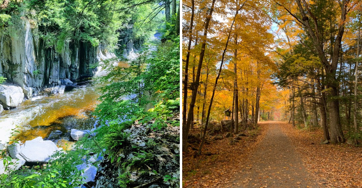
Some trails ease you into the scenery. This one gets dramatic fast.
A Massachusetts hike follows the edge of a deep gorge where rock walls rise above a rushing river and rapids break through the quiet.
The path stays close enough to the water to keep things interesting, especially when the current picks up and the cliffs close around the route.
Historic stonework adds another layer to the walk. Old bridge remains and other signs of earlier use appear along the way, giving the trail a sense of history without slowing down the scenery.
The route is not about one single viewpoint. It is the mix of water, cliffs, forest, and ruins that keeps changing as you move.
For a short outing with plenty to look at, this trail delivers far more than its length might suggest.
A Canyon Carved By Ice And Rushing Water
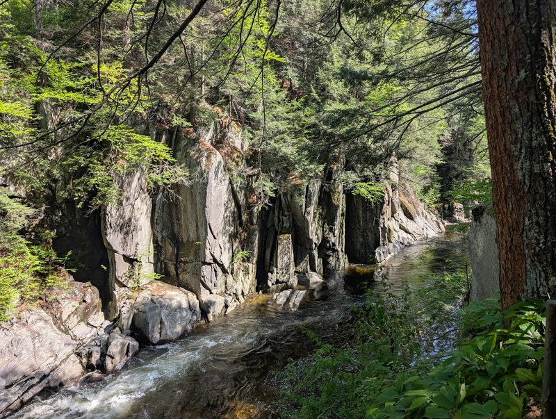
Glaciers are terrible houseguests, but they leave amazing souvenirs. Thousands of years ago, melting ice sent powerful floods rushing across the region.
That water sliced through hard metamorphic bedrock and left behind the canyon you see today.
The walls of Chesterfield Gorge drop as deep as 70 feet. That is roughly the height of a six-story building, all made of solid rock.
Standing at the top gives you a real sense of how much force it took to cut it.
The work never truly stopped. The East Branch of the Westfield River still flows through the bottom, slowly grinding and polishing the stone. Every spring flood adds a tiny new chapter to a very old story.
Look closely at the rock faces and you will notice layers, cracks and sharp edges. Some slabs lean like tilted books on a shelf.
Others look smooth, rounded by centuries of rushing water.
Geology fans will love it, but you do not need a science degree to enjoy the view. Kids tend to ask big questions here, like how long rock takes to wear away. The honest answer is a very, very long time.
Bring a camera and try shooting from a few different spots along the rim. Morning light and late afternoon light each show off the walls in their own way. You may end up with more photos than you planned.
A Short Cliff-Top Trail With Big Views
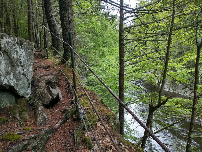
Good news for anyone who dreads steep climbs. The main trail here is only about half a mile long, and it hugs the cliff tops above the river.
You get big views without needing a full day or a backpack full of snacks.
Most people rate the path as easy to moderate. Some sections are rocky and uneven, so sneakers with good grip or hiking boots are a smart choice.
Roots like to pop up where you least expect them.
Safety railings line the edges along the steepest drops. They let you lean in for a better look while staying on solid ground. Parents with curious kids will appreciate that extra peace of mind.
Shady forest fills the spaces between the viewpoints. One moment you hear birds, and the next you hear the roar of water below.
That switch keeps the short walk feeling full of surprises.
Informative signs along the way explain the history and nature of the area. Take a minute to read them.
They turn a simple stroll into something closer to an outdoor classroom.
Want more miles? The reserve connects to longer paths, including a wide dirt road that follows the river downstream for miles.
Nearby Gilbert A. Bliss State Forest adds even more room to roam, and leashed dogs are welcome too.
Roaring Rapids And Round Stone Potholes
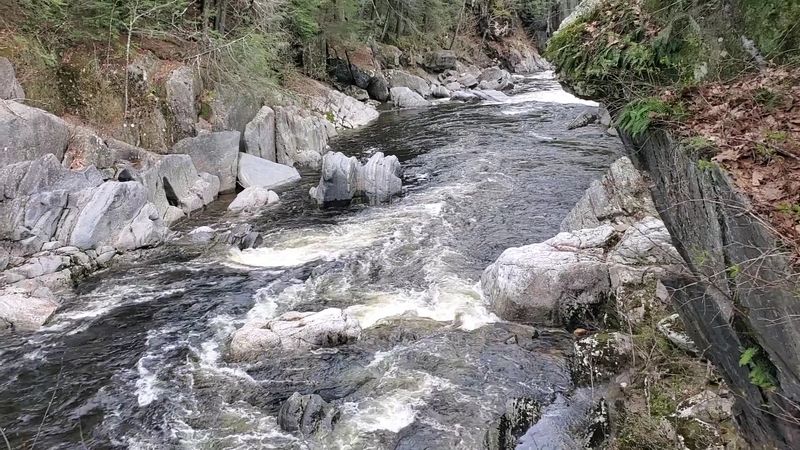
Nobody needs a sound machine at this spot. The river crashes through the narrow channel in a steady roar that you can hear before you even see it.
It is nature’s version of turning the volume all the way up.
Rushing rapids and small cascades tumble over the rocks below the cliffs. After snowmelt in spring, the flow gets especially wild and foamy.
By late summer, the water often calms down and turns clear enough to see the stones beneath.
Keep an eye out for potholes in the rock. These are round holes carved by swirling water spinning pebbles and gravel in circles.
Over a very long time, that spinning acts like a drill. Some potholes are small enough to hold a puddle. Others look like giant stone bowls. They are one of the coolest features in the whole reserve, and they make great photo subjects.
Now for the serious part, told simply. Swimming and rock climbing are not allowed inside the gorge, and the river within its walls is off limits.
The currents are strong and the rocks are slippery, so enjoy the show from above.
Downstream, past the gorge walls, the river spreads out and grows calmer. That is where many people find quieter spots to sit and listen.
Pack a small lunch, find a flat rock and let the water do the talking.
A River With A National Title To Its Name
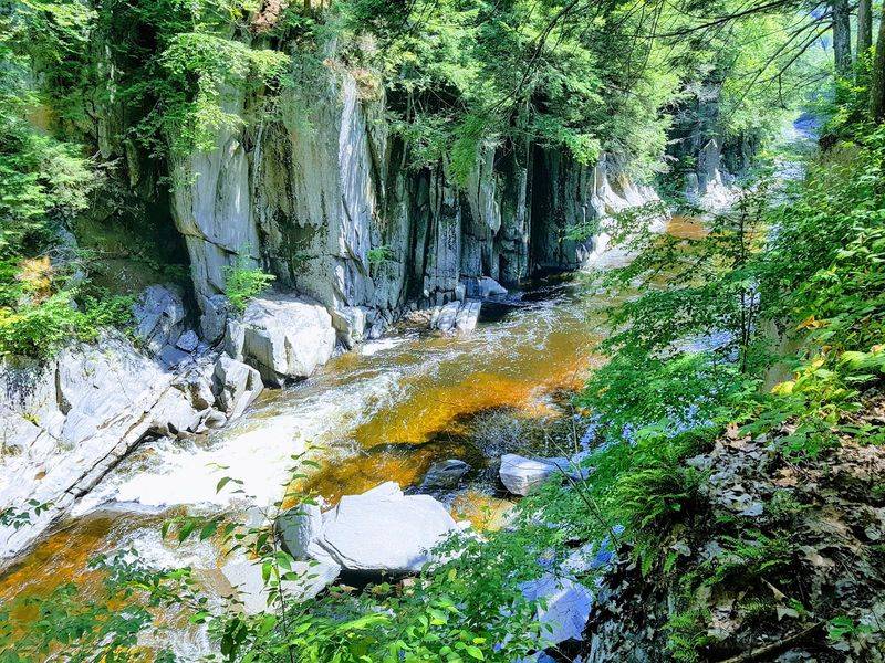
Not every river gets a fancy title from the federal government. The East Branch of the Westfield River earned one.
It is designated a National Wild and Scenic River, a label saved for waterways with outstanding natural value.
That status helps protect the river’s free-flowing character. It also recognizes the special scenery, wildlife and history found along its banks.
In other words, experts agree this river is worth keeping just the way it is.
The Westfield River begins high in the Berkshire hills. Its branches wind through forests and small towns before joining the Connecticut River.
The stretch through Chesterfield Gorge is one of the most dramatic sections of its journey.
Protection efforts here go back a long time. The Trustees of Reservations, a nonprofit conservation group, has owned and cared for the gorge since 1929.
That is nearly a century of keeping trash out and trails in good shape.
You can help continue that effort in small ways. Carry out everything you carry in, and stay on marked paths.
Picking up one stray wrapper makes a bigger difference than you might think.
Thinking of the river as a protected treasure changes how you see it. Standing on the rim, you are looking at water the whole country has chosen to protect. Even the rapids seem a little more precious.
Stone Ruins Of A Colonial Bridge
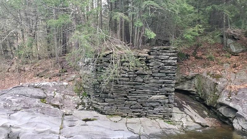
History buffs, this one is for you. Along the gorge, you can spot old stone abutments that once held up a bridge across the river. They look like stacked stone walls standing guard at the water’s edge.
The bridge was built around 1762. Back then, it was an important link on the old post road between Boston and Albany, New York.
Mail riders, wagons and families on the move all needed a safe way across this rugged river.
A toll gate once stood at the bridge’s eastern end. People paid a small fee to cross, a bit like a highway toll today.
No trace of the gate remains, so you will have to use your imagination.
The abutments, however, are still easy to see. Builders fitted heavy stones together by hand, without modern machines.
The fact that they still stand after more than 250 years says a lot about their skill.
Take a moment to picture the scene in colonial times, when this was a busy crossing. Horses clopping over wooden planks.
Voices calling out as a coach rolled toward the next town.
These ruins turn a nature walk into a small time-travel trip. Kids often enjoy guessing how the bridge looked when it was brand new and busy. Ask them to sketch it, then compare ideas on the drive home.
Redcoats, Rushing Floods And Vanished Mills
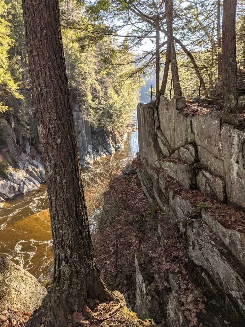
Here is a fun fact to share at dinner. During the American Revolution, British soldiers marched over the bridge at this very spot.
They crossed after their defeat at the Battle of Saratoga in 1777.
Those redcoats were headed east along the post road. Picture long lines of red uniforms filing across the river through these quiet hills.
It is a big moment in American history, right here in a small Massachusetts town.
The bridge served the area for decades after the war. Nearby, grist mills ground grain into flour and sawmills cut logs into lumber.
The river’s power made this a busy little hub of work.
Then came 1835, a year the town would not forget. A powerful flood swept the bridge away, along with the nearby mills. The river reminded everyone who was really in charge.
After the flood, the forest slowly crept back over the old work sites. Wooden wheels and rooftops disappeared under leaves and moss. Today only the stone abutments hint at that busy past.
Knowing this story makes the walk feel richer. The rushing water that carved the gorge also shaped the lives of the people who lived beside it.
Stand near the ruins, listen to the current and let history catch up with you.
Forest Neighbors And Fly Fishing Fun
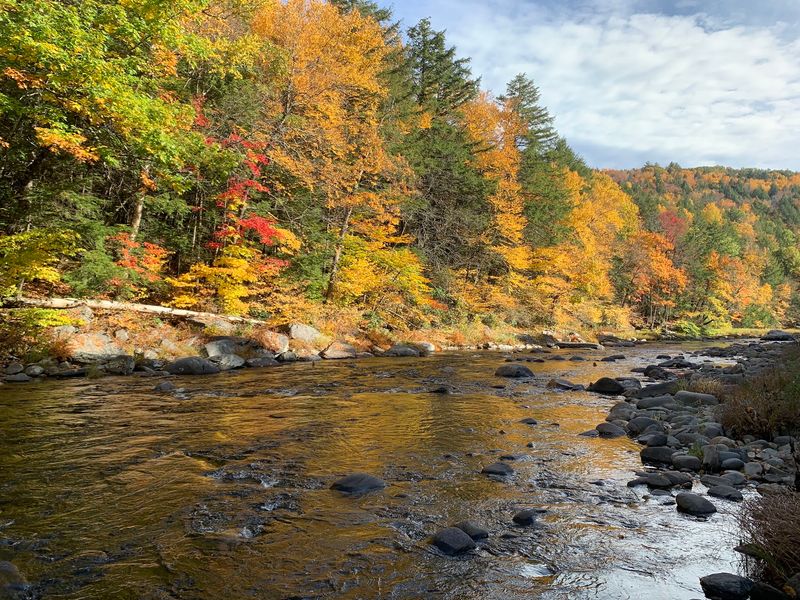
Squirrels may be the chattiest residents, but they are far from the only ones. The woods around the gorge are home to black bears, bobcats and wild turkeys.
Deer also wander through the area, especially near dawn and dusk.
Bears sound scary, but they usually avoid people. Still, keep food packed away and give any animal plenty of space. A zoom lens is your best friend for wildlife photos.
The forest itself is a pleasant mix of oak, pine, hemlock and ash. Hemlocks keep things shady and cool on hot summer days. In fall, the oaks and ash trees add warm splashes of color.
Anglers have their own reason to love this place, and it is not just the scenery. Catch-and-release fly fishing for trout is popular along the river.
Watching someone cast a line over the rippling water is almost as relaxing as doing it yourself.
If you plan to fish, bring a valid state fishing license. Check current fishing rules before your trip, since regulations can change.
Stick to spots outside the gorge walls, where the river is safer to reach.
Birdwatchers should pack binoculars too. The mix of rushing water and thick forest attracts all kinds of feathered neighbors. Early mornings tend to be the busiest time for bird songs.
Look down now and then at mossy logs and damp rocks. Ferns, mushrooms and tiny critters thrive in these shady corners.
Smart Tips For Seasons, Parking And Trail Rules
A little planning goes a long way here. Chesterfield Gorge sits on River Rd in West Chesterfield, MA 01084, in the rolling hills of western Massachusetts.
Cell service can be spotty, so download directions before you leave home.
The reserve is open every day from sunrise to sunset. Parking costs $5 for nonmembers, while members of The Trustees of Reservations and Chesterfield residents park for free.
Check the Trustees website before you go for the latest details.
Timing matters too. Late spring through fall is the best stretch, when the river runs strong and the trees look lush.
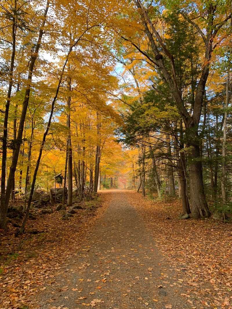
Autumn is the crowd favorite, thanks to bright leaves framing the rocky walls.
Winter has its own charm, with icicles and snowy paths made for snowshoes and cross-country skis. Just know the parking lot is not plowed.
Wear boots with good traction if you head out after a storm. Facilities are basic, so plan ahead before you arrive. Bring water, snacks and a bag for your trash. Bug spray is handy in warmer months.
The lot can fill quickly on sunny weekends. Arriving early gives you quieter trails and a better shot at a parking space.
With a bit of prep, Chesterfield Gorge makes an easy and memorable day trip.