
This Tennessee Road Passes Through What Locals Call The World’s Shortest Tunnel
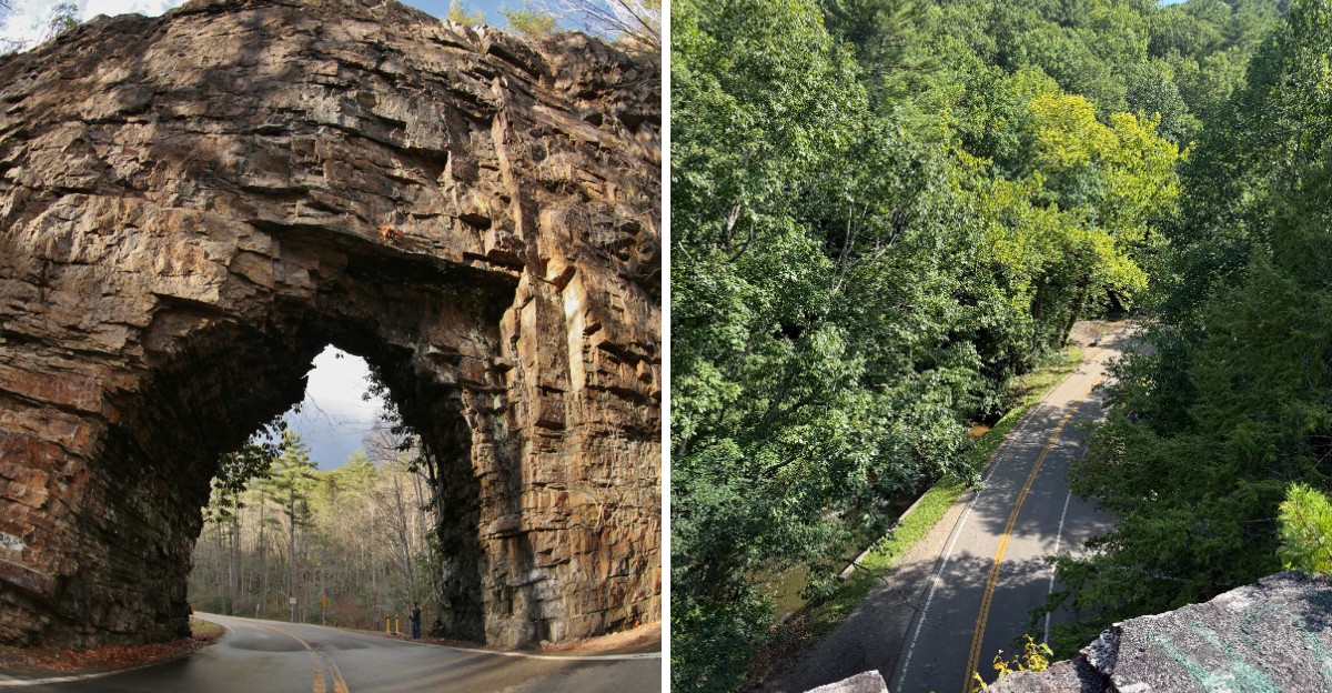
A road that cuts straight through a wall of rock is already unusual. One that locals call the world’s shortest tunnel is even harder to ignore.
In northeast Tennessee, a narrow two lane road passes through a tiny opening carved into a massive stone ridge. The drive through lasts only a few seconds, but the sight is strange enough to make most people want a closer look.
It feels more like a roadside curiosity than part of a normal mountain route.
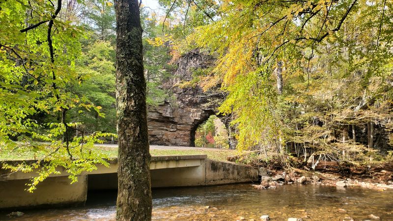
The scenery adds even more to the experience. Forested hills surround the road, a creek runs nearby, and steep rock walls rise beside the pavement.
Fall brings another layer of color as the trees shift into shades of red, orange, and gold.
Tennessee is full of scenic backroads, but this one comes with a landmark that makes the route especially memorable.
A Tunnel You Can Blink And Miss
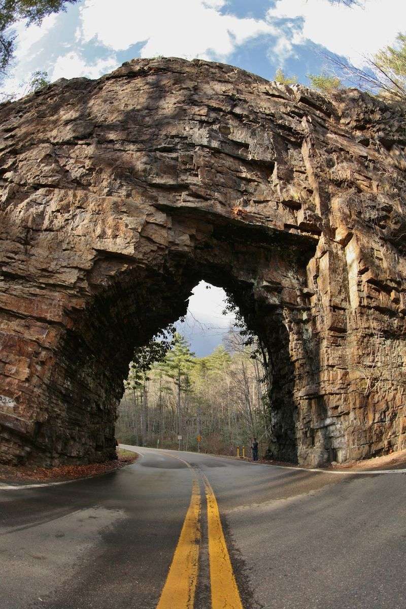
Most tunnels give you time to turn on your headlights. This one is over before you can find the switch. Drivers often slow down just to make sure they saw it right.
Backbone Rock carries the title of the World’s Shortest Highway Tunnel, according to the World Record Academy. The passage runs only about 20 feet through solid stone.
That is shorter than many school buses!
Size is not the whole story, of course. Above the opening, the rock rises more than 100 feet in a sheer, craggy wall. From the road, it looks a bit like a castle gate built by giants.
The landmark sits in northern Johnson County, in the far northeastern corner of Tennessee. For GPS users, the spot comes up at 10556-10582 TN-133, Shady Valley, TN 37688.
The Virginia state line is only a few miles away.
Photographers love the contrast here. The dark mouth of the tunnel frames the road, while green forest wraps around the gray cliff.
Morning light tends to soften the stone and make the colors pop.
Want the best photo? Park in the lot, then walk to a safe spot off the pavement. Cars still use this road, so stay alert and keep to the edges while you snap away.
Blasted For Timber Trains In The Early 1900s
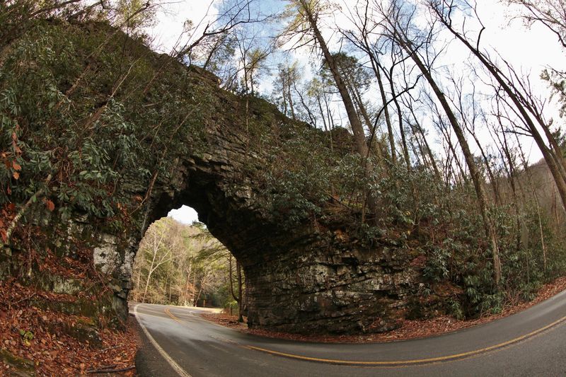
Long before cars showed up, this rock was all about lumber. Around 1901, workers blasted a hole straight through the ridge.
Some records place the work closer to 1908, but everyone agrees on the reason.
The Beaver Dam Railroad needed a path. Its trains hauled timber and other natural resources between Shady Valley, Tennessee, and Damascus, Virginia.
The thick forests of these mountains were worth a lot of money back then.
Going around the ridge was not a simple option. Beaverdam Creek hugs the rock closely, leaving little room for tracks.
So the builders chose the direct route and cut right through the middle.
Picture the scene for a moment. Crews worked with drills, blasting powder, and a lot of muscle. There were no giant modern machines to do the heavy lifting.
The railroad helped towns in the area grow. Logs rolled out of the hills, and supplies rolled back in. For a while, the steady whistle of steam engines echoed through the valley.
Today, you can still trace the rail line in your mind as you stand near the tunnel. The road follows much of the same gentle grade the trains once used.
Railroads needed easy slopes, and that choice still shapes the drive. Keep an eye out for the historical marker nearby. It shares a quick look at the railroad years.
The Smokestack Problem Nobody Saw Coming
Every great story needs a plot twist, and this one has a funny one. After the tunnel was finished, the builders ran into a tall problem. The steam locomotives would not fit!
The smokestacks on top of the engines stood too high. As a result, trains could not pass through without scraping the ceiling. Someone had clearly skipped a measurement.
The fix took patience and plenty of elbow grease. Workers had to chisel away more of the cliff by hand to raise the clearance. Chip by chip, they made room for the trains to roll through.
It is a great reminder that even big projects can miss small details. Think of it like buying a new couch and finding out it will not fit through your front door. The only choice is to make the doorway bigger.
When you stand under the arch today, look up at the rough stone. The ceiling is not smooth like a modern concrete tunnel.
The jagged surface hints at all that blasting and chiseling from long ago. Kids especially enjoy this bit of trivia. It turns a quick roadside stop into a fun history lesson.
Ask them to guess how tall a steam engine smokestack might be, then share the story. Mistakes, it turns out, can make the best memories.
From Iron Rails To Tennessee State Route 133
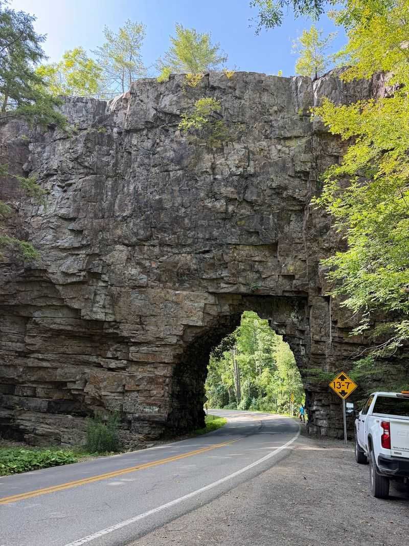
Trains came and went, but the tunnel stayed put. The Beaver Dam Railroad slowed down in the years after 1913. By around 1924, the tracks had been pulled up for good.
An empty rail bed is a terrible thing to waste. So the old route was turned into a road for automobiles.
The tunnel that once served steam engines began serving cars instead.
Changes kept coming in the 1930s. The opening was widened to handle car traffic more easily. It became part of Tennessee State Route 133, the same road drivers use today.
Around the same time, the Civilian Conservation Corps went to work nearby. This group of young workers built picnic shelters and hiking trails.
Much of their work used native stone that blends right into the forest.
That stonework is still easy to spot. Look for sturdy walls, steps, and structures that seem to grow out of the hillside. They are almost a century old and still doing their job.
Drivers should take care near the tunnel. The road bends, and seeing oncoming traffic can be tricky. Pulling out of the parking lot needs extra caution, since the view to the left is limited.
Take it slow and enjoy the moment. Rolling through a former railroad tunnel is not something you get to do every day.
A Rocky Spine Shaped By Holston Mountain
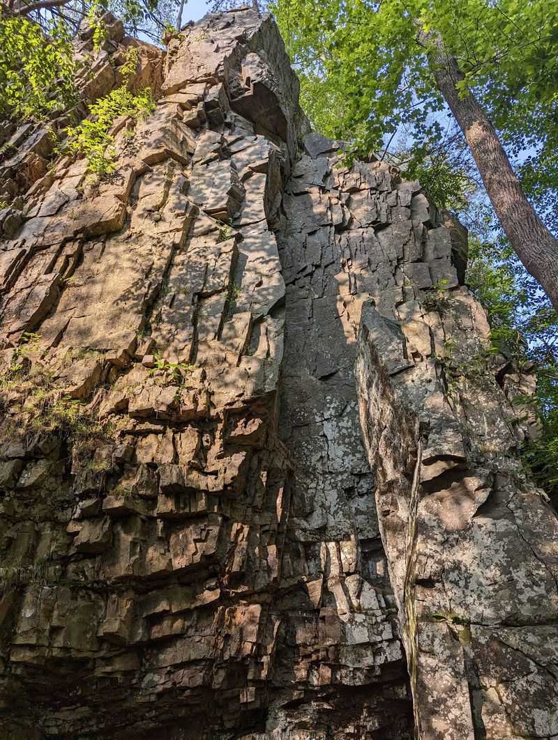
Nature did most of the heavy lifting here long before any railroad crew arrived. Backbone Rock is a spur ridge of Holston Mountain.
Over time, weather and water shaped it into a long, narrow fin of stone.
The name makes sense once you see it. The ridge rises and dips like the bumpy spine of a giant animal, or even a person.
Some people say it looks like a row of vertebrae lined up along the creek.
What makes it so special is how thin it is. Where the tunnel cuts through, the ridge is only about 20 feet deep.
Yet its highest points tower more than 100 feet above the ground.
Beaverdam Creek flows right alongside the base. The water has helped carve this landscape for a very long time.
Its steady sound adds a peaceful soundtrack to the whole area.
Rock lovers, bring your curiosity. The exposed stone shows off textures, cracks, and colors that tell a slow story of change.
Moss and ferns cling to shady ledges, softening the rugged look.
The ridge sits inside the Cherokee National Forest, one of the largest stretches of public land in the state. That means the scenery around it is protected.
Tall trees, clear water, and mountain air are all part of the package.
Stone Steps To The Top Of The Ridge
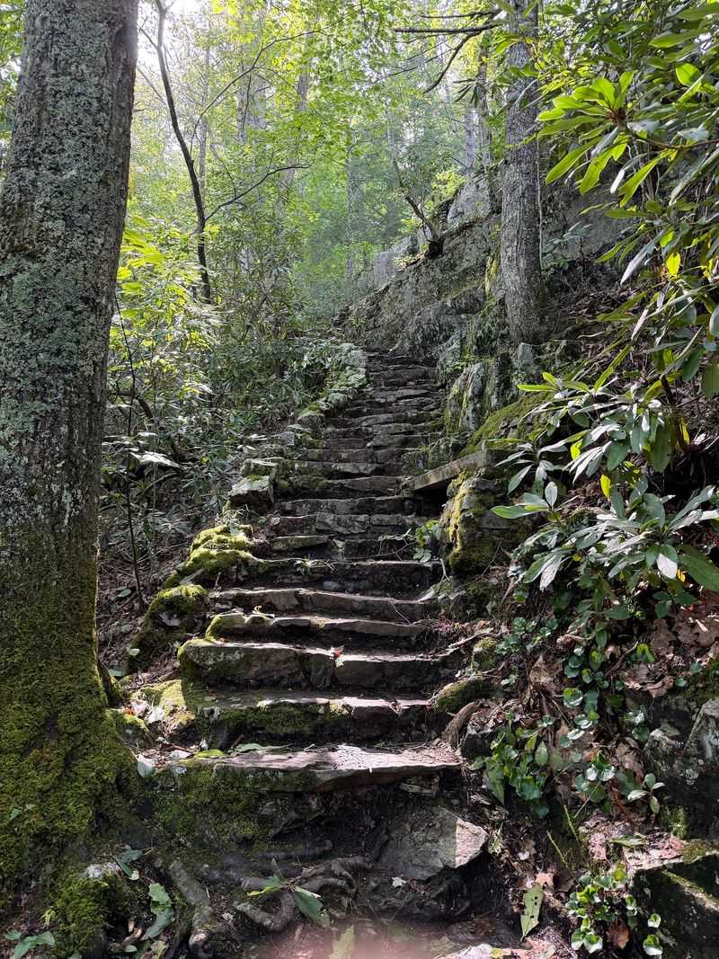
Driving through the rock is fun, but walking on top of it is even better. A trail climbs up from the parking area to the crest of the ridge.
It is one of the most popular things to do at Backbone Rock.
The path starts with a series of stone steps. Some are steep and uneven, so take your time. Good shoes with solid grip make a big difference here.
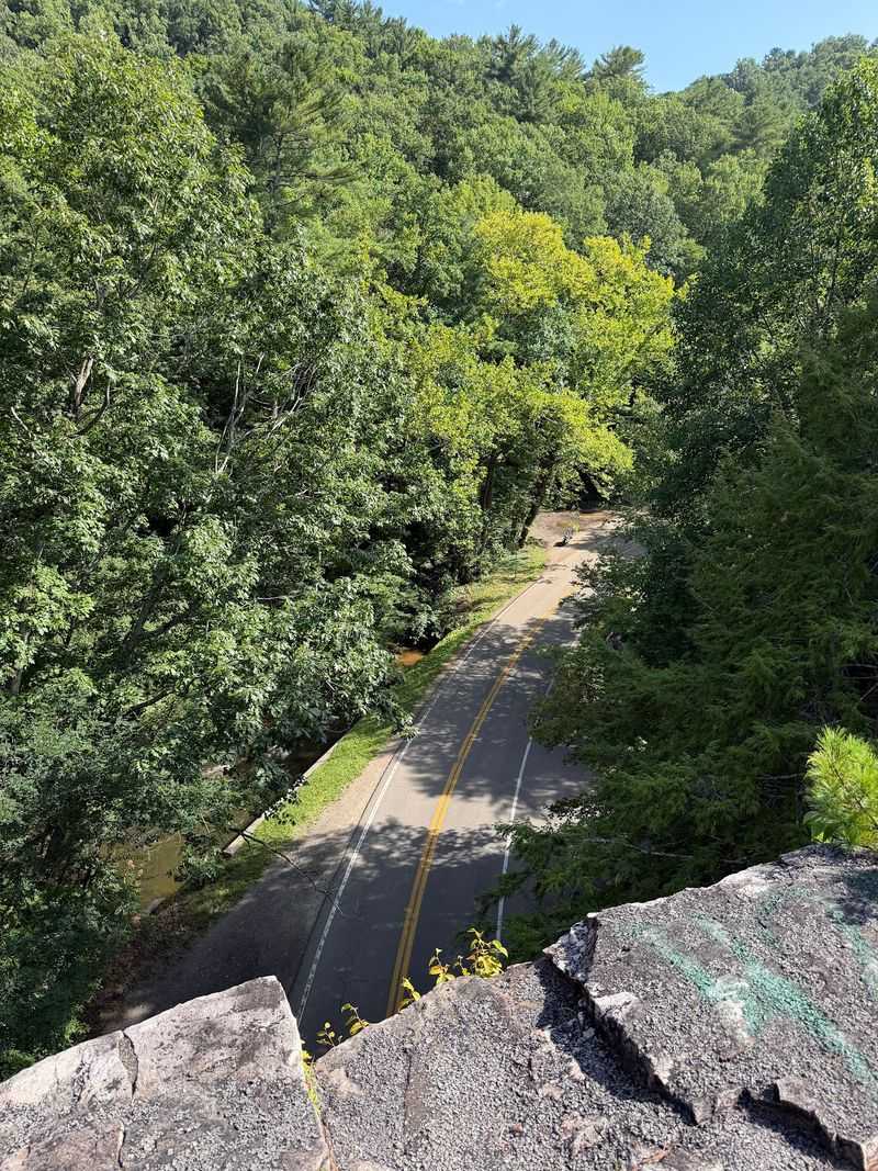
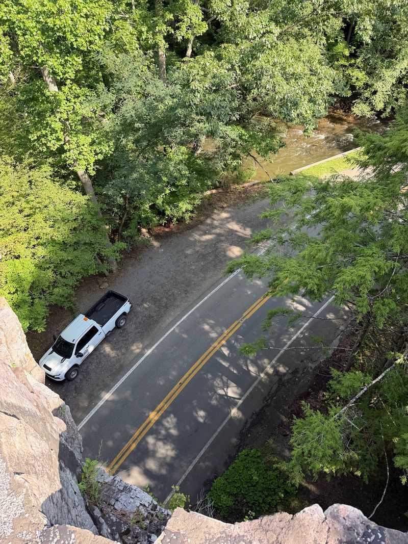
Once you reach the top, the reward is worth every huff and puff. You can walk right across the ridge above the tunnel. Cars pass below while you stand high above them.
Views stretch out over the forest and the winding creek. It is a great place to snap photos and catch your breath.
Clear days bring out the deep greens of summer and the bright colors of autumn.
Safety matters on this route. There are steep drop-offs, and only some sections have railings or small bridges.
Families with young children should think carefully before heading up.
A few simple tips help a lot. Stay on the marked trail and keep a firm hand on little ones. Avoid the climb after heavy rain, since wet rock can be slippery. The hike is short, but it packs plenty of adventure into a few minutes.
Backbone Falls And The Creekside Trail
Just across the road from the parking lot, a different kind of beauty waits. A second trail leads to Backbone Falls. It is a sweet little waterfall that splashes down over mossy rocks.
Many people find this path a bit gentler than the climb over the ridge. It winds through the woods and along the hillside. The sound of rushing water gets louder the closer you get.
Backbone Falls is not a towering giant. Still, it has plenty of charm, especially after a good rain. The cascade turns lively and white as it tumbles through the forest.
Bring a camera and a little patience. The falls look great in soft, cloudy light when the shadows are not too harsh. Spring brings fresh green leaves, while fall adds warm reds and golds.
Hikers with bigger plans have options too. Trails here link up with the famous Appalachian National Scenic Trail. That connection opens the door to much longer walks through the mountains.
Rock climbers and rappellers also enjoy the area. The cliffs offer a place to practice basic skills with the right gear and training.
Groups often gather here to learn ropes and safety techniques together.
Whatever trail you choose, pack water and snacks. Wear sturdy shoes and leave the trail as clean as you found it.
Trout, Picnics, And A Short Hop To Damascus
Fishing fans, grab your rods, because Beaverdam Creek is stocked with trout. The clear mountain water is a favorite spot for anglers. Just be sure to have a valid fishing license for the state.
On hot summer days, the creek becomes a natural cool-down zone. Some shallow spots are popular for wading and swimming. Always check the water level and current before jumping in.
Picnic lovers are in luck as well. The recreation area has tables near the water, grills, and a covered day-use pavilion. The CCC stonework gives the whole place a rustic, old-time feel.
Want to stay longer? A campground in the Backbone Rock Recreation Area lets you sleep under the stars. Sites can be reserved through Recreation.gov, so plan ahead during busy seasons.
The fun keeps going beyond the tunnel. Damascus, Virginia, sits only about five miles north. Known as Trail Town USA, it is a hub for hikers and cyclists.
From there, you can ride the Virginia Creeper Trail or explore sections of the Appalachian Trail. Grayson Highlands State Park is also within driving distance. Its open balds and mountain views make a great add-on.
Road trippers heading through Shady Valley might also enjoy nearby US 421, a curvy route nicknamed The Snake. Pair it with this quirky tunnel, and you have one memorable mountain day.