
9 North Carolina Hiking Trails Locals Avoid In October Because The Snakes Are Too Active
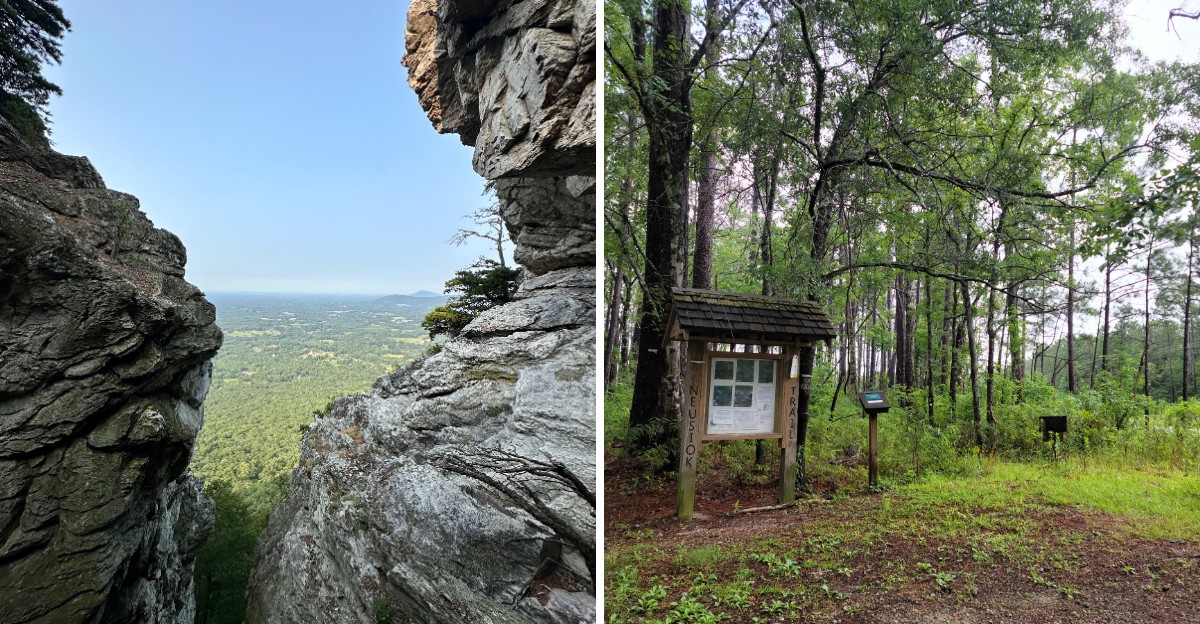
Golden leaves crunch underfoot while sun-warmed rocks glow across the path like tiny heated benches.
Cute, right? Well, the snakes think so too.
October in North Carolina feels crisp and gorgeous, yet the reptiles skipped the memo about slowing down. Locals know it, and plenty of them avoid certain hiking trails until the chill turns serious.
Swamps drip with moss. Mountain ledges soak up lingering heat, and boardwalks creak over dark water where something slithery might be watching.
The scenery looks unreal, which makes those active snakes feel extra sneaky.
So do you dare lace up anyway? North Carolina rewards sharp eyes and steady steps with views worth every careful move.
Curious which trails earned a spot on the list? Your next autumn adventure could be waiting just below.
1. Lassiter Trail, Merchants Millpond State Park, North Carolina
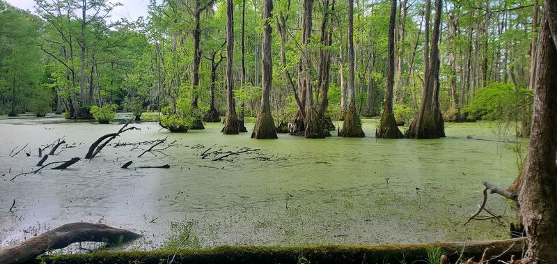
Ever felt like a swamp was watching you? That was my first thought on the Lassiter Trail at Merchants Millpond State Park.
This park sits in Gates County, in northeastern North Carolina, not far from the Virginia line. The centerpiece is a huge, very old millpond wrapped in cypress and gum swamp.
Spanish moss drapes the ancient trees like party streamers. The water stays dark, calm, and mysterious.
Here is the catch for October. Warm, wet ground like this makes perfect snake territory, and cottonmouths and water snakes may lounge near the edges.
Locals often wait for a crisp October morning before strolling here. I get it, since leaf litter hides a lot this time of year.
Watch every log before you step over it. Keep your eyes on the path, not just the pretty moss.
The good news? The park trails stay mostly flat and easy, so you can focus on your footing.
Rent a kayak or canoe if you want a different view. Paddling lets you admire the cypress knees without crunching through brush.
Bring binoculars for birdwatching, too. Alligators have been spotted here, near the northern edge of their natural range.
Treat this swamp with respect, and it rewards you with pure magic.
Location: Merchants Millpond State Park, Gates County, North Carolina, USA.
2. Palmetto Boardwalk, Goose Creek State Park, North Carolina
Palm trees in North Carolina? Well, sort of, and they come with a slithery side.
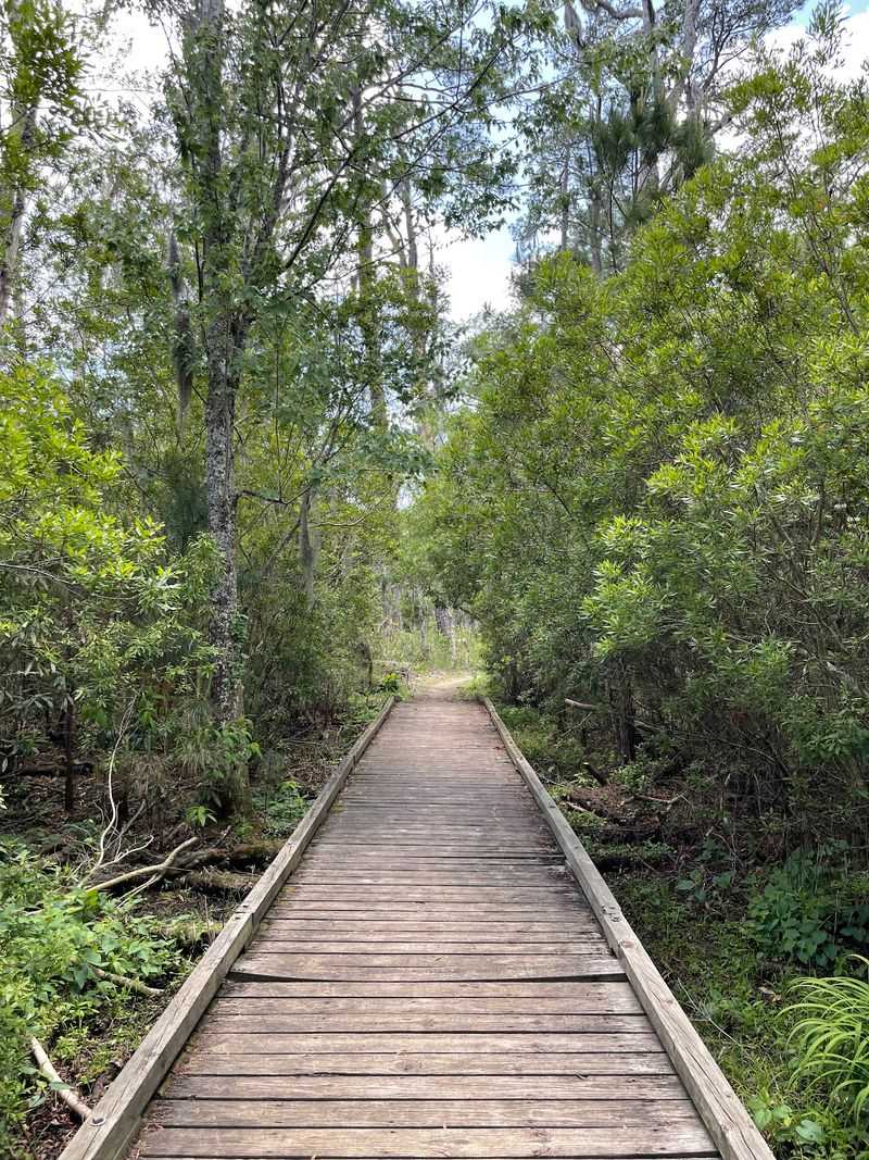
Goose Creek State Park sits in Beaufort County near the town of Washington. It hosts one of the northernmost populations of dwarf palmetto, and the Palmetto Boardwalk shows them off beautifully.
The boardwalk floats over a shadowy cypress swamp. Fan-shaped fronds pop up everywhere like green paper fans.
Frogs, turtles, and several snake species call these wetlands home. In October, reptiles may still sun themselves on warm boards or nearby roots.
So why hike it at all? The boardwalk keeps you off the muddy ground, which helps a lot.
Still, stay alert. Scan the edges of the planks before you lean on a railing or stop for photos.
Keep an ear out for marsh wrens and look for herons and egrets in the brackish marshes. River otters and muskrats sometimes make surprise appearances too.
Save time for the giant live oak whose branches stretch over the Pamlico River. It makes a lovely shady rest stop.
Kayaking, fishing, and camping round out a full day. Seasonal swimming happens at a designated beach area.
Visit on a cool morning, and let the palmettos do the talking.
Location: Goose Creek State Park, near Washington, Beaufort County, North Carolina, USA.
3. Flytrap Trail, Carolina Beach State Park, North Carolina
Plants that eat bugs, and snakes that nap nearby. Welcome to one wild little loop.
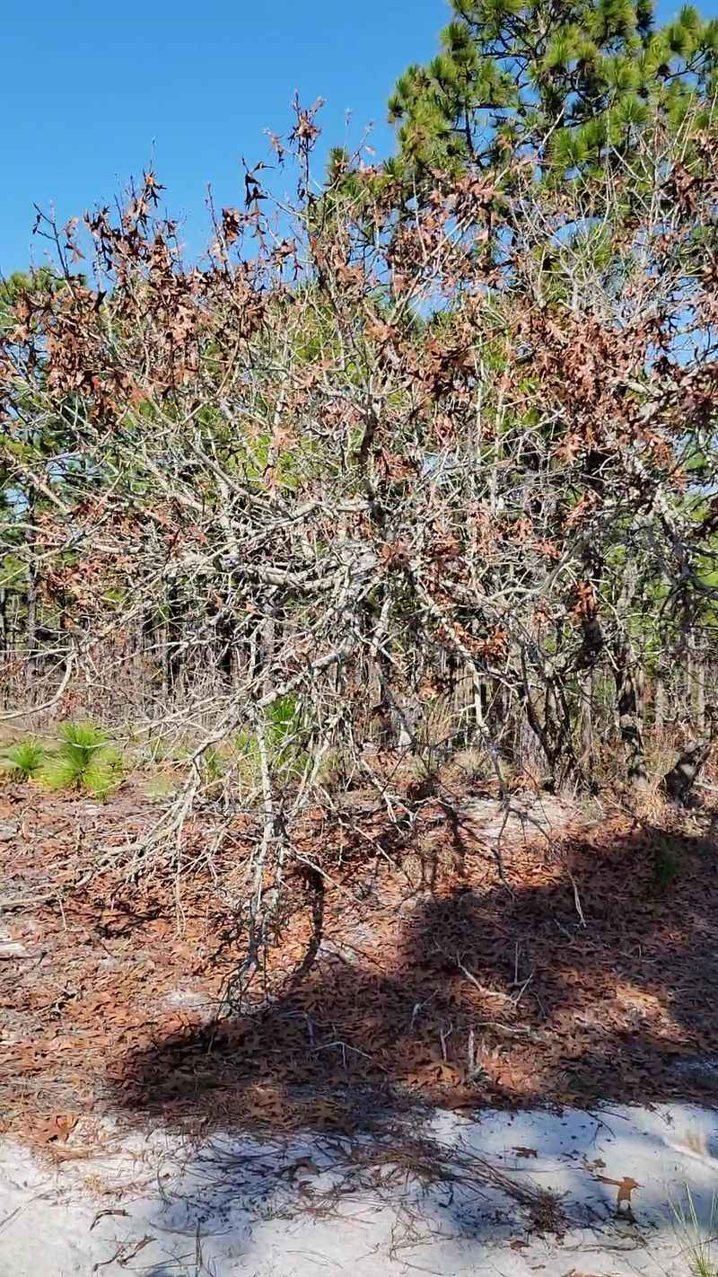
Carolina Beach State Park sits on Pleasure Island, south of Wilmington in New Hanover County. It ranks among the few places on Earth where Venus flytraps grow naturally.
The Flytrap Trail gives you the best shot at spotting them. Look low, since these plants stay tiny.
That low gaze helps in October for another reason. Sandy pine habitat attracts snakes, and warm afternoons can bring them onto the path.
Stay on the trail and never poke into the brush. Your boots and the rare plants both stay happier that way.
Pocosin wetlands nearby shelter pitcher plants, sundews, and butterworts. Honestly, it feels like a carnivorous plant festival.
The trail is wheelchair accessible, which I love. Wider paths also make it easier to spot anything curled up ahead.
Afterward, climb toward Sugarloaf Dune, an old landmark once used by river pilots. The view over the Cape Fear River is worth the sandy shoes.
The park also offers biking, paddling, fishing, and a marina. Pack a picnic and make an afternoon of it.
Come back in cooler weeks if you want a calmer, snake-lite stroll.
Location: Carolina Beach State Park, Pleasure Island, New Hanover County, North Carolina, USA.
4. Neusiok Trail, Croatan National Forest, North Carolina
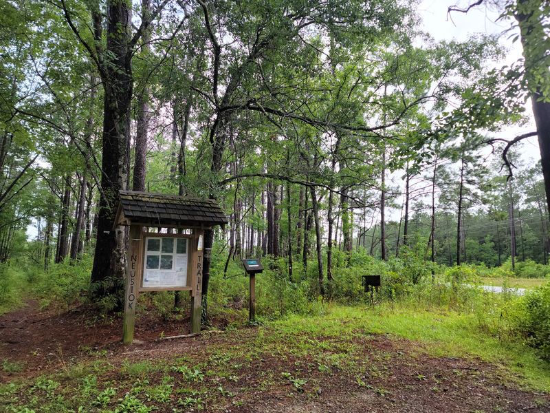
Picture a long, lonely trail with pine needles underfoot and swamp water on both sides. Now picture a rattlesnake enjoying the same view.
The Neusiok Trail cuts through Croatan National Forest in eastern North Carolina. This forest spreads across Craven, Carteret, and Jones counties, between New Bern and Morehead City.
People often call it a true coastal forest. You get pine stands, bogs, estuaries, and raised swamps called pocosins.
Eastern diamondback rattlesnakes can live in the sandy areas here. Alligators and plenty of other reptiles share the space too.
October keeps things warm, and mosquitoes and biting flies often join the party. Many locals simply hold off until late fall.
Planning to go anyway? Wear long pants, pack bug spray, and carry plenty of water.
Step onto logs, not over them. Use trekking poles to tap ahead in tall grass.
The payoff feels huge. Black bears, bobcats, river otters, and countless birds roam this quiet corner.
Hike a short section instead of the whole route if the heat feels heavy. The trail runs long, so pacing matters.
Finish with a paddle or some fishing on nearby rivers and creeks.
Location: Croatan National Forest, between New Bern and Morehead City, eastern North Carolina, USA.
5. Raven Rock Loop Trail, Raven Rock State Park, North Carolina
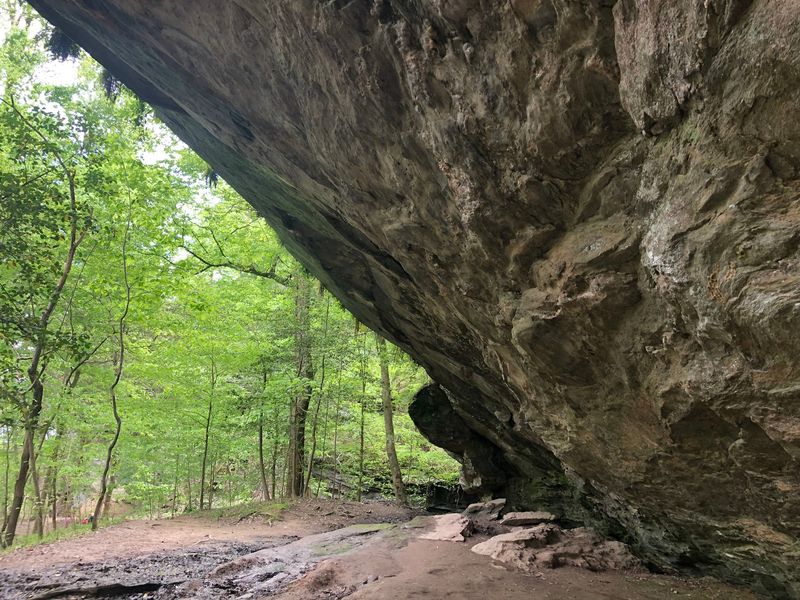
Rocks soak up sunshine all day. Guess who loves a warm rock in October?
Raven Rock State Park sits in Harnett County, southwest of Raleigh. Its star is a towering crystalline cliff rising above the Cape Fear River.
The Raven Rock Loop Trail winds through hardwood forest to reach it. Moderate hills and scenic overlooks keep the walk interesting.
Some stretches feel rooty, rocky, or steep. Those rocky nooks can hide copperheads catching some late-season heat.
Keep your hands off ledges you cannot see. Look before you grab any boulder for balance.
The park lies in the fall zone, where hard foothill rock meets softer coastal plain soil. That mix creates surprisingly varied scenery in a short hike.
Mountain laurel brightens the bluffs, and salamanders thrive near the river. Deer and cottontails often dart across the trail.
Head down the stairs to the river for the best view of the cliff face. The scale really hits you there.
Spring and fall usually bring the mildest weather here. Late fall tends to feel calmer on the reptile front.
Stay for paddling, fishing, or a night in a camper cabin. Trust me, the sunset over the water is a keeper.
Location: Raven Rock State Park, Harnett County, North Carolina, USA.
6. Moore’s Wall Loop Trail, Hanging Rock State Park, North Carolina
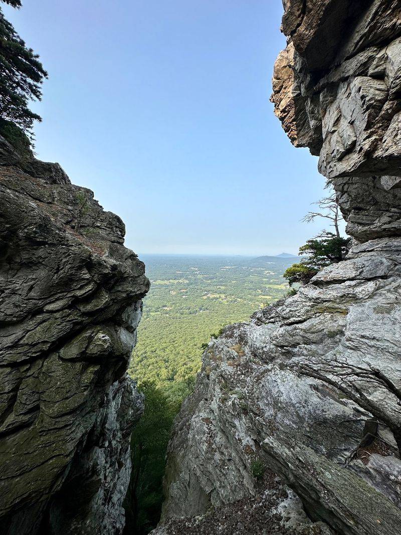
Hundreds of stone steps, one tall tower, and a lot of sun-warmed rock. Ready to sweat?
Moore’s Wall Loop Trail lives in Hanging Rock State Park in Stokes County, north of Winston-Salem. The park sits within the Sauratown Mountains, old peaks worn down over ages.
This loop feels strenuous, so pace yourself. It climbs to Moore’s Observation Tower, the highest point in the range.
From the tower, views spread in every direction. On a clear day, the ridges roll on and on.
Now the snake part. Rocky outcrops and ledges draw timber rattlesnakes and copperheads that love basking in warm weather.
Watch the steps closely on the way down. Locals nickname that stretch the endless staircase for good reason.
Look for Balanced Rock along the descent. It looks like it should tip over, yet it never does.
The trailhead starts behind the stone bathhouse near the lake parking lot. Easy to find, hard to forget.
Cool off afterward with seasonal lake swimming or some paddling. Spring peepers and chorus frogs often serenade the lake in warm months.
Rock climbers and campers flock here too. Come in late fall, and you might have the tower almost to yourself.
Location: Hanging Rock State Park, near Danbury, Stokes County, North Carolina, USA.
7. Pinnacle Trail, Crowders Mountain State Park, North Carolina
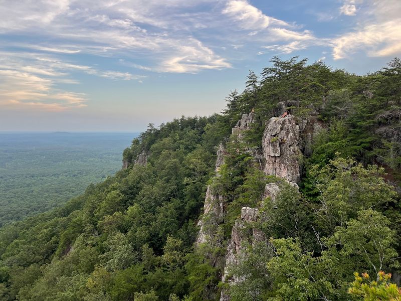
Short on flat ground, long on bragging rights. The Pinnacle does not mess around.
Crowders Mountain State Park sits in Gaston County near Kings Mountain and Gastonia. Its rugged peaks rise sharply above the rolling Piedmont.
The Pinnacle Trail climbs toward some of the best overlooks in the region. Expect a moderate to strenuous workout with steady elevation gain.
Near the top, rocks and boulders take over. Those sunny slabs make prime basking spots for snakes in October.
Scramble carefully and never reach blindly into cracks. Check shady crevices before you sit down for a snack.
Honestly, the summit makes every step worthwhile. Wide views stretch across forests and small towns below.
Rock climbers and boulderers love this park. You might watch someone scale a cliff while you catch your breath.
Bring lots of water, since the climb warms you up fast. Sturdy shoes help on loose rocks too.
Paddling and fishing offer a calmer pace down at the lake. Backcountry and tent camping let you stretch the trip.
Weekends can get busy here, so arrive early. Busy trails also mean snakes often slip away before you notice them.
Wait for a crisp November day for the clearest skies.
Location: Crowders Mountain State Park, near Kings Mountain, Gaston County, North Carolina, USA.
8. Chestnut Knob Trail, South Mountains State Park, North Carolina
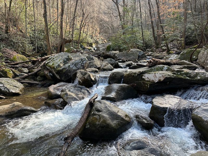
Steep, shady, and packed with views. Just keep one eye on those rocky outcrops.
South Mountains State Park sits in Burke County near Morganton and Valdese. It holds the title of North Carolina’s largest state park.
The Chestnut Knob Trail starts at the Jacob Fork parking area. From there, it climbs hard through thick hardwood forest.
Your legs will feel it quickly. Take breaks, drink water, and enjoy the cooler shade.
Rocky outcrops dot the upper sections. In warm October weather, snakes may stretch out on those sunny stones.
Pause before stepping up onto any ledge. A quick look saves a lot of surprise.
The effort pays off with sweeping views over the Jacob Fork River gorge and wide mountain ridges.
Birders, bring your binoculars. Dozens of bird species nest within the park.
Horseback riders have their own long trails here, and an equestrian campground with a horse barn sits ready for overnight stays.
Camping options include tent, RV, equestrian, and backpacking sites. You could easily spend a whole weekend exploring.
Plan your climb for a cool autumn morning, and the summit feels twice as sweet.
Location: South Mountains State Park, near Morganton, Burke County, North Carolina, USA.
9. Table Rock Summit Trail, Linville Gorge Wilderness, North Carolina
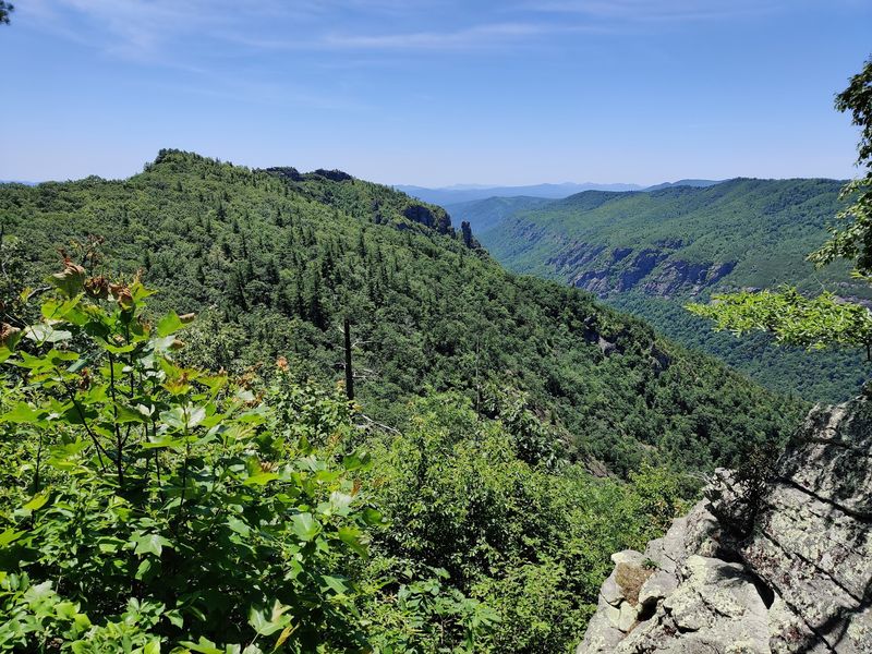
People call it the Grand Canyon of the East. One look off Table Rock, and you will understand why.
The Table Rock Summit Trail sits within Linville Gorge Wilderness in the mountains of Western North Carolina, though Hurricane Helene damage has closed the summit parking area, so check Forest Service updates before planning your route.
The Linville River carves straight through the gorge far below. Steep cliffs and dense forest surround you on every side.
Table Rock ranks among the state’s top climbing spots. All that exposed rock heats up nicely in October sun.
Rattlesnakes and copperheads may bask along rocky edges. Watch where you place your hands during any scramble.
Trails in the wider wilderness stay primitive and often lack signs or blazes. Carry a map and compass, and know how to use them.
Deer, bears, turkeys, and grouse roam these woods. Keep your food packed tight and your eyes open.
The summit rewards you with sweeping views across the gorge. Sunset from up there feels unforgettable.
Planning to camp? Permits are required on weekends and holidays during the busy season.
Hiking, backpacking, fishing, and climbing all draw adventurers here. Save this summit for late fall, and let the crisp air do its magic.
Location: Linville Gorge Wilderness, Pisgah National Forest, Western North Carolina, USA.