
The Massive Massachusetts Reservoir That Flooded Homes, Mills, Churches, And Nearly 30 Miles Of Roads
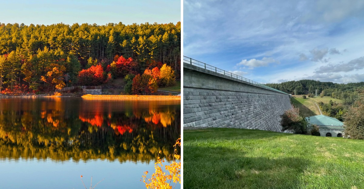
Entire neighborhoods once stood where open water stretches today.
A massive Massachusetts reservoir changed the landscape so dramatically that homes, mills, churches, roads, and pieces of everyday life had to disappear to make room for it.
Nearly 30 miles of roads were affected, along with buildings and communities that had existed long before the project began.
That makes the shoreline feel different once you know the history. What looks peaceful now carries traces of a much busier past, when people lived, worked, traveled, and gathered across land that no longer looks the same.
Massachusetts needed a reliable water supply, but creating it came with a huge transformation. Roads vanished. Buildings were removed. Familiar landmarks were lost.
Today, the reservoir tells two stories at once: one about engineering on a massive scale, and another about everything that had to be left behind.
A Thirsty City Sparks A Giant Plan
Boston had a serious drinking problem in the 1890s, and it involved plain old water. The city was growing fast, and its old supplies could not keep up.
Planners needed a big, clean source, and they looked west. Their answer became the Wachusett Reservoir. Work began in 1897 and wrapped up in 1905.
The plan was to block the South Branch of the Nashua River just above the town of Clinton.
Patience was part of the deal. Once the dam was ready, the valley slowly filled, and the reservoir first reached its full level in May 1908. That is a long time to wait for a bathtub to fill.
Size made this project famous. About 4,380 acres disappeared under the water, spread across Boylston, West Boylston, Clinton, and Sterling. That is roughly 6.5 to 7 square miles of former farmland, villages, and riverbanks.
Back then, few places on Earth had tried anything this large for public water. Engineers, laborers, and town leaders all had to work together for years. The result changed the map of the region forever.
Here is a fun way to picture it. If you stood on a hill in 1896, you would see farms and mills below. Stand there today, and you see a shining lake stretching toward the horizon.
Families Who Packed Up An Entire Valley
Moving day is stressful enough when you only change apartments. Now imagine your whole town moving at once. That was life for over 1,700 people in the reservoir zone.
Homes and farms sat right where the water would rise. Some buildings were taken apart or knocked down.
Others were lifted and hauled to new spots on higher ground, which was a remarkable feat with 1900s tools.
Farmers felt the change in a big way. Fields their families had plowed for generations would soon be lakebed. Many started fresh on new land in nearby towns.
West Boylston saw a large share of the change. Busy little neighborhoods along the river slowly emptied out. Stores, homes, and gathering spots all had to find new addresses or close.
It helps to think about this the next time you turn on a faucet. A glass of water in Boston connects to choices made by real families long ago. Their sacrifice still shapes daily life for millions.
Local historical societies keep these memories alive today. The Beaman Memorial Public Library in West Boylston holds photos and records from the old villages.
If you love history, those old pictures are a treasure. They show porches, barns, and dirt lanes that now rest quietly beneath the waves.
Mill Wheels That Stopped Turning
Rivers in old New England worked harder than most people. They spun wheels, powered looms, and kept whole villages employed.
The South Branch of the Nashua River was no exception.
Several mills lined its banks before the reservoir arrived. Records show about six mills had to be relocated or shut down. For towns that depended on them, that was a huge shift.
Mill jobs supported many local families. Workers made cloth and other goods that traveled across the state. When the water began to climb, those buildings could not stay where they were.
Think of a mill as the beating heart of a small town. Shops, homes, and churches often grew up around it. Remove the mill, and the whole neighborhood changes shape.
Some owners rebuilt elsewhere and kept their businesses going. Others moved on to new kinds of work. The region slowly adjusted, as Massachusetts towns have done many times through history.
Here is a quirky detail worth knowing. The same flowing water that once powered looms now flows toward city taps instead.
In a way, the river just switched careers. It went from factory helper to drinking water hero, and it has kept that job for well over a hundred years.
The Stone Church That Refused To Sink
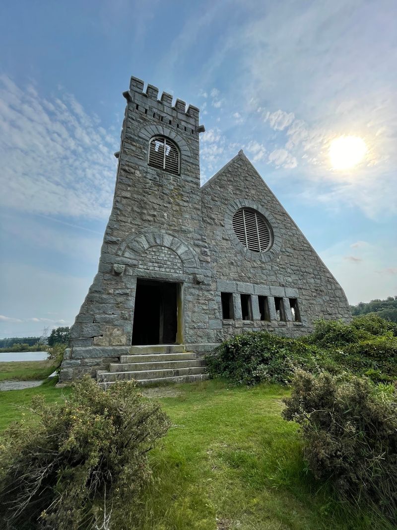
Some buildings simply know how to pick a good spot. The Old Stone Church in West Boylston sits on a small hill, and that hill saved it. While the water rose around it, the church stayed dry.
Built in 1891, it replaced a Baptist church that had been lost to fire. Sadly for its members, the congregation left in 1902 when reservoir work began.
About four churches and eight schools in the area were relocated during the project.
Local history groups fought to keep the stone church standing. They saw it as a scenic landmark worth protecting. Their effort paid off in a big way.
In 1973, the church joined the National Register of Historic Places. A year earlier, its roof had collapsed. The community rallied and rebuilt it in 1977, which shows how much people cared.
Today, it is easily the most photographed spot along the Wachusett Reservoir. Its gray walls glow at sunset, and the water reflects the arched windows.
You can even spot it from the road on the West Boylston side near Route 140.
Bring a camera and arrive in the late afternoon. The light turns golden, and the old stones look almost magical against the shimmering water.
Roads That Slipped Beneath The Surface
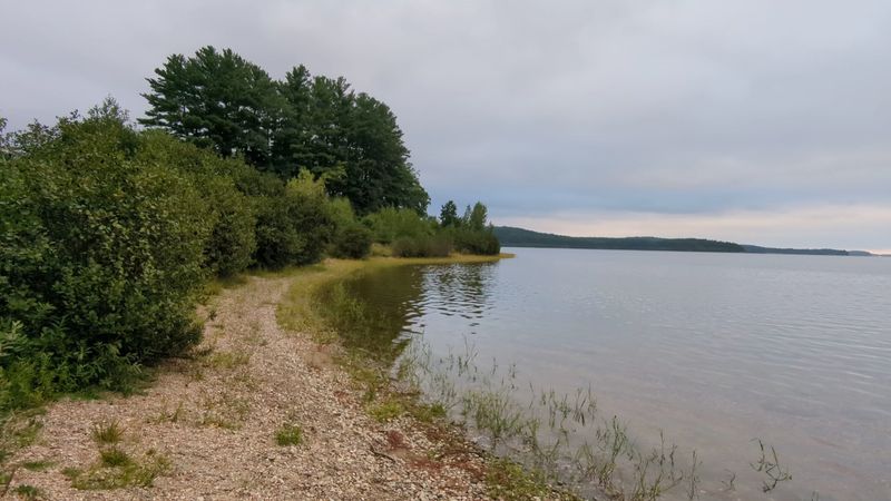
Ever had your GPS say a road no longer exists? People in this valley lived that for real. Miles of local roads ended up underwater once the reservoir filled.
Country lanes that linked farms and villages simply disappeared. Some sources count around 17 miles of submerged local roads, while broader tallies of all affected routes run higher. Either way, getting around town suddenly became a puzzle.
Engineers solved it by building fresh routes. Highways such as Routes 70, 110, and 140 now help reconnect Boylston, West Boylston, Clinton, and Sterling.
Many drivers use them every day without knowing their backstory.
Railroads had to move too. Existing tracks were rerouted to avoid the new shoreline. That took careful planning, since trains cannot exactly turn on a dime.
Here is a smart tip for a scenic drive. Route 140 and Route 70 skirt parts of the water and offer lovely views. Fall is especially pretty, when red and orange leaves frame the blue lake.
Next time you cruise along one of these roads, picture the old lanes resting below. Horse carts and farm wagons once rolled through that valley.
Now fish swim where wheels used to creak, which is a pretty wild thought for a Sunday drive.
A Mighty Dam Shaped By Human Hands
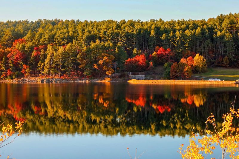
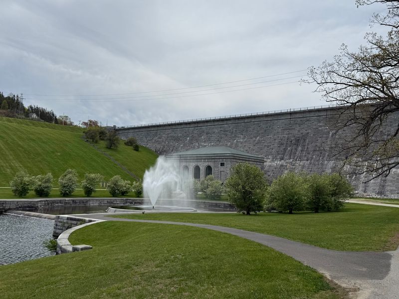
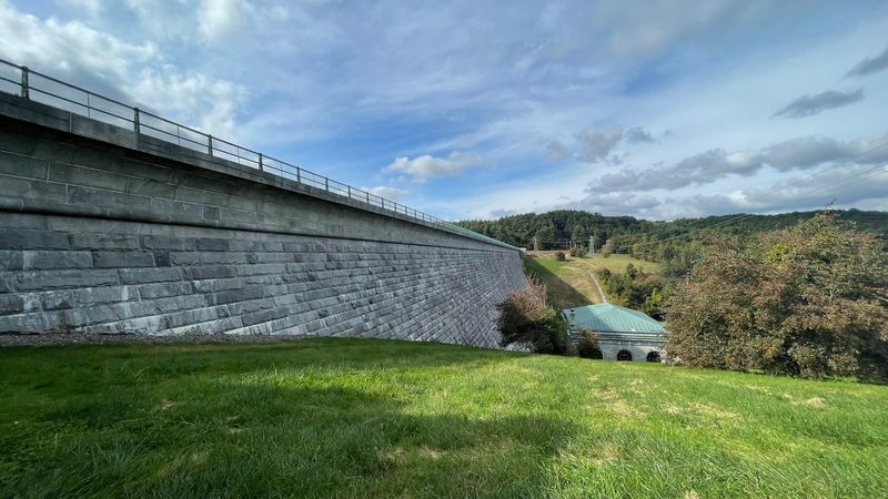
No giant machines, no problem. The Wachusett Dam was built largely by hand, and it is still called the largest hand-dug dam in the world. That is a lot of shovels.
Workers finished the dam in 1905. At the time, it formed the largest public water supply reservoir anywhere.
It was also counted as the largest gravity dam on the planet, which means its sheer weight holds back the water.
You can find it at 265-283 Boylston Street in Clinton, Massachusetts. The granite walls feel huge up close.
A stepped spillway sends water tumbling down, creating a waterfall that sounds wonderful on a breezy day.
Bring comfortable shoes, because there are plenty of stairs. Climbing them makes a great free workout with a view.
The flat walk across the top is easy and offers wide looks over the water.
Nearby sits an old building that once housed turbines. It is usually closed, but peeking through the windows feels like spying on history.
The stonework around the grounds is a craft you rarely see today.
Winter adds drama to the scene. The rushing water seems louder and colder when snow covers the banks. Every season paints this spot a little differently, so it rewards return trips.
Clean Water Flowing To Millions
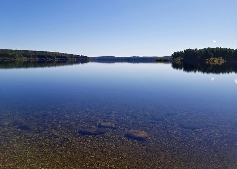
Here is a number that will make your water bottle feel fancy. The Wachusett Reservoir holds about 65 billion gallons. That makes it the second-largest body of water in Massachusetts.
Its water reaches around 2.7 to 3.1 million people in the Boston area. Even more impressive, it is an unfiltered source.
The water is so clean that it does not need traditional filtration before treatment and delivery.
Two agencies work as a team to protect it. The Massachusetts Water Resources Authority handles the water system.
The Department of Conservation and Recreation cares for the land and watershed around it.
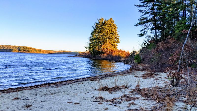
The shoreline stretches about 37 miles. Thick forests surround much of it, acting like a natural sponge and filter. Those trees help keep soil and runoff from muddying the water.
So why all the careful rules? Every choice near the shore affects what ends up in someone’s kitchen sink. Protecting this place is really about protecting public health.
Here is a helpful way to see it. When you hike these woods, you are walking through a giant outdoor water treatment plant built by nature.
It is quiet, green, and working hard every single minute. Pretty amazing for something that looks like a peaceful lake.
Trails, Trout, And Loons Along The Shore
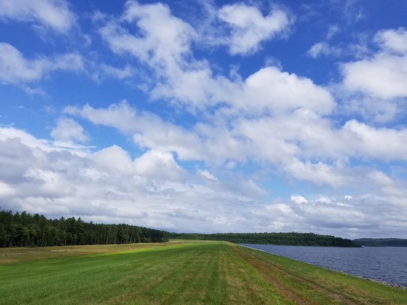
Anglers, grab your gear, because this shoreline holds bragging rights. The Wachusett Reservoir claims six state fishing records.
It is also one of only two places in Massachusetts that supports lake trout.
Shoreline fishing opens in marked areas from the first Saturday in April through November. Brown trout, rainbow trout, landlocked salmon, smallmouth bass, and white perch all swim here.
Patience and a good lure can pay off nicely.
Not into fishing? Fire roads and trails wind through the woods for hiking, bird watching, and nature walks. In winter, snowshoes turn those same paths into a quiet wonderland.
Keep your eyes on the sky and water. Migrating waterfowl, common loons, and even eagles appear here. Deer often wander through the trees, and you might spot a fox too.
Rules keep the water pure, so plan ahead. Dogs, horses, boats, swimming, fires, drones, and ATVs are not allowed. Pack out everything you bring, and leave the shore as clean as you found it.
For maps and details, check the DCR Field Headquarters at 180 Beaman Street in West Boylston. Numbered gates mark access points around the reservoir.
Bring bug spray in summer, a camera always, and plenty of curiosity.