
Plan A Weekend Road Trip To Visit This South Carolina Waterway Packed With Lost History
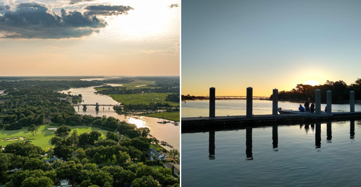
In 1780, British troops built redoubts beside a narrow tidal channel to guard their fleet. Today, people launch kayaks and fishing boats from that same stretch of water.
The channel also flows past the land where a teenage Eliza Lucas tested indigo in the 1740s. Her experiments helped turn a blue dye into a fortune for colonial South Carolina.
Not bad for a creek most drivers zip over without a second look.
The funny thing is, the modern spot is a plain public boat ramp. It has concrete lanes, a parking lot, and a drawbridge humming overhead.
Yet the water underneath carried soldiers, supply boats, and early traders long before anyone towed a bass boat here.
I’ve come to realize the best history lessons sometimes come with a tide chart. You get marsh views, a strong current, and stories layered like oyster shells.
It just feels right to plan a weekend around a place like this. So what exactly happened on this little ribbon of salt water?
A Humble Ramp Opens The Door To A Whole Watery Network
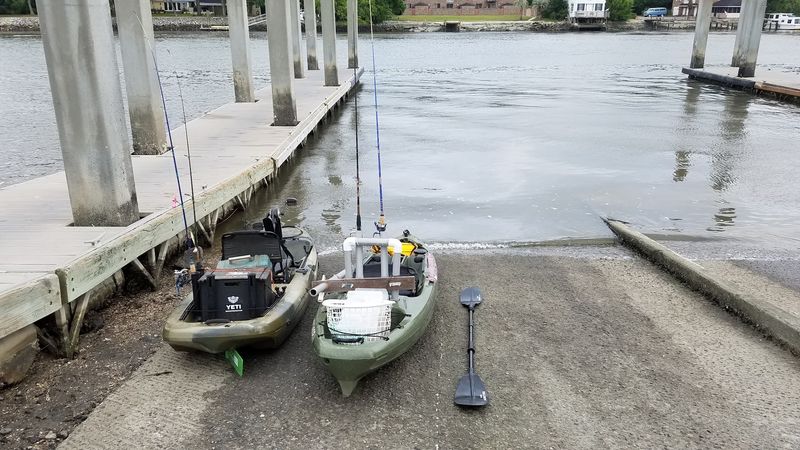
Concrete lanes, a parking lot, and salt marsh do not sound like the start of a history adventure. Wappoo Cut Boat Landing proves otherwise the moment your boat touches the water.
Charleston County Park and Recreation Commission lists it among its public boat landings. The ramp sits along Wappoo Cut in Charleston, between West Ashley and James Island.
Location is the real superpower here. Wappoo Cut links up with Wappoo Creek, the Ashley River, and the Stono River.
It also forms part of the Atlantic Intracoastal Waterway. That means boats can head toward Charleston Harbor or wind south toward Elliott Cut.
Paddlers and powerboaters both use the landing as a jumping-off point. The choice of routes is wide enough to fill a whole weekend without repeating a trip.
Fishing is a big draw too, thanks to all that moving salt water. Just remember a South Carolina saltwater fishing license is required for most anglers.
Keep one more thing in mind before launching. This is a working waterway, not a quiet pond, so boat traffic is part of the scenery.
Think of the landing as a front door. Behind it waits a maze of creeks with centuries of stories.
A Blue Dye Fortune Started Just Up The Creek
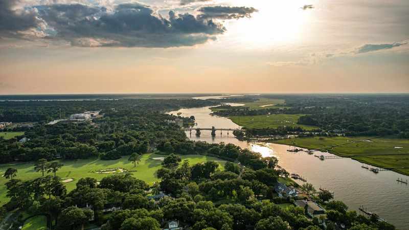
Eliza Lucas was only a teenager when she started running her family’s lands near Charleston. One of those properties, Wappoo Plantation, sat right along Wappoo Creek.
In the early 1740s, she began experimenting with indigo seeds sent from the West Indies. Early crops struggled, but she kept trying for several seasons.
Her patience paid off in a big way. Indigo became one of colonial South Carolina’s most valuable exports for decades.
That blue dye ended up coloring fabric across Britain. It all traces back to experiments near this tidal waterway.
The creek itself carries an even older story. Its name is believed to come from a Native American word, a reminder of the Indigenous communities who lived along these waters long before European settlement.
Later, settlers dug channels, or cuts, to connect natural streams. Those changes made the route more useful for boats moving goods.
So as you float past the marsh, consider what this water has carried. Canoes, trade boats, and crops all moved through these bends.
No plaque at the ramp spells it out for you. That makes knowing the story feel a little like holding a secret.
Redcoats Once Guarded These Same Tidal Bends
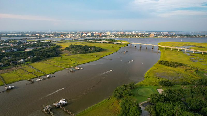
March 1780 brought serious company to this quiet channel. British forces were closing in on Charlestown during the American Revolution.
To protect their fleet, they built a fort at Hudson’s House on James Island. They also placed redoubts along the Stono River and the Wappoo Canal.
A redoubt is a small defensive earthwork. Picture dirt walls built fast to hold a key spot, minus any modern comforts.
The waterway mattered because boats could slip between rivers through it. Controlling that shortcut gave the British a real edge.
Hessian officer Captain Johann Ewald scouted Patriot positions near the Wappoo Canal. His scouting led to an ambush of Patriot dragoons, which were soldiers on horseback.
Charlestown fell to the British that May after a long siege. The Wappoo route played a supporting role in that chapter.
Today, nothing at the landing marks those tense weeks. Marsh grass and boat wakes have long since covered the scene.
Still, it’s fun to realize that your fishing trip follows a path military planners once studied closely. History buffs, consider that your bonus souvenir.
Bridges Of Wood And Pontoons Carried Troops In The 1860s
Eighty years after the British left, the cut became important all over again. During the Civil War in the 1860s, it served as a lifeline between James Island and Charleston.
Two crossings spanned the water at that time. One was called the New Bridge, and the other was a pontoon bridge.
Pontoon bridges float on boats or barrels lashed together. They could be built quickly, which made them handy for moving troops and supplies.
Confederate forces relied on these crossings to reach James Island defenses. That island guarded the southern approach to Charleston Harbor.
Union forces understood the value of the route too. They used the waterway to reach the Stono River during their campaigns.
Same water, different century, and once again everyone wanted it. Geography has a stubborn habit of repeating itself.
Those old bridges disappeared long ago. Modern traffic now rolls overhead on a much sturdier crossing.
When you stand by the ramp, look across the cut toward James Island. It’s a short span on a map, yet it shaped big decisions for two separate generations.
That Drawbridge Overhead Comes With Its Own Family Tree
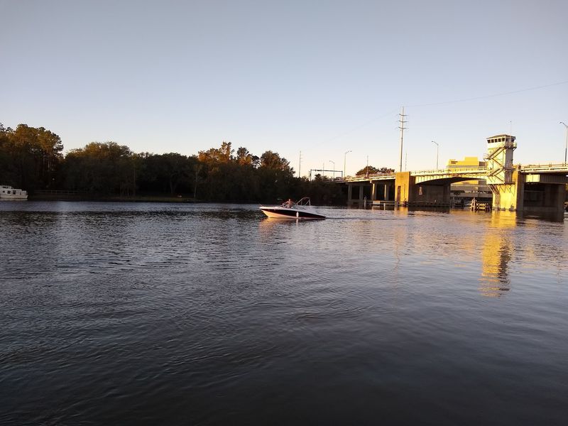
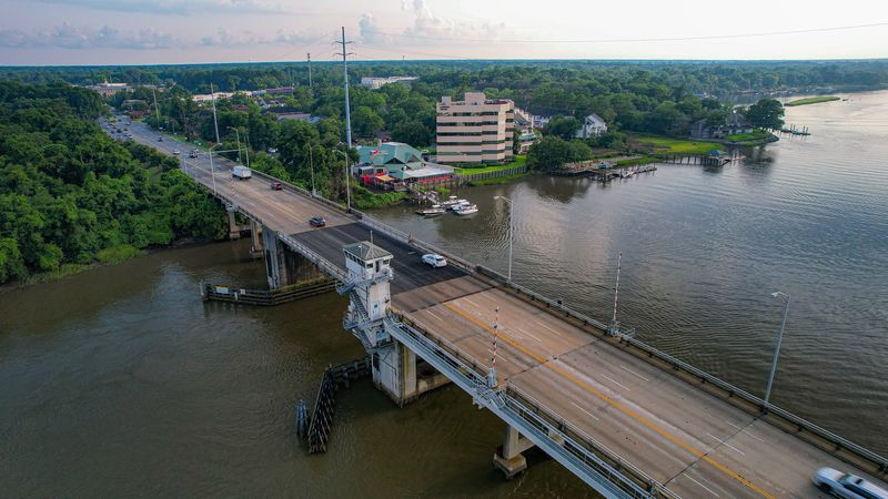
Look up from the ramp, and you’ll spot a drawbridge carrying SC Highway 171. It’s a bascule bridge, which means its deck lifts to let tall boats through.
This crossing is the latest in a long line. The first was a wooden toll bridge built by a private company chartered in 1896.
Charleston County bought that bridge in 1918. Drivers no longer had to pay just to cross the creek.
A concrete and metal swing bridge opened in 1926. Instead of lifting, it rotated sideways to clear the channel.
The current bridge, named for Burnet R. Maybank, opened to traffic in 1956.
It still links West Ashley and James Island today.
Bridge openings are such a part of local life that people track them online. Sailboats heading along the Intracoastal Waterway often need the lift.
For visitors, that makes for a free show. Watching the deck rise while a mast glides under it never really gets old.
Photographers love the view from the landing too. Bring a camera and catch the bridge against the marsh for a shot with real backstory.
Trailer Folks, This Parking Lot Was Built With You In Mind
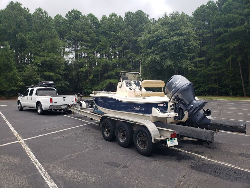
Good news for anyone towing a boat. The landing offers multiple concrete launch lanes, so the line usually moves along.
You’ll find Wappoo Cut Boat Landing at Tranquil Dr, Charleston, SC 29412. It sits off Folly Road near the drawbridge, close to both West Ashley and James Island.
The paved lot includes plenty of spaces designed for trucks with trailers. Some spots fit longer rigs, which helps on busy days.
Here’s the catch for car drivers. Trailer spaces are meant for trailers, and parking there with just a car can earn you a ticket.
Standard car parking is more limited. If you’re only visiting for the view, plan accordingly.
Pulling in and out can take patience when bridge traffic backs up. A little timing goes a long way here.
Courtesy docks beside the ramps help with loading and unloading. They make it easier to tie off while someone parks the truck.
One smart move is to prep your boat before backing down. Strap removal, plugs, and gear checks are best done in the staging area, not on the ramp itself.
Respect The Current And It Will Treat You Kindly
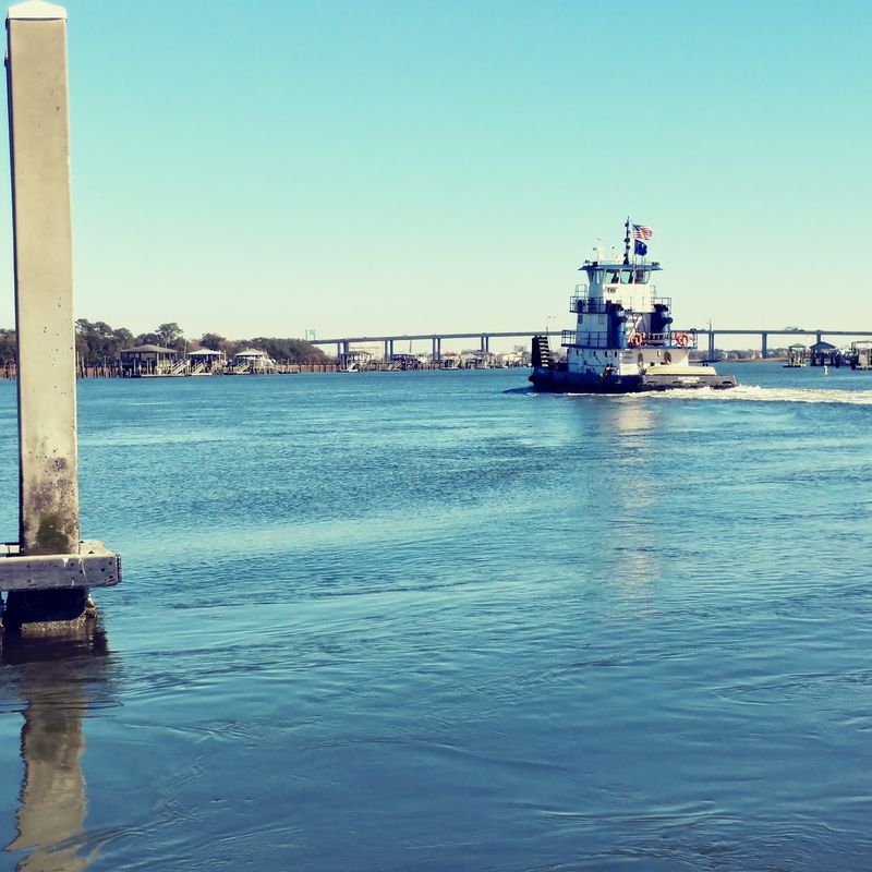
The water here moves with real purpose. Wappoo Cut is a narrow channel, and tides push a lot of water through it fast.
That strong current is the most talked-about trait of this landing. Launching and loading can get tricky when the tide is running hard.
Newer boaters may want to practice somewhere calmer first. Once you’ve gained confidence, this ramp becomes much less intimidating.
Timing helps more than muscle. Checking a tide chart and aiming for slack tide can make your day far smoother.
Kayakers should pay attention too. Paddling against a full current feels like jogging on a treadmill set too fast.
Larger boats need extra care in tight quarters. Cross currents and steady boat traffic leave little room for mistakes near the ramp.
Swimming here is not a supervised activity. Moving water and passing boats make it a poor choice for a dip.
None of this should scare you off. A little planning turns that swift water into part of the fun, and it sweeps you toward the harbor in no time.
Grab A Picnic Table And Let The Sunset Do The Talking
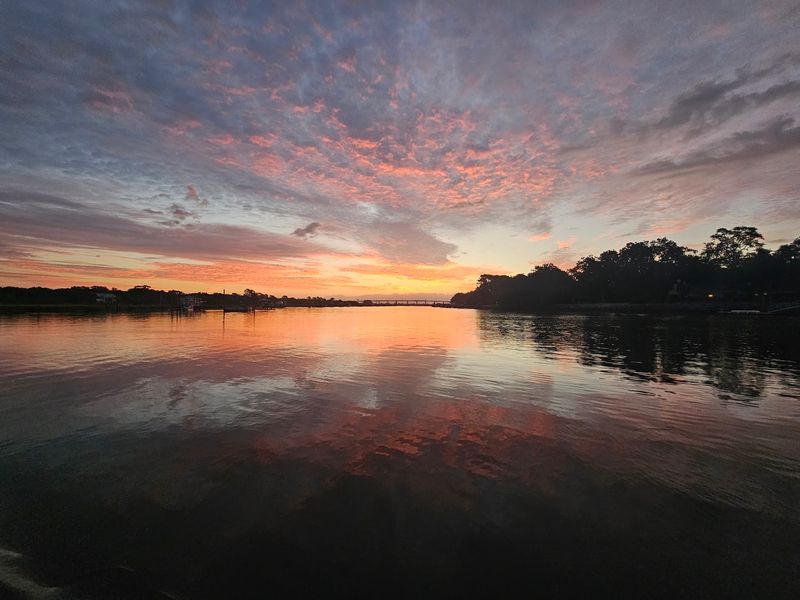
Not everyone comes here with a boat. A grassy rise above the ramp holds concrete picnic tables shaded by trees.
That little perch offers a wide look at the marsh and estuary. On a clear day, downtown Charleston appears in the distance.
It’s a relaxing place to unwrap a sandwich and watch boats come and go. The drawbridge adds a steady parade of movement to the scene.
Sunsets here earn plenty of praise. The western sky glows over the marsh as the water turns gold and pink.
Early risers get their own reward. Sunrise launches mean cooler air and calmer starts before the weekend rush.
Shade matters a lot during South Carolina summers. Those trees by the tables can feel like a gift by midday.
Pack a cooler with drinks and snacks, plus bug spray for the marsh. A folding chair is handy if the tables are taken.
History, views, and a picnic all in one stop? That’s a pretty strong lineup for a spot many drivers only see from the bridge.
Smart Moves That Make Your Weekend Trip Smooth Sailing
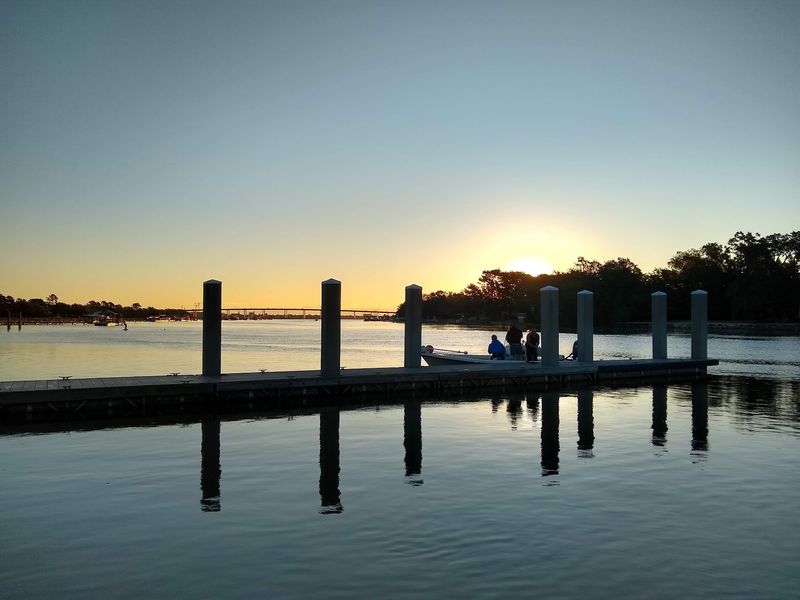
Night owls and early birds can both rejoice. The landing is open 24 hours a day, every day of the week.
Weekends bring the biggest crowds by far. Arriving early is the easiest way to grab a trailer spot and skip the shuffle.
Weekdays feel much more relaxed. If your schedule allows, a Friday morning launch can start the weekend right.
Plan to be self-sufficient. Restrooms and trash cans may not be available, so pack out everything you bring.
A small trash bag and a pit stop beforehand will save headaches. Your fellow boaters, and the marsh, will thank you.
Brush up on local fishing and boating rules before heading out. South Carolina regulations cover licenses, size limits, and safety gear.
Make it a full weekend by pairing the landing with nearby Charleston sights. James Island and Folly Beach sit just down the road.
Wappoo Cut Boat Landing rewards anyone who looks past the concrete. Indigo fortunes, redcoat redoubts, and swinging bridges all share this water, and now your road trip can too.