
The Secret Nevada Scenic Drive That Explodes With Color Every Fall
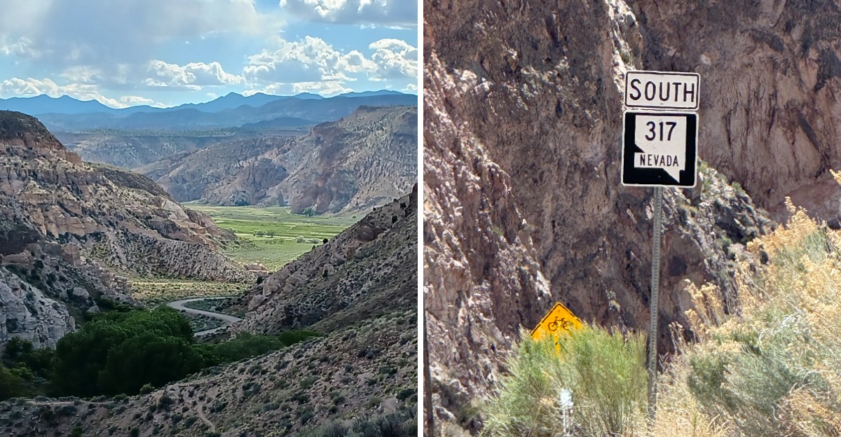
Red, yellow, white, blue, and green stripes climb canyon walls in this corner of eastern Nevada. Minerals soaked into old volcanic rock did the painting.
A smooth two-lane road follows a desert wash for roughly twenty miles. Freight trains roll beside it nearly the entire way.
Who knew a scenic drive could come with its own soundtrack?
Cottonwoods along the water turn orange and gold every fall. Those leaves glow against rusty cliffs.
Ancient rock art hides along the canyon walls. A shady state park and a century-old schoolhouse wait farther down the route.
How many back roads pack that much into one afternoon?
Flash floods sometimes close the road, so check conditions before heading out.
So why does this stretch of Nevada stay off so many travel lists?
Start With A Road That Paints Itself In Stripes
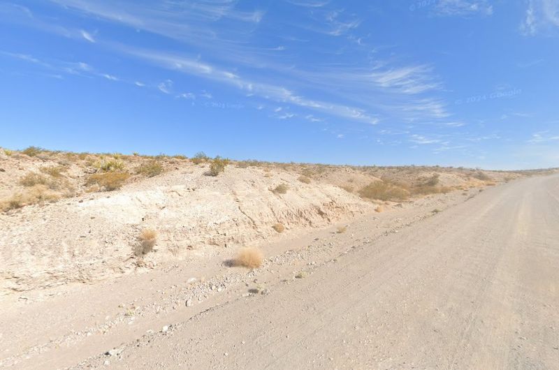
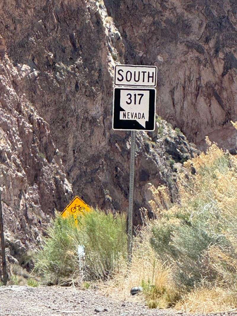
Rainbow Canyon Scenic Drive (State Route 317) is the kind of Nevada road trip that makes passengers put their phones down. It runs about 21 to 22 miles between Caliente and Elgin in Lincoln County.
The pavement is smooth, and most vehicles handle it fine when the weather cooperates. Walls on both sides climb as high as 3,000 feet in places.
Stripes of rust-red, yellow, white, blue, and green stack up like a geology textbook come to life. The road follows Meadow Valley Wash, so the canyon floor curves along with the water’s old path.
Nobody needs a ticket, since the road is generally open around the clock. That makes sunrise and late afternoon fair game for photos.
Plan on a slow pace, because every bend brings a fresh band of color. Caliente is the only incorporated community in Lincoln County, so it makes a handy starting point.
Restaurants, gas stations, and motels are all available in town. Fill the tank and pack snacks before heading south.
The Bureau of Land Management office in Caliente can share up-to-date visitor information. Even a short out-and-back trip feels like a full adventure.
A good playlist helps, though the passing scenery might drown it out anyway. Keep a charged camera nearby, because the colors change with the light.
Fall Leaves Add Orange And Yellow Along The Wash
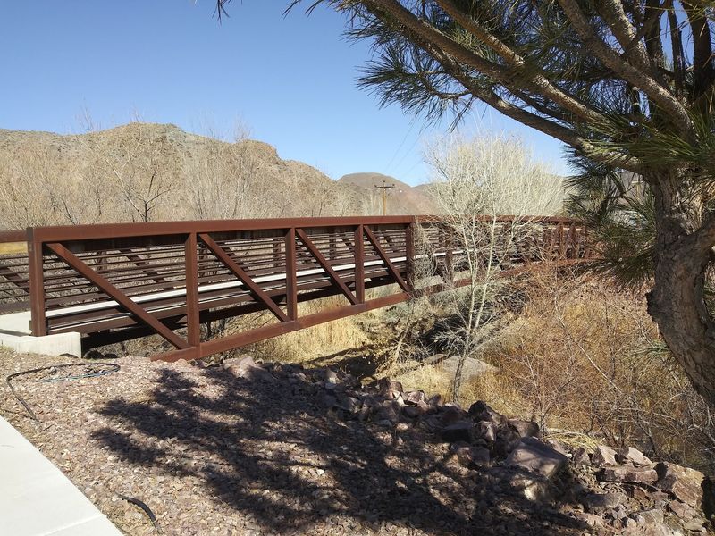
Cottonwood and aspen groves line Meadow Valley Wash, and in fall they turn orange and yellow. Those leaves sit right next to rust-red cliffs and white ash walls.
Few road trips offer a backdrop that busy. Green junipers add a steady contrast all year.
White rabbitbrush adds pale tones to the mix. Mesquite and pinyon pines also grow in the area.
Lush greenery and wildflowers can appear along the wash as well. The stone colors stay put year-round, so a visit never feels wasted.
Fall simply adds a bonus layer of leaf color. Late fall through early spring is also a comfortable window for exploring.
Summer temperatures in this part of Nevada can be brutal. Cooler months make stepping out for photos much easier.
Pack layers, since canyon shade and open sun feel very different. Flooding is a seasonal concern along the wash, so weather matters.
A quick forecast check before leaving saves disappointment. Leaf timing varies, so treat peak color as a moving target.
Stop where the road allows and let the colors sink in. Then keep rolling and see what the next bend offers.
Rabbitbrush and juniper keep the palette from ever going plain. That mix makes fall especially rewarding for photographers.
Volcanic Ash And Minerals Did The Painting
Thirty-four million years ago, volcanic eruptions began stacking layers of ash across this part of Nevada. That ash hardened into tuff, the soft stone that forms many of the cliffs.
Later, mineral-rich hot water seeped into cracks and stained the rock. Iron created the red and yellow shades.
Copper added blue and green. The white cliffs are pure volcanic ash.
Water escaping from a large lake valley carved the canyon itself about a million years ago. So the colors came first, and the canyon shape arrived much later.
Fire and water both left their marks here. Mile after mile, the walls shift from tan to rust to nearly white.
Each change marks a different layer or mineral stain in the rock. Natural caves open up in the canyon walls as well.
Cliffs this tall reward a slow look from a safe distance. Light changes through the day, so the colors can look different on a second pass.
Driving the route in both directions gives you two different views. Pull over safely whenever a color combination catches your eye.
A quick read about tuff beforehand makes every cliff more interesting. Nobody needs a science degree to enjoy the whole colorful show.
A Train Might Roll By Any Minute
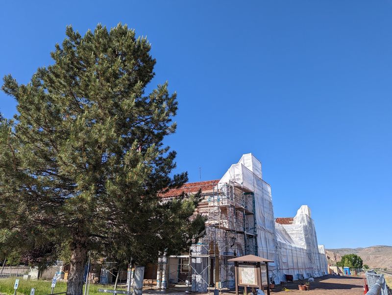
Union Pacific trains rumble through the canyon on an active mainline that runs the entire length of the drive. The road and the tracks travel side by side from start to finish.
Trains pass frequently, reportedly about every 20 minutes or so. Rail fans can plan a whole afternoon around that rhythm.
The railroad was one reason Caliente became a town in the first place. The historic Caliente Railroad Depot still stands in town.
It now houses city offices, a ballroom, and a library. Flash floods in Meadow Valley Wash wiped out the railroad in earlier days.
That history explains why flooding talk comes up so often here. Pull off safely and stay well back from the tracks.
Active rail corridors are no place for wandering. Cameras love a train winding past colorful cliffs.
A train against red stone makes for a classic shot. Kids who like trains may never ask whether you’re there yet.
Timing a stop for a passing train adds a little suspense. Nobody can promise the schedule, so patience helps.
Still, the odds look good on a route this busy. Bring snacks and make the wait part of the fun.
The canyon provides plenty to look at in the meantime. The mix of steel, stone, and desert color is hard to beat.
It’s a simple pleasure.
Shade Is The Star At Kershaw-Ryan State Park
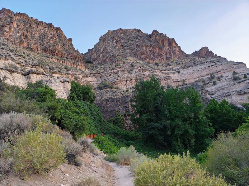
Shade is the star at Kershaw-Ryan State Park, a short side road off State Route 317. The park sits about 2 to 3 miles south of Caliente at the northern edge of Rainbow Canyon.
Cottonwood and elm trees and canyon walls keep it shaded most of the time. Temperatures there are typically cooler than the surrounding desert.
The park’s shady grove has an oasis-like feel. A natural spring-fed wading pool gives kids and adults a place to cool off.
Picnic areas and volleyball courts round out the day-use options. Campers will find modern bathrooms with flush toilets and showers.
Hiking trails leave from the park for those who want to stretch their legs. The Kershaw family homesteaded Kershaw Canyon in the 1870s.
The state park itself was established in 1935. A flood in 1984 severely damaged its facilities.
That history shows how powerful the wash can be. Bring sun protection anyway, since trails can leave the shade.
Treat it as a calm first stop before the longer drive. Pack lunch and linger a while.
The cooler air makes the pause feel earned. Then the road opens up for the rest of the canyon.
Trees like these are a rare treat in desert country. Kids can splash while adults enjoy the shade.
Ancient Rock Art Adds A Human Chapter
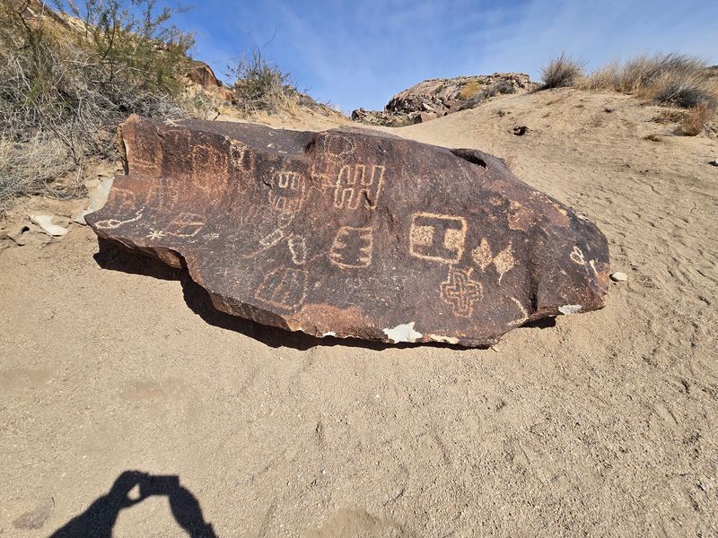
Long before highways, people left messages on these canyon walls. Petroglyphs are carved into rock, and pictographs are painted onto it.
Both types appear along the route and up side canyons. Known sites include Etna Cave, Tunnel No. 5, Grapevine Canyon, and Petroglyph Boulder.
Artifacts in the area date back 3,000 to 3,500 years. Evidence points to human presence here for more than 10,000 years.
Newe (Western Shoshone), Southern Paiute, Hualapai, Chemehuevi, and Mojave people have used these lands for generations. That makes every pullout feel like a living museum.
Look with your eyes and leave the rock untouched. Oils from skin and scratches can damage fragile surfaces.
Side canyons offer hiking and backpacking for those who want to search further. Cooler months make that kind of wandering far more comfortable.
Bring plenty of water and tell someone your plans. Carry a paper map as a backup.
A little patience helps when scanning cliff faces. Take photos from a respectful distance and let the stories stand.
Respect keeps the sites available for the next visitor. Few roadside stops can claim a past that deep.
Stand quietly for a moment and take that in. The art adds a human chapter to a very colorful geology lesson.
Bighorn Sheep, Eagles, And Other Canyon Neighbors
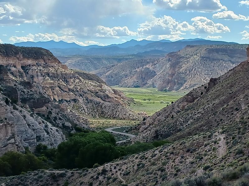
Desert bighorn sheep, mule deer, and mountain lions all call this habitat home. Bobcats, coyotes, gray foxes, and ringtails share the neighborhood too.
Spotting any of them takes luck and patience. Golden eagles and red-tailed hawks are among the birds that can be seen overhead.
Songbirds fill in the smaller details along the wash. Trees and water draw wildlife in a landscape that’s otherwise dry.
That explains why the wash corridor is so lively. Scan the cliff ledges first, since bighorn sheep favor rugged terrain.
Then check the tree lines for birds and movement. Binoculars turn a distant speck into an identifiable animal.
Keep a respectful distance from every creature you see. Wild animals deserve space, and so does the habitat.
Quiet voices help, and so does staying in one place for a few minutes. Early and late hours are popular times for wildlife watching in desert country.
Pair that with the canyon glow and the outing feels special. Pack a field guide if you enjoy naming what you see.
Even without a sighting, the setting delivers plenty. A drive this colorful rarely leaves anyone bored.
Rodents scurry through the rocks and brush as well. Nature does not follow a schedule, so flexibility helps.
A Climbing Wall And A One-Room School Wait Down South
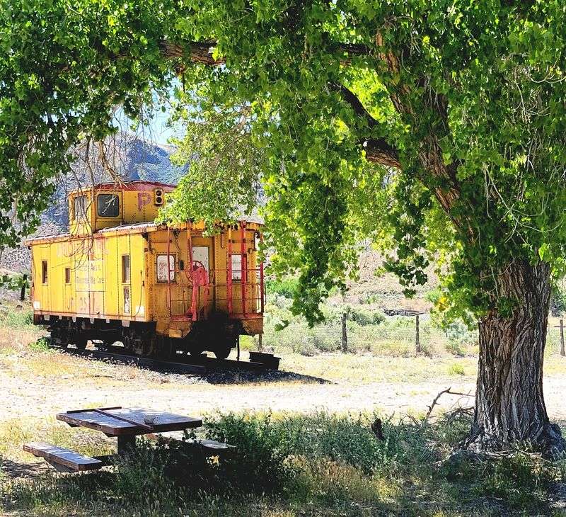
At about mile 17, Finlay Crack stands out as a striking basalt wall. Climbers know it for sport and trad routes on Bureau of Land Management land.
Non-climbers can still admire the wall from a safe spot. Primitive camping is available in some areas on BLM land within the canyon.
Check local rules before setting up for the night. Near the southern end, Elgin Schoolhouse State Historic Site waits.
The one-room country schoolhouse was built in 1922. Classes ran there until 1967.
The state acquired the property in 2005. Visitors can admire the old building and eat lunch in the shade.
It’s a simple, quiet place to end the drive. The trip from Caliente covers roughly 21 to 22 miles.
Plan for the return as well, since the road works in both directions. The canyon looks different when you face the opposite way.
Bring a picnic and make the schoolhouse a proper destination. A single room can hold a lot of history.
Take a moment to consider the school days that ended in 1967. Then turn around and enjoy the colors again.
Rock climbers should bring their own gear and plan carefully. Everyone else can bring a camera and a sense of curiosity.
Check The Road Before You Go, Because Floods Happen
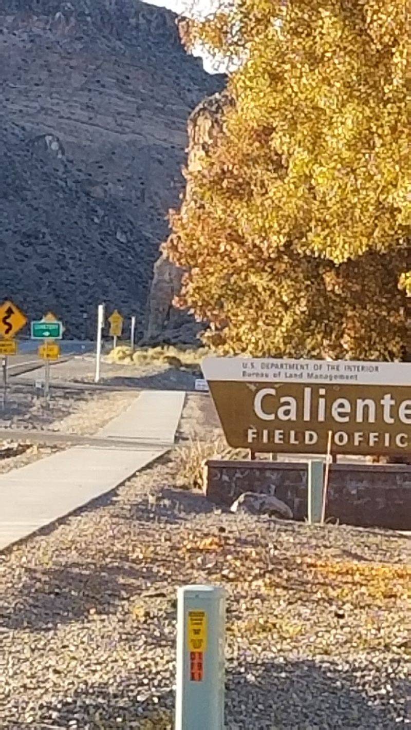
Flooding can shut Rainbow Canyon Scenic Drive without much notice. As of November 2, 2026, State Route 317 was reported closed in both directions from US-93 to Kane Springs Road.
All lanes were blocked because of high water. Meadow Valley Wash, which the drive follows, is prone to seasonal flooding.
Check weather and road conditions before leaving home. Nevada 511 and the Caliente Field Office of the Bureau of Land Management offer current updates.
The Google Maps pin lists the area as an unnamed road in Caliente, NV 89008. Caliente City Hall sits at 100 Depot Avenue in Caliente, Nevada 89008.
Low-clearance vehicles may struggle during heavy rain. The driest part of summer is the best time for avoiding floods.
Summer heat is brutal, though, so early mornings help. Late fall through early spring is better for hiking and rock art.
Cooler months in Caliente also bring fewer crowds. If the road is closed, wait for it to reopen.
Never drive through water covering the pavement. Nearby state parks within 50 miles include Beaver Dam, Cathedral Gorge, Spring Valley, and Echo Canyon.
Those make fine backup plans on a closure day. The canyon has waited millions of years, so it can wait another week.