
Skip The Mall On Black Friday And Hike These 8 Arkansas Trails Instead
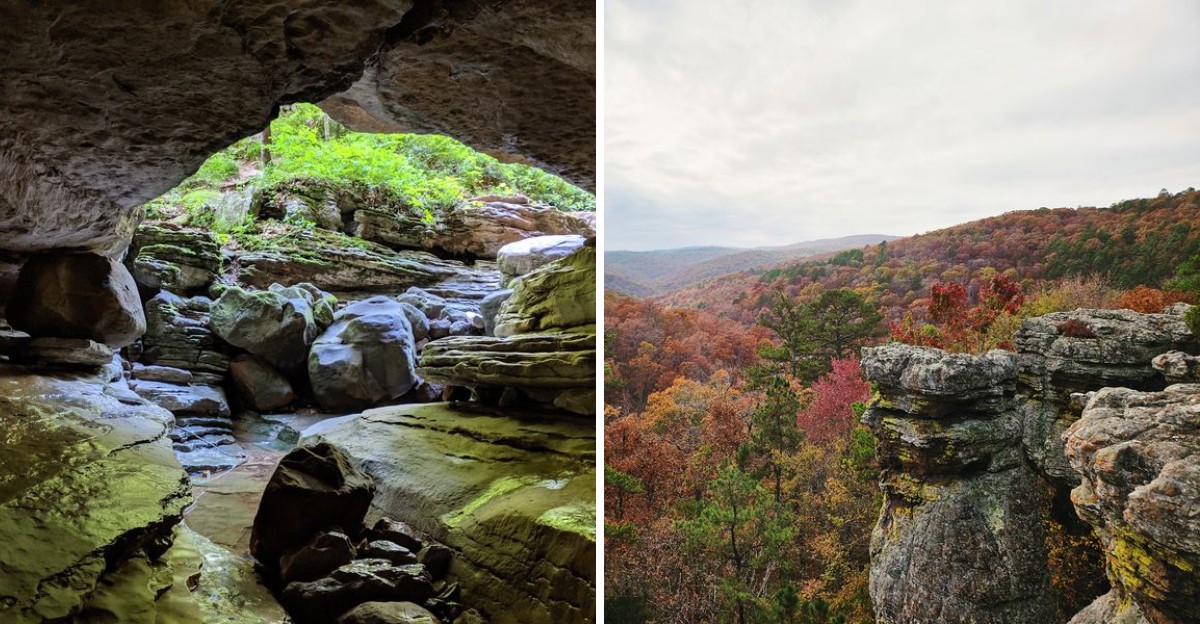
Black Friday does not have to start in a crowded parking lot before sunrise. Arkansas has a much better reason to set that early alarm.
How about a waterfall hidden deep inside a cave? Bring a flashlight, because the payoff waits in the dark.
Other trails lead to a sandstone ledge hanging over a wild valley. Another loops around a mountaintop with views nearly the whole way.
There are even stone towers that look stacked by a very patient giant. Would a doorbuster sale ever top that?
Several of these paths welcome dogs, and a few work well for younger hikers. A leftover turkey sandwich makes the perfect trail snack.
These eight hikes across Arkansas trade checkout lines for crisp air and big views. Which one will you tackle first?
1. Hawksbill Crag Trailhead
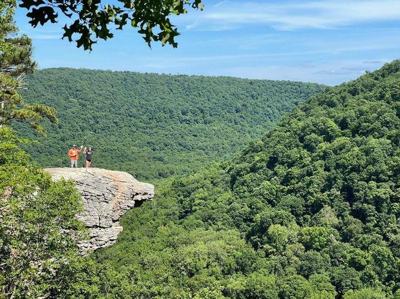
Arkansas has one rock ledge that shows up on more phone screens than most celebrities. It sticks out over the Upper Buffalo Wilderness like a giant diving board made of sandstone.
Some folks call it Whitaker Point, and others call it Hawksbill Crag. Either way, the trail starts near Kingston off County Road 406, and the last stretch of the drive is on dirt roads.
Plan for a hike of about a mile and a half each way, so roughly three miles total. The path is moderate and a little rugged in spots, with ups and downs that keep your legs honest.
Along the way, you get more than one cliffside spot to stop and stare. That means the big ledge at the end is the grand finale, not the only show.
Late November is a sweet time for this one. The leaves thin out, the ridgelines look sharper, and the cool air makes the climb back feel a lot friendlier.
Bring your dog if you like, since pups are allowed on the trail. Keep a leash handy, though, because those cliff edges do not come with railings.
The trailhead is open around the clock, which helps if you want an early start. Weekday afternoons tend to be calmer, and a quieter ledge makes for much better photos.
Wear real shoes, pack water, and give the edge plenty of respect. The view will be just as good from a few safe steps back.
Address: County Road 406, Kingston, AR 72742
2. Cedar Falls Trailhead
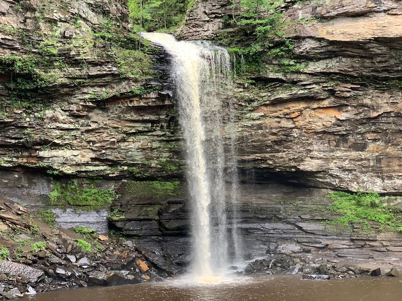
Your legs may grumble on the way back up, but your camera roll will be thrilled. Cedar Falls sits deep in a canyon at Petit Jean State Park, Arkansas’s first state park.
The fun actually starts before you hit the dirt. Views of the canyon begin near Mather Lodge, so you get a preview before you commit.
Expect about two miles round trip with steep sections. The descent uses switchbacks to zigzag you down, and a bridge carries you across the water along the way.
At the bottom, the waterfall pours over tall sandstone cliffs into the canyon below. It is the kind of view that makes you forget about your phone for a few minutes.
The trail is well-marked, so getting lost is not much of a worry. Getting winded is another story, since the climb out takes some real effort.
Do not skip the Cedar Falls overlook either. It offers views that stretch for miles, and it gives you a smart spot to catch your breath.
Pace yourself on the return trip. Take short breaks, sip water, and remind yourself that nobody here is racing you to a checkout counter.
A few snacks in your pack will help too. After all, Thanksgiving leftovers taste even better at the top of a canyon.
Address: Cedar Falls Trailhead, Petit Jean State Park, Morrilton, AR 72110
3. Lost Valley Trailhead, Kingston, AR
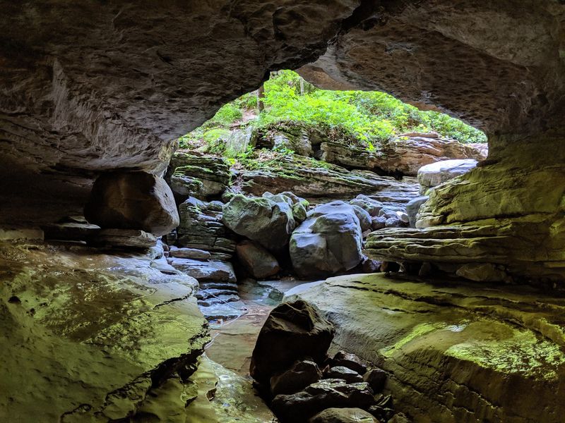
Somebody hid a waterfall inside a cave out here, and you get to go find it. That alone makes this Buffalo National River trail worth skipping a doorbuster sale.
The trail starts off Lost Valley Road near Kingston. Much of the path is flat and easy to walk, which makes it a strong pick for families with younger hikers.
Running water follows you for a good part of the trip. You will pass creeks, rocky spots, and plenty of natural nooks that kids love to climb and poke around in.
Near the end, the trail reaches a cliff and a cave with a big surprise. Crawl through a tight squeeze, and you can find a waterfall of about 25 feet tumbling down inside the rock.
Bring a headlamp or flashlight for the cave part. You will also want clothes you do not mind getting a little muddy, because caves do not care about your outfit.
Another cave in the area holds its own surprise on the far side. Half the fun is exploring at your own pace and seeing what turns up.
The wider area also offers horse trails and fishing, so the outdoors crowd stays busy here. Saturday mornings tend to fill up, so an early start can help you grab elbow room.
Is a cave waterfall better than a discounted TV? Most kids would vote yes in about two seconds.
Address: Lost Valley Rd, Kingston, AR 72742
4. Yellow Rock Trailhead, West Fork, AR
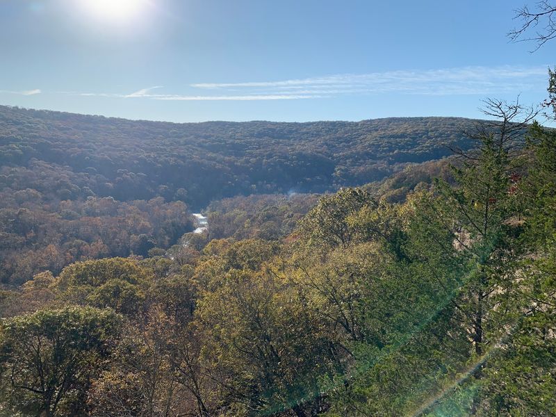
A rock named for its color gets top billing on this loop, and honestly, it earns the spotlight. Yellow Rock sits in Devil’s Den State Park, one of the prettiest corners of northwest Arkansas.
The loop runs about three miles. Many hikers call it moderately challenging, though the wide path keeps it manageable for a whole family.
Shade covers much of the route, which is a nice bonus on a sunny day. The ground gets rocky in places, so sturdy shoes beat sneakers here.
As you walk, the scenery keeps changing. You will pass cliffs, streams, and rock formations that look like they were stacked by a very patient giant.
Then comes the star of the show. The overlook opens up wide views over the park, and it makes a perfect spot for a snack break.
Watch your footing near the edge, especially with little ones. A great view is best enjoyed with both feet on solid ground.
Dogs are welcome on the trail, so your four-legged hiking buddy can join the fun. They will probably enjoy the stream smells more than you enjoy the view.
The trail is well-marked and well-kept, which takes the stress out of the day. Saturday mornings can get busy, so Black Friday may be a calmer day to visit.
Address: 354655 AR-74, West Fork, AR 72774
5. Pinnacle Mountain West Summit Trail, Roland, AR
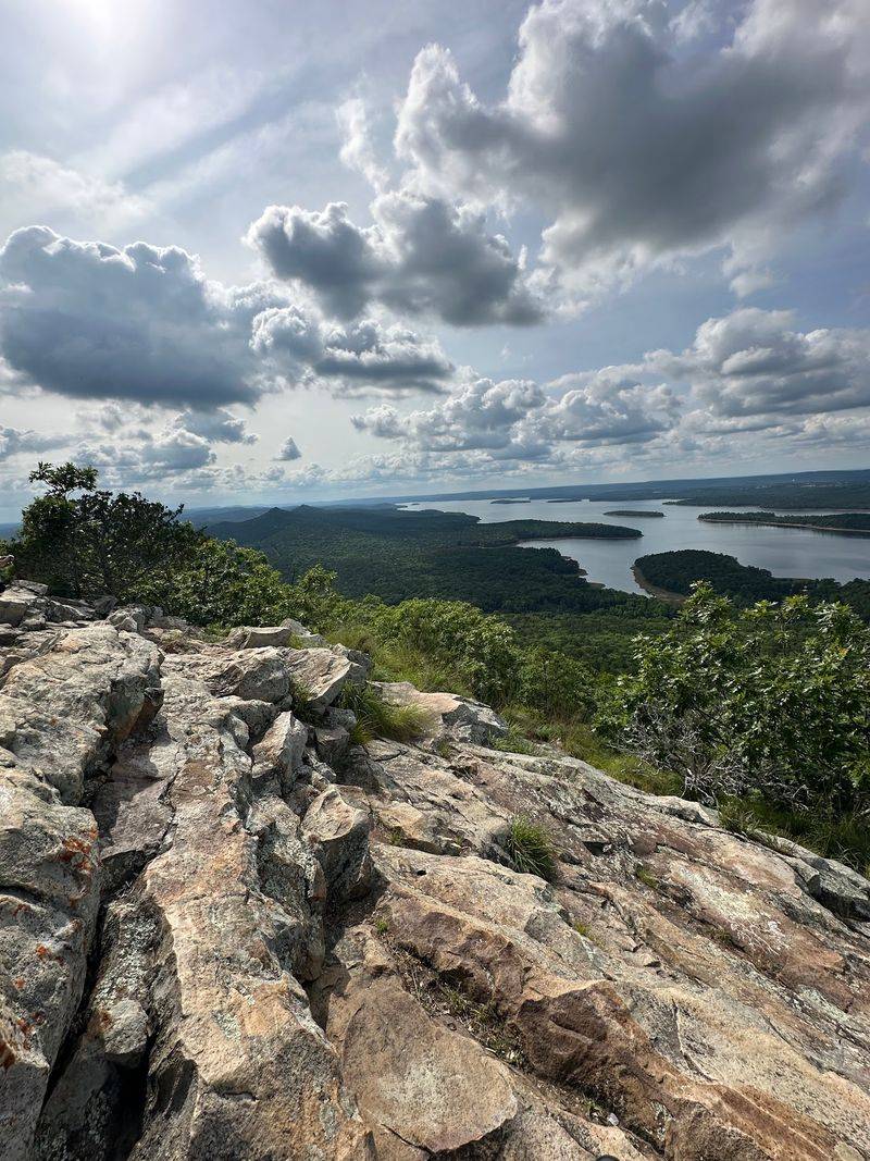
Call it a hike, call it a rock climb, or call it a leg workout with a view. The West Summit Trail at Pinnacle Mountain State Park is a little bit of each.
This trail sits near Roland, just west of Little Rock. It is short on flat ground and long on rocks, with steep stretches that ask you to use your hands now and then.
Plan on rocky scrambles as you get closer to the top. If you are not used to climbing over boulders, some sections will feel tough.
So why do people keep coming back? The summit view rewards your effort with wide scenery that makes the sweaty climb feel totally worth it.
Shoes with good grip matter a lot here. Smooth soles and loose rocks are not friends, and gloves can even help on the steeper parts.
Go slow on the way down. Coming down a rocky slope can be trickier than going up, so take your time and test each step.
Weekends from morning to afternoon are the busiest stretch. If you want a calmer climb, try to beat the crowd with an early arrival.
Leave the heavy backpack at home and bring just water and a snack. Your knees will thank you when you reach the top feeling light and proud.
Address: RGQ4+PP, Roland, AR 72135
6. Goat Rock Trail
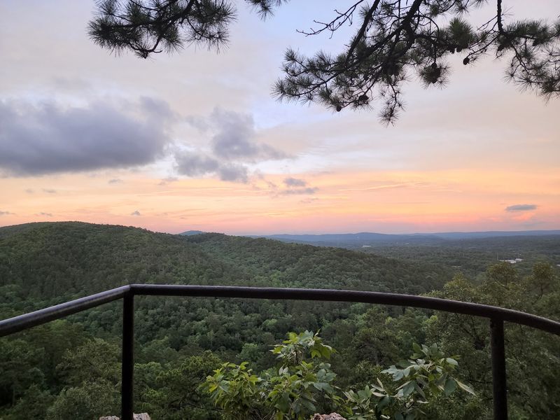
Hot Springs National Park is famous for its bathhouses, but its woods deserve some love too. Goat Rock Trail proves you can swap steam rooms for mountain views in about an hour.
The trail runs about 1.1 miles through forest. It ends at a vista point where the Ouachita Mountains roll out in front of you like a soft, wrinkled blanket.
Most of the path is moderate, with gentle climbs and dips. That makes it a solid choice for young kids or anyone easing back into hiking after a big holiday meal.
Along the way, you will spot some impressive rocks. Goat Rock itself is the big highlight, and the lookout point is a great place to pause.
Pets are allowed, so bring your pup along for the ride. A short trail like this suits dogs who love sniffing more than marathon miles.
Parking is free, both in a lot and on the street nearby. That is a pleasant change from circling a mall garage for twenty minutes.
Some of the best views can even be seen near the parking area. Still, the walk through the trees makes the payoff feel more earned.
Looking for a fun date idea after Thanksgiving? This trail fits the bill, and the only thing you will spend is a little energy.
Address: Goat Rock Trail, Hot Springs National Park, AR 71901
7. Mount Nebo Rim Trail, Dardanelle, AR
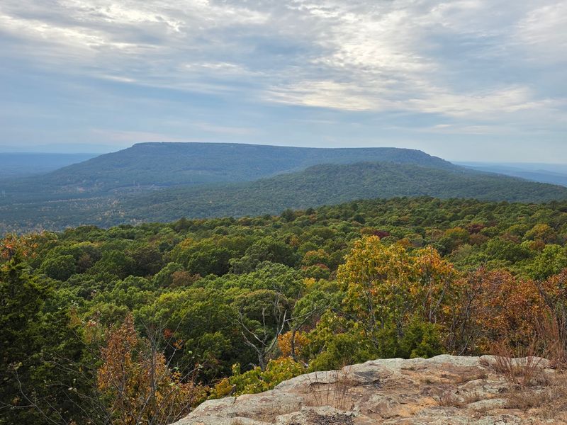
Most trails make you wait for the good part. The Rim Trail at Mount Nebo State Park hands you views nearly the whole way around.
The loop runs about three miles and circles the top of the mountain. Since you are walking near the rim, the scenery keeps peeking through the trees again and again.
That means lots of chances for photos. You do not have to save all your camera time for one big lookout at the end.
The park sits near Dardanelle in the Arkansas River Valley. From up high, the land below spreads out in a patchwork of fields, water, and forest.
Getting to the top is part of the adventure. The road up the mountain is steep and twisty, so take it slow and enjoy the climb.
Once you start walking, pick a direction and settle into an easy rhythm. A loop means no backtracking, which keeps the views fresh from start to finish.
Bring a light jacket for late November. Mountain air can feel cooler than the valley, especially when the wind picks up along the rim.
Sunday mornings tend to be quieter, but Black Friday is a great day to try it too. You could wrap up your hike just in time for a leftover pie break.
Address: 16700 State Hwy 155, Dardanelle, AR 72834
8. Pedestal Rocks & Kings Bluff Trailhead, Pelsor, AR
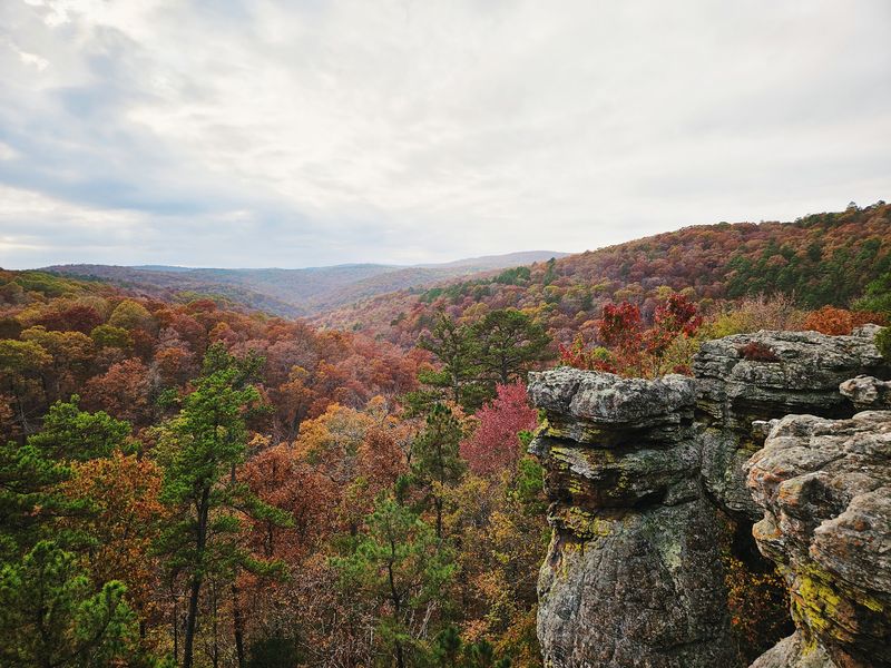
Mother Nature clearly got creative with the stacking blocks out here. Tall stone columns rise from the forest floor, each one topped with a wider cap of rock.
This trailhead sits on Highway 16 near Pelsor in the Ozark National Forest. From one parking area, you can choose between two loop trails that bring you right back to your car.
The Pedestal Rock loop shows off those odd rock towers. It also leads past caves that beg for a closer look, so bring a flashlight for peeking inside.
Kings Bluff is the other loop, and it brings a waterfall into the mix. After rain, it is worth checking out, and the bluff views add extra drama.
Hiking to the pedestal rocks and caves takes about 2.2 miles. The paths are easy to follow, and the area stays shady for much of the walk.
That makes this a nice pick for families and first-time hikers. There is plenty to explore without a brutal climb wearing everyone out.
Dogs are allowed, and parking is free in the lot. Weekends can get busy, so Black Friday morning may give you a bit more breathing room.
Why not hike both loops if you have the energy? You will see rock towers, caves, and a waterfall in one trip, and no shopping bags required.
Address: AR-16, Pelsor, AR 72856