11 Unusual Natural Formations In South Dakota Few Travelers Visit
South Dakota holds secrets that most people never discover.
While everyone flocks to Mount Rushmore, there are hidden geological wonders scattered across this state that barely see a handful of visitors each year.
I’ve explored these unusual formations myself, and trust me, they’re worth the detour from the typical tourist trail.
Get ready to discover landscapes that look like they belong on another planet, tucked away in corners of South Dakota that few travelers ever think to explore.
1. Yellow Mounds Overlook
Ancient soils paint the landscape in colors you wouldn’t expect from South Dakota.
Yellow Mounds Overlook sits along the Badlands Loop Road, but most people zoom right past without stopping.
The mounds glow in shades of yellow, purple, and red because of fossilized soils that date back millions of years.
These aren’t your typical gray rock formations—they’re remnants of an ancient floodplain where tropical forests once thrived.
Early morning light makes the colors pop dramatically, so plan your visit accordingly.
The overlook requires minimal effort to reach, just a short walk from the parking area.
Photographers love this spot because the textures and hues create stunning contrasts against the blue sky.
You’ll find yourself standing in awe, realizing that this colorful wonderland exists in a state most people associate with prairies and farmland.
Pack water and sunscreen since shade is nonexistent here.
2. The Castle (Castle Trail Area)
Towering like a fortress from medieval times, this formation earned its name honestly.
The Castle rises dramatically from the surrounding badlands terrain, its layered walls telling stories of erosion and time.
Most hikers tackle the Castle Trail for exercise, but they miss the real treasure.
This specific formation stands as a testament to how water and wind sculpt rock into architectural masterpieces.
Getting there requires a moderate hike, so wear sturdy shoes and bring plenty of water.
The trail stretches about ten miles round trip if you go the full distance, but you can spot The Castle from various points along the way.
Wildlife sightings are common here—bighorn sheep often graze near the formations.
The isolation means you might have this geological wonder entirely to yourself.
Sunset casts incredible shadows across The Castle’s ridges and valleys, transforming it into something almost mystical.
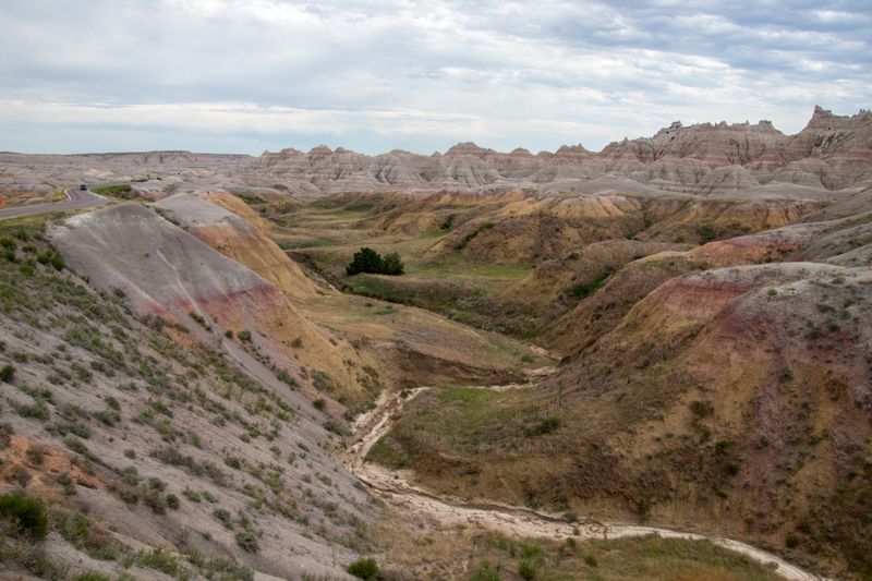
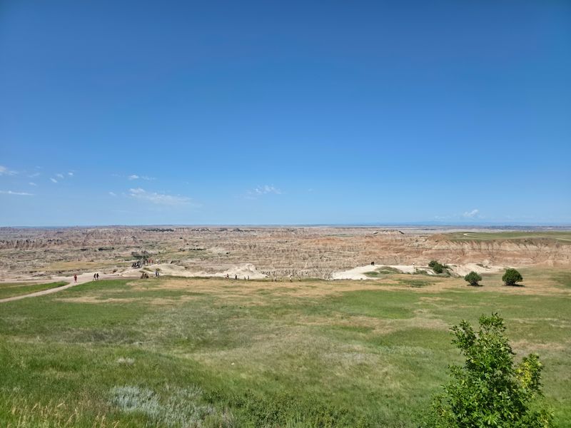
3. Burns Basin Overlook
Vastness hits you differently when you’re standing at Burns Basin Overlook.
The panoramic view stretches for miles, revealing layer upon layer of eroded peaks and valleys that seem to go on forever.
This overlook sits in a quieter section of Badlands National Park.
Fewer tourists venture this far, which means you can actually hear the wind whistling through the formations.
The basin itself formed through millions of years of water erosion, carving deep channels into soft sedimentary rock.
What remains looks like a moonscape, all sharp edges and impossible angles.
Bring binoculars if you have them—the distance reveals details you’d miss with the naked eye.
Prairie dogs inhabit the flatter areas, their towns creating little communities against this harsh backdrop.
Weather changes fast here, so check forecasts before heading out.
The exposed location means wind can be fierce, especially during spring and fall.
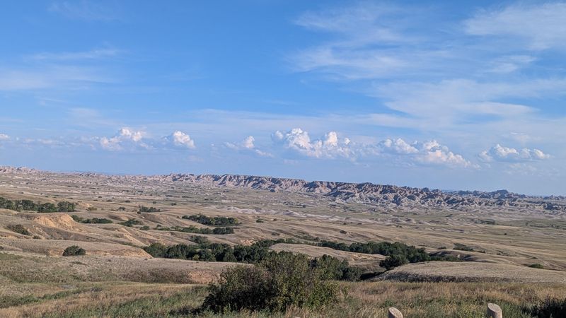
4. Hay Butte Overlook
A solitary butte stands guard over the prairie like a silent sentinel.
Hay Butte Overlook offers views of this distinctive flat-topped formation that rises unexpectedly from relatively flat grasslands.
The butte itself is a remnant of what used to be a much larger plateau.
Erosion ate away everything around it, leaving this lone survivor behind.
Geologists find this spot fascinating because it shows erosion in action.
You can actually see the layers of different rock types that make up the butte’s structure, each one representing a different era in Earth’s history.
The overlook provides a perfect vantage point for understanding how the Badlands formed.
It’s like reading a textbook, except you’re standing in the middle of the lesson.
Wildflowers bloom around the overlook area in late spring and early summer.
The contrast between delicate flowers and harsh rock formations creates memorable photo opportunities that capture South Dakota’s surprising diversity.
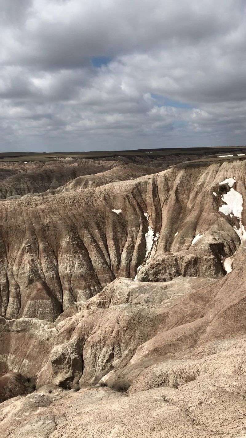
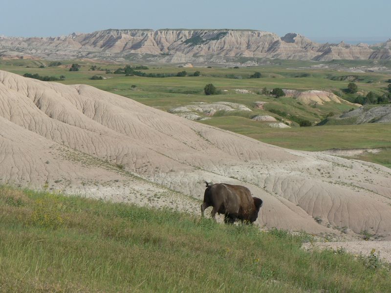
5. Badlands Wilderness Overlook
Silence becomes something you can almost touch at Badlands Wilderness Overlook.
This viewpoint gazes into the park’s designated wilderness area, where human impact remains minimal and nature rules completely.
The wilderness section covers over 64,000 acres of raw, untamed landscape.
From this overlook, you’ll see terrain that looks virtually unchanged from when Native Americans first roamed these lands.
Sharp pinnacles and deep canyons create a maze of rock that seems impossible to navigate.
Yet experienced backpackers do venture into this wilderness, seeking solitude and adventure far from any trail.
Bison sometimes wander through the viewable areas, appearing as small dark shapes against the pale formations.
Their presence reminds visitors that this landscape, though harsh, supports life in unexpected ways.
The overlook itself is easily accessible from the main road, making it perfect for those who want wilderness views without the wilderness hike.
6. Sage Creek Basin Overlook
Where prairie meets badlands, something magical happens.
Sage Creek Basin Overlook sits at this transition zone, offering views of both ecosystems in one sweeping panorama.
The basin spreads out below like a green carpet dotted with silvery sagebrush.
Beyond it, the badlands rise up in their characteristic rugged glory, creating a stark contrast that’s purely South Dakota.
This area is prime bison habitat, and you’re almost guaranteed to spot these massive animals grazing peacefully.
The Sage Creek herd roams freely here, one of the few places in America where bison still live in a relatively wild state.
Photographers camp out here during golden hour when the light turns everything warm and glowing.
The combination of wildlife, prairie, and formations creates compositions that win awards.
The unpaved Sage Creek Rim Road leads to this overlook, adding a sense of adventure to your journey.
Just take it slow and watch for wildlife crossing.
7. Devil’s Gulch
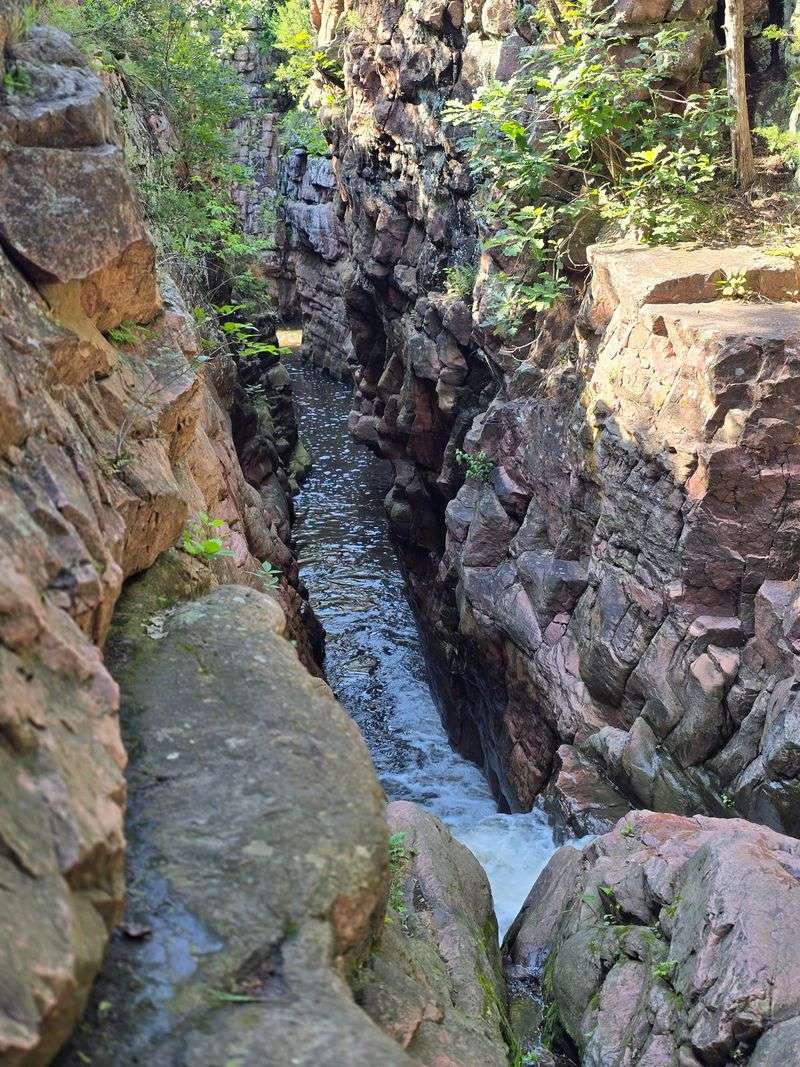
Legend says Jesse James jumped this chasm on horseback while fleeing from lawmen.
Whether that’s true or not, Devil’s Gulch remains one of South Dakota’s most dramatic natural features.
The gulch is a narrow chasm with sheer quartzite walls that plunge down to a small creek below.
It’s only about twenty feet wide at the jump point, making the Jesse James legend seem almost plausible—almost.
Located near the small town of Garretson, this spot offers easy access and well-maintained trails.
A small waterfall cascades through the gulch, adding sound and movement to the dramatic scenery.
The surrounding Devil’s Gulch Park provides picnic areas and walking paths.
Families love this spot because it combines natural beauty with fascinating folklore and doesn’t require serious hiking.
Spring brings the highest water flow, making the waterfall more impressive.
The quartzite walls show beautiful pink and red hues that intensify in certain lighting conditions.
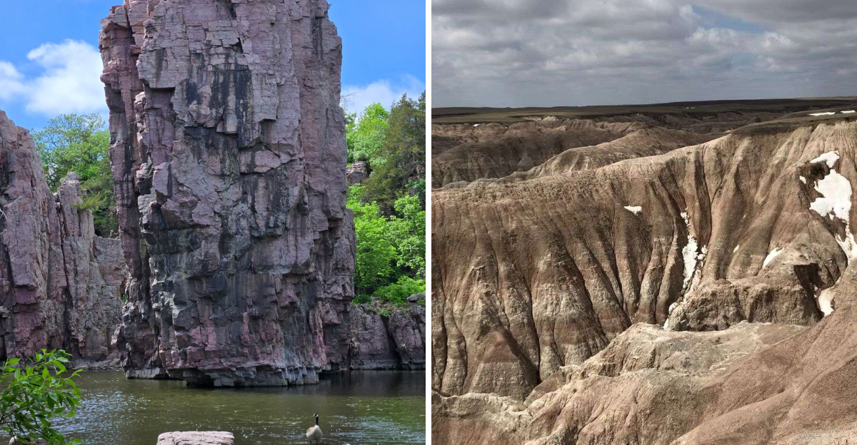
8. Sioux Quartzite Cliffs & Spires (Palisades State Park)
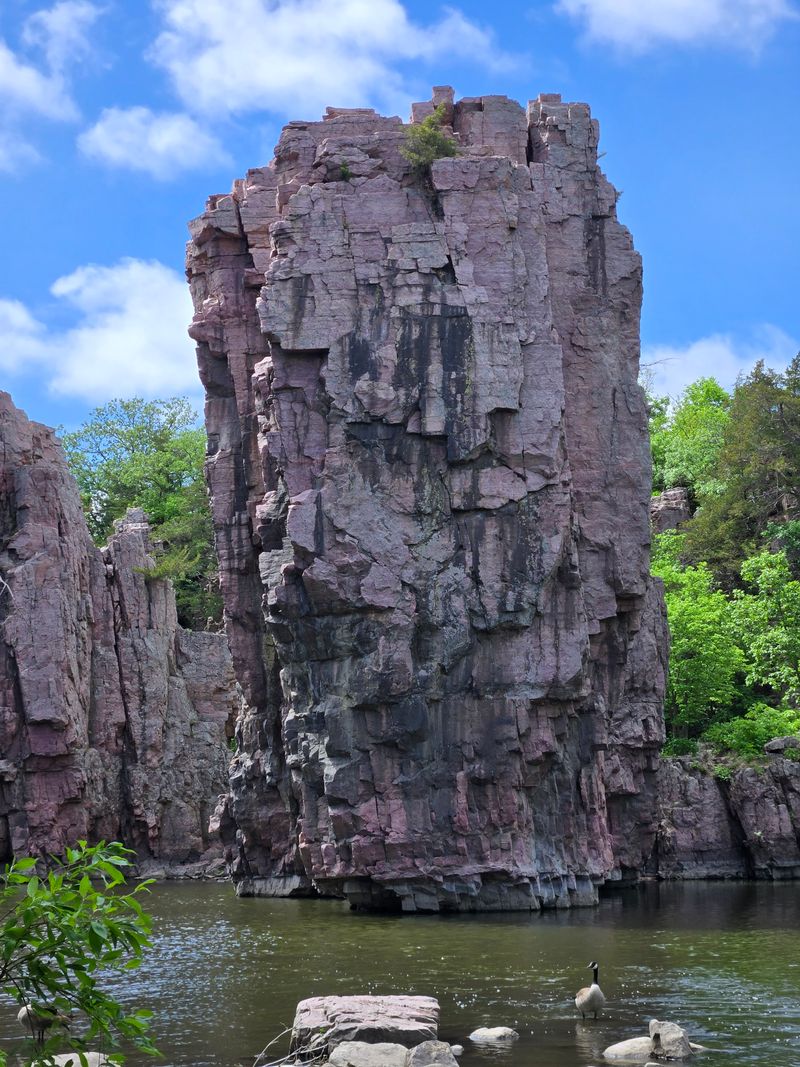
Pink rock towers rise fifty feet above Split Rock Creek, creating a scene more reminiscent of Utah than South Dakota.
Palisades State Park protects these stunning Sioux Quartzite formations that formed over a billion years ago.
The quartzite here is some of the hardest rock in North America.
It resisted erosion while softer rocks around it wore away, leaving these magnificent cliffs and spires standing tall.
Rock climbers travel from across the country to test their skills on these pink walls.
Even if you don’t climb, watching others scale the vertical faces is entertainment enough.
Trails wind through the park, offering various viewpoints of the formations.
Split Rock Creek adds a water element, flowing past the base of the cliffs and creating peaceful sounds that contrast with the imposing rock.
Camping is available here, letting you experience these formations at different times of day.
Early morning fog rising from the creek creates an ethereal atmosphere around the ancient stone.
9. Bear Butte

Rising 1,200 feet above the surrounding plains, Bear Butte commands attention from miles away.
This isn’t technically a volcano, but rather a laccolith—magma that pushed up but never broke through the surface.
The mountain holds deep spiritual significance for many Native American tribes.
Prayer cloths tied to trees along the trails flutter in the wind, creating a sacred atmosphere that visitors should respect.
Hiking to the summit takes about two hours round trip on a moderately challenging trail.
The views from the top stretch across the Black Hills and out onto the Great Plains, making every step worthwhile.
Geologically, Bear Butte formed around 60 million years ago during the same upheaval that created the Black Hills.
Erosion eventually exposed the harder igneous rock, leaving this distinctive dome shape.
Wildlife abounds here—deer, turkey, and even the occasional mountain lion call this area home.
The state park surrounding the butte offers a visitor center with excellent exhibits explaining the geology and cultural significance.
10. Needle’s Eye
Someone had the brilliant idea to carve a road right through a natural granite spire.
The Needle’s Eye in Custer State Park represents both a natural wonder and an engineering feat from the 1920s.
The original natural opening was small, but road builders widened it just enough for cars to squeeze through.
Today, driving through this narrow tunnel carved in solid granite feels like threading a needle—hence the name.
The surrounding area showcases the Black Hills’ characteristic granite formations.
Tall spires and balanced rocks dot the landscape, remnants of millions of years of weathering and erosion.
This spot sits along the Needles Highway, one of America’s most scenic drives.
The entire route winds through impossible terrain, with the Needle’s Eye serving as the most photographed feature.
Modern vehicles barely fit through the opening, adding an element of adventure to your drive.
RVs and large vehicles can’t make it, so check your clearance before attempting passage through this geological marvel.
11. Jewel Cave
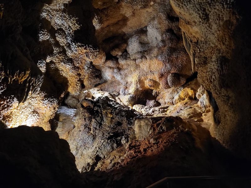
Calcite crystals coat the walls like frozen jewels, giving this cave its perfect name.
Jewel Cave ranks as the third longest cave system in the world, with over 200 miles of mapped passages and more being discovered regularly.
The crystals formed as water seeped through limestone, depositing minerals that eventually created these sparkling formations.
Under the guide’s flashlight, the walls seem to come alive with twinkling points of light.
Tours range from easy scenic routes to challenging wild caving adventures.
Even the basic tour requires some climbing and squeezing through tight spaces, so wear comfortable clothes you don’t mind getting dirty.
The cave maintains a constant 49 degrees Fahrenheit year-round.
Bring a jacket even if it’s sweltering outside—you’ll appreciate the warmth in the cool underground passages.
Scientists believe vast sections remain unexplored, making Jewel Cave an ongoing adventure in discovery.
Each expedition reveals new passages, new formations, and new mysteries hidden beneath the Black Hills.