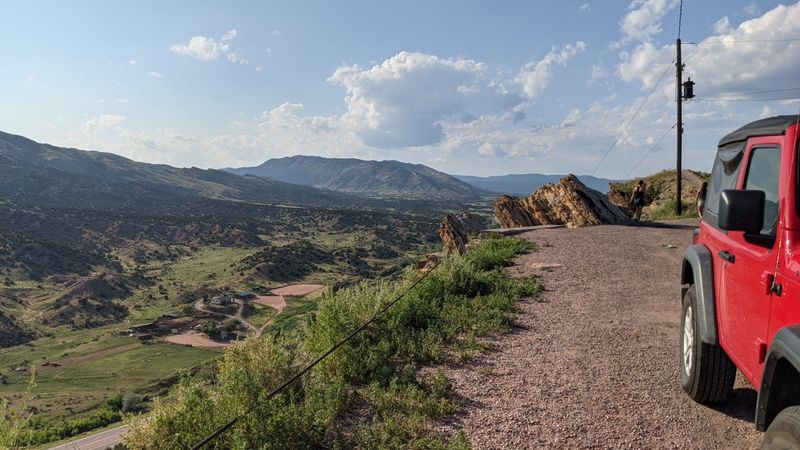
13 Scenic Colorado Drives That Belong On Your Road Trip Bucket List
Colorado’s mountain roads unfold like a painter’s canvas, with winding paths that snake through towering alpine forests, across majestic passes, and beside sparkling rivers. From vibrant wildflower meadows to golden aspen groves and snow-capped peaks, every twist and turn offers a new breathtaking view.
This is the kind of scenery that makes you want to pull over, breathe it all in, and capture the moment. Buckle up, because these drives promise more than just a trip, they promise an unforgettable adventure.
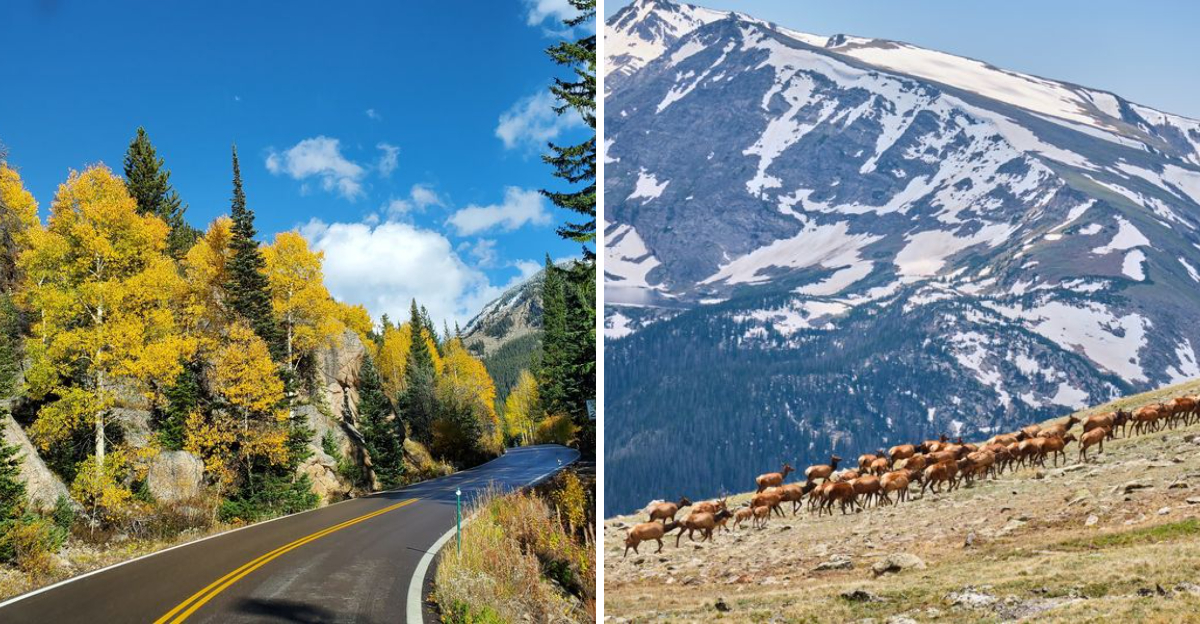
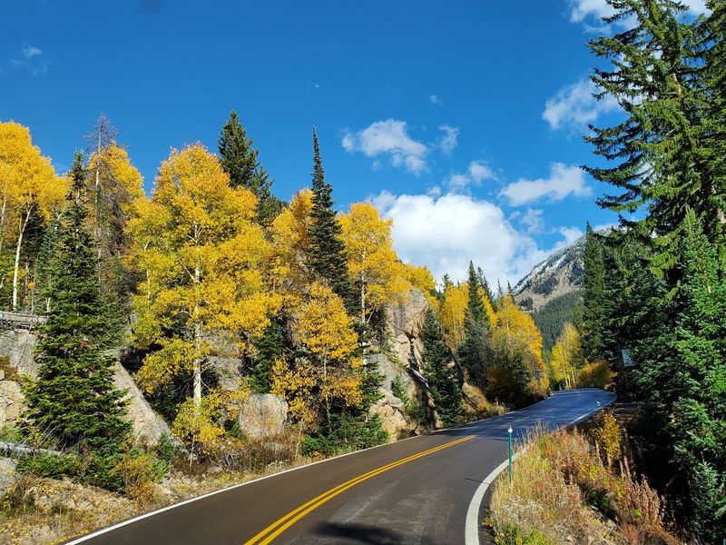
1. Trail Ridge Road Scenic Byway
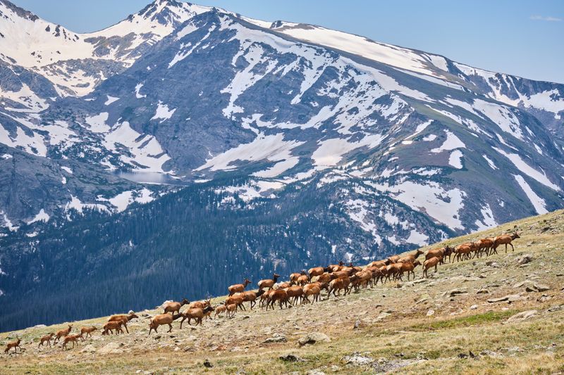
Cruising above the clouds at over 12,000 feet, this legendary route cuts straight through Rocky Mountain National Park and holds the title of highest continuous paved road in North America. You’ll feel like you’re driving on top of the world as tundra landscapes stretch endlessly in every direction.
Elk graze beside the road, marmots pop up from rocky outcrops, and the air gets so thin you might feel a little lightheaded from the altitude.
The journey between Estes Park and Grand Lake takes about two hours without stops, but trust me, you’ll want to pull over constantly. Alpine Visitor Center sits right at the summit, offering panoramic views and a chance to stretch your legs.
Snowfields linger well into summer up here, creating a surreal contrast against bright blue skies.
Plan your trip between late May and mid-October when the road is actually open. Afternoon thunderstorms roll in fast, so morning drives offer the clearest skies.
Bring layers because temperatures can drop thirty degrees from the base to the top.
2. San Juan Skyway Scenic And Historic Byway
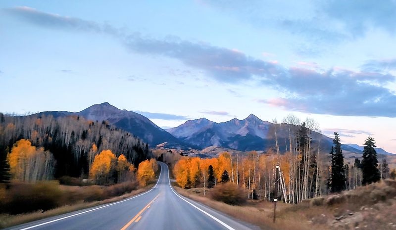
Picture a 236-mile loop that weaves through old mining towns, red rock canyons, and some of the most dramatic mountain passes in the Rockies. Starting from Durango, this circular route takes you through Silverton, Ouray, Telluride, and Dolores, each town brimming with Wild West history and charm.
Every season paints this drive in completely different colors, from spring wildflowers to fall’s golden aspen explosions.
The entire loop takes about five to six hours of pure driving time, but most people split it over two or three days to really soak it all in. You’ll climb over three mountain passes, each one more stunning than the last.
Historic mining structures cling impossibly to cliffsides, telling stories of Colorado’s silver boom days.
Telluride’s box canyon will stop you in your tracks with waterfalls tumbling from sheer walls. Ouray’s hot springs provide the perfect place to relax after a day behind the wheel.
Don’t rush this one because every mile deserves your full attention and appreciation.
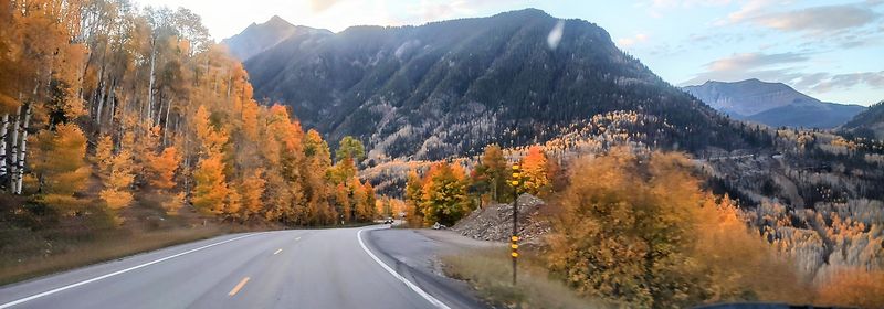
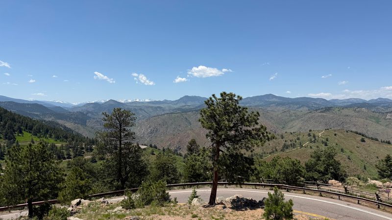
3. Independence Pass (Part Of Top Of The Rockies Byway)
Buckle up for one of Colorado’s most thrilling white-knuckle adventures as Highway 82 climbs to 12,095 feet between Aspen and Twin Lakes. Hairpin turns and steep dropoffs keep your hands gripped tight on the wheel, but the payoff is absolutely worth every nerve-wracking moment.
Continental Divide views stretch for miles, and wildflower meadows explode with color throughout July and August.
This pass closes completely in winter, typically from late October through Memorial Day weekend. Summer weekends bring crowds of tourists and cyclists, so weekday mornings offer the most peaceful experience.
The road narrows considerably near the summit, with barely enough room for two vehicles to pass.
Aspen groves on the eastern descent create tunnel-like canopies that glow golden in autumn. Pull over at the summit parking area to snap photos and catch your breath in the thin mountain air.
Twin Lakes at the bottom offer stunning reflections of Mount Elbert, Colorado’s tallest peak, making a perfect finale to this heart-pounding drive.
4. Peak To Peak Scenic Byway
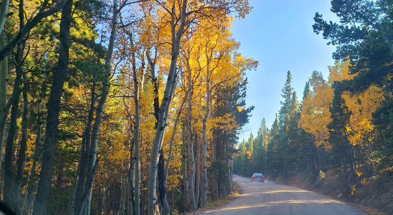
Running along the front range of the Rockies, this 55-mile route connects Estes Park to Black Hawk through some of Colorado’s most accessible mountain beauty. You’ll cruise past century-old mountain towns like Nederland and Ward, where time seems to move a little slower and locals still wave from their porches.
The road follows ridgelines that offer constant views of the Continental Divide rising to the west.
Unlike some of Colorado’s more extreme passes, this byway stays relatively gentle with elevations between 7,000 and 9,000 feet. That makes it perfect for a leisurely afternoon drive or a quick escape from Denver’s urban sprawl.
Historic mining cabins dot the landscape, and quirky roadside stops like the Carousel of Happiness in Nederland add unexpected charm.
Fall transforms this corridor into an aspen wonderland, with entire hillsides turning brilliant gold. Winter brings cross-country skiers and snowshoers to the surrounding forests.
Stop at Brainard Lake Recreation Area for easy hiking trails and postcard-perfect mountain reflections in crystal-clear alpine lakes.
5. Million Dollar Highway (Part Of San Juan Skyway)
Connecting Silverton and Ouray along a 25-mile stretch of pure adrenaline, this legendary road earns its dramatic name from either the gold ore in its roadbed or the million-dollar views depending on who you ask. Sheer cliffs drop thousands of feet with no guardrails to catch you, making passengers grip their seats while drivers focus intensely on every curve.
Red Mountain Pass tops out at 11,018 feet, surrounded by jagged peaks stained rust-orange from mineral deposits.
Historic mine remnants cling to impossible slopes, reminding you that people once worked in these treacherous mountains year-round. Waterfalls cascade down rock faces so close you could almost reach out and touch them.
The road stays open year-round, though winter driving requires serious skill and nerves of steel.
Ouray sits at the northern end, known as the Switzerland of America for its dramatic box canyon setting. Silverton anchors the south, a perfectly preserved Victorian mining town that feels frozen in the 1880s.
Take it slow and savor every terrifying, beautiful moment of this unforgettable drive.
6. Colorado River Headwaters Scenic Byway
Following the mighty Colorado River from its humble beginnings near Rocky Mountain National Park, this 69-mile route traces Highway 40 through pastoral valleys and working ranch country. You’ll watch the river grow from a babbling creek into a substantial waterway as it flows toward Grand Lake and beyond.
Rolling meadows dotted with grazing cattle create a peaceful contrast to Colorado’s more dramatic mountain passes.
The towns of Granby, Hot Sulphur Springs, and Kremmling offer authentic glimpses into Colorado’s ranching heritage without the tourist crowds. Fishing access points line the entire route, attracting fly-fishermen chasing trophy trout.
Mountains rise on both sides of the valley, creating a sense of being cradled by the Rockies.
Summer brings wildflowers to the riverside meadows and perfect weather for a top-down convertible cruise. Winter transforms the landscape into a snowy wonderland popular with snowmobilers and cross-country skiers.
Stop at the Kremmling Cliffs overlook for stunning views of the river carving through red rock formations below, proving this mellow drive has its own dramatic moments.
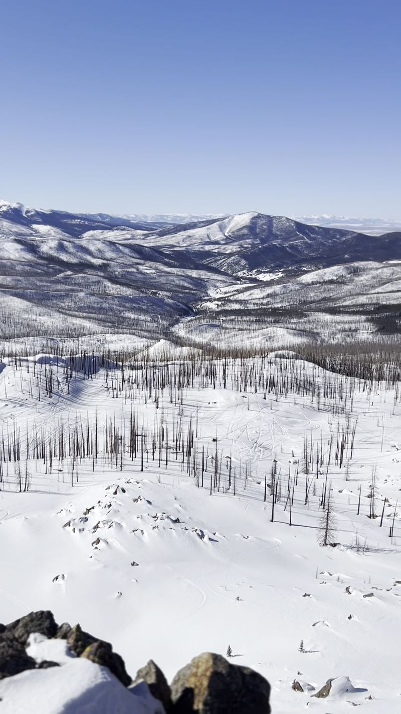
7. Grand Mesa Scenic Byway
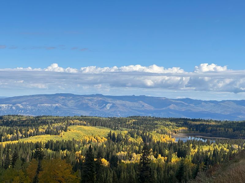
Climbing onto the world’s largest flat-topped mountain, this 63-mile route ascends from the desert landscapes near Grand Junction to a high-altitude wonderland dotted with over 300 alpine lakes. The elevation gain is staggering as you rise from 4,500 feet to over 10,000 feet, passing through multiple ecosystems in a single drive.
Sagebrush gives way to pinyon-juniper forests, then dense spruce and fir, and finally opens to vast meadows and shimmering ponds.
The mesa top feels like a secret world hidden above the surrounding valleys, cool and green even when the lowlands bake in summer heat. Fishing, hiking, and camping opportunities seem endless with so many lakes to explore.
Fall brings hunters and leaf-peepers, while winter transforms the mesa into a snowy playground for snowmobilers.
Land’s End Road branches off the main byway, leading to jaw-dropping overlooks where the mesa drops away dramatically to reveal the Grand Valley far below. Pack a picnic and spend the day exploring side roads that lead to hidden lakes.
This drive proves Colorado’s diversity extends far beyond its famous peaks.
8. Gold Belt Tour Scenic And Historic Byway
Looping through the heart of Colorado’s gold mining history, this 131-mile route connects Cripple Creek, Victor, and Canon City through landscapes that once produced billions in precious metals. You’ll wind past abandoned mines, historic cemeteries, and ghost towns that whisper stories of boom-and-bust fortunes.
The terrain shifts constantly from high alpine meadows to rugged canyons carved by ancient geological forces.
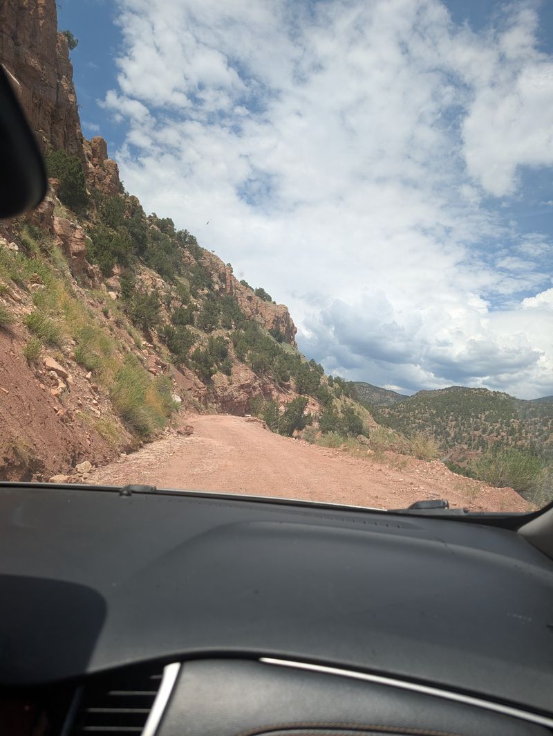
Phantom Canyon Road offers the most adventurous section, following an old railroad grade through a narrow canyon with sheer walls rising on both sides. This unpaved stretch requires careful driving but rewards you with solitude and stunning rock formations.
Shelf Road provides another thrilling option, hugging cliffsides popular with rock climbers who dangle from the vertical faces.
Cripple Creek still operates as a gambling town, its Victorian buildings housing modern casinos. Canon City sits at the southern end, home to the famous Royal Gorge Bridge spanning a thousand-foot-deep chasm.
Spring wildflowers blanket the hillsides, while summer brings perfect weather for exploring the numerous hiking trails that branch off from the main route.
9. Cache La Poudre-North Park Scenic Byway
Tracing the Cache la Poudre River through its spectacular canyon before climbing over Cameron Pass, this 101-mile journey showcases northern Colorado’s rugged beauty. The river crashes over boulders and through narrow gorges, creating a constant soundtrack for your drive.
Ponderosa pines cling to canyon walls while cottonwoods shade the riverbanks, attracting wildlife from bighorn sheep to black bears.
Highway 14 climbs steadily westward from Fort Collins, passing campgrounds and fishing spots that fill up quickly on summer weekends. The Poudre Canyon section offers numerous pullouts for whitewater rafting companies and kayakers testing their skills.
As you gain elevation, the landscape transitions to subalpine forests of spruce and fir.
Cameron Pass tops out at 10,276 feet before dropping into the wide-open expanse of North Park, one of Colorado’s hidden gems. This high mountain valley feels remote and wild, with more moose and elk than people.
Winter closes the pass periodically, but summer and fall deliver perfect conditions for exploring this lesser-known route that locals prefer to keep secret from the tourist masses.
10. Silver Thread Scenic And Historic Byway
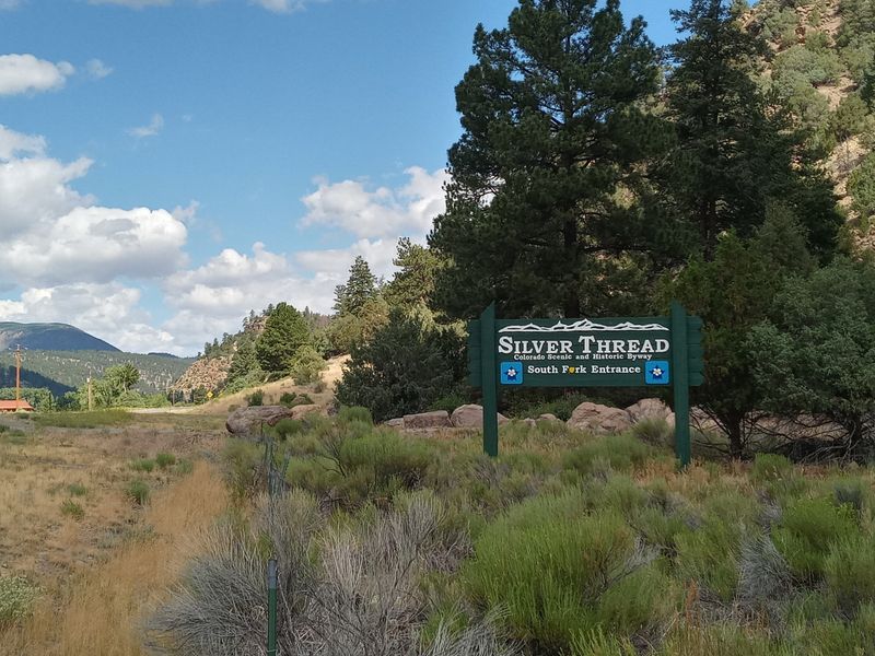
Weaving 117 miles through the San Juan Mountains between South Fork and Ouray, this route follows the path of early explorers and miners who sought fortune in these remote peaks. Highway 149 climbs over Slumgullion Pass and Spring Creek Pass, offering constantly changing scenery from dense forests to alpine tundra.
The Rio Grande River accompanies much of the journey, its headwaters born in these high mountains.
Lake City sits roughly midway, a charming Victorian town surrounded by fourteeners and mining history. The Bachelor Loop branches off here, leading to numerous ghost towns and abandoned mines worth exploring.
Bachelor-Syracuse Mine still offers tours, taking you deep underground to experience what miners faced daily.
North Clear Creek Falls provides a spectacular roadside stop where water plunges over a cliff in a powerful display. Wildflower season peaks in July, painting entire meadows in purple, yellow, and red.
The southern section near Creede passes through stunning volcanic formations and narrow canyons that showcase millions of years of geological history compressed into a single unforgettable drive.
11. Lariat Loop Scenic And Historic Byway
Just a short escape from Denver’s metro area, this 40-mile loop climbs into the foothills through Golden, Morrison, and Evergreen, offering quick access to mountain scenery without the all-day commitment. Red Rocks Amphitheatre provides a stunning detour where natural rock formations create one of the world’s most beautiful concert venues.
The route connects numerous parks, trails, and historic sites that tell Colorado’s story from dinosaurs to gold rushes.
Lookout Mountain offers panoramic views of the entire Denver metro area sprawling across the plains below. Buffalo Bill’s grave sits atop this peak, attracting history buffs and curious tourists year-round.
The drive winds through charming mountain communities where locals live the Colorado dream just minutes from urban amenities.
Highway 40 climbs steadily through evergreen forests before dropping back down through Bear Creek Canyon, a narrow gorge popular with cyclists and motorcyclists. Fall brings aspen color to the higher elevations while lower sections stay green longer.
This drive proves you don’t need to venture deep into the wilderness to experience Colorado’s mountain magic and natural beauty.
12. Skyline Drive (Cañon City)
Perched along a razor-thin hogback ridge, this one-mile road delivers some of the most heart-pounding views per mile of any drive in Colorado. The narrow pavement runs right along the spine of the ridge with 800-foot drops on both sides and absolutely no guardrails to protect you.
Built by prisoners in 1906, this engineering marvel seems almost too crazy to be real.
Canon City spreads out below on one side while the Sangre de Cristo Mountains rise dramatically on the other. The road is one-way only, preventing any terrifying encounters with oncoming traffic on the narrow ridge.
Your passengers will probably spend the entire time gripping their seats and questioning your sanity for choosing this route.
Despite its intimidating reputation, the road is well-maintained and perfectly safe if you drive slowly and carefully. Sunset paints the surrounding landscape in brilliant oranges and reds, creating unforgettable photo opportunities.
The entire drive takes maybe five minutes, but you’ll remember the adrenaline rush for years. This short detour proves that sometimes the best adventures come in the smallest packages.
13. Slumgullion Pass (Hinsdale County)
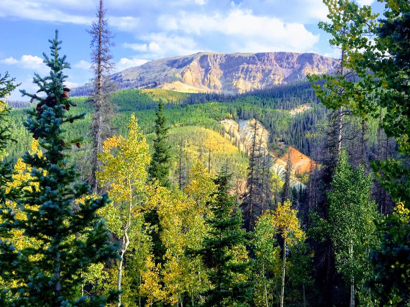
Crossing the Continental Divide at 11,530 feet, this section of Highway 149 offers front-row seats to one of Earth’s most fascinating geological features: an active landslide that’s been moving for over 700 years. The Slumgullion Earthflow creeps downhill at about 20 feet per year, creating a bizarre landscape of jumbled rocks, dead trees, and oddly tilted terrain.
Lake San Cristobal formed when an ancient version of this slide dammed the Lake Fork of the Gunnison River.
The pass provides sweeping views across the San Juan Mountains, with peaks stretching endlessly in every direction. Interpretive signs explain the geology and help you spot evidence of the ongoing landslide.
Yellow and orange lichens coat the rocks, giving the area its unusual name that references a gold rush-era stew.
Summer brings wildflowers and comfortable temperatures, while fall delivers golden aspen groves and crisp mountain air. The road typically closes from November through May due to heavy snowfall.
Stop at the overlooks to truly appreciate how this landscape constantly reshapes itself, reminding us that mountains are never truly static.