This Crystal-Clear Oregon River Feels Like A Hidden Slice Of Paradise
Somewhere in the high desert of central Oregon, a river appears almost out of nowhere, emerging clear and steady as if the landscape decided to reveal a quiet secret. Fed by powerful springs at the foot of an ancient volcanic peak, the water winds through tall ponderosa pines and stretches of old-growth forest before eventually reaching a deep canyon reservoir miles away.
It’s the kind of place that earns quiet loyalty from those who stumble upon it, drawing fly fishers, hikers, campers, and anyone who simply wants to sit beside moving water and breathe. Few rivers in the American West offer this same mix of clarity, cold water, and peaceful scenery.
A Spring-Fed River With Remarkably Clear Water
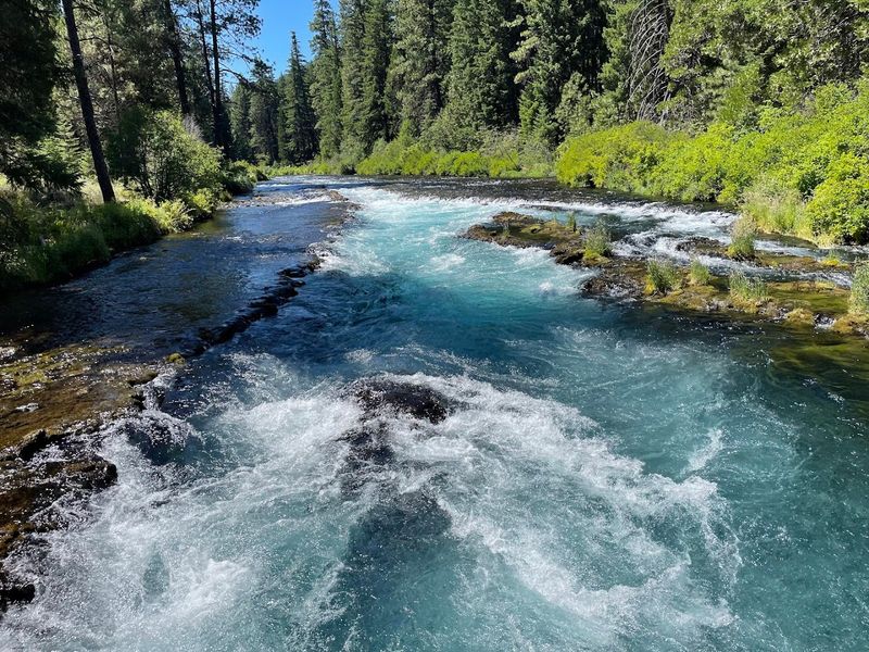
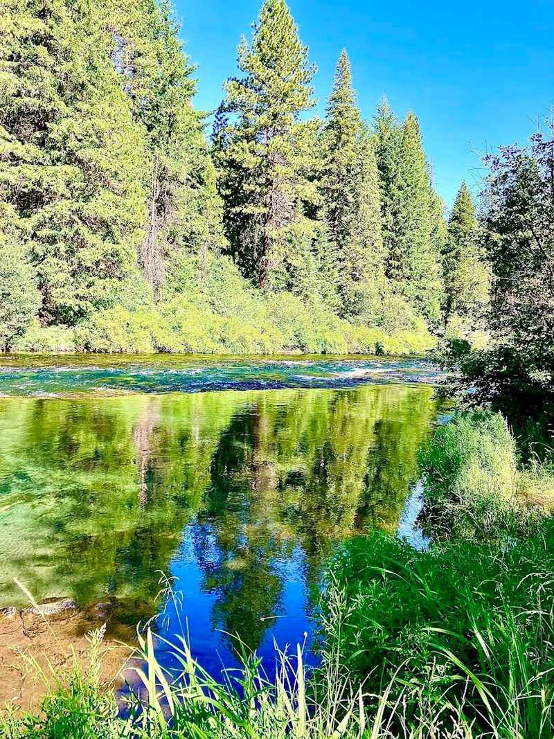
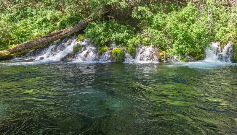
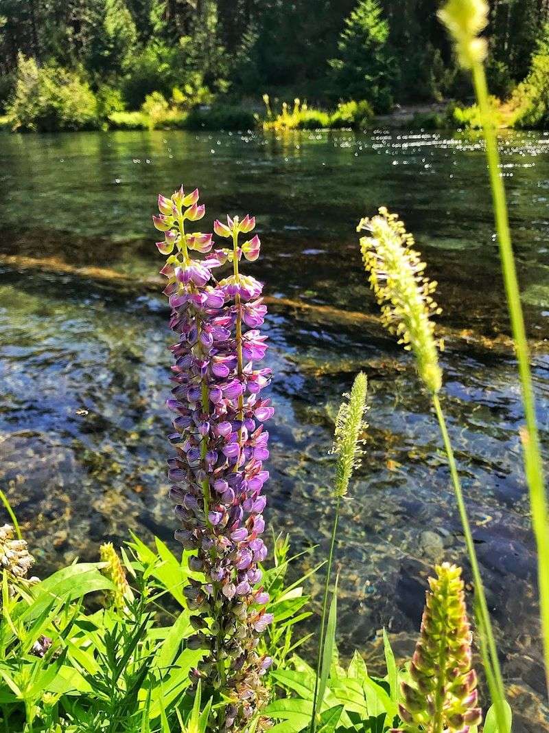
Few rivers announce themselves the way the Metolius does. The water emerges from the earth at a constant, startling clarity that makes the riverbed look close enough to touch even when it sits several feet below the surface.
The blue-green tones shift depending on the angle of sunlight, and on a clear September afternoon near the fish hatchery bridge, the water practically glows.
Spring-fed rivers behave differently from those fed by snowmelt or rainfall. Their source is groundwater, filtered slowly through volcanic rock over years, which strips away sediment and produces water of unusual purity.
The Metolius draws from the same underground reservoir system that feeds much of central Oregon’s hydrology.
Standing at the bank and watching the current move, you get the sense that this water has been traveling a long time just to arrive here. That sense of patience seems to belong to the river itself.
The River Begins At Metolius Springs Near Black Butte
The origin of the Metolius is one of those geographical moments that stops people mid-step. Water simply rises from the ground in full force near the base of Black Butte, forming an immediate, confident river without any visible trickle or gradual build-up.
The viewing area near Camp Sherman gives visitors a clear look at this emergence, and the sight remains genuinely surprising no matter how many times you have read about it beforehand.
Geologists attribute the spring to the porous volcanic terrain of the Oregon Cascades, where water from the western slopes travels underground for years before surfacing here. Black Butte itself is a shield volcano that dominates the skyline to the northwest, providing an unmistakable landmark for orientation.
The Metolius Springs area is located off Forest Road 14 near Sisters, Oregon, and a short, well-maintained path leads visitors directly to the viewpoint. Chipmunks along the trail show little concern for personal space.
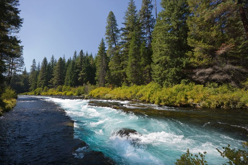
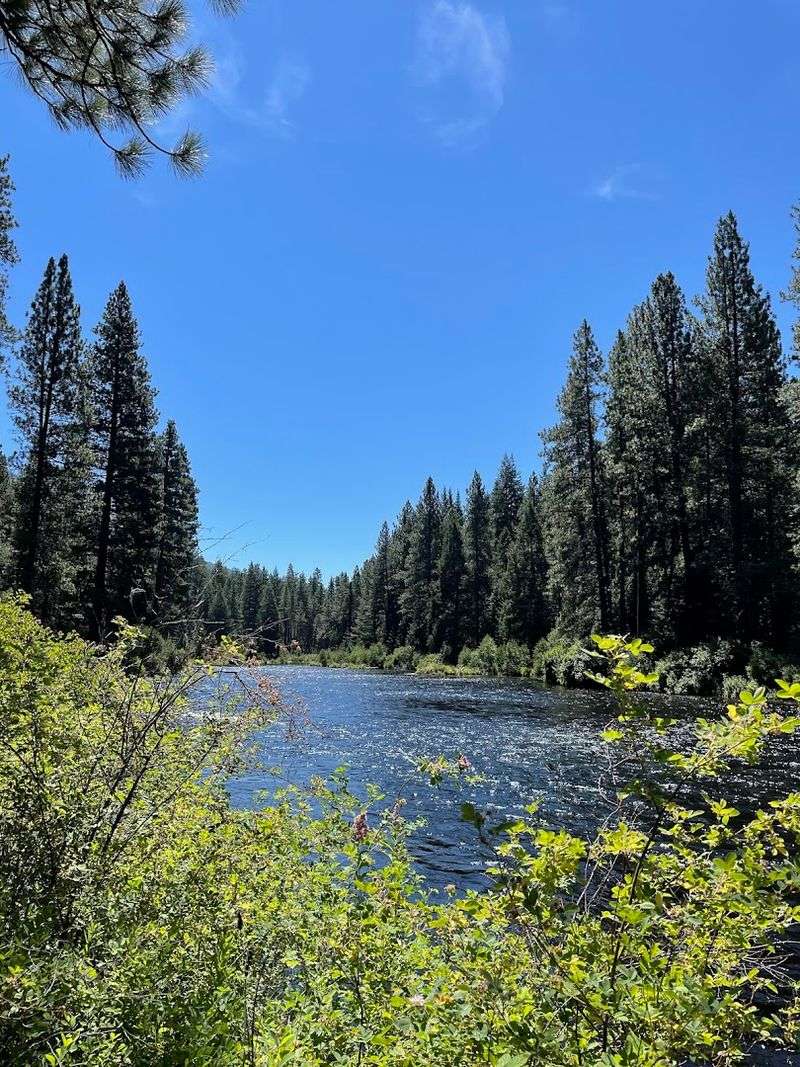
A Scenic River Flowing Through Deschutes National Forest
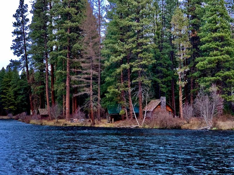
Deschutes National Forest covers more than 1.6 million acres of central Oregon, and the Metolius River corridor runs through one of its most visually compelling sections. Tall ponderosa pines line both banks, their bark carrying the warm orange tones that make this species instantly recognizable.
The forest floor stays relatively open, giving the landscape a parklike quality that invites long, unhurried walks.
The river itself cuts a steady, winding path through the forest, moving at a pace that feels deliberate rather than urgent. Side channels, log jams, and gravel bars appear along the route, each one offering a slightly different perspective on the water and the trees surrounding it.
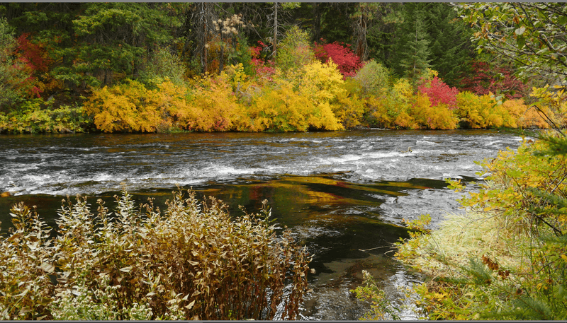
Seasonal changes shape the experience considerably. Autumn brings yellows and golds from cottonwoods and willows along the bank, while summer keeps the forest dense and the light filtered.
Either season rewards visitors who take the time to walk slowly and pay attention to what surrounds them.
One Of Oregon’s Most Famous Fly-Fishing Rivers
Fly fishing on the Metolius carries a reputation that extends well beyond Oregon’s borders. The river holds wild rainbow and bull trout, and its clarity means that anglers can often spot fish holding in the current before making a cast.
That visibility raises the challenge considerably, since the trout can see the angler just as well.
The Metolius is a catch-and-release fishery for most of its length, a management approach that has helped sustain trophy trout populations over many decades. Regulations change by section, so consulting current Oregon Department of Fish and Wildlife guidelines before arriving is a practical necessity rather than an optional courtesy.
The river’s consistent flow and cold temperature keep insect hatches active across multiple seasons, giving fly fishers reasons to return in spring, summer, and fall. Mornings tend to produce the most reliable activity, particularly during caddis and pale morning dun hatches that draw trout to the surface with predictable enthusiasm.
A River That Stays Cold And Clear Year-Round
Most rivers in Oregon follow a seasonal rhythm, running high and cold in spring before warming and dropping through summer. The Metolius operates outside that pattern entirely.
Because it originates from a spring rather than snowmelt, the river maintains a water temperature between 46 and 54 degrees Fahrenheit throughout the year, regardless of what the air above it is doing.
This thermal consistency has real ecological consequences. Cold, well-oxygenated water supports fish species that struggle in warmer environments, and the Metolius has historically provided critical habitat for bull trout, a species listed as threatened under the Endangered Species Act.
The river’s stability makes it an important refuge in a region where water temperatures are increasingly variable.
For visitors, the cold water is simply a fact to respect. Swimming is possible in summer, but the temperature discourages prolonged immersion.
Wading while fishing requires proper gear, and the current, though moderate in appearance, carries more force than it initially suggests.
Trails And Campsites Line The River’s Forested Banks
The Metolius corridor is generously equipped for those who want to stay longer than a single afternoon. The USDA Forest Service manages eleven campgrounds along the river, ranging from small, intimate sites to larger facilities with vault toilets and designated picnic areas.
Most sites sit close enough to the water that the sound of the current becomes the background soundtrack for the entire stay.
The trail system follows both banks for much of the river’s accessible length, connecting campgrounds, the Wizard Falls Fish Hatchery, and several bridge crossings. The loop from the hatchery to Lower Bridge and back covers roughly six miles and stays close to the water for most of the route, which is an uncommon luxury on most river trails.
Reservations for popular sites during summer fill quickly, and arriving without one during peak season is an optimistic strategy at best. Early October visits offer a quieter experience alongside the added reward of autumn color along the cottonwood-lined banks.
Wildlife Like Eagles, Deer, And Otters Are Often Seen Here
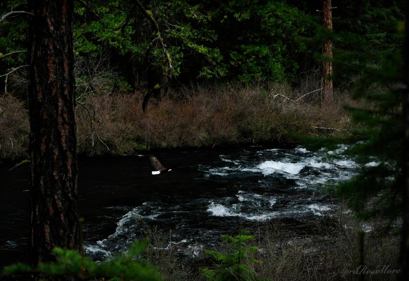
The Metolius River corridor supports a breadth of wildlife that rewards patient observation rather than rushed scanning. River otters move through the water with a fluid ease that makes their hunting look effortless, and spotting one mid-current is the kind of moment that stays with you.
Bald eagles appear regularly, particularly near deeper pools where fish concentrate.
Mule deer move through the forest bordering the river, often visible in the early morning hours before human activity increases. Osprey hunt the shallower sections with a precision that puts most aerial maneuvers to shame, hovering briefly before committing to a vertical plunge.
Black bears have also been documented in the area, though encounters remain uncommon for most visitors.
The diversity of habitat along the river, from open gravel bars to dense riparian thickets to old-growth pines, supports this range of species. Bringing binoculars improves the experience considerably, and moving quietly along the trail tends to produce far better sightings than moving at a conversational volume.
A Peaceful Escape Near The Small Community Of Camp Sherman
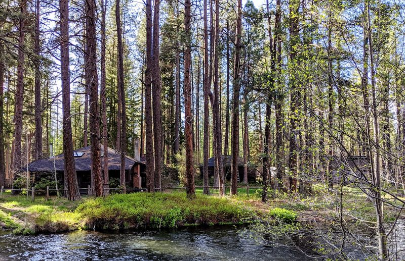
Camp Sherman sits at the upper end of the Metolius corridor, a small community of cabins, a general store, and a handful of lodges that has served as a base for river visitors since the early twentieth century. The Camp Sherman Store functions as the social center of the area, stocking fishing licenses, basic provisions, and the kind of unhurried conversation that seems to come standard in small Oregon communities.
The atmosphere here runs deliberately slow. People come to Camp Sherman specifically to step back from schedules, and the place accommodates that intention without apology.
Rental cabins along the river book well in advance, particularly during the summer months and fall fishing season.
The community sits at an elevation of roughly 2,900 feet, which keeps summer temperatures comfortable compared to the lower desert to the east. Evenings cool quickly, making a campfire less of an affectation and more of a genuine necessity after the sun drops behind the surrounding ridgeline.
The River Eventually Flows Into Lake Billy Chinook
After running approximately 29 miles through forest and canyon, the Metolius delivers its cold, clear water into Lake Billy Chinook, a reservoir formed by the construction of Round Butte Dam on the Deschutes River. The meeting point sits within a deep canyon where basalt walls rise sharply from the water, creating a dramatic visual contrast with the forested upper corridor the river has just traveled through.
Lake Billy Chinook draws a different crowd than the upper Metolius. Boating, waterskiing, and warm-water fishing for kokanee salmon and smallmouth bass are popular activities on the reservoir, and the Cove Palisades State Park offers camping and recreation infrastructure along its shores.
The transition from the quiet, shaded upper river to the open canyon of the reservoir illustrates how dramatically Oregon landscapes can shift within a short distance. Visiting both sections in sequence gives a fuller picture of what this river system offers across its entire length, from spring to terminus.
A Protected River Known For Its Natural Beauty
The Metolius River holds federal designation as a Wild and Scenic River, a status that limits development along its banks and helps preserve the qualities that make it worth visiting in the first place. The designation covers approximately 11 miles of the river and prohibits activities that would alter its free-flowing character or degrade its water quality.
That legal protection has real, visible consequences.
Development along the Metolius is deliberately minimal. No dams interrupt its flow within the protected section, no large commercial facilities crowd its banks, and the Forest Service manages the corridor with an emphasis on conservation over accommodation.
The result is a river that still looks and behaves much as it did before the region was widely settled.
For visitors accustomed to rivers that have been substantially modified by human activity, the Metolius offers a useful reminder of what a river looks like when it is largely left alone. The clarity of the water, the health of the fish populations, and the continuity of the forest all speak to what consistent protection can accomplish over time.