Enjoy 9.6 Miles Of Stunning Views On This Bike Pathway In Tennessee
Some trails make exercise feel less like a workout and more like a small adventure. In Tennessee, this 9.6-mile bike pathway gives riders a mix of easy movement, fresh air, leafy stretches, bridges, neighborhood views, and quiet moments that make the miles pass quickly.
It is long enough to feel satisfying but approachable enough for a relaxed day outside. Bring a bike, pack water, and let the route set the pace.
For anyone craving a scenic ride with history, charm, and plenty to enjoy along the way, this Tennessee pathway is a lovely choice.
The Trail Surface And Terrain You Can Expect
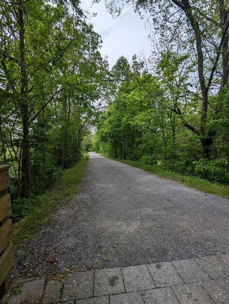
One of the most practical things about this trail is how approachable it is for almost everyone. Built on a former railroad bed, the route maintains a notably flat grade throughout its length, which makes it accessible for casual cyclists, families with young children, older adults, and anyone who prefers a steady pace over a strenuous climb.
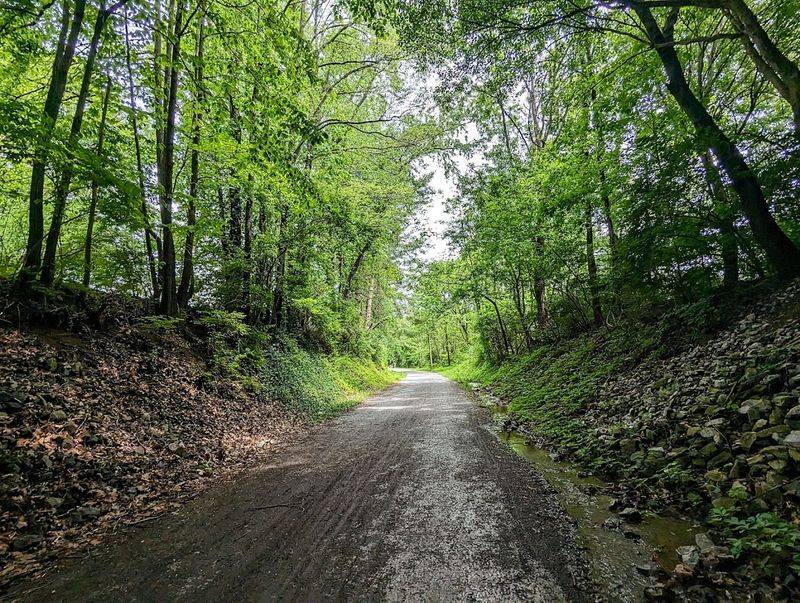
The surface combines compacted stone with paved sections, providing a stable and manageable ride or walk regardless of your preferred activity. You do not need a mountain bike or trail running shoes to enjoy this path.
A standard road or hybrid bike handles the surface comfortably, and walking shoes are more than sufficient for hikers.
Mile markers appear at regular intervals, which helps users plan their distance and turnaround points with confidence. Benches are placed along the route for anyone who needs a rest or simply wants to sit and take in the surroundings.
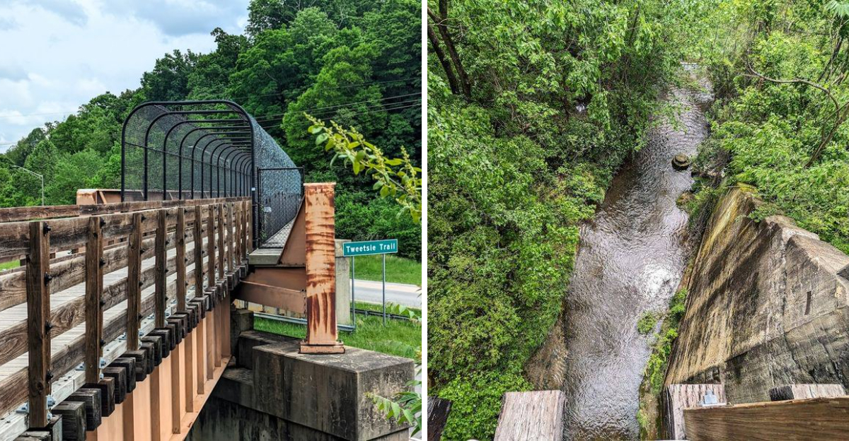
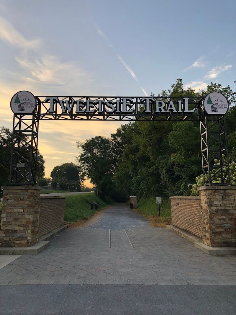
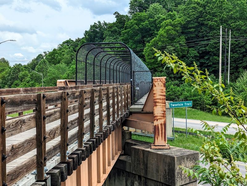
The trail runs approximately 9.6 miles between Johnson City and Elizabethton, Tennessee, offering a satisfying out-and-back option or a point-to-point route if you arrange transportation at each end.
The History Behind The Tweetsie Name
Long before the trail existed, a narrow gauge railroad wound through these Tennessee valleys with a personality all its own. The East Tennessee and Western North Carolina Railroad earned the nickname “Tweetsie” from the high-pitched, almost musical sound its steam whistles made as the trains rolled through mountain passes and rural communities.
That name stuck for generations, eventually becoming the identity of the trail that replaced the old rail line. The railroad operated from the 1880s until the mid-20th century, serving as a vital link for communities across the region.
It carried passengers, livestock, and goods through terrain that roads could barely manage at the time.
Walking or riding the Tweetsie Trail today, you are literally following the same route those steam engines once traveled. Interpretive signage along the path tells the story of the railroad, the people who depended on it, and the landscape it crossed.
It is history you can experience at your own pace, mile by mile, rather than read about in a book. Few trails carry this kind of layered identity so gracefully.
Scenery That Shifts With Every Mile
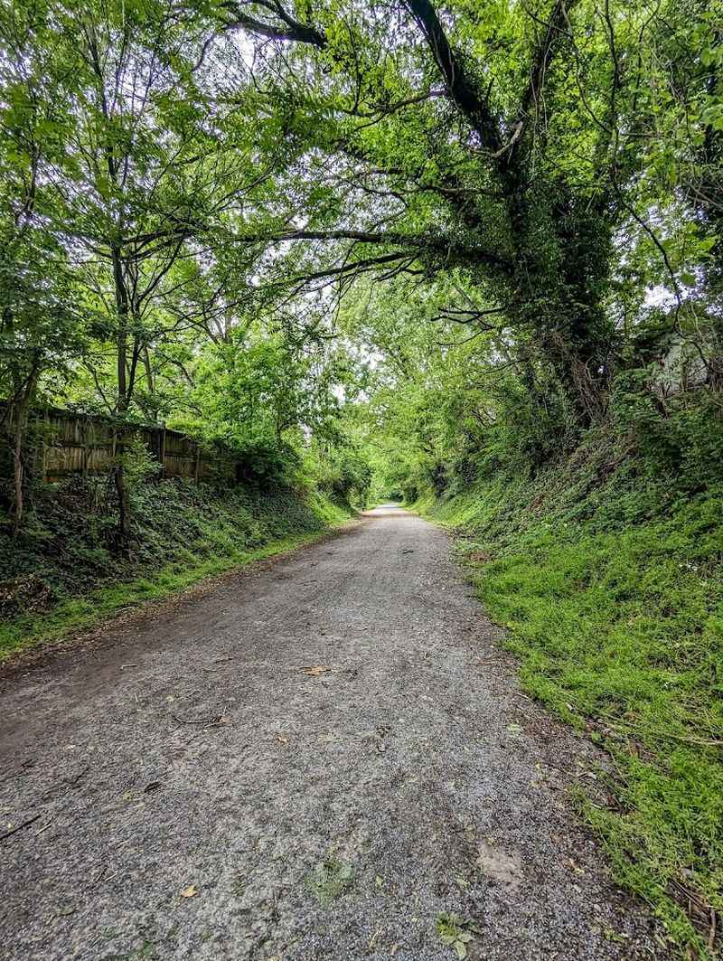
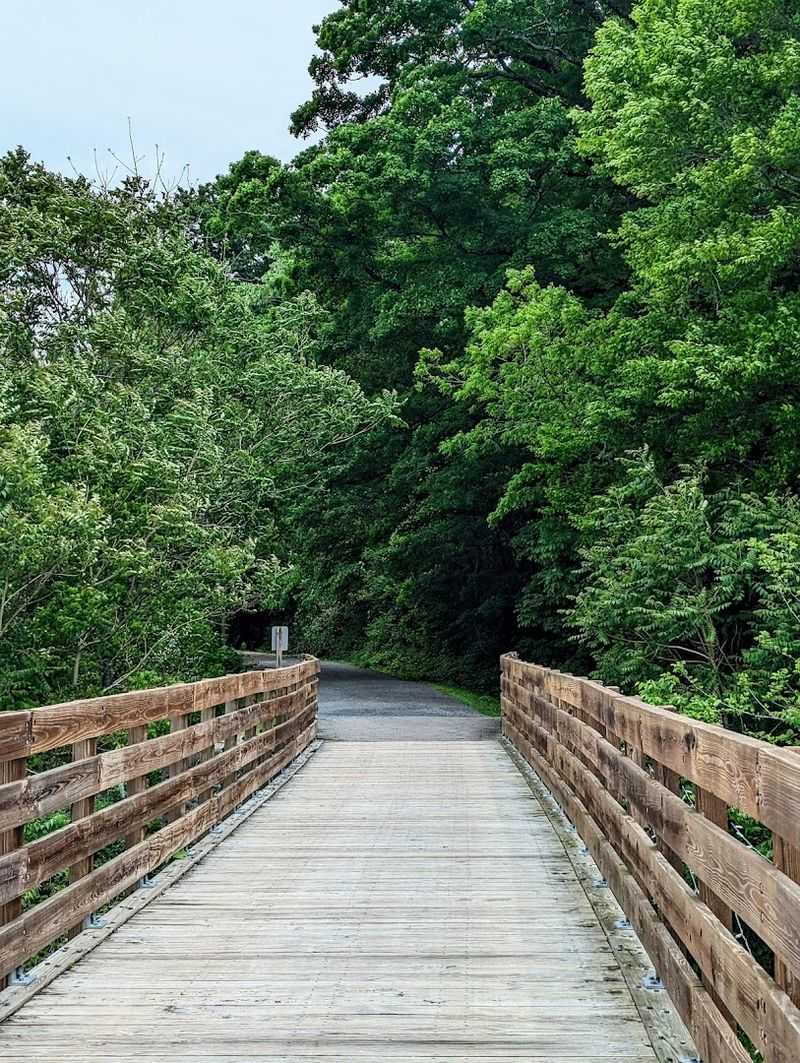
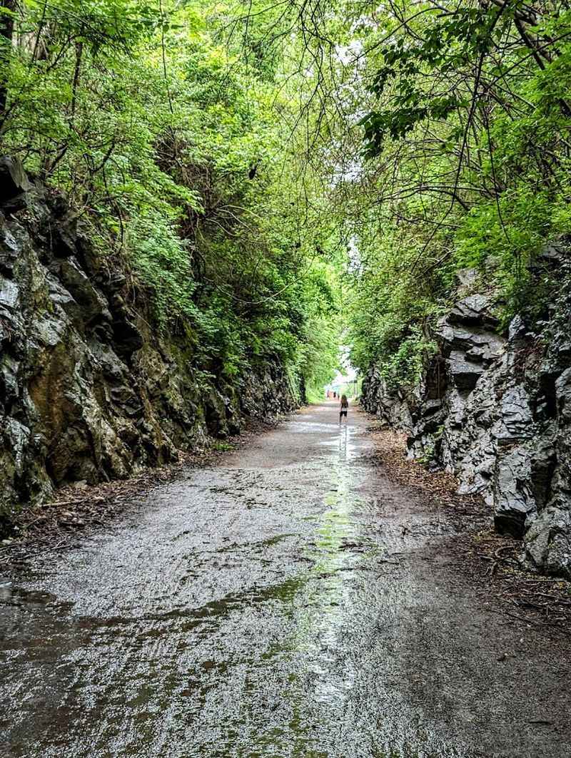
Part of what makes this trail genuinely enjoyable is that the scenery does not stay the same for long. Within a single outing, you move through urban trailheads, open agricultural land, shaded hardwood corridors, and pastoral valleys that feel entirely removed from modern life.
The variety keeps the miles interesting.
Tobacco fields and old wooden barns appear alongside the path in certain stretches, offering a glimpse into the agricultural traditions that still define this part of Tennessee. Grazing livestock, rolling hills, and distant mountain ridges complete the picture in a way that feels thoroughly regional and unforced.
Autumn is a particularly rewarding season on the Tweetsie Trail. The hardwood forest sections ignite with color during peak fall foliage, turning what is already a scenic route into something genuinely memorable.
Spring brings its own rewards, with wildflowers appearing along the edges of the trail and the surrounding landscape filling back in with green. Summer visits offer cool shade in the wooded sections, and at least one reviewer noted that the tree canopy kept the trail noticeably cooler than the surrounding area even on hot days.
Happy Valley Overlooks Worth Stopping For
Happy Valley has a name that sounds almost too cheerful to be real, but the view from the Tweetsie Trail confirms it earns the title. Certain sections of the trail rise just enough to offer broad, open sightlines across the valley, where the land spreads out in layers of green and gold depending on the season.
These overlook points are among the most photographed spots along the entire route. Visitors regularly stop here to take in the mountain backdrop and the patchwork of farmland below.
It is the kind of view that makes you pause mid-pedal and simply look for a moment before continuing.
The valley sits within the broader landscape of northeastern Tennessee, framed by the Blue Ridge and Unaka mountain ranges. The visual depth of the scene changes dramatically with weather and light.
Early morning visits offer soft mist settling over the lower fields, while late afternoon light gives the ridgelines a warmer tone. Regardless of when you arrive, the Happy Valley overlooks represent the Tweetsie Trail at its most visually rewarding.
Bring a camera, or simply commit the view to memory. Either way, it stays with you.
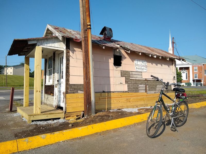
The Johnson City Trailhead And Its Amenities
Starting your Tweetsie Trail experience in Johnson City means beginning with a well-equipped trailhead that takes the guesswork out of preparation. The facility includes paved parking, water fountains, restrooms, and a bike repair station, which is a thoughtful addition for cyclists who discover a mechanical issue before or after a long ride.
The repair station is stocked with basic tools and a pump, covering the most common on-trail needs without requiring a trip to a bike shop. For families loading up bikes and gear, having these conveniences at the starting point reduces stress and adds to the overall experience of the outing.
Johnson City itself offers additional resources nearby, including restaurants and shops accessible from the trail corridor. The trailhead also features interpretive signage that introduces visitors to the history of the former railroad and the communities it once connected.
Taking a few minutes to read through these panels before heading out adds meaningful context to everything you see along the route. The Johnson City end of the trail is located in northeastern Tennessee, and the trailhead is easy to find with standard navigation apps.
It is a solid starting point for both first-time visitors and returning regulars.
Elizabethton And The Trail’s Southern Terminus
Reaching Elizabethton at the southern end of the Tweetsie Trail feels like arriving somewhere rather than simply stopping. The small city has its own distinct character, with a historic downtown that gives trail users a genuine destination to explore after completing the route.
Local restaurants and shops are accessible from the trail corridor, making Elizabethton a natural spot for a post-ride meal or a browse through local businesses. The city sits along the Doe River, and its historic covered bridge is one of the oldest surviving covered bridges in Tennessee, adding another layer of interest for visitors who take time to explore beyond the trail itself.
For those doing a point-to-point ride rather than an out-and-back trip, Elizabethton serves as the logical finishing point. Arranging a shuttle or a second vehicle here allows you to experience the full 9.6-mile route in one direction without retracing your steps.
The transition from the trail into the town is relatively smooth, and local signage helps orient visitors who are unfamiliar with the area. Elizabethton rewards curiosity, and the trail provides a fitting approach to a community worth exploring at a measured pace.
Jacob’s Nature Park And Sinking Creek Access
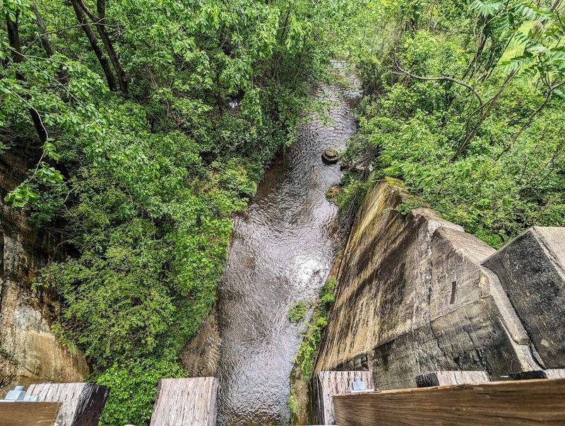
One of the quieter rewards along the Tweetsie Trail is the access point to Jacob’s Nature Park at Sinking Creek. This natural area sits along the trail corridor and offers a brief detour into a more intimate, creek-side environment that contrasts nicely with the open pastoral stretches elsewhere on the route.
Sinking Creek itself is a modest waterway, but its presence adds a calming dimension to the surrounding landscape. The sound of moving water, the vegetation that grows along the banks, and the generally undisturbed feel of the area make it a worthwhile stop for anyone who appreciates natural spaces beyond the main trail surface.
Jacob’s Nature Park is particularly appealing for families with younger children who enjoy exploring natural environments at a slower pace. The area provides an opportunity to step off the trail and observe local plant and animal life in a setting that feels genuinely removed from the surrounding development.
Trail users who pass through without stopping often mention later that they wished they had taken the time to explore it. If your schedule allows for a slower pace, the nature park connection is one of the Tweetsie Trail’s more understated pleasures and well worth the brief detour.
The Milligan Depot Replica And Historical Markers
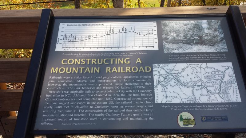
Railroad history comes into sharper focus at the Milligan Depot replica, one of the more tangible historical features along the Tweetsie Trail. The structure pays tribute to the original depot that once served the East Tennessee and Western North Carolina Railroad, offering a physical reference point for the transportation history embedded in this corridor.
The replica is modest in scale but effective in purpose. Standing beside it, you get a clearer sense of how the railroad functioned as a community anchor rather than just a transportation line.
Depots like this one were gathering points, mail stops, and the first point of contact for goods arriving from distant places. They mattered to the towns they served in ways that extended well beyond the trains themselves.
Interpretive signage throughout the trail reinforces this historical context, covering topics from local geology to ecological features and the social history of the railroad era. These panels are written accessibly and genuinely informative, not just decorative additions.
Visitors who engage with the signage come away with a richer understanding of the landscape they are moving through. The Milligan Depot replica is located mid-route and serves as a natural stopping point for both rest and reflection on the journey covered so far.
Best Times To Visit And What To Bring
Timing a visit to the Tweetsie Trail well makes a noticeable difference in the overall experience. Late September through early November stands out as the most visually rewarding period, when the hardwood trees along the route transition through their full range of autumn color.
The temperatures during this window are also well-suited for physical activity.
Spring visits offer a different but equally appealing experience, with fresh greenery and wildflowers appearing along the trail edges. Summer remains popular, and the tree canopy in wooded sections provides meaningful shade, though early morning starts are advisable on the hottest days.
Winter use is possible on dry days, and the bare trees open up long sightlines across the valley that are unavailable during leafy months.
Regardless of season, a few items make the outing more comfortable. Water is essential, especially on warmer days, and the water fountains at the Johnson City trailhead are a useful starting resource.
Sunscreen and a light layer for cooler mornings round out a basic packing list. Helmets are strongly recommended for cyclists, and comfortable footwear handles the compacted surface well.
The trail runs approximately 9.6 miles total, so planning your turnaround point in advance helps manage energy and time effectively.
Why Families And Solo Adventurers Both Love This Trail
Few trails manage to work equally well for a solo rider seeking solitude and a family looking for a manageable weekend outing, but the Tweetsie Trail handles both with ease. The flat grade removes the intimidation factor for younger cyclists and less experienced riders, while the scenery and historical context give more seasoned visitors plenty to engage with along the way.
Families regularly cite the trail as an ideal setting for introducing children to outdoor activity. The absence of significant elevation change means kids can cover meaningful distance without exhaustion, and the variety of scenery keeps attention levels up throughout the ride.
Dogs on leashes are welcome, adding another layer of appeal for pet owners looking for an outdoor activity that includes the whole household.
Solo visitors tend to appreciate the meditative quality the trail offers. At a steady cycling pace, the miles pass with a rhythm that encourages clear thinking and quiet observation.
Runners use the route for long training efforts, and walkers find the surface forgiving enough for extended distances. The Tweetsie Trail connects Johnson City and Elizabethton, Tennessee, across a route that rewards both the unhurried and the goal-oriented.
It is the kind of place that earns repeat visits without ever overpromising on what it delivers.