
Climb The Steps To The Top Of Monks Mound At Cahokia Mounds In Collinsville, Illinois
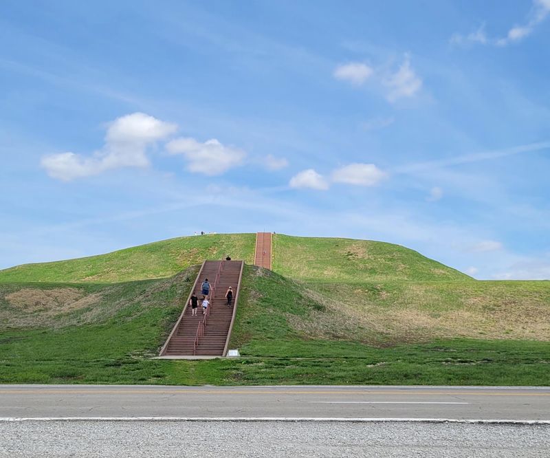
Somewhere in southern Illinois, just off a highway most people speed right past, there is a grass-covered hill that turns out to be one of the biggest things human hands ever built on this continent. I expected a quiet field and a couple of signs.
What I got instead was a staircase, a burning set of calf muscles, and a view that stretched all the way to a famous silver arch on the horizon. Roughly a thousand years ago, thousands of people lived at the bottom of those steps, and standing up top makes that suddenly feel very real.
Where the Mound Rises From the Bottomlands
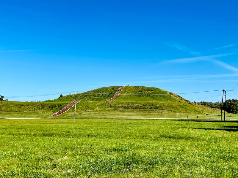
Head about fifteen minutes east of the Mississippi River and you land in the flat American Bottom floodplain, where Cahokia Mounds UNESCO World Heritage Site spreads across the landscape at 30 Ramey St in Collinsville, Illinois.
The centerpiece is Monks Mound, the largest man-made earthen mound in North America and the biggest pyramid anywhere north of Mesoamerica. It climbs roughly 100 feet, and its base covers nearly 15 acres, which is about the same footprint as the Great Pyramid of Giza.
Measured across, the mound runs about 955 feet north to south and 775 feet east to west. Numbers like that are hard to picture until you park at its base and realize the green slope in front of you keeps going up long after you expected it to stop.
What surprises most first-timers is how ordinary the surroundings look. A road, some parking lots, a few interpretive signs, then this enormous flat-topped structure holding down the middle of it all.
Visitors regularly mention being stunned that something on this scale sits so quietly beside a busy metro area.
A City of Ten Thousand, Built by Hand
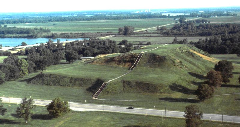
Around 900 to 950 CE, people of the Mississippian culture began piling up the earth that would become Monks Mound, finishing the work near 1100 CE. Construction happened in stages, possibly across fourteen separate phases, with basket-carried soil and clay, sod blocks, and scattered earth fill.
Some analyses suggest two bursts of rapid building took place in under twenty years, somewhere between 1050 and 1150 CE.
All of it went up without wheels, draft animals, or metal tools. Think baskets on backs, trip after trip, generation after generation.
The city around it flourished between roughly 700 and 1400 CE, peaking near 1100 CE with an estimated 10,000 to 20,000 residents. Wider estimates for Greater Cahokia run as high as 40,000 to 50,000 people.
Originally the settlement held about 120 mounds across 4,000 to 6,000 acres, and roughly 70 to 80 of those survive today.
Monks Mound itself was no decoration. Its summit supported major ceremonial and leadership structures, making it the political and spiritual high point of the entire city.
How the Mound Got a Monk’s Name
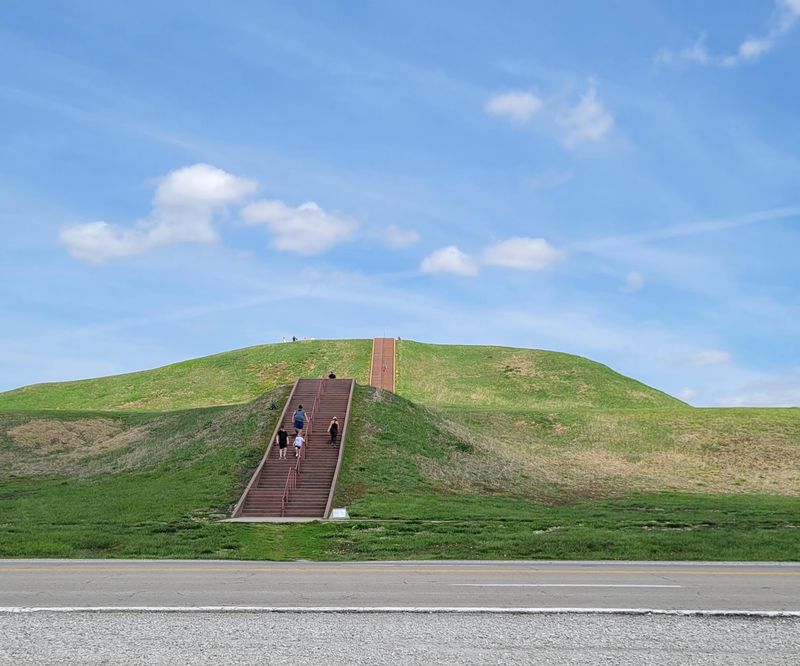
Odd thing about the name: no monk had anything to do with building it. The title came from Trappist Monks who lived on a nearby mound in the early 1800s and farmed the first terrace of the big one, leaving their label stuck to it ever since.
Even before them, French missionaries put up a chapel on that same first terrace back in 1735, near where a Cahokia Illini settlement stood. Layer upon layer of history, quite literally.
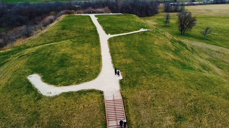
Speaking of layers, the mound rises in four distinct terraces, with the largest and lowest spreading across the southern end. Standing on that first level gives you a sense of how much usable ground the builders created up in the air.
The site earned National Historic Landmark status in 1965, then joined the UNESCO World Heritage list in 1982, placing it in the same category as the world’s most significant cultural monuments.
Visitors often say the name feels like a historical accident, and it is. A borrowed label on something far older and far more remarkable than the borrowers.
The Staircase and What Your Legs Are In For
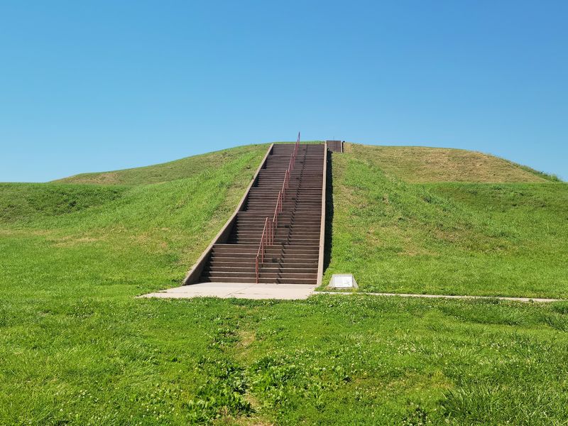
Roughly 147 to 154 steps stand between the parking lot and the summit, though people who count as they climb report anywhere from 120 to 158. Nobody agrees, and honestly by step ninety you stop caring.
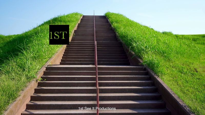
The stairs run straight up the south face in two long flights, with a handrail the whole way and benches placed along the route for anyone who wants a breather. Regular visitors describe the climb as manageable but genuinely aerobic, best suited to those in moderate physical shape.
Some locals treat it as their workout, doing laps up and down while tourists pause halfway to catch their breath and pretend they are admiring the view.
Plenty of families with children of all ages make it up without trouble, and the pace is entirely yours to set.
One rule the signs make clear: stay off the grassy slopes. The sides are steep and the whole mound remains an active archaeological site, so rolling down is firmly off the table no matter how tempting it looks to a bored teenager.
Summit Views Stretching to the Gateway Arch
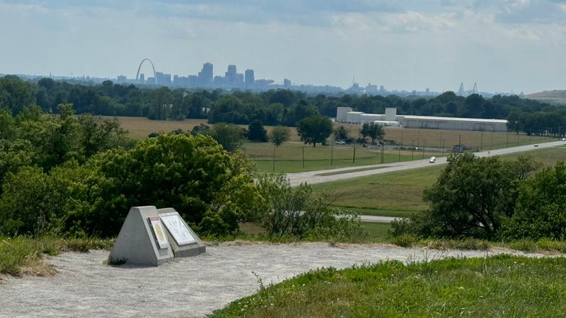
The payoff arrives all at once. Step onto the flat summit and the horizon opens west across the floodplain to the St. Louis skyline, with the Gateway Arch catching light in the distance.
Turn the other way and you look down over the grand plaza and the smaller mounds scattered through the grass, which finally makes the layout of the ancient city legible in a way no map manages.
Interpretive signs at the top help sort out what you are seeing, pointing toward features and explaining the vistas. There are only a couple of them, so anyone expecting a museum up there will be disappointed.
The view is the exhibit.
People who make the climb frequently call it one of the best outlooks in the whole St. Louis metro area, and many describe a quiet, reflective moment standing where leaders once stood a thousand years ago.
Wind is a regular companion up there. Bring a hat with a chin strap if you own one, since more than one visitor has watched theirs sail off mid-photo.
Woodhenge, Trails and the Interpretive Center
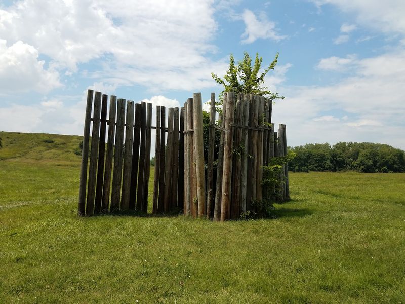
Monks Mound gets the attention, but the grounds hold plenty more. A short drive west brings you to Woodhenge, a circle of tall timber posts reconstructing an ancient astronomical observatory used to track the sun through the seasons.
A reconstructed section of stockade wall shows how the central precinct was once enclosed, and trails thread out toward dozens of other mounds where you can often walk without seeing another person for stretches.
The Interpretive Center houses artifacts, exhibits, restrooms and a small gift shop, and staff there have a reputation for being welcoming and genuinely knowledgeable. Some visits include hour-long tours led by a site archaeologist.
An augmented reality and audio app is available for a few dollars at various stops, and several people who tried it said it gave real perspective on the scale of the vanished city.
Wildlife shares the space too. Herons, deer and nesting birds turn up regularly, which suits the calm mood of the place.
Note that the center has been through renovation closures, so checking ahead saves disappointment.
Planning the Practical Side of Your Visit
Outdoor grounds, Monks Mound included, stay open daily from dawn until dusk, so an early morning or golden-hour climb is entirely possible. The Interpretive Center keeps shorter hours, running 9 AM to 3 PM Wednesday through Sunday and closed Mondays and Tuesdays.
Arrive after three and you can still park across the street and walk the mound, with signs directing you where to go.
Visitors report no charge for grounds access, though an admission fee may apply at the Interpretive Center. Parking is plentiful on both sides of the site, and even weekend middays can feel uncrowded.
Restrooms and a water fountain sit at the Monks Mound lot. Shade is scarce, so sunscreen and a hat matter, and a charged phone helps if you plan to use the AR app.
Most people spend one to two hours covering the highlights. Reaching the site is easy from Interstate 55/70, and the address is 30 Ramey St, Collinsville, Illinois.
Call ahead at 618-346-5160 to confirm center hours.
Accessible signage and walkways serve the parking areas, though the stair climb demands real fitness.
Worth the Burn in Your Calves
A thousand years ago, this was the largest city north of Mexico, and hardly anyone driving past on the interstate today knows it exists. That gap between significance and recognition is exactly what makes the climb hit so hard.
Holding a 4.7-star average across more than five thousand reviews, the site clearly lands with people. Common threads in what visitors share: the history is fascinating, the signage does a solid job explaining it, the grounds feel peaceful, and the summit view justifies every step.
History buffs, families looking for a real outdoor lesson, walkers who want a workout with a payoff, and anyone curious about early North America will find something here. Those who cannot manage stairs still have the Interpretive Center, trails and Woodhenge to enjoy.
My honest take is simple. Go on a clear day, climb slowly, sit on a bench at the top, and give yourself ten quiet minutes to picture the plazas and houses that once filled the ground below.
Few places in the Midwest reward that little effort with quite so much perspective.