Idaho Has A 69-Mile Drive So Gorgeous It Barely Feels Real From Behind The Wheel
What if a single road handed you Teton views, golden farm fields, and a whole chapter of frontier history? Idaho keeps that road surprisingly quiet, even though the mountains here rival anything Wyoming has to offer.
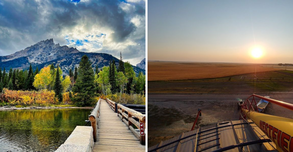
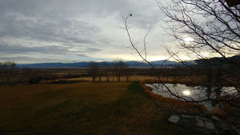
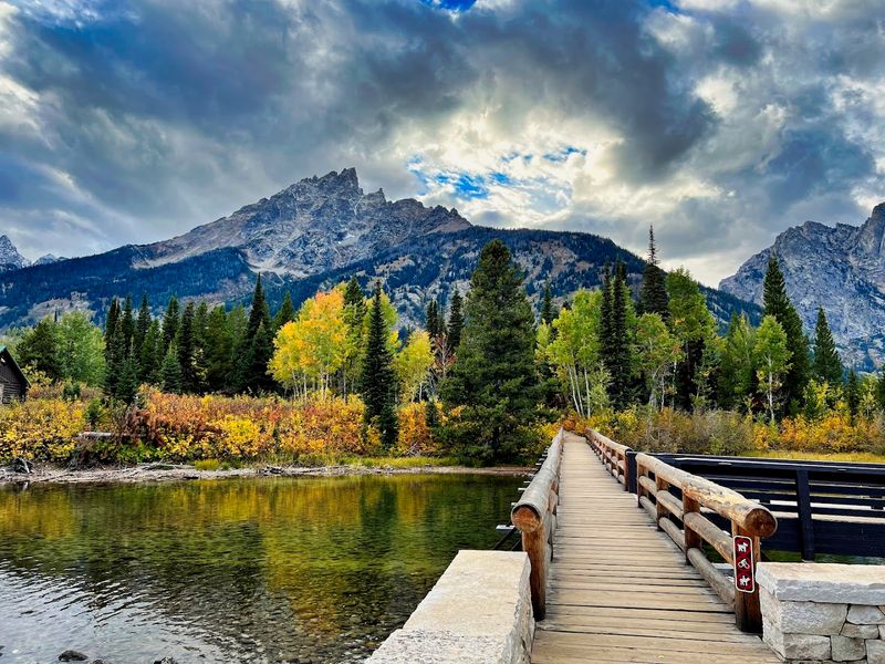
The Teton Scenic Byway stretches 69 miles through the wide valley below the western face of the Tetons. It is raw, open, and completely uncrowded.
Every small town along the route adds a distinct layer. Victor has its famous huckleberry milkshakes.
Driggs holds Idaho’s oldest soda fountain. Tetonia delivers long, unobstructed mountain views that stretch the full width of the valley.
The western face of the Tetons looks nothing like the postcards from the other side. Plan a loop and find out why photographers specifically come here.
The Road Less Traveled Through The Quiet Side Of The Tetons
Most people race to Wyoming to see the Tetons. They miss the fact that Idaho has its own front-row seat to the same mountain range.
The Teton Scenic Byway runs 69 miles through eastern Idaho, following Highways 31, 33, and 32 between Swan Valley and Ashton.
Unlike the heavily trafficked roads on the Wyoming side, this byway stays calm and unhurried. Traffic is light.
Pull-offs are easy to find. The pace here matches the landscape, slow, wide, and generous.
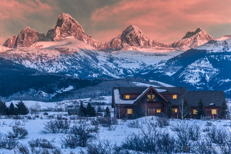
Locals call this stretch the quiet side of the Tetons, and that description fits perfectly. The mountains rise above 13,700 feet and dominate the skyline without any crowds blocking the view.
It is the kind of drive that makes passengers forget to check their phones entirely.
Swan Valley, Where The Snake River Sets The Tone
Swan Valley does not announce itself loudly. It eases the driver in gently, with the Snake River running alongside the road in a way that feels almost like a welcome handshake.
This small community marks the starting point of the Teton Scenic Byway in Idaho. The Snake River here is legendary among fly fishing enthusiasts, drawing anglers who come specifically for its clear, cold waters and healthy trout populations.
The valley itself sits at a lower elevation and stays lush through much of the year. Fields stretch out on either side of the road.
The mountains have not yet appeared in full force, but the anticipation builds with every mile.
Swan Valley also serves as a practical launching pad for the drive. Fuel up, grab something to eat, and take a moment to appreciate the river before the route starts climbing toward Pine Creek Pass.
The calm here is deliberate, and worth soaking in before the scenery turns dramatic.
Pine Creek Pass And The Climb That Changes Everything
The byway does not stay flat for long. After leaving Swan Valley, the road begins its climb through the Caribou-Targhee National Forest toward Pine Creek Pass.
This is the highest point on the entire route. The grade reaches six percent in sections, which means drivers will feel the engine working.
The forest closes in around the road as the elevation rises, with tall conifers lining both sides of the highway.
At the top, the view opens without warning. The Teton Valley spreads out below in a wide, flat panorama that looks almost like a painting.
The mountains stand in a long, dramatic line across the eastern horizon.
Winter driving through this pass can involve icy conditions, so checking road conditions before attempting the route in colder months is strongly recommended. In late spring and early fall, though, the pass rewards every driver with color, light, and the kind of view that justifies the entire trip on its own.
Victor, The Gateway Town With A Cult Following
Victor punches well above its weight for a small Idaho town. It sits right at the entrance to Teton Valley and has built a devoted following among visitors who stumble in and never quite want to leave.
The town is compact and walkable, with a relaxed mountain-town energy that feels earned rather than manufactured. Victor Emporium is perhaps the most talked-about stop in town, famous for its huckleberry milkshakes that have become something of a local legend.
Beyond the milkshakes, Victor serves as a genuine gateway community. Outdoor recreation surrounds it on all sides, from hiking and cycling in summer to cross-country skiing in winter.
The town sits close enough to the Teton Range that the peaks feel almost overhead on a clear day.
Linn Canyon Ranch operates nearby and adds an agricultural texture to the area. Victor manages to feel both practical and charming at once, which is a harder balance to strike than it looks from the outside.
Driggs, The Cultural Heart Of Teton Valley
Driggs earns its reputation as the cultural center of the Teton Valley without trying too hard. The town has a lived-in quality that feels authentic and unhurried.
History runs deep here. The valley served as a rendezvous site for mountain men and fur trappers in the early 1800s.
John Colter, a member of the Lewis and Clark Expedition, was among the first non-native explorers to pass through this region. That history gives Driggs a sense of weight that most small towns cannot match.
Modern Driggs holds onto its heritage while adding contemporary character. Idaho’s oldest soda fountain operates here, inside the historic Corner Drug pharmacy on Main Street.
The Teton Geo Center offers educational exhibits about the geological forces that shaped the valley and the mountains above it.
Grand Targhee Resort sits close by on the Wyoming border, making Driggs a practical base for skiers and hikers who want to explore both sides of the range.
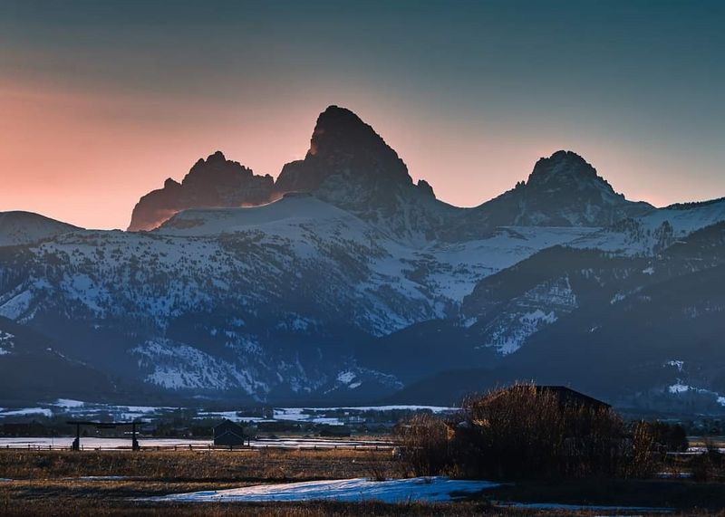
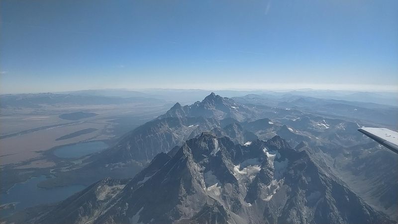
The Western Face Of The Tetons Looks Nothing Like The Postcards
Every famous photo of the Tetons shows the eastern face from Wyoming. That view is stunning, but it is also familiar to the point of becoming expected.
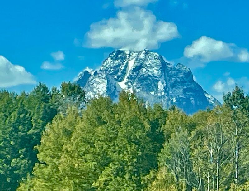
The western face, visible from the Teton Scenic Byway in Idaho, tells a completely different story. The mountains appear more rugged from this angle.
The slopes drop sharply, and the peaks look rawer and less polished than their eastern counterparts.
The scale of the range becomes clearer from the valley floor. With flat farmland in the foreground and nothing interrupting the sightline, the mountains rise in an unbroken wall that seems almost impossible in its height and proximity.
The peaks push above 13,700 feet and are visible for most of the byway’s length.
Photographers who know about this vantage point treat it like a secret. The light hits differently here, especially in the early morning and late afternoon.
The western face deserves far more recognition than the postcard version ever gives it.
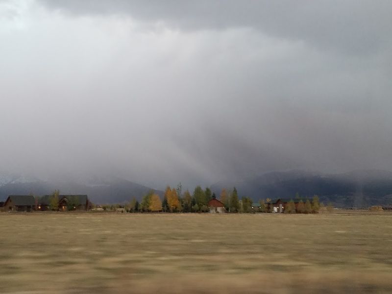
Farmland, Fields, And The Idaho Landscape In Full View
The Teton Scenic Byway is not just about mountains. The farmland it passes through is a major part of what makes the drive feel so visually complete.
Fields of barley, wheat, and Idaho potatoes line the valley floor for long stretches of the route. These are working farms, not decorative ones, and that distinction matters.
The landscape looks purposeful and alive rather than staged for tourists.
In late summer, the fields turn gold and amber, adding warm tones to a scene already dominated by blue sky and green mountain slopes. The contrast between cultivated farmland and wild mountain terrain creates a visual rhythm that holds attention mile after mile.
The Big Hole Mountains also appear along the western side of the valley, adding another layer of texture to the view. Between the Tetons to the east and the Big Holes to the west, the byway runs through a corridor of scenery that feels genuinely rare.
Idaho’s agricultural identity and its wild landscape coexist here without any tension.
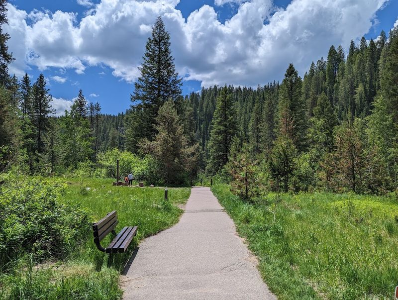
The Ashton to Tetonia Trail Runs Right Alongside The Byway
Not every part of this experience has to happen from inside a car. The Ashton to Tetonia Trail offers a slower, ground-level way to experience the same scenery.
The trail runs approximately 29.6 miles along an old railroad grade between the two towns its name describes. It is flat, wide, and accessible for hikers and cyclists of most fitness levels.
The former rail bed keeps the surface consistent and the grade gentle throughout.
Views from the trail are remarkably similar to those from the road, except without the windshield between the traveler and the landscape. The Teton Range sits clearly visible to the east for much of the trail’s length.
Wildlife sightings are more common on foot or by bike than from a moving vehicle.
The trail connects communities along the byway and adds a recreational dimension to the route that many road-trippers overlook. Bringing a bike or planning a short walking section adds a completely different texture to the overall Teton Scenic Byway experience.
Wildflowers In Spring And Foliage In Fall Make Timing Matter
The byway looks different depending on when you show up. Timing the visit well can turn a great drive into an unforgettable one.
Late spring brings wildflowers across the valley floor and the mountain slopes. The color contrast between blooming meadows and snow-capped peaks creates a visual combination that photographers specifically plan trips around.
The air is cool, the roads are clear, and the crowds have not yet arrived.
Early fall delivers a different kind of spectacle. The aspens and cottonwoods shift to gold and orange, and the farmland takes on warm harvest tones.
The mountains often catch early snow at their summits in September, creating a layered scene of color from valley floor to peak.
Summer works well too, with long days and clear skies making the drive comfortable. Winter is possible but requires preparation, as Pine Creek Pass can develop icy conditions.
The byway rewards visitors year-round, but spring and fall represent the highest return on a single tank of gas.
Mountain Men And Fur Trappers Walked This Valley First
The Teton Valley has a history that stretches far beyond the paved road running through it today. Long before the byway existed, this valley was a crossroads for some of the most adventurous people in American history.
In the early 1800s, the valley served as a rendezvous site for mountain men and fur trappers. These gatherings were part trade fair, part social event, drawing people from across the frontier to exchange goods and information.
The valley’s geography made it a natural meeting point between mountain and plain.
John Colter, who had traveled west with the Lewis and Clark Expedition, is believed to be among the first non-native people to pass through this region. His route through what is now eastern Idaho helped open the area to further exploration and eventual settlement.
That layered history adds depth to what might otherwise be just a scenic drive. The fields and mountains that line the byway today were once a wilderness that shaped the early American frontier in ways that still echo through the region.
Tetonia And The Wide Open Northern End Of The Valley
By the time the byway reaches Tetonia, the Teton Valley has opened up to its widest point. The town is small and quiet, but its position in the landscape makes it feel expansive.
Tetonia sits at the northern end of the valley, where the flat agricultural land begins to give way to the terrain leading toward Ashton. The mountain views here are broad and unobstructed, offering some of the longest sightlines on the entire route.
The town connects directly to the Ashton to Tetonia Trail, making it a natural starting or ending point for anyone planning to bike or hike a section of the route. The community has a working agricultural character that contrasts nicely with the more tourist-oriented towns to the south.
Stopping here, even briefly, rewards the attentive traveler. The light in the late afternoon catches the mountains in a way that makes the entire valley glow.
Tetonia may not appear on many travel itineraries, but it earns its place on this particular drive without any difficulty.
Ashton And The Connection To Mesa Falls Scenic Byway
Ashton marks the northern endpoint of the Teton Scenic Byway, but it is far from a dead end. The town sits at the junction where the byway connects with the Mesa Falls Scenic Byway, making it a natural pivot point for extending the road trip further.
The Mesa Falls route heads east from Ashton toward some of Idaho’s most dramatic waterfall scenery. Travelers who plan ahead can link the two byways into a longer loop that covers an impressive range of landscapes in a single day or over a relaxed weekend.
Ashton itself has a quiet, agricultural personality. The surrounding area grows significant quantities of seed potatoes, and the town reflects the working character of the region.
It is not a tourist destination in the conventional sense, but it provides everything needed for a comfortable stop.
Ending the Teton Scenic Byway in Ashton carries a satisfying finality. The 69 miles from Swan Valley leave the driver with a clear picture of what eastern Idaho actually looks like, feels like, and offers to anyone willing to take the less obvious road.