Locals’ Top 13 Secret Virginia Spots You Should Never Visit Alone
Virginia hides wild places that locals whisper about around campfires and share only with their most adventurous friends. These remote corners of the state offer breathtaking beauty, but they also demand respect and careful planning.
Many of these spots sit far from cell towers, marked trails, and rescue stations, making solo trips risky even for experienced outdoors lovers. Grab a hiking buddy, pack your gear, and get ready to explore some of Virginia’s most stunning secret locations that are best experienced with someone watching your back.
1. Beartown Wilderness (Tazewell County)
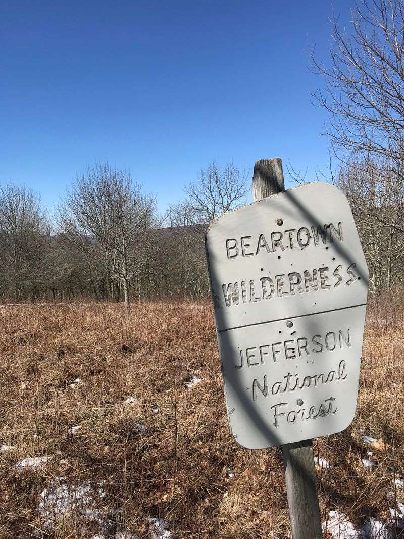
Massive boulders rise from the forest floor like ancient giants frozen in time. This 5,600-acre wilderness area in southwest Virginia feels like stepping into another world entirely.
The rock formations here create natural mazes that can confuse even GPS devices.
Getting lost happens easier than you’d think among these towering stones and dense rhododendron thickets. The terrain shifts constantly, and what looks like a clear path forward can dead-end into sheer rock faces.
Cell service vanishes the moment you enter, cutting you off from emergency help.
Trails here aren’t marked like your typical state park paths. You’ll navigate using instinct, maps, and hopefully a companion who can help you backtrack if needed.
The wilderness lives up to its name with black bears frequently spotted in the area.
Local hikers recommend bringing a physical compass and detailed topographic maps. Weather changes fast in these mountains, turning sunny afternoons into foggy nightmares.
Two sets of eyes always beat one when you’re threading through boulder fields where a twisted ankle could mean serious trouble.
2. Overall Run Falls (Shenandoah National Park)
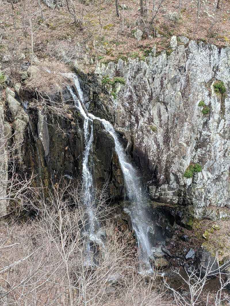
At 93 feet, this cascade claims the title of Shenandoah’s tallest waterfall. Water tumbles down in stages, creating a thundering symphony that echoes through the canyon.
But reaching this beauty means tackling one of the park’s most challenging and isolated trails.
The hike stretches over six miles round trip with serious elevation changes that’ll test your endurance. Rocks along the path stay slick year-round from constant moisture and moss growth.
One wrong step on these wet surfaces could send you sliding down steep sections with nothing to grab.
Few people make this trek compared to more popular Shenandoah destinations. That means help might be hours away if something goes wrong.
The trail crosses streams multiple times, and during spring runoff, these crossings become genuinely dangerous.
Winter transforms this area into an ice palace with frozen waterfalls and treacherous footing. Locals who’ve hiked it dozens of times still bring partners for safety.
The remote location and technical terrain make this a terrible choice for solo adventures, no matter how experienced you think you are.
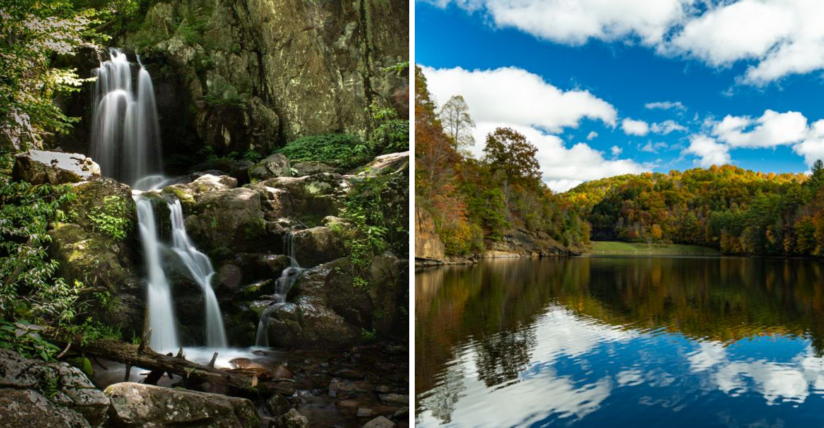
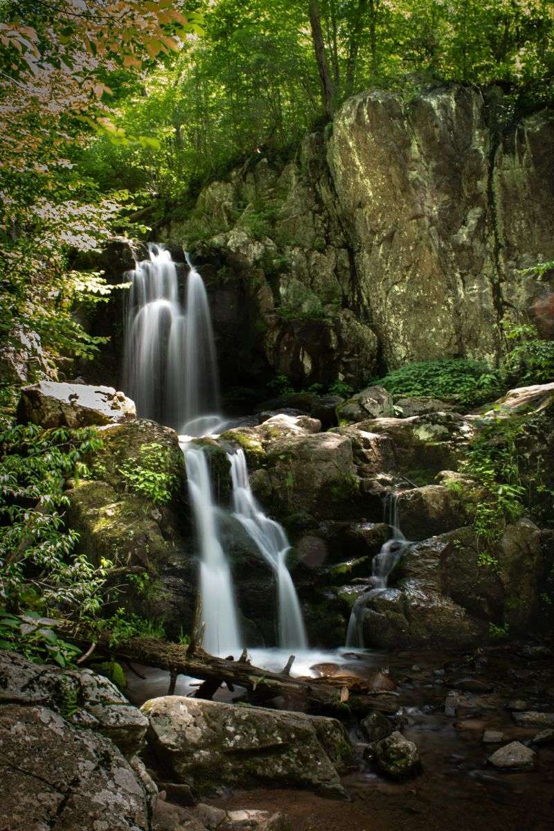
3. Crabtree Falls (George Washington National Forest)
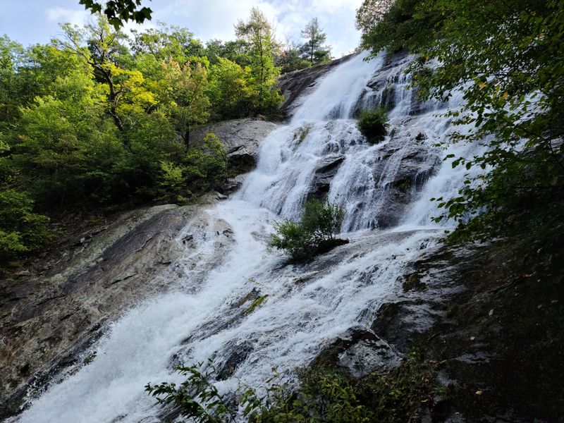
Five major cascades drop a total of 1,200 feet, making this Virginia’s highest vertical-drop waterfall system. Tourists flock here, but that popularity comes with a dark side.
This beautiful spot has claimed more lives than any other waterfall in Virginia, with over 30 deaths recorded since the 1970s.
The three-mile loop trail hugs cliff edges with steep drop-offs just feet from the path. Wet rocks near viewing platforms become skating rinks after rain.
People die here trying to get closer to the falls or attempting to climb on slippery boulders for photos.
Signs warn visitors to stay on marked trails, but the temptation to explore off-path proves fatal. Spring brings the most dramatic water flow and the highest risk.
Swift currents have swept people over falls edges in seconds.
Even the maintained trail presents challenges with steep sections and uneven footing. Hikers suffer heart attacks on the demanding climb back up.
Having a companion means someone can run for help or perform CPR while waiting for rescue teams. Rangers strongly discourage solo trips here for good reason.
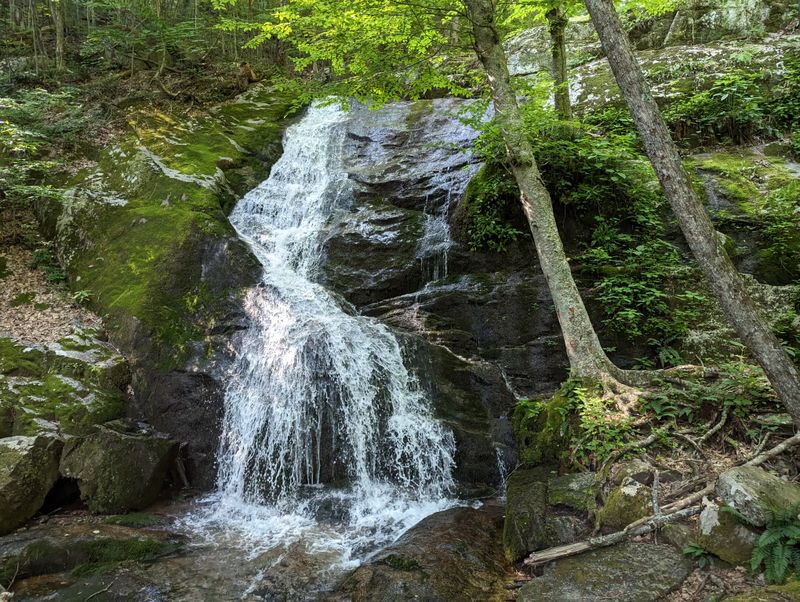
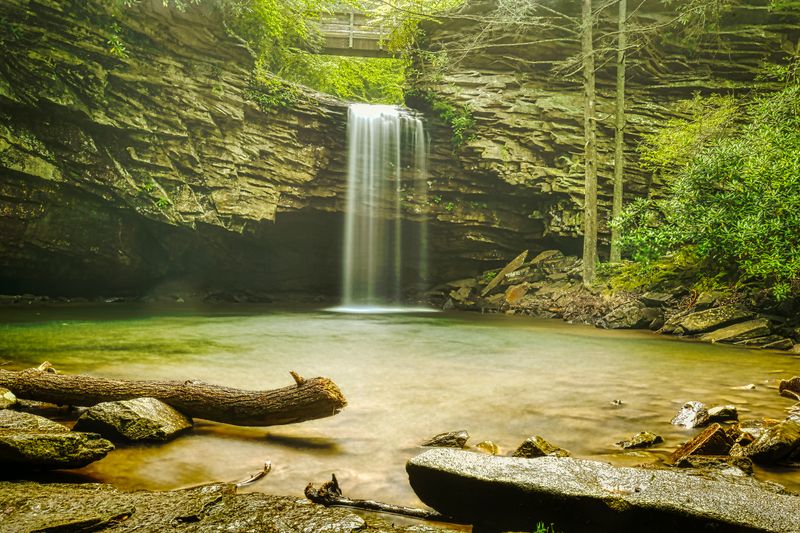
4. Doyles River Falls (Shenandoah National Park)
Two stunning tiers make this waterfall system a photographer’s dream destination. Upper Doyles drops 28 feet while Lower Doyles plunges 63 feet into a rocky pool below.
The catch? You’ll descend 1,100 feet in elevation to see both falls, then climb it all back out.
This strenuous hike pushes your limits on the return journey when legs are already tired. The trail becomes extremely steep in sections with loose rocks that shift underfoot.
Exhaustion leads to mistakes, and mistakes on steep mountain trails lead to injuries.
Fewer hikers venture this far into the backcountry compared to roadside attractions. You might go hours without seeing another soul, especially on weekdays.
That isolation feels magical until someone twists an ankle miles from the trailhead.
The descent tricks people into thinking the hike will be easy. Coming back up in summer heat has caused hikers to collapse from dehydration and exhaustion.
Stream crossings near the falls can be treacherous during high water. Bringing a hiking partner means sharing the weight of extra water and having backup if the climb back becomes too much to handle safely alone.
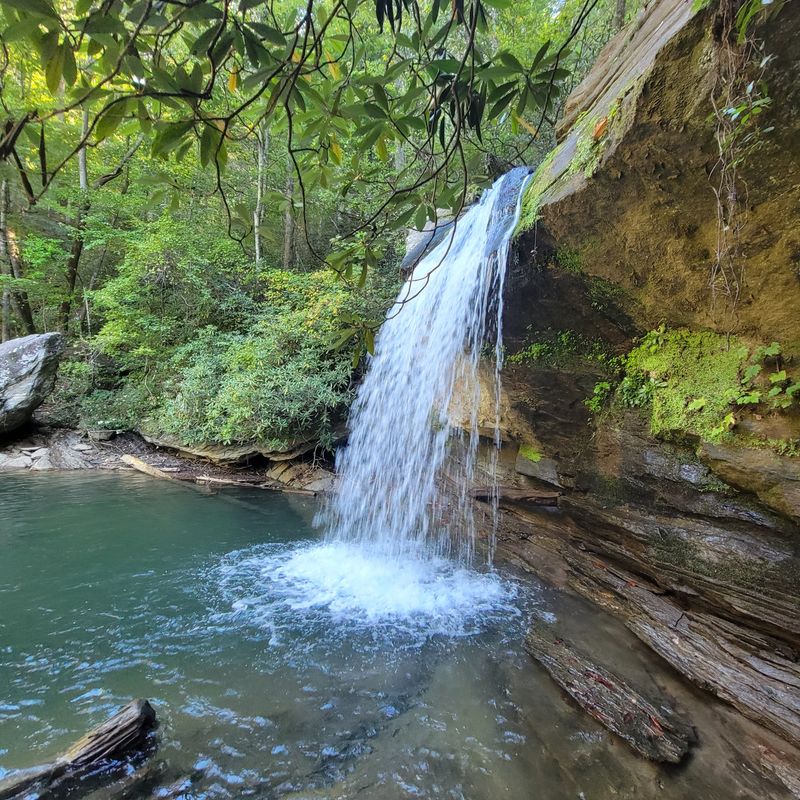
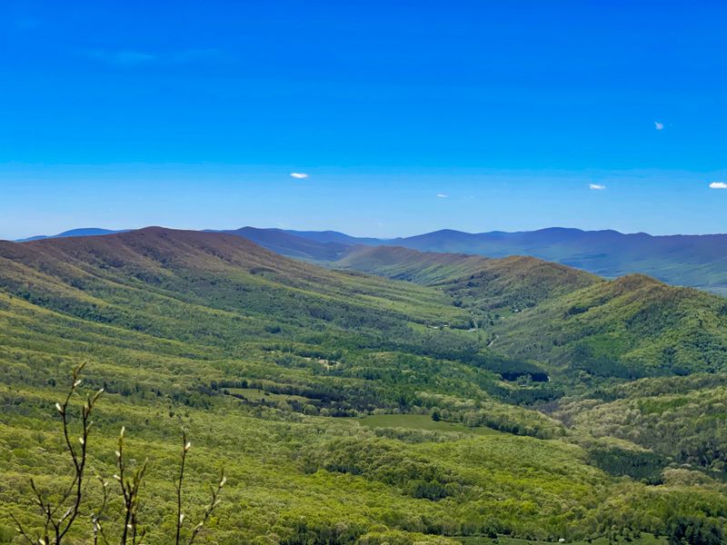
5. Big Cedar Falls (Blue Ridge Mountains)
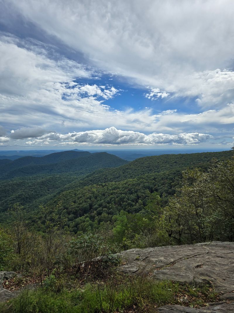
Finding this hidden gem requires local knowledge and serious navigation skills. No official trail leads here, meaning you’ll bushwhack through thick mountain laurel and navigate by topographic features.
The waterfall itself drops into a deep, cold pool perfect for swimming on hot days.
Getting there involves scrambling over logs, crossing unmarked streams, and hoping your GPS coordinates are accurate. The approach terrain changes with seasons as vegetation grows or dies back.
What worked in winter might be impassable by summer.
This spot sits on private land or national forest property depending on which approach route you take. Trespassing concerns add legal risk to physical dangers.
The pool beneath the falls looks inviting but hides submerged rocks and unexpected depth changes.
Cold mountain water can cause shock even in summer, and the remote location means rescue could take hours. People have gotten injured on the slippery rocks surrounding the swimming area.
Without cell service, your hiking buddy becomes your lifeline. Locals who know this spot never go alone because getting hurt here with no way to call for help could turn tragic fast.
6. Dismal Creek Area (George Washington & Jefferson National Forests)
This remote drainage basin earned its gloomy name for good reason. The area stretches across rugged terrain where trails fade in and out of existence.
Creek crossings come frequently, and during spring runoff, they can be waist-deep and dangerous.
The forest here grows thick and dark even on sunny days. Navigation becomes challenging as landmarks blend together in the dense vegetation.
Old logging roads crisscross the area, but many lead nowhere or peter out into impassable thickets.
Black bears thrive in this isolated region, and you’re more likely to encounter them here than in heavily trafficked areas. The remoteness means you’re truly on your own if wildlife encounters go wrong.
Cell coverage is nonexistent for miles in any direction.
Hunters use this area heavily during season, adding another layer of risk. The terrain includes steep ravines where a fall could leave you stranded.
Water sources seem plentiful but require treatment to avoid getting sick miles from help. Experienced backpackers familiar with the region still bring partners because the combination of difficult terrain, wildlife, and isolation makes solo trips foolish.
7. Hoop Hole (Wild Area Near Covington)
Locals guard the exact location of this wild area like a precious secret. The terrain here is unforgiving, with steep gorges and rocky outcrops that require scrambling skills.
No maintained trails exist, so you’re creating your own route through challenging landscape.
The name itself suggests the circular nature of the terrain that can confuse your sense of direction. Trees grow so thick in places that sunlight barely reaches the forest floor.
This darkness makes it easy to lose track of time and distance traveled.
Rattlesnakes sun themselves on rocks during warmer months, and the rough terrain means watching every hand and foot placement. The area floods during heavy rains, turning gentle creeks into raging torrents.
What looks passable in summer can become deadly in spring.
Few people venture here, which preserves its wild character but eliminates any chance of encountering help. The isolation attracts those seeking true wilderness experiences.
However, that same isolation means a broken leg or snake bite becomes a life-threatening emergency. Having a companion to stabilize injuries and hike out for rescue makes the difference between an adventure story and a tragedy.
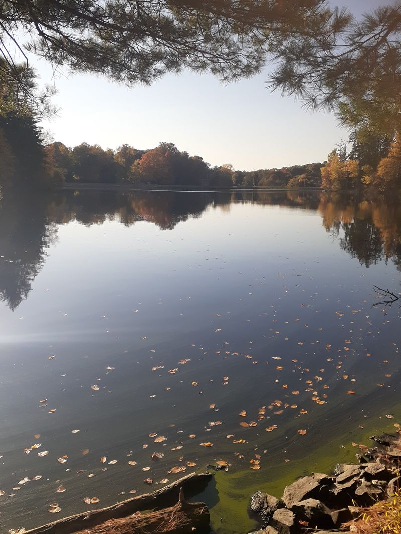
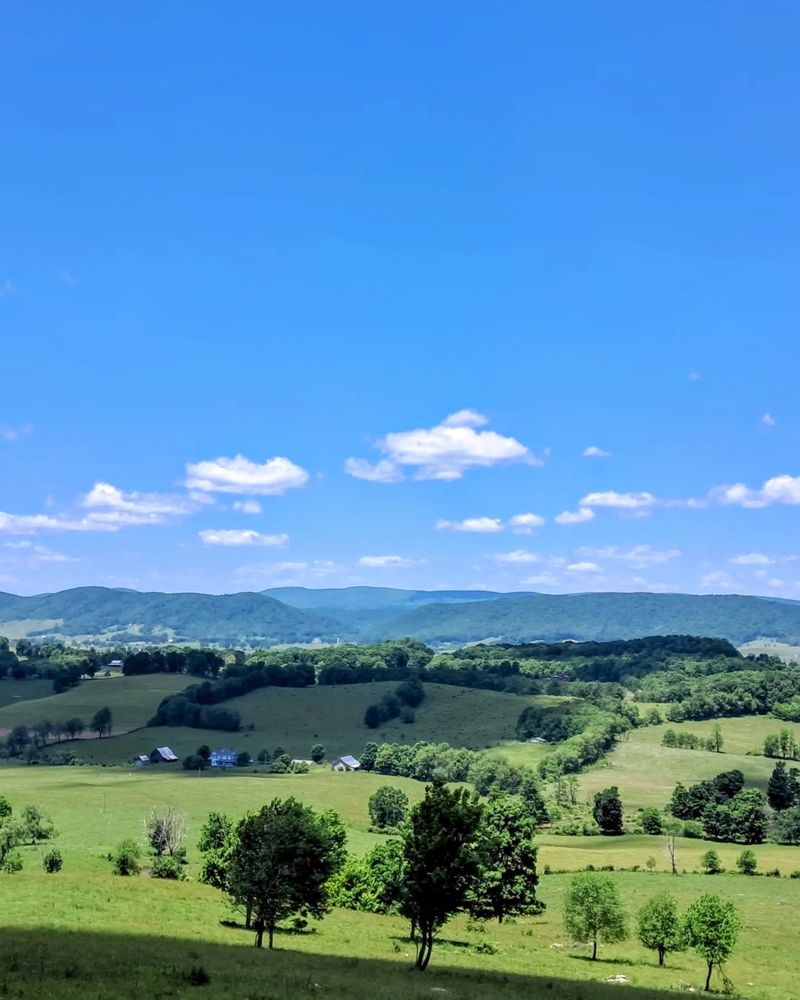
8. Sweet Run State Park (Loudoun County)
Don’t let the pleasant name fool you into thinking this small park is tame. The property sits in a transitional zone where suburban development meets genuine wilderness.
Trails here see less maintenance and fewer visitors than major state parks.
Creek crossings lack bridges, requiring you to hop rocks or wade through water. These crossings become hazardous during high water when rocks disappear beneath swift current.
The park’s compact size means you’re never truly far from civilization, but thick vegetation can make you feel isolated.
Poison ivy grows abundantly here, and ticks are a serious concern during warmer months. The area hosts healthy populations of copperheads that blend perfectly with leaf litter.
Mountain bikes share some trails, creating collision risks on blind corners.
Evening visits put you in prime time for wildlife activity, including coyotes that have adapted to suburban edges. The park closes at dusk, but enforcement is minimal, tempting people to linger.
Getting injured after dark in this park means rescue crews have to search a surprising amount of terrain. The combination of natural hazards and limited ranger presence makes solo visits riskier than you’d expect from a county park.
9. Devil’s Fork (Conservation Area)
The name warns you about what you’re getting into at this conservation area. Multiple creek branches converge here, creating a complex drainage system that confuses navigation.
During dry periods, you can hop between drainages, but spring transforms this into a waterlogged maze.
Conservation areas receive less development and maintenance than state parks. Trails may be marked only with occasional blazes that are easy to miss.
The primitive nature attracts serious outdoors enthusiasts but eliminates the safety nets of more developed areas.
The fork system creates natural barriers that can trap you between rising waters if storms hit. What looks like an easy creek crossing in morning can become impassable by afternoon.
The area’s protected status means limited access points and long distances between you and help.
Beavers actively engineer the landscape here, creating unexpected ponds and changing water flow patterns. Their dams can flood trails overnight, forcing detours through unmarked terrain.
The conservation area’s remoteness means encountering another person is unlikely. Having a companion doubles your problem-solving ability when beaver activity or rising water forces route changes.
Solo visitors risk getting stranded between flooded creek branches with no backup plan.
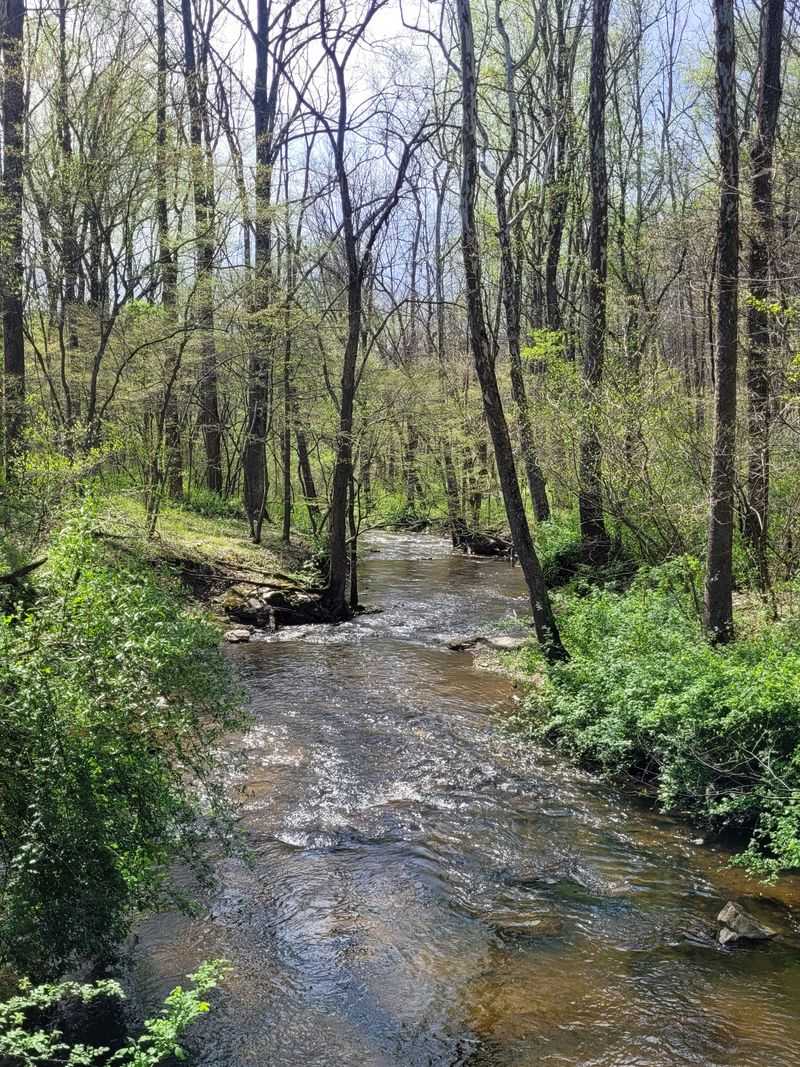
10. Little Stony Creek
This creek system carves through remote mountain terrain creating spectacular cascades and deep pools. The gorge it has cut over millennia features sheer rock walls and technical scrambles.
Following the creek means constantly moving between water and land, never quite sure which offers safer passage.
The streambed becomes the trail in many sections, requiring you to wade through cold mountain water. Depth changes unexpectedly, and algae-covered rocks hide beneath the surface.
One slip could mean a dunking or worse, getting wedged between rocks in moving water.
The gorge walls limit escape routes if flash flooding occurs upstream. Sound of rushing water masks other noises, including warnings that weather is changing.
The creek’s remote location means you’re unlikely to see other people, especially on weekdays.
Water levels fluctuate dramatically based on recent rainfall. What was knee-deep yesterday could be chest-deep today.
The cold water can cause hypothermia even in summer if you’re soaked for hours. Having a partner means someone can help if you lose footing in the current or need assistance climbing out of deep pools.
The combination of water hazards and isolation makes this a terrible solo destination.
11. North Fork Of The Pound
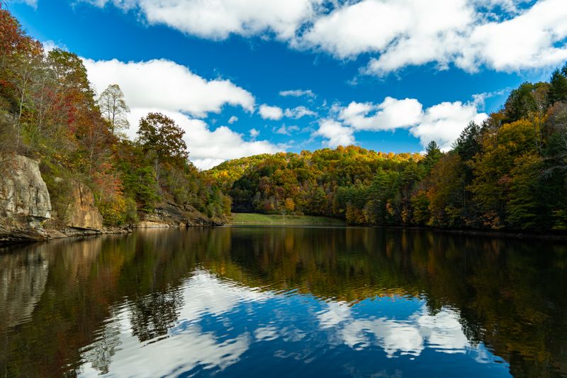
This drainage feeds into the larger Pound River system through some of Virginia’s most isolated mountain country. The north fork cuts through terrain that sees few visitors and even fewer maintained trails.
Old coal mining activity left behind hidden hazards mixed with natural beauty.
The river valley here is narrow and steep-sided, creating a committed route once you start following it. Side ridges offer few practical escape routes if you need to bail out.
The river itself requires multiple crossings, and high water makes these dangerous or impossible.
Abandoned mining infrastructure occasionally appears, including unstable structures and contaminated areas. These industrial relics blend into the landscape after decades of weathering.
The isolation that makes this area special also means help is measured in hours, not minutes.
Wildlife thrives in this remote valley, including black bears that rarely see humans. The terrain makes it easy to surprise animals around blind corners.
Cell service is nonexistent for the entire drainage. Local anglers who fish here for native brook trout always bring buddies because the combination of river crossings, rough terrain, and complete isolation creates too many ways for solo trips to go wrong.
12. Barbours Creek‑Shawvers Run Cluster
Multiple creek drainages converge in this wilderness cluster creating a complex landscape that challenges navigation skills. The area spans thousands of acres with limited trails and fewer landmarks.
Getting turned around happens easily as one creek valley looks remarkably similar to the next.
The cluster designation means this area is managed for primitive recreation with minimal development. You won’t find trail signs, bridges, or maintained camping areas.
This appeals to those seeking authentic wilderness but eliminates safety infrastructure that prevents accidents elsewhere.
Steep ridges separate the various creek systems, requiring significant elevation gain to move between drainages. These climbs exhaust hikers, and fatigue leads to poor decisions.
The dense forest canopy makes it difficult to use sun position for navigation.
Old homestead sites occasionally appear, marked only by rock foundations and invasive plants. These historical features add interest but also indicate how isolated this area was even when people lived here.
The cluster’s size means you could wander for days without hitting a road. Having a partner means two people working to maintain orientation and make navigation decisions.
Solo adventurers in this cluster risk becoming seriously lost with no way to call for help or signal their position.
13. Garden Mountain Cluster
Multiple peaks and ridges form this wilderness cluster in some of Virginia’s most remote backcountry. The area earned protection for its pristine character, which means it lacks the trails and facilities found in more developed areas.
Navigation requires strong map and compass skills combined with experience reading terrain.
The cluster’s complex topography creates microclimates where weather can vary dramatically over short distances. Ridgetops might be clear while valleys fill with fog.
These conditions make it easy to lose track of your location and planned route.
Old logging roads crisscross some sections but often lead to dead ends or have been reclaimed by forest. Following these can actually get you more lost than bushwhacking.
The area’s protected status means limited access points, so getting in and out requires commitment.
Wildlife populations thrive here due to minimal human pressure. Bear encounters are more likely than in heavily visited areas.
The remoteness that makes this cluster special also means you’re truly on your own if things go wrong. Having a companion means sharing the mental load of navigation and decision-making.
Two people can better assess whether conditions are deteriorating and when to turn back.