
10 New York Walks Under 2 Miles For People Who Want The Views Without The Tough Hike
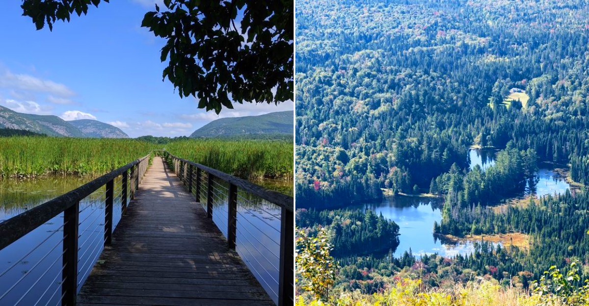
Two miles can be plenty when the payoff shows up early. A short path may lead to a broad river view or a waterfall before your legs have time to complain. New York makes that trade surprisingly easy.
Several walks keep the distance low without making the scenery feel like the backup prize.
Shorter routes also leave room for the rest of the day, which is a win nobody talks about enough. You can take your time, stop often, and still finish before lunch starts sounding urgent. Steep climbs are not required for every memorable view.
Sometimes the smarter outing is the one that gives you the scenery and lets you keep enough energy to enjoy whatever comes next.
1. Anthony’s Nose – Hudson Highlands State Park, Near Peekskill
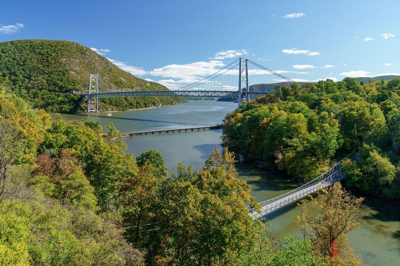
Funny name, serious payoff. Anthony’s Nose sits high above the Hudson River and stares straight down at the Bear Mountain Bridge like it owns the place.
The round trip runs roughly two miles, and the money shot arrives about a mile in. Climbing happens early on the old woods road, then the grade mellows out and your lungs get a break.
Once you reach the rocky lookout, the lower Catskills stretch out across the water. Cars on the bridge look like toys, and the river bends south toward the city.
Parking is shared with other trails in the area, across from the visitor center at 3011 NY-9D, Cold Spring, NY 10516. Arrive before 9 a.m. on weekends unless you enjoy circling for a spot.
The lot sits along a busy road, so crossing carefully matters more than most trailheads.
Footwear matters here. The path has loose rock and a few uneven steps, so sneakers with grip beat flat-soled shoes every time.
Bring water and a sandwich, because the ledge practically begs for a picnic. Autumn turns the whole valley into a quilt of orange and gold, though a crisp winter morning delivers the sharpest views of the year.
2. Little Stony Point – Cold Spring
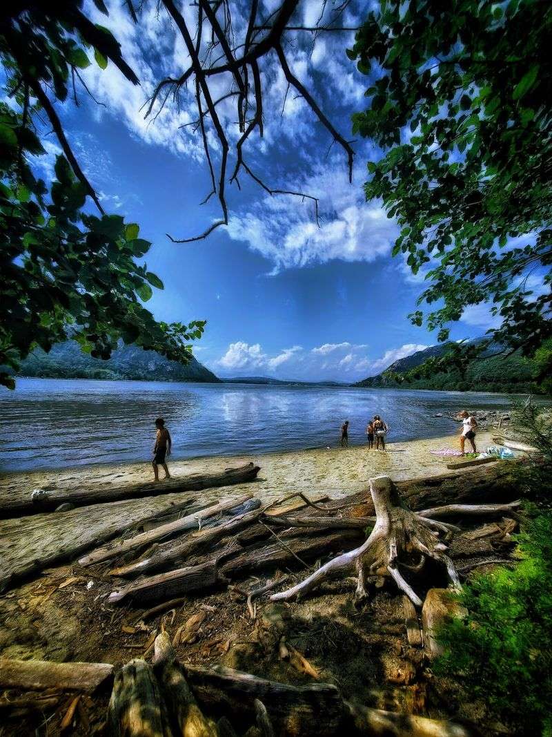
Sandy beach on a river, cliffs above it, and a loop you can finish before your coffee cools. Little Stony Point punches way above its weight.
The loop measures about one mile and hugs the Hudson River shoreline the whole way. A short spur climbs to a clifftop perch where the Hudson Highlands rise on both sides of the water.
Kids love the small beach, and the rock scramble near the top feels adventurous without any real risk. Storm King and Breakneck Ridge dominate the skyline north of you.
Navigate to the shared lot at 3011 NY-9D, Cold Spring, NY 10516, then follow the marked path toward the river. The village of Cold Spring sits minutes away, so lunch afterward is nearly mandatory.
Trains rumble along the tracks nearby, which sounds odd but adds a strange charm to the walk. Photographers show up at sunset for good reason.
Flat shoes work fine on the loop itself. Save the grippy soles for the short clifftop detour, where the footing gets rocky and the reward gets loud.
3. Drayton Grant Park At Burger Hill – Rhinebeck
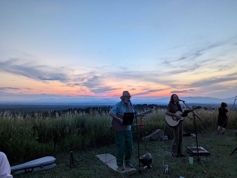
Grass, sky, and a hill that does all the work for you. Burger Hill has no forest to block the view, which is exactly the point.
The stroll to the top covers about a half mile, making the whole outing roughly a mile. Mowed paths cut through open meadow, so strollers and tired knees both manage fine.
Up top, the Hudson Valley unrolls in every direction. The Catskills sit to the west, the Taconics to the east, and farm fields fill everything in between.
You will find the entrance at 3158 New York 9G, Rhinebeck, NY 12572, with a small parking area right off the road. Sunset here is the local favorite, and the hilltop rarely feels crowded. Leashed dogs are welcome, which makes this an easy outing with the whole household.
Wind whips across the summit even on mild days, so a light jacket earns its keep. Wildflowers take over in summer and hawks ride the thermals overhead.
No shade exists on the hill, which makes a hat smart in July. Rhinebeck village sits a few minutes away with bakeries and bookshops for the encore.
4. Cold Spring Harbor State Park – Cold Spring Harbor
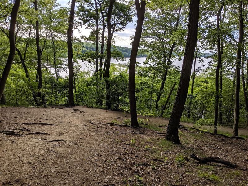
Long Island gets a bad rap for flat terrain, and this park quietly proves otherwise. Rolling hills and thick woods hide a genuine harbor overlook.
The main trail runs about 1.8 miles out and back, with a handful of short climbs that raise your heart rate politely. Oak and beech shade most of the route, which helps on humid August afternoons.
Openings in the canopy frame views of Cold Spring Harbor and the boats bobbing below. On the North Shore, that kind of quiet feels like a small miracle.
Head to the park entrance at 95 Harbor Road, also known as Route 25A, in Cold Spring Harbor. Parking is limited, so a weekday visit beats fighting for space.
Roots and rocks appear along the way, meaning sneakers with tread serve you better than flip-flops. Trail markers can be faint, so a quick photo of the map board helps.
Spring brings songbirds and a green tunnel effect overhead. Come November, the bare branches open up more water views than you expect.
5. Constitution Marsh Audubon Center – Garrison
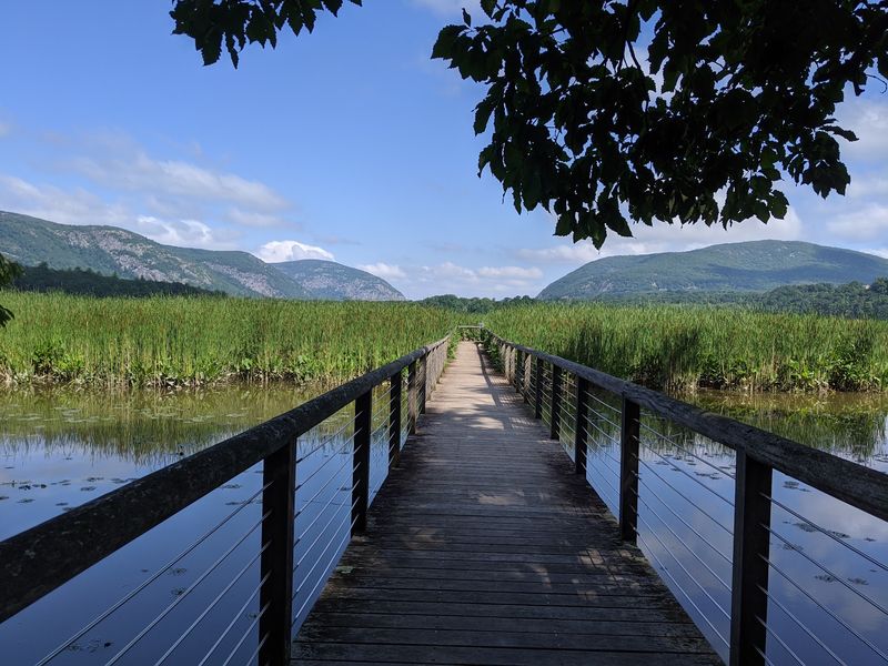
Over 200 bird species call this marsh home, and a 700-foot boardwalk puts you right in the middle of the action. Binoculars are strongly encouraged.
The trail measures roughly a mile total and drops through woods before reaching the wetland. Once you hit the boardwalk, cattails rise on both sides and the Hudson River Highlands loom ahead.
West Point sits across the water, gray and stately, which makes for an unusual backdrop while you count herons. Osprey and egrets show up regularly during warmer months. Guided programs run seasonally and fill quickly, so booking ahead makes sense.
Find the sanctuary at 127 Warren Landing Rd., Garrison, NY 10524, and check hours before driving out since the center keeps a limited schedule. Parking is small and the access road is narrow.
The wooded portion has a short descent with steps, so take it slow on wet days. Bug spray belongs in your pocket from June through August, no debate.
Tides change the whole personality of the marsh. High water turns it into a mirror, while low tide reveals mudflats packed with feeding birds.
6. Azure Mountain – Waverly, Franklin County
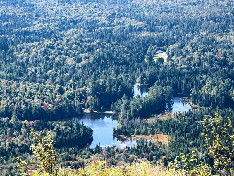
Adirondack summits usually demand a full day and a bag of snacks. Azure Mountain hands over a 360 degree view for less than a mile of climbing.
The trail runs 0.9 miles to the top, so 1.8 miles gets you up and back. It climbs steadily and gets rocky near the end, but the distance keeps things manageable.
Open bedrock at the summit reveals a sea of forest with almost no buildings in sight. A restored fire tower stands there too, and the steps add another layer of view for anyone comfortable with heights.
Trailhead parking sits off Blue Mountain Road, about seven miles from the turn off NY 458 near Saint Regis Falls. Plug in the coordinates 44.537787, -74.485284 because cell service vanishes out there.
The access road is dirt and can get rough after heavy rain. Go early and you may have the whole peak to yourself.
Northern New York weather shifts fast, so pack a layer even in July. Blueberries grow near the summit in late summer, a small bonus for patient pickers.
7. Bald Mountain Rondaxe Fire Tower – Old Forge
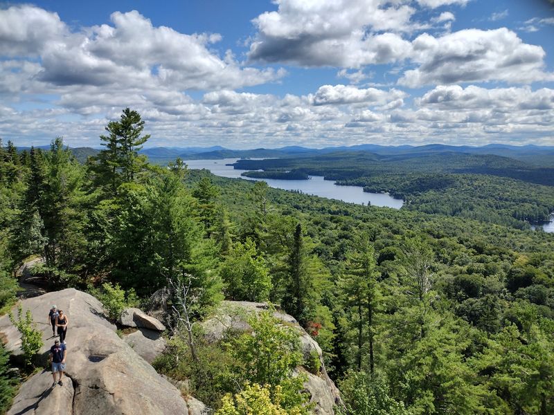
Few Adirondack hikes deliver this much lake for this little sweat. Bald Mountain runs 1.9 miles round trip and ends with the Fulton Chain of Lakes spread out below.
The path climbs gradually across open rock ledges, which means views start before the summit does. Kids handle it well, and the ridge feels dramatic without any scary drop-offs.
At the top, the renovated Rondaxe fire tower lets you climb a few flights for an even wider look. Lakes stack up one after another like stepping stones through the forest.
Parking sits on Rondaxe Road in Old Forge. Drive north on Route 28 for 4.5 miles from town, turn left onto Rondaxe Road, and the lot appears 0.2 miles ahead on the left.
Exposed rock gets slick when wet, so grippy shoes make a real difference. Weekend crowds are common in July and August, and an early start solves that.
Fall color here is legendary across upstate New York. Bring a camera with room on the memory card, because one photo never suffices.
8. Kaaterskill Falls Observation Platform – Haines Falls
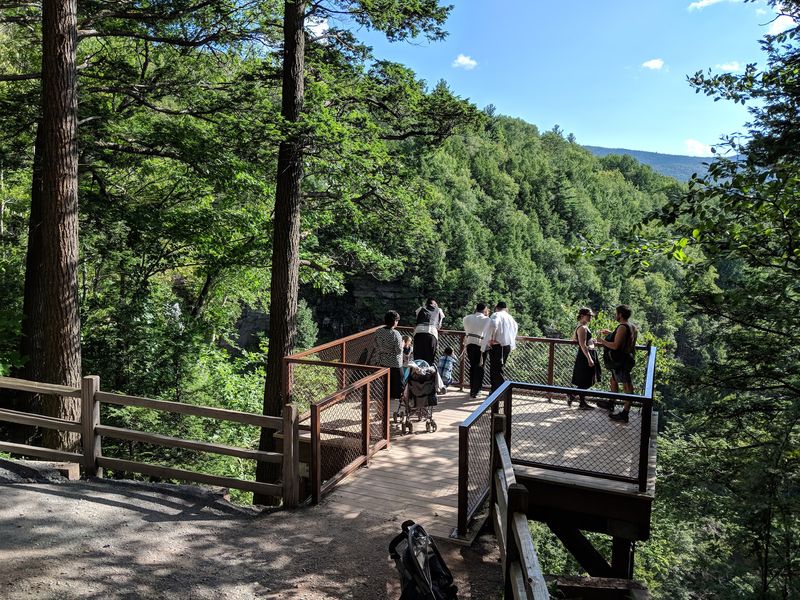
New York’s highest waterfall sits at the end of a walk shorter than a lap around the grocery store. Kaaterskill Falls drops in two tiers through a green Catskill gorge.
From the Laurel House Road parking area, the stroll to the observation platform covers just 0.3 miles. The surface is smooth and mostly level, which makes it friendly for almost everyone.
The platform hangs near the top of the falls and frames both tiers at once. Mist rises off the rocks in spring when snowmelt sends the water roaring.
Set your GPS for 103 Laurel House Road, Haines Falls, NY 12436. The lot fills quickly on summer weekends, so mornings are your friend.
Stay behind the railings and skip the temptation to wander off trail near the edge. The rock is slippery and the drop is serious.
Artists of the Hudson River School painted these falls back in the 1800s, which explains why the scene looks familiar. Visit after a rainy stretch and the volume of water will genuinely startle you. Winter transforms the falls into columns of ice, though the road access gets trickier.
9. Catskill Mountain House Site And Artists Rock – North-South Lake State Campground
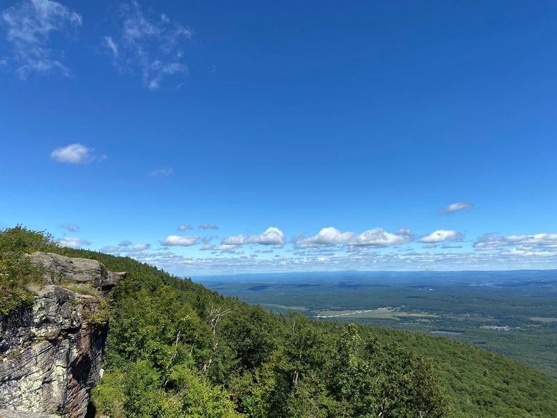
A grand hotel once stood on this ledge, hosting presidents who came for the view. The building is long gone, and the panorama remains free of charge.
A short stroll from the campground road brings you to the Catskill Mountain House site, where the Hudson Valley falls away beneath your feet. On clear days, five states come into view from that grassy platform.
Artists Rock waits about a half mile away along the escarpment trail. The name comes from the painters who once hauled easels up here for inspiration.
Everything starts at North-South Lake State Campground on County Route 18, Haines Falls, NY 12436. A day use fee applies during the season, and the lakes make a fine cooldown spot afterward.
The walk to the hotel site is nearly flat, so it suits almost any pace. The stretch toward Artists Rock has rocky sections that ask for sturdier shoes.
Sunrise from the ledge is the stuff of local legend. Pack a thermos and claim your seat early.
10. Joppenbergh Mountain Loop – Rosendale
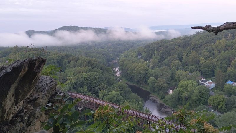
Cement mining hollowed out this mountain more than a century ago, and now it belongs to hikers. Joppenbergh delivers a trestle view that stops people mid-sentence.
The loop ranges from 1.5 to 2.2 miles depending on which spurs you take. Hardwood forest covers most of the route, then exposed bedrock ridges open up for the payoff.
The Rosendale Trestle stretches across the valley below, a former railroad bridge now part of the Wallkill Valley Rail Trail. Shawangunk ridgelines fill the horizon behind it.
Park at Willow Kiln Park, 5 Hardenburgh Lane, Rosendale, NY 12472, and pick up the trail from there. The lot is modest but usually workable outside of festival weekends.
A few sections tilt upward enough to warrant a breather, though nothing here qualifies as brutal. Fallen leaves hide loose rock in October, so watch your footing.
Rosendale’s main street sits a two minute walk away with cafes and a historic theater. Few walks in New York offer this much scenery with a downtown attached. Trail junctions come unmarked in spots, so a downloaded map saves some guesswork.