
One Arkansas Spring Flows Into A Lagoon So Blue It Looks Unreal
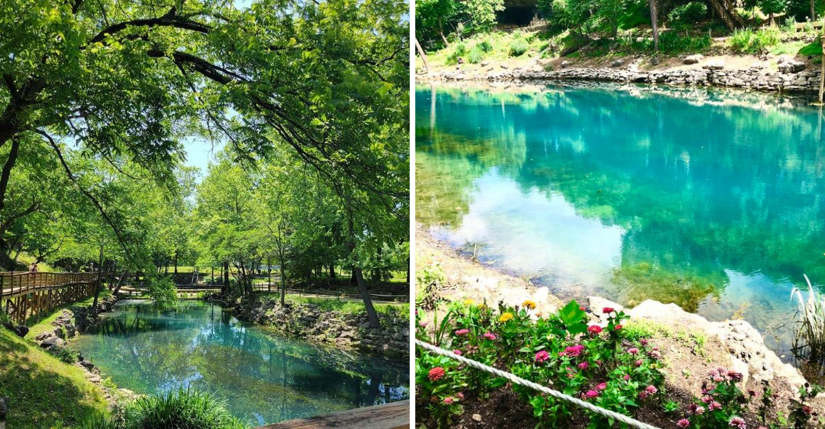
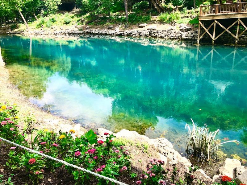
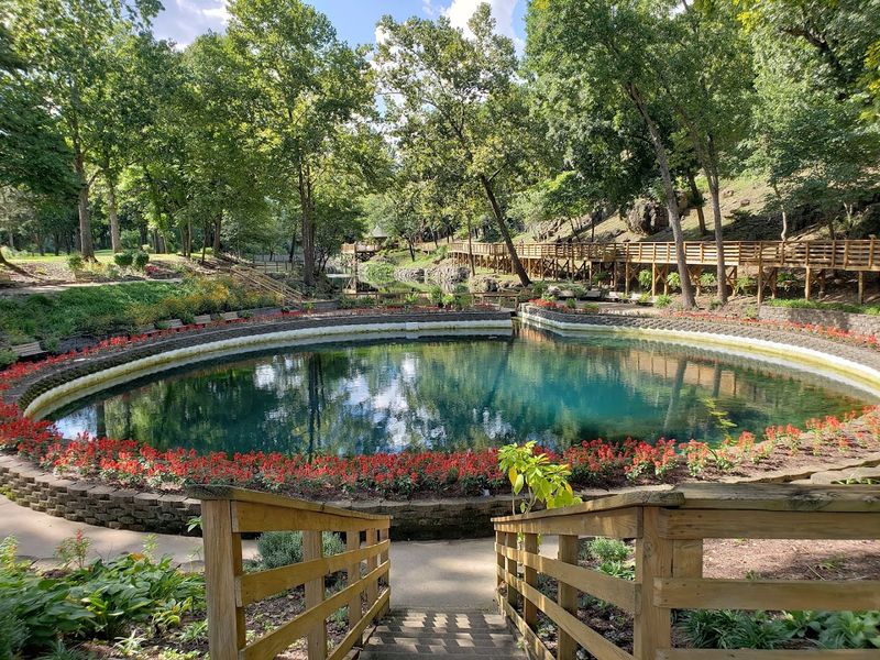
Turquoise water steals the attention before anything else has a chance. Millions of gallons surge daily into a lagoon so vivid that photographs barely capture it.
Arkansas visitors follow garden paths, cross shaded trails, and pause along the banks while the spring keeps pouring without a break. The scenery is striking, but the history adds another layer.
Evidence shows people gathered here thousands of years ago, leaving traces of trade, travel, and survival around the bluff shelter. Native plants now fill the surrounding grounds, connecting the landscape to the cultures that relied on it.
Spread over thirty three acres, this remarkable place blends powerful geology, deep human history, and water that seems almost electrically blue under the changing Ozark light.
Blue Spring Releases 38 Million Gallons Every Day
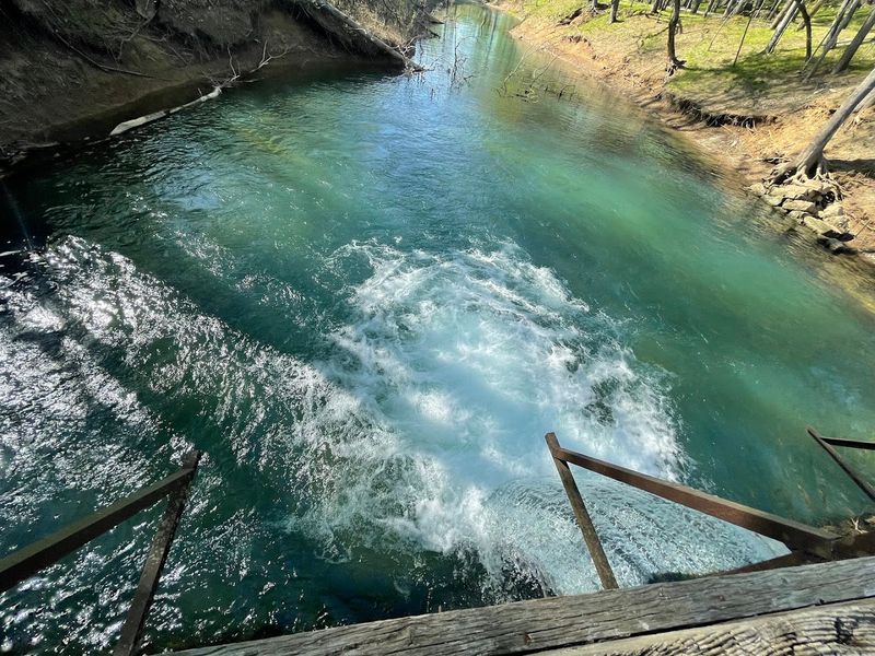
The volume of water emerging from this spring defies easy comprehension. Each day, 38 million gallons push up through limestone formations, maintaining a constant temperature of 54 degrees regardless of season.
This flow rate places Blue Spring among the most productive water sources in the Ozarks. The sheer consistency of output has shaped the landscape for millennia, carving channels and sustaining ecosystems that depend on reliable hydration.
Geologists attribute this abundance to underground aquifers fed by rainfall across a wide recharge zone. The water you see surfacing today fell as rain years ago, filtered slowly through layers of rock that stripped impurities and added the minerals responsible for that startling color.
Standing near the source, you can hear the constant rush and feel a coolness in the air that persists even during August heat.
The Water Collects In A Trout-Filled Lagoon
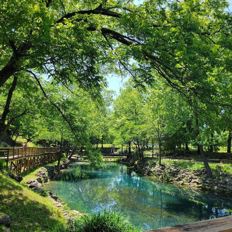
After surging from the earth, the spring water spreads into a lagoon that serves as both spectacle and habitat. Rainbow trout cruise through the shallows, visible from the boardwalk that curves along the water’s edge.
The lagoon functions as a natural holding pond, allowing sediment to settle and giving visitors a chance to observe aquatic life up close. Machines dispense fish food for a quarter, and the resulting feeding frenzy delights children and adults alike.
Because the water stays cold year-round, trout thrive here in conditions that mirror their preferred mountain streams. The clarity lets you track individual fish as they dart between submerged rocks and fallen branches.
Benches positioned along the perimeter invite quiet observation, and the play of light on water creates patterns that shift with every passing cloud.
The Lagoon Eventually Reaches The White River
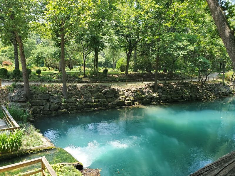
The journey of spring water does not end at the lagoon. Overflow spills into a creek that winds through the property before joining the White River, a major tributary in the Arkansas watershed.
This connection links Blue Spring to a much larger hydrological system stretching across the state. The cold, mineral-rich water contributes to the ecological health of the river, providing temperature refuges for fish during summer months.
You can follow the creek along a section of trail that traces its path downhill. The transition from still lagoon to moving stream happens gradually, with riffles forming over gravel bars and the sound of flowing water growing louder.
Ecologists value these spring-fed tributaries for their role in maintaining biodiversity. The consistent flow and stable temperature create microhabitats that support species unable to survive in the main river alone.
It Is Northwest Arkansas’ Largest Spring
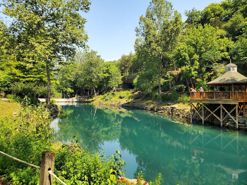
Among the many springs scattered across the Ozark plateau, Blue Spring claims the title of largest in the northwest region. Its output dwarfs neighboring seeps and smaller springs that dot the hillsides around Eureka Springs.
This distinction matters beyond mere bragging rights. Large springs like this one serve as bellwethers for aquifer health, their flow rates reflecting rainfall patterns and groundwater conditions across a wide area.
The spring’s size also influenced human settlement patterns. Indigenous peoples camped here for thousands of years, drawn by reliable water and the game animals that congregated nearby.
Later settlers recognized the same advantages, and the spring powered mills that processed grain and lumber. The scale of the resource made it valuable in ways that transcended simple drinking water, shaping the economic and social development of the surrounding region for generations.
More Than A Mile Of Garden Trails Surrounds The Water
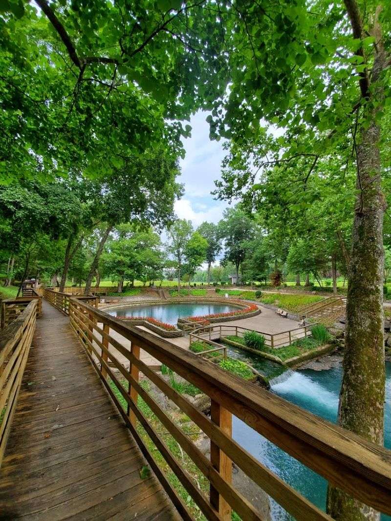
The property at 1537 County Road 210 encompasses more than just the spring itself. Visitors can explore over a mile of interconnected trails that loop through gardens, along ridgelines, and down into the spring valley.
These paths vary in difficulty, with some sections featuring stairs that descend more than 150 steps to reach water level. Other routes follow gentler grades, though all involve some elevation change given the terrain.
Signage marks points of interest and provides historical context at key locations. The trail system was designed to offer multiple perspectives on the spring, from overlooks high above to boardwalks that bring you within arm’s reach of the water.
Walking the full circuit takes most visitors between one and two hours, depending on pace and how often you stop to read interpretive signs or simply absorb the surroundings. The trails remain open daily from 9 AM to 6 PM throughout the week.
Native Plants Fill The 33-Acre Property
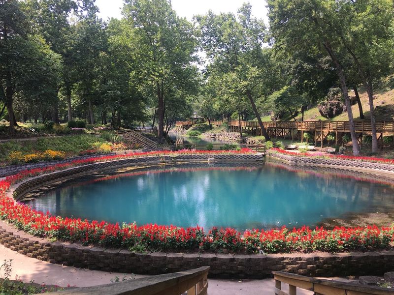
The landscaping here prioritizes species that evolved in the Ozarks, creating gardens that reflect the region’s natural plant communities. You will find beds of coneflower, black-eyed Susan, and wild bergamot during growing season.
This approach serves multiple purposes beyond aesthetics. Native plants require less maintenance than exotic ornamentals, support local pollinator populations, and demonstrate ecological principles to visitors interested in conservation.
Butterflies patrol the flower beds in impressive numbers during warmer months, drawn by nectar sources they recognize instinctively. The property functions as a living laboratory where visitors can observe plant-insect relationships that have developed over thousands of years.
Interpretive signs identify species and explain their traditional uses by Indigenous peoples. The gardens thus become teaching tools, connecting botany to cultural history in ways that enrich understanding of both disciplines and the landscape itself.
A Medicine Wheel Garden Honors Indigenous Traditions
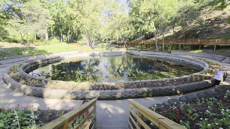
One garden section takes the form of a medicine wheel, a circular arrangement significant in many Indigenous spiritual practices. The design uses stone and plantings to create quadrants representing different directions and their associated meanings.
This installation acknowledges the deep connection between Native peoples and this landscape. The spring provided not just water but a gathering place where different groups came to trade, hold ceremonies, and access resources.
The wheel serves as a memorial and educational feature, prompting visitors to consider perspectives beyond European-American settlement narratives. It recognizes that this land held meaning and value long before it became a tourist attraction.
Approaching the medicine wheel garden, you notice how its circular form contrasts with the linear paths elsewhere on the property. The design invites contemplation rather than hurried passage, creating a space where the pace naturally slows and attention turns inward.
The Three Sisters Garden Shows How Crops Work Together
Agricultural demonstration plots illustrate the Three Sisters method, an intercropping technique practiced by Indigenous peoples across North America. Corn, beans, and squash grow together in a mutually beneficial arrangement that maximizes yield and soil health.
The corn provides vertical structure for beans to climb. Bean roots fix nitrogen in the soil, enriching it for all three crops.
Squash leaves shade the ground, retaining moisture and suppressing weeds.
This elegant system produces more food per acre than monoculture planting and requires no synthetic fertilizers. The Three Sisters garden demonstrates ecological knowledge refined over centuries of careful observation and experimentation.
Visiting during summer, you can see the system in action, with bean vines spiraling up cornstalks and squash sprawling across the intervening spaces. The garden offers a practical lesson in sustainable agriculture and Indigenous innovation that remains relevant today.
Woodland Walkways Pass Native Ozark Plant Life
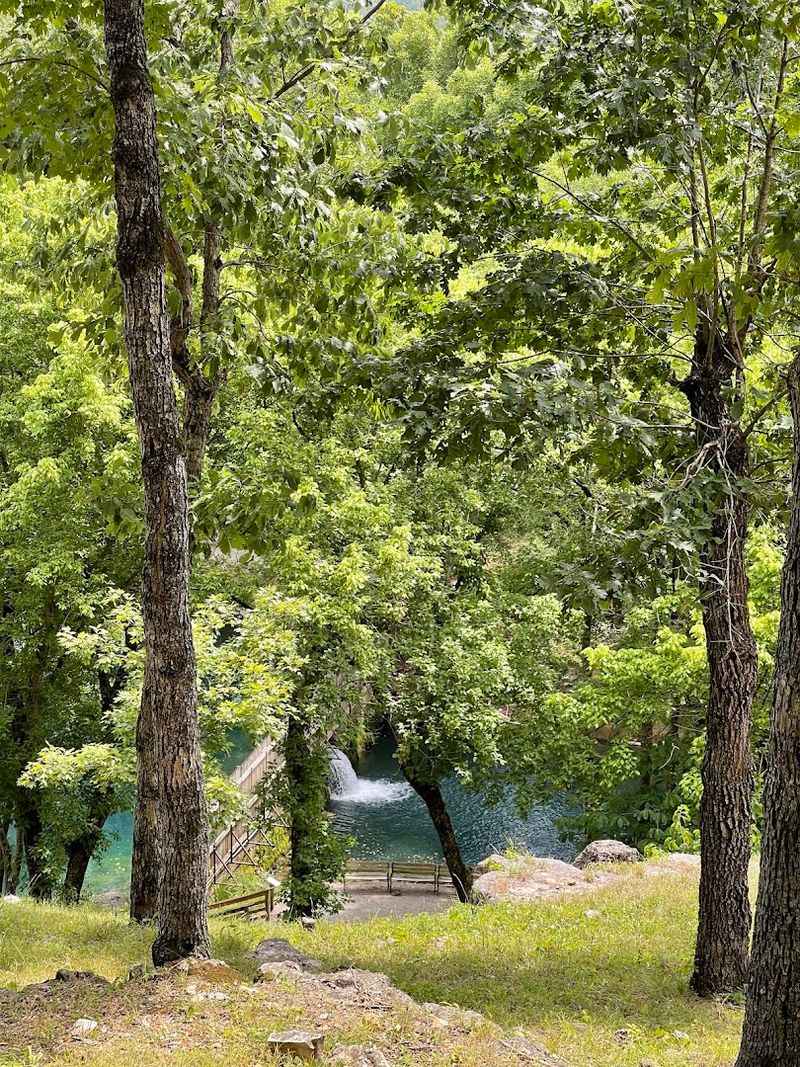
Portions of the trail system wind through wooded sections where the canopy closes overhead and the temperature drops noticeably. These stretches showcase the forest communities typical of the Ozark highlands.
Oak and hickory dominate the overstory, while understory species include redbud, dogwood, and pawpaw. Ferns carpet areas where moisture collects, and mosses soften the edges of limestone outcrops.
The woodland paths offer respite from sun exposure and a different sensory experience than the open garden areas. Bird calls echo through the trees, and the sound of the spring becomes muted and distant.
These sections also reveal the topography that makes springs possible. You walk across ridges formed by erosion-resistant rock layers, then descend into valleys where water has carved its way through softer stone over geologic time, creating the conditions for springs to emerge at the contact between formations.
The Bluff Shelter Holds Thousands Of Years Of History
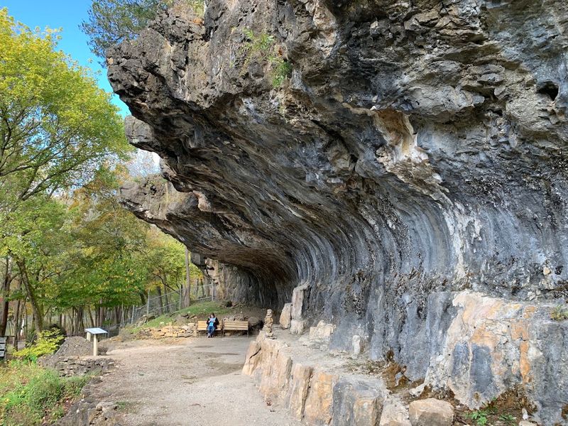
A limestone overhang near the spring served as shelter for humans across millennia. The bluff’s deep recess protected occupants from weather while providing a vantage point overlooking the water and the valley below.
Archaeological investigations documented the layers of occupation here, with evidence of fires, tool manufacturing, and food preparation accumulating over thousands of years. The shelter represents one of countless such sites across the Ozarks where geography and resources aligned to support human presence.
Standing beneath the overhang, you can immediately understand its appeal. The rock face blocks wind and rain, while the open front admits light and allows smoke to escape.
The bluff shelter reminds visitors that this landscape has always drawn people. The spring’s reliability made it a logical stopping point for travelers and a sustainable location for extended camps, creating a continuity of human use that stretches from the Paleoindian period to the present day.
Artifacts Found Here Date Back To 8000 BC
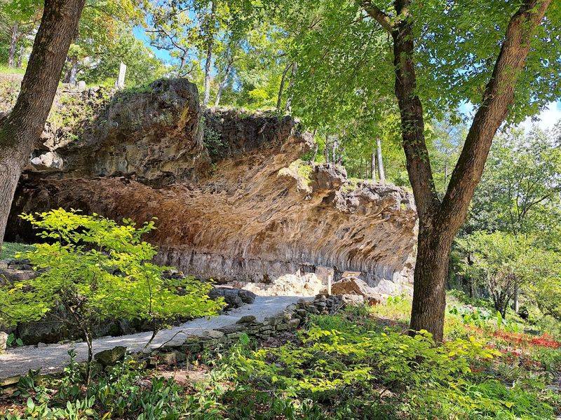
Material evidence recovered from the site includes projectile points, scrapers, and other stone tools dating to the early Archaic period. These artifacts place human activity here at roughly ten thousand years ago, shortly after the last ice age ended.
The visitor center displays some of these finds, allowing you to examine the craftsmanship of people who lived before agriculture, before pottery, before metal working. The stone tools represent sophisticated technology perfectly adapted to the resources and challenges of their time.
Finding artifacts of this age requires careful excavation and analysis. Archaeologists must distinguish between layers deposited centuries apart, documenting the changing tool styles and subsistence strategies that mark different cultural periods.
The artifacts connect contemporary visitors to ancestors whose names are lost but whose presence is undeniable. They made choices about where to camp, what stone to select for tools, and how to exploit the resources around them, leaving traces that endure long after their fires went cold.
The Spring Offered Respite During The Trail Of Tears
During the forced removal of Cherokee people from their homelands in the 1830s, groups traveling the northern route passed through this area. The spring provided desperately needed water and a place to rest during a journey marked by suffering and death.
Interpretive materials at the site acknowledge this dark chapter in American history. The spring that seems so peaceful today witnessed profound trauma as families were marched westward under military guard, far from the mountains they called home.
Recognizing this history adds weight to the experience of visiting. The same cold, clear water that delights modern tourists sustained people enduring one of the great injustices in the nation’s past.
The spring’s role during the Trail of Tears illustrates how natural resources become entangled with human events. Water holds no political allegiance, yet its presence or absence shapes the course of history, offering mercy in moments of crisis regardless of the circumstances that brought people to its edge.