Oregon’s Only Saltwater Lake Is Disappearing And The Window To See It May Already Be Closing
Out in the high desert, Oregon holds one of its most surprising secrets. Right now, that secret is slowly vanishing.
There is a lake out here unlike anything else in the state, a hypersaline body of water that has fueled massive migratory bird gatherings for thousands of years. The window to witness it is not guaranteed.
Water levels have crashed, turning a vibrant, living ecosystem into cracked salt and exposed lakebed. People make the long drive to this corner of Oregon just to stand at the edge.
A towering fault scarp rises dramatically above the shoreline, wild and ancient. No admission fee, no visitor center, no marked trails.
Just the lake, the cliffs, and a landscape quietly running out of time.
What Makes Lake Abert Unlike Any Other Lake In Oregon
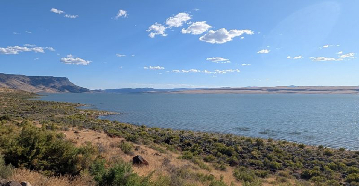
Oregon has mountains, rivers, forests, and volcanic craters, but it has only one saltwater lake. Lake Abert, located in Lake County in southern Oregon, is classified as a hypersaline terminal lake.
That means it has no outlet. Water flows in from the Chewaucan River, but it never flows out.
The only way water leaves is through evaporation.
That process concentrates salt over time, making the water far saltier than the ocean. At its healthiest, the lake supported thriving populations of brine shrimp and alkali flies, tiny organisms that formed the base of a massive food web for migratory birds.
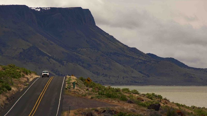
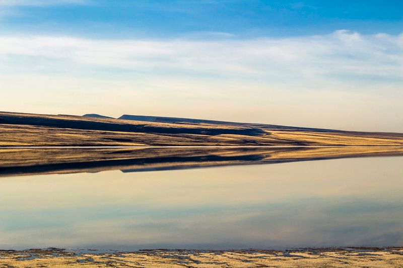
The lake sits at roughly 4,260 feet above sea level in the Oregon high desert. Highway 395 runs along the eastern shore, offering an unobstructed view of the lake to the west, while Abert Rim rises dramatically to the east directly above the roadway.
The Towering Abert Rim And The Geology Behind The Lake
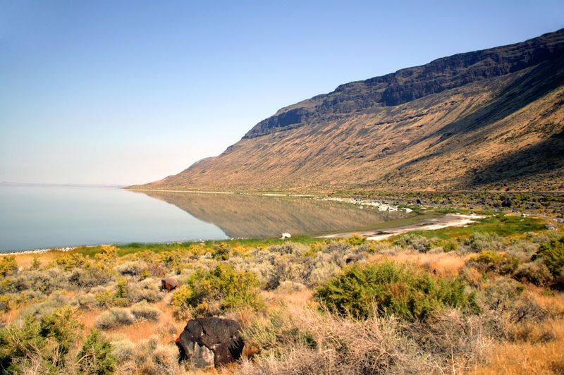
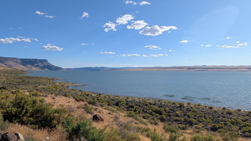
The cliffs behind the lake are not just a backdrop. Abert Rim is the longest exposed fault scarp in North America, stretching more than 30 miles and rising dramatically above the lake floor.
It was formed during the Miocene epoch, when basaltic flood lavas blanketed much of eastern Oregon and subsequent Basin and Range faulting tilted massive crustal blocks into the cliff face visible today.
The rim towers high enough that it creates its own weather patterns and casts long shadows across the lake in the late afternoon. Bighorn sheep and mule deer have been spotted navigating the rocky terrain along its base and slopes.
From the highway below, the scale of the cliff face is almost hard to process. It rises so steeply and so uniformly that it looks almost constructed.
The volcanic rock layers visible in the cliff face tell a long geological story, one that stretches back far beyond human memory. Photographers consistently rank the rim among the most striking natural formations in southern Oregon.
A Lake That Dries Up More Often Than It Should
Historically, Lake Abert dried up only about once every 20 years. Before 2014, the last time it came close to completely drying out was during the Dust Bowl era of the 1930s.
That fact alone shows how unusual the recent pattern has become.
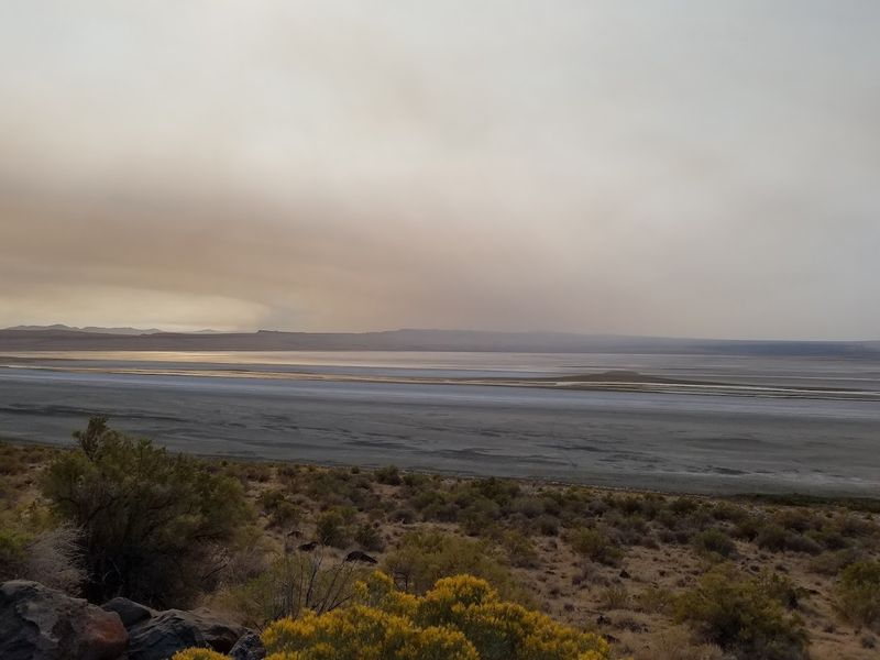
The lake has gone nearly or completely dry in 2014, 2015, 2021, and 2022. Water levels dropped below the lowest recorded gauge measurement in 2019 and have not meaningfully recovered since.
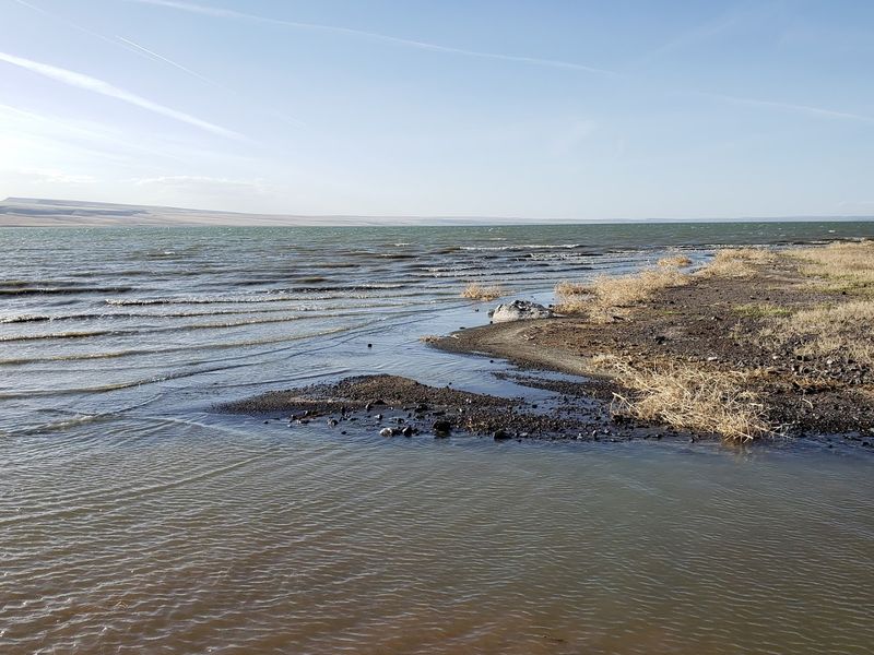
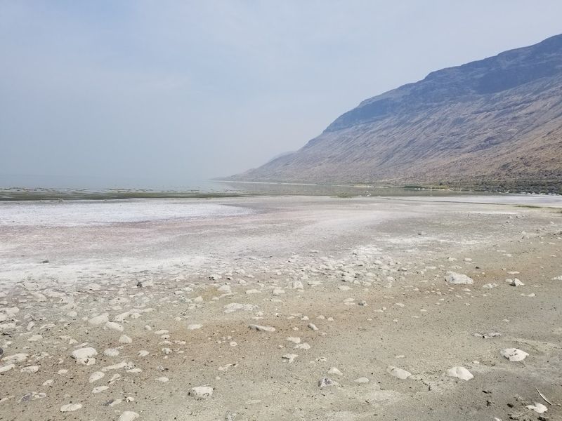
What water remains in many recent visits sits at roughly one to two feet deep across a lakebed that once held far more volume.
For visitors arriving during one of these dry periods, the experience is striking in a very different way. The exposed lakebed reveals white salt crusts and cracked mud stretching across the basin.
It is a powerful visual reminder of how quickly a landscape can change when the water that defines it disappears.
Climate Change And Drought Are Squeezing The Lake
Research points to two overlapping climate forces pushing the lake toward its limits. First, the region has experienced fewer days of snow cover and rising surface temperatures between 2001 and 2021.
Less snowpack means less meltwater feeding into the Chewaucan River, the lake’s primary water source.
Higher temperatures accelerate evaporation from the lake’s surface, pulling water out faster than it can be replaced. The Oregon high desert has always been dry, but the trend has intensified significantly in recent decades.
Scientists describe the situation as a compounding drought, where each dry year builds on the stress of the last.
This is not a short-term weather fluctuation. Researchers studying Lake Abert describe a structural shift in how much water the region receives and retains across an entire year.
Without meaningful changes in precipitation patterns or human water use upstream, the lake’s ability to bounce back after dry years becomes increasingly limited with each passing season.
How Upstream Water Use Is Cutting Off The Lake’s Lifeline
Climate is only part of the story. Human water management upstream plays a significant role in how much water actually reaches Lake Abert.
The Chewaucan River is the lake’s main source of inflow, but agricultural withdrawals along the river reduce how much water makes it to the lake.
A reservoir built upstream in 1994 further reduced natural flow by capturing water before it could reach the lake. Lake Abert itself holds no legal water rights, which means it has no formal claim to the water flowing toward it.
When upstream users draw from the river, the lake has no legal standing to object.
This combination of legal vulnerability and physical infrastructure puts the lake in a difficult position. Even in wetter years, the water that might have historically refilled the basin is now redirected before it arrives.
Conservation groups have raised this issue repeatedly, but resolving water rights in the American West is a notoriously slow and complicated process.
When Salinity Spikes, The Food Web Collapses
As the lake shrinks, the salt concentration rises. The math is straightforward.
Less water in the basin means the same amount of dissolved salt is packed into a smaller volume, pushing salinity higher and higher. Since 2020, salinity at Lake Abert has risen above 250 grams per liter.
That number matters because brine shrimp and alkali flies, the organisms that feed the lake’s migratory birds, struggle to survive when salinity exceeds 200 grams per liter. The optimal range for these species sits between 30 and 80 grams per liter.
At current levels, conditions are far outside what these creatures can handle.
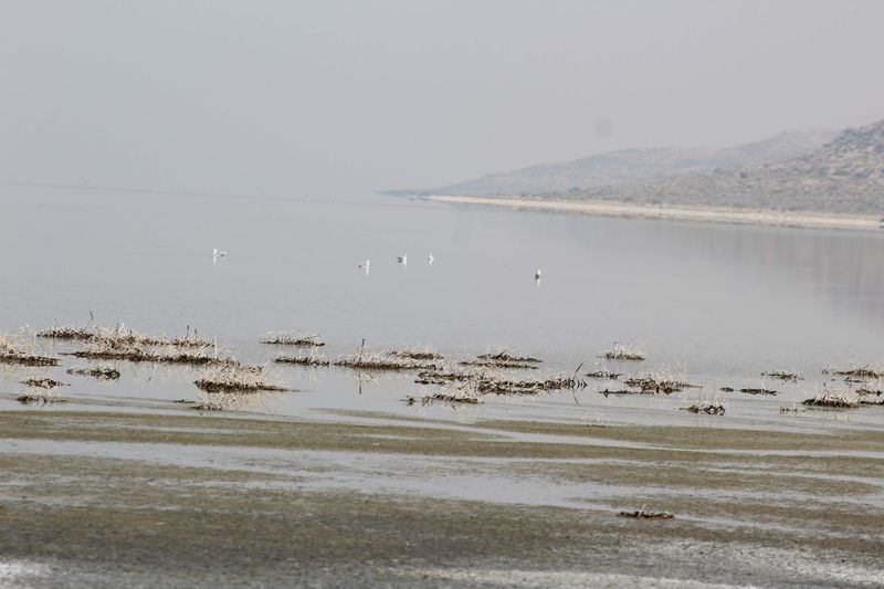
When brine shrimp and alkali flies disappear, the birds that depend on them have nothing to eat. The food web that once made Lake Abert one of the most productive stopover points on the Pacific Flyway essentially unravels from the bottom up.
No food source means no reason for birds to stop, and the ripple effects move quickly through the ecosystem.
The Bird Counts Tell A Sobering Story
The numbers are hard to ignore. Just over a decade ago, Lake Abert hosted more than 250,000 migratory birds in a single year.
By 2021, that count had dropped to roughly 11,000. That is a decline of more than tenfold in a short span of time.
The lake sits along the Pacific Flyway, one of the major migratory bird routes in North America. For species like phalaropes, avocets, and various shorebirds, it was a critical refueling stop.
The brine shrimp and alkali flies provided dense, high-energy food in massive quantities. Losing that resource forces birds to seek alternatives that may not exist at the same scale.
Birders who visited Lake Abert years ago describe scenes of enormous, swirling flocks moving across the water at dawn. Those scenes are increasingly rare now.
The lake still attracts some birds, but the spectacle that once drew dedicated wildlife watchers from across Oregon and beyond has diminished significantly.
What Visitors Can Actually See When They Arrive Today
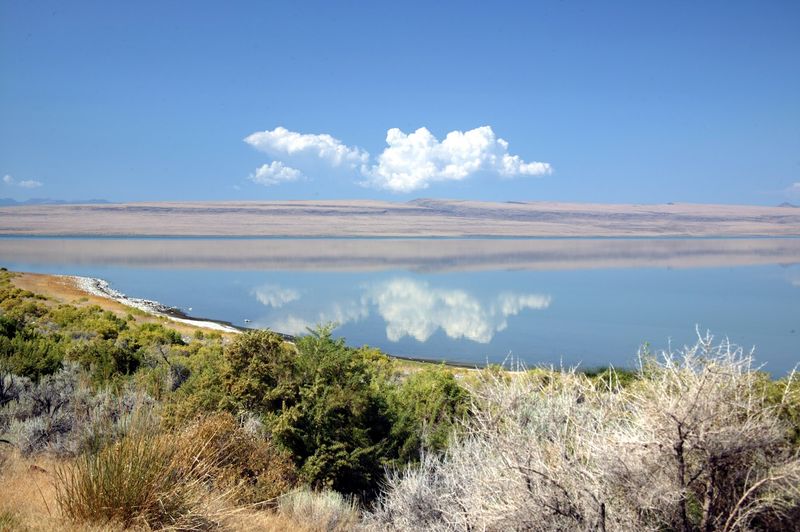
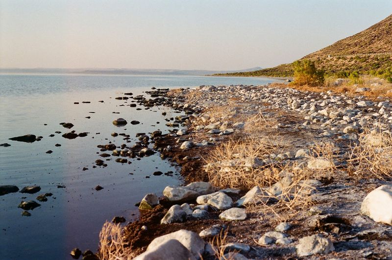
Driving north along Highway 395, the lake appears on the left as a wide, flat expanse that shifts in color depending on the season and water level.
In wetter years or early spring, the water can look genuinely blue against the dark volcanic cliffs. In dry years, it fades to a pale gray-white as salt crusts form across the exposed bed.
Pull-offs along the highway give visitors a place to stop, step out, and take in the view. The rim dominates the western horizon, rising steeply in a way that makes the lake feel small by comparison.
Binoculars are worth bringing. Even with reduced bird populations, there are usually some shorebirds and waterfowl visible near the water’s edge.
Horse flies can be active near the shore, so light covering is practical. The smell of the lake, often described as similar to low tide at the ocean, is part of the sensory experience.
It is unmistakable and oddly fitting for a saltwater lake in the middle of the Oregon desert.
The Best Time Of Year To Visit And What To Expect
Spring is the most reliable window for seeing the lake at its best. Snowmelt from the surrounding mountains feeds the Chewaucan River, and water levels in the lake tend to be at their highest between March and May.
The light during this period is also particularly good for photography, with long golden hours and dramatic cloud formations.
Migratory birds typically pass through during spring and fall. Spring visits offer the better chance of seeing meaningful bird activity, though the numbers have dropped considerably from historical highs.
Fall visits can still be rewarding, particularly for the light and the quieter atmosphere on the highway.
Summer heat accelerates evaporation quickly, and the lake can look very different in August compared to April. Winter access is generally possible along the highway, but conditions can be unpredictable in the Oregon high desert.
Visitors planning a trip should check road conditions and recent water level reports before making the drive, as conditions vary significantly year to year.
Conservation Efforts And The Fight To Save The Lake
Scientists and conservation organizations have been working to understand what is driving the lake’s decline and whether anything can be done to slow or reverse it. Research has focused on quantifying the roles of climate change, evaporation rates, and upstream water withdrawals in reducing inflow to the lake.
One of the central challenges is the legal framework around water rights in Oregon and the broader American West. Lake Abert holds no water rights, which puts it at the back of the line when water is scarce.
Advocates have pushed for policy changes that would give the lake some legal protection, but progress has been slow.
Restoration discussions have included ideas like modifying upstream water use agreements and increasing minimum flow requirements for the Chewaucan River. None of these solutions are simple or fast.
The future of the lake remains genuinely uncertain, and researchers are careful not to make promises about outcomes. What is clear is that without action, the window for meaningful recovery narrows with each passing dry year.
Why This Lake Deserves Attention Before It Is Too Late
Lake Abert is not famous in the way that Crater Lake is famous. It does not appear on most tourist itineraries, and it does not have a visitor center or a ranger station.
But it represents something that very few places in Oregon can claim: a one-of-a-kind ecosystem that evolved around extreme conditions and supported extraordinary wildlife migrations for thousands of years.
The fact that it is disappearing makes it more urgent to visit, not less. Seeing the lake now, even in its diminished state, provides a direct understanding of what is at stake when water systems are pushed beyond their limits.
The Abert Rim still rises. The highway still runs beside the shore.
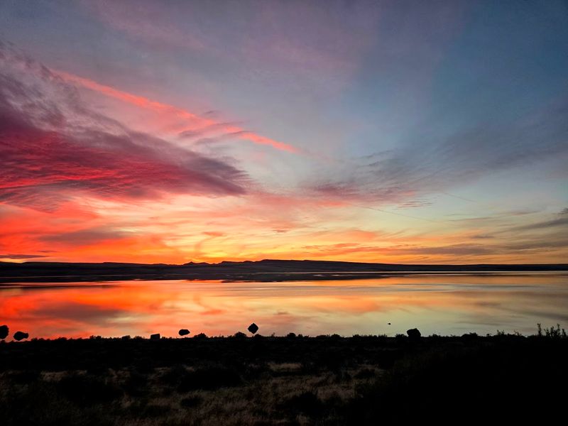
The high desert sky still puts on a show at sunrise and sunset.
What has changed is the water, and with it, the birds, the brine shrimp, and the living pulse of the place. Oregon still has this lake, at least for now.
The window to see it as something more than a salt flat may not stay open much longer.