14 Scenic Drives In Arizona Made For Epic Road Trips
Arizona isn’t just a desert, it’s a land of dramatic contrasts, where red rocks tower over winding roads, pine forests stretch across mountain ranges, and historic highways carry stories from decades past. From the iconic curves of Route 66 to the breathtaking climbs up sky islands, this state offers some of the most unforgettable drives in the country.
Whether you’re chasing sunsets over canyons or cruising through wildflower-dotted valleys, these scenic routes promise adventure, beauty, and memories that will last a lifetime.
1. Red Rock Scenic Byway
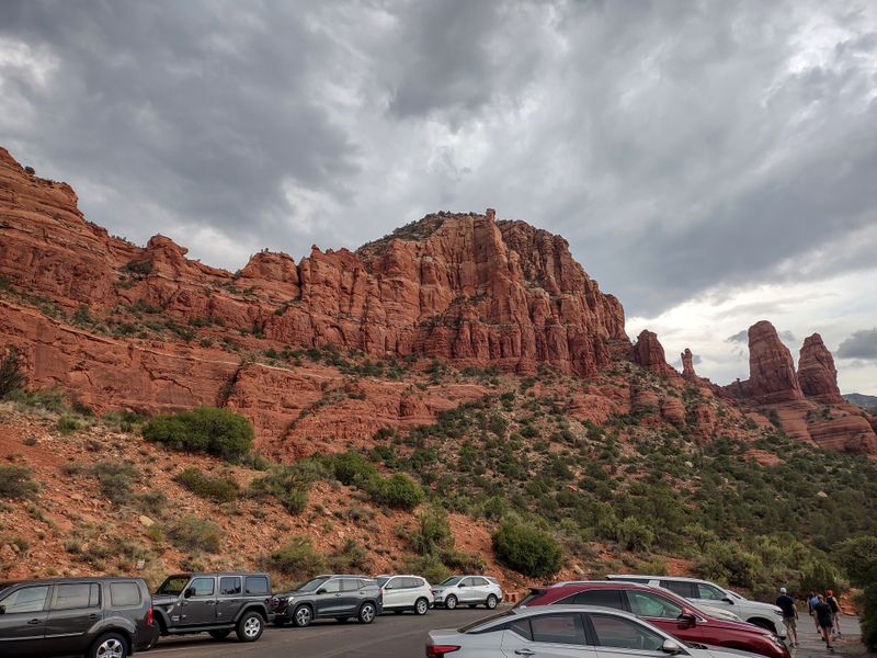
Winding through Sedona’s crimson canyon walls, this 7.5-mile stretch of State Route 179 feels like driving through a painting. Every turn reveals another jaw-dropping vista—Cathedral Rock, Bell Rock, and Courthouse Butte rise like ancient sentinels against impossibly blue skies.
The colors shift throughout the day, glowing amber at sunrise and blazing scarlet at sunset.
Pull over at one of the many scenic overlooks to snap photos or simply soak in the views. Hiking trails branch off from the byway, offering chances to explore red rock formations up close.
The energy here is electric, drawing artists, adventurers, and spiritual seekers alike.
Plan for plenty of stops—this isn’t a drive to rush. Visit in spring for wildflowers or fall for cooler temperatures and golden cottonwoods.
The byway connects to Oak Creek Canyon, extending your journey through even more natural splendor.
2. Historic Route 66 All-American Road

Nothing screams classic American road trip quite like Route 66. Arizona preserves one of the longest remaining stretches of the Mother Road, running from Ash Fork through quirky Seligman and into Kingman.
Vintage motels, retro diners, and roadside attractions line the highway, frozen in time like a 1950s postcard.
Seligman is the heart of Route 66 nostalgia, with its neon signs, antique shops, and the famous Snow Cap Drive-In serving ice cream with a side of pranks. Kingman offers the Route 66 Museum, packed with memorabilia and stories from the highway’s golden age.
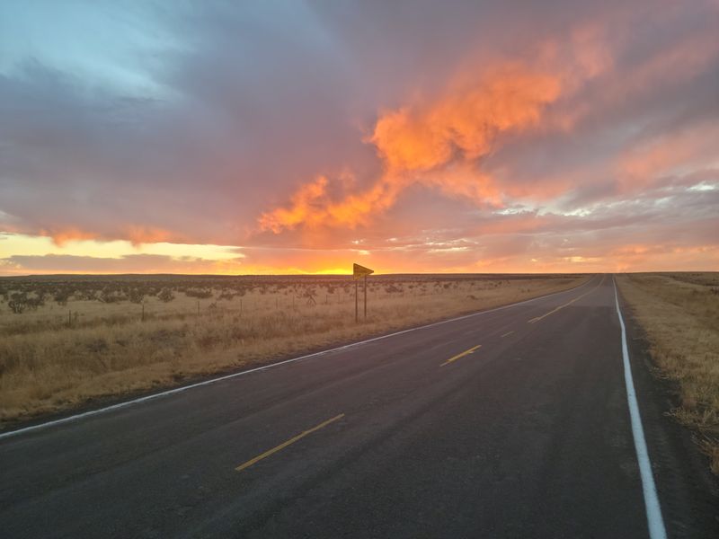
The open desert vistas feel endless, with tumbleweeds and distant mountains completing the scene.
This drive is pure Americana, perfect for history buffs and anyone who loves vintage charm. Stop often, chat with locals, and embrace the slower pace of a bygone era.
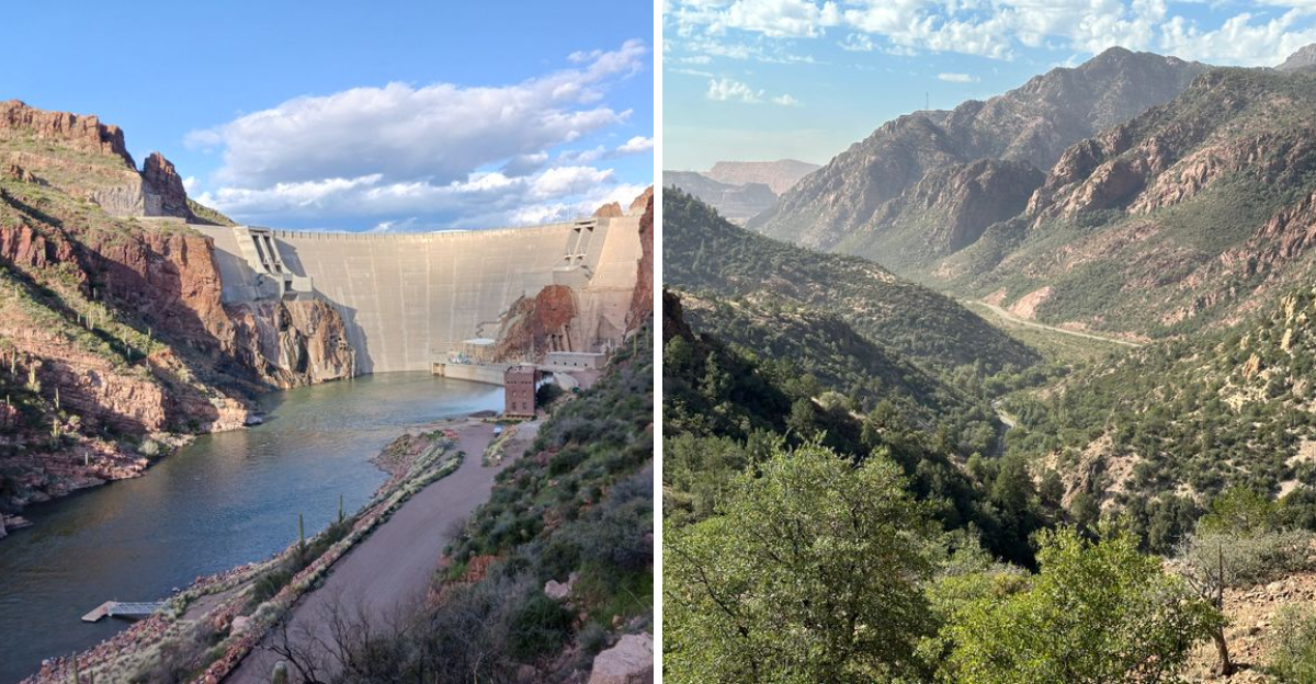
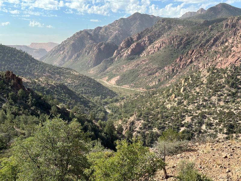
3. Apache Trail Historic Road
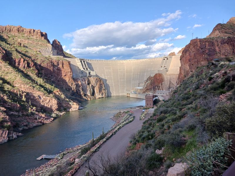
Buckle up for one of Arizona’s most thrilling drives. The Apache Trail snakes 46 miles from Apache Junction into the rugged Superstition Mountains, climbing through canyons and hugging cliff edges with stomach-dropping drop-offs.
Part of the route remains unpaved, adding to the wild, adventurous vibe.
Canyon Lake and Apache Lake shimmer like turquoise jewels against the desert backdrop, offering spots for swimming, kayaking, or simply admiring the view. Tortilla Flat, a tiny town with a population of six, serves up legendary prickly pear ice cream and walls covered in dollar bills left by visitors.
The scenery shifts from cactus-studded desert to pine-dotted highlands.
This isn’t a drive for the faint of heart—narrow roads and steep grades demand your full attention. But the reward is worth every white-knuckle moment, with vistas that rival anything in the Southwest.
4. Coronado Trail Scenic Byway
Prepare for 123 miles of pure driving bliss. The Coronado Trail twists through eastern Arizona’s mountains with 460 curves, climbing from desert grasslands to alpine forests thick with ponderosa pines and aspens.
Named after Spanish explorer Francisco Vázquez de Coronado, this route follows ancient paths through some of the state’s most remote wilderness.
Elevation changes are dramatic—you’ll climb from 3,000 to 9,000 feet, passing through multiple climate zones. Wildlife sightings are common, from elk grazing in meadows to hawks circling overhead.
Fall is spectacular when aspens turn gold, but spring and summer bring wildflowers and rushing streams.
Small mountain towns like Alpine and Clifton offer places to rest and refuel. The drive takes several hours, so start early and pack snacks.
This is Arizona at its most untamed and beautiful.
5. Sky Island Scenic Byway
Starting in the saguaro-studded Sonoran Desert near Tucson, this 27-mile climb up Mount Lemmon is like traveling from Mexico to Canada in less than an hour. The temperature drops about 30 degrees as you ascend, and the landscape transforms from cacti to pine forests, earning the mountain range its “sky island” nickname.
Windy Point offers breathtaking views over Tucson and the surrounding valley—a perfect spot for photos or a picnic. Higher up, the village of Summerhaven provides restaurants, shops, and trailheads for hiking among towering conifers.
In winter, the summit even has skiing, making it Arizona’s most accessible snow destination.
The drive features countless pullouts and viewpoints, so take your time. Watch for bighorn sheep and Gila monsters at lower elevations, while deer and black bears roam the higher forests.
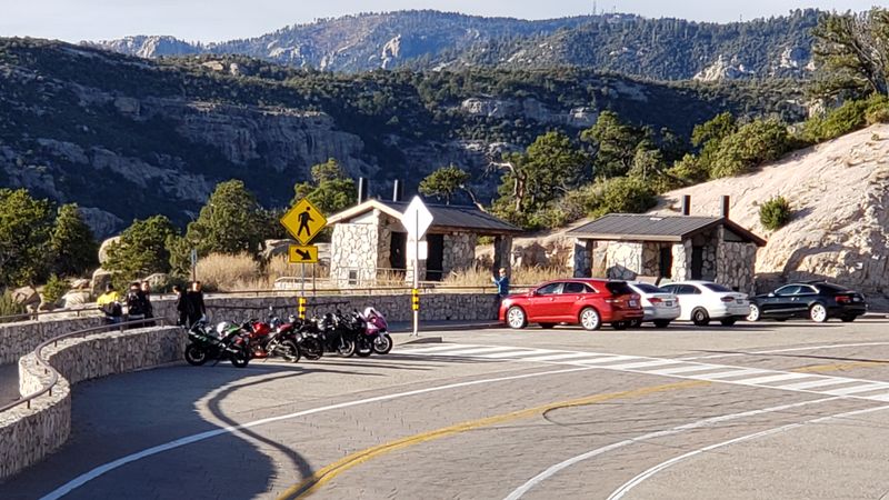
6. Kaibab Plateau-North Rim Parkway
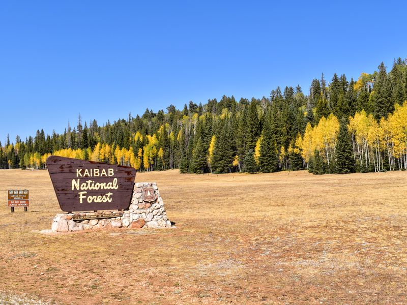
Far quieter than its famous southern counterpart, the drive to the Grand Canyon’s North Rim along SR 67 is an adventure in itself. This 44-mile route cuts through the Kaibab National Forest, where meadows burst with wildflowers in summer and aspens glow golden in fall.
Towering ponderosa pines frame the road, creating a cathedral-like canopy overhead.
The North Rim sits 1,000 feet higher than the South Rim, offering cooler temperatures and a completely different perspective of the canyon. Fewer crowds mean more opportunities for peaceful contemplation and wildlife watching—mule deer, wild turkeys, and even the rare Kaibab squirrel call this forest home.
Note that SR 67 closes in winter due to heavy snow, typically from mid-October through mid-May. Plan your trip for summer or early fall to experience this pristine corner of Arizona.
7. Desert To Tall Pines Scenic Road
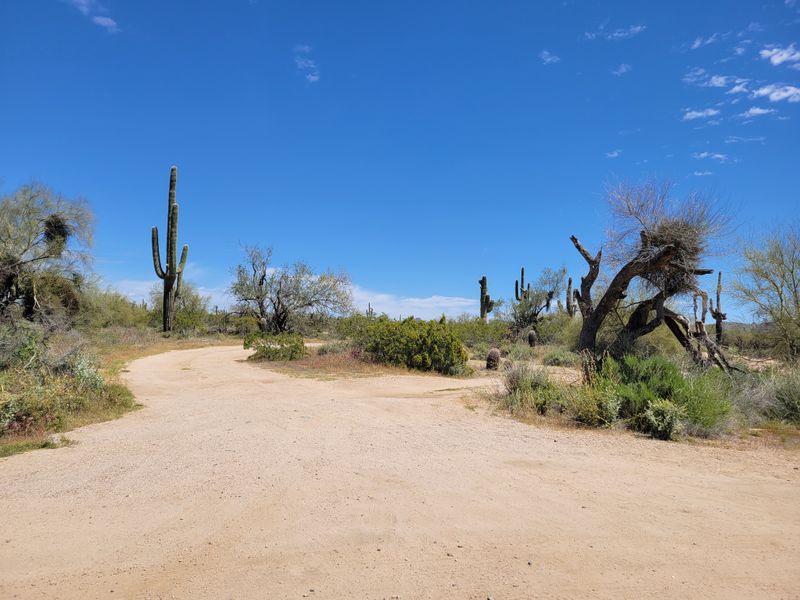
Living up to its name, SR 288 delivers a rapid transition from desert scrubland to towering pine forests in just 58 miles. This lesser-known gem in central Arizona follows the Salt River through remote wilderness, passing ghost towns and old mining sites that whisper stories of frontier days.
The road is partially unpaved and can be rough in spots, so a high-clearance vehicle is recommended. But that ruggedness keeps crowds away, offering solitude and pristine scenery.
Roosevelt Lake sparkles in the distance as you climb, while the Tonto National Forest envelops you in green as elevation increases.
History buffs will appreciate Young, a tiny settlement that feels frozen in the Old West. Pack a lunch and plenty of water—services are scarce along this route.
It’s raw Arizona beauty, perfect for those seeking adventure off the beaten path.
8. Black Hills Back Country Byway
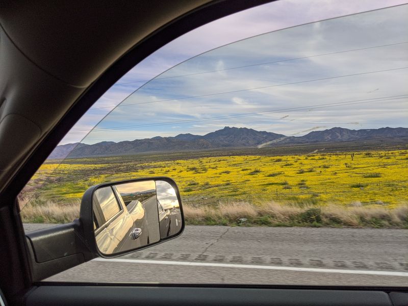
Just outside Prescott, this 21-mile unpaved loop takes you deep into the Bradshaw Mountains, where granite boulders the size of houses balance impossibly on hillsides. The Black Hills Back Country Byway winds through juniper and pinyon forests, offering glimpses into Arizona’s mining past with abandoned claims and rusty equipment scattered along the route.
Spring brings carpets of wildflowers—lupines, Indian paintbrush, and poppies paint the landscape in vibrant hues. Summer monsoons can make the road muddy, so check conditions before heading out.
High-clearance vehicles are a must, though four-wheel drive isn’t always necessary in dry conditions.
Prescott itself is worth exploring, with its Victorian-era downtown and Whiskey Row saloons. Combine the byway with a visit to nearby Thumb Butte or Watson Lake for a full day of central Arizona exploration.
This drive rewards those willing to venture onto dirt roads.
9. Joshua Forest Scenic Road
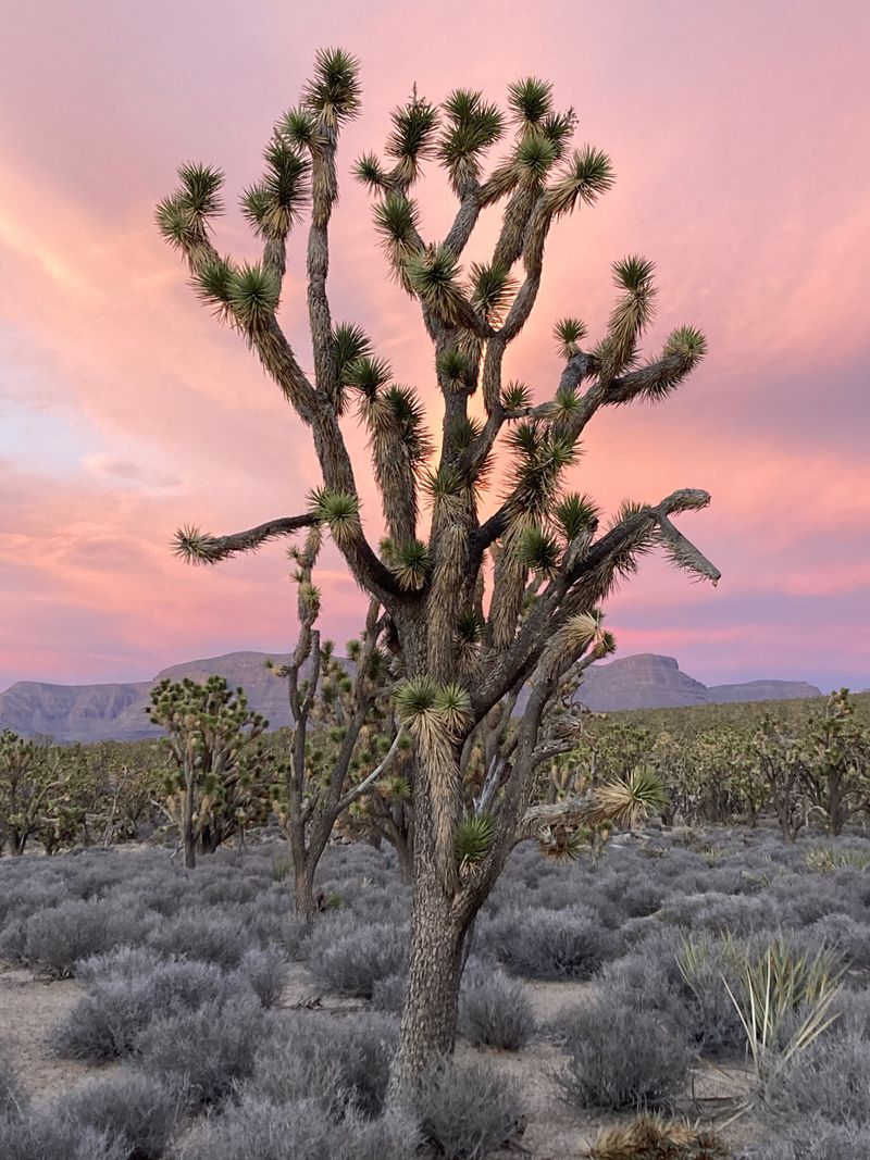
Between Wikieup and Wickenburg, US 93 passes through Arizona’s largest concentration of Joshua trees—those wonderfully weird, Dr. Seuss-like plants that define the Mojave Desert. The 25-mile stretch feels otherworldly, especially at sunset when the spiky silhouettes glow against orange skies.
These ancient trees, some over 150 years old, create a forest unlike any other. Pull off at designated areas to walk among them and appreciate their twisted beauty up close.
The surrounding landscape is classic high desert, with distant mountains and wide-open spaces that make you feel wonderfully small.
Spring is prime time when Joshua trees bloom with creamy white flowers, attracting hummingbirds and desert bees. Wickenburg, at the southern end, is a charming Old West town with art galleries and guest ranches.
This drive proves that Arizona’s deserts hold endless surprises beyond saguaros.
10. Fredonia-Vermilion Cliffs Scenic Road
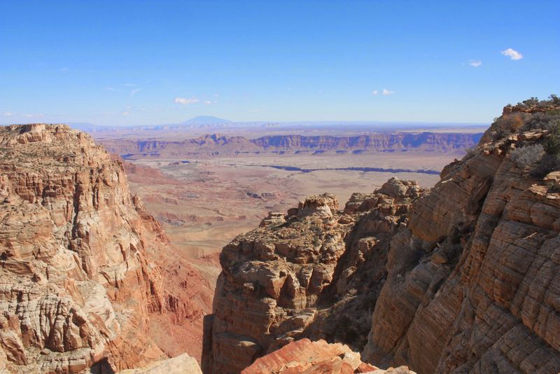
US 89A between Fredonia and Marble Canyon is a masterclass in geology and color. The Vermilion Cliffs rise like a massive red wave frozen in stone, their layered bands of crimson, orange, and cream telling millions of years of Earth’s history.
This remote stretch of northern Arizona feels like the edge of the world.
Condors—North America’s largest birds—soar overhead, part of a successful reintroduction program in the area. Keep binoculars handy for spotting these magnificent creatures with their 9-foot wingspans.
The landscape is stark and beautiful, with juniper-dotted plateaus stretching to distant horizons.
Marble Canyon and the Navajo Bridge mark the eastern end, where you can peer down at the Colorado River beginning its journey through the Grand Canyon. This drive combines natural wonder with profound solitude—perfect for contemplation and photography.
11. Gila-Pinal Scenic Road
US 60 through the Pinal Mountains between Superior and Miami is a white-knuckle thrill ride with rewards at every turn. The road climbs steeply through Queen Creek Canyon, with hairpin curves and tunnels carved through solid rock.
It’s not for nervous drivers, but the scenery is absolutely worth the adrenaline.
Superior sits at the western base, home to the famous Boyce Thompson Arboretum, where desert plants from around the world thrive. As you climb, saguaros give way to agave and oak, then pine forests at higher elevations.
The views back down the canyon are spectacular, with layers of mountains fading into blue distance.
Miami and Globe, historic mining towns at the eastern end, offer glimpses into Arizona’s copper mining heritage. Stop for Mexican food and explore small-town Arizona before or after tackling this dramatic mountain passage.
12. Swift Trail Parkway
Climbing from the desert floor near Safford to the summit of Mount Graham, SR 366 packs incredible diversity into 35 miles. You’ll gain over 6,000 feet in elevation, passing through five distinct ecosystems—from prickly pear and ocotillo to Douglas fir and Engelmann spruce.
Mount Graham is home to the endangered Mount Graham red squirrel, found nowhere else on Earth. The summit also hosts astronomical observatories, taking advantage of the clear, dark skies at 10,720 feet.
Several campgrounds and picnic areas offer chances to linger in the cool mountain air.
The Swift Trail is named for the refreshing change of pace it offers from southeastern Arizona’s desert heat. Summer weekends see locals escaping to the high country, but weekdays remain peaceful.
Fall brings golden aspens and crisp air perfect for hiking the numerous trails branching from the parkway.
13. Lake Mary Road
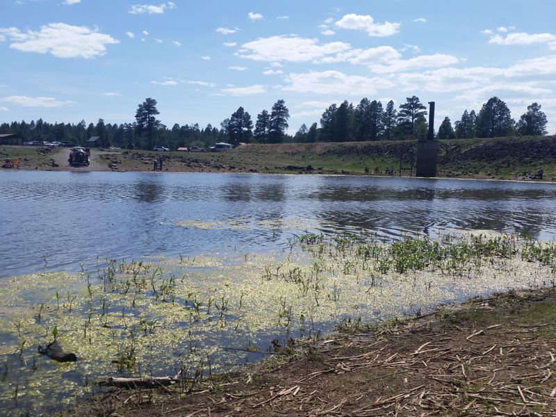
Just southeast of Flagstaff, Lake Mary Road offers easy access to high-country beauty without the white-knuckle curves of some mountain drives. This paved route runs about 20 miles through ponderosa pine forests, connecting Upper and Lower Lake Mary—popular spots for fishing, boating, and wildlife watching.
Elk are commonly spotted grazing in meadows, especially at dawn and dusk. The lakes themselves are scenic, though water levels fluctuate with seasonal rainfall.
Several Forest Service campgrounds provide overnight options, while day-use areas welcome picnickers and photographers.
Fall is magical when aspens scattered through the pines turn brilliant gold. Winter brings cross-country skiing and snowshoeing opportunities.
The road is generally open year-round, though winter storms can temporarily close it. It’s a perfect half-day excursion from Flagstaff, combining mountain scenery with recreational opportunities for all ages and abilities.
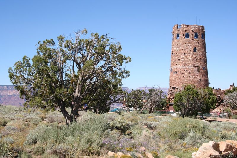
14. Desert View Drive
Connecting Grand Canyon Village with the East Entrance, Desert View Drive is 25 miles of pure wonder. Multiple overlooks along the route provide different perspectives of the canyon’s immense scale and ever-changing colors.
Each viewpoint reveals new layers, temples, and side canyons that deepen your appreciation for this natural masterpiece.
Desert View Watchtower, designed by Mary Colter in 1932, stands at the eastern end—a stunning stone structure offering 360-degree views. The tower’s interior features Native American artwork and murals worth exploring.
Lipan Point and Moran Point are photographer favorites, especially for sunrise and sunset.
Unlike the crowded village area, these eastern viewpoints feel more peaceful, allowing for contemplation and connection with the canyon’s grandeur. Take your time, stopping at every overlook.
Each one offers something unique, and rushing would mean missing the full experience of this iconic landscape.