
9 Short East Tennessee Walks With Big Views And Very Little Effort
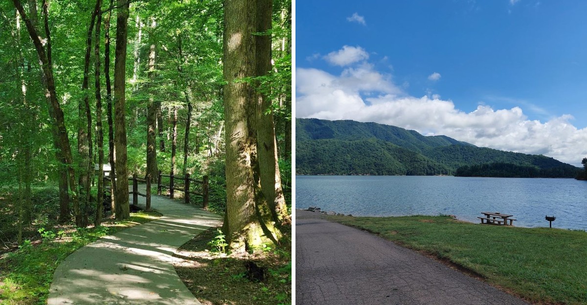
Not every great view should require a heroic amount of effort.
East Tennessee is full of short walks that make a strong case for keeping things simple. A gentle trail can still lead to mountain overlooks, quiet rivers, waterfalls, and wide stretches of scenery without leaving you worn out before lunch.
That is part of what makes this corner of Tennessee so easy to enjoy. You can fit a scenic walk into a busy day, bring along family members who are not serious hikers, or save your energy for whatever comes next.
Some routes take only a few minutes. Others stretch just long enough to feel satisfying without becoming a workout.
These are the kinds of places that prove a memorable outdoor day does not need mileage bragging rights. A comfortable pair of shoes, a little curiosity, and a short stretch of trail may be all it takes to reach a view worth stopping for.
1. East Rim Overlook, Big South Fork National River And Recreation Area, Oneida
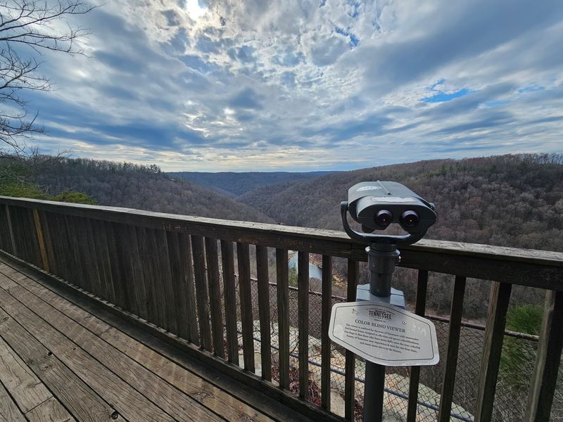
Three hundred feet. That is the entire distance between the parking area and one of the most impressive gorge views in the state.
The path here is paved and level, which makes it welcoming for strollers, wheelchairs, and anyone who would rather save their energy for looking around.
Located in the Big South Fork National River and Recreation Area near Oneida, the overlook sits high above a wide, forested valley.
What you see from the railing is the Big South Fork of the Cumberland River, curling through a deep gorge lined with sandstone cliffs. Odd rock formations poke out of the treetops. On a quiet morning, the only sound is wind moving through the pines.
A thoughtful detail sets this spot apart. A special viewfinder has been installed to help visitors with color vision differences see the fall colors more vividly. It is a small addition that makes a big difference in October.
Timing matters more than fitness at this overlook. Early light softens the cliff faces, while late afternoon deepens the shadows in the gorge below.
Pack a snack and linger a while, since there is no rush getting back to the car. Few places in East Tennessee hand over such a dramatic scene for so little walking, and that trade feels almost unfair in the best possible way.
2. Look Rock Tower Trail, Great Smoky Mountains National Park, Walland
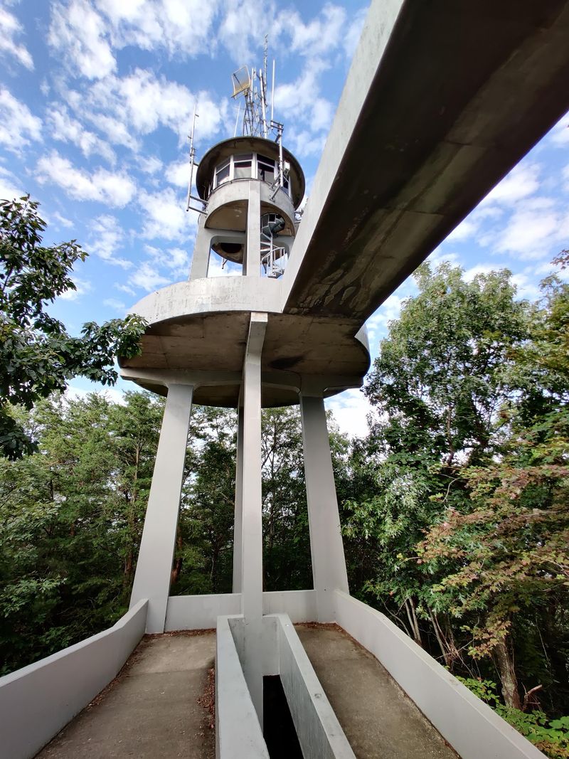
Climbing a tower usually sounds like work. In this case, the reward arrives after less than a mile of round trip walking, and the payoff is genuinely enormous.
The trail leaves the Foothills Parkway West between Walland and Chilhowee, following a paved route through cool forest. Expect a few gentle inclines and a couple of spots where tree roots have lifted the pavement.
Most people finish the whole thing in twenty to thirty minutes.
At the summit stands the observation tower, and from its deck the view runs a full 360 degrees. On clear days visibility stretches roughly forty to fifty miles.
Look one direction and you will find Clingmans Dome, Mount LeConte, and Rich Mountain lined up like a mountain roll call. Turn around and the Tennessee River Valley spreads out, with Maryville and Knoxville visible in the distance.
Sunrise and sunset are the star performances here. Colors bounce across ridge after ridge, and the layered blue haze that gave the Smokies their name shows up beautifully.
The Foothills Parkway drive is part of the appeal too. Traffic tends to be lighter than on the busier park roads, so the whole outing feels calmer.
Bring a light jacket even in warm months, because the breeze at the top has opinions of its own.
3. John Oliver Cabin Walk, Cades Cove, Townsend
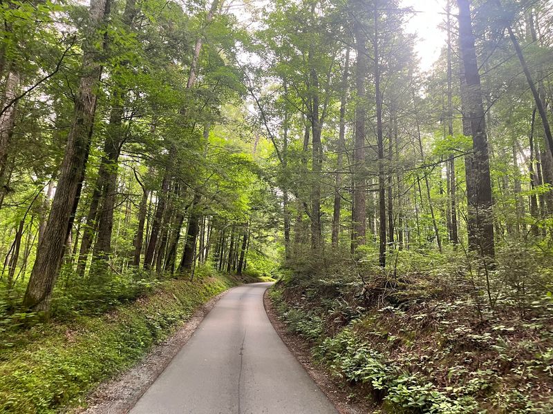
A five minute stroll does not usually come with two centuries of history attached. Cades Cove breaks that rule with ease.
The walk to the John Oliver Cabin starts near Townsend inside Great Smoky Mountains National Park, covering roughly 0.3 miles round trip. Most of the surface is paved, then it shifts to level packed gravel.
Grades stay easy, which makes it one of the friendlier historic stops in the park.
Waiting at the end is a log cabin built by early European American settlers in the 1820s. Its construction is the surprising part.
Notched corners and plain gravity hold the whole structure together, with no pegs and no nails involved.
Meadows and woodland surround the site, and wildlife shows up often. Deer graze in the grass, turkeys wander through in noisy groups, and songbirds work the tree line.
Look back toward the ridges as you return to the car. The crest of the Smokies rises above the cove and frames the cabin like a painting someone planned on purpose.
Morning visits tend to be quieter, and mist across the fields adds atmosphere. Cades Cove is a one way loop road, so allow extra time for traffic.
Short, scenic, and steeped in East Tennessee history, this one is hard to beat.
4. Falling Water Falls Overlook Walk, Walden Near Chattanooga
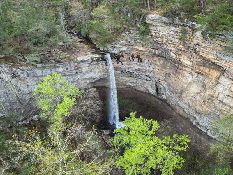
Ten miles north of downtown Chattanooga, a five minute walk delivers a 110 foot waterfall. That math works out very nicely for anyone short on time.
The natural area sits atop Signal Mountain in Walden, and the path from the parking area runs somewhere between a quarter mile and just under half a mile.
Little Falling Water Creek drops over the sandstone cap of the Cumberland Plateau and disappears into Falling Water Gorge below.
From the overlook the scene widens out considerably. Bluff views open toward the Tennessee River Valley, Pickett Gulf, and Buzzard Point.
Forest along the trail is thick with oak, hickory, mountain laurel, and rhododendron. That mix keeps things green through much of the year and shady during summer heat.
Rain changes everything here. After a good soaking storm, the falls thunder and the spray hangs in the air, so plan your trip a day or two after wet weather.
Stay behind railings and away from the slick rock near the lip of the falls. Sandstone gets deceptively slippery when damp.
Considering how close the city sits, the quiet feels almost startling. Traffic noise fades, the creek takes over, and a busy afternoon in East Tennessee turns peaceful in a matter of minutes.
5. Signal Point, Signal Mountain
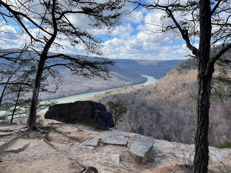
Civil War signal crews once used this spot to send messages across the valley. Today the effort required to reach the view is close to zero.
Perched on Signal Mountain northwest of Chattanooga, the main overlooks sit a short stroll from the parking area. Stone walls and railings make the vantage points feel solid and safe.
What unfolds below is the Tennessee River Gorge, where the river cuts a wide path through the Cumberland Plateau. Signal Mountain sits on one side and Raccoon Mountain on the other, framing the water in green ridges.
Boulders and unusual rock formations dot the area, which gives kids something to explore while adults hog the view. Interpretive information explains how the site served as a communication point during the war.
Serious hikers use this same trailhead for the Cumberland Trail, which continues for miles into rugged terrain. Nobody is required to follow them, and the best photos happen right at the top.
Late afternoon light works magic on the gorge, turning the ridgelines into stacked silhouettes. Fall brings color that runs from the river all the way up the slopes.
History and scenery rarely arrive in one small package. Signal Point manages both without asking for much more than a parking spot and a few free minutes.
6. Point Park, Lookout Mountain
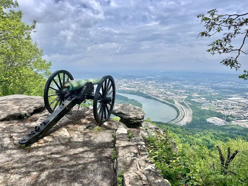
Cannons, a peace monument, and a skyline view all sit within a mile of easy walking. Point Park packs a remarkable amount into a small space.
The park crowns Lookout Mountain near Chattanooga as part of Chickamauga and Chattanooga National Military Park. Its loop trail runs roughly half a mile to a mile, mostly paved and mostly flat.
From the rocky rim, the Tennessee River bends far below and downtown Chattanooga spreads out in full view. Signal, Elder, and Raccoon Mountains rise in the distance, and on clear days the panorama reaches into Georgia and North Carolina.
History sits everywhere you look. Civil War era cannons point out over the valley, interpretive plaques explain the Battle of Lookout Mountain, and the New York Peace Monument stands tall near the overlook.
The Ochs Memorial Observatory adds another viewing platform, built right into the rock. Steps lead down to it, and the perspective from there is worth the short descent.
Paved paths make this a comfortable stop for multi generation groups. Benches appear at useful intervals.
Plan for a slower visit than the distance suggests, because reading the plaques takes longer than the walking does. Few East Tennessee viewpoints combine city, river, and mountains quite this generously.
7. Backbone Falls Loop, Cherokee National Forest, Shady Valley Area
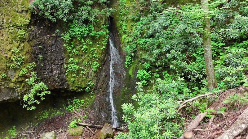
Ever visited the world’s shortest tunnel? Backbone Rock holds that claim, and a waterfall sits just around the corner from it.
The loop lies in Cherokee National Forest in the Shady Valley area of Johnson County. Total distance runs about half a mile, and reaching the falls takes roughly five minutes.
Water drops somewhere between forty and forty five feet into a calm pool at the base of a small gorge. Several vantage points along the loop let you see the cascade from different angles.
Beaverdam Creek runs nearby, filling the forest with a steady rushing sound. Moss coats the rocks, ferns crowd the edges of the trail, and hemlocks shade most of the route.
Photographers love the setup because the falls face a natural opening in the canopy. Soft, overcast days often produce the best images.
Families do well here too, since the distances are tiny and the scenery arrives fast. Just keep an eye on footing near the wet rock.
The tunnel itself is worth a look before you leave. Cars pass straight through a ridge of stone, which never stops being slightly ridiculous.
For a corner of East Tennessee this remote, the reward to effort ratio is remarkably lopsided in your favor.
8. Watauga Point Picnic Area Loop, Watauga Lake
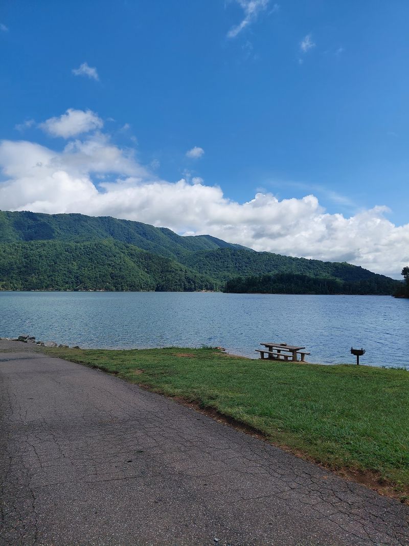
Sometimes the best walk is the one that ends with your feet in the water. This little loop makes that easy.
Set on the southern side of Watauga Lake in Carter County, the gravel trail measures roughly four tenths of a mile. Grades stay mild and the surface is smooth enough for casual shoes.
Lake views stay in sight almost the entire way. Watauga Lake covers about 6,400 acres and sits above 1,900 feet in elevation, making it the highest reservoir in Tennessee.
That elevation shows up in the water, which runs strikingly clear and cool. Across the lake, the Big Laurel Branch Wilderness Area rises in unbroken forest with no houses in sight.
The picnic area feels park like, with shade trees, grassy space, and tables for a proper lunch. Midway around the loop, a small beach like stretch invites a pause and a bit of wading.
Summer weekends draw crowds, so mornings and shoulder seasons offer more quiet. Autumn turns the surrounding ridges gold and rust, doubled in the reflection.
This is a day use area, which keeps things tidy and relaxed. Pack a blanket, walk the loop twice if you feel ambitious, then settle in and let the mountains do the entertaining.
9. Sugarlands Valley Nature Trail, Gatlinburg
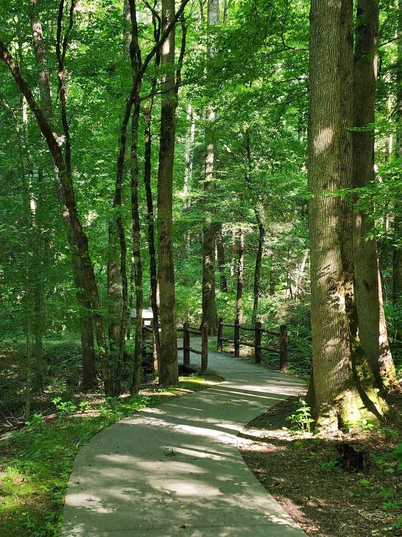
Smooth concrete, nearly flat grades, and river views the whole way. Accessibility rarely comes with this much scenery attached.
The trail sits inside Great Smoky Mountains National Park just outside Gatlinburg, forming a loop of roughly half a mile. Most visitors finish in twenty to thirty minutes, longer if they stop to read every sign.
Cove hardwood forest lines the route, tall and leafy, with the West Prong of the Little Pigeon River running alongside. The water tumbles over boulders in a constant, easy rhythm.
History appears in unexpected places along the path. Old stone chimneys and rock walls remain from the Sugarlands settlement, quiet reminders of the families who farmed this valley before the park existed.
A wooden bridge crosses a small stream partway around, and it is a favorite photo stop. Benches show up at intervals, so resting never requires sitting on a rock.
Wheelchairs and strollers handle the surface without trouble, which makes this a genuine option for everyone in the group. Interpretive signs explain the forest and the settlement story in plain language.
Its position near the Sugarlands Visitor Center means you can pair the walk with maps, restrooms, and exhibits. As introductions to East Tennessee mountain scenery go, this one is close to ideal.