
The Clearest River In Missouri Lets You See Straight To The Bottom
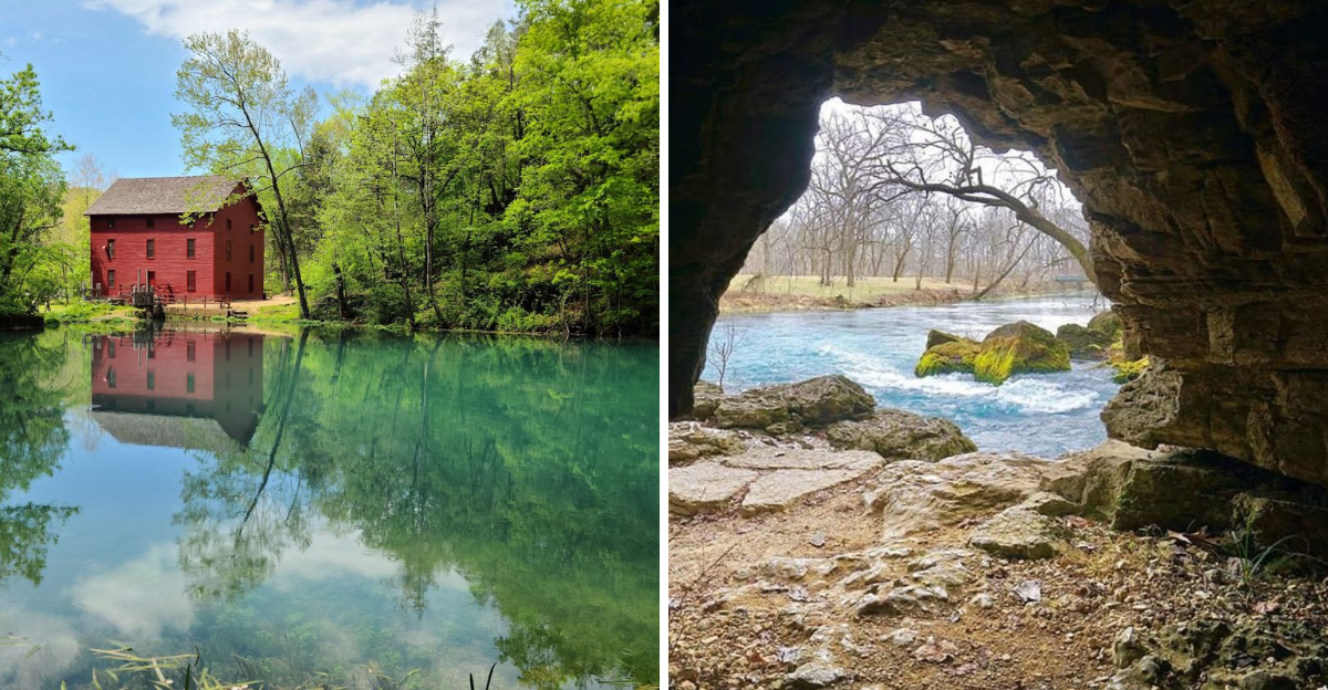
Clear water like this makes you stop and stare, then wade in without thinking twice. Missouri keeps a river so transparent you can watch fish drift below your paddle like they are floating on air.
Cold spring water feeds every mile, and it never clouds up, even in the deepest pools. Canoes glide across glass while turtles line up on half-sunken logs like they are posing for a photo.
Missouri built an entire national park around protecting this exact kind of water, and once you see straight to the bottom, you will understand why. Caves wait underground, old mills still stand by the banks, and trails wind past bluffs made for wandering.
Plan a slow day here. Bring water shoes, pack curiosity, and let the current handle the rest.
The River That Started A National First
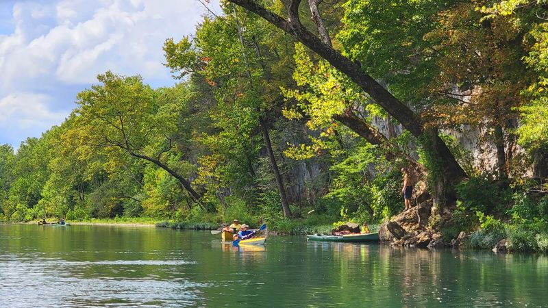
Congress made history here in 1964. The Ozark National Scenic Riverways became the first national park area created to protect a river system.
That decision came four years before the Wild and Scenic Rivers Act of 1968. The Current and Jacks Fork Rivers served as the test case for the whole idea.
Instead of damming these waters, lawmakers chose to leave them flowing. Generations later, that choice still shows in every clear, cold mile.
The park stretches across a long ribbon of southern Missouri, following the rivers rather than filling a neat square on a map. Bluffs, springs, caves, and old homesteads all fall inside its boundaries.
Administration happens away from the crowds. The park headquarters sits at 404 Watercress Rd, Van Buren, MO 63965, and it functions as an office rather than a visitor center.
Travelers looking for exhibits and displays should aim for the developed sites along the rivers instead. Rangers staff those locations during the busier months.
Understanding that difference saves a wasted drive. It also frames the bigger story of a river system saved on purpose.
Why You Can Count Pebbles On The Bottom
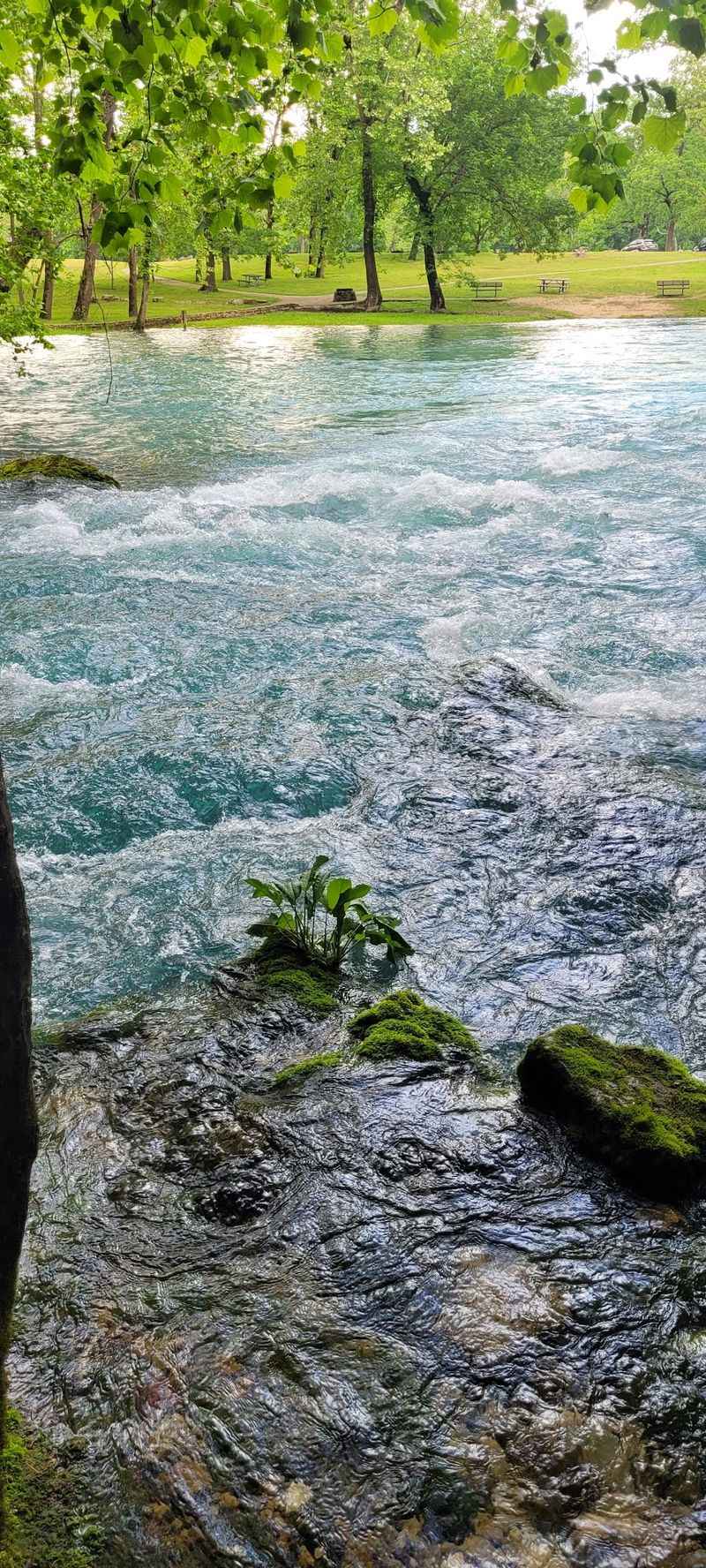
Clarity is not luck. Geology handles the filtering.
The region sits on karst terrain, where soluble bedrock like dolomite mixes with sandstone and chert. Rainwater slips underground instead of running across the surface.
Sinkholes, caves, and hidden channels carry that water through rock for miles. Sediment drops out along the way.
What finally surfaces at the springs is cold and remarkably clean. Because much of the flow arrives underground, the rivers avoid the muddy runoff that clouds so many other waterways.
Standing on a gravel bar, visitors often misjudge depth completely. Water that looks knee-deep can swallow a paddle handle.
Snorkel masks turn a simple swim into an underwater tour. Crayfish scuttle, minnows scatter, and long green plants bend with the current.
Heavy rain can change the picture temporarily. Storms push surface water and silt into the channel, and clarity dips for a few days.
Checking recent river conditions before a trip helps set expectations. On a settled, sunny week, the view straight to the bottom feels almost unreal in this corner of Missouri.
Springs That Pour Out Millions Of Gallons
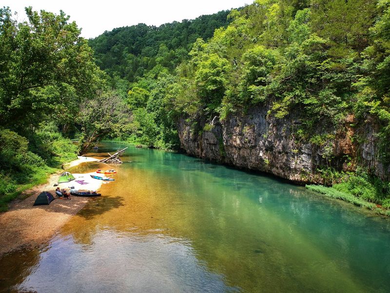
Big Spring earns its blunt name. It ranks as the largest freshwater spring in Missouri and among the biggest in the country.
Average daily discharge runs around 293 million gallons. During peak flows, the figure can climb past 800 million gallons in one day.
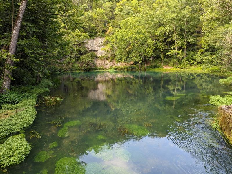
Water boils up at the base of a bluff and rushes off in a wide blue-green channel. The sound alone stops conversation.
Seven major springs and more than 300 smaller ones feed the park. Together they supply well over half of the rivers’ total flow.
Alley Spring pairs its outflow with a bright red historic mill. Round Spring sits close to a road and rewards a short walk.
Blue Spring, reached by a rough side road and a trail near Highway 106, glows an unusually deep blue. Sturdy shoes help, since the path can turn muddy.
Each spring keeps a steady chilly temperature year-round. That cold water is the engine behind the clarity everyone comes to see.
Bug spray belongs in the day pack. Gnats and ticks show up enthusiastically in warm months.
Floating Above A Living Aquarium
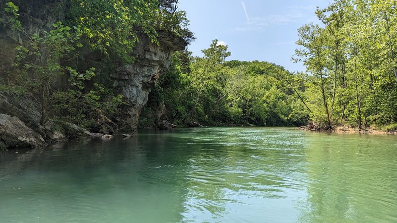
Canoes rule these rivers. Kayaks, rafts, and inner tubes fill in the rest of the traffic.
The Current and Jacks Fork rank among the best float streams anywhere in the country. Gentle current does most of the work.
Paddlers drift over pools where fish hang suspended, seemingly floating in air. Turtles line up on half-sunken logs.
Trip lengths vary widely. Some visitors run a lazy few hours, while others string together multi-day routes with gravel bar camping.
Authorized outfitters near the river towns rent boats and run shuttles. Calling ahead helps, especially for longer expeditions with personal gear.
Weekends in summer get busy. Saturdays draw the largest crowds, and weekday trips feel dramatically quieter.
Water shoes beat flip-flops on slick rock. Sunscreen, drinking water, and a dry bag round out the basics.
Life jackets matter here even on calm stretches. Cold spring water and hidden depth changes catch people off guard.
Many regulars ask one small favor of fellow floaters. Leave the loud speakers behind and let the river do the talking.
Trails Leading To Bluffs And Quiet Corners
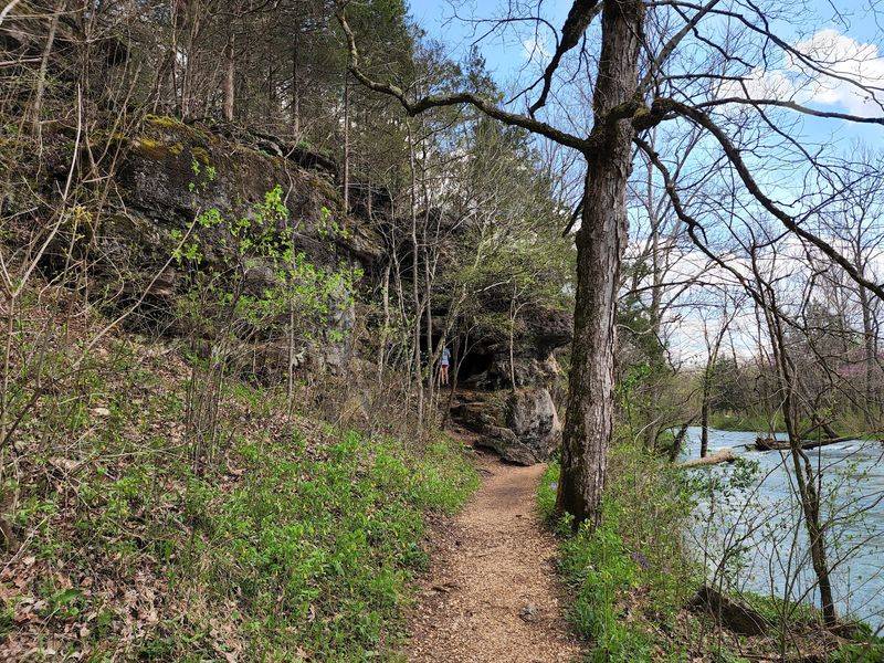
Boots deserve as much attention as paddles. A solid trail network threads through the park’s forests and ridges.
The Ozark Trail passes through sections of the area, offering long-distance mileage for ambitious hikers. Shorter routes handle casual afternoons.
Cave Spring Loop Trail, Blue Spring Trail, and the Alley Spring Overlook Trail each deliver a different payoff. Bluff views, spring pools, and shaded hollows show up along the way.
Spring brings wildflowers and rushing water. Fall paints the hillsides in warm color and cools the air to hiking perfection.
Summer hikes work best early in the morning. Humidity builds fast once the sun climbs.
Poison ivy grows abundantly along many trail edges. Long pants and a quick post-hike wash are smart moves.
Cell service disappears across much of the park. Downloading or screenshotting directions before leaving town prevents a lot of guesswork.
Signage to some springs stays sparse. Paper maps still earn their keep in this part of Missouri.
Trails also connect to river access points, letting hikers combine walking with a cold-water break.
Wildlife You Can Actually Watch
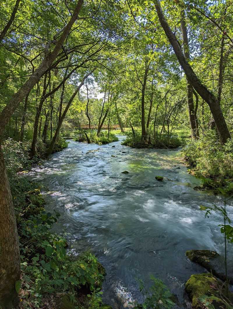
Clear water makes wildlife watching almost effortless. Fish stay visible instead of vanishing into murk.
Roughly 112 fish species live in these waters. Nearly 200 bird species pass through or nest in the surrounding forest.
Great blue herons stalk the shallows with impressive patience. River otters and beavers surprise paddlers who stay quiet.
Close to 60 mammal species live within the park boundaries. Amphibians and reptiles add dozens more, including salamanders that thrive in cool spring water.
A handful of venomous snakes live here too. Watching where hands and feet land on rocky banks solves most concerns.
More than 1,000 plant species fill the hollows and bluff faces. Ferns sprout straight out of rock cracks near the springs.
Early morning and late evening bring the most activity. Midday heat sends many animals into the shade.
Binoculars pay off on slow float days. So does simply drifting without paddling for a stretch.
Feeding wildlife stays off-limits, for their health and everyone’s safety. Observing from a respectful distance keeps the whole scene natural.
Over Four Hundred Caves Underfoot
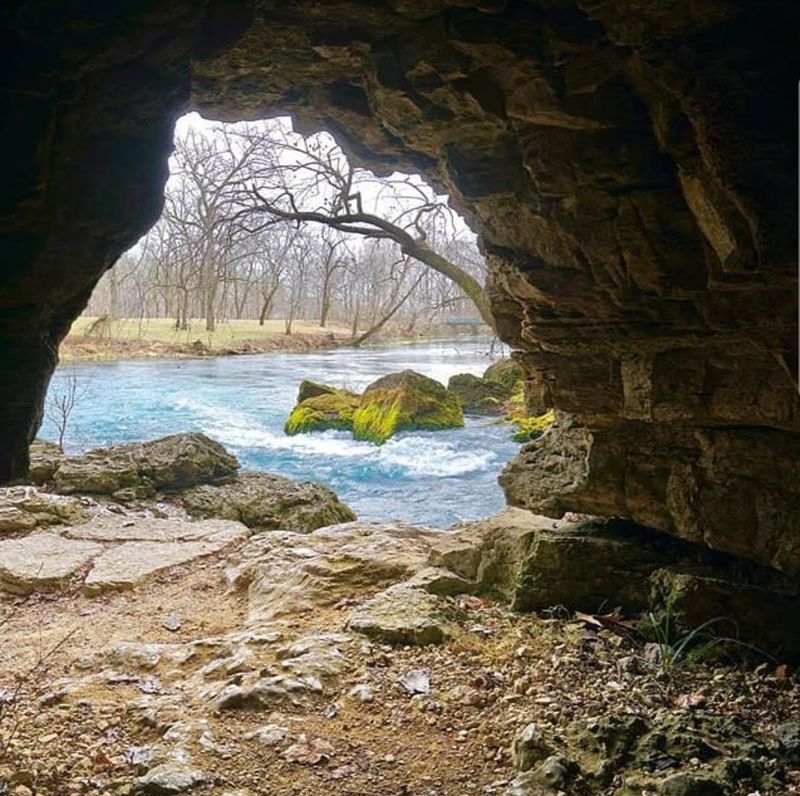
The clarity above ground has a twin below it. Karst rock riddles this landscape with hollow spaces.
More than 400 documented caves sit inside the park. Some hold streams, others hold formations built drop by drop over long stretches of time.
Round Spring Cavern has drawn visitors for its ranger-led lantern tours during summer months, though cave access can shift with seasonal conditions and infrastructure repairs, so checking current status before planning a visit is worthwhile.
Devil’s Well stands out as one of the more unusual features, a huge underground lake viewed from above. Jam-Up Cave carries a name nobody forgets.
Many caves stay closed to the public. Fragile formations and sensitive bat habitat need protection, and closures can change from season to season.
Checking current cave access before a trip prevents disappointment. Availability shifts with conservation needs and staffing.
Cave temperatures stay cool regardless of summer heat. A light jacket beats shivering through a tour.
Sturdy shoes handle damp, uneven floors much better than sandals. Cameras work, though low light tests most phones.
Underground, the story of this Missouri landscape gets even stranger.
Old Mills Still Standing By The Water
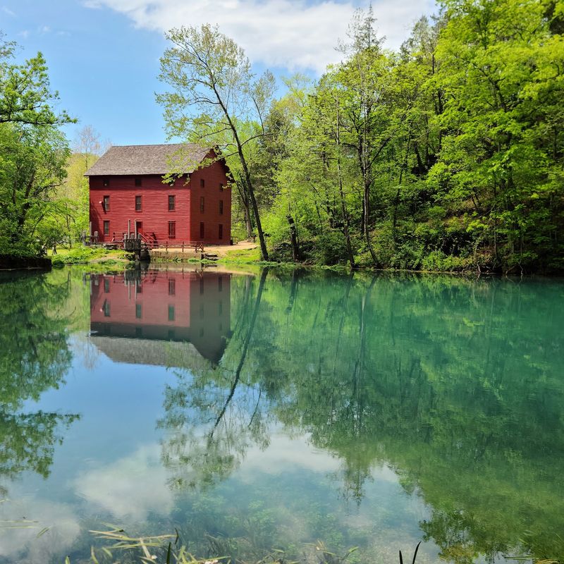
A bright red building beside turquoise water tends to stop traffic. Alley Mill does exactly that.
Spring flow once powered its machinery, grinding grain for local families. The structure remains one of the most photographed landmarks in the park.
Klepzig Mill offers a rougher, smaller counterpoint. Built along a rocky creek, it shows the scrappier side of Ozark engineering.
Both sites explain something useful about the region. Settlers built where the water ran reliably, and springs never quit.
Old homesteads and scattered ruins turn up elsewhere along the rivers. Paddlers occasionally spot foundations tucked into the trees.
Pulltite Spring sits near a historic log cabin dating back more than a century, a favorite stop for floaters curious about the area’s past.
Photography works best in morning light at Alley Mill. Crowds thin considerably outside peak summer weekends.
Interpretive programs run seasonally at several developed sites. Rangers fill in details that signs cannot cover.
Combining a mill visit with a spring walk makes an easy half-day outing. History and geology sit side by side across this stretch of Missouri.
Planning A Trip That Actually Works
One common mistake trips up first-timers. Plugging the headquarters address into a GPS does not lead to a scenic overlook.
That location functions as an administrative office, not a visitor center. Better targets include Big Spring, Alley Spring, Round Spring, or a specific trailhead.
Some access roads narrow into steep gravel or dirt lanes. Drivers uncomfortable with rough surfaces should stick to the paved, well-marked sites.
Summer draws the biggest crowds, especially on weekends. Cold spring water feels fantastic when temperatures climb into the nineties.
Fall brings color and quiet, and spring delivers strong flows with fresh greenery. Winter trades company for solitude, and the water stays clear.
Camping options range from developed campgrounds to gravel bars along the river. Regulations vary by area, so checking current rules matters.
Pack bug spray, sunscreen, water, and a paper map. Phone service drops out across much of the park.
Leave No Trace habits keep the rivers looking the way they do. Packing out trash protects the clarity that makes this Missouri park worth the drive.