
The Small Tennessee Town That Built An Entire Community Around A Gorgeous Waterfall
What happens when a river cuts through limestone for a hundred years? People show up, and they stay.
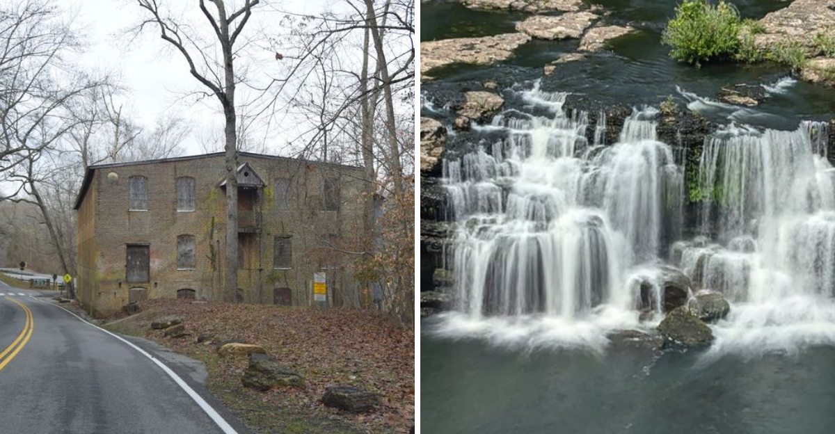
That is exactly what happened in one small corner of Tennessee, where a textile mill once ran on the power of falling water. The mill is long gone, but the falls it depended on are still roaring.
A dam, a lake, and generations of families later, this spot grew into something bigger than a scenic overlook. It became a full blown community built around cascades, swimming holes, and river bends that locals still brag about today.
Cabins line the water. Campgrounds fill up fast in warmer months.
Kayakers chase the rapids below the dam while anglers work the calmer stretches upstream. It is a place where the landscape did the planning and the people just followed along, building a life around water that never stops moving.
Where Three Rivers Converge
Few geographic features command attention the way a river confluence does.
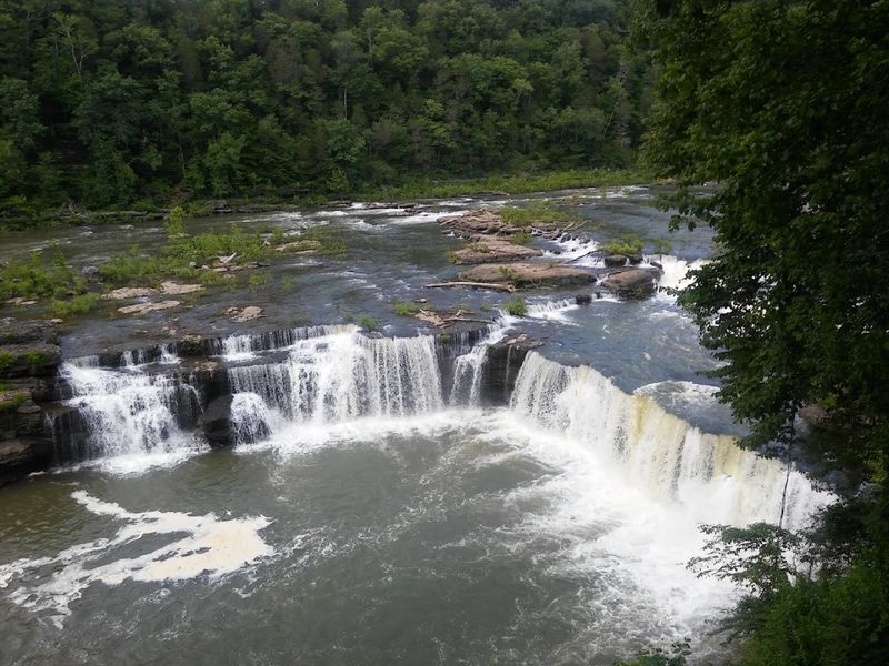
At Rock Island, Tennessee, three separate waterways, the Caney Fork River, the Rocky River, and the Collins River, come together in a dramatic union that shaped every aspect of life in this small Warren County community.
The town itself takes its name from an island sitting just below the point where the Rocky River joins the Caney Fork. That detail matters more than it might seem.
The island created natural channels and currents that early settlers recognized immediately as a source of power and possibility.
Standing at the confluence today, you get a clear sense of the raw geography that made this spot significant long before anyone built anything here. The rivers do not simply meet.
They push against each other, creating a restless energy that still defines the landscape. Water from multiple directions finds a single path forward, and the result is a flow that carved the gorges, fed the falls, and gave this community its defining character.
Geography, in Rock Island, is not background. It is the whole story.
The Ancient Power Of Falling Water
Water falling over rock is one of the oldest forces on earth, and at Rock Island, that force has been shaping the landscape for thousands of years.
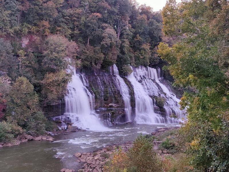
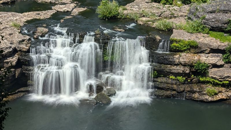
The Great Falls, the centerpiece of Rock Island State Park, drops water over a broad limestone ledge with the kind of authority that makes conversation difficult nearby.
The falls stretch roughly 80 feet wide and drop about 30 feet, though the visual impact feels considerably larger when you are standing at the base looking up.
The sheer volume of water moving through this system, especially after seasonal rains, creates a sound and a mist that you feel before you fully see the falls themselves.
What makes the Great Falls particularly compelling is how they function as both a natural spectacle and a historical engine. For the community that developed here, falling water was not just beautiful.
It was the reason industry arrived, the reason people stayed, and the reason a town grew where one might not otherwise exist.
The power contained in that falling water was recognized early and used deliberately, turning a geological feature into the foundation of an entire way of life.
Twin Falls Is A Natural Wonder Unlike Any Other
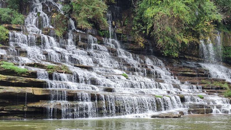
Not every waterfall arrives as a single curtain of water. At Rock Island, the river splits before it falls, producing two distinct channels that drop simultaneously and create what locals and park visitors have long called the Twin Falls.
The effect is genuinely unusual and worth some consideration.
The splitting occurs because of the natural rock formations beneath the river, which direct flow into separate paths before the water reaches the drop point. Each channel has its own character.
One tends to carry more volume, while the other moves with a slightly different angle, making the two falls visually distinct even though they originate from the same source.
Rock Island State Park, located along Highway 136 in Rock Island, Tennessee 38581, preserves this feature as part of a broader landscape that rewards careful attention.
The Twin Falls are not the loudest or the tallest attraction in the park, but they offer something that singular waterfalls cannot: a sense of the river making a choice, dividing itself between two paths before rejoining below.
That small geological drama plays out continuously, regardless of season, and gives the park one of its most photographed and genuinely memorable natural features.
Industrial Echoes Alongside The Caney Fork
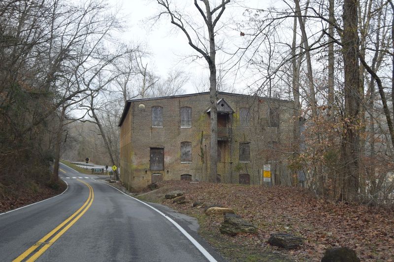
Rivers meant industry in the 19th century, and the Caney Fork River at Rock Island was no exception.
The combination of strong current and significant water volume made this stretch of river attractive to mill operators who understood how to convert moving water into mechanical power.
A textile mill was established at Rock Island in the mid-1800s, and the community that grew around it took on the rhythms of an industrial settlement. Workers lived close to the mill, and the social life of the town organized itself around the schedules and needs of production.
That pattern was common in the rural South during that era, but Rock Island had the added dimension of operating in a landscape of extraordinary natural beauty.
The Great Falls Dam, which still stands today, was constructed to harness the river’s energy more deliberately and on a larger scale. The dam altered the river’s behavior upstream while continuing to support power generation downstream.
Evidence of this industrial history remains visible in the landscape, from old structural remnants to the dam itself, which serves as a reminder that the water powering the falls also powered the ambitions of an entire community for well over a century.
Cliffs, Gorges, And Limestone Grandeur
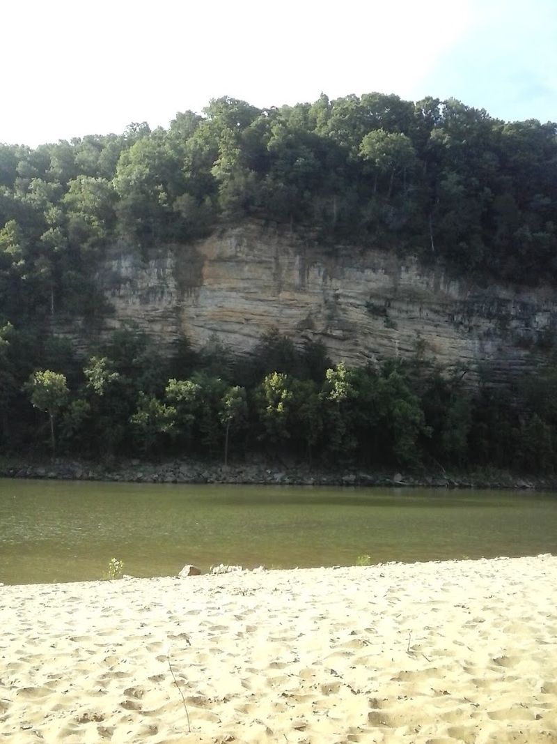
The geology of Rock Island does not announce itself subtly. Limestone cliffs rise above the river gorge with the kind of presence that takes a moment to fully absorb.
These formations were carved over millennia by the same rivers that define the town today, and the result is a landscape of considerable drama.
The gorge along the Caney Fork runs deep in places, with walls of exposed limestone that tell a layered story of ancient seabeds, erosion, and time.
The rock is pale and textured, catching light differently depending on the hour, and the contrast between the stone and the river below creates a visual depth that photographs struggle to capture honestly.
Walking the trails through Rock Island State Park means moving through this geological record at ground level. The paths along the gorge rim offer elevated perspectives, while trails descending toward the water place you inside the landscape rather than above it.
The cliffs are not merely scenic backdrops.
They are the structural result of the same water that feeds the falls, and understanding that connection gives the whole landscape a coherence that makes exploration feel genuinely rewarding rather than simply recreational.
The stone and the water here are inseparable.
Community Life Forged By Waterflow
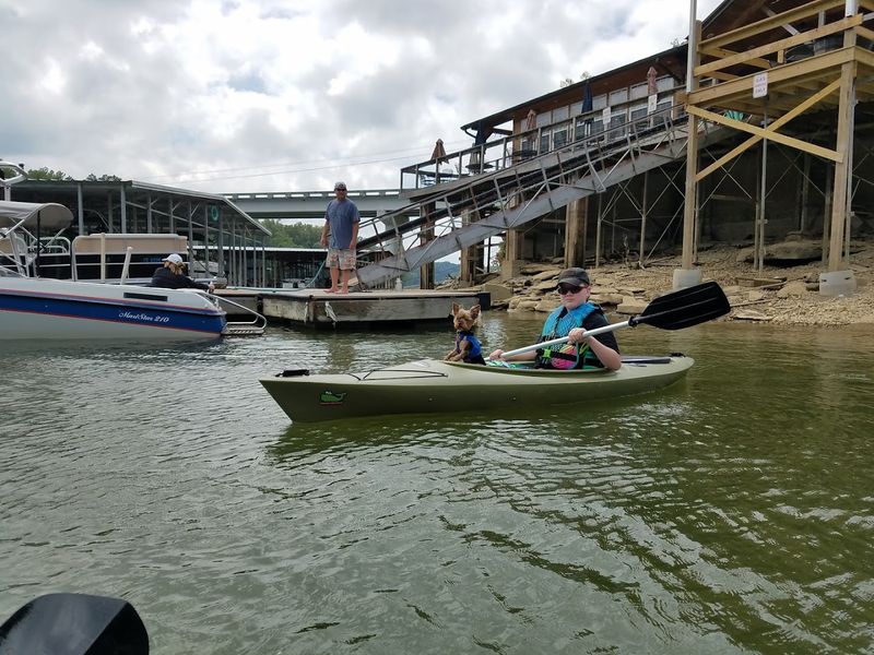
Towns built around water tend to develop a particular kind of identity, one rooted in practical respect for the natural forces that made settlement possible.
Rock Island is an unincorporated community in northeastern Warren County, and its character reflects generations of people who understood that the river was both provider and authority.
The textile mill era shaped the social fabric of the town significantly.
Mill communities in the American South often developed tight internal bonds, where neighbors shared not only geography but also work schedules, economic circumstances, and a common dependence on the same employer.
Rock Island followed that pattern, and the sense of collective identity that emerged from those years did not disappear when the industrial chapter closed.
Today, the community maintains a quiet, grounded quality that feels authentic rather than performed. The population is small, the pace is deliberate, and the relationship between residents and the surrounding landscape remains close.
People here live near the park, near the falls, near the rivers that defined everything before them. That proximity is not incidental.
It is a continuation of the same fundamental arrangement that brought the first settlers to this particular bend in the Caney Fork River generations ago.
A Sanctuary Of Aquatic Adventure
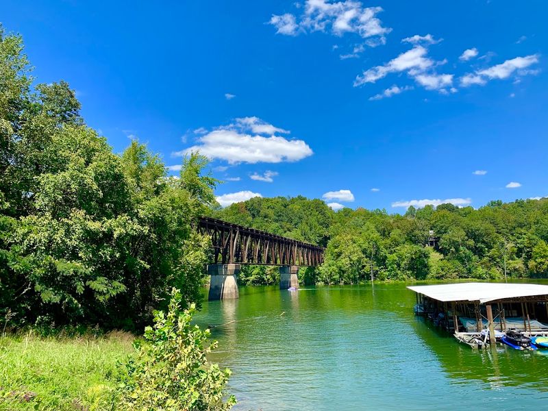
The river at Rock Island does not sit behind a fence. It invites engagement, and the park around it has developed in ways that make that engagement safe and accessible across a range of experience levels.
The clear, blue-green water pooling below the falls has become one of the most recognizable images associated with the park.
Swimming in the natural pools near the base of the falls is a long-established activity here. The water temperature stays cool even in summer, fed by the rivers above, and the clarity of the water in calm sections is genuinely striking.
Kayaking and canoeing are also popular, with the Caney Fork offering stretches of river suitable for both beginners and those looking for more technical paddling.
Fishing draws a steady presence as well. The rivers around Rock Island support populations of smallmouth bass, catfish, and other species that thrive in the cold, clear water moving through the gorge.
The combination of swimming, paddling, and fishing creates a layered recreational identity for the park that extends well beyond simple sightseeing. The water here is not just something to look at.
It is something to move through, and that distinction is central to what makes Rock Island State Park genuinely engaging across seasons.
The Park’s Enduring Legacy
Rock Island State Park has been a formal part of Tennessee’s state park system for decades, and its role in preserving this landscape has only grown more significant as development pressure increases across the region.
The park protects not only the falls and the gorge but also the ecological systems that keep the water clear and the landscape functional.
The park offers camping, picnic areas, and a network of trails that range from easy riverside walks to more demanding ridge-top routes.
That range of options reflects a deliberate effort to make the park accessible without diminishing the natural character that makes it worth protecting in the first place.
The balance is not always easy to maintain, but Rock Island State Park has managed it with reasonable consistency over the years.
What the park ultimately represents is a formalization of the relationship between this community and its water. Long before state designation, the falls and rivers were the reason people came and stayed.
The park simply codified that connection, gave it infrastructure and protection, and ensured that the waterfall at the center of Rock Island’s identity would remain intact for future generations.
That is a legacy worth acknowledging, and one that continues to define this small but genuinely distinctive Tennessee community.