
These Tennessee Hikes Lead To The Ruins Of Forgotten Mills, Mines, And Mountain Settlements
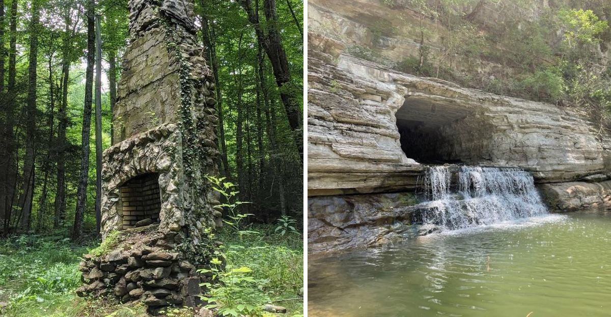
History does not always live in a museum. Sometimes it waits at the end of a trail, half swallowed by moss and time.
Tennessee holds an entire collection of places where people once built, worked, and lived, only for nature to slowly reclaim everything they left behind. Walking these paths feels less like exercise and more like time travel.
Old mill foundations sit quiet beside creeks that once powered them day and night. Mine entrances disappear into hillsides, their stories buried alongside the men who once worked there.
Entire settlements crumble into stone chimneys and scattered foundations, evidence that families once called these remote spots home. Every ruin raises a question about who lived there and why they eventually left.
Bring curiosity and sturdy shoes, because gravel and roots make footing tricky in places. These trails reward patient hikers willing to look past the obvious and imagine what once stood there.
History rarely announces itself this clearly anywhere else.
1. Wilhoite Mill Trail At Henry Horton State Park, Chapel Hill
Along the banks of the Duck River, a quiet trail hides one of Middle Tennessee’s most overlooked industrial relics.
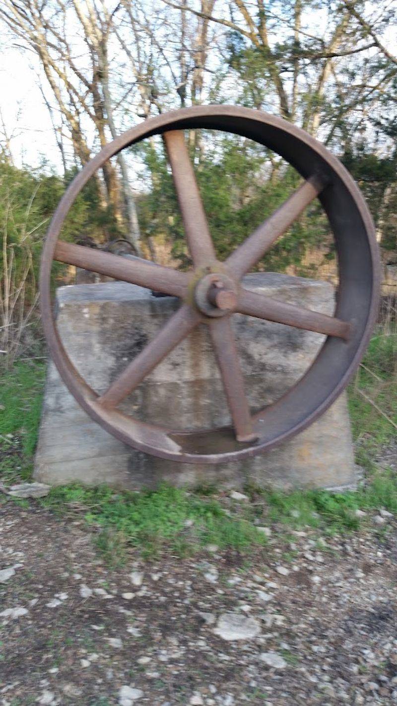
The Wilhoite Mill Trail at Henry Horton State Park in Chapel Hill winds about 0.7 miles through shaded forest to the stone foundations of a grist and sawmill that once served the local farming community for over a century.
John Wilhoite built the original structure starting in 1846, and the operation kept grinding even through the Civil War, which says something about how essential it was to everyday life here.
Union soldiers reportedly destroyed sacks of flour during a brief encounter, yet the mill carried on.
Floods and fire eventually did what soldiers could not, taking down two successive mills on this site.
What remains today is scattered but evocative. Large shafts, old cedar timbers, and original bridge piers sit within and beside the Duck River, and the old bridge remnants add a quiet drama to the scene.
The trail itself is easy enough for most hikers, making it a great choice for families who want history without a grueling climb.
Standing beside those river-worn foundations, it is hard not to picture the rhythmic turning of the millstone and the farmers who depended on it.
2. Enclosure Trail At Old Stone Fort State Archaeological Park, Manchester
Two thousand years of human history converge at a single trailhead in Manchester, Tennessee.
The Enclosure Trail at Old Stone Fort State Archaeological Park loops about 1.4 miles around a prehistoric earthwork built by Woodland Indians.
It’s a ceremonial structure so massive and so carefully placed between two rivers that archaeologists still debate its exact purpose.
What makes this trail especially compelling for history hunters is the second layer of story hiding beneath the ancient one.
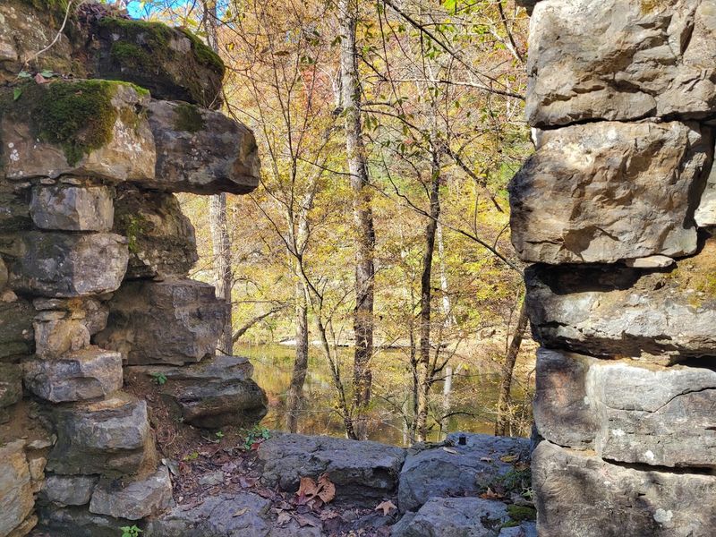
As the path follows the Duck and Little Duck Rivers, it passes the stone foundations of the Stone Fort Paper Company, an 1879 industrial operation that supplied newsprint to major publications across the Southeast.
The mill used the river’s force to power its machinery, much like the ancient builders used the water as a natural boundary for their enclosure.
Three waterfalls punctuate the route, including Big Falls, Blue Hole Falls, and Step Falls, giving the trail a rhythm that keeps the walk feeling fresh around every bend.
The combination of prehistoric mystery and 19th-century industry packed into one short loop is genuinely rare.
Few trails in the state offer this kind of layered storytelling, where ancient ceremonial builders and paper mill workers share the same piece of earth.
3. Lower Piney River Trail, Spring City
Following an abandoned narrow-gauge railroad through dense forest is already a compelling reason to hit the Lower Piney River Trail near Spring City, but the mining remnants scattered along the way make it genuinely memorable.
This section of the Cumberland Trail traces the route that once carried coal and supplies through the Piney River valley, and the forest has not quite finished swallowing the evidence.
Old mine openings appear along the route, accompanied by rubble piles and concrete construction remains that hint at the scale of operations that once ran through here.
The trail threads through mountain laurel, rhododendron, hemlock, and hardwoods, so even the industrial history is framed by remarkable natural beauty.
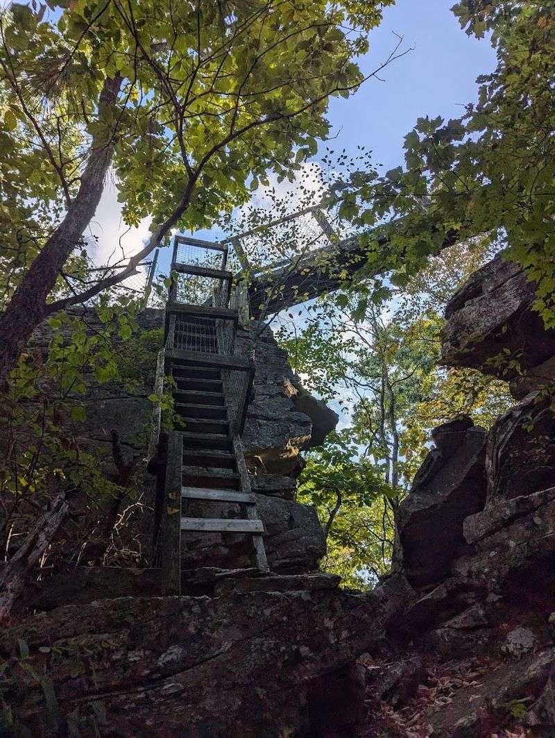
Multiple stream crossings and scenic cascades keep the pace interesting, and a 100-foot suspension bridge over the Piney River offers one of the better photo moments on any Cumberland Trail section.
One practical note worth knowing before you go: the former Newby Branch access is permanently closed due to private property restrictions. All hikers must start at Shut In Gap Road and plan for an out-and-back return on the same path.
That format actually works in the trail’s favor, since the ruins and river scenery look entirely different from the opposite direction.
4. Soddy Creek Gorge South Trail, Soddy Daisy
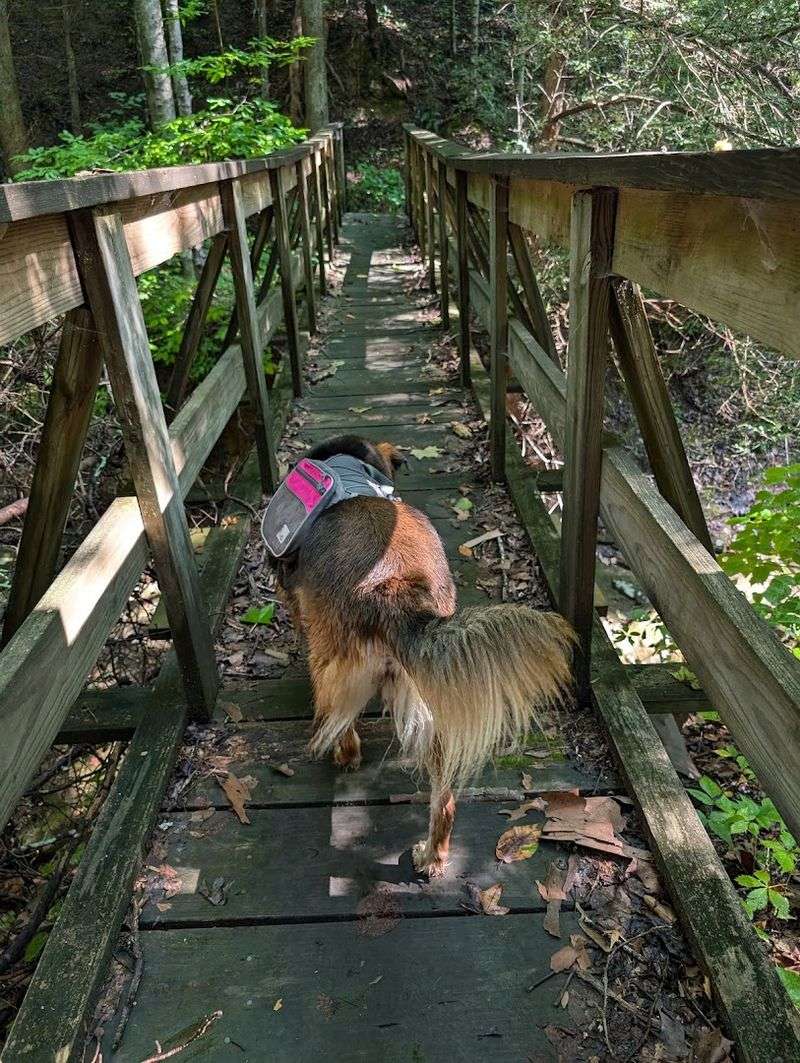
Coal has shaped this corner of Tennessee since before the Civil War, and the Soddy Creek Gorge South Trail makes sure you feel that weight with every step.
Running through the Little Soddy Historic Mining Area near Soddy Daisy, this rugged Cumberland Trail section winds past relics of an industry that put this valley on the map as far back as 1866.
Mining roads cut through the terrain like old scars, and large dirt mounds of tailings mark where the earth was turned inside out to extract coal.
Remnants of old rail routes snake through the vegetation, and features tied to the former No. 7 Mine appear along the way, including ore car paths that once rattled with loaded carts.
The valley supported multiple operations across several decades, and the landscape still carries that industrial density in its bones.
What surprises most people is how dramatically beautiful the gorge itself is. Rock formations rise sharply above the trail, creek sounds echo through the valley, and the escarpment views open up in ways that feel almost theatrical.
This is not a gentle stroll; the trail is demanding enough to keep casual hikers honest. But for anyone willing to earn the experience, the payoff is a raw and honest portrait of a Tennessee that most people never knew existed.
5. Laurel Snow Trail, Dayton
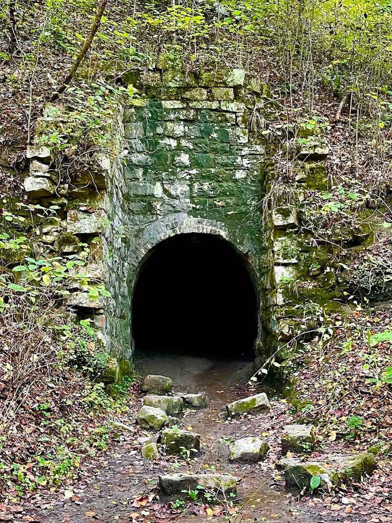
The Laurel Snow Trail near Dayton begins on flat, easy ground that gives no hint of what lies ahead.
That smooth start is actually an old railroad bed, the same one used to haul coal out of these mountains when the Dayton Coal and Iron Company was running seven mines, 375 coke ovens, and 17 miles of rail through this rugged landscape in the late 1800s.
As the trail pushes deeper into the 2,259-acre natural area, the industrial past becomes impossible to ignore.
Entrances to the Richland Mine and Dixon Slope Mine appear along the route, dark openings that look almost inviting until you remember that unstable ground, crumbling infrastructure, and dangerous air make entry genuinely hazardous.
These mines must never be entered, full stop. Near the trailhead, overgrown coke ovens still dot the terrain, their beehive shapes slowly disappearing under decades of vegetation.
Tennessee’s first designated National Recreation Trail, Laurel Snow rewards those who push through with stunning gorge scenery and a pair of waterfalls that make the whole place feel worlds away from its industrial history.
The contrast between the natural beauty and the remnants of hard labor makes this one of the most thought-provoking hikes in the state.
6. The Narrows Tunnel Trail At Harpeth River State Park, Kingston Springs
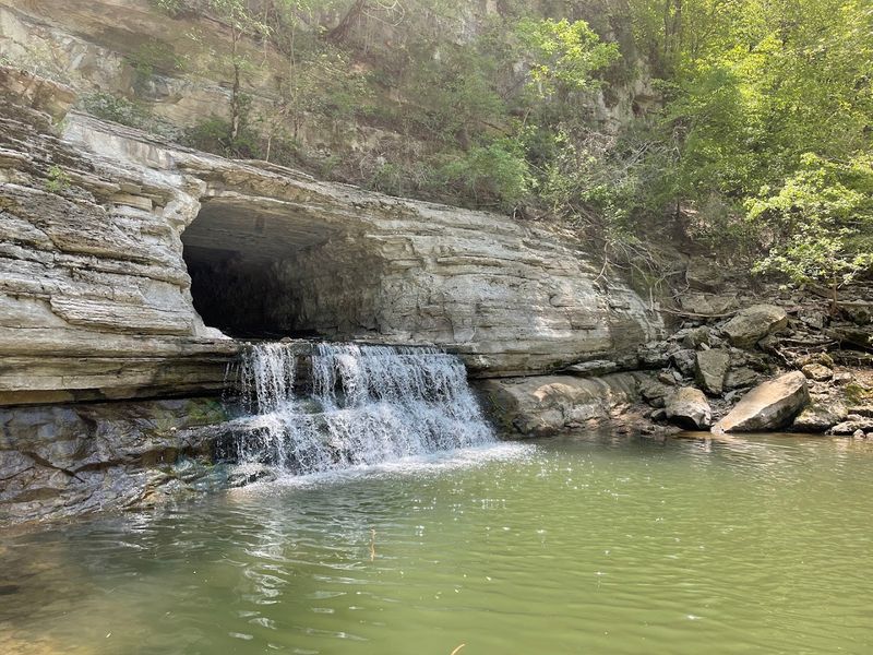
Carved by hand through 290 feet of solid limestone in 1819, the Montgomery Bell Tunnel at Harpeth River State Park near Kingston Springs is the kind of engineering feat that stops you cold when you see it.
A short quarter-mile trail leads directly to this passage, widely regarded as the first full-scale tunnel built in the United States for industrial water diversion.
Montgomery Bell, a powerhouse of early American iron production, had the tunnel cut to redirect the Harpeth River and create a water drop powerful enough to run his Pattison Forge.
The forge was named after his mother’s maiden name, a personal touch that adds a human dimension to what is otherwise a story of industrial ambition.
Wrought iron produced here became a vital material in the growing young nation.
The forge itself no longer stands, swept away by a flood in the mid-1890s, but the tunnel remains in remarkable condition and carries both National Historic Landmark and Historic Civil Engineering Landmark designations.
The natural setting adds to the experience, since the Harpeth River makes a dramatic horseshoe bend here, looping back within a short distance of itself and creating what locals call the Narrows.
It is one of those rare places where the landscape and the history feel perfectly matched.
7. Little Brier Gap Trail To The Walker Sisters Cabin, Townsend
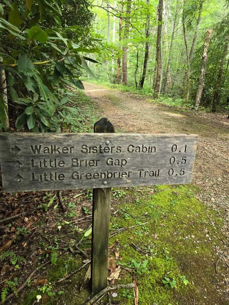
Some places carry a story so specific and so human that they stop you in your tracks. The Walker Sisters homestead, reached by the 2.6-mile roundtrip Little Brier Gap Trail near Townsend in Great Smoky Mountains National Park, is one of those places.
The cabin at the center of it all dates to parts built in the 1840s, with significant expansion by John Walker after he moved the family onto the property in 1870.
His seven daughters, Margaret, Polly, Martha, Nancy, Louisa, Sarah Caroline, and Hettie, became something of a legend in these mountains.
When the national park was established in the 1930s and families were relocated off the land, the Walker Sisters refused to go.
They negotiated a lifetime lease and continued farming, preserving, and living by hand on their 122-acre property well into the 1960s, long after electricity and modern conveniences had transformed the world outside their hollow.
The property once included a barn, springhouse, smokehouse, corncrib, pig pen, apple barn, blacksmith shop, and a small tub mill, making it a fully self-sustaining mountain homestead.
Much of that is gone now, but the cabin still stands, listed on the National Register of Historic Places.
Walking through this clearing, you get the rare sense that the women who lived here were not relics of the past but simply people who knew exactly what they valued.
8. Jakes Creek And Little River Trails At Elkmont, Gatlinburg
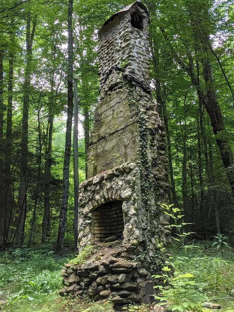
Elkmont started as a logging camp and somehow ended up as one of the most fashionable mountain retreats in the early 20th century South.
This area went from timber operation to vacation colony almost overnight, drawing wealthy Knoxville families who built summer cabins along Jakes Creek and the Little River in the years following the Little River Lumber Company’s arrival.
The Jakes Creek Trail and Little River Trail pass through what remains of that world, and the ruins are genuinely evocative. Stone walls emerge from the undergrowth.
Chimneys stand without houses around them, pointing at the sky like quiet monuments.
Foundations mark the outlines of cabins that once hosted members of the Appalachian Club and guests of the Wonderland Hotel, where prominent figures came to escape the summer heat.
Several restored structures near the trailheads, including the Appalachian Clubhouse and Spence Cabin, give context to what the community looked like at its height.
The Jakes Creek Trail runs about 3.7 miles, while the Little River Trail extends roughly 6 miles, offering options for different energy levels and time commitments.
Walking through Elkmont feels like wandering through a polite ghost town, one where the forest has moved in gracefully and the ruins wear their age with quiet dignity.
9. Old Settlers Trail In Greenbrier, Gatlinburg
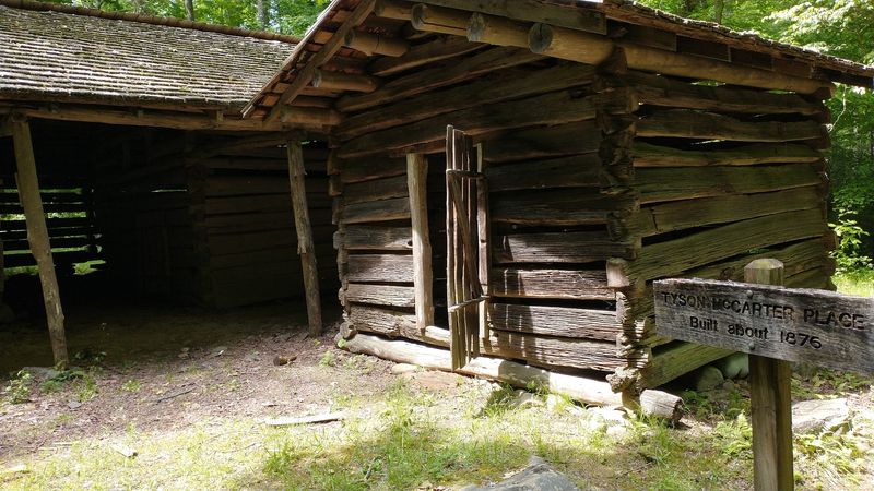
At roughly 15.8 miles, the Old Settlers Trail in the Greenbrier section of Great Smoky Mountains National Park near Gatlinburg is not a casual afternoon outing.
It is a serious mountain hike through the heart of what was once a thriving Appalachian community, and every mile delivers something that rewards the effort.
The Greenbrier area supported hundreds of farming families in the late 1800s and early 1900s, complete with churches, schools, stores, and sawmills.
The trail follows the same corridors those families walked daily, and the evidence of their lives surfaces constantly along the route. Crumbling foundations mark where houses stood.
Family cemeteries appear in forest clearings, their weathered gravestones still legible if you take time to look closely. Carefully laid stonework that once defined property lines and livestock enclosures now borders the trail like a silent map of the past.
Near the Maddron Bald Trail junction, the Tyson McCarter Place preserves remnants of a drive-through barn and corn crib, structural details that make the homestead feel tangible rather than abstract.
The forest has been reclaiming this land for nearly a century now, and the result is a landscape that feels both wild and deeply inhabited.
For hikers who want history to feel personal and earned, this trail delivers exactly that.