
This 23.7-Mile New York Rail Trail Winds Through Stunning Towns, Forests And Historic Railroad Country
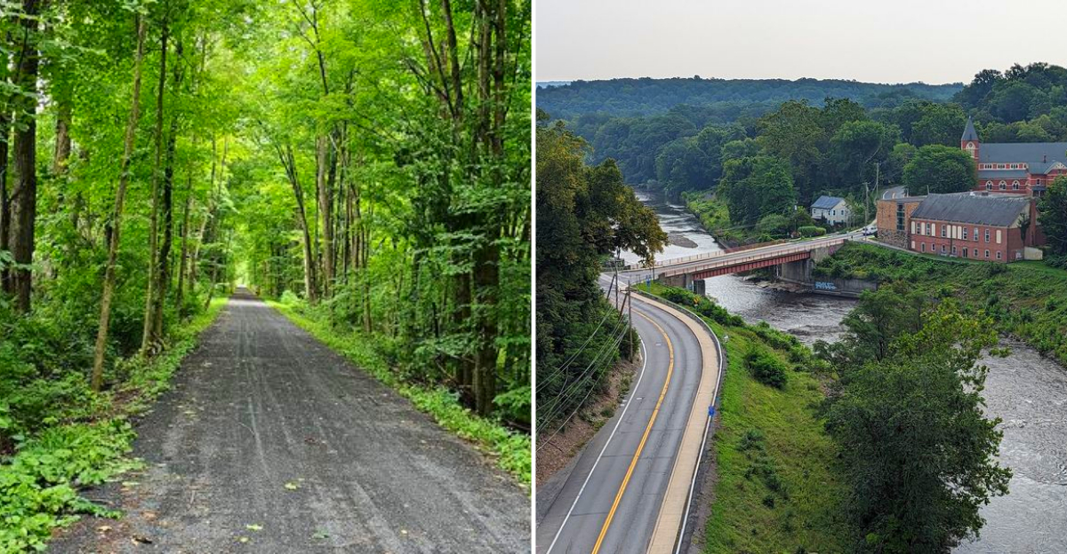
Old train tracks in New York once carried freight and passengers through farm country, and today one of those routes carries people on foot, on bikes, and on horseback instead. A railroad line usually stops being useful once the trains are gone. Not this one.
Nearly 24 miles of old track bed now carry bikes, hikers, and horseback riders through farmland and quiet woods. New York gave this route a second life. The path stays mostly flat, which means the scenery gets your attention instead of a steep climb.
The best stretches feel like little chapters of the same trip. One moment brings open fields, then a small downtown appears, followed by a bridge rising high above the creek below. Old railroad history stays close without turning the outing into a lesson.
You can cover a short section or make a full day of it. Either way, the route keeps giving you reasons to continue past the point where you planned to turn around.
A Railroad Corridor Reborn As Something Better
Trains ran this route for more than a century, hauling apples, hay, cement, and people through the Hudson Valley. The last one rolled through in 1977, and what could have vanished became a 23.7 mile linear park instead.
Railroad grades never climb steeply, since locomotives dislike hills as much as tired legs do. That single fact makes the whole corridor gentle enough for a six year old on a first two wheeler and satisfying enough for a rider chasing serious mileage.
Forests close in overhead for long shaded stretches, then release you into open farmland where the Shawangunk Ridge rises pale and stony on the western skyline. The Wallkill River drifts alongside for miles, quiet and green.
Four communities sit along the route, each with its own accent and appetite. You can walk two miles and turn around, or commit to the full run across Ulster County in New York.
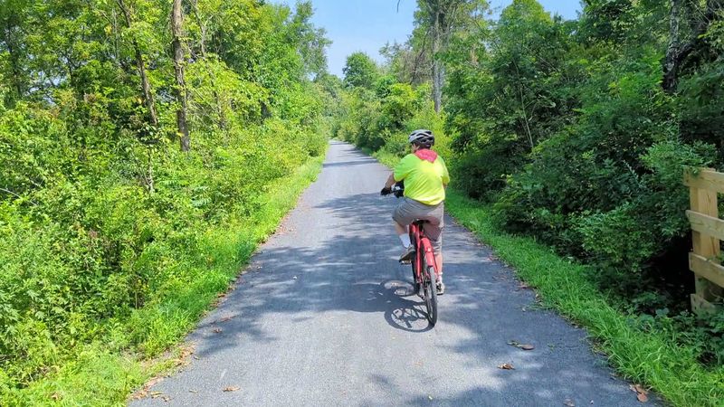
The surface is mostly crushed stone, packed firm and easy underfoot. No motors are allowed, so the loudest thing you will hear is usually a woodpecker working overtime on a dying limb of oak.
Meet The Wallkill Valley Rail Trail
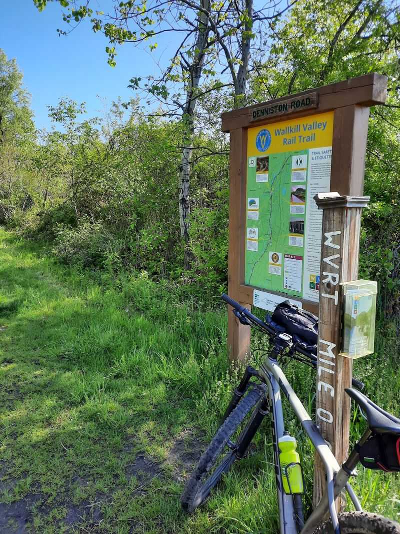
Officially, the whole corridor answers to the name Wallkill Valley Rail Trail, and the southern anchor sits at Wallkill Valley Rail Trail, Gardiner, NY 12525. That pin marks the beginning of a route that runs north to the Kingston city line.
The Wallkill Valley Railroad opened after the Civil War and carried traffic from 1866 until 1977. Volunteers, land trusts, and towns did the patient work of turning rusting rail bed into public pathway.
Ratings hover around 4.7 stars, which is rare for anything 23.7 miles long. Regulars praise the scenery, the shade, and the sheer variety packed into a single corridor.
Access points appear at regular intervals, so you never have to walk the whole thing in one push. Mile markers stand along the route and make it simple to track your progress.
Gates stay open around the clock, though most people stick to daylight for obvious reasons. Dogs are welcome on leash, and plenty of them treat the trail as their personal social hour with every passing stranger.
Gardiner Sets The Tone At The Southern End
Small and unhurried, Gardiner makes a fine opening act. The village sits on Route 44/55, and parking for the trail waits just north of that road, off 2nd Street, where a trailhead sign points the way.
Seasoned regulars share one piece of advice worth repeating. The very southern tip of the corridor has no parking and a rougher, muddier surface, so start from town and head north for the good stuff.
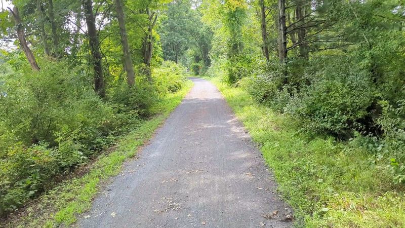
Another solid option is grabbing a spot near the Gardiner Library, which gives you the freedom to travel either direction. From there the crushed gravel runs firm and wide.
Fields open up quickly once you leave the buildings behind. The Wallkill River keeps pace off to one side, and the Shawangunk cliffs glow amber in late afternoon light.
Road crossings do appear, so keep your head up and slow down at each one. Otherwise the walking is flat, calm, and easy on the knees, the kind of morning that ends with coffee and zero complaints.
New Paltz Brings The Buzz
College energy hits you before the storefronts do. New Paltz hums with students, cyclists, farmers, and climbers heading for the cliffs, and the trail runs right through the middle of it all.
Some sections here are paved asphalt, a smooth surprise after miles of stone. Bike shops, bakeries, and restaurants sit within a short walk of the corridor, and Water Street Market gathers a good cluster of them in one spot.
Trail junctions make this village a genuine hub. The Empire State Trail links in here, and the River to Ridge Trail heads west toward Mohonk Preserve and Minnewaska for anyone who wants real elevation.
Sojourner Truth Park offers a breather beside the water, with launches for kayaks and canoes onto the calm Wallkill River. Paddling and pedaling in one day is entirely doable.
Municipal parking makes New Paltz a practical starting point too. Ride south toward Gardiner for shade and quiet, or north toward Rosendale for the headline attraction waiting a few miles up the line.
Huguenot Street Holds Three Centuries
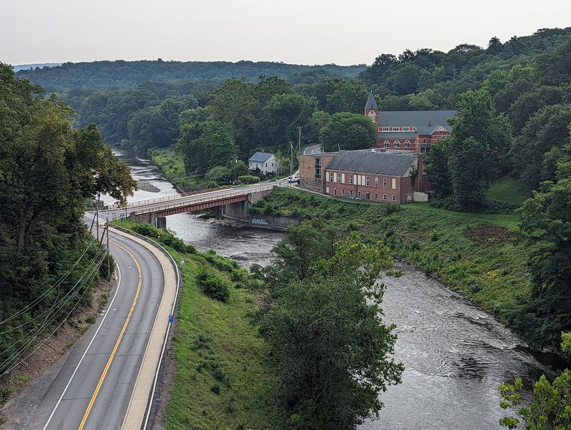
A short detour off the trail leads to one of the oldest neighborhoods in the country. Huguenot Street Historic District in New Paltz claims the title of oldest continuously inhabited street in the United States.
Thick stone houses line the road, built by French speaking Huguenot families who settled here in the late 1600s. Their walls have outlasted revolutions, railroads, and roughly three hundred winters.
A reconstructed 1717 stone church anchors the site, and a museum fills in the human details behind the architecture. Guided tours run seasonally and explain how these families farmed, traded, and lived along the Wallkill.
The contrast is what makes the stop memorable. One minute you are cruising a converted rail bed, the next you are standing on ground that predates the entire concept of a locomotive.
Plan an hour if you want to look properly. Bike racks and shade are available, and the walk from the trail is short enough that nobody in your group will grumble about the extra steps.
Rosendale’s Cement Legacy Runs Deep
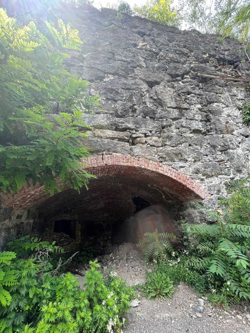
Ever wonder what holds up the Brooklyn Bridge? A good share of the answer came out of the ground right here. Rosendale natural cement built that bridge, the base of the Statue of Liberty, and plenty more besides.
Limestone from Joppenbergh Mountain fed the industry, and that peak rises nearly 500 feet above the hamlet. Old kilns and mine openings still sit near the trail, mossy and quietly impressive.
Cool air spills out of the mine entrances even in August, a natural air conditioner courtesy of geology. Hikers who pause there often linger longer than planned.
The Binnewater Historic District adds another chapter, with structures tied to the quarrying and shipping operations that once ran nonstop through this valley.
Farmland fills the miles between New Paltz and Rosendale, so the shift into industrial history feels sudden and interesting.
Rosendale itself is compact and welcoming, with a walkable main street and the Rail Trail Cafe serving locally sourced food and, some evenings, live music.
The Rosendale Trestle Steals The Show
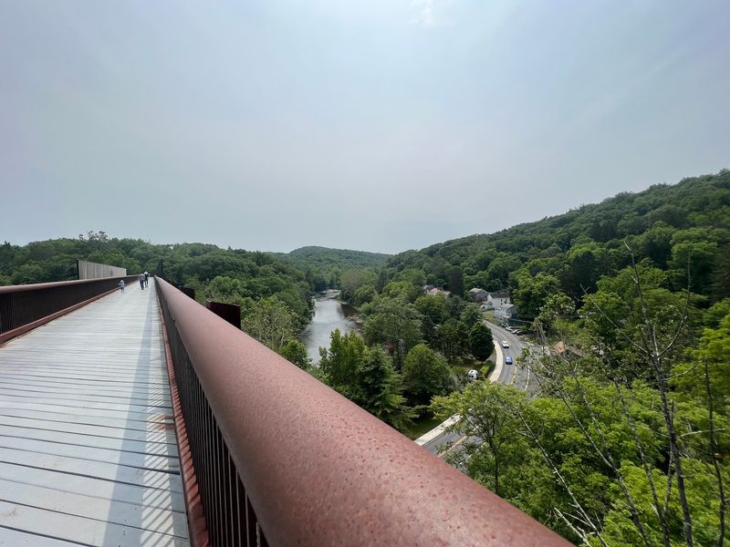
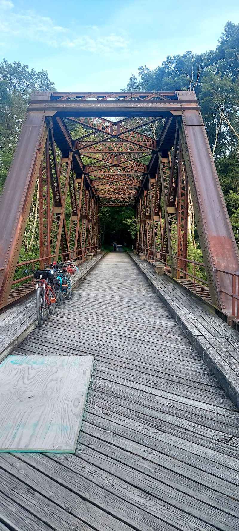
Nothing else on the corridor comes close. The Rosendale Trestle stretches 940 feet across the valley and floats 150 feet above Rondout Creek, and crossing it is the reason many people come at all.
Built for trains, it once ranked as the highest span bridge in the United States. Decades of disuse followed, then a restoration brought it back for foot and bike traffic in 2013.
Views open in every direction from the middle. Treetops sit below you, the creek winds along the valley floor, and the ridgeline stacks up in the distance like a paper cutout.
Railings run the full length, so the crossing feels secure even if your stomach registers the height. Kids tend to sprint across, adults tend to stop and stare.
Morning fog and October color are the two peak conditions, though honestly there is no bad time. Park just north of Rosendale and you can reach the trestle within minutes, which is the shortcut every visitor eventually learns.
Northward To Kingston’s City Line
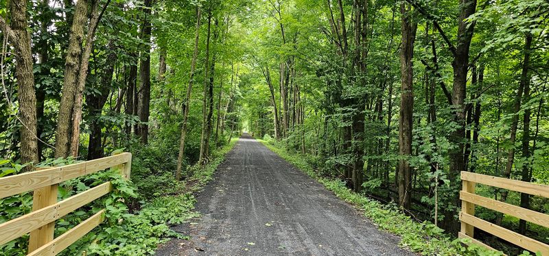
Quiet returns north of Rosendale. The trail rolls through the town of Ulster on freshly laid stonedust, a smooth surface that rides like a dream compared with older sections.
Trees crowd close for long stretches, and the traffic thins out considerably. Riders looking for uninterrupted rhythm often name this their favorite part of the whole corridor.
The official route wraps up at a parking area near the Kingston city line. That does not have to be the finish, though.
A two mile road connection brings you into Kingston’s Stockade District, where stone buildings from the 1600s share blocks with restaurants, bookshops, and galleries. Kingston is bike friendly and easy to navigate on two wheels.
Regional connections keep the options open too. The O and W Rail Trail branches off nearby and adds more miles for anyone who is not ready to stop pedaling.
Ending in a real city has practical perks. Food, restrooms, and a proper sit down meal all wait at the top of the route, which beats a granola bar in a parking lot every single time.
Smart Planning Makes The Miles Fly
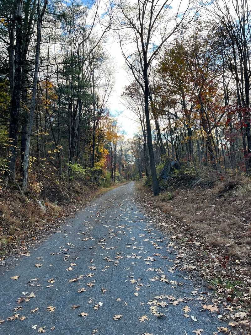
Tire choice matters more than fitness on this route. Mountain bikes and hybrids handle the crushed stone happily, while skinny road tires will make you regret every decision leading up to that moment.
Because the corridor is linear rather than a loop, plan your return. Backtracking is the simple answer, though a two car shuttle turns a long day into a one way glide.
Benches are scarce in the southern half, and restrooms are limited outside the towns. Pack water, snacks, and sunscreen before you roll out.
Seasons change the personality completely. Spring brings wildflowers along the riverbank, summer delivers deep shade, autumn lights the whole valley up, and winter turns the surface into a route for cross country skis and snowshoes.
Rain can wash out short sections and leave soft patches, especially near the southern tip. Give the trail a day to drain after heavy weather.
Most of all, resist the urge to rush. This New York corridor rewards the wanderers, the snack stoppers, and anyone willing to read an interpretive sign twice.