
This 24.9-Mile Scenic Tennessee Route Follows A Historic Railroad Grade Through River Gorges And Woodlands
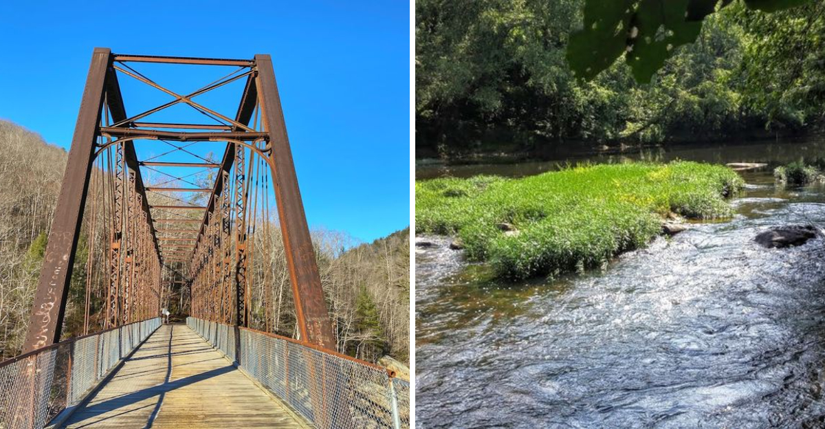
Tennessee holds a stretch of ground that used to carry steam engines instead of hikers. Steel rails once hauled coal and timber through this stretch of the Cumberland Plateau, and today the old grade carries walkers, bikers, and riders instead.
The route stays close to the water for most of its length, tracing a path beside sandstone bluffs and river bends that shift with every mile. Spring brings wildflowers along the banks.
Autumn turns the canopy into a wall of color that stretches for miles. Wildlife shows up often too, from herons wading the shallows to deer stepping quietly through the trees.
The terrain rolls gently in places and climbs sharply in others, so hikers get a real workout without needing technical skill. What makes this route stand out is the sense of time travel it offers.
Every bend feels like a page pulled from an old logging ledger, except now the only cargo moving through is curiosity.
A Railroad’s Legacy Through Tennessee’s Wilderness
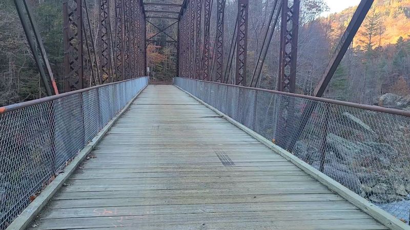
Long before hiking boots and mountain bikes claimed this corridor, coal cars and timber loads rolled through the same terrain.
The Oneida and Western Railroad, commonly called the O&W, began construction on November 4, 1913, in Oneida, Tennessee, connecting with the Cincinnati Southern Railway to move raw materials out of some of the most remote land in the eastern United States.
The railroad operated for just over four decades, finally running its last train on March 31, 1954.
What brought it down was a combination of forces: the Great Depression slowed demand, automobiles offered new mobility, roads improved steadily, and the virgin timber that once justified the line had been largely exhausted.
What remained after the rails were pulled was the grade itself, a remarkably intact earthen corridor running through Big South Fork country.
Today, that same pathway serves hikers, cyclists, and equestrians exploring the Big South Fork National River and Recreation Area.
The 24.9-mile scenic route preserves the physical memory of an industrial era that shaped this part of Tennessee more than most visitors realize when they first set foot on the trail.
This Historic Bridge Design Still Feels Like a Marvel Every Time You See It
The bridge itself is the kind of structure that stops people mid-sentence.
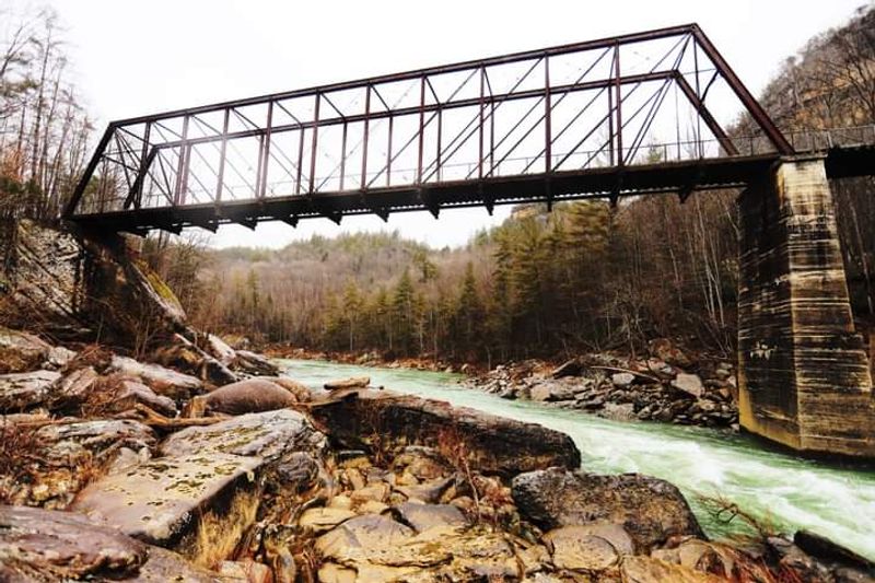
Spanning the Big South Fork of the Cumberland River at O and W Rd, Oneida, TN 37841, the O&W Bridge is a Whipple through truss design, a style originally built in the 1880s for a different railroad entirely.
In June 1915, the Nashville Bridge Company relocated and reassembled it at its current site for the newly laid O&W line.
What makes this bridge particularly unusual is its material. It was constructed of iron rather than steel, which was already the industry standard by that point.
One end of the bridge rests on a large natural boulder, a detail that gives the structure an almost improvised quality that somehow makes it more impressive, not less.
The O&W Bridge is listed on the National Register of Historic Places and is considered one of the last remaining Whipple through truss bridges in the entire country. Visitors can walk across it and look down at the river moving through the gorge below.
Note that vehicular access was closed in autumn 2024 due to a condemned bridge on Pine Creek along O&W Road, though a replacement was nearing completion as of early 2026.
A Working Railroad Once Ran Here, Now It Welcomes Hikers Instead
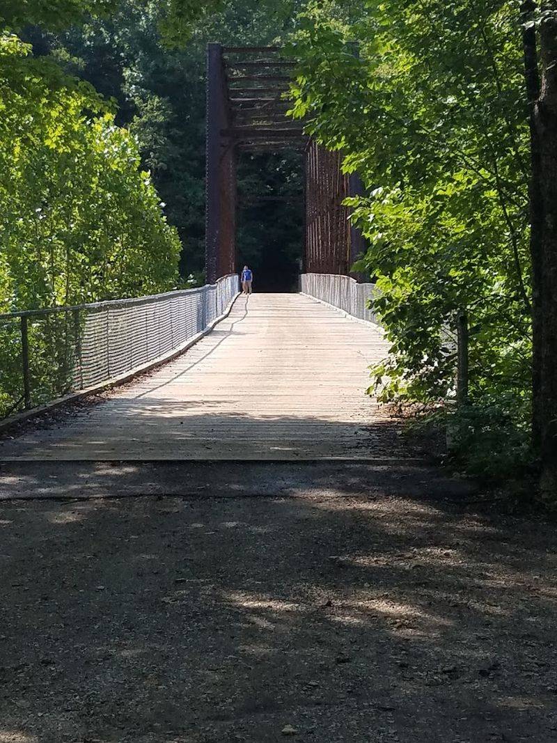
Repurposing a railroad grade for public recreation sounds straightforward until you consider the terrain it crosses.
The former O&W rail bed runs through gorges, across creek drainages, and through woodland that remains largely unchanged from the days when locomotives struggled up its steep inclines.
Converting that corridor into a usable trail required both vision and patience from land managers.
The Big South Fork National River and Recreation Area now oversees much of the route. Sections like the Spruce Creek Trail and the O&W Trail offer different experiences depending on how far a visitor wants to travel.
The O&W Trail from Leatherwood Ford to the O&W Bridge covers 2.3 miles one-way, making it accessible even for casual walkers who are not prepared for a full-day outing.
The longer Oneida and Western Railroad trail segment stretches approximately 32.8 kilometers, suitable for both hiking and mountain biking. The surface varies considerably along the way, transitioning from graded gravel to rougher natural terrain.
Travelers arriving by vehicle should expect a dirt and gravel road for the final several miles to the bridge, narrow enough that passing another car requires one driver to pull aside and wait. Plan accordingly and bring water.
Journey Through Big South Fork’s Captivating Gorges
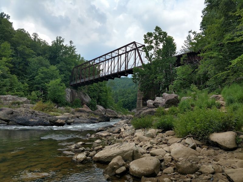
The gorge carved by the Big South Fork of the Cumberland River drops roughly 600 feet in places, creating a landscape that feels genuinely separate from the surrounding plateau.
Traveling the O&W route means descending gradually into that gorge, watching the walls rise on either side as the river comes into view below.
The effect is gradual and cumulative rather than sudden.
At the bridge, the river is close enough to read. Depending on the season and recent rainfall, it can move with considerable force, and visitors have noted that wading near the bridge is not advisable for children due to the current’s speed.
In calmer stretches upstream and downstream, tubing and swimming are popular warm-weather activities.
Coal deposits appear along the river’s edge, eroded from the surrounding geology and carried downstream over centuries. These dark seams in the rock walls are a quiet reminder of why the O&W Railroad existed in the first place.
The gorge itself is the kind of place that holds your attention without demanding it. Spend enough time standing on that bridge, looking up and down the river corridor, and the idea of leaving becomes surprisingly difficult to act on.
Engineering Marvels Of A Forgotten Era
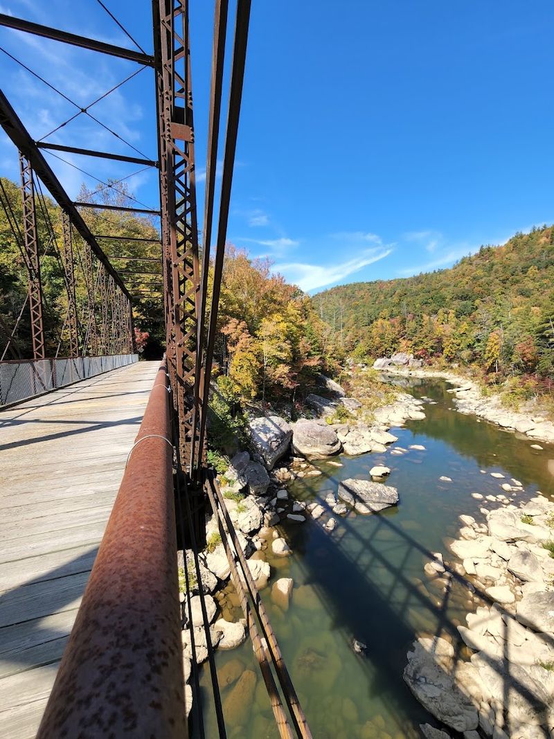
Building a railroad through the Big South Fork country in 1913 was not a modest undertaking. The terrain demanded constant problem-solving.
Engineers had to bridge rivers, cut through ridgelines, and maintain grades shallow enough for loaded coal cars to navigate without losing traction or momentum. The result was a line that required more infrastructure per mile than most railroads of its era.
The O&W Bridge stands as the most visible remnant of that engineering effort. Its Whipple through truss design, originally fabricated in the 1880s, was chosen for its load-bearing strength relative to its material weight.
Moving and reassembling a bridge of that complexity in 1915, through terrain with no paved roads, speaks to the ambition of the project and the skill of the crews involved.
One of the bridge’s most discussed features is the railroad track frame embedded in its structure, stamped with the year 1906, a detail that visitors who look closely enough can still find.
The iron construction, rather than steel, also sets it apart from nearly every comparable structure still standing in the United States.
For anyone with an interest in industrial history or structural engineering, this bridge is worth the drive down a narrow gravel road to examine firsthand.
A Sanctuary Of Southern Appalachian Flora And Fauna
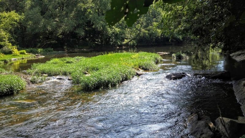
The forest along the O&W route is not the uniform pine plantation that covers large portions of the American South.
It is a mixed hardwood and broadleaf woodland dominated by beech and maple, with an understory that includes mountain laurel and rhododendron.
In late spring, when those shrubs bloom, the trail corridor takes on a quality that makes the industrial history feel very far away indeed.
Large rock outcroppings break through the forest floor at irregular intervals, and these formations provide habitat for a range of species. Deer move through the area with the casual confidence of animals that rarely encounter hunting pressure.
Wild turkeys are common enough to be unremarkable, and patient observers have reported bald eagle sightings along the river corridor, though the birds do not guarantee appearances on any particular visit.
Visitors should be aware that poison ivy is present along the trail, particularly on the descent to the riverbank near the bridge. Some of it has been observed climbing the bridge support posts.
Wearing long pants and being attentive to what you brush against will prevent most problems. Bug spray is also a practical consideration, especially during summer months when insects are active throughout the gorge.
Hikers, Bikers, And Explorers All Find Something To Love On This Grade
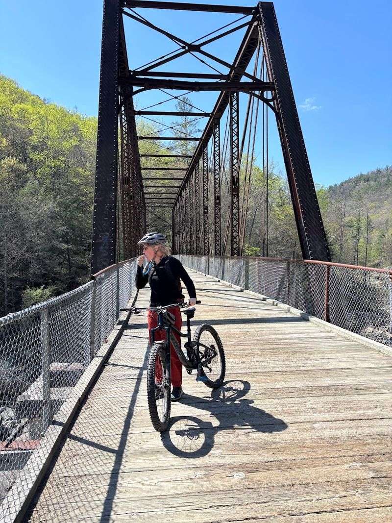
The O&W corridor attracts a genuinely mixed crowd. Hikers come for the trail access and the river views.
Mountain bikers appreciate the long, sustained grade that the old railroad bed provides, since railroad engineers designed their lines to avoid steep pitches, which translates into rideable terrain for cyclists.
Equestrians have historically used portions of the route as well, and the width of the old grade accommodates all of these users without serious conflict.
The approach road to the bridge deserves direct discussion. From the intersection of Toomey Road and O&W Road, the bridge is approximately 4.5 miles away.
The road transitions from pavement to gravel and then to a narrow dirt track in places. Expect to travel no faster than 10 miles per hour on the rougher sections, and be prepared to reverse or pull aside if you meet oncoming traffic.
A vehicle with decent ground clearance is a reasonable precaution.
Once at the bridge, the Devils Den Trail offers a 1.2-mile round trip hike that several visitors have described as well worth the modest effort.
A staircase near the bridge leads down to the river, where rock hopping, swimming, and simply sitting beside the water are all legitimate ways to spend an afternoon.
Preserving A Piece Of Tennessee’s Heritage
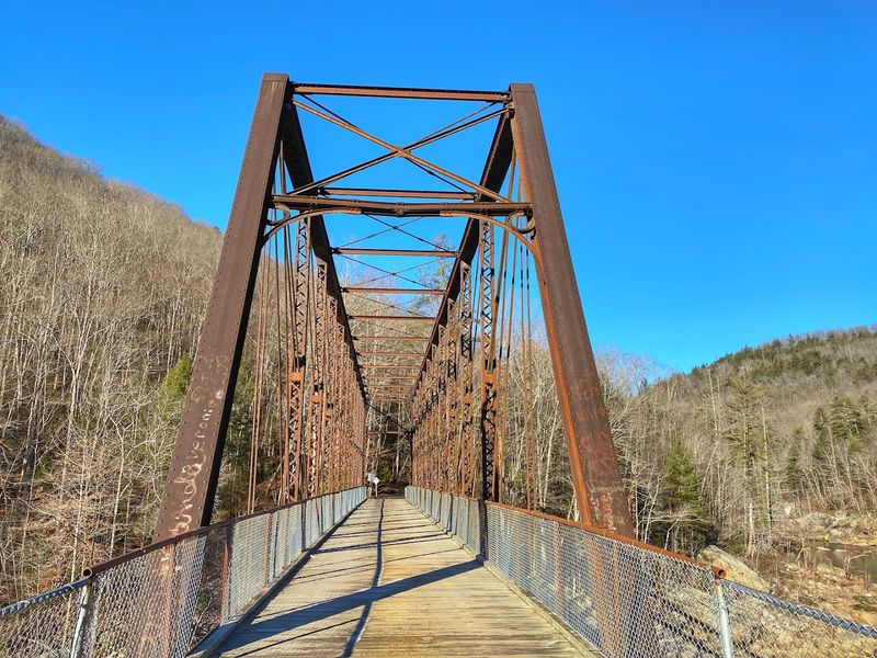
Scott County pursued and secured a listing on the National Register of Historic Places for the O&W Bridge, a designation that acknowledges the structure’s significance in American transportation history.
That recognition matters practically as well as symbolically, since it brings the bridge into a framework of preservation standards that guide how it is maintained and modified over time.
The National Park Service manages the surrounding Big South Fork National River and Recreation Area, which provides the broader context for the bridge’s continued existence as a public resource.
The NPS website at nps.gov/biso serves as the primary information source for visitors planning a trip, and the park’s phone number, listed as +1 423-569-9778, connects callers to staff who can provide current road and trail conditions.
Preservation efforts face practical challenges.
The condemnation of a separate bridge on Pine Creek along O&W Road in autumn 2024 temporarily closed vehicle access to the O&W Bridge, demonstrating how the survival of one historic structure can depend on the condition of another.
A replacement bridge was reported to be nearing completion as of January 2026.
The lesson is straightforward: check current access conditions before making the drive, and support the organizations working to keep this corridor open for future generations.