
This Ancient Louisiana Spot Emerges From The Flat Delta Farmland Along A Peaceful Highway
I think we’re a unique generation. Unlike people who lived millennia ago, nobody will have to guess how we lived, since everything will already be documented.
This ancient Louisiana city offers a glimpse into exactly that kind of unanswered history. It rises quietly from flat delta farmland along a peaceful highway.
Structures here date back further than most visitors expect. Some remnants stay barely recognizable after centuries of weather and time.
Historical markers along the way explain what little is known about the site’s origins. Regulars recommend slowing down, since rushing through misses details easy to overlook on a quick drive.
Nothing about the site feels overly commercialized, preserved instead with the respect its age demands. This city proved that some of the oldest history requires driving slowly to actually notice it.
Historical Significance Of Ancient Earthworks
Here is a fact that tends to stop conversations cold. The earthworks in this corner of Louisiana were raised between roughly 1730 and 1350 BCE, meaning construction wrapped up long before the Colosseum was even an idea.
UNESCO called it a remarkable achievement in earthen construction that nothing in North America topped for at least 2,000 years. That is a bold statement from an organization that does not hand out compliments freely.
What makes the whole thing stranger is who built it. These were not farmers with surplus grain and a labor force to spare.
They hunted, fished, and gathered wild plants, and somehow still organized one of the largest prehistoric earthwork complexes on the continent.
It also beats Cahokia in Illinois by well over 2,000 years, which surprises plenty of people who assume older always means smaller. The site became a National Historic Landmark in 1962 and a UNESCO World Heritage Site in 2014.
Only about two dozen such sites exist in the entire United States. The scale and the layout together suggest this was both a place people lived and a place they gathered for something bigger than daily survival.
You can see it for yourself at 6859 LA-577, Pioneer, LA 71266.
Archaeological Findings From Early Civilizations
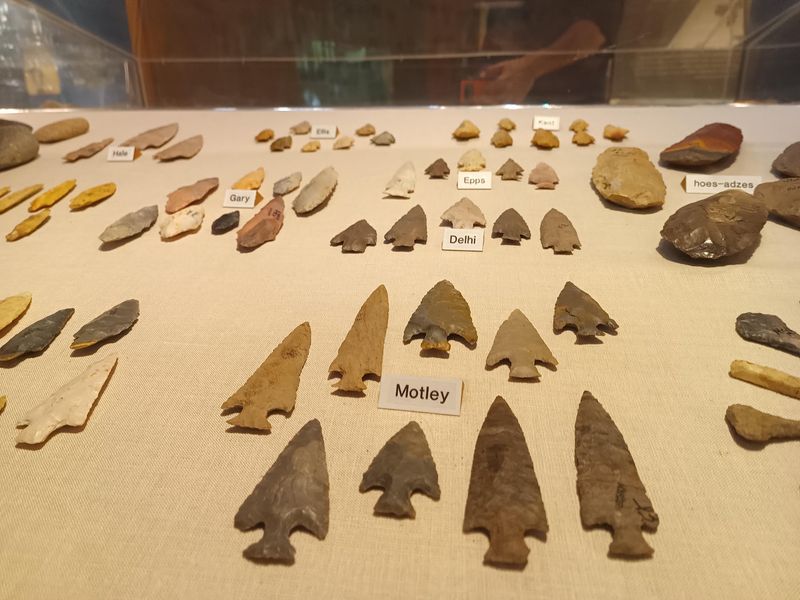
Hundreds of thousands of artifacts have come out of the ground here, and the numbers alone are worth sitting with. Over 8,000 intact projectile points.
More than 100 tiny clay figurines. Nearly 200 objects made of copper.
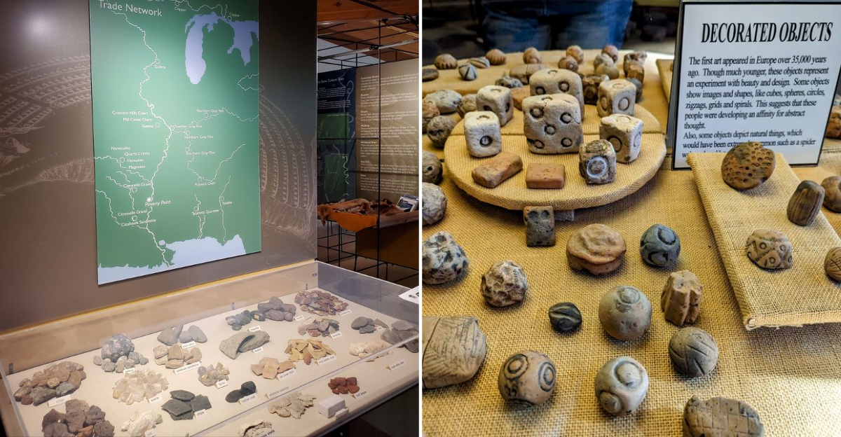
The copper is the eyebrow-raiser. Northeast Louisiana has no copper, no soapstone, no quartz, and honestly barely a decent rock anywhere in the alluvial mud.
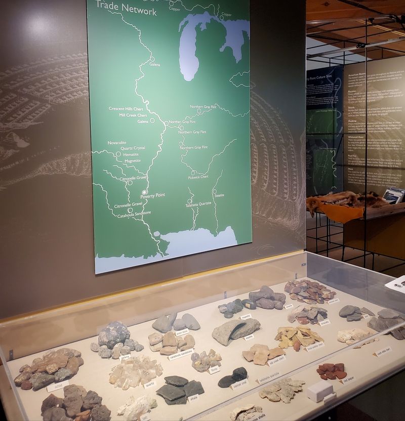
Yet the artifacts include materials that traveled from as far as 800 miles away. That points to a trade network stretching across the eastern half of the continent, moving goods along rivers long before anyone drew a map.
Then there are the clay cooking balls, which sound unglamorous but tell a great story. People shaped them, baked them hard, then heated them and used them to cook food, an early version of a slow cooker made entirely of mud.
Archaeologists also found post molds, dark stains left in the soil where wooden posts rotted away centuries ago. Those stains outline homes built from wattle and daub, woven sticks packed with clay.
Here is the puzzle that keeps researchers arguing. No burial mounds have turned up, and evidence of long-term housing is thin.
Some believe the place served as a seasonal gathering ground for trade, work, ceremony, and socializing rather than a full-time town. The museum on site displays a strong slice of these finds.
Architecture And Construction Techniques Revealed
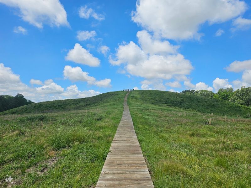
Mound A stands more than 70 feet tall, and locals call it the Bird Mound because from above the shape suggests wings. It ranks among the largest mounds in North America, built with no wheelbarrows, no oxen, and no pulleys.
Just baskets, backs, and a whole lot of coordination. Roughly 53 million cubic feet of soil may have been moved to complete the full complex.
The monumental core covers somewhere between 350 and 400 acres. Six concentric semi-elliptical ridges curve around a central plaza, some standing four to six feet high, with the outermost arc measuring close to three-quarters of a mile across.
Five mounds punctuate the layout. Walking the loop gives a real sense of the geometry, though the ridges read as gentle swells rather than dramatic walls.
Now for the part that genuinely rewrote textbooks. Recent research suggests Mound A went up in a matter of months, possibly weeks, not generations.
Microscopic soil analysis showed builders deliberately mixed clays, silts, and sand to create a blend that resists water damage. That recipe is why the mound still stands after more than 3,000 years of Louisiana downpours.
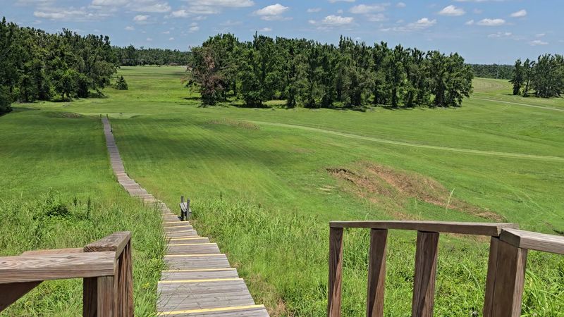
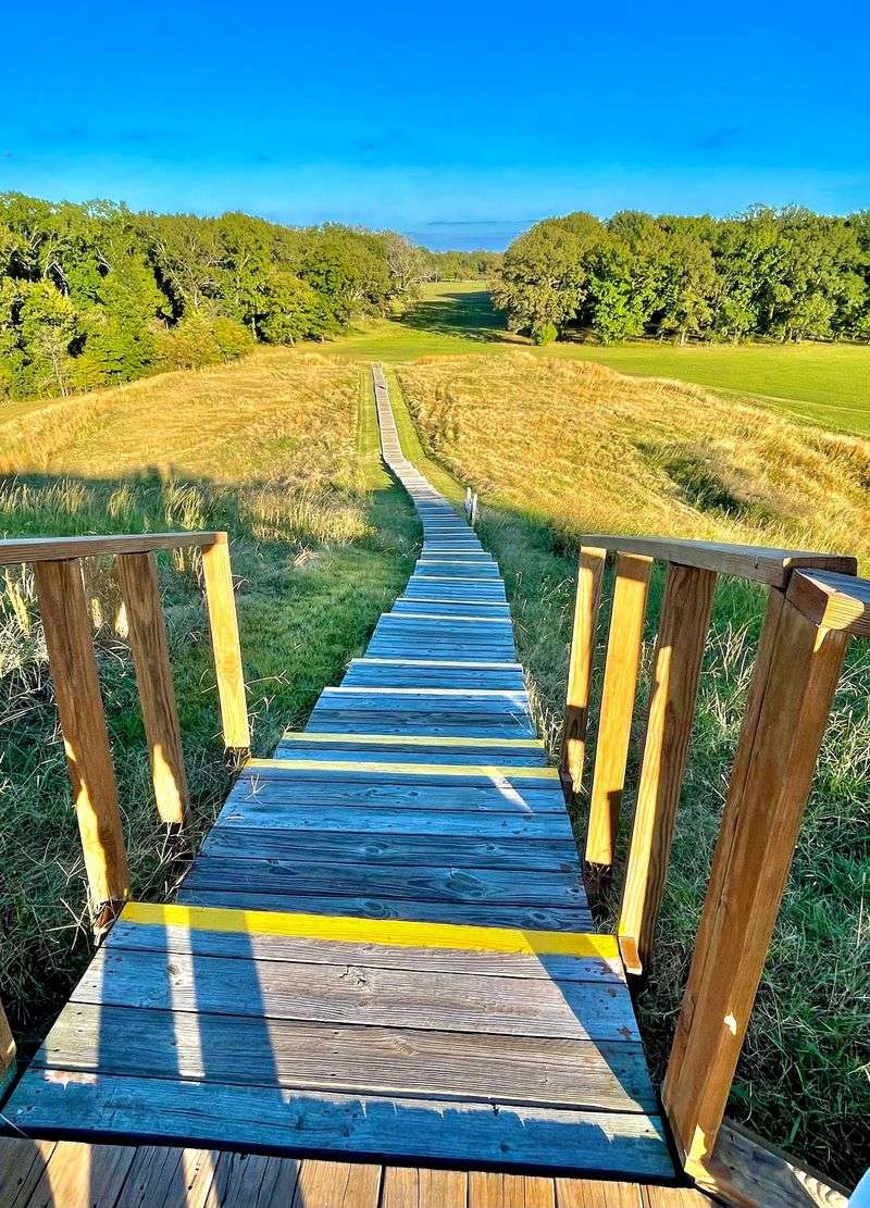
Climbing to the top involves stairs, with benches along the way for anyone who needs a breather. The view stretches over farmland that hides most of the story.
Environmental Influence On Ancient Settlements
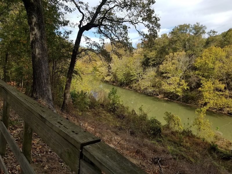
Location, location, location. The builders picked a narrow strip of slightly raised ground overlooking the Mississippi River floodplain, right beside Bayou Macon.
That choice gave them steady fresh water without the regular soaking that drowns most low spots in the alluvial valley. Smart real estate instincts, roughly 3,500 years ahead of any realtor.
Food was the other half of the equation. Fish, deer, alligators, turtles, frogs, hickory nuts, persimmons, and wild grapes were all available, and much of it year-round.
Most hunter-gatherer groups packed up and followed the seasons. Here the pantry stayed stocked, which meant a large community could settle in one spot without farming a single field.
What the land did not offer was stone. Not a usable chunk of it for miles, which is a serious problem when your tools depend on hard rock.
That single shortage likely pushed these people to build trade relationships across half a continent. Scarcity turned into connection, which is a pretty elegant twist.
Visitors today still feel the setting. A 2.6-mile hiking trail winds through the property, and deer, squirrels, and cardinals show up regularly along the way.
The site also holds one of the larger paw paw groves in the country, a fruit tree most Americans have never tasted. Shaded picnic areas make the heat manageable.
Cultural Practices Of Early Inhabitants
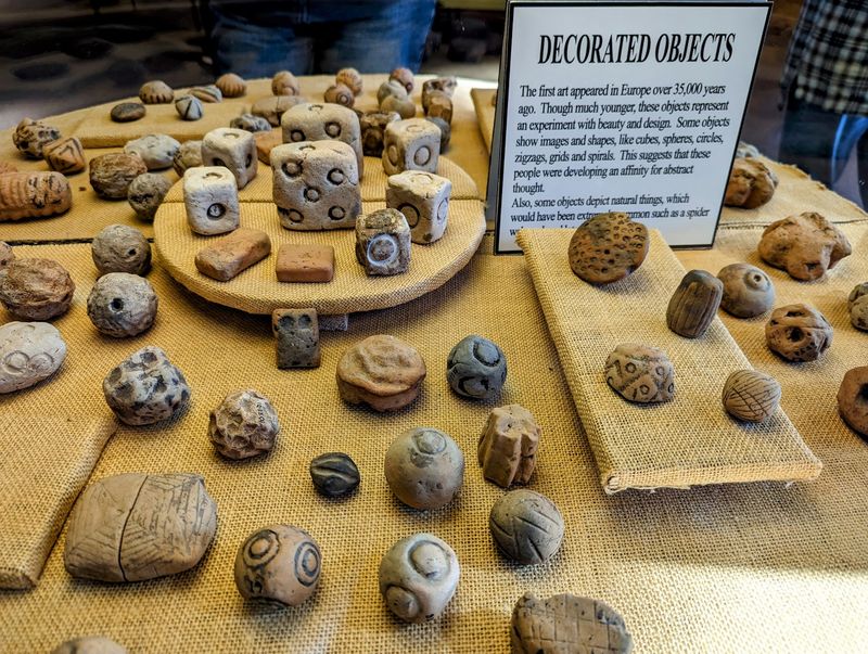
Tiny stone owls. That is one detail that sticks with people long after they leave.
Craftspeople here carved miniature beads shaped like owls, dogs, locusts, and turkey vultures, polished and stylized with real skill. Nobody knows exactly what they meant, but you do not spend hours on an owl bead for no reason.
Trade shaped daily life more than almost anything else. Materials arrived from the Appalachians, the Great Lakes, and the Ohio and Tennessee River valleys.
Hematite, magnetite, quartz, sandstone, soapstone, chert, and copper came in raw and left as pipes, ornaments, effigies, buttons, and tools. The rivers worked like highways, carrying boats loaded with goods and ideas.
Language and religion remain mysteries. No written records exist, and without burials there are no bones for DNA analysis, which frustrates researchers to no end.
Some archaeologists think the place functioned as a capital, a commercial and ceremonial hub for a wide culture. Others lean toward a seasonal meeting ground.
One theory about the mounds themselves is quietly beautiful. Building them may have been a cooperative offering to an unpredictable world of storms and floods, a way of pushing back against forces nobody could control.
Estimates suggest around 700 people lived on the site. The museum film does a solid job putting faces to that number.
Preservation Efforts And Challenges Today
Louisiana humidity is brutal on ancient objects. Fired clay and stone hold up reasonably well, but the museum still monitors temperature and moisture carefully to keep artifacts from breaking down.
Outside, the enemy is water moving downhill. Erosion ranks as the single biggest threat to the earthworks.
Trees turned out to be part of the problem, which surprises most people. Root systems loosen soil, and heavy rains wash it away.
Conservation crews have replaced trees with grass in key areas to hold the ground in place. It looks less dramatic in photos, but it keeps the mounds from melting.
Here is something remarkable. Less than one percent of the site has been disturbed by excavation or modern construction.
Compare that to most ancient places, which have been plowed, looted, or paved over repeatedly. The soil here still holds nearly everything it started with.
Researchers now lean heavily on remote sensing, advanced dating methods, and lab analysis to learn more without digging. Every trench avoided is information saved for the future.
Groundskeeping shows in small ways too, with mown paths, marked trails, benches, and clean facilities. One honest note for expectations: outside of Mound A, several features read as low grassy rises rather than obvious monuments.
The interpretive signs and pamphlet help enormously with spotting what your eyes might otherwise skip.
Visitor Experience And Available Educational Programs
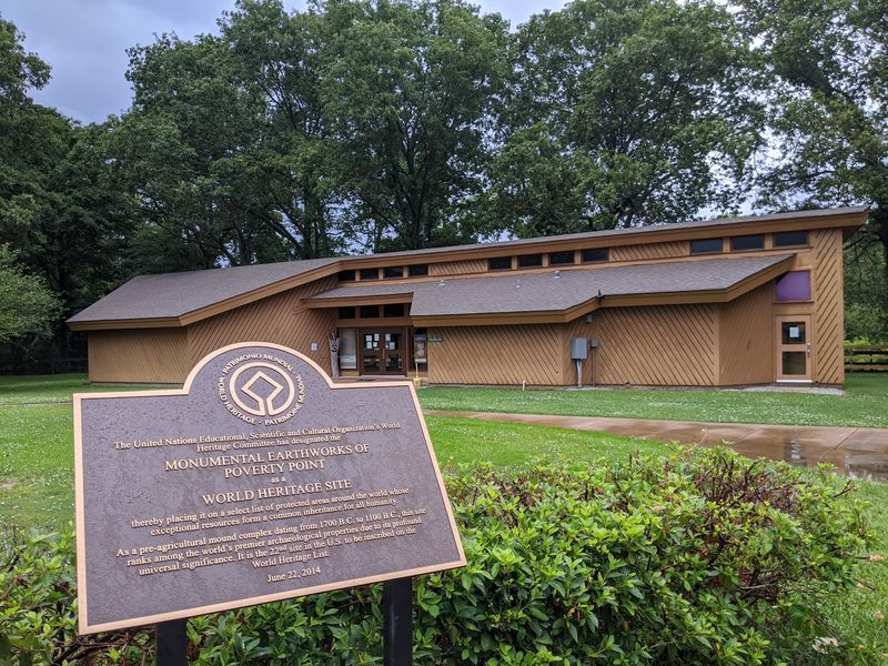
Start at the visitor center. Everything else makes more sense afterward.
The museum is compact but packed, and a short film runs about 15 minutes and gives context that turns grassy bumps into a real city. Interpretive displays walk through the artifacts and the theories.
Guided tram tours run Wednesday through Sunday, weather permitting, lasting roughly 45 minutes to an hour. Rangers narrate, and their knowledge of the site runs deep.
Prefer independence? A self-guided driving route follows numbered stops along a paved road, and the accompanying pamphlet points out details most people would walk right past.
Walkers get the 2.6-mile trail with about 20 markers. Plan on an hour to 90 minutes, longer if you stop to read everything, and expect soggy patches after rain.
Hours run 9 a.m. to 5 p.m. daily, and school field trips fill weekdays. Interpretive rangers will demonstrate ancient technology on request, which is worth asking about.
The Explore Louisiana State Parks app adds virtual and augmented reality at nine stations across the property. Point your phone and watch the earthworks appear as they may have looked over 3,000 years ago.
Practical advice: bring a hat, water, sunscreen, and bug spray. Give yourself at least two hours, and do not skip the climb up Mound A.
Impact Of Geography On Social Development
Geography did a lot of the heavy lifting in this story. A raised landform above the floodplain, fresh water from Bayou Macon nearby, and a food supply that never really ran dry added up to a rare situation.
Hunter-gatherers usually keep moving. These people stopped, stayed, and built.
The stone shortage flipped the script in the opposite direction. Needing raw material forced outward contact, and outward contact brought exchange with cultures hundreds of miles away.
The Mississippi and its tributaries functioned as travel corridors, carrying canoes full of goods, news, and probably a fair amount of gossip. Isolation was never really an option here.
What that means for social structure is genuinely interesting. Moving tens of millions of cubic feet of dirt without draft animals or wheels takes organization, planning, and a lot of willing hands.
For a long time, researchers assumed such projects required a chief barking orders from the top. Evidence here suggests something more cooperative and possibly more equal, which challenges old assumptions about how complex societies get started.
Standing in that flat delta today, the whole thing feels almost impossible. Farmland stretches in every direction, a quiet highway runs past, and a 3,500-year-old planned landscape sits right there in the grass.
Older than Stonehenge. Older than the Great Pyramid’s neighbors in fame.