
This Arizona Road Trip Leads To Stunning Overlooks That Belong On Every Travelers Bucket List
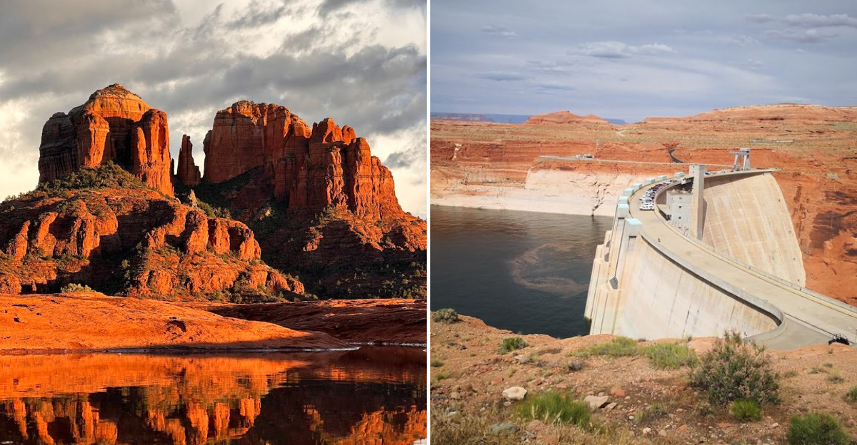
The desert holds secrets that only reveal themselves to those willing to drive into the horizon. This specific asphalt ribbon winds through canyons that make your car feel like a toy.
Red rocks tower above the highway like ancient guards frozen in time. My grandfather always said that the earth speaks loudest where the cliffs are steep.
He was right about this corner of Arizona. The final viewpoint appears suddenly after a long bend in the road.
The sheer drop creates an instant sense of vertigo that stops your breath. Colors shift from deep orange to violent purple as the sun dips lower.
You do not just look at this landscape. You feel it in your chest.
Travelers leave their cars in total silence. Nature did not build this place for a casual glance.
1. Grand Canyon South Rim
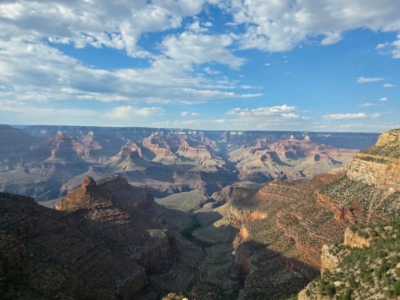
Standing at the edge of the Grand Canyon South Rim for the first time is almost unfair. Nothing prepares you for that scale.
The canyon stretches over 270 miles long and plunges over a mile deep.
Mather Point is the classic first stop for a reason. The views there hit differently at sunrise.
Colors shift from deep purple to fiery orange in minutes.
Walk the Rim Trail for a more relaxed experience. It runs nearly 13 miles along the canyon edge.
You can hop on and off the free shuttle buses easily.
Bright Angel Trail is the most popular hiking route. It winds down into the canyon with incredible layered rock views.
Even a short walk down changes your entire perspective.
El Tovar Lodge has been sitting on the rim since 1905. It is a historic landmark worth visiting even just for a look around.
The architecture alone tells a story of old American adventure.
Ranger programs run daily and are completely free. They cover geology, wildlife, and Native American history.
You will leave knowing way more than when you arrived.
Plan at least a full day here, seriously. Most visitors regret not staying longer.
2. Chiricahua National Monument
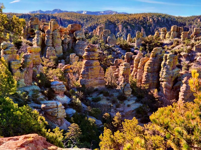
Chiricahua National Monument looks like someone stacked thousands of boulders and just walked away. It is wild, weird, and completely wonderful.
Volcanic eruptions about 27 million years ago created this surreal landscape.
The rocks are called rhyolite, formed from ancient ash flows. Wind and water sculpted them into towers, spires, and balanced columns.
Some pinnacles reach over 200 feet tall.
This place is often called the Land of Standing-Up Rocks. The Chiricahua Apache who lived here had a very good name for it.
Their history echoes through every trail and canyon.
The Echo Canyon Loop Trail is the most popular hike. It winds through narrow passages between towering formations.
You feel like you are walking through a giant natural maze.
Wildlife here is seriously impressive. Coatimundis, white-tailed deer, and over 170 bird species call this place home.
Birdwatchers consider it one of Arizona’s top spots.
Night skies at Chiricahua are jaw-dropping. The monument sits far from city lights, making stargazing exceptional.
On a clear night, the Milky Way stretches fully across the sky.
It is quieter than the Grand Canyon, which honestly makes it better. You can have entire trails nearly to yourself.
Find it at 12856 East Rhyolite Creek Road, Willcox, AZ 85643.
3. Tonto Natural Bridge State Park
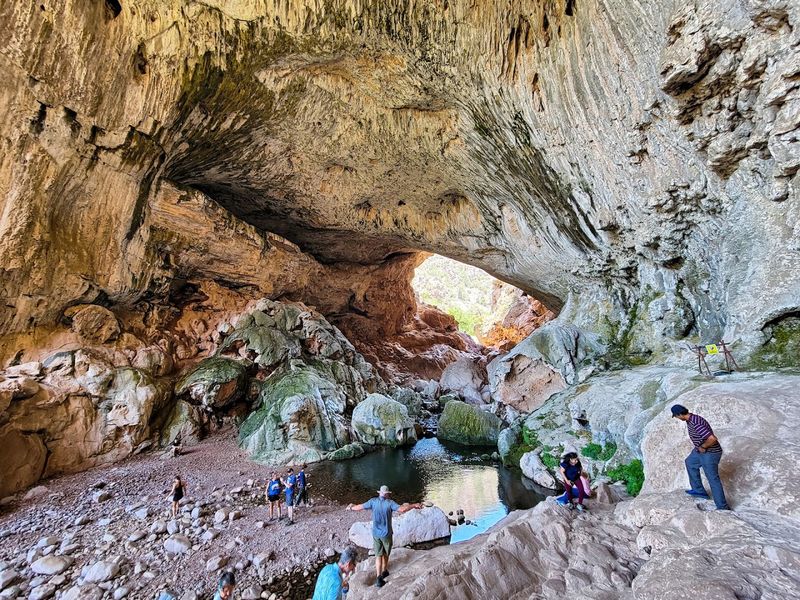
Tonto Natural Bridge is officially the largest natural travertine bridge on the entire planet. That is not a small claim.
It stands 183 feet high and spans 150 feet across a stunning natural tunnel.
A Scottish prospector named David Gowan stumbled upon it in 1877. He was actually hiding from an Apache raiding party inside the tunnel.
Imagine discovering one of the world’s wonders while running for your life.
The travertine formed over thousands of years from mineral-rich spring water. It built up layer by layer into this massive natural arch.
The colors range from cream white to deep amber.
Pine Creek flows right through the tunnel below the bridge. You can actually swim in the cool pools beneath it.
On a hot Arizona afternoon, that water feels absolutely incredible.
Four trails lead down to different viewpoints and creek access. The Gowan Trail is the most popular and offers the best full view.
It is steep but absolutely worth every step.
The park sits surrounded by tall ponderosa pines. That pine scent fills the air everywhere you walk.
It feels nothing like the desert, which surprises most visitors completely.
The park is small but mighty in personality. Crowds are manageable, and the vibe is relaxed.
Visit this spot located at Nf-583A, Pine, AZ 85544.
4. Horseshoe Bend
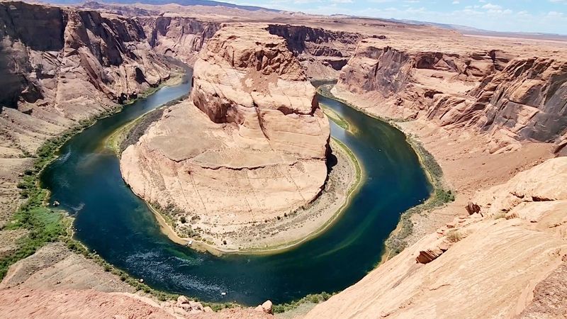
Horseshoe Bend is the photo you have definitely seen a thousand times online. Seeing it in person is completely different.
The Colorado River makes a perfect horseshoe curve 1,000 feet below your feet.
The hike from the parking lot is only about 1.5 miles round trip. It is short, but the desert sun is no joke.
Bring water and wear sun protection without question.
The overlook sits right at the cliff edge with no railing in most spots. It is both thrilling and mildly terrifying in the best way.
Heights lovers will be completely in their element here.
Sunrise and sunset are the golden hours at Horseshoe Bend. The canyon walls glow in deep orange, red, and pink.
Photographers line up well before sunrise to grab the perfect spot.
The Colorado River carved this bend over millions of years. The Navajo sandstone walls surrounding it are around 190 million years old.
Standing there, that kind of time scale genuinely bends your brain.
Crowds have grown significantly here in recent years. Visiting on a weekday morning gives you a much calmer experience.
The view is equally stunning with fewer elbows in your face.
It is one of the most accessible bucket list spots in Arizona. Easy trail, massive payoff.
The address is 1001 Page Pkwy, Page, AZ 86040.
5. Monument Valley
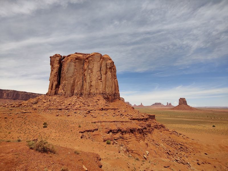
This spot is one of those places that feels borrowed from a movie set. And honestly, it basically is.
John Ford used these mesas as a backdrop for classic Westerns going all the way back to 1939.
The famous mittens and Merrick Butte rise over 1,000 feet from the valley floor. They are made of red Cutler Formation sandstone.
The color deepens to almost blood red at sunset.
This is Navajo Nation land, and that matters deeply. The Navajo people call it Tse Bii Ndzisgaii, meaning Valley of the Rocks.
Their connection to this land goes back countless generations.
The 17-mile Valley Drive loop is unpaved but manageable in most vehicles. It passes eleven major overlooks and formations.
Take your time because every angle looks different and equally stunning.
Navajo-guided tours take you deeper into the valley than the self-drive loop allows. Guides share stories, history, and cultural context that you simply cannot get from a map.
It is absolutely worth booking one.
The view from John Ford Point is iconic. It is where Ford staged his famous stagecoach shots.
Standing there feels like flipping through a history book in real time.
Campgrounds inside the park let you sleep under a sky full of stars. Waking up to those mesas at dawn is unforgettable.
6. Cathedral Rock View
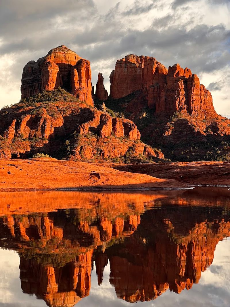
Cathedral Rock might be the most photographed spot in all of Sedona, and Sedona does not lack for competition. The four towering spires of red sandstone shoot straight up into the blue Arizona sky.
It is genuinely hard to look away.
The best reflection shot comes from Red Rock Crossing at Oak Creek. The sandstone spires mirror perfectly in the shallow water below.
Photographers practically sprint there at golden hour.
Many people believe Cathedral Rock sits on a powerful energy vortex. Sedona has four main vortex sites, and this one draws the most visitors.
Whether you feel the energy or not, the scenery alone is worth the trip.
The hike up to Cathedral Rock is short but steep. It covers only 1.5 miles round trip but gains 742 feet in elevation.
The scrambling near the top requires some hands-on rock navigation.
Views from the saddle between the spires stretch across the entire Sedona valley. You can see red rock formations in every direction.
The scale of it genuinely stops you mid-step.
Sedona itself is a fantastic base for exploring this area. Restaurants, art galleries, and spa retreats fill the small city.
It is a great place to recover between hikes.
Sunsets from Cathedral Rock are something people cry actual tears over. No exaggeration.
Head to 2185 Red Rock Loop Rd, Sedona, AZ 86336.
7. Lost Dutchman State Park
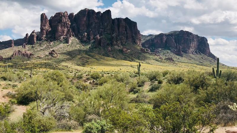
A place like this carries one of the best legends in the entire American West. Somewhere in those jagged Superstition Mountains, a lost gold mine supposedly waits to be found.
People have been searching for over a century.
The park is named after Jacob Waltz, a German prospector in the 1800s. He claimed to know the location of an incredibly rich gold deposit.
He passed away without ever revealing exactly where it was.
The Superstition Mountains themselves are dramatic and moody. Volcanic activity shaped these peaks millions of years ago.
They look like they are keeping secrets, which honestly feels appropriate.
Saguaro cacti dot the landscape in every direction. In spring, desert wildflowers carpet the ground in yellow, purple, and orange.
The Sonoran Desert puts on a serious show here.
The Siphon Draw Trail is the park’s most challenging route. It climbs steeply to the Flatiron formation near the mountain summit.
The panoramic view from the top covers the entire Phoenix metro area.
Night sky programs at the park draw serious astronomy fans. The dark skies here are exceptional for stargazing.
Ranger-led events make it accessible for beginners too.
Wildlife sightings include coyotes, javelinas, and Gila woodpeckers. Keep your eyes open because the desert is busier than it looks.
Visit it at 6109 N Apache Trail, Apache Junction, AZ 85119.
8. Antelope Canyon Tours
Antelope Canyon is the kind of place that makes people question whether it is actually real. The walls glow in waves of orange, red, and purple.
Water carved these narrow corridors through Navajo sandstone over thousands of years.
There are three sections you can visit: Upper, Lower, and Mystical Antelope Canyon. Each one has a completely different personality.
Upper is famous for those iconic light beams that shoot through the openings above.
Upper Antelope Canyon light beams appear between late March and early October. Midday on sunny days gives you the best show.
Tour guides stir up the sand to make the beams more visible and dramatic.
Lower Antelope Canyon requires climbing down metal staircases into the earth. The canyon narrows dramatically in certain sections.
It feels genuinely adventurous and slightly claustrophobic in the best possible way.
Mystical Antelope Canyon is the newest and least crowded of the three. It offers a more intimate experience without the shoulder-to-shoulder crowds.
Photography there feels less rushed and more personal.
All tours here are run by Navajo-owned companies. Visiting means directly supporting the Navajo Nation and its families.
That context adds real meaning to every photo you take.
Book your tour well in advance because slots fill up fast. Especially during peak season, availability disappears quickly.
Find it at 22 S Lake Powell Blvd, Page, AZ 86040.