
This Arkansas River Is So Clear You Can See Every Stone On The Bottom
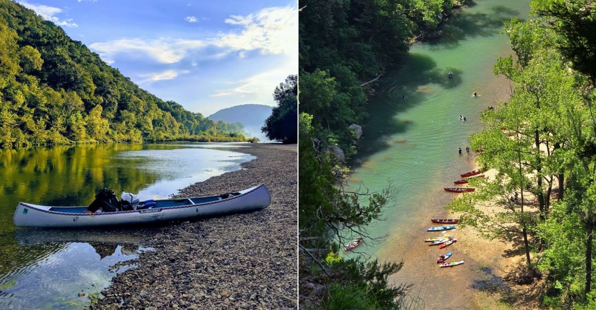
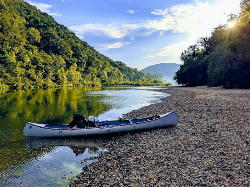
Arkansas hides a stretch of water so clean that the riverbed looks like it sits under glass. Float a canoe across it and you can count pebbles, watch minnows dart, and see your own shadow slide over the gravel below.
Towering cliffs rise straight from the banks, some taller than a 40-story building, and waterfalls spill from the woods after a good rain. Elk graze in the valleys at dawn.
At night, the sky fills with more stars than most people ever see in a lifetime. Nothing here has been dammed, paved over, or built up.
The water runs free for 135 miles through the Ozark Mountains, exactly as it has for thousands of years.
Campers pitch tents on gravel bars, hikers wander past century-old cabins, and swimmers cool off in deep green pools. Arkansas locals guard this place with real pride, and once you see it, you will understand why.
Water Clear Enough To Count Pebbles
Say hello to the Buffalo National River, the star of northern Arkansas and the first waterway in the country to earn national river status. It winds 135 miles through the Ozark Mountains, and the water stays so transparent that paddlers often think their canoe is floating on air.
The secret lies underground. The whole region sits on karst rock, a mix of limestone, dolomite, sandstone, and shale riddled with caves, springs, and sinkholes.
Rain soaks through that stone like a giant natural filter before it ever reaches the channel. By the time it arrives, it has left most of its sediment behind.
Begin at the Boston Mountains, where the river gathers its first cold trickles, and follow it east as it grows. The color shifts from pale green to deep blue depending on the light and depth.
Standing knee-deep, you can watch crayfish scuttle sideways and small fish nibble at your toes. Bring polarized sunglasses if you want the sharpest view through the surface glare.
Tourists often describe the shock of looking down and realizing they can see six feet straight to the bottom. Photographers love it because the stones show up in pictures without any editing tricks.
What would you spot first, a school of minnows or a perfect skipping stone?
America’s First Protected Wild River
March 1, 1972 changed everything here. On that day the Buffalo became the first river in the United States to receive national river protection, a title created just for places like this.
Before that, the plan was very different. Engineers wanted to build dams and turn these flowing miles into flat reservoirs.
Neighbors, paddlers, and conservationists argued for decades. They wrote letters, testified, and floated politicians down the river so they could see it themselves.
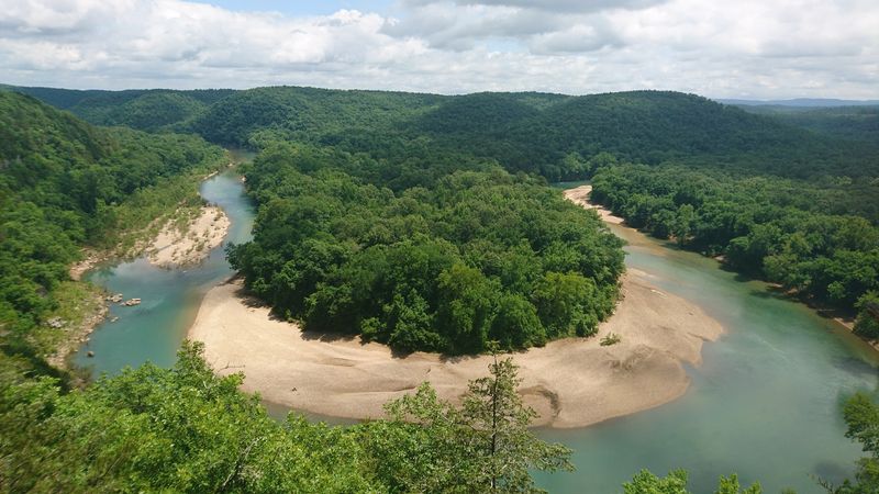
Their stubbornness paid off. Today all 135 miles run free, with no concrete blocking the current anywhere along the route.
That single decision is why the water still looks the way it does. Dams trap sediment, warm the water, and change what lives in it, and none of that happened here.
The protection also covers the land along the banks, so you will not find billboards, condos, or gas stations crowding the view. Just bluffs, woods, and sky.
Visitors often say the quiet feels almost startling after a long drive. No motorboat engines, no traffic hum, only water moving over rock.
Arkansas gets serious bragging rights for hosting a first like this. It set the pattern for river protection across the whole country.
Does knowing the fight that saved it make the view feel even better?
Bluffs That Scrape The Sky
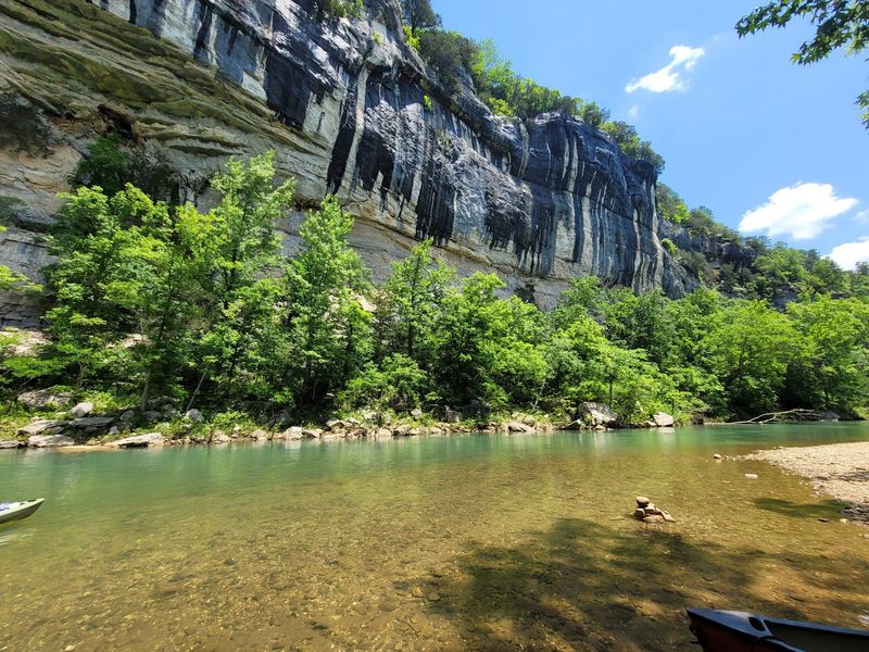
Some of these cliffs climb more than 500 feet straight up from the water. Paddle beneath one and your canoe suddenly feels like a toy in a bathtub.
Erosion carved them over millions of years, layer by layer. Streaks of orange, gray, tan, and rust run across the rock face like brushstrokes.
Big Bluff and Roark Bluff draw the biggest crowds, and both are worth every mile of the drive. Steel Creek gives you a knockout view without much walking.
The stone hides more than pretty colors. Over 500 caves have been mapped in this corner of the Ozarks, along with sinkholes, springs, and strange rock formations.
Then there is Hemmed-In-Hollow Falls, a ribbon of water dropping 209 feet into a mossy bowl. It ranks as the tallest waterfall between the Southern Appalachians and the Rockies.
Reaching it takes effort. The trail is steep, and the reward is best after spring rain when the falls actually roar.
Sunrise and sunset paint the bluffs in completely different colors, so photographers often visit the same spot twice. Golden hour turns the pale stone almost pink.
Arkansas has plenty of pretty overlooks, but few match this scale. Would you rather paddle below the bluffs or stand on top of one?
Paddle, Splash, Repeat All Day
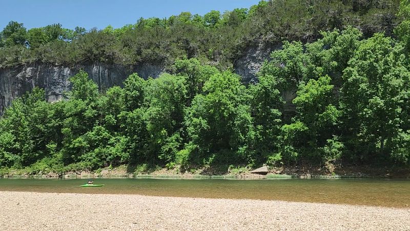
Floating is the main event around here, and almost everyone tries it at least once. Canoes, kayaks, and rafts all work, and outfitters near the access points handle rentals and shuttles so you never worry about hauling gear.
The upper district keeps things lively with rapids and quick chutes, especially in spring. Lower stretches stay calmer, with long glassy pools perfect for beginners.
A popular half day run covers a few miles and takes two or three hours at an easy pace. Longer trips of ten or eleven miles fill an entire day.
First timers usually manage fine. The current does much of the work, and the tricky spots are more fun than frightening.
When summer heat kicks in, the swimming holes become the real prize. Cold water, smooth stones underfoot, and shade from the bluffs make an unbeatable combination.
Gravel bars scattered along the banks double as picnic spots and campsites. Many paddlers pull over, eat lunch, nap in the sun, then push off again.
Water levels swing a lot through the year, so check conditions before you book anything. Low water can mean dragging your boat across shallow riffles, which some folks call part of the fun.
Which sounds better to you, a splashy rapid or a lazy drift?
Trails Leading To Forgotten Places
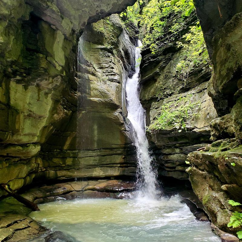
More than 100 miles of maintained trail thread through these hills. Some routes take twenty minutes, others swallow a whole weekend.
Lost Valley Trail wins the popularity contest for good reason. It packs a creek, a natural bridge, a cave, and a waterfall into one short, mostly gentle walk.
People have used this valley for thousands of years. Prehistoric groups sheltered under the bluff overhangs, and archeologists have studied sites tucked along the same path hikers use today.
Elsewhere, trails pass weathered log cabins and rusting farm tools left by settler families. Collier Homestead gives you a real look at how tough life was in these hollows a century ago.
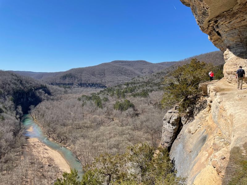
Bluff-top routes deliver the big panoramas. One tourist described watching a bald eagle soar below the ledge where she stood, which flips your whole sense of up and down.
Wear real shoes with grip. Rock can be slick near springs and after rain, and loose gravel likes to slide.
Ticks show up in warm months, so bug spray belongs in every pack. Long socks help more than you would think.
Carry water even on short hikes, since Arkansas humidity sneaks up fast in summer. Which discovery would thrill you more, an old cabin or a hidden cave mouth?
Elk Herds And Endless Stars
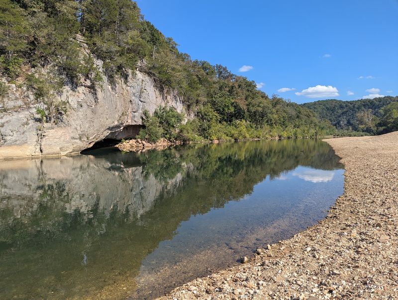
Roughly 450 elk roam this river corridor, and they are the only wild elk herd in the entire state. Fall mornings bring the bugling, a high eerie call that echoes across the fields.
Boxley Valley is the classic viewing spot. Arrive early or stay until dusk, stay in your car when animals are close, and bring binoculars.
Other residents keep the woods busy. White-tailed deer, black bears, river otters, mink, and raccoons all live here, plus more than 250 bird species.
Otters are the show-offs. Spot one sliding down a muddy bank and you will grin for the rest of the day.
Then the sun goes down and a second park appears overhead. In June 2019 this became the first International Dark Sky Park in Arkansas.
That title means the darkness is measured, protected, and genuinely rare. The Milky Way stretches from horizon to horizon on clear nights.
Gravel bars make natural viewing platforms since nothing blocks the sky. Lie back, let your eyes adjust for twenty minutes, and the star count multiplies.
New moon nights are darkest and best. A red flashlight keeps your night vision sharp while you find your way around camp.
Plan Smart, Float Even Better
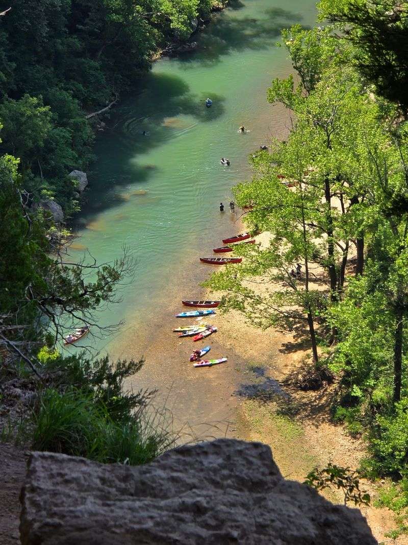
Twenty-plus access points spread across three districts, upper, middle, and lower, which sounds confusing until you look at a map. Each district has its own personality and its own best season.
Tyler Bend serves as a main visitor center with orientation displays, restrooms, and staff who know exactly where the water is running well.
Here is a tip locals repeat often. GPS goes wonky in these hills, so carry a paper Arkansas highway map or a printed park map as backup.
Spring, roughly March through May, brings the strongest flow and the loudest waterfalls. Paddlers usually target this window for the upper river.
Summer shifts the action downstream where deeper pools hold water. Swimming, wading, and shady bluff-side floats rule those hot months.
Fall might be the sweetest season of all. Leaves turn gold and crimson, elk get active, temperatures drop, and the stargazing sharpens.
Winter hiking is underrated. Bare trees open up views you cannot see in July, and trails stay quiet enough that some visitors have entire routes to themselves.
Always check current water levels and conditions before you commit to a float plan, and confirm operating hours since they shift with the seasons. Which season fits the trip you are imagining?
Keeping The Clear Water Clear
That famous clarity does not maintain itself. Park scientists sample water at many sites along the river and its feeder creeks, tracking dissolved oxygen, pH, turbidity, and bacteria levels.
Those numbers tell them when something upstream needs attention. Steady monitoring keeps the ecosystem healthy for fish, otters, and everyone who swims.
Visitors carry real weight here too. Leave No Trace is not a slogan on a sign, it is the reason gravel bars still look untouched after busy weekends.
Pack out everything you carry in, including fruit peels and bottle caps. Use established fire rings, keep soap and shampoo far from the water, and never move rocks around in the shallows.
Small habits multiply fast when thousands of people share one river each summer. Picking up a single stray wrapper genuinely helps.
Drive carefully near the banks as well, since soft gravel traps vehicles more often than people expect. Park on firm ground and walk the last stretch.
Plan your visit through the park headquarters at 402 N. Walnut Street, Suite 136, Harrison, AR 72601, where staff can point you toward the right district for your trip.