
This Massachusetts Coastal Escape Has 4.5 Miles Of Trails And Unforgettable Harbor Views
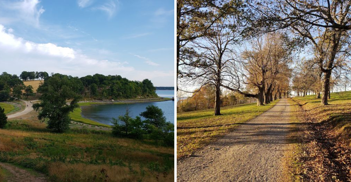
Some coastal walks give you a quick glimpse of the water. This one keeps the harbor beside you for miles.
Along the Massachusetts coast, 4.5 miles of trails curve through open fields, wooded paths, and quiet shoreline. The scenery changes often, which makes the walk feel fresh even after the first few turns.
One moment brings wide water views. The next feels peaceful and shaded.
It is the sort of escape that makes you slow down without even trying. Boats drift across the harbor, sea breezes move through the trees, and grassy hills create perfect spots for a break.
Every section seems to offer another reason to stop and look around.
The trails are manageable, but the setting feels far removed from crowded streets and busy schedules. Bring comfortable shoes, give yourself extra time, and keep your camera ready.
This Massachusetts coastal retreat proves that a simple walk can feel like a full day away.
A Land Shaped By Ancient Forces And Foresighted Hands
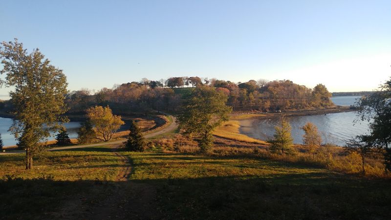
Long before any trail was cut or tree planted, glaciers were doing the heavy lifting.
The four drumlins that define the topography of World’s End were formed thousands of years ago, when massive sheets of ice carved and deposited their way across New England.
These spoon-shaped hills, including Pine Hill and Planter’s Hill, rise and fall across the peninsula with a rhythm that feels almost deliberate.
The highest drumlin reaches 140 feet above sea level. From that elevation, the harbor spreads out below in every direction, and on a clear day, the Boston skyline appears with surprising clarity across the water.
The landscape rewards those who pay attention to its contours.
What makes this place particularly layered is how human history and natural history have folded into each other here. Colonial farmers once connected what was originally an island to the mainland.
Centuries later, landscape architect Frederick Law Olmsted arrived in 1890 with plans to reshape the land entirely. His influence, combined with forces far older than any deed or blueprint, produced a peninsula unlike anything else on the South Shore.
The Gentle Curve Of Carriage Paths
Frederick Law Olmsted designed some of the most celebrated landscapes in American history, including Central Park in New York.
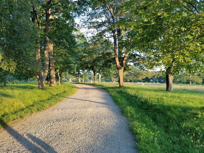
At World’s End, his hand is visible in every curving carriage road, every tree-lined stretch of gravel path that unfolds with an almost cinematic sense of proportion.
The drives were constructed. The trees were planted. The 163-home subdivision he was commissioned to design, however, was never built.
What remains is something arguably better than the original plan. The carriage roads, wide and well-graded, move through the landscape with a logic that feels instinctive rather than imposed.
Walking them, you get the sense that the path is guiding you rather than simply carrying you forward.
The 4.5 miles of interconnected trails and carriage roads allow for routes of varying length. A shorter inner loop covers roughly two miles.
A fuller exploration of the property takes closer to two hours at a comfortable pace. Footwear matters here, especially after rain, when the gravel paths can become soft in places.
Sturdy shoes make the difference between a pleasant walk and an unnecessarily muddy one. The trails are clearly marked with vibrant, informative posts throughout the property.
The address is Martins Ln, Hingham, Massachusetts.
Vistas Across The Water To A Distant Cityscape
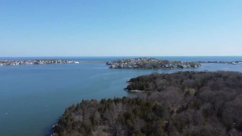
Standing on the upper ridge of the peninsula, you can see Boston without any obstruction. The skyline sits low on the horizon, close enough to recognize but distant enough to feel like another world.
Between here and there, the harbor water catches light in ways that shift constantly depending on the time of day and the season.
This particular view has drawn people for generations. It is the kind of sight that stops a conversation mid-sentence.
On autumn afternoons, when the angle of the sun drops and the water turns copper, the scene becomes genuinely difficult to leave behind. Even on overcast days, the harbor has a mood worth experiencing.
The Boston skyline view is one of the most distinctive features of World’s End, and it is accessible from multiple points along the trail system.
You do not need to climb to the highest drumlin to appreciate it, though the elevation does add dimension to the panorama.
Benches are positioned along the trail length, which means you can sit with the view for as long as you like. Bring something to eat, settle in, and let the harbor do what it does best.
Echoes Of Unbuilt Dreams And Grand Proposals
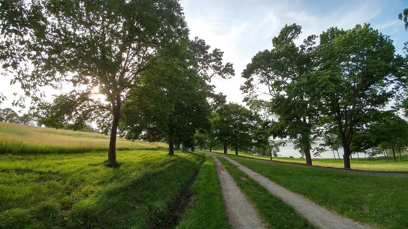
Few places carry as many near-misses as this peninsula. The story begins with John Brewer, who owned the property in the 1800s and hired Frederick Law Olmsted to design a residential subdivision across the land.
The carriage roads were built. Trees were planted in careful rows.
Then, for reasons history does not record with great clarity, the homes were never constructed.
The land sat largely undisturbed. Then, in 1945, it was considered as a finalist location for the United Nations headquarters.
That proposal also came to nothing. Two decades later, planners evaluated the site as a potential location for a nuclear power plant.
That idea, too, was eventually set aside.
Each of these proposals, had any one of them moved forward, would have transformed the peninsula beyond recognition. The carriage roads would have been buried under concrete.
The drumlins would have been graded flat or fenced off entirely. Instead, through a combination of circumstance and the determined fundraising of local residents, The Trustees of Reservations acquired the property in 1967.
What survives is not just land. It is the accumulated result of decisions not made, a place preserved almost in spite of itself.
Where Glacial Drumlins Meet The Tidal Shore
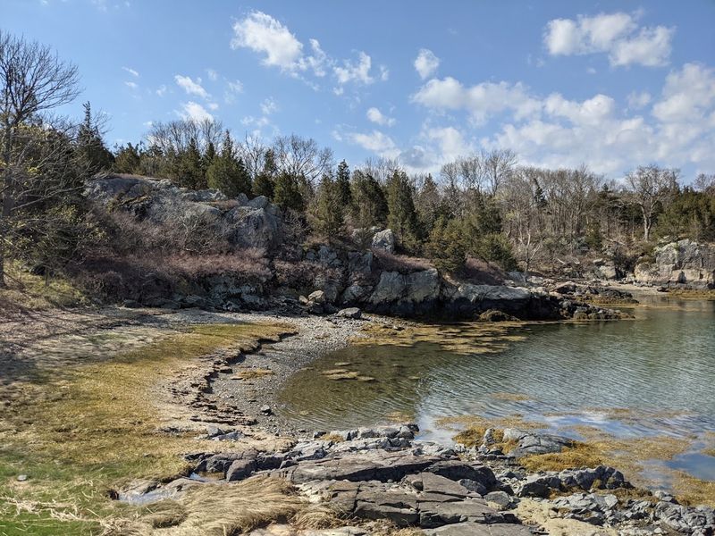
The meeting point between the drumlins and the tidal shoreline is where the character of this place becomes most vivid. Rocky edges drop toward the water with an abruptness that feels ancient, because it is.
The Weir River borders the peninsula to the north and east, while Hingham Harbor defines its western boundary. The result is a property almost entirely surrounded by moving water.
Along the lower trails, the shoreline shifts with the tides. Saltwater marsh grasses bend in the wind.
Shorebirds work the exposed mudflats with quiet efficiency. The smell of the ocean is constant, carried inland even when the water itself is not immediately visible through the tree line.
Wildlife appears without announcement here. Foxes have been spotted on the trails.
Dogfish and rays have been seen in the shallow water near the bridge. Great egrets perch in dead trees above the marsh with the kind of composed stillness that makes you stop walking entirely.
Bird blinds are positioned around the property for those who want to observe without disturbing.
The intersection of glacial topography and active tidal ecology gives this shoreline a texture that changes every time the water moves.
A Sanctuary Of Saltwater Marshes And Wind-Swept Meadows
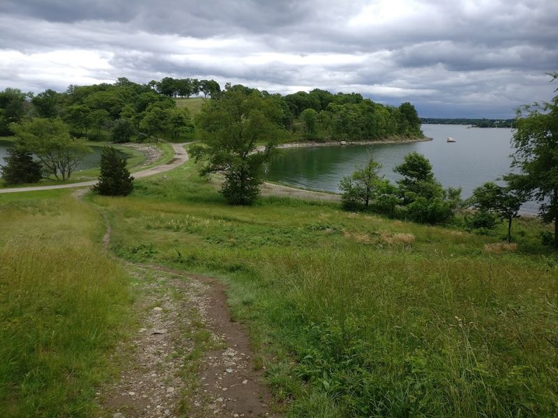
From mid-August through mid-September, the open meadows at World’s End fill with yellow and white wildflowers. The effect is immediate and unhurried, the kind of seasonal display that does not announce itself but simply arrives.
Walking through the meadow during this period, with the harbor visible beyond the grasses and the wind moving everything at once, is one of the more quietly satisfying experiences the South Shore offers.
The saltwater marshes add a different texture to the landscape. They are not dramatic in the way that cliffs or waterfalls are dramatic, but they carry their own particular atmosphere.
Light moves differently over marsh grass than it does over open water. The colors shift from green to gold depending on the season and the hour.
The combination of meadow and marsh gives the peninsula an ecological range that supports a wide variety of bird species. Birdwatchers find the property consistently rewarding across all seasons.
Even on cold or overcast days, the landscape retains its character. The wind, which can be significant depending on the season, adds a sensory layer that photographs cannot fully capture.
Bring a jacket and plan to stay longer than you originally intended.
The Stewardship Of A Seaside Peninsula
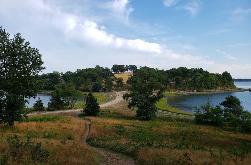
The Trustees of Reservations, who have managed World’s End since 1967, maintain the property with a standard that is immediately apparent to anyone who spends time here. The trails are clean and clearly signed.
Restrooms are available on site. A ranger station and informational kiosk greet you near the entrance.
Benches appear at regular intervals along the trails, positioned where the views are strongest.
Practical details matter when planning a trip here. Parking passes must be reserved in advance, particularly on weekends and holidays.
Non-members pay an admission fee, which covers parking per vehicle. Trustees members park at no additional cost.
Reservations can be made through the organization’s website at thetrustees.org, and the process is straightforward.
Dogs are welcome on leash throughout the property. For those with mobility considerations, a GRIT Freedom Chair, an all-terrain wheelchair, can be reserved at no additional cost beyond admission.
This thoughtful provision reflects the broader ethos of the place. Horseback riding is permitted with an annual permit.
The phone number for the property is +1 781-740-6665. Every practical element of a visit has been considered by the people who care for this land, and that care shows in every detail.
Finding Solitude Along Hingham’s Edge
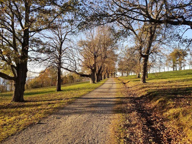
There is a particular quality to the silence at World’s End that is hard to locate elsewhere on the South Shore.
The trails are wide enough to accommodate other walkers without crowding, and the property’s 251 acres spread out in enough directions that solitude is genuinely available even on busy days.
Move past the first curve of the carriage road, and the parking area disappears behind the tree line.
The inner loop covers about two miles and suits those with limited time or energy. A full circuit of the property, including the outer paths along the shoreline, approaches four miles and takes the better part of two hours.
Picnic tables are available for those who want to extend the experience beyond the trail itself.
World’s End sits within the Boston Harbor Islands National Park Area, a designation that places it within a much larger ecological and cultural framework. Yet on the ground, it feels entirely self-contained.
The harbor is present. The city is visible but distant.
The drumlins rise and fall with the kind of quiet authority that only geology can produce. This is a place that earns its name not through drama, but through the steady accumulation of everything it simply is.