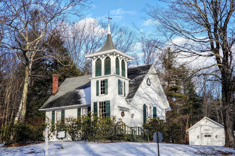
This Massachusetts Mountain Town Is So Remote That Even Most Locals Haven’t Found It Yet
Massachusetts has coastlines, college towns, and a whole lot of history. But mountains? That surprises people. And a mountain town so remote it barely shows up on most locals’ radar? That surprises them even more.
There is a place in the southwestern corner of the state where fewer than 200 people live year-round, one business keeps the lights on, and four roads are all that connect it to the outside world.
No post office. No traffic. Just elevation, forests, and a quiet so complete it feels intentional.
Most people drive through Massachusetts their whole lives without ever knowing this place exists. That is exactly what makes it worth finding.
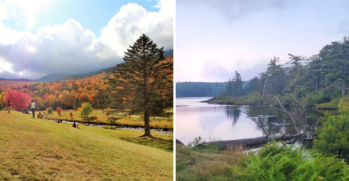
A Town Among The Clouds With Almost No One In It
Imagine a town so elevated and so removed from the rest of the state that its own mail gets handled by a neighboring village. That is daily life in this community perched on a plateau within the Taconic Mountains at nearly 2,000 feet above sea level.
The 2020 census counted just 160 residents, making it the least populous town in Berkshire County and the third least populous in all of Massachusetts.
The town sits at the very southwestern corner of the state, sharing borders with New York and Connecticut. Four mountain peaks surround it: Cedar, Alander, Race, and Everett.
Locals call it “the town among the clouds,” and once you see the morning fog rolling across the plateau, that name earns every word.
There are no state roads running through town. The single connection to the rest of Massachusetts runs along East Street toward Egremont.
One commercial business operates here, the Austin Blueberry Farm. For anyone accustomed to suburban convenience, this level of solitude feels almost theatrical. For the people who actually live here, it is simply Tuesday.
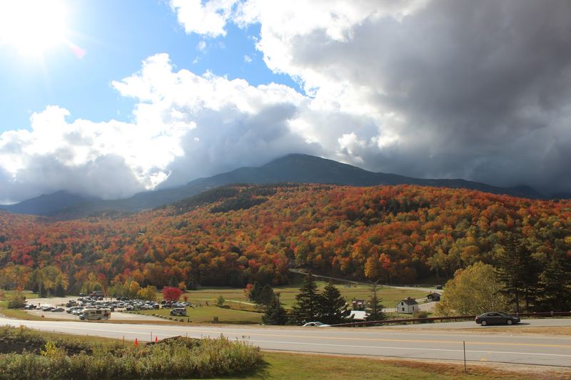
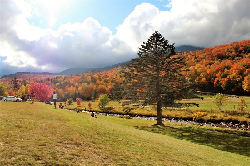
This Is What Massachusetts Looks Like When Nature Decides To Show Off
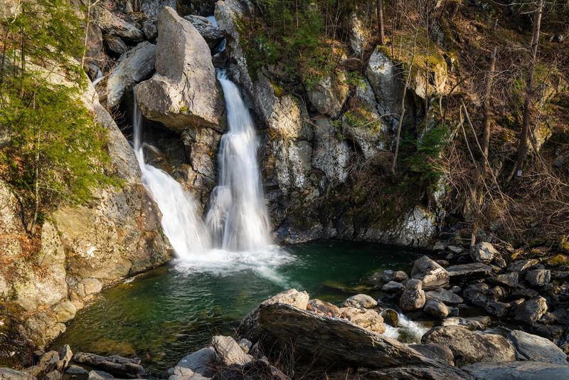
There is a moment standing at the base of Bash Bish Falls when conversation becomes unnecessary. The water drops 60 feet through a narrow gorge, splitting around a central rock before crashing into a deep pool below.
It is the highest single-drop waterfall in Massachusetts, and it earns that title without any argument.
Bash Bish Falls State Park sits within the boundaries of Mount Washington, making it the town’s most visited attraction despite the town’s general obscurity.
The trail from the main parking area takes roughly 30 to 40 minutes on foot, winding through forest with a steady incline.
Sturdy footwear is genuinely recommended, not as a formality but as practical advice for uneven terrain.
The falls carry a weight of local legend, including stories from the Mahican people who originally inhabited this region. Swimming in the pool below the falls is prohibited for safety reasons, though the view from the observation area is reward enough.
Visit in early spring when snowmelt amplifies the volume, or come in October when the surrounding maples turn the gorge into something that feels almost unreal.
Climb Mount Everett And Suddenly Three States Are Laid Out Right In Front Of You
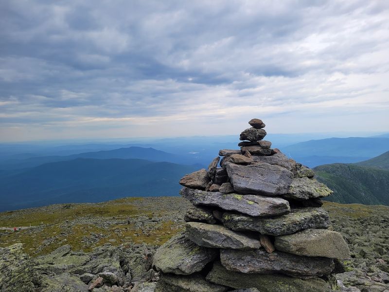
Standing at the summit of Mount Everett on a clear day, you can see into three states simultaneously. Massachusetts spreads out below you to the north and east, New York opens to the west, and Connecticut sits quietly to the south.
Few hiking destinations in New England offer that kind of geographic payoff for the effort involved.
Mount Everett is the highest point within Mount Washington, and it falls under the protection of Mount Everett State Reservation.
The trail to the summit passes through pitch pine and scrub oak zones that feel notably different from the lower forest, giving the hike a sense of moving through distinct ecological layers rather than just climbing a hill.
The Appalachian Trail runs nearby, and section hikers frequently include this summit as part of a longer route through the southern Berkshires. The elevation gain is meaningful but manageable for hikers with moderate fitness.
Early morning visits reward patience with clear air and minimal foot traffic.
Bring water, a light layer for wind at the summit, and enough time to simply stand there and absorb the view without rushing back down.
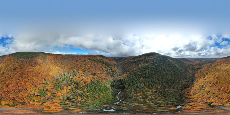
Mount Washington State Forest And Its 30 Miles Of Trail
The 4,169-acre Mount Washington State Forest covers a substantial portion of the town’s land, and it rewards anyone willing to explore beyond the parking area.
Over 30 miles of trails cross the forest, ranging from flat woodland walks to challenging ridgeline routes that demand attention and decent footwear.
Mountain biking is permitted on designated trails, and the terrain keeps even experienced riders engaged.
The South Taconic Trail is the standout route within the forest, leading hikers up to the summit of Alander Mountain. The views from Alander are expansive and unhurried, the kind that make you want to sit on a rock and eat your sandwich slowly.
A backcountry cabin near the summit has historically offered basic overnight shelter, though visitors should verify current availability before planning a stay.
Wilderness camping within the forest has been available in the past, though conditions and permits vary seasonally. Rangers and updated trail maps are accessible through the Massachusetts Department of Conservation and Recreation.
The forest connects to neighboring trail networks, including routes that cross into New York State, making it a practical base for multi-day exploration in the Taconic range.
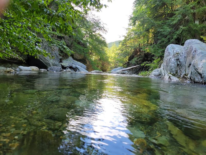
Sage’s Ravine Might Be The Most Underrated Natural Spot In All Of Massachusetts
Some places earn their reputation quietly, and Sage’s Ravine is one of them.
The ravine sits along the Connecticut border within the Mount Washington area, carved by Sage’s Ravine Brook as it tumbles through a narrow hemlock-shaded corridor.
The water runs cold and clear even in summer, and the sound it makes moving over the rocks sets a particular tone that is hard to replicate anywhere else in the region.
The Appalachian Trail passes directly through Sage’s Ravine, which means through-hikers and section hikers encounter it as part of a longer journey. Day hikers, however, tend to approach from the Bear Mountain trailhead in Connecticut or from access points within Massachusetts.
Either way, the ravine rewards the walk with scenery that feels genuinely untouched.
Hemlocks and hardwoods crowd the banks, filtering light in ways that make midday feel like late afternoon. Wildflowers appear along the edges in spring, and the brook stays lively through most of the year except during dry stretches in late summer.
This is not a destination that announces itself loudly. It simply exists, steady and composed, waiting for the visitors who take the time to find it.
The Appalachian Trail Passes Right Through This Quiet Corner
The Appalachian Trail enters Massachusetts from Bear Mountain in Connecticut, and its path runs close to the eastern border of Mount Washington before continuing north through the Berkshires.
For a town with 160 residents and no traffic lights, hosting a section of one of the world’s most famous long-distance trails is a quietly remarkable fact.
The trail brings through-hikers who have been walking since Georgia and section hikers completing the Massachusetts stretch over a long weekend.
Both groups tend to pass through without fully realizing which town they are standing in, which is consistent with Mount Washington’s general profile.
The trail does not announce the town, and the town does not announce itself.
For day hikers based in the Berkshires, this section of the AT offers access to Sage’s Ravine, the Bear Mountain connector, and the ridge walks leading toward Mount Everett.
Trail conditions vary with the seasons, and the spring mud season can make certain sections genuinely difficult.
The Massachusetts section of the Appalachian Trail is maintained through a partnership between the AMC and the National Park Service, and detailed maps are available through both organizations for anyone planning a visit.
80 Percent Protected Land
Roughly 80 percent of Mount Washington’s 14,300 acres fall under some form of protected status. That figure is not just an environmental statistic.
It is the reason the town looks the way it does, sounds the way it does, and draws the kind of visitor who prefers forest to foot traffic. Protected land here includes the state forest, Mount Everett State Reservation, and the Jug End Wildlife Management Area.
For visitors, this means trail access to large, contiguous blocks of forest without the interruptions of private development. Wildlife corridors remain intact, which is why black bear, white-tailed deer, and wild turkey sightings are routine rather than exceptional.
Birders find the area productive across all four seasons, with migratory warblers passing through in spring and resident raptors visible year-round.
The Jug End Wildlife Management Area, located along the town’s northern edge, offers additional access for hunting, fishing, and wildlife observation under Massachusetts Division of Fisheries and Wildlife regulations.
The combination of state forest, reservation land, and wildlife management areas creates a mosaic of habitats that supports biodiversity well above what most Massachusetts towns can claim.
Visitors who understand land protection tend to appreciate Mount Washington on a different level entirely.
The North Schoolhouse
From 1868 to 1942, the North Schoolhouse served as the sole educational facility for the children of Mount Washington. A single room, a single teacher, and students spanning multiple grade levels sharing the same space and the same stove in winter.
It operated for 74 years before the town’s declining population made it impractical to maintain.
The building still stands today, though it has been vacant for decades and its condition reflects that long absence.
Preservationists and local historians have noted its significance as one of the few remaining one-room schoolhouses in Berkshire County, and it contributes to the town’s layered sense of time.
Walking past it, you get the impression that the 19th century is not entirely gone from this corner of Massachusetts.
The schoolhouse sits as a physical reminder that Mount Washington was once a more populated and more self-sufficient community than it is today. The town’s population peaked in the mid-1800s and has declined steadily since.
That arc of change, from a working agricultural and logging community to a nearly uninhabited mountain plateau, is the quiet story behind every old foundation and overgrown field you encounter while exploring the area.
Fiber Optic Internet In A Town With One Store
Here is a detail that surprises almost everyone who hears it. Mount Washington, a town with 160 residents, no state roads, no post office, and one commercial business, owns and operates its own fiber optic network.
Residents have access to dedicated high-speed internet and telephone services through a system the town manages independently. That is not a detail you expect from a place this remote.
The decision to build out fiber infrastructure reflects a practical understanding that modern rural living requires connectivity, even when the landscape looks like it belongs to a different century.
Remote workers, retirees, and families who choose Mount Washington for its solitude still need to participate in the digital world.
The town’s investment in fiber makes that possible without requiring residents to drive 45 minutes to find a reliable signal.
This contrast, between the physical remoteness of the plateau and the digital accessibility of its residents, says something genuine about how small communities adapt.
Mount Washington did not wait for a state program or a large telecom provider to solve the problem. It built its own solution.
For a town that most Massachusetts residents have never heard of, that is a quietly impressive piece of civic infrastructure worth acknowledging.