
This Nevada Bridge Soars Nearly 900 Feet Above The Colorado River
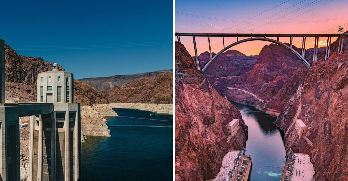
Nearly 900 feet of open air separates your boots from a river that carved this canyon over millions of years. Nevada guards a crossing that rewrote engineering record books the moment it opened.
Wind slaps the walkway with real force. Hats vanish fast if you let go for even a second.
Below, the water glints far down between dark canyon walls. Above, concrete and steel twist into a shape unlike anything else in the country.
Bighorn sheep sometimes appear nearby, adding a wild touch to the view. Nevada built this thing to outlast generations, rivet by rivet.
Can a single crossing really deliver views this dramatic, history this heavy, and thrills this sharp all in one stop? Bring water, grab your camera, and start mapping out that desert afternoon.
A Bridge That Rewrote The Record Books
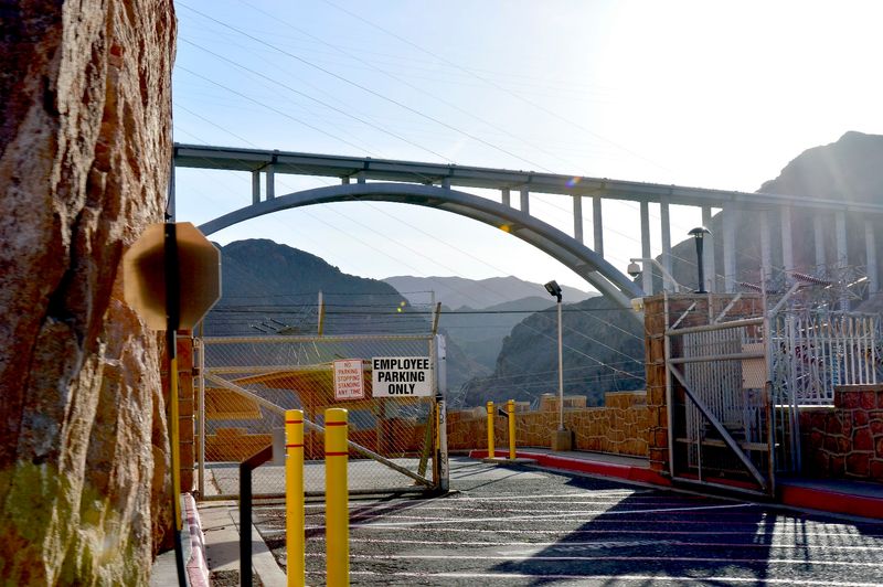
Few road bridges in America can claim the kind of statistics this one carries. Soaring approximately 890 feet above the Colorado River, the Mike O’Callaghan–Pat Tillman Memorial Bridge holds the title of the highest road bridge in the United States.
It also ranks as the highest bridge on the entire Interstate Highway System. That puts it in rare company, and the numbers only get more impressive from there.
The total length of the bridge stretches to 1,900 feet, with a main arch span of 1,060 feet. It is the first concrete-steel composite deck arch bridge ever built in the United States.
The concrete arch is also the widest of its kind in the entire Western Hemisphere.
Opened to vehicle traffic on October 19, 2010, it carries both Interstate 11 and U.S. Route 93 across the canyon.
Before this bridge existed, drivers had to navigate a much more dangerous and congested route directly over the top of Hoover Dam. The bypass changed everything for regional travel.
Why This Bridge Needed To Be Built
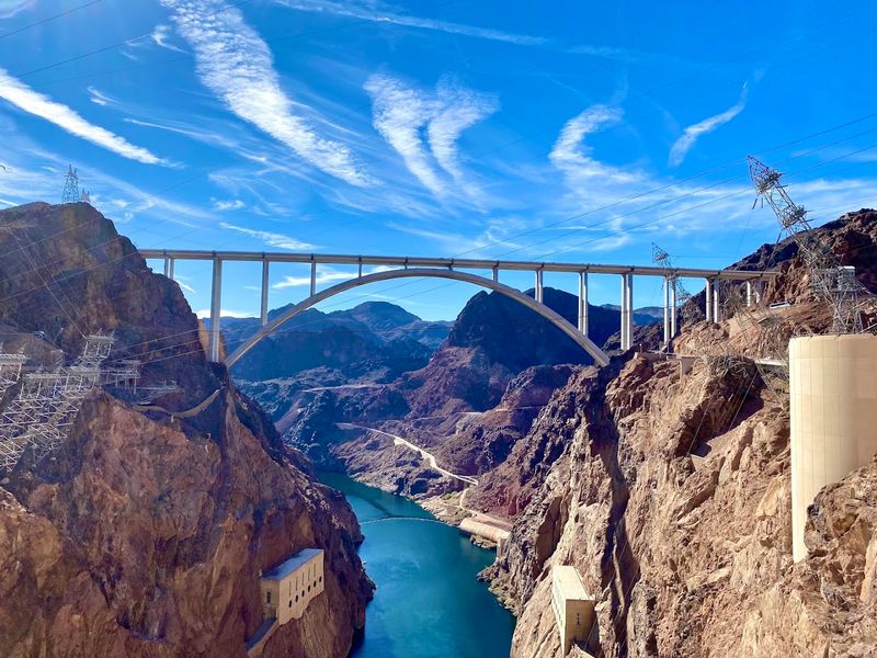
Before 2010, every vehicle crossing the Colorado River at this location had to drive directly across the top of Hoover Dam. That route was narrow, winding, and increasingly dangerous as traffic volumes grew over the decades.
Hairpin turns and blind curves made the drive stressful for ordinary motorists. For large commercial trucks, it was a logistical nightmare.
The road was simply not designed to handle modern traffic loads.
Security concerns added another layer of urgency. After the September 11 attacks, authorities restricted commercial truck traffic over the dam entirely.
That restriction created serious delays and economic disruption for freight moving between Nevada and Arizona.
Planners began designing a bypass solution that would reroute U.S. Route 93 around the dam entirely.
Construction of the bridge began in February 2005 and took years of careful engineering work to complete.
The entire Hoover Dam Bypass project cost approximately 240 million dollars, with the bridge portion accounting for around 114 million dollars. The investment paid off immediately in improved safety and traffic flow.
Engineering Feats That Defy Imagination
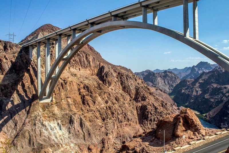
Building a bridge nearly 900 feet above a river canyon is not a standard construction project. Engineers and workers faced challenges that pushed the limits of what was considered possible in American bridge construction.
The arch itself is made up of 106 individual pieces, with 53 sections forming each side. Most of these pieces were cast in place rather than prefabricated elsewhere and shipped in.
That approach required extraordinary precision at extreme heights.
Workers and materials were hoisted nearly 900 feet above the Colorado River during construction. Loads of up to 50 short tons were lifted at a time, with desert winds adding constant unpredictability to every operation.
The design also had to account for the harsh desert environment. High winds, extreme heat, and the remote canyon setting all influenced structural decisions.
Durability was built into every calculation.
The result is a bridge that can flex slightly under traffic and wind loads without compromising its integrity. That intentional flexibility is actually a sign of smart engineering, not weakness, and it keeps the structure safe for decades to come.
The View From The Pedestrian Walkway
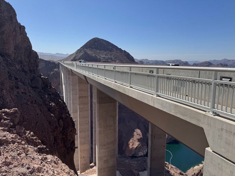
The pedestrian walkway is where this bridge truly becomes a destination rather than just a crossing. Visitors access it from the Nevada side, climbing a set of stairs or using the accessible ramp from the parking area below.
Once on the walkway, the view unfolds fast. Hoover Dam appears directly in front, massive and unmistakable.
The Colorado River glints far below, cutting through the dramatic walls of Black Canyon.
Standing at the center of the bridge offers a perspective that no tour of Hoover Dam itself can match. The scale of the dam only becomes fully clear when viewed from this elevation and distance.
The walkway runs the full length of the bridge, but since parking is only available on the Nevada side, most visitors walk out and back the same way. That round trip still delivers plenty of time to absorb the scenery and take photos from multiple angles.
Informational plaques line the route, explaining construction milestones and the story behind the bridge’s name. Pedestrian access is free, making this one of the best no-cost viewpoints in all of Nevada.
Wind, Heat, And What To Expect On The Bridge
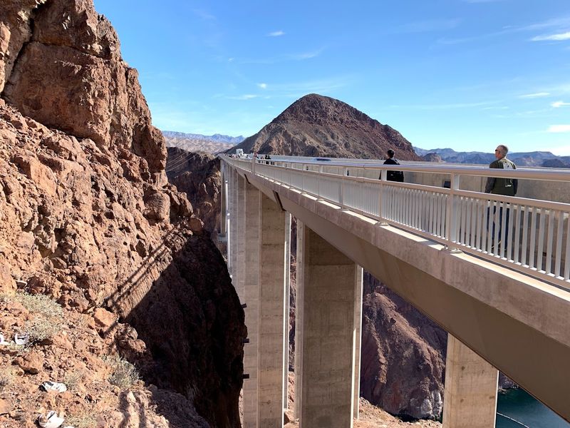
The bridge sits in a desert canyon environment, and nature makes its presence felt every single visit. Wind is the most talked-about element among visitors, and for good reason.
Gusts can sweep across the walkway with surprising force. Hats, loose items, and anything not secured can disappear over the railing faster than expected.
Holding on to belongings is genuinely practical advice, not just a suggestion.
Heat is the other major factor. The open walkway offers no shade, and the desert sun reflects off the concrete surface.
Temperatures can climb well above what feels comfortable, especially during summer months.
Bringing water is strongly recommended. The parking area has restrooms, but there are no refreshment vendors at the site.
Visitors who arrive unprepared for the heat often cut their time short.
Early mornings and late afternoons offer the best combination of cooler temperatures and softer light for photography. Checking wind and weather conditions before heading out can also save a lot of discomfort.
Preparation makes the experience far more enjoyable for everyone who makes the trip.
The Names Behind The Bridge
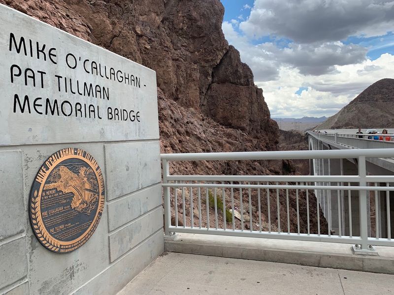
A bridge this significant deserves names that carry real weight. The Mike O’Callaghan–Pat Tillman Memorial Bridge honors two individuals whose lives represented dedication and sacrifice in very different arenas.
Mike O’Callaghan served as the Governor of Nevada from 1971 to 1979. He was also a decorated Korean War veteran whose commitment to public service made him a respected figure in the state’s history.
The connection to Nevada runs deep in his legacy. Naming a landmark of this scale after him reflects how much his contributions still resonate in the region.
Pat Tillman was a professional football player for the Arizona Cardinals who walked away from his sports career to enlist in the United States Army. He was killed in Afghanistan in 2004, and his story became a symbol of personal conviction and sacrifice.
A memorial plaza on the Nevada side of the bridge honors both men. Plaques and informational panels tell their stories for visitors who take the time to read them.
The plaza adds genuine emotional depth to what is already a powerful physical landmark.
How To Get There And Where To Park
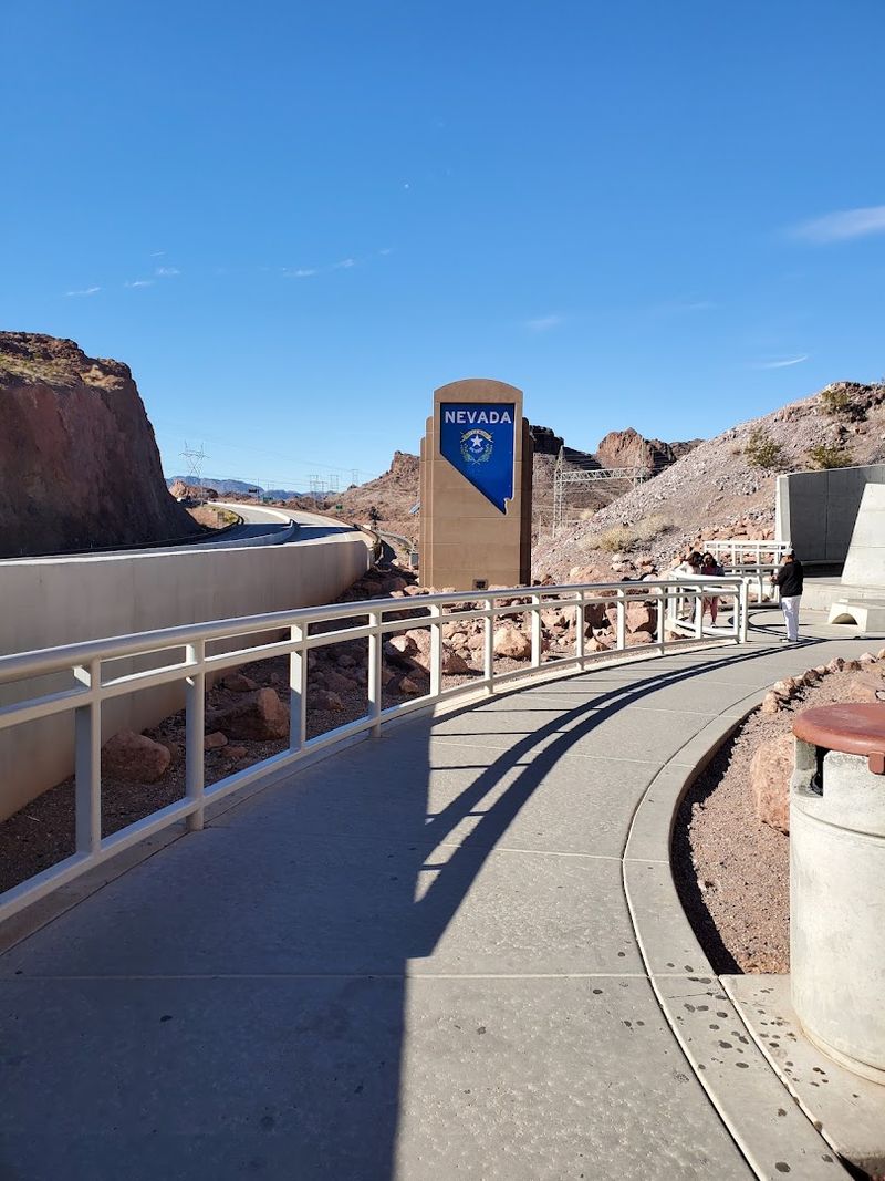
Getting to the bridge is straightforward from most directions. It sits along US Route 93, the Hoover Dam Bypass, in Boulder City, Nevada, approximately 30 miles southeast of Las Vegas.
The official address is located at 27953 Great Basin Highway, Boulder City, NV 89005.
The parking area on the Nevada side is compact, so arriving early is the best way to guarantee a spot.
Parking is free, which makes this stop especially appealing for road trippers watching their budget.
Restrooms are available at the parking lot level, which is a practical detail worth knowing before making the climb. There are no food or drink vendors on site, so stocking up beforehand is the smart move.
From the lot, visitors climb a series of stairs or take the accessible ramp to reach the bridge walkway. The climb takes only a few minutes but can feel intense in the heat.
Comfortable shoes and a water bottle cover the two most important preparation steps.
The site is popular, so arriving early on weekends helps avoid the biggest crowds and secures a better parking spot.
Black Canyon And The Colorado River Below
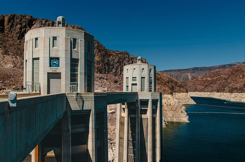
The Colorado River has been carving through this landscape for millions of years. From the bridge walkway, that geological story becomes immediately visible in the canyon walls stretching in every direction.
Black Canyon frames the scene with walls of dark volcanic rock that drop sharply to the river below. The contrast between the deep blue water and the dark canyon stone creates a visual that photographs cannot fully capture.
Looking straight down from the walkway is not for the faint-hearted. The river sits roughly 890 feet below, and the drop is fully exposed to anyone willing to peer over the railing.
The bridge does flex slightly in wind and traffic, which some visitors notice more than others.
The canyon also provides habitat for desert wildlife. Bighorn sheep have been spotted on the canyon walls, and various bird species use the thermal currents rising from the gorge.
The combination of geological drama, wildlife, and the engineering marvel overhead makes Black Canyon one of the most layered natural settings in the entire Lake Mead National Recreation Area, which surrounds this stretch of the Nevada desert.
Combining The Bridge With A Hoover Dam Visit
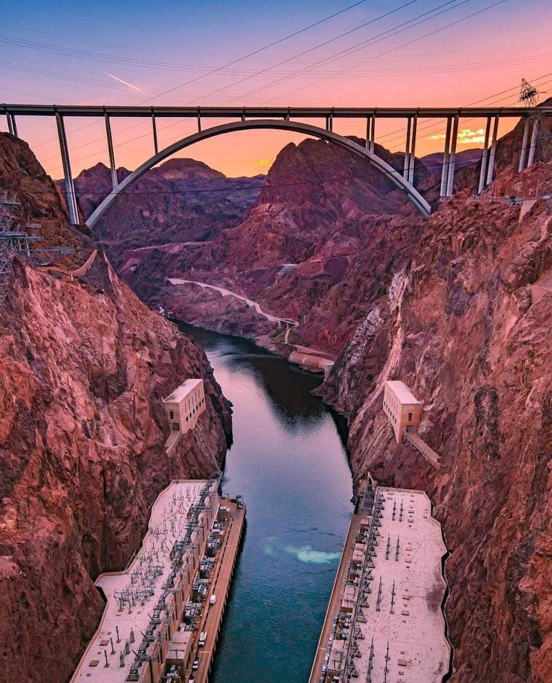
Most visitors combine the bridge with a stop at Hoover Dam, and the two complement each other perfectly. The dam is just a short drive away, and the two sites offer completely different perspectives on the same engineering legacy.
From inside the dam or on its crest, visitors look up at the bridge towering overhead. From the bridge walkway, the dam spreads out below in full panoramic view.
Both angles are worth experiencing.
Tour groups often visit the dam first, then walk the bridge afterward. That sequence works well because the dam tour provides historical context that makes the bridge visit feel even more meaningful.
The parking areas for both sites are separate, so driving between them is necessary. The short trip along US Route 93 takes only a few minutes and passes through some striking desert scenery.
Combining both stops into a half-day outing from Las Vegas is very manageable. The bridge walk itself takes under an hour, leaving plenty of time to explore the dam, the visitor center, and the surrounding Lake Mead National Recreation Area in Nevada before heading back.
Tips For Getting The Best Photos
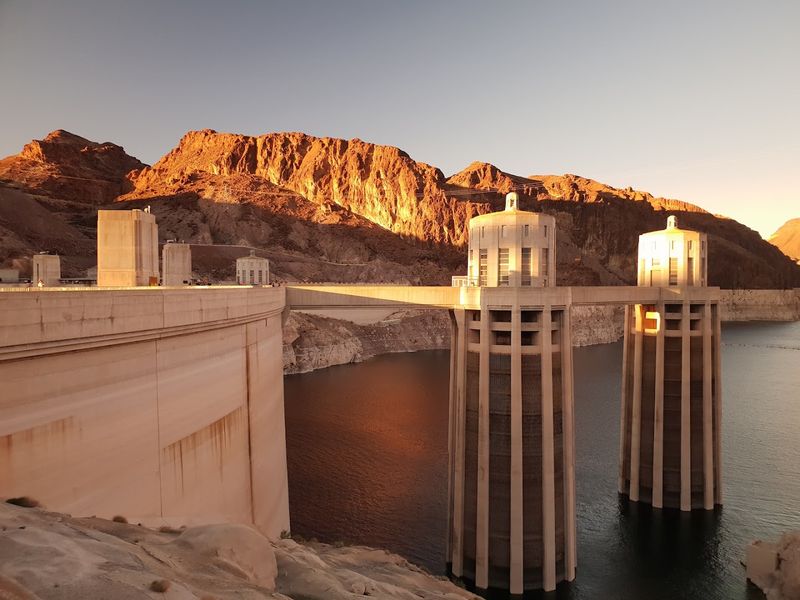
The bridge is one of the most photogenic spots in the entire Southwest, and a little planning goes a long way toward capturing its best angles. The pedestrian walkway gives direct sightlines to Hoover Dam, the canyon, and the river all at once.
Golden hour light transforms the scene. Early morning visits catch soft warm tones on the canyon walls before the harsh midday sun washes out the contrast.
Late afternoon brings similar rewards with longer shadows and richer colors.
Wide-angle lenses work well for capturing the full sweep of the canyon and the dam together. Shooting downward through the railing shows the dramatic depth of the drop to the river below.
Wind is a constant factor, so securing camera straps and lens caps is a practical must. Phones and small cameras are especially vulnerable to gusts at this elevation.
The informational plaques along the walkway also make interesting foreground elements for photos that tell a story beyond just the scenery. Visitors who spend time composing their shots rather than rushing through often come away with images that genuinely do justice to this remarkable Nevada landmark.