
This North Carolina Town Is So Remote Many Residents Have Never Left The County
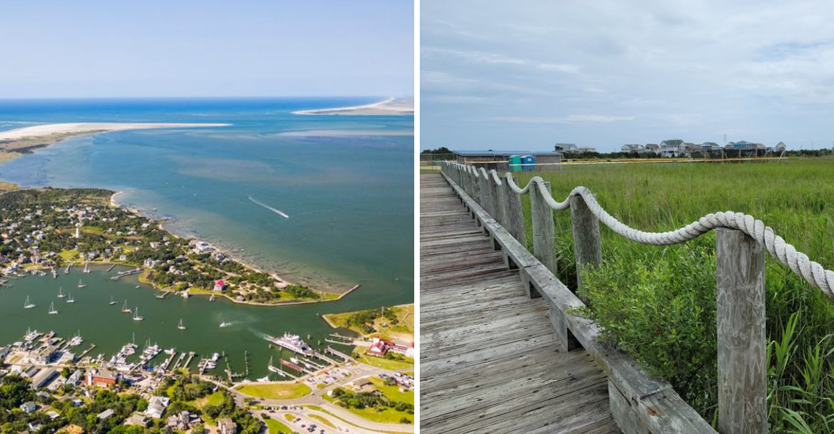
No bridge, no stoplights, and a county many people have never left.
Life here runs on boat schedules instead of clocks, and locals wouldn’t have it any other way. Golf carts hum past sandy lanes as a lighthouse watches over the harbor.
This corner of North Carolina feels like it slipped through a crack in time. Pirates once prowled these waters, and their legends still cling to the shoreline.
Ask a local about the weather and you might hear an accent unlike anything else in North Carolina. No road reached this place for generations.
Sixteen miles of untouched beach wait past the village. An unexpected forest surprises most first-time visitors, too.
Ready to trade traffic for tide charts? This remote coastline is calling, and it’s worth every ferry line.
Ferries Are The Only Front Door
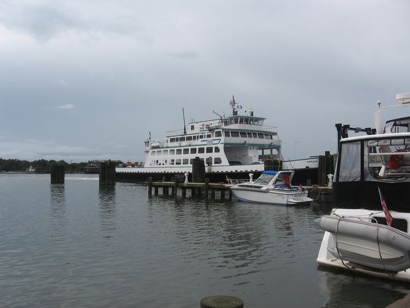
Want to reach the island? Pack patience, because no bridge exists.
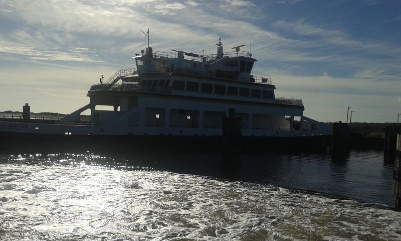
Three vehicle ferries and one seasonal passenger ferry connect Ocracoke to the rest of the world. The Hatteras route runs free and often, taking roughly an hour across the inlet.
Mainland crossings from Cedar Island and Swan Quarter stretch beyond two hours. Both require reservations, so booking ahead saves a long wait on the dock.
Locals plan their days around departure times. Doctor visits, deliveries, and school events all bend to the boat schedule.
That rhythm explains a lot about island life. When leaving means committing half a day, staying home starts to look pretty appealing.
Visitors should arrive early during busy summer weeks. Vehicle space fills, and standing in line beats missing a sailing.
The crossing itself becomes part of the trip. Pelicans glide alongside, dolphins sometimes surface, and the shoreline slowly shrinks behind the wake.
By the time the ramp clangs down, the mainland feels much further away than the mileage suggests.
A Village Built Around Silver Lake
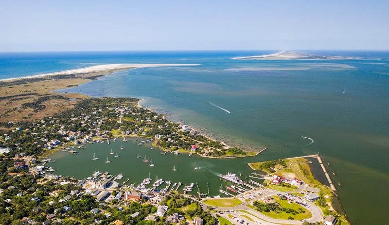
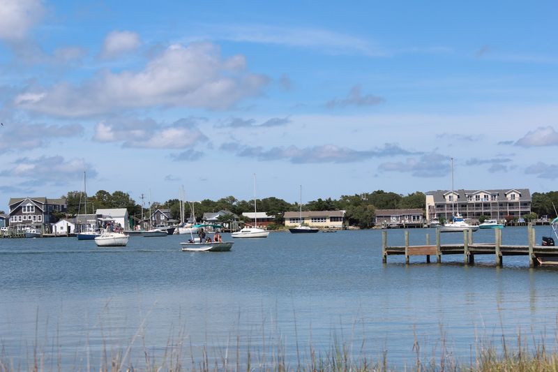
Silver Lake sits at the heart of everything here. Boats bob in the small harbor while shops and restaurants line its edge.
The water functions as the village common. People gather along the shore in the evening for sunsets that turn the whole basin orange.
Streets nearby stay narrow and shaded, with sandy lanes branching off toward cottages and live oaks. Bikes lean against fences instead of cars filling driveways.
Golf carts hum past at walking speed. Nobody seems in a rush, and honking feels almost rude.
Distances stay short enough that most errands happen on foot. That car-light setup is one reason the village feels so unhurried.
Anyone planning a first visit can find guidance at the National Park Service Visitor Center, 38 Irvin Garrish Highway, right near the ferry docks.
Maps, tide details, and local pointers all live there. Stopping in before exploring makes the rest of the stay smoother.
The harbor keeps drawing people back at dusk, camera or not.
The 1823 Lighthouse Still Standing Watch
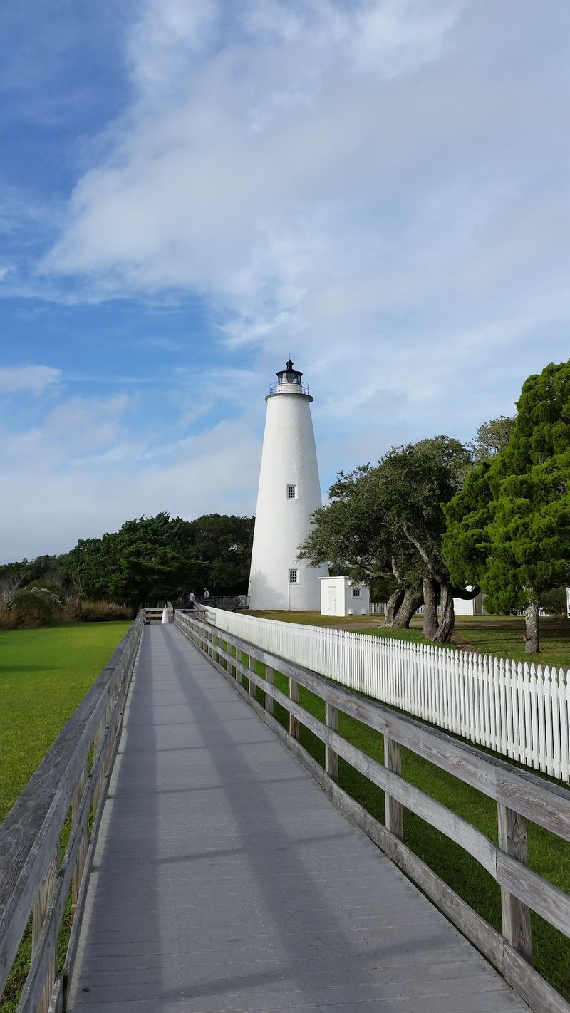
Short, white, and stubbornly steady, the Ocracoke Lighthouse has guided vessels since 1823.
It ranks among the oldest operating lighthouses in North Carolina. Unlike its taller striped cousins up the Outer Banks, this one keeps a modest profile.
Climbing inside is not allowed. The base opens seasonally, letting visitors peek at the structure up close.
The address is 360 Lighthouse Road, a short pedal from the village center. Bikes and golf carts fill the small lot most afternoons.
Whitewash and live oaks frame the tower nicely for photos. Morning light tends to work best before crowds gather.
Sailors once relied on that beam to navigate Ocracoke Inlet, a passage in use since the 16th century. Shifting sandbars made the guidance essential.
Today the light still functions, quietly doing the job it was built for. That continuity gives the site real weight.
Standing beneath it, the island’s long relationship with the sea becomes easy to understand.
Blackbeard’s Shadow Over Springer’s Point
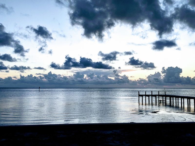
Pirate legend clings to this island, and Springer’s Point is where it feels closest.
Blackbeard’s story is tied closely to Ocracoke, with 1718 marking his final year in these waters.
Sandy trails wind under gnarled live oaks and thick maritime forest. Shade covers most of the route, which helps on warm days.
The path opens onto a quiet shoreline facing Pamlico Sound. Water laps gently, and the view stretches wide and empty.
Bug spray earns its place in the daypack here. Mosquitoes take the humidity personally.
The preserve stays low-key, with no ticket booth or gift shop. Visitors simply walk in and follow the sandy track.
Separating fact from legend gets tricky with pirate tales, and locals will admit as much. Still, the setting makes the stories easy to imagine.
Late afternoon brings soft light through the branches and fewer footsteps on the trail. It ranks among the most atmospheric corners of the whole island.
Hoi Toider Talk You Will Not Hear Elsewhere
Ask a longtime resident about the weather. The answer may sound like nothing else in the country.
The island dialect, called the Hoi Toider brogue, traces back to 17th-century English. Irish and Scottish influences shaped it, and some claim traces of old seafaring slang linger too.
Vowels stretch and twist in unexpected ways. High tide becomes hoi toide, which is exactly where the nickname comes from.
Centuries of isolation preserved the speech. Without a bridge, mainland accents never flooded in and flattened it out.
Many island families trace ancestry back through numerous generations. Surnames repeat across the village, and everyone seems related somehow.
Visitors get a nickname too. Locals sometimes call outsiders dingbatters, usually with more humor than heat.
Younger generations use the brogue less than their grandparents did. Linguists have studied it for decades because of that gradual shift.
Listening respectfully beats asking someone to perform. The accent shows up naturally in conversation once the ferry line small talk starts.
Sixteen Miles Of Undeveloped Shoreline
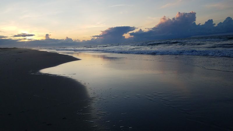
Empty sand stretches in both directions, and that is not an accident.
Much of the island belongs to Cape Hatteras National Seashore. Protection means no high-rises, no boardwalk arcades, and no rows of rental towers.
Dunes topped with sea oats separate the road from the surf. Wooden ramps and small parking areas mark the access points.
Wide beaches make room to spread out even in July. Walking a few minutes from the ramp usually finds near solitude.
Shelling rewards early risers, especially after a storm churns the shallows. Whelks, scallops, and olive shells turn up regularly.
Swimmers should watch for currents and check posted conditions. Lifeguard coverage is limited, so caution matters more than usual.
Shade is scarce, which makes an umbrella genuine gear rather than luxury. Water bottles disappear fast in the coastal sun.
Sunrise over the Atlantic here comes without traffic noise or crowds. That quiet is the whole reason people keep boarding ferries year after year.
A Small British Cemetery With A Big Story
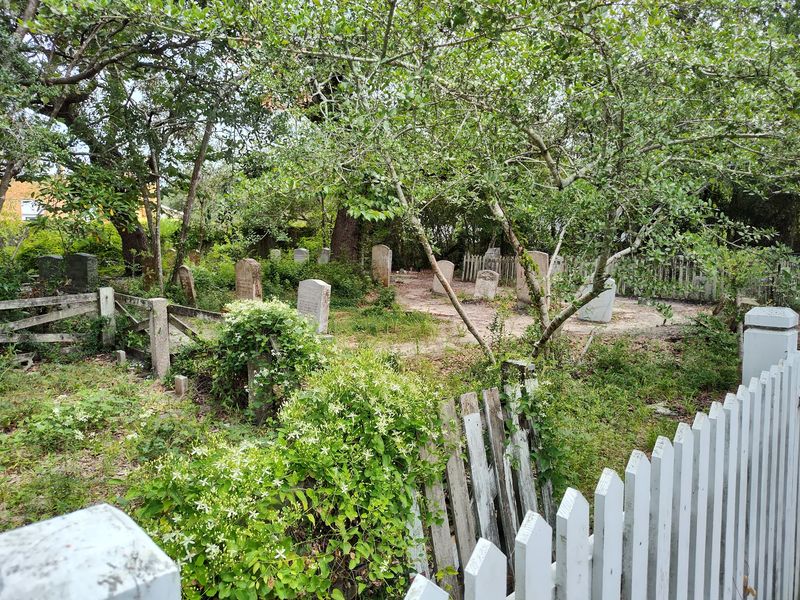
A British flag flies over a tiny plot on a quiet island lane.
The British Cemetery honors British sailors whose vessel was struck off the North Carolina coast during World War II. Their memorial rests here, far from home.
The site is small, fenced, and carefully maintained. A short walk from the village center brings visitors right to it.
Ceremonies mark the anniversary each year. Local families have tended the ground for generations.
The Outer Banks saw considerable wartime activity offshore. Islanders watched events unfold from their own shoreline.
Standing there takes only a few minutes. The quiet does most of the explaining.
Signage nearby offers context without overwhelming detail. Reading it adds real depth to a beach vacation.
Photos are fine, though visitors tend to lower their voices without being asked. Respect comes naturally in a space this intimate.
The contrast is striking. Sunny bike rides one moment, international history the next, all within a few blocks.
Golf Carts, Bikes, And Zero Traffic Lights
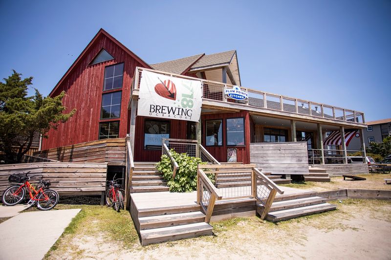
Traffic lights? Not a single one on the entire island.
Bicycles and golf carts handle most village transportation. Rentals are available, and pedaling beats hunting for parking.
Sandy lanes and short distances make two wheels practical for nearly everything. Grocery runs, beach trips, and dinner outings all work fine.
A free shuttle operates within the village during summer months. It helps visitors skip driving entirely once they arrive.
Cars still come over on the ferries, mostly for beach access down the highway. In the village itself they often just sit parked.
Speeds stay low, and drivers expect cyclists everywhere. Kids ride freely in a way that feels increasingly rare.
Lights on bikes matter after dark since street lighting is sparse. A small flashlight in the bag is a smart move.
Sand gets into everything, including gears and shoes. Nobody seems bothered.
Trading a steering wheel for handlebars changes the whole pace of a vacation, usually for the better.
Museum Rooms Full Of Island Memory
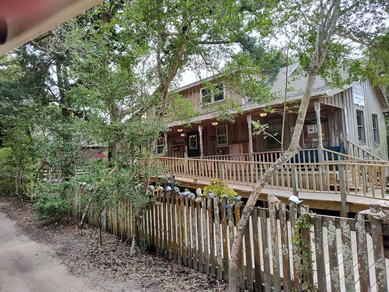
An early 1900s house holds the island’s collective memory.
The Ocracoke Preservation Society Museum fills its rooms with local history. Fishing gear, household objects, photographs, and family records tell the story.
Exhibits cover shipwrecks, storms, and the daily work of people who lived by the water. Hurricane accounts land especially hard here.
Volunteers often share stories that never made it onto a placard. Those conversations become the highlight for many visitors.
The building itself is part of the exhibit. Its porch and simple rooms reflect how islanders actually lived.
Rainy afternoons make this an easy call. A beach trip washed out turns into an unexpected history lesson.
Kids tend to gravitate toward the maritime displays and old tools. Adults linger over the photographs.
Seasonal hours vary, so checking before pedaling over saves disappointment.
Understanding how a place stayed self-reliant for centuries changes how visitors see every sandy lane afterward. The museum does that work quietly and well.
Trails Through Marsh And Maritime Forest
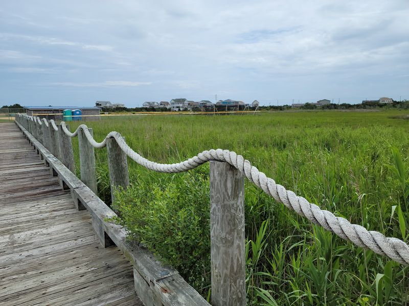
Beyond the beach, a different island waits under the trees.
Hammock Hills Nature Trail loops through maritime forest, dunes, and salt marsh. The path is short and mostly flat, good for families.
Interpretive signs explain how plants survive salt spray and shifting sand. The lesson sticks better outdoors than in any classroom.
Marsh overlooks reveal herons, egrets, and fiddler crabs going about their business. Binoculars pay off.
Ocracoke sits along migration routes, so bird variety shifts with the seasons. Spring and fall bring the biggest surprises.
Closed-toe shoes handle the sandy footing better than flip-flops. Insect repellent belongs in the pocket year-round.
The trail sits across from a campground area along the highway. Parking is simple and free.
Walking it takes well under an hour. Slowing down stretches it into something more memorable.
Few visitors expect forest on a barrier island in North Carolina. Finding it here reframes the whole landscape in the best way.
Water Sports, Fishing, And Clam Digging
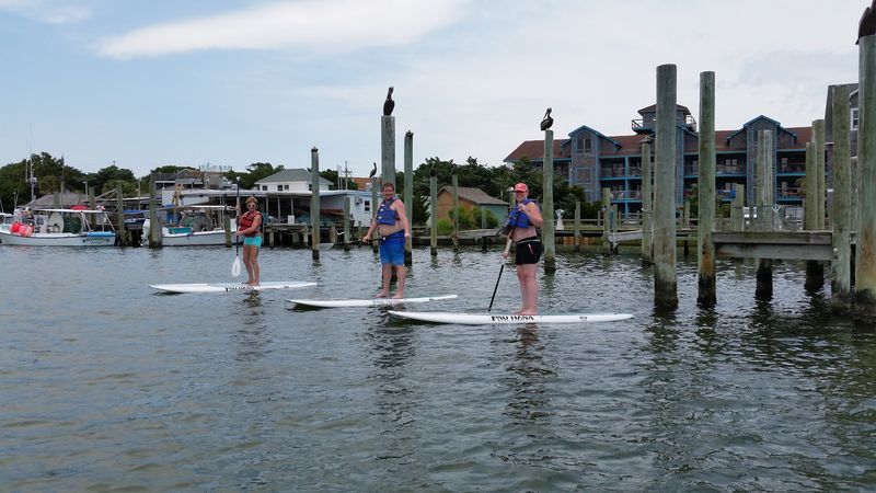
Two coastlines, two completely different playgrounds.
The sound side offers shallow, calmer water for kayaking and paddleboarding. Beginners find it far friendlier than the ocean.
Kitesurfers chase the steady breezes that sweep across the flats. Watching from shore is entertainment on its own.
Surf fishing draws anglers to the Atlantic beaches with rods planted in the sand. Regulations and permits apply, so checking rules first matters.
Clamming in the shallows is a longtime island tradition. Local outfitters can explain licensing and the right spots.
Charter trips head offshore for bigger species. Availability depends on weather and season.
Day trips to uninhabited Portsmouth Island run by boat, offering empty beaches and old village buildings. Reservations are usually needed.
Sunscreen, hats, and water bottles are non-negotiable on the exposed flats. Shade barely exists out there.
Gear rentals in the village cover most needs, so hauling equipment on the ferry is optional. Half the fun is picking which side of the island to explore first.
Timing A Trip To This Off-Grid Village
Choosing when to come matters as much as choosing what to do.
Summer brings warm water, full ferry lines, and the busiest village streets. Reservations for lodging and mainland ferries should be locked in early.
Late spring and early fall soften the crowds while keeping pleasant weather. Many regulars swear by those shoulder weeks.
Hurricane season runs through the summer and into autumn. Storms can close ferries and cut access, so flexible plans help.
Winter turns quiet, with reduced services and some businesses closed. The solitude appeals to a certain kind of traveler.
Cash is handy for small vendors, though cards work most places. Cell service can be patchy in spots.
Pharmacies and big-box stores do not exist here. Bringing medications and specialty items along avoids trouble.
Ferry schedules shift seasonally, making advance checking wise before departure day.
Isolation is the whole appeal of this North Carolina island, and a little planning turns that remoteness into the best part of the trip rather than a headache.