This Overlooked Utah Scenic Drive Has Views So Gorgeous They Belong Hanging In A Museum
That Morricone whistle… ta-na-naaaa, tananana-na-na, ta-na-naaa… You know the one.
You can hear it in your head already, and you haven’t even seen the place yet. Utah has a way of earning that soundtrack.
A road runs along the Colorado River, carving through canyon walls that glow amber and rust in the afternoon sun. The kind of landscape that makes you slow down without thinking.
Windows down, one arm out, eyes drifting toward the ridgelines. Red rock formations rise on both sides like something a filmmaker dreamed up.
The river moves quietly below. A lone raven circles overhead.
Dust settles on the trail behind you. It doesn’t look entirely real.
It looks like a set. Like, at any moment, a figure on horseback might appear on that distant mesa.
Silhouetted against the fading sky. They won’t.
But the whistle in your head won’t stop either.
Captivating Geological Formations Along The Road
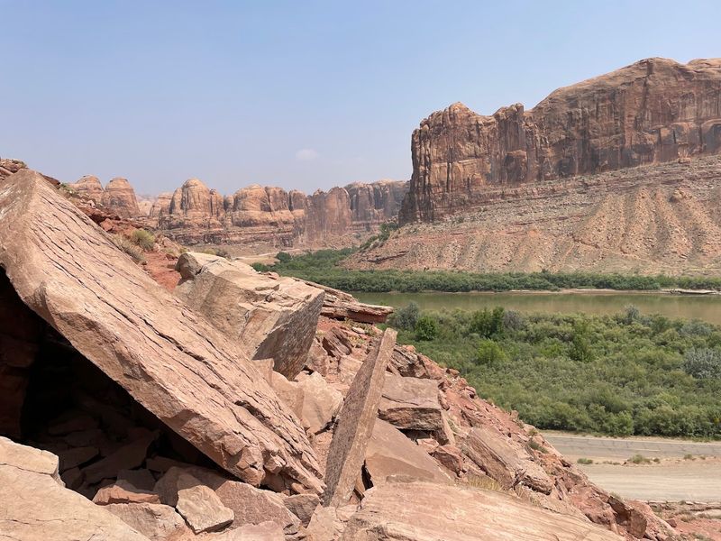
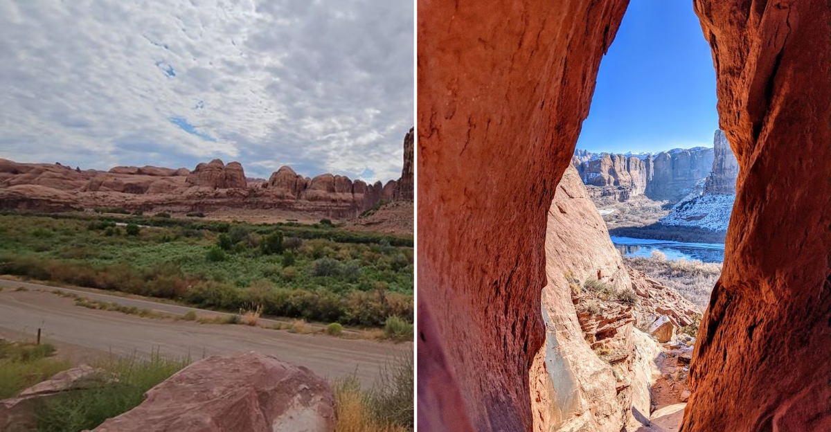
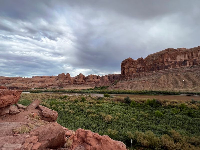
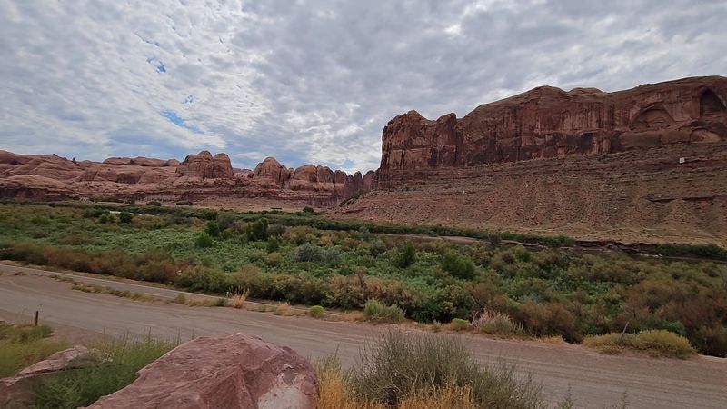
This amazing road introduces itself with a geological showstopper. The moment you turn off Highway 191, enormous sandstone walls called “Wall Street” rise on one side while the Colorado River flows quietly on the other.
These cliffs were not built overnight. They formed over millions of years through layers of sediment, pressure, and time, stacking up like pages in an ancient book.
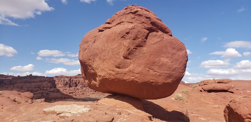
The formations shift constantly as you drive. Some sections look folded, almost wrinkled, as if the earth could not quite make up its mind.
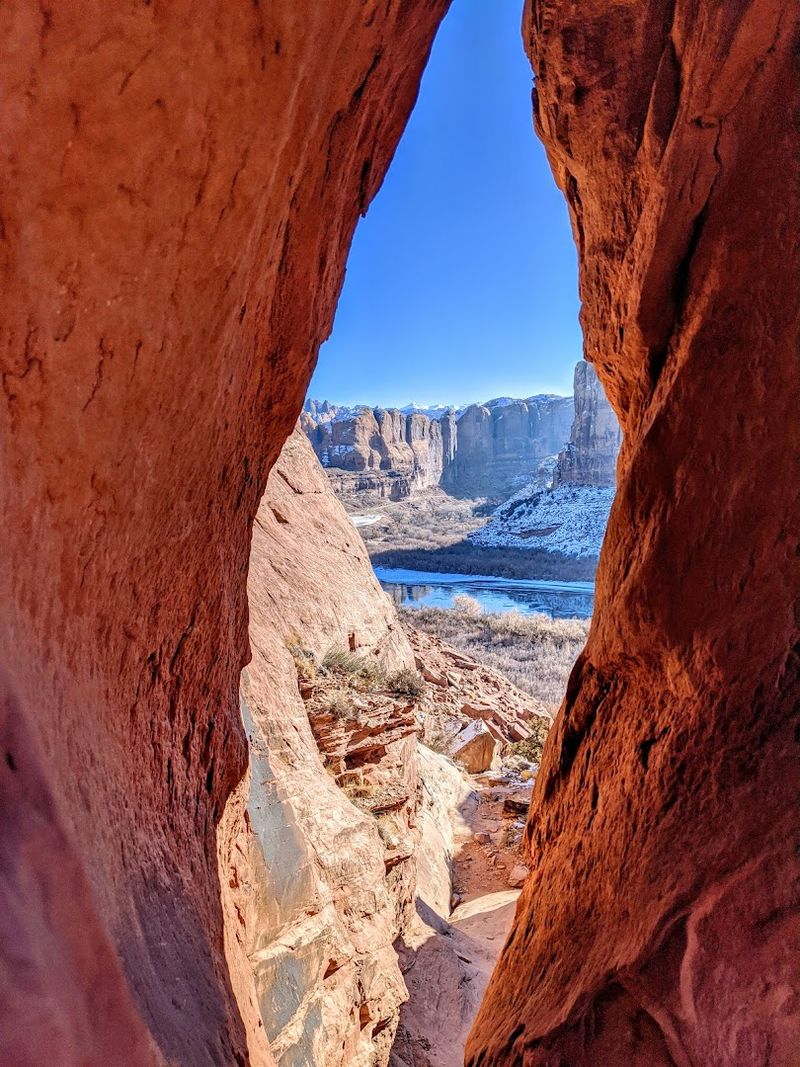
Others stand perfectly vertical, smooth and proud, catching the sun at angles that make them glow like embers. You will spot arches carved into the rock by centuries of wind and water erosion working patiently away.
Dinosaur tracks are preserved in stone near signed pullouts along the route. Three-toed meat-eating dinosaurs left their marks here, and those prints are still sharp enough to make your brain short-circuit a little.
The road itself stays flat and well-paved, making the whole experience accessible to any regular passenger vehicle. You can find Potash Road off Highway 191 near Moab, Utah, 84532.
Opportunities For Wildlife Viewing In Scenic Areas
Wildlife along Potash Road is not shy. The Colorado River corridor creates a natural habitat corridor where animals move freely between water, rock, and sparse vegetation.
Great blue herons are practically regulars here, standing motionless at the river’s edge like they are posing for a nature documentary.
Desert bighorn sheep sometimes appear on the cliff faces above the road. Spotting one requires patience and a willingness to scan the rocks carefully, but the payoff is worth every neck cramp.
Mule deer also wander through the area, especially in early morning and late afternoon when temperatures drop, and they feel safer moving around.
The river itself supports a surprising amount of life. Bald eagles have been spotted soaring above the water during colder months, hunting for fish near the surface.
Smaller birds, including canyon wrens and swallows, nest in crevices along the sandstone walls. Lizards dart across sun-warmed rocks at midday.
The variety of wildlife here is genuinely impressive for what looks, at first glance, like a dry and quiet desert road. Bring binoculars because your phone camera will not cut it from the car window.
Perfect Times Of Year To Visit For Clear Views

Timing your visit to Potash Road makes a massive difference in what you actually experience. Spring and fall are the sweet spots.
Temperatures stay comfortable, usually ranging between 55 and 80 degrees Fahrenheit, which means you can actually step out of the car and enjoy the scenery without instantly regretting your life choices.
Spring brings occasional wildflowers poking through the desert floor and the Colorado River running higher and faster from snowmelt upstream.
Fall transforms the cottonwood trees lining the riverbank into vivid gold, creating a color contrast against the red rock that feels almost too good to be real. Both seasons also bring fewer visitors compared to the packed summer months.
Summer visits are doable but demand serious preparation. Temperatures regularly exceed 100 degrees Fahrenheit, and the exposed road offers zero shade.
Early morning drives starting before 8 a.m. help you avoid both the heat and the crowds. Winter is surprisingly pleasant on clear days, with crisp air and soft light that photographers absolutely love.
Snow occasionally dusts the canyon rim, adding a surreal layer to the already dramatic landscape. Plan around the weather and this road rewards you generously.
Tips For Photographing Expansive Canyon Landscapes
Photographing Potash Road is one of those experiences where you feel like every single frame could be a magazine cover. The light here does something special.
Throughout the day, it shifts the rock colors from soft pink at sunrise to blazing orange at midday to deep burgundy near sunset. Golden hour is not just recommended here; it is basically mandatory.
Shoot from the pullouts along the road rather than stopping in the lane. Several designated spots exist specifically for this, giving you clear sightlines to both the cliffs and the river simultaneously.
A wide-angle lens captures the full scale of the canyon walls towering above you. A telephoto lens lets you isolate details like petroglyphs on distant rock faces or climbers scaling Wall Street.
Reflections in the Colorado River add a painterly quality to any shot taken near the water’s edge. Polarizing filters help cut glare off the river surface and deepen the blue of the sky against the red rock.
Overcast days actually work surprisingly well here because soft diffused light removes harsh shadows from the canyon walls. Bring extra battery power because you will not want to stop shooting once you start.
The scenery simply refuses to get boring.
Notable Rock Colors And Textures To Observe
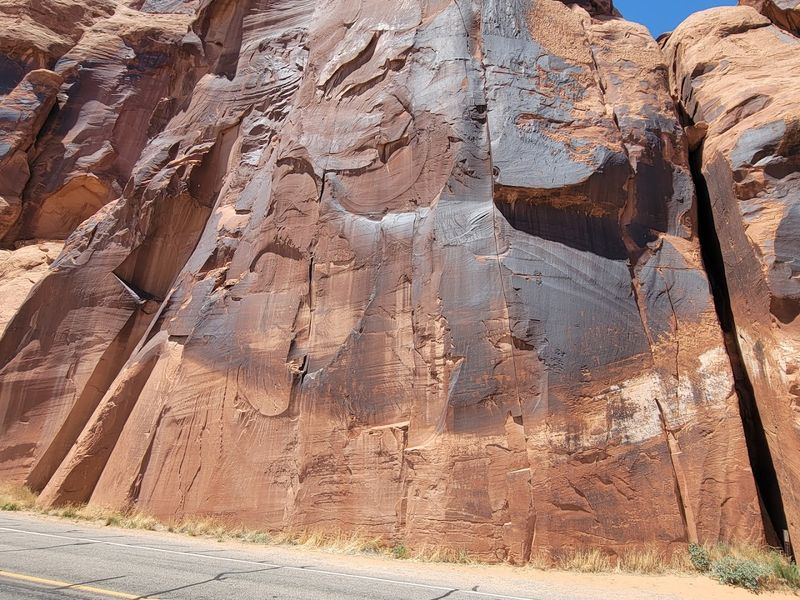
The rock along Potash Road reads like a color palette that a painter would call excessive, but a geologist would call perfect. Dominant shades of burnt orange, rust red, and warm cream stack in visible horizontal layers called cross-bedding.
These layers formed from ancient dunes that solidified over millions of years under tremendous pressure.
Dark streaks called desert varnish run vertically down many cliff faces. This varnish forms when manganese and iron oxides accumulate on the rock surface over thousands of years, creating dramatic dark ribbons against the brighter stone beneath.
Ancient peoples used these varnished surfaces as canvases for the petroglyphs visible along the road, which is why so many panels appear on these darker sections.
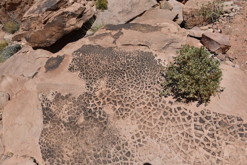
Texture varies wildly from one formation to the next. Some surfaces look almost smooth and wind-polished, while others are rough, pitted, and fractured into sharp angular blocks.
Pockmarks called tafoni appear where softer minerals eroded inside the rock, leaving Swiss-cheese-like hollows in the cliff face. Running your eyes slowly across these walls reveals a geological story that no museum exhibit could fully replicate.
Every layer represents a different era, and the road puts all of it right at eye level.
Features Of The Surrounding Ecosystem And Vegetation
The ecosystem along Potash Road thrives quietly in conditions that look almost impossibly harsh. Cryptobiotic soil crust covers much of the desert floor between plants.
This fragile dark crust is actually a living community of cyanobacteria, mosses, and lichens working together to hold the soil in place and prevent erosion.
A single footstep can destroy decades of growth, so staying on established paths matters enormously.
Cottonwood trees line the riverbank in dense clusters, their roots reaching deep toward the water table. These trees provide critical shade and nesting habitat for birds moving through the canyon corridor.
Tamarisk, an invasive species, also grows heavily near the river and has been a persistent challenge for land managers trying to restore native plant communities.
Away from the river, the vegetation shifts quickly to classic high-desert species. Utah juniper, blackbrush, and Mormon tea grow in scattered clumps across the rocky terrain.
Rabbitbrush bursts into yellow bloom in late summer and fall, adding unexpected color to the otherwise earthy tones of the landscape. Prickly pear cactus appears tucked against boulders throughout the drive.
The contrast between the lush riparian corridor at the river and the sparse desert just meters away illustrates how dramatically water shapes life in canyon country.
Safety Precautions While Navigating Mountain Passes
Potash Road is paved and relatively flat for most of its 17-mile length, making it far more forgiving than many Utah backcountry routes. That said, the road does narrow in sections and shares space with cyclists, hikers, and the occasional large vehicle.
Staying alert and keeping your speed reasonable prevents most problems before they start.
Cell service along the route is unreliable at best and completely absent in several stretches. Download offline maps before you leave Moab and carry a physical map as backup.
Letting someone know your planned route and estimated return time adds a simple but effective safety layer, especially if you plan to hike from any of the trailheads along the way.
Heat is the most underestimated hazard on this road. Even in spring and fall, direct sun on exposed rock creates temperatures that rise sharply above the air temperature.
Carry more water than you think you need, at least a liter per person per hour of planned activity. The road transitions from paved to a rugged 4×4 track near the Potash Boat Ramp heading toward Canyonlands.
Standard passenger vehicles should stop at the pavement’s end. Do not attempt the Shafer Trail section without a high-clearance four-wheel-drive vehicle and solid off-road experience.
Nearby Attractions Enhancing Scenic Driving Experience
Potash Road does not exist in isolation. The surrounding area packs an almost unfair amount of worthwhile stops into a small geographic footprint.
Corona Arch sits just a short hike from a trailhead along the byway and rewards visitors with one of the most spectacular free-standing arches in the entire Colorado Plateau.
Bowtie Arch hangs directly above it, making the pair an extraordinary geological double feature.
The Potash evaporation ponds near the road’s end are genuinely strange and fascinating. Bright turquoise and blue-green pools sit in stark contrast to the red desert surrounding them.
They are industrial in origin, created by the potash mining operation nearby, but they photograph beautifully and feel completely out of place in the canyon landscape.
A memorial near the site honors miners lost in a 1963 accident, adding historical weight to the stop.
Jug Handle Arch is another roadside highlight, visible from a signed pullout without any hiking required.
Wall Street draws rock climbers from around the world and watching skilled climbers navigate those sheer vertical faces from the comfort of your car window is both thrilling and slightly terrifying.
Canyonlands National Park and Arches National Park both sit within easy driving distance, making Potash Road an ideal warm-up act for a full Utah canyon country adventure.